
Aracaju: Difference between revisions
No edit summary |
No edit summary |
||
| Line 1: | Line 1: | ||
<!-- Infobox begins !--> |
<!-- Infobox begins !--> |
||
{{Infobox settlement |
{{Infobox settlement |
||
|name = |
|name = Aracaju |
||
|settlement_type = Municipality |
|settlement_type = Municipality |
||
|official_name = The Municipality of Aracaju |
|official_name = The Municipality of Aracaju |
||
Revision as of 22:39, 27 March 2014
Aracaju | |
|---|---|
Municipality | |
| The Municipality of Aracaju | |
| Skyline of Aracaju, Top of left:Night in Ponte Aracaju-Barra Bridge and Sergipe River, Top of right Centro area in Aracaju, Middle of left:Viadoto Cavalho area in night, Middle of right Avenida Beira Mar area and July 13 Avenue, Bottom:View of Alataia area from Santa Luzia Island Skyline of Aracaju, Top of left:Night in Ponte Aracaju-Barra Bridge and Sergipe River, Top of right Centro area in Aracaju, Middle of left:Viadoto Cavalho area in night, Middle of right Avenida Beira Mar area and July 13 Avenue, Bottom:View of Alataia area from Santa Luzia Island | |
 Flag  Seal | |
| Nickname: "Cajueiro dos Papagaios" ("Cashew tree of the Parrots") | |
| Motto: "Cidade de Todos" ("City of Everybody") | |
 Location of Aracaju in the State of Sergipe | |
 | |
| Country | |
| Region | Northeast |
| State | |
| Founded | 1592 |
| Incorporated (as capital) | March 17. 1855 |
| Government | |
| • Mayor | João Alves Filho (DEM) |
| Area | |
| • Total | 181.857 km2 (70.215 sq mi) |
| Elevation | 4 m (13 ft) |
| Population (2012) | |
| • Total | 587,701 |
| • Density | 3,200/km2 (8,400/sq mi) |
| Time zone | UTC-3 (UTC-3) |
| • Summer (DST) | UTC-2 (UTC-2) |
| Postal Code | 49000-000 |
| Area code | (+55) 79 |
| Website | Aracaju |
Aracaju (Portuguese pronunciation: [aɾakaˈʒu]) is the capital of the State of Sergipe, Brazil, located in the northeastern part of the country, about 350 km (217 mi) north of Salvador. It has a population of 570,937 inhabitants, which represents approximately 33% of the state population. The coast of Aracaju has many unspoiled beaches, such as the ones in Santa Luzia Island, and urban beaches, such as the Atalaia. These coastal neighborhoods include playgrounds, squares, football fields, volleyball and basketball courts, residential buildings, bars, nightclubs, restaurants, banks and hotels.
Aracaju, one of the first cities to be planned in Brazil, was built with the intention of becoming the state capital. It was founded in 1855, as the capital of Sergipe.
History

Although the first contact of the Portuguese in Sergipe was here, the first and most important city of that place which would be a province in the future was São Cristóvão (Saint Christopher), which became a city in 1590 and was capital of Sergipe from 1823 to 1855. In the mid-19th century, there was a sudden need for a purpose-built harbor and administrative centers, and the core of modern Aracaju was constructed overnight, becoming the province capital in 1855, and after 1889 the state capital. In 1910, the city was made the seat of the Roman Catholic Archdiocese of Aracaju.
Unlike the other Brazilian capitals that were planned and built in the 19th century, Aracaju is known throughout the country for its modern look, several festivals, and pre-carnival feast. Oil wealth, sugar cane cultivation, and more recently tourism continue to stimulate its growing economy. Colonial towns, such as Laranjeiras and São Cristóvão, are only a short bus ride away (Adapted from The Rough Guide to Brazil (2000), UK).
Geography
Climate
The climate is hot and humid, with rainy season from March to August. The average annual temperature is 26 °C and average annual rainfall of 1590 mm.
The warmest months Aracaju experiences are: January, February and March, with temperatures averaging 27°C, while the average highs are 31°C and the minimum is 25°C. The coldest are July and August, with temperatures averaging 24°C, with a mean maximum not exceeding 28°C, and at night the temperature drops to 22°C. But it may happen that the temperature gets warmer in winter and cooler in summer, as in 2002.
The temperature record in the city is 40°C and reached a minimum of 17.5°C in the winter of 2008.
Aracaju experiences its wettest months between March and August, owing to the strong wind created by lower temperatures in the South and Southeast. During this period, the average amount of rainfall exceeds 200 mm per month. Between those months, the rainiest is April, where it rains about 241 mm. The driest months, between September and February, see the winds weakening and only really managing to bring light clouds. There is also less rain. The driest month is November, when it rains about 48 mm. The average rainfall between these months is approximately between 60 mm and 75 mm.
| Climate data for Aracaju | |||||||||||||
|---|---|---|---|---|---|---|---|---|---|---|---|---|---|
| Month | Jan | Feb | Mar | Apr | May | Jun | Jul | Aug | Sep | Oct | Nov | Dec | Year |
| Record high °C (°F) | 35 (95) |
34 (93) |
36 (97) |
32 (90) |
36 (97) |
32 (90) |
33 (91) |
30 (86) |
32 (90) |
35 (95) |
31 (88) |
35 (95) |
36 (97) |
| Mean daily maximum °C (°F) | 30 (86) |
30 (86) |
30 (86) |
30 (86) |
29 (84) |
28 (82) |
27 (81) |
27 (81) |
27 (81) |
28 (82) |
29 (84) |
29 (84) |
28 (82) |
| Daily mean °C (°F) | 27 (81) |
28 (82) |
27 (81) |
27 (81) |
26 (79) |
26 (79) |
25 (77) |
25 (77) |
26 (79) |
26 (79) |
27 (81) |
27 (81) |
26 (79) |
| Mean daily minimum °C (°F) | 25 (77) |
25 (77) |
25 (77) |
25 (77) |
24 (75) |
23 (73) |
22 (72) |
22 (72) |
23 (73) |
24 (75) |
25 (77) |
25 (77) |
24 (75) |
| Record low °C (°F) | 21 (70) |
21 (70) |
21 (70) |
21 (70) |
21 (70) |
18 (64) |
17 (63) |
15 (59) |
18 (64) |
18 (64) |
21 (70) |
21 (70) |
15 (59) |
| Source: Weatherbase | |||||||||||||
Vegetation

Aracaju lies in tropical forest. Rainforests are characterized by high rainfall, with minimum normal annual rainfall between 2,000 mm (about 78 inches or 2 meters) and 1,700 mm (about 67 inches). The soil can be poor because high rainfall tends to leach out soluble nutrients.
Economy
The economy is based on services and industry.
The GDP for the city was R$ 5,021,660,000 (2005).[1]
Education

Portuguese is the official national language, and thus the primary language taught in schools, with English and Spanish wich one of then also part of the official high school curriculum.
Educational institutions
- Universidade Federal de Sergipe (UFS) (Federal University of Sergipe);
- Universidade Tiradentes (Unit) (Tiradentes University);
- Faculdade de Administração e Negócios de Sergipe (FANESE);
- Faculdade São Luís (FSL) (São Luís College);
- Sociedade de Ensino Superior de Sergipe;
- Faculdade Sergipana (Fase)
- and many others.
Culture

Museum
Museu do Artesanato, Museu do Instituto Histórico e Geográfico de Sergipe, Museu do Homem Sergipano, Museu Memorial de Sergipe, Museu de Antropologia, Museu de Arte Bélica da Polícia Militar de Sergipe and Museu de Arte e História Rosa Faria, Museu da Gente Sergipana.
Library
Arquivo Público Estadual de Sergipe, Biblioteca da FANESE and Biblioteca Pública Epiphâneo Dórea.
Movies
Movie theaters in the Jardins Mall and Riomar Mall(Cinemark), and Shopping Premium.

Infrastructure
Airport
The city is served by the Santa Maria Airport. It began operating on 30 October 1952 with a single 1,200m runway, though it did not have an access road until 1958. In 1961, the runway was extended to 1,500m and a passenger terminal was built in 1962. Since February 1975 the airport is operated by Infraero. The runway was further extended to 2,200m in 1993 and the passenger terminal greatly enlarged in 1998.
Highways
Aracaju is connected to the major cities of Brazil by BR-235 and BR-101 federal highways.
Sister cities
Social problems
Main article: Crime in Brazil and Social issues in Brazil
Images
-
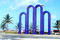 Arcos Square.
 -
Buildings in Aracaju.
-
 Aracaju bridge.
 -
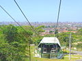 Aracaju aerial tramway.


References
- ^ GDP (PDF) (in Portuguese). Aracaju, Brazil: IBGE. 2005. ISBN 85-240-3919-1. Retrieved 2007-07-18.
External links
 Definitions from Wiktionary
 Media from Commons
 News from Wikinews
 Quotations from Wikiquote
 Texts from Wikisource
 Textbooks from Wikibooks
 Resources from Wikiversity
 Travel information from Wikivoyage
10°55′00″S 37°03′00″W / 10.9167°S 37.05°W
| |||||||||||||||||||||||||||||||||||||||||||||||||||
| Related topics | |||||||||||||||||||||||||||||||||||||||||||||||||||