
Luton
| Borough of Luton | |
|---|---|

| |
| Geography | |
| Status: | Unitary, Borough |
| Region: | East of England |
| Ceremonial County: | Bedfordshire |
| Area: - Total |
Ranked 311th 43.35 km² |
| Admin. HQ: | Luton |
| ONS code: | 00KA |
| Demographics | |
| Population: - Total (2022) - Density |
Ranked / km² |
| Ethnicity: | 71.9% White 18.3% S.Asian 6.3% Afro-Carib. |
| Politics | |
| Leadership: | Leader & Cabinet |
| Executive: | |
| MPs: | Kelvin Hopkins, Margaret Moran |
Luton is a large town and local government district in the south of England, located 51 km (32 miles) north of London. Luton, Dunstable and Houghton Regis form a conurbation which had a population in excess of 230,000 in 2001.[1] Luton is home to Luton Town Football Club, London Luton Airport and the University of Bedfordshire. It was famous for hatmaking and was home to a large Vauxhall factory for many years.

About Luton
Luton Town Football Club
For the main article see Luton Town
Luton is the home town of Luton Town Football Club who currently play in the Coca-Cola Football League Championship, the 2nd Flight of the English league structure. Their nickname, "The Hatters", dates back to when Luton had a substantial millinery industry.
Their only piece of major silverware to date is the League Cup, which they won in 1988 under the management of Ray Harford.
University of Bedfordshire
For the main article see University of Bedfordshire
The main campus of the University of Bedfordshire is in the town centre, a further campus is based on the edge of town in Putteridge Bury an old manor house.
Vauxhalls
From 1905 until 2002 the town had a Vauxhall Motors car plant, the first Vauxhall plant and the location that the company was founded. The M1 motorway runs between Luton and Dunstable: it does not form the boundary, as parts of Luton are to the west of it.
Parks
The town has several large parks, Wardown houses the museum and is located near the town centre. Stockwood houses a craft museum and the Mossman Collection. Wardown Park and the museum were a gift to the town from the then Mayor Asher Hucklesby. Luton has a Site of Special Scientific Interest at Warden Hills on its outskirts.
Luton Carnival
For the main article see Luton Carnival
Luton Carnival is the biggest one-day carnival in Europe, which usually takes place on the late May Bank Holiday. Crowds usually top 150,000[2] on each occasion, with it being a huge multicultural event attended by people from all over the country.
Luton Airport
For the main article see London Luton Airport
The town is famous for its airport, London Luton Airport, which is currently the fastest-growing airport in the United Kingdom[citation needed]. The airport is renowned for being a hub for budget airlines offering cheap flights. The England football team regularly fly from the airport[3] when playing matches abroad.
The airport was mentioned in a 1970s advert for Campari featuring Lorraine Chase[4] when asked "Were you truly wafted here from paradise?" she replied "Nah, Luton Airport!" which became a catchphase for her for many years.
History
Early History
Settlements have existed in the area since the Paleolithic era, most notably the henge monument now called Waulud's Bank, which dates from 3000 BC. The Roman settlement in the area was concentrated at Durocobrivis and Verulamium. The foundation of Luton is usually dated to the 6th century when a Saxon outpost was founded on the river Lea, Lea tun[5].
Luton is recorded in the Domesday Book as Loitone and also as Lintone; when the towns population was around 700-800. Agriculture dominated the local economy at this time.

In 1121 Robert, 1st Earl of Gloucester started work on St Mary's Church in the centre of the town, which was completed by 1137. A Castle which gives its name to 'Castle Street' was built in 1139. The castle was demolished in 1154. The site is now home to Matalan. During the middle ages Luton is recorded as being home to six water mills. Mill Street, in the town centre, takes its name from one of them.
King John (1166-1216) had hired a mercenary soldier, Falkes de Breauté, to act on his behalf. (Breauté is a small town near Le Havre in France.) When he married, he acquired his wife, Margaret's London house which came to be known as "Fawkes Hall", subsequently corrupted over the years to "Foxhall", then "Vauxhall". In return for his services, King John granted Falkes the manor of Luton. He was also granted the right to bear his own coat of arms and chose the mythical griffin as his heraldic emblem. The griffin thus became associated with both Vauxhall and Luton in the early 13th century. [1]
By 1240 the town is recorded as Leueton. The town had an annual market for surrounding villages in August each year, and with the growth of the town a second fair was granted each October from 1338.
In 1336, much of Luton was destroyed by a great fire, however the town was soon rebuilt.
The agriculture base of the town changed in the 16th century with a brickmaking industry developing around Luton, many of the older wooden houses were rebuilt in brick.
During the English Civil War of the 17th century there were two incidents in Luton. The first of which took place in 1645 when royalists entered the town and demanded money and goods. Parliamentary forces arrived and during the fighting four royalist soldiers were killed and a further 22 were captured. A second skirmish occurred three years later in 1648 when a royalist army passed through Luton. A small number of which were attacked by parliamentary soldiers at an inn on the corner of Bridge Street. Most of the group of royalists escaped but nine were killed.
It was in the 17th century when the hatmaking that became synonymous with the town began. By the 18th century the hatmaking industry, especially straw hat manufacture, dominated the town as its only significant industry. Hats are still produced in the town on a smaller scale.
Luton Hoo, a nearby large country house, little of the original house remains as much of it was rebuilt after a fire in 1843.
19th century

The town grew strongly in the 19th century; in 1801 the population was 3,095 [6]. By 1850 it was over 10,000 and by 1901 it was almost 39,000. This rapid growth was fuelled by the arrival of the railway in 1858, which bypassed Dunstable, the nearby market town, which until then had overshadowed Luton.
Luton had a gas supply in 1834, and the gas street lights were erected and the first town hall opened in 1847.
Newspaper printing arrived in the town in 1854, co-incidentally the year the first public cemetry was opened. Following a cholera epidemic in 1848 Luton formed a water company and had a complete water and sewerage system by the late 1860s. The first covered market was built (the Plait Halls - now demolished) in 1869. Luton was made a borough in 1876[7] and the football club was founded in 1885.
20th century
In the 20th century, the hat trade severely declined and was replaced by more modern industries. In 1905, Vauxhall Motors opened the largest car plant in the United Kingdom in Luton. Electrolux built a household appliances plant which was followed by other light engineering businesses.
In 1904 councillors Asher Hucklesby and Edwin Oakley purchased the estate that became Wardown Park, and then donated the property to the people of Luton. Hucklesby went on to be Mayor of Luton. The main house in the park became Luton Museum.
The town had a tram system from 1908 until 1932 and the first cinema was opened in 1909. By 1914, the population reached had 50,000.
The original town hall was destroyed in 1919 during the Peace Day celebrations at the end of the First World War; local people including many ex-servicemen were unhappy with unemployement and had been refused the use of a local park to hold celebratory events, and so stormed the town hall setting it on fire. (See Luton Town Hall) A replacement town hall was completed in 1936. Luton Airport opened in 1938, owned and operated by the council.
In World War II, the town suffered a number of air raids, and although only 107 people died [8] there was extensive damage to the town and over 1,500 homes were damaged or destroyed. The Vauxhall Factory built Churchill tanks as part of the war effort and was heavily camaflaged, the SKF factory was producing ball bearings, which were a vital part of the war effort. Although a bomb landed at the SKF Factory[9] no major damage was inflicted.
Post-war, the slum clearance continued and a number of substantial estates of council housing were built, notably at Farley Hill, Stopsley, Limbury, Marsh Farm and Leagrave, (Hockwell Ring). The M1 passed just to the west of the town in 1959. In 1962 a new library (to replace the Carneige Library) was opened by the Queen in the corner of St Georges Square. In the late 1960's a large part of the town centre was cleared to build a large covered shopping centre, the Arndale Centre, which was opened in 1972[10]. The Arndale Centre has had a major refurbishment, including a new glass roof, which has transformed the area.
In 2000, Vauxhall announced the end of car production in Luton; the plant closed in March 2002[citation needed]. At its peak it had employed around in excess of 30,000 people.
The future
A major regeneration programme for the town centre is planned, which will include upgrades to the town's bus and train stations as well as general improvements the town's streetscape. St Georges square is currently undergoing a rebuild[11] which is due to be completed by the end of 2006. Planning applications for an extension to the existing Arndale Shopping Centre[12] and also for a new centre in Power Court[13] (near to St Marys Church) have been submitted. It is hoped this will breathe life into the town, which has been flagging with the decades of decline of the manufacturing industry in Great Britain, which Luton once thrived upon.
Places within Luton
For main article see List of places within Luton.
Former villages and hamlets: Biscot, Crawley Green, Leagrave, Limbury, Round Green, Stopsley
Early expansion of Luton: Bury Park, High Town, New Town
New estates: Bramingham, Bushmead, Farley Hill, Hockwell Ring, Lewsey, Marsh Farm, Sundon Park, Warden Hills, Wigmore
Parks and amenities: Kenilworth Road, Luton Museum, Stockwood Park, Wardown Park, Waulud's Bank

Transport
Luton is well connected by transport links and is less than 30 miles from the centre of London.
Air

An airport was first opened on the current airport site on the 16 July 1938 by the Secretary of State for Air, Kingsley Wood. During the Second World War the airport was a base for Royal Air Force fighters.
Flights from the airport increased substantially from the 1960s as new charter airlines (e.g. Court Line) flew from there rather than the London airports. Despite problems in the 1970s, a new terminal was added in 1985[citation needed]. The airport was renamed London Luton Airport in 1990, just before Ryanair took its business to Stansted. The growth of new low-cost flights rejuvenated the airport and passenger numbers more than doubled from 1992 to 1998. In 1999, a new terminal was added and a new railway station, Luton Airport Parkway, opened.
Rail
Luton enjoys good rail connections via its three stations (Luton, Luton Airport Parkway and Leagrave) to London and through to Brighton and Sutton on First Capital Connect's Thameslink line and north to Derby, Leicester, Nottingham, Sheffield and other cities on the Midland Main Line, provided by Midland Mainline. There are plans to introduce 24-hour rail services to Luton and Luton Airport Parkway.[14]
Road
Luton is connected to the motorway network with two junctions onto the M1 motorway, (Junctions 10 and 11). The M1 was built on the west of the town in 1959, and provides access to London and the North. The A6 passes through the town heading north to Bedford and south to St Albans (although south of the town the road has been re-numbered as the A1081).
The A5 passes though nearby Dunstable, and the A505 provides a connection towards the East and the A1(M).
In 2006 work started on widening the M1 past Luton and to the South, and work also started on upgrading the access from the M1 to the Airport.
In 2003, an Office of Fair Trading study identified Luton Airport as having the highest daytime fare for a 2-mile taxi journey in the UK.[15]
Politics and demographics
Luton is represented by two Members of Parliament. The constituency of Luton North has been held by Kelvin Hopkins since 1997 and Luton South by Margaret Moran also since 1997. Luton is within the East of England (European Parliament constituency).
Historically Luton was part of the county of Bedfordshire, but since 1997 it has been an administratively independent unitary authority.
The local authority is Luton Borough Council (see www.luton.gov.uk local council website). The town is split into 19 wards, represented by 48 councilors. Elections are held for all seats every four years, with the next local elections due to be held in May 2007.
The town remains part of Bedfordshire for ceremonial purposes and is in the East of England region, but was formerly in South East England region, and in common usage is still often considered to be in the South East.
Trivia
In 2004, Luton was voted as the 'crappiest' town in the UK in the book Crap Towns II edited by Sam Jordison and Dan Kieran, beating previous winner in Crap Towns, Kingston upon Hull. The "award" was said to have won due to its abundance of abysmally ugly architecture, abundance of chain stores and lack of heart. However, given that fellow towns on this list were places such as Windsor, Oxford, Winchester, Liverpool (European Capital of Culture), and tiny London commuter belt villages, the list is of limited relevance.
This book deeply offended some people who see the town as a place which has had a significant impact on the history of the UK, however, other passed no notice to the publication.
The bell in the town hall is the heaviest in the county weighing in at two tonnes.[16]
Twin towns
Luton participates in international town twinning; its current partners are:
 Bergisch Gladbach, Germany, since 1956
 Bourgoin-Jallieu, France, since 1956
 Eskilstuna, Sweden, since 1949
- Spandau, Germany, since 1959
- Wolfsburg, Germany, since 1950
Economy
This is a chart of trend of regional gross value added of Luton at current basic prices published (pp.240-253) by Office for National Statistics with figures in millions of British Pounds Sterling.
| Year | Regional Gross Value Added[17] | Agriculture[18] | Industry[19] | Services[20] |
|---|---|---|---|---|
| 1995 | 2,067 | 1 | 902 | 1,165 |
| 2000 | 2,614 | 1 | 850 | 1,763 |
| 2003 | 3,090 | 1 | 811 | 2,278 |
Local attractions
| Key | |
| Abbey/Priory/Cathedral | |
| Accessible open space | |
| Amusement/Theme Park | |
| Castle | |
| Country Park | |
| English Heritage | |
| Forestry Commission | |
| Heritage railway | |
| Historic House | |
| Places of Worship | |
| Museum (free/not free) | |
| National Trust | |
| Theatre | |
| Zoo | |
Images
-
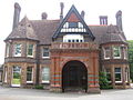
 Luton Town Centre
 -
-
-

-

-
-
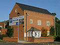
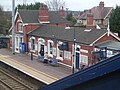 Leagrave Railway Station
 -
-


Local media
Newspapers
Two weekly newspapers are delivered free to all the houses in Luton. They are:
- Herald and Post - Delivered every Thursday
- Luton on Sunday- Delivered every Sunday
There is also a weekly sister paper of the Herald and post which is not free.
- Luton News - Published every Wednesday
Additionally once a month there is a council produced newspaper called LutonLine, usually delivered with the Luton on Sunday.
Radio
The local BBC station, Three Counties Radio broadcasts from its office in Hastings Street, Luton to Bedfordshire, Hertfordshire and Buckinghamshire.
Chiltern Radio is the local independant station and broadcasts from Bedford.
The university's radio station, Luton FM, runs for 28 days during May In addition, Ramadan FM broadcasts during the month of Ramadan. Diverse FM, another local radio station, has recently been awarded a community radio license from Ofcom and hopes to start broadcasting full-time in April 2007.
Famous people from Luton
People born in or had a strong connection with Luton.
- David Arnold, Composer
- Mick Abrahams, Rock guitarist of Jethro Tull and Blodwyn Pig
- John Badham, American film director
- Stefan Bailey, footballer for QPR went to Halyard High School
- Charles Bronson, infamous prisoner
- Ian Cashmore, actor, radio and tv presenter of Ghosthunters, born in Luton & Dunstable hospital
- Martin Dimery, Writer and performer
- Kerry Dixon, footballer with Chelsea and England
- Diana Dors was a barmaid in "The Rabbit" pub in Old Bedford Road
- John Gosling, former member of the pop group The Kinks
- Arthur Hailey Novelist (1920-2004)
- John Hegley, Poet
- Sir Alec Jeffreys, a British geneticist, developed techniques for DNA fingerprinting
- Steven Munn, Rock guitarist
- Monty Panesar, England cricketer
- David Renwick, BBC scriptwriter (One Foot in the Grave
- Lee Ross, Actor who plays Owen Turner in EastEnders
- Colin Salmon, actor, in films such as Resident Evil, AVP: Alien Vs. Predator and The World Is Not Enough
- Vaughan Savidge, BBC announcer
- Billy Schwer, champion boxer
- Andy Selway, drummer for KMFDM and Pig
- Edward Tudor-Pole, Singer/Actor of band Tenpole Tudor
- Kenneth Williams (1926-1988) went to school in Luton during World War II evacuation
- Paul Young, Singer
- Punk rock band UK Decay
- Metalcore band Elements of Refusal
External links
- Luton Borough Council
- Luton - 1911 Encyclopædia Britannica article
- A defence of Luton, the crappiest city in England in The Guardian
- Luton pubs Customer ratings and reviews of pubs in Luton
References
- ^ Luton Population
- ^ [http://www.bbc.co.uk/threecounties/do_that/2004/05/carnival/carnival_day.shtml Luton Carnival Coverage on the BBC
- ^ England players leaving from Luton
- ^ Lorraine Chase advert
- ^ Early history of Luton
- ^ Population figures for 1801, 1901 and 1901
- ^ Luton was made a borough
- ^ Deaths during WWII
- ^ See book Luton at War volume II
- ^ Arndale opened in 1972
- ^ St Georges Square on Luton Council Site
- ^ Luton Council website with Arndale plans
- ^ Website for the development of Power Court
- ^ First Capital plans
- ^ Office of Fair Trading Study
- ^ Discover Bedforshire article on Luton
- ^ Components may not sum to totals due to rounding
- ^ includes hunting and forestry
- ^ includes energy and construction
- ^ includes financial intermediation services indirectly measured
