
Flagstaff, Arizona
Flagstaff, Arizona | |
|---|---|
City | |
.jpg) Flagstaff in 2019, seen from Mount Elden | |
 Seal | |
| Nicknames: City of Seven Wonders, Dark Sky City | |
 Location in Coconino County and Arizona | |
 Map from U.S. Census | |
 Flagstaff Location in the United States  Flagstaff Flagstaff (the United States) | |
| Coordinates: 35°11′57″N 111°37′52″W / 35.19917°N 111.63111°W | |
| Country | |
| State | |
| County | Coconino |
| Settled | 1876 |
| Incorporated | 1928 |
| Government | |
| • Type | Council-Manager |
| • Body | Flagstaff City Council |
| • Mayor | Coral Evans[1] |
| Area | |
| • City | 66.08 sq mi (171.13 km2) |
| • Land | 66.02 sq mi (171.00 km2) |
| • Water | 0.05 sq mi (0.14 km2) |
| Elevation | 6,910 ft (2,106 m) |
| Population | |
| • City | 65,870 |
| • Estimate (2018)[5] | 73,964 |
| • Density | 1,120.28/sq mi (432.54/km2) |
| • Metro | 139,097 (US: 291st) |
| Demonym | Flagstonian or Flagstaffian |
| Time zone | UTC−7 (MST (no DST)) |
| ZIP codes | 86001–86002, 86004, 86011 |
| Area code | 928 |
| FIPS code | 04-23620 |
| GNIS ID(s) | 28749, 29046 |
| Major airport | Flagstaff Pulliam Airport |
| Interstates | |
| U.S. Highways | |
| State Routes | |
| Website | flagstaff |
Flagstaff (Navajo: Kinłání Dookʼoʼoosłííd Biyaagi, Havasupai: Wii Hagnbaj)[a] is a city in, and the county seat of, Coconino County in northern Arizona, in the southwestern United States. In 2018, the city's estimated population was 73,964. Flagstaff's combined metropolitan area has an estimated population of 139,097.
Flagstaff lies near the southwestern edge of the Colorado Plateau, along the western side of the largest contiguous ponderosa pine forest in the continental United States.[6] The city sits at around 7,000 feet (2,100 m) and is next to Mount Elden, just south of the San Francisco Peaks, the highest mountain range in the state of Arizona. Humphreys Peak, the highest point in Arizona at 12,633 feet (3,851 m), is about 10 miles (16 km) north of Flagstaff in Kachina Peaks Wilderness.
Originally settled by the pre-Columbian Native Sinagua people, the area of Flagstaff has fertile land from volcanic ash after eruptions in the 11th century. It was first settled as the present-day city in 1876. The early economy was based on the lumber, railroad, and ranching industries, and was dominated by the McMillan, Riordan, and Babbitt families. It was also selected as the location for the Lowell Observatory, from which Pluto was discovered, due to its altitude. The Riordans and Babbitts lobbied for Route 66 to pass through the city, which it did, turning the local industry to tourism and developing Downtown Flagstaff; though it brought Okies to the city during the Great Depression, Route 66 also presented funding opportunities that ultimately improved the economy in the early 1930s.
The city remains an important distribution hub for companies such as Nestlé Purina PetCare, and is home to the U.S. Naval Observatory, the United States Geological Survey Flagstaff, and Northern Arizona University. Flagstaff has a strong tourism sector, due to its proximity to Grand Canyon National Park, Oak Creek Canyon, the Arizona Snowbowl, Meteor Crater, and Historic Route 66. The city is also a growing center for medical and biotechnology manufacturing, home to corporations such as SenesTech and W. L. Gore and Associates.[7][8]
History
Early settlements

The Sinagua people[b] were a pre-Columbian culture that occupied a large area in Arizona from the Little Colorado River, near Flagstaff, to the Verde River, near Sedona, including the Verde Valley, area around the San Francisco Peaks, and significant portions of the Mogollon Rim country,[10][11] between approximately 500 CE and 1425 CE.[12] Christian E. Downum wrote that the Northern Sinagua began living in the pine forests of northern Arizona in the 5th century before moving into the area that is now Flagstaff in about 700 CE.[13]
Though a largely hunter-gatherer culture, Sinagua farmers cultivated maize beginning in the 8th century. They learned irrigation techniques from their southern Hohokam neighbors and added beans and squash to their crops.[9] The 1064 and 1066 eruptions of Sunset Crater covered the area in ash, which greatly enriched the soil for farming.[10][12]
Guy Gibbon mapped the cultural phases of the Northern Sinagua, placing them around Sunset Crater between 700 CE and 900 CE[12] (leaving the Wupatki National Monument ruins);[14] the Rio de Flag from 900 to 1066 (leaving the Picture Canyon site); Angell and Winona between 1066 and 1100; Padre Canyon from 1100 to 1150; Elden Pueblo between 1150 and 1250; Turkey Hill Pueblo from 1250 to 1300; and Clear Creek between 1300 and 1400.[12] Sinagua peoples left the Verde Valley by the early 15th century.[9] Like other pre-Columbian cultures in the southwest, the Sinagua apparently abandoned their permanent settlements around this time, though the precise reasons for such a large-scale abandonment are not yet known; resource depletion, drought, and clashes with the newly arrived Yavapai people have been suggested.[9]
Archeological and linguistic evidence suggests that the Yavapai people began developing independently from the Patayan at some point around 1300 CE.[15] Until western expansion in the 1860s, the Yavapai, specifically the Yavbe' (Northwestern Yavapai) and Wi:pukba (Northeastern Yavapai), occupied the land around the San Francisco Peaks that now includes Flagstaff.[16] Wi:pukba and Yavbe' groups had tumultuous relations with the Havasupai and Hualapai people throughout most of their history. Though the Pai peoples all spoke Upland Yuman dialects, and had a common cultural history, each peoples had tales of a dispute that separated them from each other; according to myth, the dispute began with a "mudball fight between children".[17] Scholars believe the split occurred around 1750.[17]
19th century
The area of Flagstaff was home to a wagon road to California in the 1800s, with a spring nearby. The first white (non-Native) settlement in the area was established by Edward Whipple, who opened a saloon on the wagon road in 1871.[18] The area came to be known as Antelope Spring.[18][19]
The first permanent settlement came in 1876, when Thomas F. McMillan built a cabin just north of the present-day town.[20] McMillan had been born in Tennessee, but prospected gold in California and reared sheep in Australia; in northern Arizona he started a successful sheep farm. The July 4, 1876 flag raising for which the city was named took place at a spring used as his sheep camp.[20] McMillan was a key developer of northern Arizona.[20]

The city is named for a makeshift flagstaff that was erected in the area, using a stripped pine tree. Various stories have been told of the circumstances,[18] with a common version telling that the instance for which the town was named occurred on July 4, 1876, when a ponderosa pine flagpole made by a scouting party from Boston (known as the "Second Boston Party") was raised to celebrate the United States Centennial.[19][21][22] Another story says that on July 4, 1855, a surveyor for the railroad by the name of Samuel Clark Hudson, accompanied by his team, climbed a tall pine tree and tied a flag.[23]
After the town took the name Flagstaff, it began to be known as 'Old Town' for a period, and was called this when the Atlantic and Pacific Railroad was being built through the area in 1882. The name Flagstaff was reinstated when a post office was introduced alongside the railroad depot.[18][19]
Development

During the 1880s, Flagstaff began to grow, with the early economy based on timber, sheep, and cattle.[18] By 1886, Flagstaff was the largest city on the railroad line between Albuquerque and the west coast of the United States.[24] In this year, it had a population of 600 and "more saloons than all other businesses combined".[25] In 1888, McMillan purchased an unfinished building that sits at the present-day intersection of Leroux Street and Route 66/Santa Fe Avenue, turning it into a bank and hotel known as the Bank Hotel.[20] Coconino County was created in 1891, and Flagstaff was chosen as its county seat over nearby Williams;[18] McMillan became chairman of the Board of Supervisors for the new county.[20]
The next year, stagecoach tours to the Grand Canyon began running from the Bank Hotel, which also housed an opera house that doubled as an events hall for entertainment.[20] In 1894, Massachusetts astronomer Percival Lowell hired A. E. Douglass to scout an ideal site for a new observatory. Douglass, impressed by Flagstaff's elevation, suggested it to Lowell, saying: "other things being equal, the higher we can get the better".[26] The Lowell Observatory was constructed on Mars Hill, overlooking the town. Two years later, the specially designed 24-inch (610 mm) Clark Telescope that Lowell had ordered was installed.[27]
The city grew rapidly, primarily due to its location along the east–west transcontinental railroad line in the United States.[28]: 65–67 By the 1890s, Flagstaff found itself along one of the busiest railroad corridors in the U.S., with about 80 to 100 trains traveling through the city every day, destined for Chicago, Los Angeles, and elsewhere.[28]: 96–97 [29]
In the 1890s, the Arizona Lumber and Timber Company was founded by the Riordan brothers to process timber. Michael and Tim Riordan worked in Flagstaff, and introduced electricity to the town for this purpose.[18] The Riordans also built the Lake Mary area of Flagstaff, and Michael Riordan took a particular interest in protecting the surrounding native ruins of the present Walnut Canyon National Monument.[18] The CO Bar Ranch was opened in about 1886 by the Babbitt brothers for cattle. Five Babbitt brothers from a mercantile background in Cincinnati, Billy, Charlie, Dave, Edward, and George, had set their eyes on becoming ranchers out West and sent Billy and Dave with $20,000 to buy a ranch; the brothers were told of some good, cheap, land just east of Flagstaff when in Albuquerque and took the railroad there, arriving in February 1886.[25]

After some years, the other Babbitt brothers also moved to Flagstaff. Three of the brothers married three daughters of a Dutch merchant, who advised the men to expand their business across many avenues, which they did, opening all kinds of stores, theaters, and even a mortuary in 1892, investing their money across northern Arizona. They also introduced sheep to their cattle farm, with Billy and Charlie working as cowboys.[25] The Babbitt family would be very influential in northern Arizona for decades (one descendant is former Governor of Arizona and Clinton's Secretary of the Interior, Bruce Babbitt).[25][30] According to True West Magazine, "it was said, God made northern Arizona, and then he turned it over to the Babbitts to run."[25]
The Northern Arizona Normal School was established in 1899, renamed Northern Arizona University in 1966.[24] In local culture, the Flagstaff Symphony made its concert debut at Babbitt's Opera House on April 11, 1899; the orchestra continues today as the Flagstaff Symphony Orchestra, with its primary venue at the Ardrey Auditorium on the campus of Northern Arizona University.[31]
.jpg)
On January 1, 1900, John Weatherford opened the Weatherford Hotel in Flagstaff.[18] In c. 1900, journalist Sharlot Hall described the houses in Flagstaff as a "third rate mining camp", with bad air and expensive goods.[32] The Babbitts saw the height of their "cattle empire" between 1907 and 1919,[25] with around 100 ranches between Kansas and California[30] funded by the brothers in the 40 years after their arrival in Flagstaff; the brothers are remembered as benevolent, often allowing their partners running the ranches unlimited credit.[25] In 1906, McMillan died; his family had been living in the Bank Hotel, which would soon pass to his son-in-law's family.[20] Weatherford opened the town's first movie theater in 1911; it collapsed under heavy snowfall a few years later, but he soon replaced it with the Orpheum Theater. The Weatherford Hotel and Orpheum Theater are still in use today.[18]
The state of Arizona was admitted to the Union in 1912; one of the first two senators was Henry F. Ashurst, who had been born in Nevada but whose family moved to a ranch near Williams when he was two, with Ashurst attending school in Flagstaff.[33] At the age of ten he showed his ambition to be a Senator by writing "Henry Fountain Ashurst, U.S. Senator from Arizona" into a speller.[34] After dropping out of school at the age of thirteen, he worked as a cowboy on his father's ranch.[35] At the age of nineteen, Ashurst was made the turnkey at the county jail in Flagstaff. While working at the jail, he developed an interest in the law by reading Blackstone's Commentaries.[35] Ashurst was admitted to the bar in 1897 and began a law practice in Williams,[35] and met his wife in Flagstaff.[36]
Flagstaff saw its first tourism boom in the early years of the 1900s, becoming known as the City of Seven Wonders, as the "Seven Wonders" of the wider Flagstaff area – listed as the Coconino National Forest, Grand Canyon, Oak Creek Canyon, San Francisco Peaks, Sunset Crater, Walnut Canyon, and Wupatki National Monument – were more widely known.[18][c]
Route 66 and incorporation
.jpg)
The railroad, which became the Santa Fe Railroad, had largely controlled Flagstaff – being its main source of industry and transport – until Route 66 was completed in 1926, with a section through Flagstaff. Route 66 had been supported by the businessmen of Flagstaff as early as 1912, knowing that the town was close to natural wonders that would make it a commercial opportunity, with the Babbitt family opening a car dealership. However, the university (then called Northern Arizona Teachers' College) and local media were against the rise of automobiles.[39] Seeing a rise in tourism, the people of Flagstaff collectively funded the Hotel Monte Vista, which opened on January 1, 1927, with local businessman John Weatherford having constructed a toll road up the nearby San Francisco Peaks in 1926.[39]
Flagstaff was then incorporated as a city in 1928,[24] with over 3,000 residents,[39] and in 1929, the city's first motel, the Motel Du Beau, was built at the intersection of Beaver Street and Phoenix Avenue. The Daily Sun described the motel as "a hotel with garages for the better class of motorists."[28]: 244–245 The units originally rented for $2.60 to $5.00 each, with baths, toilets, double beds, carpets, and furniture.[28]: 244–245 Flagstaff became a popular tourist stop along Route 66, particularly due to its proximity to the Grand Canyon, Painted Desert, and the Petrified Forest National Park.[39][40] To combat Route 66, the Santa Fe Railroad opened a new depot in Flagstaff in 1926. As part of the celebrations, Front Street was renamed Santa Fe Avenue. In 1927, Flagstaff's primary industry was still timber, though farming persisted into the 1920s. The city produced the majority of Arizona's timber supply that year, and was economically powered by the competing Arizona Lumber and Timber and Flagstaff Lumber companies, but in the last years of the decade, tourism took over and the face of the main commercial district changed to diners and motels in place of saloons.[39]
During the Great Depression, the massive expansion of Flagstaff and Coconino County was seen as likely unsustainable with a lower income. It was made worse by the unemployed workers traveling Route 66 to California stopping in Flagstaff, and young jobless Canadians venturing to the area for exploration having to be supported by the city before being deported. Southard wrote that the "down-on-their-luck migrants taxed the resources of their host cities, while contributing little to the local economy".[39] Known as "auto nomads" in Flagstaff, out-of-work families relocating to the city with children were particularly taxing on the public school system, and even those that did not stay long became unpopular as they could not afford to buy gas or food.[39] Flagstaff had also been highlighted on the map by Clyde Tombaugh's 1930 discovery of Pluto from the Lowell Observatory.[41] However, some Flagstaff residents attempted charitable endeavors, including setting up food banks and imploring hunters in the local area to donate a percentage of each kill to them. This did not last long, as in the winter of 1931–32, a rumor that California had closed its borders to Mid West migrants spread through Arizona, with people from places like Flagstaff and Yuma, the last cities on major cross-country highways before California, demanding that Arizona be closed to migrants, too.[39]
The importance of Route 66 to cross-country travel, and thus to Arizona's interests on a national level, did mean that it received a large share of state funding through the Depression, though, with highway maintenance and unemployment acts providing over $1 million of funding in May 1933. Flagstaff's unemployed soon became highway construction workers, and by the end of 1934, Flagstaff had financially recovered to pre-Depression levels, aided by tax cuts and continued tourism; in 1935, many residents had enough disposable income to remodel their homes or build new ones. In 1936, based on the city's continued economic upswing, General Petroleum announced it was building a new refinery just outside of town. The highway, now well- paved and maintained, was used to transport military outfits come the outbreak of World War II, bringing more prosperity to Flagstaff.[39]
In 1955 the U.S. Naval Observatory joined the growing astronomical presence, and established the United States Naval Observatory Flagstaff Station, where Pluto's satellite, Charon, was discovered in 1978.[41]
During the Apollo program in the 1960s, the Clark Telescope was used to map the moon for the lunar expeditions, enabling the mission planners to choose a safe landing site for the lunar modules.[42] In homage to the city's importance in the field of astronomy, asteroid 2118 Flagstaff is named for the city, and 6582 Flagsymphony for the Flagstaff Symphony Orchestra.
Flagstaff grew and prospered through the 1960s. During the 1970s and 1980s, however, many businesses started to move from the city center, and the downtown area entered an economic and social decline. Sears and J.C. Penney left the downtown area in 1979 to open up as anchor stores in the new Flagstaff Mall, joined in 1986 by Dillard's. By 1987, the Babbitt Brothers Trading Company, a retail fixture in Flagstaff since 1891, closed its doors at Aspen Avenue and San Francisco Street.[28]: 161–167
The Railroad Addition Historic District was added to the National Register of Historic Places in 1983.[43][44]
In 1987, the city drafted a new master plan, also known as the Growth Management Guide 2000, which would transform downtown Flagstaff from a shopping and trade center into a regional center for finance, office use, and government. The city built a new city hall, library, and the Coconino County Administrative Building in the downtown district, staking an investment by the local government for years to come. In 1992, the city hired a new manager, Dave Wilcox, who had previously worked at revitalizing the downtown areas of Beloit, Wisconsin and Missoula, Montana. During the 1990s, the downtown area underwent a revitalization, many of the city sidewalks were repaved with decorative brick facing, and a different mix of shops and restaurants opened up to take advantage of the area's historical appeal.[28]
On October 24, 2001, Flagstaff was recognized by the International Dark-Sky Association as the world's first "International Dark-Sky City."[45][46]
In 2012, Flagstaff was officially named "America's First STEM Community" (Science, Technology, Engineering, and Mathematics) by Flagstaff Mayor Jerry Nabours.[47][48]
Geography
Flagstaff, the county seat of Coconino County, Arizona,[49] is located at 35°11′57″N 111°37′52″W / 35.19917°N 111.63111°W.[50] According to the United States Census Bureau, the city has a total area of 63.9 square miles (165.5 km2), of which only 0.03 square miles (0.08 km2) (0.08%) is water.
At 7,000 feet (2,130 m) elevation, next to the largest contiguous ponderosa pine forest in North America, Flagstaff is on a mountain surrounded by volcanoes, in the heart of the Coconino national forest. Any type of desert climate can be found below its elevation 100 miles from Flagstaff.[51] The city is situated on the Rio de Flag watercourse,[52] and is about 130 miles (210 km) north of Phoenix.
Cityscape

Downtown Flagstaff lies immediately to the east of Mars Hill, the location of Lowell Observatory. Streets in the downtown area are laid out in a grid pattern, parallel to Route 66 and the Burlington Northern Santa Fe Rail Line, running east–west through the city. Milton Road branches off from Route 66 west of downtown, and travels south, adjacent to the Northern Arizona University campus, to the junction of Interstate 17 and Interstate 40. Milton Road becomes I-17. A road called Beulah Boulevard, which also runs south, becomes State Route 89A, and travels through Oak Creek Canyon to Sedona. Traveling north from downtown, Fort Valley Road (U.S. 180) connects with the Museum of Northern Arizona, Arizona Snowbowl, and Grand Canyon National Park. Traveling east from downtown, Route 66 and the railroad run in parallel toward East Flagstaff (and beyond), at the base of Mount Elden. Much of Flagstaff's industry is east of downtown, adjacent to the railroad tracks, as well as in East Flagstaff.
Several towns are close to Flagstaff along Interstates 40 and 17. Approximately 6 miles (9.7 km) south are the small urban areas of Kachina Village (west of I-17) and Mountainaire (east of I-17; 2 miles (3.2 km)). About 35 miles (56 km) to the west is Williams, 20 miles (32 km) to the south is Munds Park, and 30 miles (48 km) to the south on Arizona Highway 89A is Sedona. 15 miles (24 km) to the east of Flagstaff is the town of Winona, mentioned in the famous song, Route 66.
Climate
Flagstaff has a dry-summer continental climate (Köppen Dsb).[53] There are five distinct seasons - a cold and snowy winter, with extended dry periods, punctuated by deep snows about once every 3–4 weeks; a dry and windy spring with occasional snows; a very dry and warm early summer from May to early July; a wet monsoon season from July to early September; and a dry and pleasant fall which lasts until the first snows in November.
The combination of high elevation and low humidity provides mild weather conditions throughout most of the year. The predominantly clear air and high elevation radiate daytime heating effectively, resulting in overnight temperatures generally much lower than the daytime temperature. This means a 55 °F (13 °C) day in January can drop to 15 °F (−9 °C) at night. Winter nights in fact can be extremely cold, with temperatures dropping below 0 °F (−18 °C)[54] on 5 to 6 nights per year.
Winter weather patterns in Flagstaff are cyclonic and frontal in nature, originating in the eastern Pacific Ocean. These deliver periodic, widespread snowfall, followed by extended periods of sunny weather. The area's generally stable weather pattern is broken by brief, but often intense, afternoon downpours and dramatic thunderstorms common during the monsoon of July and August. Summer temperatures are moderate, and high temperatures average around 82 °F (28 °C).[24] Extreme temperatures range from −30 °F (−34 °C) on January 22, 1937 up to 97 °F (36 °C) on July 5, 1973, respectively.[55] The weather in Flagstaff is generally sunny, with much more sunshine than other snowy cities like New York City, Chicago and Boston.[55]
The annual snowfall averages 100.3 inches (254.8 cm), placing Flagstaff among the snowiest incorporated cities in the United States.[56] Overall, the city features an average of 277 days without measurable precipitation each year. Despite snowstorms often being spread weeks apart, snow often covers the ground for weeks after major winter storms due to the low night temperatures refreezing the snowpack, even when daytime temperatures are above freezing. The highest recorded snowfall in a single day was 35.9 inches (91.2 cm) on February 21, 2019.[57] The maximum daily snow cover has been 83 inches (211 cm) on December 20, 1967, although the mean maximum for a full winter is only 20 inches (51 cm) and the lowest maximum only 6 inches (15 cm) in the dry winter of 1955–56. However, due to the infrequent and scattered nature of the snowstorms, persistent snow pack into spring is rare.[24] One notable exception occurred during the severe winter of 1915–16, when successive Pacific storms buried the city under over 70 inches (178 cm) of snow, and some residents were snowbound in their homes for several days.[58]

| Climate data for Flagstaff Pulliam Airport, Arizona (1991–2020 normals, sun 1981–2010, humidity 1961–1990,[d] extremes 1898–present)[e] | |||||||||||||
|---|---|---|---|---|---|---|---|---|---|---|---|---|---|
| Month | Jan | Feb | Mar | Apr | May | Jun | Jul | Aug | Sep | Oct | Nov | Dec | Year |
| Record high °F (°C) | 66 (19) |
71 (22) |
73 (23) |
80 (27) |
89 (32) |
96 (36) |
97 (36) |
93 (34) |
91 (33) |
85 (29) |
74 (23) |
68 (20) |
97 (36) |
| Mean maximum °F (°C) | 56.9 (13.8) |
58.9 (14.9) |
65.7 (18.7) |
72.8 (22.7) |
80.5 (26.9) |
88.6 (31.4) |
90.5 (32.5) |
87.4 (30.8) |
82.9 (28.3) |
75.5 (24.2) |
66.9 (19.4) |
58.7 (14.8) |
91.4 (33.0) |
| Mean daily maximum °F (°C) | 43.4 (6.3) |
45.7 (7.6) |
52.2 (11.2) |
59.2 (15.1) |
68.1 (20.1) |
79.1 (26.2) |
82.0 (27.8) |
79.3 (26.3) |
74.1 (23.4) |
63.6 (17.6) |
52.1 (11.2) |
43.0 (6.1) |
61.8 (16.6) |
| Daily mean °F (°C) | 30.5 (−0.8) |
32.8 (0.4) |
38.0 (3.3) |
43.7 (6.5) |
51.3 (10.7) |
60.8 (16.0) |
66.7 (19.3) |
64.9 (18.3) |
58.3 (14.6) |
47.6 (8.7) |
37.5 (3.1) |
30.0 (−1.1) |
46.8 (8.2) |
| Mean daily minimum °F (°C) | 17.6 (−8.0) |
19.6 (−6.9) |
23.8 (−4.6) |
28.2 (−2.1) |
34.6 (1.4) |
42.5 (5.8) |
51.4 (10.8) |
50.6 (10.3) |
42.5 (5.8) |
31.5 (−0.3) |
23.0 (−5.0) |
16.9 (−8.4) |
31.8 (−0.1) |
| Mean minimum °F (°C) | −1.4 (−18.6) |
2.5 (−16.4) |
8.1 (−13.3) |
17.1 (−8.3) |
24.6 (−4.1) |
31.1 (−0.5) |
41.4 (5.2) |
42.3 (5.7) |
30.9 (−0.6) |
20.0 (−6.7) |
8.1 (−13.3) |
−1.4 (−18.6) |
−5.5 (−20.8) |
| Record low °F (°C) | −30 (−34) |
−23 (−31) |
−16 (−27) |
−2 (−19) |
7 (−14) |
22 (−6) |
32 (0) |
24 (−4) |
20 (−7) |
−2 (−19) |
−13 (−25) |
−23 (−31) |
−30 (−34) |
| Average precipitation inches (mm) | 2.05 (52) |
2.17 (55) |
1.88 (48) |
0.89 (23) |
0.77 (20) |
0.30 (7.6) |
2.61 (66) |
3.04 (77) |
1.84 (47) |
1.52 (39) |
1.55 (39) |
1.90 (48) |
20.52 (521) |
| Average snowfall inches (cm) | 20.9 (53) |
19.3 (49) |
15.6 (40) |
5.0 (13) |
1.1 (2.8) |
0.0 (0.0) |
0.0 (0.0) |
0.0 (0.0) |
0.0 (0.0) |
1.5 (3.8) |
8.2 (21) |
18.5 (47) |
90.1 (229) |
| Average extreme snow depth inches (cm) | 10.7 (27) |
9.8 (25) |
9.3 (24) |
3.3 (8.4) |
0.3 (0.76) |
0.0 (0.0) |
0.0 (0.0) |
0.0 (0.0) |
0.0 (0.0) |
0.6 (1.5) |
3.7 (9.4) |
8.8 (22) |
17.4 (44) |
| Average precipitation days (≥ 0.01 in) | 7.0 | 7.6 | 6.8 | 4.9 | 4.5 | 2.2 | 12.0 | 13.3 | 7.5 | 5.3 | 4.4 | 6.7 | 82.2 |
| Average snowy days (≥ 0.1 in) | 6.2 | 6.1 | 4.7 | 1.9 | 0.9 | 0.0 | 0.0 | 0.0 | 0.0 | 0.5 | 2.3 | 5.7 | 28.3 |
| Average relative humidity (%) | 61.9 | 59.5 | 54.9 | 46.5 | 39.4 | 33.6 | 51.1 | 58.1 | 54.7 | 52.6 | 56.9 | 60.6 | 52.5 |
| Average dew point °F (°C) | 15.3 (−9.3) |
16.7 (−8.5) |
18.7 (−7.4) |
20.5 (−6.4) |
24.3 (−4.3) |
28.4 (−2.0) |
44.1 (6.7) |
45.9 (7.7) |
38.3 (3.5) |
27.3 (−2.6) |
19.9 (−6.7) |
15.1 (−9.4) |
26.2 (−3.2) |
| Mean monthly sunshine hours | 231.7 | 228.6 | 286.3 | 321.0 | 369.5 | 371.8 | 324.2 | 311.9 | 298.5 | 282.8 | 229.3 | 219.8 | 3,475.4 |
| Percent possible sunshine | 74 | 75 | 77 | 82 | 85 | 86 | 73 | 75 | 80 | 81 | 74 | 72 | 78 |
| Average ultraviolet index | 2 | 2 | 3 | 4 | 5 | 6 | 6 | 6 | 5 | 3 | 2 | 2 | 4 |
| Source 1: NOAA (relative humidity 1961–1990, sun 1973–1990)[59][60][61][62] | |||||||||||||
| Source 2: Weather Atlas (UV)[63] | |||||||||||||
Demographics
| Census | Pop. | Note | %± |
|---|---|---|---|
| 1890 | 964 | — | |
| 1900 | 1,271 | 31.8% | |
| 1910 | 1,633 | 28.5% | |
| 1920 | 3,186 | 95.1% | |
| 1930 | 3,891 | 22.1% | |
| 1940 | 5,080 | 30.6% | |
| 1950 | 7,663 | 50.8% | |
| 1960 | 18,214 | 137.7% | |
| 1970 | 26,117 | 43.4% | |
| 1980 | 34,743 | 33.0% | |
| 1990 | 45,857 | 32.0% | |
| 2000 | 52,894 | 15.3% | |
| 2010 | 65,870 | 24.5% | |
| 2018 (est.) | 73,964 | [5] | 12.3% |
| U.S. Decennial Census[64] | |||
According to the 2010 census, the population of the city was 65,870.[65] The population density was 831.9 people per square mile (321.2/km²). There were 26,254 housing units at an average density of 336.5 per square mile (129.9/km²). The racial makeup of the city was 73.4% White, 1.9% Black or African American, 11.7% Native American, 1.9% Asian, 0.2% Pacific Islander, 7.3% from other races, and 3.6% from two or more races. 18.4% of the population were Hispanics or Latinos of any race. The city's African American population is considerably lower than the U.S. average (1.9% versus 12.6%), while the Native American population is markedly higher (11.7% vs. 0.9%). This is primarily attributable to the city's proximity to several Native American reservations, including the Navajo, Hopi, Havasupai, and Yavapai. Flagstaff's Native American community is chiefly Navajo, and there are about 5,500 people of Navajo ancestry living in the city.[66]
As of 2000, there were 19,306 households out of which 32.8% had children under the age of 18 living with them, 44.0% were married couples living together, 11.6% had a female householder with no husband present, and 39.9% were non-families. 23.2% of all households were made up of individuals and 3.8% had someone living alone who was 65 years of age or older. The average household size was 2.59 and the average family size was 3.13.
The age distribution was 24.3% under the age of 18, 21.7% from 18 to 24, 30.5% from 25 to 44, 18.2% from 45 to 64, and 5.3% who were 65 years of age or older. The median age was 27 years. For every 100 females, there were 98.3 males. For every 100 females age 18 and over, there were 96.4 males.
The median income for a household in the city was $37,146, and the median income for a family was $48,427. Males had a median income of $31,973 versus $24,591 for females. The per capita income for the city was $18,637. About 10.6% of families and 17.4% of the population were below the poverty line, including 17.6% of those under age 18 and 7.0% of those age 65 or over.
As a college town, Flagstaff's population is considerably more educated than the U.S. average. 89.8% of the population has a high school diploma or higher, while the national average is 80.4%; also, 39.4% of the population has a bachelor's degree or higher, compared to the national average of 24.4%.[citation needed]
Crime
For 2017, the FBI's Uniform Crime Report indicated for Flagstaff a rate of 290 cases of violent crime per 100,000 population and 2,710 cases of property crime per 100,000 population.[67]
Economy

In its early days, the city's economic base comprised the lumber, railroad, and ranching industries. Today, that has largely been replaced by tourism, education, government, and transportation. Some of the larger employers in Flagstaff are Northern Arizona University, the Flagstaff Medical Center, and the Flagstaff Unified School District. Tourism is a large contributor to the economy, as the city receives over 5 million visitors per year.[24]
Scientific and high tech research and development operations are in the city, including Lowell Observatory, Northern Arizona University, the United States Naval Observatory Flagstaff Station (NOFS) and the United States Geological Survey's (USGS) Flagstaff campus. Lowell Observatory celebrated its 125th anniversary in 2019 and continues to be a leading astronomical research center, as well as a popular destination for visitors. More than 100,000 people visited in both 2018 and 2019 and in 2019 the observatory opened its new Giovale Open Deck Observatory, an observing plaza with a suite of six advanced telescopes. Research is involved in observations of near-Earth phenomena such as asteroids and comets. In 2012 the observatory commissioned its Lowell Discovery Telescope, a 4.3-meter telescope with an instrument cube that can hold five instruments at once.[68] Lowell Observatory and NOFS also are collaborators on the Navy Precision Optical Interferometer, on nearby Anderson Mesa. NOFS is heavily involved with the science of star catalogs and astrometry, or the positions and distances of stars and celestial objects.

There are five industrial parks in the city, situated near I-40 and I-17. Major manufacturers in Flagstaff include W. L. Gore & Associates, widely known as the maker of Gore-Tex; Nestlé Purina PetCare, manufacturer of pet food; SenesTech, a biotechnology research lab and manufacturer; SCA Tissue, a major tissue paper producer; and Joy Cone, manufacturer of ice cream cones.[7][69] Walgreens operated a distribution center in the city until 2014.[24][70][8]
With proximity to Grand Canyon National Park, the city also has a thriving travel and tourism industry, with numerous hotel and restaurant chains. The downtown area is home to two historic hotels, the Weatherford Hotel and the Hotel Monte Vista. The first hotel of the Ramada Inn chain opened in 1954 at the intersection of U.S. Routes 66, 89 and 89A adjacent to what was then Arizona State College (now Northern Arizona University). The original building is still intact, operating as a Super 8 Motel.[71]
Arts and culture

Flagstaff has an active cultural scene. The city is home to the Flagstaff Symphony Orchestra, which plays concerts from September through April at Ardrey Auditorium on the NAU campus.[31] The city also attracts folk and contemporary acoustic musicians, and offers several annual music festivals during the summer months, such as the Flagstaff Friends of Traditional Music Festival, the Flagstaff Music Festival, and Pickin' in the Pines, a three-day bluegrass and acoustic music festival held at the Pine Mountain Amphitheater at Fort Tuthill Fairgrounds.[72][73][74] Popular bands play throughout the year at the Orpheum Theater, and free concerts are held during the summer months at Heritage Square.[75]
Flagstaff is home to an active theatre scene, featuring several groups. Northern Arizona University Department of Theatre is an active and successful theatre program that produces quality productions for the community as well as the campus. The department has won many prestigious awards including multiple invitations to the Kennedy Center American College Theatre Festival. NAU Theatre performs in two facilities including the Clifford E. White Theatre (named for long-time professor Clifford E. White) and the Studio Theatre. Both facilities are housed in the Fine and Performing Arts Building on campus. The season includes four mainstage and numerous second stage productions and a summer collaboration with Theatrikos Theatre Company. Theatrikos, a local community theater company, was founded in 1972 in the basement of the Weatherford Hotel, and today puts on six major productions per year. In 2002, the company moved into a new venue now known as the Doris-Harper White Community Playhouse, a downtown building which was built in 1923 as an Elks Lodge and later became the Flagstaff library.[76] Since 1995, the Flagstaff Light Opera Company has performed a variety of musical theatre and light opera productions throughout the year at the Sinagua Middle/School auditorium.[77] There are several dance companies in Flagstaff, including Coconino Community College Dance Program, Northern Arizona Preparatory Company and Canyon Movement, which present periodic concerts and collaborate with the Flagstaff Symphony for free concerts during the summer and holiday seasons.[78]
A variety of weekend festivals occur throughout the year. The annual Northern Arizona Book Festival, held in the spring, brings together nationally known authors to read and display their works.[79] The Flagstaff Mountain Film Festival is held every October, and features a variety of independent films and documentaries focusing on extreme sports, environmental issues, and global topics. The festival is four days long and consists of several sessions of films. The screenings are held at the Orpheum Theater in the historic downtown area.[80] The summer months feature several festivals, including Hopi and Navajo Festivals of Arts and Crafts, the Arizona Highland Celtic Festival, Pride in the Pines,[81] and the Made in the Shade Beer Tasting Festival.[82] For more than 20 years Flagstaff has hosted the 10-day Flagstaff Festival of Science in September. It is a family event which features open houses, lectures, informal talks, and hands-on activities at area museums, observatories, other scientific facilities, and the university. In-school programs also are an important part of the festival. The festival begins with the annual Eugene Shoemaker keynote address. Guest speakers have included famous astronauts, arctic explorers, storm chasers, and scientists from many disciplines. The Coconino County Fair is held every September at the Fort Tuthill County Fairgrounds, featuring a demolition derby, livestock auction, carnival rides, and other activities.[83]

On New Year's Eve, people gather around the Weatherford Hotel as a 70-pound, 6-foot (1.8 m) tall, metallic pine cone is dropped from the roof at midnight. The tradition originated in 1999, when Henry Taylor and Sam Green (owners of the Weatherford Hotel), decorated a garbage can with paint, lights, and pine cones, and dropped it from the roof of their building to mark the new millennium. By 2003 the event had become tradition, and the current metallic pine cone was designed and built by Frank Mayorga of Mayorga Welding in Flagstaff.[84]
The Museum of Northern Arizona includes displays of the biology, archeology, photography, anthropology, and native art of the Colorado Plateau. The Arboretum at Flagstaff is a 200-acre (81 ha) arboretum featuring 2,500 species of drought-tolerant native plants representative of the high-desert region.[85][86]
Route 66, which originally ran between Chicago and Los Angeles, greatly increased the accessibility to the area, and enhanced the culture and tourism in Flagstaff.[87] Route 66 remains a historic route, passing through the city between Barstow, California, and Albuquerque, New Mexico. In early September, the city hosts an annual event, Route 66 Days, to highlight its connection to the famous highway.[88]
Sports

There are no major-league professional sports teams based in Flagstaff. However, from 1988 to 2012 (with the exception of the 2005 season, due to an outbreak of a flu-like virus), the Arizona Cardinals of the National Football League held their summer training camp at Northern Arizona University.[89] The NAU training camp location has been cited as one of the top five training camps in the NFL by Sports Illustrated.[90] The Cardinals left Flagstaff in summer 2013.[91]
Northern Arizona University sponsors 15 sports at the Division I level, including a football team that competes at the Division I Football Championship Series level. All sports are members of the Big Sky Conference with the exception of the Women's Swimming & Diving team, which competes in the Western Athletic Conference. The Men's Cross Country team has featured four straight top ten finishes at the NCAA Division I Cross Country championships, which are held each year in Terre Haute, Indiana. The track and field team is home to several All-Americans including NCAA Champion/Olympian Lopez Lomong, two time NCAA Champion David McNeill and All-American/ 2012 Olympian Diego Estrada.
Parks and outdoor recreation

Flagstaff has acquired a reputation as a magnet for outdoor enthusiasts, and the region's varied terrain, high elevation, and amenable weather attract campers, backpackers, climbers, recreation and elite runners, and mountain bikers from throughout the southwestern United States. There are 679.2 acres (274.9 ha) of city parks in Flagstaff, the largest of which are Thorpe Park and Buffalo Park. Wheeler Park, next to city hall, is the location of summer concerts and other events.[92] The city maintains an extensive network of trails, the Flagstaff Urban Trails System, or "FUTS" includes more than 50 miles of paved and unpaved trails for hiking, running, and cycling. The trail network extends throughout the city and is widely used for both recreation and transportation.[93]
The area is a recreational hub for road cycling and mountain biking clubs, organized triathlon events, and annual cross country ski races. Several major river running operators are headquartered in Flagstaff, and the city serves as a base for Grand Canyon and Colorado River expeditions.[94]
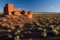
Flagstaff's proximity to Grand Canyon National Park, about 75 miles (121 km) north of the city, has made it a popular tourist destination since the mid-19th century. Other nearby outdoor attractions include Walnut Canyon National Monument, Sunset Crater Volcano National Monument, Wupatki National Monument, and Barringer Crater. Glen Canyon National Recreation Area and Lake Powell are both about 135 mi (217 km) north along U.S. Route 89.[95]
Dark Sky City
.jpg)
Flagstaff takes one of its nicknames from its legislative designation as the world's first International Dark Sky City, a deliberate dark sky preserve area with measures to reduce light pollution. This was one of the world's first coordinated legislative efforts to do so. In the city there has been over fifty years of planning and development,[96] with the support of the ecologically-aware population and community advocates, frequent government support, and the assistance of major observatories in the area – including the United States Naval Observatory Flagstaff Station and Lowell Observatory.[97][98][99][100]
The city's designation as an International Dark Sky City was on October 24, 2001, by the International Dark-Sky Association, after a proposal by the city's own Dark Sky Coalition to start the preserve program. It is seen as a world precedent in dark sky preservation.[101] Before this, it had been nicknamed the "Skylight City" in the 1890s, the same decade that the Lowell Observatory opened.[102] In 1958, it passed Ordinance 400,[96] which outlawed using large or powerful searchlights within city limits. In the 1980s a series of measures were introduced for the city and Coconino County, and the Dark Sky Coalition was founded in 1999 by Chris Luginbuhl and Lance Diskan. Luginbuhl is a former U.S. Naval astronomer,[103] and Diskan had originally moved to Flagstaff from Los Angeles so that his children could grow up able to see stars, saying that "part of being human is looking up at the stars and being awestruck."[102] It was reported in an award-winning article[104] that even though greater restrictions on types of public lighting were introduced in 1989,[105] requiring them all to be low-emission, some public buildings like gas stations hadn't updated by 2002, after the Dark Sky designation.[104]
Flagstaff and the surrounding area is split into four zones, each permitted different levels of light emissions. The highest restrictions are in south and west Flagstaff (near NAU and its observatory), and at the Naval, Braeside, and Lowell Observatories.[104] Photographs detecting emissions taken in 2017 show that Flagstaff's light is 14 times less than another Western city of comparable size, Cheyenne, Wyoming, which Luginbuhl described as "even better than [they] might have expected".[103]
Government

Flagstaff is the county seat of Coconino County.
The city government is organized under a council-manager form of government.[106] The mayor of Flagstaff is Coral Evans, who was elected in November 2016, and the town council consists of the mayor and six councilmembers: Adam Shimoni (vice mayor), Regina Salas, Jim McCarthy, Jamie Whelan, Charlie Odegaard, and Austin Aslan.[107] On July 2, 2019, the city council named Greg Clifton as city manager among 50 candidates.[108] Regular meetings of the city council are held on the first and third Tuesday of every month.[109]
At the state level, Flagstaff is in the 6th legislative district. In the Arizona State Senate, the 6th is represented by Sylvia Allen (R) of Snowflake. In the House of Representatives, the 6th is represented by Bob Thorpe (R) of Flagstaff and Walter Blackman (R) of Snowflake.
At the federal level, Flagstaff is within Arizona's 1st congressional district, which is the tenth largest congressional district, covering nearly 60,000 sq. miles. The district is represented by Tom O'Halleran (D) of Sedona.
The City of Flagstaff raised its minimum wage above the State minimum wage in 2017. This wage increase was the result of a ballot measure – Proposition 414 – on the November 8, 2016, ballot.[110] The City Council of Flagstaff then passed Title 15 of the City Ordinance, which provided for implementation of the new law.[111] The new minimum wage in Flagstaff on July 1, 2017, was $10.50, fifty cents more than the Arizona state minimum wage.[112] On January 1, 2020, the minimum wage rose to $13.00.
Education
There are 19 public schools, with 11,500 students and 800 faculty and staff, in the Flagstaff Unified School District. In 1997, Mount Elden Middle School was named an A+ School, citing an outstanding school climate, progressive use of technology and zero-tolerance approach to discipline. The 1999 National Science Teacher of the Year, David Thompson, teaches physics at Coconino High School.[113] Three Arizona Teachers of the Year from 2001 through 2003 teach at Flagstaff High School.[114]
In addition to the numerous public schools, there are several charter schools operating in the Flagstaff area including Flagstaff Junior Academy, Northland Preparatory Academy (ranked No. 52 in US News's America's Top 100 Best High Schools), the Flagstaff Arts and Leadership Academy, Pine Forest Charter School, BASIS Flagstaff (ranked No. 2 in The Washington Post's America's Most Challenging High schools) and the Montessori Schools of Flagstaff.
Flagstaff is home to two institutions of higher education, Northern Arizona University (one of the three public state universities in Arizona) and Coconino Community College.
Infrastructure

Transportation
.jpg)
.jpg)
Flagstaff is at the northern terminus of Interstate 17, which runs 145 miles (233 km) south to Phoenix. Interstate 40 runs east–west through the city, traveling to Barstow, California in the west and Albuquerque, New Mexico (and beyond) in the east. Historic Route 66 also runs east–west through the city, roughly parallel to I-40, and is a major thoroughfare for local traffic. Butler Avenue connects I-40 with downtown Flagstaff, and the major north–south thoroughfare through town is Milton Road. State Route 89A travels through the city (concurrently as parts of Milton Rd. and Route 66), going south through Oak Creek Canyon to Sedona.
The major rail corridor running through Flagstaff is the Southern Transcon, originally built by the Santa Fe Railway and now owned and operated by the BNSF Railway. Passenger rail service is provided by Amtrak at the downtown station, connecting on east–west routes to Los Angeles and Albuquerque via the Southwest Chief line.[115] Amtrak also provides connecting Thruway Motorcoach service via Open Road Tours, which has an office inside the Flagstaff depot.[116] Local bus service is provided throughout the city by the Mountain Line. Interstate bus service is provided by Greyhound Lines and Flixbus. Groome Transportation provides in-state shuttle service.[117] Bus service is provided by Hopi Senom Transit to the Hopi Reservation and by Navajo Transit to Tuba City and the Navajo Nation[118][119]
Air travel is available through Flagstaff Pulliam Airport (IATA: FLG, ICAO: KFLG, FAA LID: FLG), just south of the city. The airport is primarily a small, general aviation airport with a single 6,999 feet (2,133 m) runway. The airport finished a major expansion project to add 1,800 feet (550 m) to the north end of the runway and lengthen the taxiway in 2007. The primary purpose of the project was to increase its viability for commercial and regional jets.[120] Service to connecting flights at Phoenix Sky Harbor International Airport (IATA: PHX, ICAO: KPHX, FAA LID: PHX) is provided by American Airlines operated by Mesa Airlines.[120] As of January, 2020 the airport offers year-round direct flights to Phoenix Sky Harbor International Airport, Dallas-Fort Worth International Airport, and Denver International Airport, on American Airlines and United Airlines, respectively.[121]
Flagstaff is fairly bike-friendly; there are bike lanes on many major streets,[122] and the Flagstaff Urban Trails System (FUTS) includes more than 50 miles of off-street trails that wind throughout the community.[123] In 2006 Flagstaff was designated a Bicycle-Friendly Community by the League of American Bicyclists.[124] About nine percent of trips in Flagstaff are made by bicycle.[122]
Utilities
Electricity generation in Flagstaff is provided by Arizona Public Service, an electric utility subsidiary operated by parent company Pinnacle West. The primary generating station near Flagstaff is the coal-fired, 995-MW Cholla Power Plant, near Holbrook, which uses coal from the McKinley Mine in New Mexico. Near Page is the coal-fired, 750-MW Navajo Power Plant, supplied by an electric railroad that delivers coal from a mine on the Navajo and Hopi reservations in northern Arizona.[125] Flagstaff is also home to Arizona's first commercial solar power generating station, which was built in 1997 and provides 87 kW of electricity. Combined with 16 other solar power locations in Arizona, the system provides over 5 MW of electricity statewide.[126]
Drinking water in Flagstaff is produced from conventional surface water treatment at the Lake Mary Water Treatment Plant, on Upper Lake Mary, as well as from springs at the inner basin of the San Francisco Peaks. Groundwater from several water wells throughout the city and surrounding area provide additional sources of drinking water.[127] Water and wastewater services are provided by the City of Flagstaff.
Natural gas is provided by UniSource Energy Services. CenturyLink QC is the incumbent local exchange carrier.[128] Cable television service is offered by Suddenlink Communications.[129]
Health care
The city's primary hospital is the 267-bed Flagstaff Medical Center, on the north side of downtown Flagstaff. The hospital was founded in 1936, and serves as the major regional trauma center for northern Arizona.
Media and popular culture
This article needs additional citations for verification. (September 2016) |

The major daily newspaper in Flagstaff is the Arizona Daily Sun. Northern Arizona University's weekly newspaper The Lumberjack also covers Flagstaff news, while the other publications that serve the city include weeklies Flagstaff Live and the Navajo Hopi Observer, and monthlies Mountain Living Magazine and The Noise.
Several radio stations operate in the area, some of which operate transmitters in Prescott as well.
Flagstaff is included in the Phoenix Designated market area (DMA), the 13th largest in the U.S.[130] Over-the-air television service is provided mostly by low-powered repeaters of the Phoenix stations.[131] There is one local broadcast television station serving the city, KFPH-13 (TeleFutura).
In the early 20th century, the city was considered as a site for the film The Squaw Man by Jesse Lasky and Cecil B. DeMille, but was abandoned in favor of Hollywood.[132] Scenes from the 1969 film Easy Rider were filmed on Milton Road and Route 66 as well as near Sunset Crater. In 1983 a moment in the film National Lampoon's Vacation was filmed at a truck stop gas station near Little America Hotel. Several recent movies have been filmed, at least in part, in Flagstaff. A small scene in Midnight Run was filmed in Flagstaff at the train depot, the city was also referenced in the film. Several of the running scenes in Forrest Gump were filmed in and around the area, including a memorable scene in which Forrest is seen jogging in downtown Flagstaff and gives inspiration to a bumper sticker designer ("Shit happens"). Parts of 2007 Academy Award winner Little Miss Sunshine were filmed at the junction of I-40 and I-17 in Flagstaff, and Terminal Velocity was partially filmed in the city.[133]
During the 1940s and 1950s, over 100 western movies were filmed in nearby Sedona and Oak Creek Canyon. The Hotel Monte Vista in Flagstaff hosted many film stars during this era, including Jane Russell, Gary Cooper, Spencer Tracy, John Wayne, and Bing Crosby. A scene from the movie Casablanca was filmed in one of the rooms of the hotel.[134]
In 2005, Extreme Makeover: Home Edition built a home just outside Flagstaff for slain soldier Lori Piestewa's two children and parents. Grizzly Peak Films also filmed Sasquatch Mountain, a feature-length film for the Science Fiction Channel about a Yeti, in Flagstaff and nearby Williams.[135] In December 2007, talk show hostess Ellen DeGeneres selected Flagstaff as the winner of her show's "Wish You Were Here" contest.[136]
Notable people
Sister cities
Flagstaff has five sister cities:[137]
|
See also
Notes
- ^ These are not translations of the word 'flagstaff', they are Native names for the city.
- ^ Coined later from the Spanish for "without water" (sin and agua).[9]
- ^ Other nearby natural wonders include Canyon de Chelly,[37] Lake Powell,[38] Meteor Crater,[18] Monument Valley,[37] the Painted Desert, the Petrified Forest National Park,[18] Picture Canyon, and Rainbow Bridge National Monument.[37]
- ^ Mean monthly maxima and minima (i.e. the expected highest and lowest temperature readings at any point during the year or given month) calculated based on data at said location from 1991 to 2020.
- ^ Official records for Flagstaff were kept at the Weather Bureau in downtown from September 8, 1898 to January 11, 1950, and at Pulliam Airport since January 12, 1950. For more information, see ThreadEx
References
- ^ "Mayor Coral Evans | City of Flagstaff Official Website". www.flagstaff.az.gov. Retrieved April 5, 2020.
- ^ "2018 U.S. Gazetteer Files". United States Census Bureau. Retrieved July 1, 2019.
- ^ "Feature Detail Report for: Flagstaff". Geographic Names Information System. United States Geological Survey, United States Department of the Interior.
- ^ "American FactFinder". United States Census Bureau. Archived from the original on February 12, 2020. Retrieved June 18, 2014.
- ^ a b "Population and Housing Unit Estimates". Retrieved June 4, 2019.
- ^ "Biotic Communities of the Colorado Plateau Archived April 29, 2015, at the Wayback Machine." Northern Arizona University. Retrieved on March 2, 2007.
- ^ a b "With revenues still small, Flagstaff's SenesTech looks to sales growth in 2018". Arizona Daily Sun. Retrieved March 7, 2019.
- ^ a b "W.L. Gore & Associates: Celebrating 50 years in Flagstaff". Arizona Daily Sun. Retrieved March 7, 2019.
- ^ a b c d Linoff, Lindsay (1998). "The Sinagua People of Montezuma Castle". Mesa Community College. Retrieved November 17, 2015.
- ^ a b "Sinagua". Logan Museum of Anthropology. Beloit College.
- ^ "The Sinagua". Anthropology Laboratories of Northern Arizona University. Retrieved November 17, 2015.
- ^ a b c d Gibbon, Guy, ed. (1998). Archaeology of Prehistoric Native America: An Encyclopedia. New York: Taylor & Francis. p. 770. ISBN 978-0815307259.
- ^ Kennedy, Frances H., ed. (2008). American Indian places: a historical guidebook. Boston: Houghton Mifflin Co. ISBN 978-0-547-52367-5. OCLC 759581887.
- ^ Snow, Dean. Archaeology of Native North America. Prentice Hall. p. 134. ISBN 9780136156864.
- ^ Braatz, Timothy (2003). Surviving conquest: a history of the Yavapai peoples. Lincoln: University of Nebraska Press. p. 27. ISBN 978-0-8032-1331-9. OCLC 50235078.
- ^ Salzmann, Zdeněk; Salzmann, Joy M. (1997). Native Americans of the Southwest: the serious traveler's introduction to people and places. Boulder, CO: Westview Press. p. 58. ISBN 0-8133-2279-0. OCLC 36241644.
- ^ a b Hoxie, Frederick E. (1996). Encyclopedia of North American Indians. Boston: Houghton Mifflin Co. p. 456. ISBN 978-0-395-66921-1. OCLC 34669430.
- ^ a b c d e f g h i j k l m "Flagstaff, Arizona – City of Seven Wonders – Legends of America". www.legendsofamerica.com. Retrieved April 5, 2020.
- ^ a b c DeGraff, John G. (2011). Flagstaff. Charleston, S.C.: Arcadia Pub. ISBN 978-0-7385-8510-9. OCLC 773944194.
- ^ a b c d e f g "Rio de Flag: History/Architecture". www2.nau.edu. Retrieved April 5, 2020.
- ^ Peattie, Donald Culross (1953). A Natural History of Western Trees. New York: Bonanza Books. p. 80.
- ^ "Flagstaff Flag - Raising Historical Marker". www.hmdb.org. Retrieved April 5, 2020.
- ^ "Community Profile | City of Flagstaff Official Website". www.flagstaff.az.gov. Retrieved April 5, 2020.
- ^ a b c d e f g "Flagstaff Community Profile." Official City Website. Retrieved on April 11, 2007.
- ^ a b c d e f g Trimble, Marshall (January 20, 2017). "The Babbitt Brothers & The CO Bar Ranch". True West Magazine. Retrieved April 5, 2020.
- ^ P. Lowell to A. E. Douglass, April 16, 1894, Lowell Observatory Archives.
- ^ Gilbert, Sarah (March 23, 2016). "A Brief History of a Legendary Telescope". Lowell Observatory. Retrieved April 5, 2020.
- ^ a b c d e f Paradis, Thomas Wayne (2003). Theme Town: A Geography of Landscape and Community in Flagstaff, Arizona. iUniverse. ISBN 0595270352.
- ^ Thomas W. Paradis, "From Downtown to Theme Town: Reinventing America's Smaller Historic Retail Districts", pp. 57–74 in The Themed Space: Locating Culture, Nation, and Self, ed. Scott A. Lukas (Lanham, Maryland, Lexington Books, 2007), ISBN 0-7391-2142-1
- ^ a b "Who Are the Babbitts, One of Flagstaff's Most Famous Families? – Arizona Oddities". Retrieved April 5, 2020.
- ^ a b "History of the FSO Archived August 16, 2015, at the Wayback Machine." Flagstaff Symphony Orchestra. Retrieved April 11, 2007.
- ^ Sharlot Hall's diary, quoted in the Plateau Journal of the Museum of Northern Arizona, v. 5 No. 1, 1991, p. 13
- ^ Johnson, James W. (2002). Arizona politicians: the noble and the notorious. Tucson: University of Arizona Press. p. 114. ISBN 0-8165-2203-0. OCLC 48661604.
- ^ "The Silver-Tongued Sunbeam". Time. 79 (23): 26. June 8, 1962.
- ^ a b c Baker, Richard Allan (1999). "Ashurst, Henry Fountain". In Garraty, John A.; Carnes, Mark C. (eds.). American National Biography. Vol. 1. New York: Oxford University Press. pp. 686–87. ISBN 0-19-512780-3.
- ^ "Mrs. Henry Ashurst, Wife of Senator". The New York Times. November 2, 1939. p. 29.
- ^ a b c Zeman, Scott C. (1998). "MONUMENT VALLEY: Shaping the Image of the Southwest's Cultural Crossroads". The Journal of Arizona History. 39 (3): 307–324. ISSN 0021-9053.
- ^ Heffernon, Rick (2000). "Destination Flagstaff:How Important is the Flagstaff-Area Tourism Cluster?" (PDF). Flagstaff Convention and Visitors Bureau. Arizona State University.
- ^ a b c d e f g h i Southard, John Larsen (2013). "RICHES, RUIN, AND RECOVERY: The Impact of Route 66 on Flagstaff, 1926 to 1938". The Journal of Arizona History. 54 (2): 153–174. ISSN 0021-9053.
- ^ Kaiser, James. Grand Canyon : the complete guide (7th edition ed.). ISBN 978-1-940754-33-8. OCLC 1029870515.
{{cite book}}:|edition=has extra text (help) - ^ a b Ferguson, Joe (September 28, 2009). "Ever wonder who makes your GPS work?". Arizona Daily Sun. Retrieved October 8, 2009.
- ^ Putnam, William Lowell. "The explorers of Mars Hill : a centennial history of Lowell Observatory, 1894–1994." West Kennebunk, Me. : Published for Lowell Observatory by Phoenix Pub., c1994.
- ^ "National Register Information System". National Register of Historic Places. National Park Service. July 9, 2010.
- ^ James Garrison; Jody Gebhardt; James Woodward (September 1982). "National Register of Historic Places Inventory - Nomination Form: Railroad Addition Historic District" (PDF). National Park Service. Retrieved January 14, 2016. Also includes 1986 and 1997 boundary increases.
- ^ "Flagstaff is the world's first "International Dark-Sky City"". flagstaffdarkskies.org. May 2, 2009. Retrieved October 8, 2009.
- ^ Staff Writer. "Stellar ideas keep astronomy in state." Arizona Republic. November 19, 2006. Retrieved October 14, 2007.
- ^ Expect More Arizona (October 29, 2012). "Flagstaff Named America's First STEM Community".
- ^ Flagstaff STEM City (2015). "STEM city Flagstaff, Arizona".
- ^ "Find a County". National Association of Counties. Archived from the original on May 31, 2011. Retrieved June 7, 2011.
- ^ "US Gazetteer files: 2010, 2000, and 1990". United States Census Bureau. February 12, 2011. Retrieved April 23, 2011.
- ^ "Flagstaff: The destination for all seasons". flagstaffarizona.org. Archived from the original on October 18, 2009. Retrieved October 8, 2009.
- ^ Reporter, ADRIAN SKABELUND Sun Staff. "Rio de Flag flood control project receives $52 million in federal funding". Arizona Daily Sun. Retrieved April 5, 2020.
- ^ Updated world map of the Köppen-Geiger climate classification. Authors Peel, M.C., Finlayson, B.L., and McMahon, T.A. Published by European Geosciences Union. Note that the American winter isotherm (0 °C), not the international standard (−3 °C), is used.
- ^ "Compare Averages and Records (Flagstaff, Phoenix)". The Weather Channel. Archived from the original on June 28, 2011. Retrieved July 31, 2009.
- ^ a b "Seasonal Temperature and Precipitation Information". The Weather Channel. Retrieved February 17, 2009.
- ^ "Snowfall – Average Total in Inches". National Oceanic and Atmospheric Administration. Archived from the original on February 16, 2003. Retrieved January 28, 2011.
- ^ Flagstaff, N. W. S. (February 21, 2019). "New single-day snowfall record has been set in Flagstaff, AZ. Officially, 35.9" of snow was measured at the Flagstaff Airport yesterday (Feb 21). #azwxpic.twitter.com/wc1Cvzw4JJ". @NWSFlagstaff. Retrieved March 7, 2019.[non-primary source needed]
- ^ "Arizona’s Most Notable Storms." National Weather Service. Retrieved on July 18, 2007.
- ^ "NOWData – NOAA Online Weather Data". National Oceanic and Atmospheric Administration. Retrieved August 5, 2022.
- ^ "U.S. Climate Normals Quick Access – Station: Flagstaff Pulliam AP, AZ". National Oceanic and Atmospheric Administration. Archived from the original on June 18, 2023. Retrieved December 30, 2022.
- ^ "Station Name: AZ FLAGSTAFF PULLIAM AP". National Oceanic and Atmospheric Administration. Archived from the original on June 18, 2023. Retrieved October 20, 2019.
- ^ "NOAA". NOAA. Archived from the original on June 18, 2023.
- ^ "Climate and monthly weather forecast Flagstaff, AZ". Retrieved August 16, 2022.
- ^ "Census of Population and Housing". Census.gov. Retrieved June 4, 2016.
- ^ "Flagstaff (city) QuickFacts from the US Census Bureau". Quickfacts.census.gov. Archived from the original on June 6, 2012. Retrieved January 20, 2014.
- ^ American Factfinder, U.S. Census Bureau
- ^ "FBI Uniform Crime Report." Federal Bureau of Investigation. 2017. Retrieved March 1, 2020.
- ^ Wotkyns, Steele. "Lowell Observatory and Discovery Communications, Inc., Announce Partnership to Build Innovative Telescope Technology Archived December 10, 2006, at the Wayback Machine." Lowell Observatory. October 15, 2003. Retrieved February 22, 2007.
- ^ "Behind the scenes: Joy Cone in Flagstaff, world's largest ice cream cone manufacturer". The Arizona Republic. Retrieved March 7, 2019.
- ^ http://azdailysun.com/news/local/walgreens-layoff-might-be-largest-ever-in-flagstaff/article_1110450c-1236-11e4-ab9a-001a4bcf887a.html
- ^ McDonough, Brian. "Building Type Basics for Hospitality Facilities." 2001. John Wiley and Sons, p. 11. ISBN 0-471-36944-6
- ^ "Flagstaff Friends of Traditional Music (website)." Retrieved on July 18, 2007.
- ^ "Flagstaff Music Festival (website)." Retrieved on July 18, 2007.
- ^ "Pickin' in the Pines – Bluegrass and Acoustic Music Festival (website)." Retrieved on July 18, 2007.
- ^ "Thursdays on the Square Archived July 19, 2013, at the Wayback Machine (website)." Retrieved on July 18, 2007.
- ^ "Theatrikos: A Brief History Archived October 9, 2007, at the Wayback Machine ." theatrikos.com. Retrieved on July 18, 2007.
- ^ "Flagstaff Light Opera Company (website)." Retrieved on July 18, 2007.
- ^ "Canyon Movement Company (website)." Retrieved on July 18, 2007.
- ^ Northern Arizona Book Festival Archived November 2, 2015, at the Wayback Machine Retrieved August 10, 2012.
- ^ "Four Spectacular Days of Films (website)." Retrieved on July 18, 2007.
- ^ "History". northernazpride.org. Archived from the original on June 19, 2009. Retrieved June 26, 2009.
- ^ "Made in the Shade Beer Tasting Festival". azbeer.com. Archived from the original on June 15, 2009. Retrieved June 26, 2009.
- ^ Miller, Cindy. "Summer's worth of festival fun." Arizona Republic. June 18, 2006. Retrieved July 18, 2007.
- ^ Craven, Scott. "Dec. 31: New Year's Eve Block Party and Pinecone Drop." Arizona Republic. December 28, 2006. Retrieved July 19, 2007.
- ^ "Museum of Northern Arizona (website)." Retrieved on July 14, 2007.
- ^ "The Arboretum at Flagstaff (website)." Retrieved on July 14, 2007.
- ^ "Route 66 in the Flagstaff Area." theroadwnaderer.net. 2003. Retrieved April 11, 2007.
- ^ "Flagstaff Route 66 Days (website)." Retrieved on July 14, 2007.
- ^ Staff Writer. "Cardinals arriving for training camp." Northern Arizona University. July 26, 2006. Retrieved November 26, 2006.
- ^ King, Peter. "My top five training camps: Places to get up close and personal with NFL players." Sports Illustrated. July 6, 2005. Retrieved November 26, 2006.
- ^ "[1]"
- ^ "City Parks Archived March 21, 2009, at the Wayback Machine." City of Flagstaff Website. Retrieved on July 14, 2007.
- ^ "Flagstaff Urban Trails System." City of Flagstaff Website. Retrieved July 18, 2010.
- ^ Staff Writer. "What to Do in Flagstaff." flagstaff.com. May 10, 2007. Retrieved May 10, 2007.
- ^ National Park Service; Flagstaff Area National Monuments. "The Flagstaff Area National Monuments – Walnut Canyon National Monument (U.S. National Park Service)". nps.gov. Retrieved March 7, 2019.
- ^ a b "Flagstaff Annual Report 2018". darksky.app.box.com. Retrieved January 16, 2019.
- ^ Flagstaff Dark Skies Coalition. Flagstaffdarkskies.org (October 24, 2011). Retrieved December 3, 2011.
- ^ Coconino County Lighting and General Codes Archived July 21, 2011, at the Wayback Machine. Coconino.az.gov (January 7, 2008). Retrieved December 3, 2011.
- ^ Arizona IDA presentation on Lighting issues (PowerPoint) Archived July 6, 2010, at the Wayback Machine. darksky.org.
- ^ Lowell Observatory. Lowell.edu. Retrieved December 3, 2011.
- ^ "International Dark Sky City – Flagstaff Dark Skies Coalition". Retrieved January 16, 2019.
- ^ a b "Flagstaff: The World's First Dark Sky City". Dark Sky Diary. October 2, 2011. Retrieved January 16, 2019.
- ^ a b "Satellite images show Flagstaff's dark-sky success, National Park Service says". The Arizona Republic. Retrieved January 16, 2019.
- ^ a b c "Flagstaff's Battle for Dark Skies" (PDF). Griffith Observer. Retrieved January 16, 2019.
- ^ "Dark Skies". Flagstaff, Arizona CVB. Retrieved January 16, 2019.
- ^ "Council-Manager Charter for the City of Flagstaff, Arizona Archived April 4, 2007, at the Wayback Machine." City Government Website. Retrieved on April 11, 2007.
- ^ "Mayor & Council | City of Flagstaff Official Website". www.flagstaff.az.gov. March 1, 2020. Retrieved March 1, 2020.
- ^ https://www.flagstaff.az.gov/1414/City-Manager. Retrieved on March 1, 2020
- ^ "City Council Meetings." City Government Website. Retrieved on July 18, 2007.
- ^ Adams-Ockrassa, Suzanne. "2016 in Review: Minimum wage hikes shock some Flagstaff employers". Arizona Daily Sun. Retrieved March 2, 2020.
- ^ "Flagstaff Minimum Wage". Retrieved March 2, 2020.
- ^ "23-363 – Minimum wage". www.azleg.gov. Retrieved March 2, 2020.
- ^ "District Information Archived June 19, 2011, at the Wayback Machine." Flagstaff Unified School District. Retrieved on April 11, 2007.
- ^ "Past Teachers of the Year and Ambassadors Archived May 28, 2007, at the Wayback Machine ." Arizona Education Foundation. Retrieved on April 11, 2007.
- ^ "Flagstaff, AZ (FLG) Archived July 13, 2015, at the Wayback Machine." Amtrak. Retrieved on April 11, 2007.
- ^ "Flagstaff – Greyhound Station, AZ (FGG) Archived October 16, 2015, at the Wayback Machine." Amtrak. Retrieved on April 11, 2007.
- ^ "Flagstaff Shuttle – Groome Transportation". Groome Transportation. Retrieved January 22, 2020.
- ^ "Department of Public Works & Transportation". The Hopi Tribe. Retrieved January 22, 2020.
- ^ "Navajo Transit System – Route Schedules". Retrieved January 22, 2020.
- ^ a b "Flagstaff Pulliam Airport Archived April 5, 2007, at the Wayback Machine." City Government Website. Retrieved on April 11, 2007.
- ^ "Flagstaff Airport | City of Flagstaff". www.flagstaff.az.gov. Retrieved January 30, 2020.
- ^ a b "City of Flagstaff – Bicycle Program". Flagstaff.az.gov. Retrieved December 26, 2011.
- ^ "City of Flagstaff – Flagstaff Urban Trails System (FUTS)". Flagstaff.az.gov. July 31, 2011. Retrieved December 26, 2011.
- ^ "League of American Bicyclists * Bicycle Friendly Community Campaign". Bikeleague.org. Archived from the original on October 16, 2011. Retrieved December 26, 2011.
- ^ "About APS: Power Plants Archived June 7, 2007, at the Wayback Machine." Arizona Public Service. Retrieved on July 18, 2007.
- ^ "About APS: APS Solar Power Plants Archived July 17, 2007, at the Wayback Machine." Arizona Public Service. Retrieved on July 18, 2007.
- ^ "Drinking Water Archived August 3, 2007, at the Wayback Machine." City of Flagstaff. Retrieved on July 18, 2007.
- ^ Arizona Corporation Commission
- ^ "Suddenlink buying NPG Cable for $350 million : Business". stltoday.com. Retrieved May 25, 2015.
- ^ Holmes, Gary. "Nielsen Reports 1.1% increase in U.S. Television Households for the 2006–2007 Season Archived July 5, 2009, at the Wayback Machine." Nielsen Media Research. August 23, 2006. Retrieved April 11, 2007.
- ^ Faber, Daniel M. "Television and FM Translators: A History of Their Use and Regulation Archived May 3, 2006, at the Wayback Machine." 1993. danielfaber.com. Retrieved on April 11, 2007
- ^ Mangum, Richard & Sherry (2003). Flagstaff Past & Present. Northland Publishing. pp. 60–61. ISBN 0-87358-847-9.
- ^ Moody, Annemarie. "Arizona in autofocus: Movies put state on road map." Arizona Republic. November 7, 2006. Retrieved February 27, 2007.
- ^ "Legends of the High Desert: Haunted Monte Vista Hotel in Flagstaff." Legends of America. May 2005. Retrieved February 27, 2007.
- ^ Staff Writer. "Flagstaff economy held steady in 2005." Arizona Republic. December 28, 2005. Retrieved February 22, 2007.
- ^ Parra, Jerome. "Ellen DeGeneres coming to Flagstaff." Arizona Republic. December 3, 2007. Retrieved December 12, 2007.
- ^ Sister cities in Arizona Archived March 29, 2010, at the Wayback Machine
External links
 Definitions from Wiktionary
 Media from Commons
 News from Wikinews
 Quotations from Wikiquote
 Texts from Wikisource
 Textbooks from Wikibooks
 Resources from Wikiversity
 Travel information from Wikivoyage
- City of Flagstaff
- Flagstaff Chamber of Commerce
- Flagstaff Convention and Visitors Bureau
- Flagstaff Arizona Visitors Guide
- Flastaff's economic development
- Flagstaff Dark Skies Coalition
 Geographic data related to Flagstaff, Arizona at OpenStreetMap
| International | |
|---|---|
| National | |
| Geographic | |
| Other | |
Municipalities and communities of Coconino County, Arizona, United States | ||
|---|---|---|
| Cities |  | |
| Towns | ||
| CDPs |
| |
| Populated places | ||
| Indian reservations | ||
| Ghost towns | ||
| Footnotes | ‡This populated place also has portions in an adjacent county or counties | |