Following the 1990 U.S. Census and associated realignment of Colorado congressional districts, the 2nd Congressional District consisted of Boulder, Clear Creek, and Gilpin counties, as well as portions of Adams, and Jefferson counties.
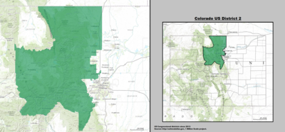
Following the 2010 U.S. Census and associated realignment of Colorado congressional districts, the 2nd Congressional District consisted of Broomfield, Clear Creek, Gilpin, Grand, Larimer and Summit counties; most of Boulder and Jefferson counties; and portions of Eagle and Park counties. Following the census, the 2nd district stretched further north to the Wyoming border while losing the western portion of Eagle County.
^Judge rules in favor of Democratic map in Colorado redistricting. Denver Post. 2011-11-14. [1]
Martis, Kenneth C. (1989). The Historical Atlas of Political Parties in the United States Congress. New York: Macmillan Publishing Company. {{cite book}}: Cite has empty unknown parameter: |coauthors= (help)
Martis, Kenneth C. (1982). The Historical Atlas of United States Congressional Districts. New York: Macmillan Publishing Company. {{cite book}}: Cite has empty unknown parameter: |coauthors= (help)


.jpg)
.jpg)
.jpg)


.jpg)
.jpg)


.jpg)

