Torrey Pines State Beach
| Torrey Pines State Beach | |
|---|---|
 | |
| Location | San Diego, California |
| Nearest city | San Diego |
| Coordinates | 32°55′53″N 117°15′37″W / 32.93139°N 117.26028°W |
| Governing body | California Department of Parks and Recreation |
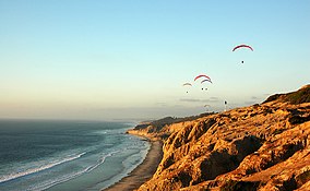
Torrey Pines State Beach is a coastal beach located in the San Diego, California community of Torrey Pines, and is located south of Del Mar and north of La Jolla. Coastal erosion from the adjacent Torrey Pines State Reserve makes for a picturesque landscape. It is a local favorite among surfers and remains a quintessential Southern California beach. Occurrences of bioluminescence have been noted.[1]
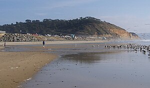
The beach is at the bottom of 300 foot sandstone cliffs of white and golden stone, with a greenish layer sometimes visible at the very bottom. At the north end of the beach the cliffs ends and Los Peñasquitos Lagoon, a salt marsh estuary, empties into the ocean. A county highway crosses the entrance, with limited free parking along the beach.
Ecology

The beach area supports a number of avifaunal (bird) species in addition to the marine biota. Soledad Valley, which includes the notable coastal marsh, Los Peñasquitos Lagoon,[2] is cut by a coastal stream which discharges into the Pacific Ocean at Torrey Pines State Beach. The endangered nominal subspecies of Torrey Pine, Pinus torreyana torreyana, is found only on the small coastal strips north and south of Torrey Pines State Beach.[3]
Surf
Waves ranging from the low 3-footers to the high 6-8 footers can be found on the north side of Torrey Pines State Beach. The Northern side of the beach has a Surfer/Surfing side while the Southern side hosts swimming, body boarding, etc. There is a red/yellow flag on the north part of the beach showing the boundary between the surfing side and body boarding side. A good rule of thumb is to occasionally check where the flag is as it moves from time to time during the day.
The beach is usually not very crowded in the early hours of the day, when primarily surfers and body boarders are present. During that time, the boundary of the surfing and body boarding areas is not as strictly enforced, as long as common courtesy is being used on both sides. The most popular part of the beach is the swimming area.
See also
References
- ^ "Surf's lighted up at San Diego beaches". September 27, 2011. Archived from the original on December 5, 2013.
- ^ "Torrey Pines State Reserve". 2006.
- ^ C. Michael Hogan (2008). "Torrey Pine: Pinus torreyana". Globaltwitcher. Archived from the original on 2013-12-26.
| To the North: Del Mar City Beach |
California beaches | To the South Black's Beach |


