Quill Lake
Quill Lake | |
|---|---|
Village | |
| Coordinates: 52°04′00″N 104°15′00″W / 52.066667°N 104.25°W | |
| Country | Canada |
| Province | Saskatchewan |
| Census division | 10 |
| Rural Municipality | Lakeside No. 338 |
| Post office | 1904-02-01 |
| Incorporated (Village) | 1907 |
| Government | |
| • Mayor | Robert Benjamin |
| • Administrator | Judy L. Kanak |
| • Councillors | Guy Martin Keith Thiessen Lyle Thibault Linda Ingram |
| Time zone | CST |
| Postal code | S0A 3E0 |
| Area code | 306 |
| Highways | Highway 5 Highway 640 |
| Website | Quill Lake website |
| [1][2][3] | |
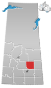
Quill Lake (2016 population: 387) is a village in the Canadian province of Saskatchewan within the Rural Municipality of Lakeside No. 338 and Census Division No. 10. It is 170 km east of Saskatoon and 200 km northeast of Regina on Highway 5.
The village is located just to the northwest of the Quill Lakes. The Quill Lakes wetland complex is a designated Western Hemisphere Shorebird Reserve Network site where many migrating shorebirds stop during long migrations. Because of this the village is also known by its residents as the "Goose Capital of Saskatchewan".
History
Quill Lake was originally established as Lally, named after a railway official of the day. Later it was renamed Quill Lake to conform to the name of the post office. The community was built around the site which was originally the location of a log school house. Quill Lake incorporated as a village on December 8, 1906.[4]
- Heritage sites
Quill Lake has one municipal heritage building, the St. Michael's Anglican Church, constructed between 1907 and 1913. The wood building was built in the Gothic revival style and has a fieldstone foundation. It was previously known as the Quill Lake United Church and the Quill Lake Methodist Church. The building was designated a heritage building in 2000.[5]
Demographics
In the 2016 Census of Population conducted by Statistics Canada, the Village of Quill Lake recorded a population of 387 living in 193 of its 228 total private dwellings, a -5.7% change from its 2011 population of 409. With a land area of 1.3 km2 (0.50 sq mi), it had a population density of 297.7/km2 (771.0/sq mi) in 2016.[8]
In the 2011 Census of Population, the Village of Quill Lake recorded a population of 409, a -1% change from its 2006 population of 413. With a land area of 1.3 km2 (0.50 sq mi), it had a population density of 314.6/km2 (814.9/sq mi) in 2011.[9]
Notable people
- Ray Meiklejohn, former Saskatchewan cabinet minister
- Lyle Odelein, former NHL hockey player
- Selmar Odelein, former NHL hockey player
References
- ^ National Archives, Archivia Net, Post Offices and Postmasters, archived from the original on October 6, 2006
- ^ Government of Saskatchewan, MRD Home, Municipal Directory System, archived from the original on January 15, 2016
- ^ Commissioner of Canada Elections, Chief Electoral Officer of Canada (2005), Elections Canada On-line, archived from the original on April 21, 2007
- ^ "Urban Municipality Incorporations". Saskatchewan Ministry of Government Relations. Archived from the original on October 15, 2014. Retrieved June 1, 2020.
- ^ St. Michael's Anglican Church Archived July 6, 2011, at the Wayback Machine
- ^ "Saskatchewan Census Population" (PDF). Saskatchewan Bureau of Statistics. Archived from the original (PDF) on September 24, 2015. Retrieved May 31, 2020.
- ^ "Saskatchewan Census Population". Saskatchewan Bureau of Statistics. Retrieved May 31, 2020.
- ^ "Population and dwelling counts, for Canada, provinces and territories, and census subdivisions (municipalities), 2016 and 2011 censuses – 100% data (Saskatchewan)". Statistics Canada. February 8, 2017. Retrieved May 30, 2020.
- ^ "Population and dwelling counts, for Canada, provinces and territories, and census subdivisions (municipalities), 2011 and 2006 censuses (Saskatchewan)". Statistics Canada. June 3, 2019. Retrieved May 30, 2020.


