
History of Banbury: Difference between revisions
→After 1869: used elseware |
→General history: Medieval history |
||
| Line 11: | Line 11: | ||
[[Grimsbury]]’s name is of early [[Saxon]] type, and is the corruption of the Saxon name for a defended enclosure (burh) of the person called ‘Grim’. It is possible that the name was derived from a pseudonym for the pagan god ‘Woden’ ([[Odin]]).<ref name="googleusercontent1">http://webcache.googleusercontent.com/search?q=cache:7Uq6vTI2xgMJ:www.cherwell.gov.uk/media.cfm%3Fmediaid%3D2147+clay+pits+in+Grimsbury+Banbury&cd=8&hl=en&ct=clnk&gl=uk {{dead link|date=March 2011}}</ref><ref name="cherwell.gov.uk">http://www.cherwell.gov.uk/media/pdf/6/5/pdf6325207015721436002.pdf</ref> |
[[Grimsbury]]’s name is of early [[Saxon]] type, and is the corruption of the Saxon name for a defended enclosure (burh) of the person called ‘Grim’. It is possible that the name was derived from a pseudonym for the pagan god ‘Woden’ ([[Odin]]).<ref name="googleusercontent1">http://webcache.googleusercontent.com/search?q=cache:7Uq6vTI2xgMJ:www.cherwell.gov.uk/media.cfm%3Fmediaid%3D2147+clay+pits+in+Grimsbury+Banbury&cd=8&hl=en&ct=clnk&gl=uk {{dead link|date=March 2011}}</ref><ref name="cherwell.gov.uk">http://www.cherwell.gov.uk/media/pdf/6/5/pdf6325207015721436002.pdf</ref> |
||
===Roman |
===Roman and Medieval history=== |
||
[[File:Banbury from the air.jpg|thumb|right|175px|Banbury from the north-west.]] |
[[File:Banbury from the air.jpg|thumb|right|175px|Banbury from the north-west.]] |
||
During excavations for the construction of an [[office building]] in [[Hennef Way]] in 2002, the remains of a [[British Iron Age]] settlement with circular buildings dating back to 200 BC were found. The site contained around 150 pieces of pottery and stone. Later there was a [[Roman villa]] at nearby [[Wykham Park]].<ref name="information-britain.co.uk">[http://www.information-britain.co.uk/history/town/Banbury11/ The history of Banbury, Oxfordshire]</ref><ref name="hist">[http://www.banbury-cross.co.uk/banhistory.htm A history of Banbury and the Banbury Cross explained]</ref> |
During excavations for the construction of an [[office building]] in [[Hennef Way]] in 2002, the remains of a [[British Iron Age]] settlement with circular buildings dating back to 200 BC were found. The site contained around 150 pieces of pottery and stone. Later there was a [[Roman villa]] at nearby [[Wykham Park]].<ref name="information-britain.co.uk">[http://www.information-britain.co.uk/history/town/Banbury11/ The history of Banbury, Oxfordshire]</ref><ref name="hist">[http://www.banbury-cross.co.uk/banhistory.htm A history of Banbury and the Banbury Cross explained]</ref> |
||
===Medieval history=== |
|||
The area was settled by the [[Saxon]]s around the late 5th century AD.<ref name="information-britain.co.uk"/> In about 556 Banbury was the scene of a battle between the local [[Anglo-Saxon]]s of [[Cynric]] and [[Ceawlin]], and the local [[Britons (historical)|Romano-British]]. It was a local centre for Anglo-Saxon settlement by the mid 6th century.<ref name="information-britain.co.uk"/> Banbury developed in the [[Anglo-Saxon England|Anglo-Saxon]] period <ref name="hist"/> under [[Danish people|Danish]] influence, starting in the late 6th century AD. It was assessed at 50 hides in the Domesday survey and was then held by the bishop of Lincoln. |
The area was settled by the [[Saxon]]s around the late 5th century AD.<ref name="information-britain.co.uk"/> In about 556 Banbury was the scene of a battle between the local [[Anglo-Saxon]]s of [[Cynric]] and [[Ceawlin]], and the local [[Britons (historical)|Romano-British]]. It was a local centre for Anglo-Saxon settlement by the mid 6th century.<ref name="information-britain.co.uk"/> Banbury developed in the [[Anglo-Saxon England|Anglo-Saxon]] period <ref name="hist"/> under [[Danish people|Danish]] influence, starting in the late 6th century AD. It was assessed at 50 hides in the Domesday survey and was then held by the bishop of Lincoln. |
||
Revision as of 13:10, 29 May 2011

Banbury (Template:Pron-en) is a circa 1,500 year old market town and civil parish on the River Cherwell in the Cherwell District of Oxfordshire. It is 64 miles (103 km) northwest of London, 38 miles (61 km) southeast of Birmingham, 27 miles (43 km) south of Coventry and 21 miles (34 km) north northwest of the county town of Oxford.
General history
Origin of the town's name
The name Banbury derives from "Banna", a Saxon chieftain said to have built a stockade there in the 6th century, and "burgh" meaning settlement.[2][3] The Saxon spelling was Banesbyrig.[4][5] The name appears as "Banesberie" in Domesday Book.[4][5] Another known spelling was 'Banesebury' in Medieval times.
Grimsbury’s name is of early Saxon type, and is the corruption of the Saxon name for a defended enclosure (burh) of the person called ‘Grim’. It is possible that the name was derived from a pseudonym for the pagan god ‘Woden’ (Odin).[6][7]
Roman and Medieval history

During excavations for the construction of an office building in Hennef Way in 2002, the remains of a British Iron Age settlement with circular buildings dating back to 200 BC were found. The site contained around 150 pieces of pottery and stone. Later there was a Roman villa at nearby Wykham Park.[4][8]
The area was settled by the Saxons around the late 5th century AD.[4] In about 556 Banbury was the scene of a battle between the local Anglo-Saxons of Cynric and Ceawlin, and the local Romano-British. It was a local centre for Anglo-Saxon settlement by the mid 6th century.[4] Banbury developed in the Anglo-Saxon period [8] under Danish influence, starting in the late 6th century AD. It was assessed at 50 hides in the Domesday survey and was then held by the bishop of Lincoln.
The Saxons built Banbury on the west bank of the River Cherwell. On the opposite bank they built Grimsbury, which was part of Northamptonshire but was incorporated into Banbury in 1889.[9] Neithrop was one of the oldest areas in Banbury, having first been recorded as a hamlet in the 13th century. It was formally incorporated into the borough of Banbury in 1889.[10]
Banbury stands at the junction of two ancient roads: Salt Way (used as a bridle path to the west and south of the town), its primary use being transportation of salt; and Banbury Lane, which began near Northampton and is closely followed by the modern 22-mile (35 km)-long road. It continued through what is now Banbury's High Street and towards the Fosse Way at Stow-on-the-Wold. Banbury's mediæval prosperity was based on wool.
The manors of Banbury and Cropredy existed in in 1086 probably included all those places known to be in the hundred in 1279, namely, Banbury, Cropredy, Hardwick, Great Bourton, Little Bourton, Neithrop, Calthorpe, Coton, Wardington, Williamscot, Prescote, Claydon, Shutford, Wickham, Swalcliffe, Swalcliffe Lea, Charlbury, Cote, Finstock, Fawler, and Tapwell. Although the extra-parochial district of Clattercote was first included among the vills of Banbury hundred in 1665 and it had formed part of the Bishop of Lincoln's estates and seems to have been included as part of Claydon in 1279. The Bishop was reportedly also interested in several parts of land around Kineton and Bicester in the latter part of 1270’s as well.[11]
The Domesday Book records that in 1086[12] Drayton had a water mill, which is presumably set on the Sor Brook, on the western boundary of the parish just below the village.[12] There is then a gap of five centuries in which no mill is recorded, but records resume with a mill operating in the parish from 1589 until 1851.[12]
Banbury Castle was built from 1135 by Alexander, Bishop of Lincoln, and survived into the Civil War, when it was besieged. Due to its proximity to Oxford, the King's capital, Banbury was at one stage a Royalist town, but the inhabitants were known to be strongly Puritan. The castle was demolished after the war.
In 1247 The hundred of Banbury was valued at £5 a year and in 1441 ‘certainty money’ due from the northern part of the hundred was 89s. 8d. It was made up of payments from Shutford, Claydon, Swalcliffe, Great Bouton and Little Bourton, Prescote, Hardwick, Calthorpe and Neithrop, Wickham, Wardington, Williamscot, Swalcliffe Lea, and the former prebend of Banbury. By 1568 these, except the rent from Wardington and amounted to 69s. 4d. in 1652, when the total profits of court were valued at 103s. 4d. a year in ‘certainty money’. In 1875 payments were made only by Williamscot, Swalcliffe, Prescote, Great and Little Bourton, Neithrop, Claydon, and Shutford since the rest were freed from their rent obligations.[11]
For centuries, trade in wool, ale, cakes and cheese created wealth for the town. Wool was first referred to in 1268, and cheese was manufactured from the 15th to the 18th centuries. Three Jewish tradesmen and craftsmen and a French draper lived in Banbury in the first half of the 13th century.[13]
In 1355 two Welshmen killed a local man in a quarrel in and in 1377 a pardon was given to another Welshman who after killing a another Welshman, after the accused had taken sanctuary in Banbury church.[11][13]
By the late 14th century Epwell village, formerly part of Dorchester hundred, began to be included in Banbury hundred. The Abbots of Eynsham early acquired many of the land rights in Charlbury formerly belonging to the Bishops of Lincoln, including by the year 1363 a 3 weeks' court and a portmoot. The payment of 3s, 4d. were payable to the town’s hundred bailiff recorded in both 1372 and 1373, which was perhaps made in connexion with the view of a frankpledge, at which the constable of Banbury had to be present as well as the abbot's steward for the hundred.[11]
The Bishop of Lincoln's vast Banbury estate, except for Neithrop and Calthorpe, was sold to the Duke of Somerset in 1547, but by 1550 he granted it (except for of Hardwick) to John Dudley, Earl of Warwick, then the Duke of Northumberland shortly afterwards, who in 1551 granted it to the Crown in exchange for other lands.[14]
Long before enclosure, the tenants of Neithrop had become freeholders, as recorded in the land deeds of 1583 to 1608 and 1614, with the permission of both Sir Anthony Cope and then his son Sir William Cope.[13]
In about 1629 Sir William Cope, 2nd Baronet.[12] sold a large acreage of land at Drayton to William Fiennes, 1st Viscount Saye and Sele of Broughton Castle.[12] By 1790 the same property belonged to Francis North, 1st Earl of Guilford of Wroxton Abbey.[12] In 1935 and 1942 the Norths then sold their lands at Drayton to Trinity College, Oxford.[12]
The English Civil War

Banbury was ravaged by heavy urban fire in 1628. Although some of the buildings have survived to the present day, many of them were destroyed.
Banbury played an important part in the English Civil War as a base of operations for Oliver Cromwell, who is reputed to have planned the Battle of Edge Hill in the back room (which can still be visited) of a local inn, The Reindeer as it was then known (today's Ye Olde Reine Deer Inn).[15] The town was pro-Parliamentarian, but the castle was manned by a Royalist garrison who supported King Charles I.
In 1645 during the English Civil War, Parliamentary troops were billeted in nearby Hanwell village [16] for nine weeks and villagers petitioned the Warwickshire Committee of Accounts to pay for feeding them.[16]
The English Civil War helped develop Banbury’s then arms industry. The Royalist garrison was constantly at work early in 1645 digging up the saltpetre in King's Sutton and making gunpowder out of it in a house specially built near Banbury. Just over 10 years earlier a government saltpetreman had operated at Banbury for a year, having moved there from the then small market town of Coventry, before moving on to Hook Norton as short while afterwards. Apparently King's Sutton was a local centre for saltpetre excavation and digging at the time.[13]
The English Civil War and the short two sieges noticeably damaged town's prosperity. It all started after two members of the Vivers family and two other fellow Bambarians petitioned Parliament for an official redress (what we now call compensation) in 1646 and 1647, making the claim that their houses had been burnt and plundered to their total loss of £20,000 in today’s money. They said the principal looter was a captain in the King's garrison ate Banbury Castle. Another self-claimed was sufferer was the mercer Edward Russell, who after nearly being executed for trying to subvert the Royalist officers to turn Parliamentarian, was jailed for three months in 1644. He also claimed his shop and house were plundered, looted and destroyed by the castle’s Royalist garrison's use.[13] The garrison was soon defeated and the castle partly blown up and demolished with gunpowder. The Parliamentarian forces appeared to have also used the River Cherwell for access in to Banbury at one point and briefly set up camp in the location of the Canalside trading estate, next to the then public gallows.[17]
The Banbury mutiny was a mutiny by soldiers of the English New Model Army. The mutineers did not achieve all of their aims and some of the leaders were executed shortly afterwards on May 17, 1649. The mutiny was over pay and political demands.
Hanoverian and Victorian reforms


Villagers farmed the parish on a two-field open field system until 1768, when Sir Charles Cope, 2nd Baronet bought out the rights of copyholders, life- and leaseholders and enclosed the common lands.[16]
The opening of the Oxford Canal from Hawkesbury Junction to Banbury on 30 March 1778 gave the town a cheap and reliable supply of Warwickshire coal.[18] In 1787 the Oxford Canal was extended southwards,[19] finally opening to Oxford on 1 January 1790.[20] The canal's main boat yard was the original outlay of today’s Tooley's Boatyard.[21]
Prior to the arrival of James Brindley's Oxford Canal in 1779, the 'Canalside' area comprised a undeveloped, low-lying watermeadows. The canal was then extended to Oxford by Banbury’s engineer, John Barnes in 1790. Both Parker's Wharf and Bridge Wharf were serviced by fly-boats to may distant cross country destinations and by market boats to Oxford and Coventry. The canal brought much growth and prosperity to Banbury over the years and is still popular with boat users today.[17] The canal's main boat yard is now the listed site today’s Tooley's Boatyard.[21]
The Cobb family may have obtained The hundred of Banbury when they bought the land site of Banbury castle in 1792[11] and in 1853 Edward Cobb was lord of the hundreds of Banbury and Bloxham.[11]
In an unusual twist of fate, the council objected to the planting of trees in Horse Fair Road, and in 1826 John Walford was then accused of injuring trees planted by the town’s commissioners which he considered, like the trees they were planting, to be a waste of money. The commissioners were heckled as a rioting mob destroyed all the trees and fences.[22]
In 1836 by the town council took over the running of Banbury and the right to erect gas-works was relinquished in 1833 to the Banbury Gas Light and Coke Company.[23]
One of the first acts of the town’s newly appointed Paving Commissioners in 1825 was to appoint a committee to report on the condition of the town's streets. In 1826 the streets were reportedly paved with official approved Yorkshire flagging stones at a cost of over £3,000, but by 1840 it was noted that, as 'poor quality' stone had been used, the kerb was considered worthless. Between 1852 and 1888 the Local Board of Health continued the official supervision of streets, laid out several new roads, and started numbering the houses for identification and postal purposes.[23]
Living conditions had improved greatly in Victorian times with the removal of several poorly built cottages that were deemed to be only 'hovels' and a reduction in childhood ill health in the early 19th century. Many cottages in the district of 'Waterloo', which apparently lay just east of Banbury Bridge to the north of the road, had been transformed after the early 19th century so that by 1841 'Waterloo' was considered one of the better off parts of Grimsbury. Banbury was booming, and Grimsbury's principal expansion occurred between 1852 and 1881, when some 500 houses were built, around Middleton Road, Causeway, Merton Street, Duke Street, and North Street.[24]
Banbury’s Freehold land Societies came into existence in the 1840s as part of a new pro-Democracy political movement inspired, organised by Liberal Radicals to effect Parliamentary Reform. Liberalised Banbury’s off shoot was a settlement in New Grimsbury. The hamlet was originally called Freetown in the 1840s. Early in 1851 an audience of 300 attended a rally lead by James Taylor of Birmingham lecture in Banbury on Freehold Land Societies. Mr Taylor was a disciple of the Unitarian minister George Dawson, and thus became a vigorous crusader for the working-classes.[6][7]
The first two railways to reach Banbury opened in 1850. First the Banbury to Verney Junction Branch Line from Bletchley on the London and North Western Railway via Buckingham and Brackley formed a terminus at Merton Street. Within months the Oxford and Rugby Railway from Oxford on the Great Western Railway via the Cherwell Valley opened a station at Bridge Street. The GWR extended the Oxford and Rugby Railway northwards in 1852. In 1900 the Great Central Railway opened a branch line to Banbury from Culworth Junction on its main line. The axis from south-east to north-west and apart from the Buckinghamshire Railway to Verney Junction (1850) as well.
Upper and Lower Cherwell Streets and Windsor Street had also been built before 1851 as the town first began to grow. Neithrop expanded further between 1850 and 1881, with new housing providing for the Municipal Borough of Banbury’s planned slum clearance from 'Waterloo' in Grimsbury and to deal with the then growing population and for the expanding population.[24] This was followed by the building between Windsor Street and Broad Street so that by 1881 there were some 350 then modern houses in the whole area.[24] The street known as Back Lane began converted into Castle Street West, as Castle Street East was created as part of a slum clearance from central Banbury in 1852.[24][24]
A Quaker Pastor was one of the leading figures in Banbury and set up its first two water treatment works in the 1860s.
In the early 1870s the east side of Regents Place was developed by a Mr William Wilkins between the years of1852 and 1871.
Duke Street, was located at the edge of Wilkins’ (now demolished) brick pit, was developed around 1870. South of the Causeway, the newly designated Merton Street was developed by various speculators between the years of 1873 and 1882. It is worth noting the cramped development of the housing on the Causeway and Merton Street (known locally as the ‘Railway Terraces’) that built by the Great Western Railway, for the company’s workers to use on payment of a rent to the GWR. It is also interesting to compare this with the then contemporary, but more generous, development of the freehold land estate with its forward looking ‘build-to-own’ policy and public ethos. Development of site in the area continued into the twentieth century, Avenue Road constructed in 1911 being a case in point. Allotments began to encroached on the mostly closed clay pit by 1923.[6][7]
Banbury town council also built the houses in King's Road and on the Easington estate at that time. More houses were built for the working population at the south end of Britannia Road and the area to the east between 1881 and 1930, and also in both Old Grimsbury Road and Gibbs Road in Grimsbury, and more up-market houses were built in both the Marlborough Road area and in Bath Road, Kings Road, Park Road, and Queen Street in Neithrop.[13][23] The mostly late 19th-century suburb of Grimsbury witnessed rapid growth between 1881 and 1930.[13][23] The former church hall of Christ Church, (now known as Oriel House), the former nonconformist chapel on Gatteridge Street, now the Kingdom Hall and the former Mechanics Institute on Marlborough Road all built in 1884. Part of and the former Mechanics Institute is now divided Banbury Public Library. [25]
In 1891 the local medical officer for Banbury found that 62 cottages were dangerously filthy, 63 had defective drains, and 21 no water supply.[13][23] By 1900, Banbury had a population of 12,968.[13][23][24]
The land that was Peoples' Park had been enclosed in Hanoverian times and was set up as a private park in 1890 and opened in 1910, along with the adjacent bowling green.
Life after 1901


In 1911 many people were living in houses unfit for human habitation. The Municipal Borough of Banbury set up a housing committee which some houses were constructed in Kings Road. The Banbury Co-operative Society completed 12 houses in 1913 in Hightown Road.[13][23]
The 1919 Housing Act was followed by the building of the Easington housing estate of 361 council houses in what was one of the first slum clearance schemes in the country. By 1930 the town's medical officer reported 131 houses still unfit for habitation. So in 1933 Banbury council opened the Ruscote housing estate of 160 houses. The heavily increased population between 1931 and 1949 was accommodated by the expansion of the town in three main areas, in each of which houses were built both by the town corporation and by private housing companies. Between the Oxford and Bloxham roads about 500 houses were built before 1939 to form the bulk of the suburb of Easington, and in the area of the older village and suburb of Neithrop some 500 houses were built before 1939 both around the earlier houses and further west in new streets on either side of the Warwick Road, a development which was extended to the south-west after 1945.[13][23]
The mostly late 19th-century suburb of Grimsbury witnessed rapid growth between 1881 and 1901. About 300 more houses were built after 1945. To the north of Grimsbury Square is the 1945-55 area of 'New Grimsbury' and south of it is the 1901 and earlier old town of 'Old Grimsbury'.[13][23]
A total of 770 council houses were built between 1919 and 1940, and another 2,545 (including Withycombe Drive in 1947) during the period from 1945 to 1967 as the population began to grow significantly. The housing developments were mainly in the western parts of the town between the Warwick and Broughton roads, with others being built on the site of the former brickworks in Grimbury. In 1961 a total of 6,504 households were built, mostly in the style of those around Neithrop's Admiral Holland pub. 231 other, older buildings in the town centre still had no indoor toilets, 1,325 had no fixed baths, 1,643 had no hot water taps, and 98 had no cold water tap.[13][23]
Broughton Road and The West Bar area were mostly built in 1922, with a few building like the Gothic Villa dating from 1871 and the neighbouring West Bar Surgery GP’s practice dating from the early 1960s.[26]
The town saw rapid expansion during the 1930s and 1940s as housing was built for newcomers from nearby towns and the emerging London overspill. A later expansion between the 1950s and 1970s would reach Hardwick, Ruscote, Easington, Bretch Hill and Poets' Corner, due to influxes from the London overspill and from the West Midlands.
The land south of the Foscote Private Hospital in Calthorpe, Oxfordshire and Easington farm were mostly open farmland until the early 1960s as shown by the Ordinance Survey maps of 1964, 1955 and 1947. It had only a few farmsteads, the odd house, an allotment field-come-rugby pitch(now under the Sainsbury’s store), and the Municipal Borough of Banbury council's small reservoir just south Easington farm and a water spring lay to the south of it. Two minor streams ran from a spring near the allotment gardens and the land under today's Timms estate. An old clay pit, kiln and brick works lay near the Poet’s Corner estate. The pit was of mid Victorian origin and the buildings were put up by the issuing of the 1881 O.S. map. The pit had been filled in by the 1920s, the buildings closed by the 1940s and the site was built on by the late 1960s. Bankside road was constructed from 1965 to 1975 in a north to south direction as the local street testifies to.
The Woodgreen swimming pool was built in the early 1960s and renovated in the late 1970s. It was closed in the early 2000s, heavily renovated in 2009 and reopened in 2010.The much frequented outdoor pool is closed from September to March due to the bad seasonal weather[27]
The Ruscote estate, which now has a notable South Asian community, was expanded in the 1950s because of the growth of the town due to the London overspill and further grew in the mid-1960s.
British Railways closed Merton Street station and the Buckingham to Banbury line to passenger traffic at the end of 1960. Merton Street freight depot continued to handle livestock traffic for Banbury's cattle market until 1966, when this to was discontinued and the railway dismantled. In March 1962 Sir John Betjeman celebrated the line from Culworth Junction in his poem Great Central Railway, Sheffield Victoria to Banbury. British Railways closed this line too in 1966.
Banbury's growth accelerated after the 1970s with the completion of the M40 motorway which gave faster access to London and Birmingham. By the 1971 census the town's population was 26,540, in 1977 it was 28,520 and in 2001 it had reached 41,802 for the town and 43,867 including the outlying villages like Drayton. In 2002 an estimate for the town went as far as 46,800 in total. Most of the Hardwick estate built in the 1970s because of the growth of the town due to the Birmingham overspill and a slum clearance scheme in Smethwick. Some Welsh families have moved in since. It was expanded further in the mid-1980s. The main shopping facility is the now partly closed Hardwick arcade. Trinity close was mostly built between 1973 and 1975, while both New Grimsbury and Bretch Hill continued to grow in the 1980s according to the O.S. street maps of those times.
Trinity Close and Powys Grove they were originally created as separate entities between the late 1960s and early 1980s as the 1973, 1977 and 1983 Ordinance Survey maps help illustrate. It is also to be noted that the Bretch Hill Road may have remained a long cul-de-sac and not reached the main road if the long planned Banbury by-pass had gone ahead in the early to mid-1980s. The housing around Appleby Close was built during the 1980’s and may have been replaced by a proposed link between the bi-pass and Bretch Hill, if the project had gone ahead. Since then there has been much redevelopment work done, with the demolition of the old lock-up garages between 52°03′57″N 1°21′58″W / 52.065821°N 1.366000°W(aprrox) Appleby Close and Edinburgh Close making way for a car park and a small housing development.
Banbury used to be home to Western Europe's largest cattle market,[28] situated on Merton Street in Grimsbury. For many decades, cattle and other farm animals were driven there on the hoof from as far as Scotland to be sold to feed the growing population of London and other towns. Since its closure in June 1998 a new housing development has been built on its site which includes Dashwood Primary School.
The town was renovated in 1981 and partly pedestrianized in 1991. Bretch Hill's Thornbury Drive went up for sail in 2000. The rather upmarket Hanwell estate, which lies between Banbury and Hanwell, was built in between 2005–06, on the grounds of the former Hanwell Farm, which has become one of the constant houses, due to the natural growth of the town's commuter population.
Recent crime and anti-social behaviour
St. Louis Meadow park area was set for an £80,000 refurbishment on September 3, 2010.[29] A plastic pay tunnel, some low wooden fencing, wood chippings, 2 cargo nets, a spring rider and a wooden climbing frame were then added. At about 10.15pm on February 9, fire fighters were called to the play area in St. Louis Meadow park, after a member of public reported a fire inside the play area. A plastic tunnel had been deliberately burnt by local youths. It will take £85,000 to repair the devastated park.[30]
This tragically mirrored an event in the Spiceball park that caused heavy damage on February 8, 2007, but did not deter the council from doing it's planned £90,000 [31] and the 2006 arson of 2 spring riders that lead to the closure of the Woodgreen Arcade play park 52°03′48″N 1°21′10″W / 52.063267°N 1.352726°W (approx.) in mid-2006.
A £10,000 blue Suzuki Baleno was stolen from Browning Road some time between November 14 and November 22, 2006, but was later recovered. [32]
There were some concerns over antisocial behaviour and heavier than average litter levels in Princess Diana Park and Hillview Park and that fly-tipping in Banbury also affects some streets and footpaths such as on the Ironstones’ paths.[33]
On February 26, 2007, 4 acts of auto-vandalism , a car theft, a car dumping and the theft of a car’s licence plates were all reported on February 26, 2007. They were possibly linked with a a car break-in at Broughton Castle. PC Siobon Cook from Banbury's Auto Crime Team said:- "Most thieves are opportunist and if they see something valuable on view they will break in to get to it.” .[34]
On 16 February 2010, a man charged with theft from a vehicle in Banbury during 7 February[35].
Car theft and breaking in to cars were also of concern to Thames Valley Police in early 2011, since between March 28-31 2011 vehicles were stolen by a gang in Banbury bad Bicester .[36][37][38]
Narcotics finds (principally ecstasy) and muggings were on the decline sine the mellenium.
Local redevelopment plans

Woodgreen's 45 year old[39][40] youth club was closed in April, 2010, demolished during July 2010,[39][40] and its replacement is due to open in early 2011. The redevelopment plan was valued at £3,000,000.[39][40]
There was a plan in the late 2000s to expand the Bretch Hill estate westwards into local farmland,[41][42][43][44] but this has now been suspended due to the credit crunch and local hostility to the plan, including the southern expansion towards Bodicote.[41][42][43][44][45][46]
The Hanwell Fields Estate was built in the north during 2008 and 2009.[41][42][43][44][45] It was intended to provide affordable social housing to the west and south of Banbury, and more upmarket housing in the Hanwell fields area.[45]
Over the past few years there have been plans to build a new estate on the undeveloped College Fields adjoining both Bodicote and the Cherwell Heights housing estate of Banbury. In February 2006 Cherwell District Council voted to approve the plans despite a 20,000 signature petition against it. About 1,070 houses will be built in the estate, which will include local shops, a public house, a church, a restaurant, a school and other local services.[47][48][49]
The now derelict former Crest Hotels headquarters that can been see behind the Morrisons garage was abandoned in the late 1980s; it may be reopened in circa 2020-2025 as either a youth hostel or housing for local university students. Heavy maintenance work is needed on the stairways and some of the floors due to both the years' neglect and heavy bird infestation in what most Bambarians regard it as Europe's largest de facto pigeon loft.
The former Penryth Road/Appleby Close play-park 52°03′58″N 1°22′00″W / 52.066235°N 1.366614°W(aprrox) was closed and the facilities (a roundabout, bench, bicycle rack and spring rider) were removed in the 1990’s due to vandalism. The area may now be redeveloped as a car park.
Industry and commerce
Before 1870

The Domesday Book in 1086 listed 3 mills, with a total fiscal value of 45 shillings, on the Bishop of Lincoln's demesne lands, and a fourth which was leased to Robert son of Waukelin by the Bishop. Among Banbury's four Medieval mills was probably a forerunner of Banbury Mill, first referred to by this name in 1695.[13] In the year 1279, Laurence of Hardwick was also paying 3 marks (equivalent to 40 shillings) in annual rent to the Bishop for a mill in the then Hardwick hamlet.[13]
The fore-runners of Butchers Row were probably long standing butchers' stalls which were known to be in situ by 1438.[13]
In 1639, the woollen cloth draper, Robert Vivers, who was also lessee of the prebendal estate, owned the Banbury Mill. In 1648 he sold it to Londoners Edward Darnelly, who was apothecary and his friend, the bowyer Thomas Brightwell, and in 1671 Mr Darnelly leased the mill windmill in Easington, for £44 a year to Samuel Bradford, the owner of Moor Mill in Oxford. Banbury's first major printer was John Cheney. He started out in 1765 as the innkeeper of the 'Unicorn' inn by next year he started selling paper as a side-line he had is known to have set up as a jobbing-printer by 1767.[13] A boat-building yard was opened in 1790 on the canal at the end of Factory Street and boats were built there until the canal ceased to be used for commercial transport. In the 18th century New Bank (and later called the Gillett Bank)[6][7] had also been Richard Tawney, who was the owner of a major brewery at Oxford. The coming of the railway enhanced Banbury's position as a market town, local economic epicentre and regional centre. This was the main factor behind the expansion of the New Bank under Joseph Ashby Gillett and his successors.[13][24] The Cobb's factory for 'weaving, webbing, and horsecloths' was founded around 1700 and continued in production until 1870. In the early 19th century the most successful brewery in Banbury was the one owned by Thomas Hunt's, opened in Bridge Street just before 1847. A blacking factory was also opened by 1832 and it had five employees in 1851, but closed around 1872.[13] The Italianate Elms House on Oxford Road, is a substantial villa built in 1863 for Jonathan Gillet, one of the senior partners of Gillet’s Bank, is now the offices of the Primary Care Trust, which lies within the grounds of the Horton Hospital site.[50]
The Canalside area began to develop became a centre of Banbury's agricultural, transport, and electrical engineering industry at about the same time as the arrival of the railways in 1850.[17] By the year 1861 the Britannia Works agricultural machinery plant had become by far the largest single enterprise, employing 380 men and boys, and the Vulcan Foundry industrial railway and steam engine works employed between 40 and 50 people. Until the mid-19th century Banbury's trade and industry were based mostly on the products of agriculture and stock raising, with a modest volume of weaving, milling, baking, brewing and boat building.[13]
The agricultural implements and milling equipment works at the Vulcan Foundry, was begun in 1837 by the firm of Lampitt and Co., a local firm that was established two years earlier by Mr Lampitt. Both Charles Lampitt produced a mobile steam-engine in 1847, and John Lampitt invented systems of 2-speed gearing and 3-speed gearing for traction engines. Among the various products of the works were portable and fixed industrial steam engines and a major industrial steam engine which supplied the power for the Hunt Edmunds Brewery for 90 years. Other engineering firms included Barrows and Carmichael, the Cherwell Engineering Works, a local branch of the Mr. Humphris Built Traction Engines in a workshop in North Bar Street.[13]
At the Great Exhibition of 1851 exhibits by firms and individuals from Banbury included the following items and displays:
- A Charles Lampitt horse-seed-driller,
- Britannia Works agricultural machinery,
- An anti-attrition threshing machine,
- Various pharmaceutical preparations,
- A public demonstration of the action of phosphate of lime and magnesia on the soil,
- Inflated saddles,
- Plushes,
- Various mohair, hemp and sackcloth, blacking, mangles with mahogany tables and
- An ornate lady's walnut worktable .[13]
The coming of the local railways made possible the expansion of the approximately 200 year old agricultural implement manufacturing business in Banbury. The Britannia Works company's site was set up by Sir Bernard Samuelson from the earlier foundry established by James Gardner. Sir Samuelson had obtained a licence to make McCormick reapers by 1851, and by 1859 the firm was producing numerous agricultural machines, including turnip cutters, a patent digging and forking machine, a patent reaping machine, and lawn mowers. It is interesting to note that the firm also built the now demolished railway viaduct at Hook Norton. By 1881 the production of the company's produce was carried out at two separate works in south-east Banbury, which were linked by a tramway with a depot beside the railway, south of the Great Western Railway's station. Britannia Works was one of the town's major employers until the 1920's.[13]
After 1869


.png)


In 1870 Mr. T. R. Cobb sold his web-girth making mill to a company that later became the Banbury Tweed Co. Grain, brewing, wool and cloth were the centuries old trade of Banbury, but the Banbury Tweed Co. factory finally closed its factory in 1932, bringing an end to an era.[13] The historic background to Banbury’s industry began with a few grain merchant's mills and weavers’ looms under the Normans and this was continuing in some form until the last tweed factory closed in the 1920s, despite of the then new industry’s like the nearby lime kiln and cabinet manufacture works, Neithrop’s timber yard or Grimbury’s clay pit and clay kilns.
The economic decline from the 1870s until the 1920s slowed down the rate of urban expansion as the various sawmills, timber yards, flour mills, a tweed factory, a lime kiln and a malthouse all closed.[24] Grimsbuy and Nietrop were the centres of the timber trade, while the rest was largely set along the canalside, apart from the odd out of town clay pit.[24]
Duke Street, was located at the western edge of Wilkins’ (now demolished) brick pit, was developed around 1870.[6][7] There was a substantial 'brick, tile and drain works' with a short tramway in it to the east of Grimsbury in the versinaty of Howard Street according to the 1882, 1883 1900, 1910, 1922 1923 and 1947 Ordnance Survey maps. It had closed by 1923[6][7] and the last workshops had shut in 1955. It was mostly built on by 1965 according to the 1955 and 1965 O.S. maps.
Co-operative Society built their shop in Broad Street during 1907 and it offices at the Art Deco Banbury Co-operative Building in 1920. They had moved on by 1935. [51]
In 1917 the Oxfordshire Ironstone Railway opened between an iron ore quarry north of Wroxton and a junction on the GWR just north of Banbury.[52] It was heavily used during World War II but closed in 1967.[52] Heavy clay and Ironstone deposits surround Banbury.[53]
The growth of Banbury's population had nearly stopped by the 1920s, and people left the town as its market and its economic importance in the district declined: it is recorded that only 9,700 animals were sold there in the whole of 1924, compared with 6,300 at the town's Michaelmas Fair alone in 1832.[13] The town's existing industries were mostly unsuccessful and in steady decline. The Banbury Tweed Co. closed its factory in 1932 and the Britannia Works, which made agricultural machinery, closed in 1933. But in the 1930s the town's economy became more diversified and less closely linked with the surrounding countryside and towns such as Daventry, Bloxham, Bicester and Southam.[13] In 1927 a large factory for corsets and surgical supports (Spencer Corsets Ltd) opened in a disused clothing factory in Britannia Road, and the manufacture of electrical equipment by Switchgear and Equipment Ltd. started in 1932, first in part of the disused machinery Britannia Works; it moved to a newly built factory on the Southam road around 1939. New industries continued to be attracted to Banbury after the Second World War, and in the 1950s the council established the Southam Road Industrial Estate, which attracted a wide range of industrial installations and works to the town. The 60 year old cabinet works near The Mill centre and the Cherwell Engineering works on the Canalside estate also closed in the late 1950s.[13]
In the late 1920s the economy of Banbury was revolutionised by the arrival of new industries and in particular by the relocation of the out of town livestock market to Grimsbury it used to be held in Neithrop and/or Bridge Street, Banbury. The new site selected due to its proximity to the railway station.[6][7]
The Northern Aluminium Co. Ltd. or Alcan Industries Ltd. pig and rolled Aluminium factory was opened in 1931 on land acquired in 1929 on the east of the Southam road, in the then hamlet of Hardwick. The various Alcan facilities on the 53-acre site closed between 2006 and 2007.[13] The factory was demolished between 2008 and 2009. The laboratory was also closed in 2004 and demolished in 2009.[13][54][55][56][57]
Since World War 2, the increasing pace of local industrialization of the town had led to a great enlargement of the urban area, the chief residential features being extension in the northwest and , north of the Warwick Road, westward between the Warwick Road and Bloxham Road, in the south around the Easington estate and on the west bank of the Oxford canal, principally, the Cherwell Heights. The industrial building has continued on both sides of the Southam road and in the late 1950s the council acquired 86 acres of land on the west side of the road for an Industrial Estate to house the influx of planned new [clarification needed].[24]
Another major employer is General Foods Ltd, now Kraft Foods, which produced convenience foods, including custard and instant coffee. The company moved to Banbury from Birmingham in 1965. Kraft Foods Banbury has become an icon of the town's economic rebirth after the mid 1960's.[13] The Fine Lady Bakeries also opened in the 1950s and expanded its local operations in 1965.
In the central area were built many large shops, a bus station, and a large car park north of Castle Street. In 1969 proposals for the redevelopment of the central area were in hand, leading to the creation of the Castle Quay shopping centre in 1977 and the nearby multi-story car park in 1972. The 1977 plans to build another multi-story car park on what is now the open air car park behind Matalan and Poundland were scrapped in 1978 and another one was built to the rear of the Castle Quay shopping mail in 1978.[24]
The former Hunt Edmunds brewery premises became Crest Hotels headquarters, but closed in the late 1970s and was abandoned in the late 1980s, while the Crown Hotel and the Foremost Tyres/Excel Exhausts shops found new owners after they closed in 1976 due to falling sales. Hella Headlamps, a vehicle headlamps firm closed its 20 year old factory on the Beaumont Industrial Estate in the mid 2000's. The much missed local ironmonger, Hoods, opened in the mid 1960s and closed circa 2007, with the shop becoming part of the then enlarged Marks and Spencer shop.
Banbury has several shops in suburban local centres and in the town centre. There is a market held on Thursdays and Saturdays in the market place, as well as a farmers' market on the first Friday of every month.[58]
A shopping centre, Castle Quay, is in the centre of Banbury. It opened as the Castle Shopping Centre in 1977 to cover the former Factory Street, before being expanded over the Castle Garden allotments in the 1990s. The centre has over 80 stores[59] including well-known names such as Marks & Spencer, Bhs, WH Smiths, F. Hindes (the Jewellers), J.J.B. Sports and Debenhams.
There are many local convenience shops scattered about the town in places like the Ruscote Arcade, Hardwick Arcade and Bradley Arcade.
Kraft Foods, Banbury

Kraft Foods in the Ruscote ward of Banbury, Oxfordshire, England is a large food and coffee producing factory in the north of the town.[60]
It was built in 1964 and was partly due to the London overspill. Kraft Foods Banbury is the Kraft centre of manufacturing with the Kraft UK headquarters located at Cheltenham.
The factory is still sometimes known as General Foods after the American company which originally owned the building, before 'GF' as it is commonly known was taken over by Kraft.
During October 2006, a block of Kraft Foods that was being prepared for demolition caught on fire and remained on fire for most of the day.
There was a notable, but thankfully non-lethal, fire at the coffee plant on Tuesday 7 December 2010.[61][62]
In Spring 2010, a lorry load of Kenco Coffee was stolen by a driver who conned his way into the plant.[63]
Industrial estates
The Tramway and Canalside industrial estates


The Tramway industrial estate and Canalside estate are mostly built on land once owned by the Britannia Works. The Tramway industrial estate is named after the industrial tramway that ran between factories on Windsor Street, Upper Windsor Street, Canal Street, Tramway Street and the plant next to Banbury station and the station's corporate freight siding between around 1881[13]-1935. The estate is now a home to many businesses like the Stagecoach bus depot, a Wacky Wardrobe fancy-dress shop, Magnet Kitchens' show, Teamtalk clothing limited room and a small local oil tanker depot by the station.
The other industrial estates
The mid 1950s saw the council established the Southam Road Industrial Estate. The estate was successful in bringing a wide range of industrial to the town. The most important newcomer at the time was General Foods Ltd, formerly Alfred Bird & Sons, and now Kraft Foods,[13][60] which produced convenience' foods, like custard and instant coffee. The company moved to Banbury from Birmingham in 1965 and received active political and fiscal co-operation from the council. A new factory with a floor space 80,000 square feet (7,400 m2) was being constructed in 1969 for Encase Ltd[13] and a factory was being built for Demag Hoists and Cranes Ltd., a subsidiary of Demag Zug, one of the world's largest manufacturers of lifting equipment.[13] The industrial estate had become one of the 'ecanomic epicenters' of the Banburyshire region by the early 1970s.[13][13]
The Overthorpe industrial estate[64] was built in the 1960s and 1970s and the Wildmear industrial estate was created in the late 1970s and early 1980s, over the former farm house, small late Victorian local Swimming pool and pond as the 1973 and 1983 Ordinance Survey maps show. The Thorpe Way industrial estate, which is next to the long established spittle fields sewerage works, started up in the 1950s and grew further towards the Overthorpe industrial estate (which is named after the nearby village of Overthorpe, Northamptonshire) in the 1960s.
Farming
Banbury was once home to Western Europe's largest cattle market, on Merton Street in Grimsbury. The market was a key feature of Victorian life in both the town and countryside. In the late 1920s the economy of Banbury was revolutionised by the arrival of new industries and in particular by the relocation of the out of town livestock market to Grimsbury it used to be held in Neithrop and/or Bridge Street, Banbury. The new site selected due to its proximity to the railway station.[6][7] It was formally closed in June 1998, after being abandoned several years earlier and was replaced with a new housing development and Dashwood Primary School.[4]
The Barber family were local landlords, who let out their Easington estate's lands, examples being Little Wood close was leased to a local man in 1690, the adjacent lands in Berrymoor to another in 1692. The Barber family's property in Easington was thus farmed as a whole by successive tenants until late Victorian times.[13]
The land south of the Foscote Private Hospital in Calthorpe, Oxfordshire and Easington farm were mostly open farmland until the early 1960s as shown by the Ordinance Survey maps of 1964, 1955 and 1947. It had only a few farmsteads, the odd house, an allotment field (which briefly became a rugby ground and is now under the Sainsbury’s store), and the Municipal Borough of Banbury council’s small reservoir just south Easington farm and a water spring lay to the south of it.
Berrymoor farm was finally demolished in circa 2004 after many years of dereliction had made it unsafe to use and became today's St. Mary's View. Much of the farm land was used to build a children's day-care, an industrial storage facility, a small electrical substation, and a branch of De Montfort University (now a branch of the Oxford and Cherwell College) on in the late 1960s.
Bretch Farm, near Claypits close, opened in about 1900, was expanded slightly in 1910, lost a large part of its land to the Bretch hill development (the watertower and communications transmissions mast) in the 1960s, closed in 1990 and has lain derelict ever since.
The 2008-2010 credit crunch


.png)
The credit crunch and subsequent UK resection has lead unemployment rising sharply upwards (it was only 1% in 2001 and 2002, but rose sharply circa 2007-2008). Several places closed, mostly between 2007 and 2011, but most have subsequently re-opened since. The Gloria Jean's café has reopened as Café Mocha, a Tescos Express store opened up in recently closed Grimsbury Pub/Restaurant, Buffalo Bills and Focus Do It All became Argos's second store. The SCS branch adjacent to the new Argos store has become a NEXT department outlet and the former Powerhouse electrical goods retailer (also situated on the retail park) became Pets at Home. B-Wise became the Family Bargains discount store; the old Littlewoods Index store became Wilkinsons and Peacocks retail outlets.
The Unicorn and 3 Pidgions pubs closed in 2009, along with the Old Flyer, which reopened as the Old Auctioneer in 2011. The Yates night club closed in 2007, but had roped as of 2010 as the Also Known AS Nightclub. The local branch of The Officers Club had moved to a smaller store, but had also weathered the economic storm. The Local branch of Woolworths is now a branch of H&M Clothing. The Littern Tree Pub closed in 2005 to be replaced by the J D Wetherspoons Fleur De Lis in 2008. Chalky's, a local music retailer formerly based on the High Street had moved into Castle Quay shopping centre to accommodate a larger floor space; sadly the recession had caused the store to cease operations and was closed only after a few months having been situated within Castle Quay in the Spring of 2009.
The Polish delicatessens – Griosk, the varicose new shops in the Hanwell Fields Housing Estate and a recruitment drive by Prodrive have reduced the unemployment levels over the latter part of 2010 as the local economy began to improve.
Local government
In January 1554 Banbury was granted royal charter that established legally the town as a borough to be thus governed by the aldermen of the town.[6][7]
Until the year 1889 the Town Council's activities were limited to the administration of local justice, the town's 'morality goal', the police, markets, fairs, trading standards and the upkeep of municipal property. By 1889 its functions were extended to include the repairing, cleansing, and lighting of the streets, which had been the responsibility of the Paving Commissioners from 1825 until 1852 and of the Local Board of Health from 1852 until 1889, and then sewerage, all sanitary matters, hospitals, the cemetery, public baths, swimming pools, recreation grounds, parks and the local fire brigade for which the Local Board of Health had been responsible.[22] Later the responsibility for elementary education passed in to the town council’s control under the Education Act of 1902.[22] Following the Reform Act of 1867, the 3 most important voting qualifications were being a man, the ownership of a freehold with a minimum value of 40 shillings and the occupation of a house worth at least £10 a year in rent moneys. This substantially enlarged the local electorate[6][7]
The town’s supply of gas, electricity and water was in the hands of private companies until 1947, when the town council purchased the water company.[22] In 1967, the water company’s former undertakings and assets that had passed to the Municipal Borough of Banbury (the then town council) were absorbed into the Oxford and District Water Board. The council also lost control to the county councils of the police in 1925 and elementary education in 1944, and the local fire brigade in 1947. The hospitals were nationalized by the Attlee government in 1946.[22]
Banbury was one of the boroughs reformed by the Municipal Reform Act 1835. It retained a borough council until 1974, when under the Local Government Act 1972 it became part of the traditionally Conservative-ruled Cherwell District Council, an unparished area with Charter Trustees. A civil parish with a town council was set up in 2000.
Notable mayors
Banbury has had several notable mayors over the years since the post was created in 1607.[65][66]
- Thomas Webb was the first Mayor of Banbury town and held office in 1607, 1619, 1629 and 1638.
- George Mieholl was mayor in 1608.
- Local business man, and Parliamentarian sympathiser, Richard Vivers held it twice in 1621 and 1633.
- Thomas Whatley was mayor in 1623
- Mathew Whately was mayor in 1636.
- Organ Nicholls held it in 1641 and Aholiah West held the position from 1644 to 1645. They have the most unusual given/1st names to date.
- Lyne Spurrell was the first female mayor in 1838.
- Richard Goffe also has the longest run at five years, but not consecutively, in 1845, 1849, 1853, 1854, 1855.
- William Edmunds was mayor from 1887 to 1889 and oversaw the major expanding of the town council's borders and powers.
- William James Harding held the post from 1914 to 1918 (5 years), making his tenure the longest consecutive run so far.
- Surinder Dhesi was the town's first Asian mayor in 2004 and 2005.
- The Wheatly, Cheney (Cheyne in earlyer years) and Edmunds families have produce more of Banbury's mayors than any others over the years with-
- Nathaniel Wheatly (1643 and 1688), William Wheatly (1667) and Richard Wheatly (1671, 1683, 1742).
- Richard Edmunds (1858, 1863 and 1864), William Edmunds (1887 to 1889) and Percy Spencer Edmudns (1895)
- Robert Cheyne (1746), John Cheney (1936) and Mary Cheney (1949)'.
- An housing estate was named after Thomas Tims (1840).
- Roads are named after Sarah Beatrice Gillett(?) (1926), William George Mascord (1929), Fred Mold (1930) and Arthur Fairfax (1897 and 1905).
Major Schools
52°04′18″N 1°22′02″W / 52.0718°N 1.3672°W

Former Cherwell British (Infants) School, and the old Dashwood school in Britannia Road was closed in the mid 2000’s, with a new Dashwood school opening near by [67]
Banbury School is a mixed, multi-heritage, fully comprehensive school with 1650 students (including sixth form) situated on Ruskin Road, in the Easington ward of Banbury, Oxfordshire, England. The school is a specialist Humanities College.
Drayton School was a comprehensive school with 650 students. It was situated on Stratford Road in Banbury, Oxfordshire. Its buildings are now occupied by the new North Oxfordshire Academy which has replaced Drayton.
The school was first opened in 1973 to help relieve the pupil demand for the oversubscribed Banbury School and was then exceed in 2 more stages. . In its first year, it was called Drayton Hall as it was affiliated to Banbury School. In 1974, it gained independent status and was re-named Drayton School. The school made local headlines in 1982 when pupils staged a rooftop protest in response to a teachers' strike.
Drayton school was well known for its sports facilities, in particular the Astroturf and the athletics track, both owned by Cherwell District Council. As a result, Drayton achieved a "Sportsmark" award by "Sports England".
In December 1997, Drayton was put in Special Measures by Ofsted following a poor inspection. Drayton was at the bottom of the league table for Oxfordshire, reaching an all-time low of 9% of pupils getting 5 or more A*-C grades in their GCSEs.
In September 1999, Graham Robb became head teacher of Drayton School, with a mission to remove Drayton from special measures and for the school to go through a successful Ofsted inspection. By 2001, weaknesses in the curriculum and in teaching and learning had been addressed and the Her Majesty's Inspectors of Schools (HMI), judged the school to have improved enough to be removed from Special Measures. As a result of the improvements between 1999 and 2001, the school received a ‘School Achievement Award’ in 2002. In the same year Drayton joined the "Specialist School and Academies Trust". In 2003, Drayton had a successful Ofsted inspection.
April 2003 proved to be a critical time for Drayton as Oxfordshire County Council wanted to amalgamate Banbury School and Drayton School together in the Banbury School and Blessed George Napier Roman Catholic site.[68] Blessed George Napier Roman Catholic School wanted to move to the Drayton School site as the school was over-subscribed. Drayton School was also planning a joint campus with Oxford and Cherwell College.
However, in the face of enormous opposition, due to the improved local reputation of the school, the County Council abandoned this proposal at an executive meeting in October 2003.[69]
Examination results also improved during this period. For example, the results of the SAT tests the students take at age 14 improved dramatically in 2003.
In July 2004, Graham Robb left Drayton School having achieved his two objectives. He is currently involved in an anti-bullying project. After the refurbishment he piloted, Drayton was one of the few schools in Oxfordshire to have achieved a "Healthy Oxfordshire Schools" award set by Oxfordshire County School.
In Summer 2006, Drayton achieved another all-time GCSEs record since it opened. It then became the North Oxfordshire Academy in 2007.
North Oxfordshire Academy is a city academy in Banbury, Oxfordshire which opened in September 2007, replacing the former Drayton School. Its sixth form opened in September 2008. The Headteacher of North Oxfordshire Academy is Ruth Robinson.[70][71]
At the end of the Summer Term 2007, two of the school’s four main blocks, A Block and C block, were cleared and sealed off ready for refurbishment work that took place from September 2007 to the middle of 2009.
North Oxfordshire Academy is run by the United Learning Trust and sponsored by Vodafone and the United Learning Trust Wikipedia Entry.[72]
In a recent Ofsted/HMI report the officials advised that the academy had innovative strategies was continuing to move in a positive direction.[73]
The Warriner School is a secondary school (with farm) which opened in 1971 and is situated on the Bloxham Road in Bloxham, Oxfordshire. The school has 1,114 pupils in the 11–16 range. It has Technology College status and serves the villages in the northern half of the Cherwell District. The school has a catering service and canteen, although school farm produce is not used for student consumption.
The school premises contain a farm, 120 acres (0.49 km2) in size and fully organic for livestock and grassland. The school has won the NFU's Rural School Of The Year Award 2005 and SSAT's Most Improved Schools Club Award 2005-06. The farm sells its produce, including, meat, eggs, and livestock.[74]
The Warriner Farm is also useful to student education, as Rural Studies lessons can be held out on the farm, giving the teachers the ability to demonstrate with live animals.
Water treatment and sanitation


Apart from assuming the functions of the Paving Commissioners, the Local Board of Health was responsible for sewage, sewers, town culverts, health, and all sanitary matters, etc. vial the local Sanitary Board. The Local Board of Health was unable to finance a regular supply of water to the town, so the responsibility was taken up by the Banbury Water Co. in 1854. They would also build a reservoir on land by the Oxford Road[22] Banbury Water Co. was formed in 1854 to take water from the River Cherwell near Grimsbury, purify it by artificial (that is to say via a sand bed) filtration, and then pump it to a covered storage reservoir on land by the Oxford Road, but the works were not in operation until 1858.[23]
Banbury has had 3 sewerage works since the mid-19th century. They were planned out in the 1850s along with a water pumping station.[23] The first was founded by a Quaker Pastor in the 1860s in the north of the then town, near the location of today's Spice Ball Park, and another a few years later under what is known as the Beaumont Industrial Estate. Both of these would cease operation in circa 1910, due to becoming obsolete.
The public’s opposition to a rate increase prevented the Local Board of Health from purchasing the water company in 1863. By 1870 the District Medical Officer urged the Local Board of Health and Sanitary Board that town’s use of the company's water should be made obligatory. The Boards were concerned by any possible public backlash over the cost or assumed reduction in civil liberties the locals may have incurred due to the project.[23]
In 1888 the local Sanitary Board and Local Board of Health were disbanded and its duties were taken over by the town council.[22]
By 1900 the Banbury Water Co. was supplying nearly the whole town with water and by 1914 a service reservoir with a capacity of 250,000 gallons had been constructed on the west side of the Oxford Road. It was then slightly enlarged after World War 2.[23]
The local council, the Municipal Borough of Banbury had taken most local waterworks over by the 1880s, along with a small reservoir near Easington farm, and the Banbury Rural District had built another on the present Spitalfields site in the 1890s as the need for formal sewerage treatment as well as water purification grew as the town expanded ever outward as illustrated in the 1882, 1900, 1910 and 1922 Ordnance Survey maps. It would be expanded after World War 2 and modernised thereafter. Banbury Rural District built Grimsbury Reservoir and the Langford Lane water pumping stations near today's Hennef Way road in abbot the mid 1960s.
A water tower was built in Neithrop circa 1964.
Hospitals
The Horton General Hospital[76] and Foscote Private Hospital are in the ward. The hospital has 236 beds and was founded in 1872 by Mary-Ann Horton. It was briefly threatened with closure in 2009, but this threat has now receded due to local pressure. It was modernised steadily from the 1960s onwards.
Transport


Waterways
The Oxford Canal is a popular place for pleasure trips and tourist activity. The canal's main boat yard is now the listed site Tooley's Boatyard.
Railways
The main station, now called simply Banbury after Merton Street closed in the 1960s, is now served by trains running between Bournemouth and Birmingham via Reading, Oxford and Leamington Spa, and from London Marylebone via High Wycombe and Bicester, the fastest non-stop train taking 68 minutes to London Marylebone (and 62 minutes for the return journey).[citation needed]
Banbury has rail services run by Chiltern Railways to Warwick and Birmingham, both running to London Marylebone via the non-electrified Chiltern Main Line. It also has services run by First Great Western to Oxford, Reading and London Paddington. Services to other parts of the country are provided by CrossCountry via Birmingham New Street, to Cardiff, Bristol, Southampton, Gloucester, Leicester, Stansted, as well as direct services to other cities across England and Scotland.
The buses
Midland Red was a former bus company that operating in Banbury. The first garage opened in the town duuring 1919, with an initial allocation of three buses that had increased to five vehicles by 1922. The perent firm was the already established Birmingham and Midland Motor Omnibus Company Limited[77][78]. All busses were nationalised in 1947, by the Atlee government[79].
It was renamed Midland Red Omnibus Company Limited in March, 1974 and Banbury’s division was, later to join several other towns under the title of Midland Red South Limited when the Midland Red Omnibus Company Limited split up during privatisation in 6th September 1981[80]. Midland Red South Limited was bought out by Stagecoach in late 1993. It traded as Stagecoach Midland Red. It became part of Stagecoach in Oxfordshire and was corporately merged with Thames Transit Limited’s country wide depot services in 2002[81][82].
Banbury has an intra-urban bus service provided by Stagecoach Group which feeds the outlying villages and provides transport to places such as Oxford, Chipping Norton and Brackley. Geoff Amos Coaches runs a intra-urban bus to Rugby and Daventry. Heyfordian operates smaller services not covered by those of Stagecoach including routes from Banbury to places including Bicester, the Heyfords, Ardley, Towcester, Wappenham and Northampton. A local operator - Tex Coaches also runs regular routes from Banbury Town Centre to Brackley via Kings Sutton and Greatworth. A Geoff Amoss coach runs between Banbury, Daventry and Rugby on weekdays, exsept in December. Banbury is also served by the National Express coach service which runs regular services in and out of Banbury, to/from major UK towns and cities.
The Banburyshire Community Transport Association Ltd charity provides special transport services for disabled in and around the town of Banbury.[83]
The public roads
The M40 motorway now runs close to the west of the village of Aynho with the nearest access at junction 10, with the A43 trunk road about 3.5 miles (5.6 km) south.
By the turn of the 1980s, plans had been unveiled to extend the motorway from Oxford to Birmingham through Banburyshire, Cherwell Valley and Warwickshire. This was constructed between 1988 and 1990 from Junction 8 joining the M42 (Junction 3A) near Hockley Heath.
There was a particularly nasty crash just north of Banbury in the winter of 1997, in which 1 person died and 9 were injured, due to a lorry hitting black ice and skidding in to an oncoming tanker truck. Several cars were also later involved in the incident.
The Hennef Way bypass in central Banbury [84] was built in 1985 to relieve town centre congestion and improve accessibility between the town and motorway. It was built between Grimbury's Old Manor farm and the Grimsbury Reservoir. The farm was demolished and replaced by an office and car show room. Hennef Way was named after the German town of Hennef. Hennef Way (A422) was then upgraded to a dual carriageway easing traffic on the heavily congested road and providing better links to north Banbury and the town centre from the M40.
A bypass was planned for the mid 1980's as both the 1983 and 1985 O.S. maps and a planning application of that time map show. The route would have been roughly from outside Drayton School, past Trinity Close and then through the still inbuilt part of Bretch Hill and Appleby close, past Dover Avenue, then beyond the water tower and communications mast (both made circa 1964), and in to Easington via land just south of Crouch Hill and finally coming on to the main road south of the Poets' Corner or Timms estates. It is also to be noted that the Bretch Hill Road may have remained a long cul-de-sac not reached the main road near the Drayton School or have had Appleby and Penrith closes added to it, if the long planned Banbury bypass had gone ahead in the early to mid-1980s as the 1973, 1977, 1983 and Ordinance Survey maps help illustrate.
In 2005 Oxfordshire County Council proposed building a ring road around Banbury, connecting the M40 to the Oxford Road at Bodicote, to ease town centre traffic. However this is not expected to be built until 2016 at the earliest.[85]
Banbury United F.C.
Banbury United F.C. was first formed as Spencer Villa in 1931 and their home matches played at Middleton Road. At this time it was essentially a works club. In 1934, they changed their name to Banbury Spencer and moved to the Spencer Stadium. They had a lot of early success, winning most of the leagues which they played in.
Banburyshire

Banburyshire is an informal (approximately 20 mile) area(52.06278°1.33816′N 1°17′W / 52.08508267°N 1.283°W{{#coordinates:}}: invalid latitude) of England that is centred on the market town of Banbury. The county of Oxfordshire has two main commercial centres, the city of Oxford itself that serves most of the south of the county, and Banbury that serves the north (such as Adderbury, Deddington, Wroxton, Great Bourton and Bloxham) plus parts of the neighbouring counties of Northamptonshire and Warwickshire.[86][87][88][89][90][91][92][93] Hook Norton brewery, on the outskirts of Banburyshire, is one of Britain's last working tower breweries (by April 2006) and supplies several Banbury and Oxfordshire pubs with beer.
From the former, the villages of King's Sutton and Middleton Cheney, and possibly also Aynho, Fenny Compton, Charlton and Croughton could be considered part of Banburyshire, and from the latter Upper and Lower Brailes also fall within Banbury's sphere of influence. Both the settlements of Bicester, Hinton-in-the-Hedges, Chipping Norton and Hook Norton are also on the border of Banburyshire's area.[87]
It is effectively encompassed by the former Banbury Rural District, Woodstock Rural District, Municipal Borough of Banbury, Southam Rural District, Brackley Rural District, Middleton Cheney Rural District and the north west of Ploughley Rural District (the part that was not in either Bicester Rural District or Headington Rural District befor 1931) local government areas, which were abolished between 1935 and 1974.
Roman and Anglo-Saxon events
During excavations for the construction of an office building in Hennef Way in 2002, the remains of a British Iron Age settlement with circular buildings dating back to 200 BC were found. The site contained around 150 pieces of pottery and stone. Later there was a Roman villa at nearby Wykham Park.[4][8] Remains of a substantial Roman villa were been found just west of the B4100 main road, near Hanwell, Oxfordshire.[16][94] A Roman town once stood at Blacklands, 0.5 miles (800 m) north of the village of King Sutton[95][96] and coins from the 4th century AD have been alo been found there.[97] The Anglo-Saxon Chronicle recorded that Vikings raided the village of Hook Norton in AD 913.[98] Banburyshire, Warwickshire and Northamptonshire were on the Front line of the Viking/Anglo-Saxon conflict of that time.[98] and a parish church was built there by AD 922.[99] The Domesday Book records that in 1086 Hook Norton had 76 villagers and two mills.
Cherwell Edge
Cherwell Edge in Northamptonshire (52°6′N 1°17′W / 52.100°N 1.283°W) is near the River Cherwell, north-west of Banbury, England. The once heavily wooded hill and valley was mostly cleared by 1925 and the near by golf courses was biult in the early 1960s. The area now also covers the nearby Cherwell Edge Golf Club that was recently built by it to.[100][101] The golf club is used by various local residents and is one of Banburyshire's leading courses.
See also
- Horton General Hospital
- Banbury Rural District
- Municipal Borough of Banbury
- Banbury railway station
- Banbury Merton Street railway station
- Midland Red buses
- Middleton Cheney Rural District
- Westminster group plc
- Banbury Sound 107.6FM
- Banbury Guardian
- Prodrive
- Norbar Torque Tools
- Alcan
- Oxfordshire Ironstone Railway
- Kraft Foods Banbury
- Benjamin Green
- Westminster Group
- Drayton, Cherwell
- Bodicote
- Banbury (UK Parliament constituency)
- Banburyshire
- November 2010 European Windstorms
Gallery
-
 A picture of a former work shed in Banbury's Tramway Estate, opposite the Morrison’s supermarket in 2011. It is now used by Lazercraft, Wacky Wardrobe and Swan Foundry. It was built c. 1880 and was part of the former Britannia Works complex.
 -
 The 2006 'fine lady' and 1859 Banbury Cross.
 -
 The building on extreme left foreground (the one where the sign is cut off to read " 'hop".) apparently has, on its Market Place-facing side, musket ball holes which date from the English Civil War. It was built in 1570. The muskets were fired from the castle, which stood on the other side of the Market Place, roughly where that row of buildings in the background stands.
 -
 Grimsbury in 1999 (right) and 2000 (left) prior to its redevelopment from 2004 to 2008. The Irish pub was reduced in size and renovated, a house was built on part of the old pub, the public toilet was removed in favour of a very small park and the garage became a Londis shop.
 -
 The "Shires" crossroads in 1999 to the left, prior to redevelopment in 2003, and the same place in 2009 to the right.
 -
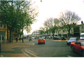 Bridge Street in 2001.
 -
 Neithrop Library.
 -
 Banbury Market
 -
 The station car park. The Whiz Kids' Nursery and activity centre is in the background.
 -
 Banbury station. An E.W.S. freight rain and a Wrexham, Marylebone train are here too.
 -
 Banbury station. A Chiltern Railways Train arrives at Banbury railway station.
 -
 Banbury station. A former Wrexham, Shropshire and Marylebone Railway loco stabled at Banbury station.
 -
 The c. 60-year-old oil terminal next to Banbury station. (It was upgraded circa 1980).
 -
 Browning park in Easington estate in 2001.
 -
 Part of the Neithrop estate, biult in the 1920's or 1930's.
 -
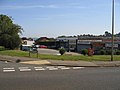 Local Shops. The small 1960s shopping precinct at the junction of Mewburn Road and the Queensway, Banbury.
 -
 Banbury Station View SE, towards Oxford and London. This is the main (General) station, on the former GWR Paddington to Birmingham line, so decrepit and a bottleneck it was rebuilt very soon after Nationalisation. Date 24 March 1961(1961-03-24).
 -
Banbury Market.
-
 Castle Quay's 1969 car park. The one from 1978 is not show.
 -
 The booking hall and main entrance Banbury railway station, managed by Chiltern Railways.
 -
 St Mary's Church. Banbury. It was built in the 1790's to replace the Medieval one damaged during the English Civil War.
 -
 Banbury's former Crest Hotels building has been derelict for a long time.
 -
 Banbury war memorial in People’s park on November 29th, 2010.


.png)
.png)

.png)
.png)
.png)
.png)


.png)


.png)


References
- ^ Lest We Forget - WW2 - Middleton Cheney Village Website. Middletoncheney.org. Retrieved on 2010-11-11.
- ^ A History of Banbury by Tim Lambert, localhistories.org
- ^ BBC - Oxford - Places - Banbury
- ^ a b c d e f g The history of Banbury, Oxfordshire
- ^ a b About Banbury, The Rotary Club of Banbury
- ^ a b c d e f g h i j http://webcache.googleusercontent.com/search?q=cache:7Uq6vTI2xgMJ:www.cherwell.gov.uk/media.cfm%3Fmediaid%3D2147+clay+pits+in+Grimsbury+Banbury&cd=8&hl=en&ct=clnk&gl=uk [dead link]
- ^ a b c d e f g h i j http://www.cherwell.gov.uk/media/pdf/6/5/pdf6325207015721436002.pdf
- ^ a b c A history of Banbury and the Banbury Cross explained
- ^ Crossley et al., 1972, pages 5-18
- ^ http://www.pagetoscreen.net/parish/neithrop/neithrop.pdf
- ^ a b c d e f The hundred of Banbury | British History Online
- ^ a b c d e f g Lobel & Crossley, 1969, pages 103-112
- ^ a b c d e f g h i j k l m n o p q r s t u v w x y z aa ab ac ad ae af ag ah ai aj ak Banbury - Economic history | British History Online
- ^ URL: http://www.british-history.ac.uk/report.aspx?compid=63791
- ^ Reindeer Inn website
- ^ a b c d Lobel & Crosley, 1969, pages 112-123
- ^ a b c http://www.civicvoice.org.uk/uploads/files/Banbury_Canalside_Vision.pdf
- ^ Compton, 1976, page 25
- ^ Compton, 1976, page 37
- ^ Compton, 1976, page 39
- ^ a b Tooley's Boatyard
- ^ a b c d e f g URL: http://www.british-history.ac.uk/report.aspx?compid=63793
- ^ a b c d e f g h i j k l m n Banbury - Local government | British History Online
- ^ a b c d e f g h i j k Banbury - Origins and growth of the town | British History Online
- ^ http://www.cherwell.gov.uk/media/pdf/7/c/Banbury_Conservation_Area_Appraisal_(2004)_Part_2.pdf
- ^ http://www.cherwell.gov.uk/media/pdf/7/c/Banbury_Conservation_Area_Appraisal_(2004)_Part_2.pdf
- ^ http://www.banburyguardian.co.uk/community/pool_is_back_by_popular_demand_1_2714525
- ^ Blood
- ^ http://www.banburyguardian.co.uk/news/refurbishment_is_planned_for_popular_town_play_area_1_1043568
- ^ http://www.thamesvalley.police.uk/yournh-tvp-pol-area-oxon-newsitem?id=165972
- ^ http://www.banburyguardian.co.uk/news/local/play_area_revamp_gets_the_go_ahead_1_588816
- ^ http://www.banburyguardian.co.uk/news/local/mystery_of_stolen_car_1_588468
- ^ http://www.thamesvalley.police.uk/yournh/yournh-tvp-pol-area/yournh-tvp-pol-area-n348
- ^ http://www.banburyguardian.co.uk/news/local/thieves_target_cars_1_588891
- ^ http://www.banburyguardian.co.uk/news/local/thieves_target_cars_1_588891
- ^ http://www.oxfordtimes.co.uk/news/8964889.Police_link_vehicle_thefts_in_Banbury_and_Bicester/
- ^ http://www.themissinglist.co.uk/police-appeal/four-vans-stolen-in-possibly-linked-incidents-banburybicester
- ^ http://www.findaproperty.com/crimefacts.aspx?edid=00&salerent=0&areaid=1187
- ^ a b c Banbury Young Peoples Centre. Spired.com. Retrieved on 2010-11-11.
- ^ a b c Banbury Young Peoples Centre. Spired.com. Retrieved on 2010-11-11.
- ^ a b c Cherwell District Council - Interactive Local Plan
- ^ a b c http://webcache.googleusercontent.com/search?q=cache:qn1UaVKXgP4J:www.banbury.gov.uk/download/Not%2520Delegated%2520Plans%2520List%2520for%2520Cttee%252007112007.doc+banbury+town+redivelopment&cd=8&hl=en&ct=clnk&gl=uk [dead link]
- ^ a b c Waterways World: Latest
- ^ a b c http://www.propertywide.co.uk/buy/property/2-bedroom-apartment-in-banbury,ox16-for-%C2%A366,000-ref-489225/
- ^ a b c DeHavilland
- ^ http://consult.cherwell.gov.uk/portal/ldf/sa/bncio?pointId=chapter_58
- ^ College Fields planning application
- ^ http://consult.cherwell.gov.uk/portal/ldf/sa/bncio?pointId=chapter_58
- ^ http://www.cherwell.gov.uk/bodicotepc/media/pdf/r/r/100713_GE_B_Exhibition_Boards_low_res.pdf
- ^ http://www.cherwell.gov.uk/media/pdf/7/c/Banbury_Conservation_Area_Appraisal_(2004)_Part_2.pdf
- ^ http://www.cherwell.gov.uk/media/pdf/7/c/Banbury_Conservation_Area_Appraisal_(2004)_Part_2.pdf
- ^ a b Oxfordshire Ironstone Quarries Headquarters site:: OS grid SP4042 :: Geograph Britain and Ireland - photograph every grid square!
- ^ http://docs.google.com/viewer?a=v&q=cache:sppuMpvgMg8J:www.oum.ox.ac.uk/learning/pdfs/oxmin.pdf+clay+pits+in+banbury&hl=en&gl=uk&pid=bl&srcid=ADGEESgn-Yi-g1qgnV32eBJ5Bi24KzjITDU7kcw_uL-KWGxPnzzgLbT8n9stdyOyB9bxEnAdJs1yyzKFGNwmj0NWApex23PAad6KTYb4lJdKEqLBNLnqifn3yk8Xc8Fp-ya8DY20dPo5&sig=AHIEtbREJLbdRHQ5aetZoqTAk3mdY2Gy0w
- ^ -://www.youtube.com/watch?v=CF97RE8oZDE
- ^ -://www.flickr.com/photos/37166458@N06/3977254123/
- ^ Former Alcan site sold - News - Banbury Guardian
- ^ End of the line for Banbury's Alcan factory (From Oxford Mail)
- ^ Banbury Cross Website: General Information About Banbury
- ^ Castle Quay Shopping Centre Home Page
- ^ a b Kraft Foods Europe Home
- ^ Kraft: coffee production 'relatively unaffected' by Banbury factory fire
- ^ Fire at Kraft factory (From Oxford Mail)
- ^ Trailer full of coffee stolen from Kraft - Local - Banbury Guardian
- ^ Overthorpe Industrial Estate jobs – Find Overthorpe Industrial Estate jobs on GoYocal.com
- ^ BanburyTown Council
- ^ BanburyTown Council
- ^ http://www.cherwell.gov.uk/media/pdf/7/c/Banbury_Conservation_Area_Appraisal_(2004)_Part_2.pdf
- ^ School website
- ^ EX141003
- ^ North Oxfordshire Academy
- ^ United Learning Trust's website for the proposal of North Oxfordshire Academy
- ^ United Learning Trust Official Website
- ^ March 2009 Ofsted/HMI Report
- ^ www.wrrinerschoolfarm.org.uk
- ^ Poo power cuts Thames electricity bill by £15m - News releases - Thames Water
- ^ Horton General Hospital
- ^ http://midlandred.net/depots/by.shtml
- ^ http://www.socialparanormal.com/metapedia/index.php?title=Banburybus
- ^ http://midlandred.net/depots/by.shtml
- ^ http://midlandred.net/depots/by.shtml
- ^ http://midlandred.net/depots/by.shtml
- ^ http://www.socialparanormal.com/metapedia/index.php?title=Banburybus
- ^ Banburyshire C.T.A. Ltd
- ^ Hennef Way bridge in Banbury:: OS grid SP4641 :: Geograph Britain and Ireland - photograph every grid square!
- ^ "Long-awaited relief road moves closer, thisisoxfordshire.co.uk, 2 February 2005
- ^ Community & news website for Banbury & Banburyshire
- ^ a b Banburyshire
- ^ Banburyshire
- ^ Banburyshire - Photos and All Basic Informations
- ^ About Banbury North Oxfordshire, historic home of Banbury Cross
- ^ Banburyshire : Gallery
- ^ Banburyshire
- ^ Planning a trip to Banburyshire, Banbury, County of Oxfordshire, United Kingdom - TripSage
- ^ Sherwood & Pevsner, 1974, page 632
- ^ Deegan & Foard, 2008, pages 118-119
- ^ Council for British Archaeology: South Midlands Region: Bedfordshire, Buckinghamshire, Northamptonshire & Oxfordshire
- ^ Pevsner & Cherry, 1973, page 279
- ^ a b Anglo-Saxons.net
- ^ St Peter's Parish Church history
- ^ Cherwell Edge Golf Club in Oxfordshire - UK Golf Guide
- ^ Welcome To Cherwell Edge Golf Club
External links
select an article title from: Wikisource:1911 Encyclopædia Britannica
- North Oxfordshire Academy
- The Former Drayton School
- United Learning Trust's website for the proposal of North Oxfordshire Academy
- FT.com / Middle East / Politics & Society - Egyptian military dissolves parliament
- Maps that show the proximity of Banbury to the other counties mentioned
- A Banburyshire genealogical resource
- Banburyshire Community Transport Association
- [1]A 1930's OS map.
