Samarra
This article needs additional citations for verification. (May 2009) |
34°11′54″N 43°52′27″E / 34.19833°N 43.87417°E
Sāmarrā'
سامَراء Samarra | |
|---|---|
City | |
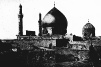
 The Shrine of two Shiite Imams in Samarra. | |
| Country | |
| Governorate | Salah ad Din Governorate |
| Population (2003 est) | |
| • Total | 348,700 |
| Official name | Samarra Archaeological City |
| Type | Cultural |
| Criteria | ii, iii, iv |
| Designated | 2007 (33rd session) |
| Reference no. | 276 |
| State Party | |
| Region | Arab States |
| Endangered | 2007–present |
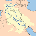
Sāmarrā (Arabic: سامَرّاء) is a city in Iraq. It stands on the east bank of the Tigris River in the Salah ad-Din Governorate, 125 kilometers (78 mi) north of Baghdad. In 2003 the city had an estimated population of 348,700. Samarra is in the Sunni Triangle and the majority of the population are Sunni Arabs.[1]
The city was once the capital of the Abbasid Caliphate and the only remaining Islamic capital that retains its original plan, architecture and artistic relics.[2] In 2007, UNESCO named Samarra one of its World Heritage Sites.[3]
Etymology
The official name, as referenced by coins, was the Arabic phrase “Surra man ra’a” (Arabic: سر من رأى), which translates to “who sees it rejoices”. But in vernacular it was always called Samarra.[citation needed]
History
Ancient Samarra


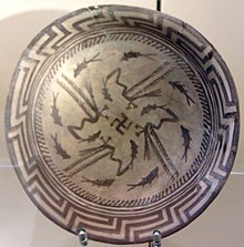
The remains of prehistoric Samarra were first excavated between 1911 and 1914 by the German Archaeologist Ernst Herzfeld. Samarra became the type site for the Samarra culture. Since 1946, the notebooks, letters, unpublished excavation reports and photographs have been in the Freer Gallery of Art in Washington, DC.
A city of Sur-marrati (refounded by Sennacherib in 690 BC according to a stele in the Walters Art Museum, Baltimore[citation needed]) is insecurely identified with a fortified Assyrian site of Assyrian at al-Huwaysh, on the Tigris opposite to modern Samarra.
Ancient toponyms for Samarra noted by the Samarra Archaeological Survey are Greek Souma (Ptolemy V.19, Zosimus III, 30), Latin Sumere, a fort mentioned during the retreat of the army of Julian the Apostate in 363 AD (Ammianus Marcellinus XXV, 6, 4), and Syriac Sumra (Hoffmann, Auszüge, 188; Michael the Syrian, III, 88), described as a village.
The possibility of a larger population was offered by the opening of the Qatul al-Kisrawi, the northern extension of the Nahrawan Canal which drew water from the Tigris in the region of Samarra, attributed by Yaqut (Mu`jam see under "Qatul") to the Sassanid king Khosrau I Anushirvan (531–578). To celebrate the completion of this project, a commemorative tower (modern Burj al-Qa'im) was built at the southern inlet south of Samarra, and a palace with a "paradise" or walled hunting park was constructed at the northern inlet (modern Nahr al-Rasasi) near to al-Daur. A supplementary canal, the Qatul Abi al-Jund, excavated by the Abbasid Caliph Harun al-Rashid, was commemorated by a planned city laid out in the form of a regular octagon (modern Husn al-Qadisiyya), called al-Mubarak and abandoned unfinished in 796.
Abbasid capital
In 221/836 the Abbasid Caliph Al-Mu'tasim founded a new capital at the banks of the Tigris. Here he built extensive palace complexes surrounded by garrison settlements for his guards, mostly drawn from Central Asia and Iran (most famously the Turks, as well as the Khurasani Ishtakhaniyya, Faraghina and Ushrusaniyya regiments) or North Africa (like the Maghariba). Although quite often called Mamluk slave soldiers, their status was quite elevated; some of their commanders bore Sogdian titles of nobility.[5]
The city was further developed under Caliph al-Mutawakkil, who sponsored the construction of lavish palace complexes, such as al-Mutawakkiliyya, and the Great Mosque of Samarra with its famous spiral minaret or Malwiya, built in 847. For his son al-Mu'tazz he built the large palace Bulkuwara.
Samarra remained the residence of the caliph until 279/892, when al-Mu'tadid eventually returned to Baghdad. The city declined but maintained a mint until the early 10th century.
The Nestorian patriarch Sargis (860–72) moved the patriarchal seat of the Church of the East from Baghdad to Samarra, and one or two of his immediate successors may also have sat in Samarra so as to be close to the seat of power.[6]
After the collapse of the Abbasid empire in about 940 Samarra was abandoned. Its population returned to Baghdad and the city rapidly declined. Its field of ruins is the only world metropolis of late antiquity which is available for serious archaeology.
Islamic significance
The city is also home to the al-Askari Mosque, containing the mausoleums of the Ali al-Hadi and Hasan al-Askari, the tenth and eleventh Shia Imams, respectively, as well as the place from where he went into occultation. Muhammad al-Mahdi, known as the "Hidden Imam", is the twelfth and final Imam of the Twelvers. This has made it an important pilgrimage centre for the Twelvers. In addition, Hakimah and Narjis, female relatives of the Muhammad and the Imams, held in high esteem by Muslims, are buried there, making this mosque one of the most significant sites of worship.
The Sunnis also pray in the mosques similar to the Shi'a; they also conduct pilgrimages to these sites (coming as far as from South Asia), but they do not believe this to be obligatory, but rather an affair providing spiritual blessings.
Modern era

During the 20th century, Samarra gained new importance when a permanent lake (Lake Tharthar) was created through the construction of the Samarra Dam, which was built in order to prevent the frequent flooding of Baghdad. Many local people were displaced by the dam, resulting in an increase in Samarra's population.[citation needed]

Samarra is a key city in Salahaddin province, a major part of the so-called Sunni Triangle where insurgents were active during the Iraq War.
Though Samarra is famous for its Shi'a holy sites, including the tombs of several Shi'a Imams, the town is dominated by Sunnis. Tensions rose between Sunnis and Shi'as during the Iraq War and on February 22, 2006, the golden dome of the al-Askari Mosque was destroyed by bombs, setting off a period of rioting and reprisal attacks across the country which claimed hundreds of lives. No organization claimed responsibility for the bombing but on June 13, 2007, suspected al-Qa'eda insurgents attacked the mosque again and destroyed the two minarets that flanked the dome's ruins.[citation needed] On July 12, 2007 the clock tower was blown up. No fatalities were reported. Shiite cleric Muqtada al-Sadr called for peaceful demonstrations and three days of mourning.[citation needed] He stated that he believed no Sunni Arab could have been behind the attack.[citation needed] The mosque compound and minarets had been closed since the 2006 bombing. An indefinite curfew was placed on the city by the Iraqi police.[7][8]
Samarra in popular culture
The metaphor of "Having an appointment in Samarra", signifying death, is a literary reference to an ancient Babylonian myth: Death is both the narrator and a central character, transcribed by W. Somerset Maugham. The story was titled "The Appointment in Samarra", and subsequently formed the germ of the novel Appointment in Samarra by John O'Hara. The original story was re-told in verse by F. L. Lucas in his poem 'The Destined Hour' in From Many Times and Lands (1953).[9]
References
- ^ http://www.pbs.org/newshour/bb/middle_east-july-dec03-samarra_12-01/
- ^ UNESCO, Samarra Archaeological City, http://whc.unesco.org/en/list/276
- ^ "Unesco names World Heritage sites". BBC News. 2007-06-28. Retrieved 2010-05-23.
- ^ Stanley A. Freed, Research Pitfalls as a Result of the Restoration of Museum Specimens, Annals of the New York Academy of Sciences, Volume 376, The Research Potential of Anthropological Museum Collections pages 229–245, December 1981.
- ^ Babaie, Sussan (2004). Slaves of the Shah. New York: I.B.Tauris & Co Ltd. pp. 4–5. ISBN 1 86064 721 9.
- ^ Mari, 80–1 (Arabic), 71–2 (Latin)
- ^ Qassim Abdul-Zahra (June 13, 2007). "Iraqi police say famous shrine attacked". Associated Press.
- ^ "Blast hits key Iraq Shia shrine". BBC. 2007-06-13. Retrieved 2012-04-21.
- ^ Lucas, F. L., ‘The Destined Hour’ in From Many Times and Lands (London, 1953); reprinted in Every Poem Tells a Story: A Collection of Stories in Verse, ed. Raymond Wilson (London, 1988; ISBN 0-670-82086-5 / 0-670-82086-5)
Selected Bibliography
- De la Vaissière, Étienne (2007): Samarcande et Samarra. Élites d’Asie central dans l’empire abbaside (Studia Iranica, Cahier 35), Paris.
- Gordon, Matthew S. (2001): The Breaking of a Thousand Swords. A History of the Turkish Military of Samarra (A.H. 200-275, 815-889 C.E.), Albany.
- Northedge, Alastair (2005): The historical topography of Samarra, London.
- Robinson, Chase (ed.) (2001): A Medieval Islamic City Reconsidered: An Interdisciplinary Approach to Samarra (Oxford Studies in Islamic Art 14). Oxford.
External links
- Ernst Herzfeld Papers, Series 7: Records of Samarra Expeditions, 1906-1945 Smithsonian Institution, Freer Gallery of Art and Arthur M. Sackler Gallery Archives, Washington, DC
- Ernst Herzfeld Papers, Series 7: Records of Samarra Expeditions, 1906-1945 Collections Search Center, S.I.R.I.S., Smithsonian Institution, Washington, DC
- Iraq Image - Samarra Satellite Observation
- Samarra Archaeological Survey
- The Appointment in Samarra
- Destruction of Askari Mosque
- Samarra on Google Earth


