
Akçakoca
Akçakoca | |
|---|---|
 Akçakoca beach | |
 Akçakoca | |
| Coordinates: 41°5′N 31°7′E / 41.083°N 31.117°E | |
| Country | |
| Province | Düzce |
| Area | |
| • District | 440.26 km2 (169.99 sq mi) |
| Population (2012)[2] | |
| • Urban | 23,359 |
| • District | 37,216 |
| • District density | 85/km2 (220/sq mi) |
| Climate | Cfb |
Akçakoca is both a town and district of Düzce Province, in the Black Sea region of Turkey, located about 200 km east of Istanbul. The town was named after a Turkish chieftain of the 14th century CE who captured the area for the Ottoman Empire, and sports a statue in his honor. The town features a modern mosque of unusual design. Tourist attractions include beaches and a small ruined castle. It is the regional center of hazelnut cultivation. The mayor is Cüneyt Yemenici (Ak Parti).
List of villages of Akçakoca district
- Akkaya
- Aktaş
- Altunçay
- Arabacı
- Balatlı
- Beyhanlı
- Beyören
- Çayağzı
- Çiçekpınar
- Dadalı
- Davutağa
- Deredibi
- Dereköy
- Dilaver
- Doğancılar
- Döngeli
- Edilli
- Esmahanım
- Fakıllı
- Göktepe
- Hasançavuş
- Hemşin
- Kalkın
- Karatavuk
- Kepenç
- Kınık
- Kirazlı
- Koçar
- Koçullu
- Kurugöl
- Kurukavak
- Küpler
- Melenağzı
- Nazımbey
- Ortanca
- Paşalar
- Sarıyayla
- Subaşı
- Tahirli
- Tepeköy
- Uğurlu
- Yenice
- Yeşilköy
History
In the late 19th and early 20th century, Akçakoca was part of the Kastamonu Vilayet of the Ottoman Empire.
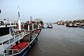
Gallery
-
 Melen Creek
 -

-

-
 Autumn in Akçakoca
 -
 Fakıllı Cave


References
- ^ "Area of regions (including lakes), km²". Regional Statistics Database. Turkish Statistical Institute. 2002. Retrieved 2013-03-05.
- ^ "Population of province/district centers and towns/villages by districts - 2012". Address Based Population Registration System (ABPRS) Database. Turkish Statistical Institute. Retrieved 2013-02-27.
External links
Wikimedia Commons has media related to Akçakoca.
Wikivoyage has a travel guide for Akçakoca.
- District governor's official website Template:Tr icon
- District municipality's official website Template:Tr icon
- Pictures of Akçakoca
Akçakoca in Düzce Province of Turkey | |||||||||||||||||||||||||||
|---|---|---|---|---|---|---|---|---|---|---|---|---|---|---|---|---|---|---|---|---|---|---|---|---|---|---|---|
| Districts |   | ||||||||||||||||||||||||||
|
Metropolitan municipalities are bolded. | |||||||||||||||||||||||||||
| International | |
|---|---|
| National | |
This geographical article about a location in Düzce Province, Turkey is a stub. You can help Wikipedia by expanding it. |