Amroha
Amroha is a town in north-western Uttar Pradesh state in northern India, located north-west of Moradabad, near the Sot River. It is the administrative headquarters of the Amroha district.
History

The name of Amroha may derive from its production of mangoes (aam) and fish (rohu). Raja Amarjoda, of the Bansi dynasty, was the ruler of region Amroha in 479 BC. The author of Tarikh-i-Amroha states that Amroha was ruled by Rajputs between 676 and 1141 AD. Mahmud of Ghazni conquered Amroha in 589 AH/1093 AD. Behram Shah (1240–42) appointed Malik Jalaluddin to the position of Hakim of Amroha in 1242. Ghiyasuddin Balban crushed a rebellion in this region, and so ruthless was his repression that the territory of Badaun and Amroha remained quiescent till the reign of Jalaluddin Khalji. Ambar Sultani built a mosque at Amroha. During Alauddin Khalji's reign, Malik Tughluq and Malik marched through the city to confront the Mongols at the Battle of Amroha. Saiyid Salim was assigned Amroha and Sirsi as an iqta and after his death, the iqta was assigned to his sons. It is also recorded that Khizr Khan was punished by Alauddin Khalji with an enforced stay at Amroha with Hisamuddin.
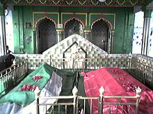
The historical architecture of Amroha begins with the fort wall, remnants of which still stand. The Moradabadi Darwaza, built by Saiyid Abdul Maajid in 1642 AD, is the only extant gate. The wall was constructed during the reign of Shah Jahan, by Siyadat Maab Saiyid Abdul Maajid, who had constructed this fort under the supervision of Kamal Khan Khanazad in 1652 AD. It is fifty feet high with three parallel arches, covered with a roof. Other monuments from this period include mosques, idgahs, khanqash, dargahs, imambaras, diwan khana, madrasas and mandirs. Some of these are of the Delhi Sultanate period, others of the Mughal period.
Social groups
Amroha has a predominantly Muslim population, both Sunni and Shia.[citation needed] Other religions are also represented, particularly Hindu.[citation needed]
Demographics
As per provisional data of 2011 census, Amroha had a population of 197,135, out of which males were 102,804 and females were 94,331. The literacy rate was 63.88 per cent.[1]
Economy and eduction
Amroha is known for its mangoes; many of the cultivars grow there.[2] Its main industries are pottery making, hand-loom weaving, and sugar milling and secondary ones are carpet manufacturing, wood handicrafts and small-scale production of cotton cloth.
Major degree colleges
- Hashmi Girls Degree College.[3]
- Waseem Turki Memorial Degree College[4]
- H.M.U Hashmi College Of Law[3]
- Rashida Begum Muslim Mahavidyalaya[5]
- DNS College of Engineering and Technology[6]
- Jagdish Saran Degree College[7]
References
- ^ "Urban Agglomerations/Cities having population 1 lakh and above" (PDF). Provisional Population Totals, Census of India 2011. Retrieved 2012-07-07.
{{cite web}}: Cite has empty unknown parameter:|1=(help) - ^ BBC report
- ^ a b Hashmi Girls PG College, Hashmi Nagar, Amroha-244221, Distt.JP Nagar, UP, India
- ^ http://www.wtmdegreecollege.com
- ^ rbmm.org
- ^ D.N.S College Of Engineering and Technology
- ^ :: Welcome to J.S
Amroha Population & Literacy Rate
