
User:Kew Gardens 613/New York City Subway Track Layout, Bellmouths and Provisions
| This is a Wikipedia user page. This is not an encyclopedia article or the talk page for an encyclopedia article. If you find this page on any site other than Wikipedia, you are viewing a mirror site. Be aware that the page may be outdated and that the user in whose space this page is located may have no personal affiliation with any site other than Wikipedia. The original page is located at https://en.wikipedia.org/wiki/User:Kew_Gardens_613/New_York_City_Subway_Track_Layout,_Bellmouths_and_Provisions. |

This list is compiled from information from books, newspaper articles, track maps, and from information on subchat. For better references, I would need to find official documentation. Several Electric Railroaders' Association Bulletins, such as those from 1964 and 1965 by Dave Rogoff, had information on abandoned tunnels, stations, and structures, and would be helpful. Many of these provisions were constructed for proposed lines as part of the IND Second System. If you have any information concerning any provisions or planned lines please feel free to add it or discuss it on my talk page. If any of this information is incorrect, please fix it.
IND Division[edit]
Track layout | ||||||||||||||||||||||||||||||||||||||||||||||||||||||||||||||||||||||||||||||||||||||||||||||||||
|---|---|---|---|---|---|---|---|---|---|---|---|---|---|---|---|---|---|---|---|---|---|---|---|---|---|---|---|---|---|---|---|---|---|---|---|---|---|---|---|---|---|---|---|---|---|---|---|---|---|---|---|---|---|---|---|---|---|---|---|---|---|---|---|---|---|---|---|---|---|---|---|---|---|---|---|---|---|---|---|---|---|---|---|---|---|---|---|---|---|---|---|---|---|---|---|---|---|---|
Upper level
| ||||||||||||||||||||||||||||||||||||||||||||||||||||||||||||||||||||||||||||||||||||||||||||||||||
| ||||||||||||||||||||||||||||||||||||||||||||||||||||||||||||||||||||||||||||||||||||||||||||||||||
Lower level
| ||||||||||||||||||||||||||||||||||||||||||||||||||||||||||||||||||||||||||||||||||||||||||||||||||
| ||||||||||||||||||||||||||||||||||||||||||||||||||||||||||||||||||||||||||||||||||||||||||||||||||
Archer Avenue Lines[edit]
Provisions east of the Jamaica Center–Parsons/Archer station[edit]
The tracks on both levels of the Jamaica Center–Parsons/Archer station on the Archer Avenue lines extend past the station for possible future extensions, but are currently used for storage.[1][2] On the lower level, they continue one train length of about 480 feet (150 m) and end at bumper blocks at 160th Street;[2][3] they were originally planned to extend as far as Merrick Boulevard.[3] This was a planned extension toward 190th Street–Hollis Avenue (near the Hollis LIRR station). Where the lower level tracks end, there is a provision for a diamond crossover switch at the end of the tunnel (under 160th Street).[4][3] On the upper level, the tracks extend around 2,000 feet (610 m) or just over 3 train lengths of about 600 feet (180 m), curving south under the LIRR Atlantic Branch 60 feet (18 m) below ground. They then run under 160th Street within the York College campus and stop at about South Road, also ending at bumper blocks.[1][2][3][5][6] This was the site of the line's original groundbreaking in 1973.[4] The plan was for this line to use the LIRR Atlantic Branch right-of-way and run to Springfield Boulevard or Rosedale LIRR station.[6][4][3] Where the upper level tracks stub end, there's a provision for a portal to go outside if the line going to Southeastern Queens is ever built.[4][3] The tunnel was originally planned curve west towards the Atlantic right-of-way just north of Liberty Avenue, running underneath the York College Athletic Field.[3]
East of the upper level platform, a Central Instrument Room (753CIR) is located deep in the tunnel on track D2A (upper level) bench wall. East of the station, next to the D1A tail track on the upper level, the tunnel catwalk structure widens, and the track curves south along with the D2A track. Where the catwalk structure ends, there is a stairway to the lower level tail tracks. There is no provision for a connection between the upper and lower levels of the Archer Avenue Lines.
Queens Boulevard Line[edit]
Track layout | ||||||||||||||||||||||||||||||||||||||||||||||||||||||||||||||||||||||||||||||||||||||||||||||||||||||||||||||||||||||||||||||
|---|---|---|---|---|---|---|---|---|---|---|---|---|---|---|---|---|---|---|---|---|---|---|---|---|---|---|---|---|---|---|---|---|---|---|---|---|---|---|---|---|---|---|---|---|---|---|---|---|---|---|---|---|---|---|---|---|---|---|---|---|---|---|---|---|---|---|---|---|---|---|---|---|---|---|---|---|---|---|---|---|---|---|---|---|---|---|---|---|---|---|---|---|---|---|---|---|---|---|---|---|---|---|---|---|---|---|---|---|---|---|---|---|---|---|---|---|---|---|---|---|---|---|---|---|---|---|
Upper level
| ||||||||||||||||||||||||||||||||||||||||||||||||||||||||||||||||||||||||||||||||||||||||||||||||||||||||||||||||||||||||||||||
| ||||||||||||||||||||||||||||||||||||||||||||||||||||||||||||||||||||||||||||||||||||||||||||||||||||||||||||||||||||||||||||||
Lower level
(east of station) | ||||||||||||||||||||||||||||||||||||||||||||||||||||||||||||||||||||||||||||||||||||||||||||||||||||||||||||||||||||||||||||||
| ||||||||||||||||||||||||||||||||||||||||||||||||||||||||||||||||||||||||||||||||||||||||||||||||||||||||||||||||||||||||||||||
Provisions for the extension of the subway along Hillside Avenue[edit]
To the east (railroad north) of 179th Street on the IND Queens Boulevard Line is a large storage and relay yard consisting of two levels with four relay tracks each,[7] extending approximately .25 miles (0.40 km)[8] to around 185th Street.[a][10][12][9][7] This total of eight storage tracks gives 179th Street the highest peak terminal capacity of any station in the New York City Subway: 63 trains per hour, or one train every 57 seconds, although the station currently operates at a far lower throughput (only 17–18 trains per hour during peak hours).[b][14][15][16] Terminating trains enter on one of the two northbound tracks, then relay to one of the two levels—the upper level if coming from the express track, or the lower level if coming from the local track.[7] They then return on the corresponding track on the southbound side.[17] Due to the switching configuration at the station, the few E trains that begin here always leave from the express track and run express along Hillside Avenue. F trains may leave from either track, switching to the local track east of 169th Street if necessary.[17] Outside of relay operations, the yard provides storage for ten trains.[11]
The configuration of the relay tracks is evidence of the original plans to build an extension of the Queens Boulevard Line further east into Queens. The line would have continued under Hillside Avenue to Springfield Boulevard and Braddock Avenue (formerly Rocky Hill Road) in Queens Village,[18][19] with later plans to extend the line to Little Neck Parkway in Bellerose near the Nassau County border.[20] The upper level was to be extended eastward while the lower level tracks were always intended to be relay tracks.[7][21] The tracks on the upper level are longer than the lower level tracks and the upper level tracks have a wooden partition at the bumper blocks.[7][22] The tracks on the lower level end at a concrete wall.
In anticipation of the future extension of the subway along Hillside Avenue, that street was widened between 218th Street and 229th Street in 1931.[23][24][25]
169th Street Terminal[edit]
Track layout | ||||||||||||||||||||||||||||||||||||||||||||||||||||||||||||||||||||||||||||||||||||
|---|---|---|---|---|---|---|---|---|---|---|---|---|---|---|---|---|---|---|---|---|---|---|---|---|---|---|---|---|---|---|---|---|---|---|---|---|---|---|---|---|---|---|---|---|---|---|---|---|---|---|---|---|---|---|---|---|---|---|---|---|---|---|---|---|---|---|---|---|---|---|---|---|---|---|---|---|---|---|---|---|---|---|---|---|
| ||||||||||||||||||||||||||||||||||||||||||||||||||||||||||||||||||||||||||||||||||||
When the 169th Street station was the terminal of the IND Queens Boulevard Line, the switches to the north of the station were controlled by Parsons Boulevard Tower. The old switch arrangement east of 179th Street had a diamond crossover between the express tracks north of the station instead of a single tail switch. This was used for relayng trains.
Once the line was extended to 179th Street in 1950, a new tower was built, controlling the relaying of trains on the upper and lower levels. Since it was a terminal decision whether a train was going to relay on the upper or lower level, control of the 169th Street Interlocking was transferred to the new 179th Street Tower. There are a lot of levers missing at the Parsons Boulevard Tower.
This station used to be heavily used as most buses that terminate at Jamaica Center used to end here. Since the station was ill-equipped to handle the demand bars were put behind the stairs. Because of the high ridership, F express trains stopped here before switching to the express for Parsons Boulevard.
Provisions east of Briarwood for the Van Wyck Boulevard Line[edit]
Track layout | ||||||||||||||||||||||||||||||||||||||||||||||||||||||||||||||||||||||||||||||||||||||||||||||||||||||||||||||||
|---|---|---|---|---|---|---|---|---|---|---|---|---|---|---|---|---|---|---|---|---|---|---|---|---|---|---|---|---|---|---|---|---|---|---|---|---|---|---|---|---|---|---|---|---|---|---|---|---|---|---|---|---|---|---|---|---|---|---|---|---|---|---|---|---|---|---|---|---|---|---|---|---|---|---|---|---|---|---|---|---|---|---|---|---|---|---|---|---|---|---|---|---|---|---|---|---|---|---|---|---|---|---|---|---|---|---|---|---|---|---|---|---|
| ||||||||||||||||||||||||||||||||||||||||||||||||||||||||||||||||||||||||||||||||||||||||||||||||||||||||||||||||
The Briarwood station on the IND Queens Boulevard Line opened on April 24, 1937, and a branch of the Queens Boulevard Line was planned east of this station. There were bellmouths built to the east of the station for a planned line running down Van Wyck Boulevard (now the Van Wyck Expressway) to Rockaway Boulevard as part of the IND Second System. These bellmouths were used during the 1980s to connect to the IND Archer Avenue Line. The grade separated tunnels for tracks D1A and D2A were built as part of the Queens Boulevard Line under Public Works Administration (PWA) project number 2741 in 1935 and 1936. The original tunnel lighting was installed and operative. They were labeled tracks D5 and D6 in 1935–1936, and the tunnel was originally built from the Briarwood station to the middle of the present interlocking just north of the Jamaica–Van Wyck station. When the Archer Avenue Extension was constructed, the original tunnel was kept the same except for the addition of ties and track. The existence of the provisions made it a lot easier for the connection to be built between the Queens Boulevard Line and the Archer Avenue Line in the 1970s and 1980s. The connection from Briarwood to the IND Archer Avenue Line was termed as the Hillside Avenue Connection during the construction of the project.
Bellmouths east of 63rd Drive–Rego Park[edit]
East of the 63rd Drive–Rego Park station on the IND Queens Boulevard Line there is a turn-off provision off the Manhattan-bound local track (D1 Track) that would have gone down to the Rockaways via the abandoned Rockaway Beach Branch of the Long Island Rail Road. The turnoff goes underneath the IND Queens Boulevard Line to curve south, and ends under 66th Avenue just short of Austin Street. The section underneath the four mainline tracks is 200 feet (61 m) long and is sealed up at both ends with chaining marks on the wall. According to the as built blueprints, the westbound tunnel to Whitepot Junction is shown with track, signals and third rail in place. At the 63rd Drive station the structure at the end of the eastbound end was intended to be the tower for the proposed Rockaway Line connection. The end of the bellmouth on the south side is a false wall similar to the one that used to block the ramp to Nevins Street lower level south of Hoyt Street and the tunnel was actually was built all the way to the Long Island Rail Road right-of-way that it was supposed to connect to. The false wall makes the tunnel section appear as if it was just a short bellmouth. During construction, the areas are actually still the property of the contractor until they are formally turned over to the transit agency, and if the contractor is paid for all of their work, but the agency declines to accept the finished work in its entirety, by sealing it off, the area then becomes unposted abandoned property and is no longer the concern of the city or the transit agency.[22]
IT IS LOCATED APX.200 FEET SOUTH OF 66TH AVE.IN THE CENTER MEDIAN OF QUEENS BLVD.THERE ARE 2 OF THEM,1 FOR THE E/B LOCAL & 1 FOR THE W/B LOCAL. I,VE BEEN IN BOTH AT LEAST A DOZEN TIMES OR MORE. THE ONE IN THE PHOTO IS JAMAICA BOUND.
Woodhaven Boulevard express station provisions[edit]
At Woodhaven Boulevard on the IND Queens Boulevard Line, at each end of the station, both northbound and soutbound platforms, bellmouths exists in the tunnel walls where the tunnels widen to allow the conversion of the station to an express station. The bellmouths don't branch out, but they point ahead and they abruptly end on both sides of the station. The local track would be rerouted on both the northbound and southbound sides, using the bellmouths, going around the station platform. The platform wall would be removed to allow the new local track to have access to the platforms. The platforms would be extended over the current local tracks to reach the express tracks, allowing for express trains to stop with a cross-platform transfer.[26] The station would have accommodated a major system expansion, with additional service coming from the Roosevelt Avenue Terminal station and the former LIRR Rockaway Line.[27][28] Requests to convert the station were also put forward by the local community shortly after the station opened due to heavy bus traffic feeding into the station and overcrowding at the Roosevelt Avenue express stop.[29][30]
Track layout | |||||||||||||||||||||||||||||||||||||||||||||||||||||||||||||||||||||||||||||||||||||||||||||||||||||||||||||||||||||||||||||||||||||||||||||||||||
|---|---|---|---|---|---|---|---|---|---|---|---|---|---|---|---|---|---|---|---|---|---|---|---|---|---|---|---|---|---|---|---|---|---|---|---|---|---|---|---|---|---|---|---|---|---|---|---|---|---|---|---|---|---|---|---|---|---|---|---|---|---|---|---|---|---|---|---|---|---|---|---|---|---|---|---|---|---|---|---|---|---|---|---|---|---|---|---|---|---|---|---|---|---|---|---|---|---|---|---|---|---|---|---|---|---|---|---|---|---|---|---|---|---|---|---|---|---|---|---|---|---|---|---|---|---|---|---|---|---|---|---|---|---|---|---|---|---|---|---|---|---|---|---|---|---|---|---|
| |||||||||||||||||||||||||||||||||||||||||||||||||||||||||||||||||||||||||||||||||||||||||||||||||||||||||||||||||||||||||||||||||||||||||||||||||||
Roosevelt Avenue Terminal[edit]
Along the ramp leading to the southeastern fare control at the Roosevelt Avenue/74th Street station on the IND Queens Boulevard Line there is an unused and uncompleted Roosevelt Avenue terminal station for the IND Second System directly above the Manhattan-bound platform.[31][32][33] This terminal has an island platform with a trackway on each side. There are no rails in the trackbeds, but tiles depicting the station name on the tile walls are present.[32][34][35] The signs hanging over the platform, however, are blank. East of the station lies a long, dark section of a three-block-long tunnel[32][34][36][37] with provisions for a crossover[34][38] and a ramp down to the Manhattan-bound local track of the active mainline below.[39] The unused tunnel has about 750 feet (230 m) of trackway. Along these trackways, trains from the lower level tracks can be seen.[40] The never-used upper level platform is around 500 feet (150 m), only long enough for eight 60-foot (18 m) cars rather than the IND maximum of ten.[34] The platform itself has been converted to offices and storage.[32][41][42][43][22]
There is a trackway just east of Roosevelt Avenue that diverges away from the Manhattan-bound local track. The trackway ramps up to the same level as the two trackways coming from the never-used Roosevelt Avenue Terminal,[39] making three trackways on the upper level. The ramp flies over the mainline tracks along with the two other trackways. Between 78th and 79th Streets, the three trackways on upper level curve towards the south and ending at the wall at the edge of constructed subway. There is a diverging bellmouth next to the Jamaica-bound local track several hundred feet north of the station just at the location where the three upstairs trackways are crossing over. This bellmouth also curves towards the south and similarly ends on a concrete wall shortly after the start of the bellmouth.[44] At the end of the unused tunnel there is an emergency exit[45] that opens out to the south side of Broadway across the street from Elmhurst Hospital. The four-track subway running south was a plan for a line along the Long Island Rail Road right-of-way to Garfield Avenue and 65th Place. The line would have turned along 65th Place to Fresh Pond Road and then along Fresh Pond Road to Cypress Hills Street. The line would have merged with the Myrtle–Central Avenues Line to the Rockaways proposed in 1929.[34][46][47][48]
All four trackways end at a concrete wall where they begin to diverge from the excavation for the existing line.[32]
East of this station, next to the southbound track, the bellmouth with the ramp ascending to the upper level once had a layup track on it.[48] On the Roosevelt Avenue interlocking machine in the station tower, there are spare levers for the necessary signals and switches. On the southbound local track, there is a homeball signal, "D1-1415", which has the lower portion lenses covered over and now functions as an automatic signal. The interlocking machine still shows evidence of the now-nonexistent interlocking where the Winfield spur was to have turned off from the D1 track and the D2 track.[49]
also when the R32s ran on the E and F trains, on the D3 track (manhattan bound express track), after passing Elmhurst Avenue and before Roosevelt Avenue, at the front railfan window looking up at the subway tunnel's ceiling, for a short second, between the two stations you should see an incandescent light bulb, which is the upper level tunnel coming from the never-used Roosevelt Avenue terminal. in fact, on the upper level a peek into one of the 'escapes'(tunnel niches?) shows you a high ceiling and one of the Jamaica/Forest Hills-bound tracks below.
To the east (railroad north) end of the Upper Level platform, there is space for a diamond crossover, and an unused dispatcher's office/tower. The Upper Level platform was only 480 feet (150 m), and could only handle 8 60 foot cars, which is unusual for IND construction. The model board in the Roosevelt Avenue Tower has the switches and signals shown in place on both the northbound and southbound sides but they are painted over, but visible in a certain light. The associated switch and signal levers are still in place on the machine, but are painted yellow, the color of spare levers on interlocking machines for New York City Transit.
Winfield Spur route[edit]
The Winfield Spur would have turned right on 78th Street from Broadway. The playground over there would have been a portal from the subway. The line would have then turned right under Garfield Avenue, south on 65th Place, and it would then ease over to Fresh Pond Road south to Myrtle Avenue. It would then go left into Central Avenue to 99th Street, where it would go alongside the Long Island Rail Road's Rockaway Beach Branch to the Rockaways.[43][50] In order to cross the Plateau, along 65th Place, there likely would have been a deep tunnel construct like the tunnel on the IND Eighth Avenue Line between 181st Street and 190th Street in Washington Heights, Manhattan.
There is rumored to be either a station shell or a tunnel built at Fresh Pond Road and Myrtle Avenue as part of the construction of the line. This was mentioned in a New York City Transit Authority (NYCTA) book about building the IND lines. This book had a green cover and was a somewhat official book by the NYCTA.
Steinway Street tunnel[edit]
North of the Steinway Street station, on the IND Queens Boulevard Line, there is a door located along the catwalk on the southbound (Manhattan-bound) side. A lower level tunnel can be seen by looking down through this door. This tunnel would have been part of a route from the 1939 IND Second System plan. That plan included a subway line that would have branched off of the IND Queens Boulevard Line local tracks before the turn at Steinway Street, and then under the East River and 76th Street and south under Central Park before connecting with the IND Sixth Avenue Line at 57th Street. The plan was later modified to have the route run via 63rd Street, and the ensuing result are the 63rd Street Lines, which opened in 1989. The tunnel at Steinway Street was allegedly used by the New York City Police Department as a firing range.
Court Square–23rd Street[edit]
The switches south of Court Square were installed at a later date.
Crosstown Line[edit]
South Fourth Street provisional platforms[edit]
The north end of the Broadway station on the IND Crosstown Line has been blocked by false walls and is used as storage. This northern third of the platform level area consists of closed transfer passages that are sealed behind doors and fences. These passages lead to an unfinished station shell on an upper level, provisionally called South Fourth Street, which is accessible by passages that would have become stairs. To avoid confusion with this station, the West Fourth Street station is not called Fourth Street. The shell was built as part of a planned expansion of the Independent Subway System.[51][48][52][53][54][55][56]
The station is a semi-complete shell with four island platforms and six track beds, having the same layout as Hoyt–Schermerhorn Streets station. No rails, tiles, lights, or stairs were built.[57] The unfinished station, which is only about as long as Union Avenue is wide, was designed to be the main transfer point from the proposed Worth Street and Houston Street Lines coming from Manhattan with the Crosstown Line. These lines would have become two major trunk lines going east. One line would have gone towards the proposed Utica Avenue Line and the other line towards the Myrtle Avenue–Central Avenue Line to the Rockaways.[58][51][59]
The now-closed northern mezzanine would have had a passageway to the unfinished station, which would have had street stairs to the intersection of South 4th Street and Meserole Street.[58]
In 2010, dozens of street artists created murals on the walls of the unfinished station over the course of 18 months, collectively called "the Underbelly Project", without clearance from the MTA. Afterwards, the MTA sealed up once-available entrances to the station shell.[60][61]
The South Fourth Street shell, if complete, was supposed to handle service as follows:
| Level 1 | Northbound | ← Broadway line westbound |
| Southbound | ← Broadway line eastbound → | |
| Level 2 | Northbound | ← Utica Avenue express to Sixth Avenue |
| Northbound | ← Flushing/Utica Avenues local (termination platform) | |
| Northbound | ← Flushing Avenue express to Eighth Avenue | |
| Southbound | ← Flushing Avenue express from Eighth Avenue → | |
| Southbound | ← Flushing/Utica Avenues local → | |
| Southbound | ← Utica Avenue express from Sixth Avenue → | |
| Level 3 | Southbound | ← Utica Avenue local → |
| Southbound | ← Utica Avenue local → | |
Note: The locals would have short-turned here. There would have been two tunnels under the East River: East Houston Street and Grand Street.
Another plan for the South Fourth Street shell was simpler (and was the plan that was partially completed):
| Level 1 | Northbound | ← Flushing Avenue express to Eighth Avenue |
| Northbound | ← Utica Avenue express to Sixth Avenue via East Houston Street | |
| Northbound | ← Utica Avenue local to Sixth Avenue via Stanton Street | |
| Southbound | ← Utica Avenue local from Sixth Avenue via Stanton Street → | |
| Southbound | ← Utica Avenue express from Sixth Avenue via East Houston Street → | |
| Southbound | ← Flushing Avenue express from Eighth Avenue → | |
Note: The Flushing Avenue local would have diverged off to the IND Crosstown Line. There would have been three tunnels under the East River: East Houston Street, Stanton Street, and Grand Street.
Track layout | ||||||||||||||||||||||||||||||||||||||||||||||||||||||||||||||||||||||||||||||||||||||||||||||||||||||||||||||||
|---|---|---|---|---|---|---|---|---|---|---|---|---|---|---|---|---|---|---|---|---|---|---|---|---|---|---|---|---|---|---|---|---|---|---|---|---|---|---|---|---|---|---|---|---|---|---|---|---|---|---|---|---|---|---|---|---|---|---|---|---|---|---|---|---|---|---|---|---|---|---|---|---|---|---|---|---|---|---|---|---|---|---|---|---|---|---|---|---|---|---|---|---|---|---|---|---|---|---|---|---|---|---|---|---|---|---|---|---|---|---|---|---|
| ||||||||||||||||||||||||||||||||||||||||||||||||||||||||||||||||||||||||||||||||||||||||||||||||||||||||||||||||
Bedford–Nostrand Avenues middle track and Classon Avenue trackway[edit]
The middle track at Bedford–Nostrand Avenues on the IND Crosstown Line is used for storage of rush hour trains, or for maintenance and refuse trains. West (railroad south) of this station, the center track has switches to the two outer tracks before ending at a bumper block. South of Bedford-Nostrand Avenues the tunnel narrows to two tracks before widening back as the line continues into Classon Avenue. Also, a now sealed-off tunnel structure is located at the southern end of the Bedford–Nostrand station. East (railroad north) of the station, the middle track splits into two tracks that ramp down under the outer tracks before those tracks curve north. The tail tracks continue to Marcy Avenue and end at bumper blocks.[64][65][66] A signal and switch tower is located in the tunnel north of the station, staffed during rush hour and midday service, but primarily used during construction reroutes if trains need to be terminated at the station.[67][68][69][70]
Unused in regular service, the middle and tail tracks were originally intended for an unbuilt extension proposed in the IND Second System, and were intended to be a separate line. Not part of the first official plan in 1929, it was proposed by the city Board of Transportation on October 12, 1930 as an addition to the original plans.[65][71] The plan was for a line to continue east along Lafayette Avenue to Broadway (at Kosciusko Street of the BMT Jamaica Line), then northeast along Stanhope Street to a junction with the BMT Myrtle Avenue Line and a planned IND Myrtle-Central Avenues Line along Myrtle Avenue (between the Central Avenue and Knickerbocker Avenue stations). The IND would then run east along Myrtle Avenue past the Myrtle El, then along Central Avenue in Queens (as opposed to Central Avenue in Brooklyn) to 73rd Place and Cooper Avenue in Glendale, Queens, adjacent to the Long Island Rail Road's Montauk Branch. The line would have likely continued along or parallel to the Montauk and Rockaway Beach Branches of the LIRR to Rockaway Beach and Far Rockaway.[65][71][72][73] Upon completion of the extension, the center track would have been used to terminate short-run trains, or to provide an additional track to hold trains during peak hours.[71]
The middle trackway at the Classon Avenue station on the IND Crosstown Line appears to have been set aside for a relay or a lay up track. On the south end of the southbound platform there is a room that looks like it was supposed to become a tower. Had the line that was intended to feed into the Crosstown Line at Bedford–Nostrand been built, this station might have been a terminal during part of the day. North of the station's northbound platform there are rooms that resemble crew facilities.[74] Railroad south of Classon Avenue, the two tracks curve closer to each other and the center trackway ends.
Track layout | ||||||||||||||||||||||||||||||||||||||||||||||||||||||||||||||||||||||||||||||||||||||||||||||||||
|---|---|---|---|---|---|---|---|---|---|---|---|---|---|---|---|---|---|---|---|---|---|---|---|---|---|---|---|---|---|---|---|---|---|---|---|---|---|---|---|---|---|---|---|---|---|---|---|---|---|---|---|---|---|---|---|---|---|---|---|---|---|---|---|---|---|---|---|---|---|---|---|---|---|---|---|---|---|---|---|---|---|---|---|---|---|---|---|---|---|---|---|---|---|---|---|---|---|---|
| ||||||||||||||||||||||||||||||||||||||||||||||||||||||||||||||||||||||||||||||||||||||||||||||||||
Concourse Line[edit]
East of the 205th Street station[edit]
This station was not intended to be the terminus of the Concourse Line or the D train; both tracks were supposed to have been extended east past Bronx Park and the IRT White Plains Road Line along Burke Avenue to Kingsland Avenue at Bartow Avenue to serve the northeast section of the Bronx.[75][76][77] This idea was postponed due to lack of funding, and ultimately abandoned when the City of New York bought the right-of-way of the bankrupt New York, Westchester and Boston Railway and converted it for subway use in 1941.[78] Another proposal in the 1970s involved extending the Concourse Line to White Plains Road, but financial troubles caused the plan to be aborted.[78][79]
As a result of the planned extension, the two tracks continue east of this station for about 700 feet (210 m) along 205th Street to Webster Avenue, ending at a concrete wall,[80][81][82] and this station does not have any crew quarters. Crews are changed at Bedford Park Boulevard, the next station south. Additionally, there is no diamond crossover between the tracks west of this station; here, a center track forms leading west to the Concourse Yard.[83][84] Because of this, terminating trains arrive on the southern (railroad northbound) track and discharge their passengers before continuing east to the end of the track. They then use the diamond crossover there to return to this station on the northern (railroad southbound) track and begin service to Manhattan and Brooklyn.[80][83][82][84] Due to the track configuration, trains may reverse into the yard from the southern track, and trains from the yard may start service on the northern track.[83][84]
Eighth Avenue Line[edit]
Provisions for a line over the George Washington Bridge at 174th Street Yard[edit]
North of 168th Street, on the IND Eighth Avenue Line, the center tracks continue to the 174th Street Yard, where the C train relays. These tracks was supposed to be a proposed connection to New Jersey over the George Washington Bridge via a proposed lower level for trains.[85] The bridge was designed by Othmar Ammann, and unlike the previous proposal, which included more than a dozen train tracks, this proposal would have the bridge viewed "primarily as a highway structure, only incidentally accommodating rail traffic." The lower level would have held four tracks. The lower level on the bridge was anticipated in Ammann's original plans, was approved by Lt. Col. Joseph R. McCammon, U.S. Army Corps of Engineers and opened to the public on August 29, 1962 for use by cars.[86][87][88] As part of the opening of the lower level, six of the eight lanes were paved for automotive traffic, with the two center lanes remaining unpaved for the possible future use of rail. These lanes are still unused.[89]: 86
The provision north of the bumping blocks at the yard were destroyed when the crosstown expressway was built. In New Jersey, the line would have looped around Fort Lee, Palisades Park and Leonia among other areas. The plan was nixed by Robert Moses in favor of the Cross Bronx Expressway. Austin Tobin, then the Port Authority's executive director, made the final decision that discarded the two sets of tracks that were to tie in with the IND subway at 178th Street and two sets of rails to serve a future commuter line from Washington Heights into the Passaic-Bergen area.
125th Street Sign[edit]
At 125th Street, there used to be illuminated signs with green letters on a black background indicating either "For local stops on the Concourse Line take trains marked CC" or "Trains marked D make local stops on Concourse Line" depending on the time of day. These signs were mounted on the columns between the northbound and southbound express tracks at various locations within the station. When the Concourse Line opened in 1933, AA local service was discontinued and CC locals ran 24/7 with A trains making local stops between 168th Street and 145th Street. As late as the early 1970s, there were signs on the Central Park West northbound local platforms informing passengers for Washington Heights to change at 125th Street for A trains.
Track layout | |||||||||||||||||||||||||||||||||||||||||||||||||||||||||||||||||||||||||||||||||||||||||||||||||||||||||
|---|---|---|---|---|---|---|---|---|---|---|---|---|---|---|---|---|---|---|---|---|---|---|---|---|---|---|---|---|---|---|---|---|---|---|---|---|---|---|---|---|---|---|---|---|---|---|---|---|---|---|---|---|---|---|---|---|---|---|---|---|---|---|---|---|---|---|---|---|---|---|---|---|---|---|---|---|---|---|---|---|---|---|---|---|---|---|---|---|---|---|---|---|---|---|---|---|---|---|---|---|---|---|---|---|---|
Upper platforms
8th Avenue Line | |||||||||||||||||||||||||||||||||||||||||||||||||||||||||||||||||||||||||||||||||||||||||||||||||||||||||
| |||||||||||||||||||||||||||||||||||||||||||||||||||||||||||||||||||||||||||||||||||||||||||||||||||||||||
Lower platforms
Concourse Line | |||||||||||||||||||||||||||||||||||||||||||||||||||||||||||||||||||||||||||||||||||||||||||||||||||||||||
| |||||||||||||||||||||||||||||||||||||||||||||||||||||||||||||||||||||||||||||||||||||||||||||||||||||||||
| |||||||||||||||||||||||||||||||||||||||||||||||||||||||||||||||||||||||||||||||||||||||||||||||||||||||||
Homeball Alley[edit]
Until the early 1990s, there were no switches between the express and local tracks north of 125th Street, meaning that trains stopping at 135th Street couldn't switch to the express track until 59th Street. In the other direction, trains on the local track leaving 59th Street couldn't switch to the express until 145th Street. The switches were installed using provisions in the tunnel. These switches were installed as part of the installation of new signaling. Previously, only southbound expresses could cross to the local and northbound locals could cross to the express.
Central Park West Line design[edit]
The Central Park West Line was originally planned to go under Central Park immediately east of Central Park West itself rather than under the avenue, but friends of the park precluded that and had enough clout that except at Columbus Circle and 110th Street, there are no subway entrances on the park side necessitating the unique two level construction of the subway. The stacked station design was built so that you would walk down the extra flight to go to Central Business District, but you would walk up fewer steps coming home.
Worth Street Line provisions south of Canal Street and at East Broadway[edit]
South of Canal Street on the IND Eighth Avenue Line, bellmouths were built on the southbound and northbound local tracks. This was where trains were supposed to come off the Eighth Avenue Line and turn onto Worth Street and East Broadway towards the major South Fourth Street station. Not too far from the turnout, there used to be an arrow painted with the words "Worth Street". This was intended for one of the many lines to be constructed as part of the IND Second System.[52][90][91]

At the East Broadway station on the IND Sixth Avenue Line there are locked doors at the north end of the station mezzanine that were originally intended to lead up to where the Worth Street subway line would have had a transfer station. To enter the tunnel, you use a door on the west wall of the mezzanine area, and a wooden ramp leads down to the track and the track beds, which are used as a storage area. The tunnel runs about 60 feet (18 m). The support pillars are painted red, and the tunnel is not tiled. This station wasn't built, however, there is an empty trackway built over the station. The lower mezzanine has a door, and the trackway might be visible behind the door, as the Worth Street subway would have gone where the lower mezzanine is. Part of the uppermost mezzanine is designed to be exactly above the station shell.[52][74]
Fulton Street Line[edit]
Court Street Shuttle[edit]
When the HH shuttle ran it was a single track operation on A1 track between Court Street and Hoyt–Schermerhorn Streets. It didn't need to turn anywhere else. The original "HH" shuttle was a two-car consist of Arnines that ran back and forth on track A1, and operating between 7:00 a.m. and 7:00 p.m. Mondays-Saturdays (no service on Sundays). Stan Fischler in the latest NYC subways book he authored, and which was released during the centennial, talks about its operation in more detail from his own riding experiences on that route.
Track layout | |||||||||||||||||||||||||||||||||||||||||||||||||||||||||||||||||||||||||||||||||||||||||||||||||||||||||||||||||||||||
|---|---|---|---|---|---|---|---|---|---|---|---|---|---|---|---|---|---|---|---|---|---|---|---|---|---|---|---|---|---|---|---|---|---|---|---|---|---|---|---|---|---|---|---|---|---|---|---|---|---|---|---|---|---|---|---|---|---|---|---|---|---|---|---|---|---|---|---|---|---|---|---|---|---|---|---|---|---|---|---|---|---|---|---|---|---|---|---|---|---|---|---|---|---|---|---|---|---|---|---|---|---|---|---|---|---|---|---|---|---|---|---|---|---|---|---|---|---|---|---|
| |||||||||||||||||||||||||||||||||||||||||||||||||||||||||||||||||||||||||||||||||||||||||||||||||||||||||||||||||||||||
Nostrand Avenue[edit]
Express[edit]
The Nostrand Avenue station on the IND Fulton Street Line was originally planned to be a local station with a mezzanine and it was designed as one. The upper platforms are double wide which would have been consistent with the design of a mezzanine. The change was probably made in the early days of its construction, probably after changing it to a more recognizable express format became impossible or too costly. That is why they decided to make it an express station instead. They decided this early on, as the tiles change color at Nostrand Avenue, but it was after the shell was already there that the IND probably decided to make it an express station. The express tracks ascend and decend, they do not curve too far outward, so there would have been enough to make a normal station at that point if they didn't already build a "local" station shell there before they changed the plans in the 1930s. The express tracks and local tracks are not perfectly on top of each other like at other stacked express stations. They are in the middle, just on a different level. Nostrand Avenue is an after-thought express station. If the IND planned it as a stacked express station from the beginning, it would have platforms that look like those at Kingston–Throop Avenues, and the platforms would have been stacked right on top of each other, and the tracks right on top of each other. By the time it was time for the tiles, it was already decided that Nostrand would be an express station, having the express tracks go through what was originally planned to be the mezzanine of a local station. If it was planned to be a double-decker express station right from the start because of topography, it would look like Bergen Street. The underground right-of-way is four tracks wide at this staation, not two tracks wide. The express tracks go up to what was supposed to be a mezzanine, and are still in between the local tracks, except they are one level up. The curtain wall between the local tracks on the lover level hides the big void where the two express tracks were originally supposed to go through.
Bedford Avenue subway[edit]
Nostrand Avenue was made an express stop instead of Franklin Avenue in order to provide a transfer to the future Bedford Avenue subway. The unique design of the station was to allow for the transfer. Since the original purpose of the IND was to put to the BMT out of business, there was no reason to allow for a transfer to the BMT when a new subway under Bedford Avenue would compete with it.
The closed mezzanine at the northeast of the upper level of the station was designed to give passengers access to the Bedford Avenue subway, with a crossover to Bedford Avenue and a closed exit to Arlington Place. There is space above the Fulton Street Line north of Nostrand Avenue (to the west) to accommodate this line. Here the upper level platforms continue at the same level into the mezzanine and the express tracks dip down to the same level as the local tracks. This high tunnel roof allowed for space for a two-track superstructure used as an emergency exit at Bedford Avenue that leads into the partial shell station, which is past Fulton Street. The provision is separated from the walkway by a false wall with a door as an entrance to it.
Utica Avenue Subway construction[edit]
During the 1930s, some work was done on the proposed IND Utica Avenue Line south of the shell station on Fulton Street. According to some local residents, work was done at Atlantic Avenue and Dean Street. Like other subway lines, this section was done with cut-and-cover.
Utica Avenue station shell[edit]
The Utica Avenue station on the IND Fulton Street Line was designed to be a major transfer point between the Fulton Street Line and the planned Utica Avenue Line. From top to bottom there is the upper level mezzanine from the entrances, including closed entrances, the intermediate level mezzanine (from the entrances) and station shells, and the lowest level consists of the current platforms. In the center of the Fulton Street Line station, the ceiling slopes down compared to the rest of the station to allow for the provisional station shell for the Utica Avenue Line above. The about 300 feet (91 m)-long station shell includes four trackways and two unfinished island platforms running diagonally across the ceiling in the center of the station, and would have been part of the proposed Utica Avenue Line of the IND Second System. The station shell has no tile on the walls, and just is bare concrete. The support columns do not line up with the slightly angular direction of the proposal line, and instead are in perfect alignment with the Fulton Street Line below. On the platforms there are stairway cutouts with steep ramps that lack steps, and are not guarded by railings. In 1983 there were temporary wooden barriers around the ramps. These ramps used to extend all the way down to the Fulton Street Line platforms and were enclosed in hollow spaces which concealed stairway provisions, which were removed as part of the station's renovation in 1995 and 1996. Two ramps (staircases) led to each island platform of the station in active use, were encased in cement and had access doors. The Utica Avenue station is partially under the street and private property to allow for the construction of the Utica Avenue Line, the transfer ramps, and the station shell.
Access to the station shell used to be provided through blocked stairways up from platform level. Evidence of the staircases exist at ceiling level. In addition, there are some locked doors which could serve access to the platforms. The station is relatively clean and well-lit. Prior to the renovation of the station it was possible to see the station shell from the mezzanine. Past the main station booth there was a long ramp that went down to a landing from which staircases that led to the platforms of the Fulton Street Line station. Behind a fence there was a tiled wall with a door with some missing slots. The unused station platforms and trackways can be seen through the door. This access point to the station was removed as part of the station renovation, meaning that the only access to the unused platforms is from the locked doors in the mezzanine.[52][92]
Rockaway Avenue[edit]
Rockaway Avenue was used as a temporary terminal from its opening in 1936 until the extension to Broadway Junction extension opened in 1948. Trains stub-ended in the station on the express tracks, and the local tracks at Ralph Avenue and Rockaway Avenue were covered by temporary wooden platforms. There were crossovers between the express tracks north of Rockaway Avenue. Rockaway Avenue was set up similar to Flatbush Avenue on the IRT.
The temporary platforms at Rockaway Avenue did not line up with the regular platforms, which is evident from a location on the express tracks about opposite the 8 car marker on the local track with a few feet of Type 1 roadbed, instead of the concrete where the bumping blocks used to be located. This setup was probably done to allow for a crossover ramp for passengers to get to and from the entrance/exits.
The columns at Ralph Avenue and Rockaway Avenue were built so that the train doors lined up between the girder work for the temporary wooden platforms, unlike all other IND stations. The old IND rule that required conductors to observe the platform until their position cleared the end of the platform, which later changed to three car lengths, did not apply to these two stations since there was insufficient clearance between the station columns and the conductors' steps.
With the opening of East New York station, the wooden platform was removed from the northbound track, and though southbound trains continued to use the express track south of Utica Avenue, northbound trains used the local track. Southbound trains used the express track to north of East New York, where they crossed to the northbound express track. There was a diamond crossover between the northbound local and express tracks at this point, and trains used the northbound island platform at East New York as a stub terminal.
The switches at Rockaway Avenue were controlled by Utica tower. The levers and associate signals were shown on the interlocking machine in yellow as they were spares. If one looked at the model board in the proper light, one could see the switches and signals for the Rockaway Avenue Interlocking under the paint. The crossover space north of Rockaway Avenue is still visible and, since there were no support columns between the express tracks in this location, there are additional support columns between the local and express tracks in both directions to support the tunnel roof.
Past here, the Fulton Street Line veers north away from Fulton Street to clear the East New York Freight tunnel just west of Van Sinderen Avenue. A hump in the Broadway Junction station can be seen with different cutouts in the wall about 100 feet (30 m) away from the stairs. This is also why the Long Island Rail Road Atlantic Branch has to climb to street level at the East New York station.
Broadway Junction Provisions and proposals to eliminate part of the Jamaica Elevated[edit]
Just west of the Liberty Avenue station on the IND Fulton Street Line and just east of Broadway Junction's switches, there are bellmouths. According to David Rogoff track layouts from the Electric Railroaders' Association, which can be found in the Sprague Library, this provision was built for a proposed connection to the BMT Jamaica Avenue elevated, or for a Jamaica Avenue Subway, that would directly compete with the Brooklyn Manhattan Transit Company, as mayor John Hylan wanted from the start. This was not a provision of the IND Second System. The provision on the northbound side has an emergency exit in it. The Jamaica Avenue Subway would have connected to the Jamaica Elevated at Cypress Hills.[93]
There have been several attempts to replace the old original Brooklyn elevated line on Fulton Street and Crescent Street. There was one plan in the 1960s that made the newspapers that would have had a three-track line built on Fulton Street, and then would have cut diagonally across to Jamaica Avenue. This proposal probably died because it would have destroyed a fairly stable working-class community.
Track layout | |||||||||||||||||||||||||||||||||||||||||||||||||||||||||||||||||||||||||||||||||||||||||||
|---|---|---|---|---|---|---|---|---|---|---|---|---|---|---|---|---|---|---|---|---|---|---|---|---|---|---|---|---|---|---|---|---|---|---|---|---|---|---|---|---|---|---|---|---|---|---|---|---|---|---|---|---|---|---|---|---|---|---|---|---|---|---|---|---|---|---|---|---|---|---|---|---|---|---|---|---|---|---|---|---|---|---|---|---|---|---|---|---|---|---|---|
| |||||||||||||||||||||||||||||||||||||||||||||||||||||||||||||||||||||||||||||||||||||||||||
Sixth Avenue Line[edit]
Second Avenue[edit]
At the Second Avenue station on the IND Sixth Avenue Line, space was reserved for the proposed IND Second Avenue Line, as evident if you look above at the Second Avenue end of the station, where the ceiling is higher up. The crew quarters that were formerly used when the V train was in service, is the only original part of the 1929 Second Avenue subway that was actually built. It was a large empty vault above the IND Sixth Avenue Line that was meant to be an express stop, that was built within the confines of the existing four track right-of-way. At the time the Houston Street subway was built, the city still wasn’t sure whether the lower portion of the line would be under Second Avenue or First Avenue, so provisions for transfer were built at both ends of the Second Avenue station.[52]
The center tracks in the station end shortly past the false wall. The two tracks extend about 535 feet (163 m) from the end of the platform to the end of the track and tunnel, just shy of one train length. There is nothing more beyond that point, although, as part of the IND Second System, it would have continued under the East River to the South Fourth Street station in Brooklyn.[94] When service began operating to Second Avenue, the false wall was moved a little farther back into the tunnel to give the trains a little more than just 600 feet (180 m) to birth in the station. The center tracks also continue disused along Houston, but rise to an upper level and stub-end near Avenue A at bumper blocks. Near the ending of the tail tracks, the tracks begin to separate and end at bumper blocks. At the end of the tracks at the bumper blocks, there is a provision for a center track that extends for only 15 feet and it stops at the diamond crossover at the end of the tunnel.
These tracks east of the station were previously used for train storage but became an oft-frequented spot for the homeless due to its location near local missions and soup kitchens.[94][95] The area was cleared out in 1990, and corrugated metal walls with bumper blocks were installed just past the east end of the platforms to seal the tunnels.[52]
63rd Street Lines[edit]
Track layout | ||||||||||||||||||||||||||||||||||||||||||||||||||||||||||||||||||||||||||||||||||||||
|---|---|---|---|---|---|---|---|---|---|---|---|---|---|---|---|---|---|---|---|---|---|---|---|---|---|---|---|---|---|---|---|---|---|---|---|---|---|---|---|---|---|---|---|---|---|---|---|---|---|---|---|---|---|---|---|---|---|---|---|---|---|---|---|---|---|---|---|---|---|---|---|---|---|---|---|---|---|---|---|---|---|---|---|---|---|---|
| ||||||||||||||||||||||||||||||||||||||||||||||||||||||||||||||||||||||||||||||||||||||
Queens Bypass[edit]
East of the 21st Street–Queensbridge station on the IND 63rd Street Line, before the line connects to the IND Queens Boulevard Line south of 36th Street just under 29th Street, the train tracks start to veer off to the left, and the tunnel walls go straight. This is a bellmouth for what was supposed to be the Queens Bypass Line that would have ran along the Main Line of the Long Island Rail Road and would have then run under Yellowstone Boulevard with a new station at Forest Hills before merging with the Queens Boulevard local tracks. This was planned from 1968 to the 1990s before it was scrapped.[96][97]
One of the older alignments for East Side Access had tracks T1A and T2A of the NYCT Super Express and a yard lead extended to the bored tunnel launch wall. East Side Access would have constructed a bored tunnel and approach into the REA area of Sunnyside Yard for a future New York City Transit yard that even planned for aerial ramps off of the IRT Flushing Line viaduct. The reality of extending place holder tunnels hundreds of feet, including under Northern Blvd at great $/ft, slowly killed the extensions as part of East Side Access. The route is indeed protected.
Revised alignments and profiles have been created that keep a 3D envelope clear of East Side Access works until past 43rd Street.[98] Not too hard to do except just across Northern Blvd in Yard A. In this area, the contract docs for the current open-cut work prohibit tiebacks intruding on these alignments. At the bellmouth, the LIRR segment will be designed to support one of the sidewalls of the Manhattan-bound alignment due to the obvious proximity as the tunnels are back to 2-over-2. A Yard Services Building, which will begin design soon, will require a grade beam foundation to keep footings/piles out of the eastbound alignment.[99]
The tunnels for the Queens Bypass would have to be at considerable depth at 43rd Street so as to pass underneath the East Side Access tunnels, new retention walls, and other underground obstructions.
As part of the FEIS for East Side Access, it was said that the T1A and T2A tracks would be extended to provide a logical future connection to the planned New York City Transit storage yard in Sunnyside Yard. The tracks would be extended to a point to minimize future impact on LIRR operations, not to preclude future expansion by New York City Transit.[100]
Second Avenue Subway connections[edit]


Track layout | ||||||||||||||||||||||||||||||||||||||||||||||||||||||||||||||||||||||||||||||||||||||||||||||||||||||||||||||||||||||||||||||
|---|---|---|---|---|---|---|---|---|---|---|---|---|---|---|---|---|---|---|---|---|---|---|---|---|---|---|---|---|---|---|---|---|---|---|---|---|---|---|---|---|---|---|---|---|---|---|---|---|---|---|---|---|---|---|---|---|---|---|---|---|---|---|---|---|---|---|---|---|---|---|---|---|---|---|---|---|---|---|---|---|---|---|---|---|---|---|---|---|---|---|---|---|---|---|---|---|---|---|---|---|---|---|---|---|---|---|---|---|---|---|---|---|---|---|---|---|---|---|---|---|---|---|---|---|---|---|
Current layout
| ||||||||||||||||||||||||||||||||||||||||||||||||||||||||||||||||||||||||||||||||||||||||||||||||||||||||||||||||||||||||||||||
| ||||||||||||||||||||||||||||||||||||||||||||||||||||||||||||||||||||||||||||||||||||||||||||||||||||||||||||||||||||||||||||||
Track layout | ||||||||||||||||||||||||||||||||||||||||||||||||||||||||||||||||||||||||||||||||||||||||||||||||||||||||||||||||||||||||||||||||||||||||||||||||||||||||||||
|---|---|---|---|---|---|---|---|---|---|---|---|---|---|---|---|---|---|---|---|---|---|---|---|---|---|---|---|---|---|---|---|---|---|---|---|---|---|---|---|---|---|---|---|---|---|---|---|---|---|---|---|---|---|---|---|---|---|---|---|---|---|---|---|---|---|---|---|---|---|---|---|---|---|---|---|---|---|---|---|---|---|---|---|---|---|---|---|---|---|---|---|---|---|---|---|---|---|---|---|---|---|---|---|---|---|---|---|---|---|---|---|---|---|---|---|---|---|---|---|---|---|---|---|---|---|---|---|---|---|---|---|---|---|---|---|---|---|---|---|---|---|---|---|---|---|---|---|---|---|---|---|---|---|---|---|---|
| ||||||||||||||||||||||||||||||||||||||||||||||||||||||||||||||||||||||||||||||||||||||||||||||||||||||||||||||||||||||||||||||||||||||||||||||||||||||||||||
The station was built using a combination of cut-and-cover construction and tunneling machines.[103][104] However, after the construction of the Second Avenue Subway ceased in 1975 due to the city's severe fiscal crisis, the BMT side basically led to a non-existent subway line, so the BMT side was abandoned and walled off with a "temporary" orange brick wall, and a false ceiling was placed on the upper level's IND side. Finishing touches were only applied to the IND side of the station.[105][106][107] The tracks on the closed-off BMT side were used only to store trains outside of rush hour.[108][109]
East of this station on the IND side are turnouts for a connection to Phase 3 of the Second Avenue Subway, clearly visible from a moving train,[110] which would allow future service from Queens towards Midtown and Downtown Manhattan. The bellmouths go for about 25 feet (7.6 m). Also to the east, the eastbound track of the IND line rises to the upper level of the tunnel, as both IND tracks are located on the upper level of 63rd Street Tunnel for the trip under the East River. The two tracks on the lower level of that tunnel are being connected to the Long Island Rail Road (LIRR) via the East Side Access project. The project will bring trains from the LIRR's Main Line to Grand Central Terminal, but the lower level currently unused.
East of this station on the BMT side, the planned track connections to the Second Avenue Subway curved slightly north. After the tracks ended, the roadbed went on for a few hundred feet before ending. With the Second Avenue Subway connection, these tunnels now merge into the tunnels of Phase 1 of the IND Second Avenue Line, which opened on January 1, 2017 .[111][112] As part of Phase One construction of the Second Avenue Subway, the wall was taken down revealing that the station actually has two island platforms.
South of the 72nd Street station there are provisions for the Second Avenue Subway to continue further south via Second Avenue.[113] The tracks would pass over track G4, which connects the BMT 63rd Street Line to the uptown Second Avenue Subway track, track S2.[114]
About 200 feet (61 m) of Grand Street there is a bellmouth where the connection to the Second Avenue Subway was intended to be.
BMT Division[edit]
Jamaica Line[edit]
Chestnut Street Connection[edit]
Between the Norwood Avenue and Crescent Street stations on the BMT Jamaica Line, the remains of a former connection to the Long Island Rail Road's Atlantic Branch one block to the south of the BMT Jamaica Line can be seen at Chestnut Street. In the 1890s, the LIRR wanted access to Manhattan while the Brooklyn Rapid Transit company wanted access to the Rockaways. Due to the close proximity of the two lines, the companies cooperated on a connection beginning in 1898. The LIRR ran service to Broadway Ferry while BRT ran service to the Rockaways via Woodhaven Junction. When the Williamsburg Bridge opened, LIRR service was extended to Essex Street and later Chambers Street. This was the LIRR's first direct access to Manhattan. The LIRR used MP41s on its service. Chambers Street had a separate fare area and tickets were cross-honored on both lines. There are no known photos of this operation.
In 1917, the United States Railroad Administration ruled that a commuter railroad line cannot operate on the same tracks with a subway or elevated line, requiring this connection to be severed. Most of the junction's structure remained until the 1940s when it was dismantled so the steel could be used in World War II and the Atlantic Avenue Branch was moved underground.

Alabama Avenue Ramp[edit]
The Alabama Avenue station on the BMT Jamaica Line has a flat roof canopy, suggesting that there was a planned third express track that would use the flat top for support. All that was built is a trackway that rises east of Broadway Junction, and ends as the west end of the Alabama Avenue station. This never-used ramp was built as part of the Dual Contract reconstruction of the Broadway Junction complex that took place between 1915 and the early 1920s. There are some photos of the ramp with track and third rail. It was probably used to store a train at one point.
Broadway Ferry[edit]
Monday, July 3rd, 1916 would be the last day of service for the Broadway Ferry Shuttle on the BRT Broadway-Brooklyn elevated. It was not closed because of declining ridership, as in most closings. There were 2 crowded three-car gate shuttles which ran between Broadway Ferry and Marcy Ave in rush hours. This supplemented a single car (#998) non-rush hour service. The reason was that the Broadway el was being third tracked, which would result in heavier traffic at Marcy Avenue. Also, part of the third tracking would have also eliminated the shuttle's center pocket track over Keap Street. The BRT instituted a shuttle trolley service, in addition to the routes serving Broadway Ferry. As you might have expected, complaints about overcrowded surface cars resulted, but the BRT kept the B'way Ferry-Marcy Avenue shuttle as a single streetcar service.
Myrtle Avenue Line[edit]
Express track[edit]
A center express track was installed on the Myrtle Avenue Line in 1917–1918[115] between the connection with the BMT Jamaica Line and Seneca Avenue, and it lasted until 1948. It was built with an express track because originally, when the Myrtle El's northern end was rebuilt as part of the Dual Contracts, the Canarsie Line through Bushwick was supposed to be on an elevated from Montrose Avenue to Broadway Junction. An early form of NIMBYism in Bushwick stopped that, and got them to put it in the subway. The Canarsie line would have crossed at Myrtle and Wyckoff Avenues at-grade, and connections between the two els would have been made, and service patterns would have been different, and the express track perhaps used. Once the Canarsie line was put underground at Wyckoff instead, the express track was basically useless. So it's basically was useless right from the beginning, as it's original use and plan never materialized.
Prior to the implementation of the express track, all platforms on the Myrtle Avenue Line with the exception of Fresh Pond Road and the Metropolitan Avenue terminal were island platforms. In order to fit a center express track the island platforms at Central Avenue and Knickerbocker Avenue were removed, and replaced by side platforms. The Wyckoff Avenue station was made an express station with two island platforms. South (railroad north) of the Central Avenue station there was a station at Evergreen Avenue. It was closed on May 3, 1917 as part of the addition of the express track. The express track dead ended just south of the island platform at Seneca Avenue.[116]
Nassau Street Line[edit]
Delancey Street Trolley Terminal[edit]
There is an abandoned trolley terminal south of the Delancey Street–Essex Street station on the BMT Nassau Street Line. There are are provisions to run trolley cars over the subway tracks to Chambers Street and then over the Brooklyn Bridge via the Brooklyn Bridge ramps that were put in by the Department of Bridges, not the Brooklyn Rapid Transit Company in 1910. Only a few lines were written about this unique operation that never took place in an old ERA bulletin. It is uncertain if trolley wire was to be strung in the tunnels, or the trolleys were to be equipped with third rail shoes or where the trolleys were to have stops and how would they get passengers off a low platform trolley onto a high platform subway station. Apparantely this was a hot item because several trolley companies bid on it.
Provisions for the Third Avenue Subway[edit]
The Bowery station on the BMT Nassau Street Line has a high ceiling for part of the station, the closed end, which was built in anticipation of a proposed Third Avenue Subway line passing through it. A "Future Doorway" exists at this station where an opening could be made to connect to the never-built subway station, if it had side platforms. It is unknown if a shell station was built there. At the closed end, only a brick wall separates the fare control area from the station area.
To allow for the construction of a subway line under Bowery, the Nassau Street Line dips lower at the street.[117]: 71
There are two bellmouths one block west of the present Chrystie Street Line, which came off the original A1 and A2 tracks off the Manhattan Bridge, and which unfortunately can no longer be seen from any trains. There is also a partial bellmouth west of Bowery station off the J2 track which may or may not have been for a proposed connection to a Third Avenue subway, but it is west of Bowery which becomes Third Avenue and was also pre-dual contracts. I have never seen any documentation to indicate that the Nassau Street Line was to be part of anything else that what it presently is.
The other is an actual two track bellmouth which due to the reconfiguration of the Manhattan Bridge tracks in 1967 is no longer easily visible. These were about a block west of the current Sixth Avenue Manhattan Bridge tracks and were also intended as a connection to the proposed Third Avenue subway. Prior to 1967, they were readily visible from the railfan window of any northbound BMT train coming off the Manhattan Bridge enroute to Canal Street.
Spring Street Subway[edit]
Coming off the Broad Street-bound local track when the line curves south from Delancey Street into Centre Street at Mulberry Street there is a bellmouth for a line under Spring Street. This was constructed as part of Section 9-0-4.[117]: 71
Chambers Street and Nassau Loop provisions[edit]
History[edit]
There are two provisions at the Chambers Street station on the BMT Nassau Street Line. The station was originally planned as a four-track station, but two more tracks were added to the plan in 1909. In 1910, after the plan was reverted to a four track station, provisions were built for adding two more tracks on the east side if needed. The second provision concerns the line's planned connection to the Brooklyn Bridge. The 1909-1910 revisions only had the western two tracks, J2 and J4, connect to the Brooklyn Bridge as opposed to connecting to all four tracks as in the 1908 plan. The eastern two tracks, J1 and J3, would go via the proposed Nassau Street subway. The two western tracks, south of the station, were to rise south of the station and curve east to reach the elevated tracks on the Brooklyn Bridge. The J1 and J3 tracks would have passed under the ramp to reach the proposed Nassau Street subway. The track configuration north of Chambers Street was built to allow Eastern Division trains from the Broadway-Brooklyn line to loop up to the Brooklyn Bridge and to allow Southern Division trains coming off of the Manhattan Bridge to continue to Nassau Street and to the Montague Tunnel. The Public Service Commission admitted that the grade and curvature would be steep enough to require "heavy motive power." Once the final configuration was decided upon, the plan to have Brooklyn Bridge service via Centre Street was abandoned. As a result, the J1 track was elevated slightly to match the grade of the J2 track, and these two tracks were connected to Nassau Street. The grade of the J4 track was changed to decrease so that it would match the grade of J3 and pass under the northbound track to the relay track that exists today.
What was built and what can be seen today[edit]
Construction of the connection between the Centre Street Line and the Brooklyn Bridge was partially completed (only 200 feet (61 m)but was never used.[118] Construction on the subway ramp started in 1910 and was built by the Department of Bridges. The bridge-bound ramp can be seen from the downtown platform. The tracks to the bridge would have connected to two outer storage tracks between Park Row and the Brooklyn Bridge. The western two tracks, today, still ramp up slightly at the southeastern part of the station and the eastern tracks dip slightly at the same place. The high ceiling in the station was a provision for starting the incline farther north, within the station. Transit staff today report that some parts of the ramp still exist. Most of it was destroyed in 1928-1931, and nothing can be seen from the station or trains.
At the southbound platform, if you walk alongside the express track to the south end of the platform, you will see a big empty space. If you look up at approximately a 45 degree angle, in the distance you'll see a single yellow bulb hanging from a ceiling, over what appears to be a darkened tunnel or trackway that crosses over the entire width of the tunnel. Its too far away to even know what it is. This was for the proposed Brooklyn Bridge connection. From where the cliff leaves off to the BMT Nassau Street tracks below, it would have been quite a steep grade to climb. There is an old steel set of steps connected it to the Wine Cellar. By climbing the steps and ducking down along a truely low ceiling (3, perhaps 4 feet at some spots), you'd reach the cliff overlooking the J/Z stop. Short of the 'loading dock', two tunnels meet - one comes in on a curve, and the other (which has the steps in from the wine cellar) is straight. In the dirt where there two tunnels met, you could clearly see some type of rail switch track. The truely puzzling part is that perhaps 10, 20 feet from this switch, the track runs directly into the 'loading dock'(!), pointing in the direction of the cliff and the Nassau Street Line station.
Broadway Line[edit]
Lexington Avenue–59th Street unfinished platform[edit]
The Dual System plan adopted in 1913 assigned the Lexington Avenue to the IRT company, and added another subway, the Broadway line, for the Brooklyn company, crossing the Lexington at 59th and 60th Streets. The Broadway subway was to run to Queens over the Queensborough Bridge. Because the side streets are so narrow, the Queens-bound track was to run under 59th Street and the return track under 60th Street. There would be a station at Lexington Avenue. The crossing would run under the Lexington local track but over the deep level Lexington express track.[119]
The Lexington Avenue subway was already under construction, so to avoid disruption later, the Public Service Commission ordered the two single track lines built just from one side of the work zone to the other. Each consisted of a trackway and a platform, of much less than full length, to be completed later when the Broadway subway was put under construction. The Broadway subway plan was changed in 1915 to route both tracks into 60th Street, and to cross the East River by a tunnel just north of the Queensborough Bridge. The Public Service Commission explained in their Report... for the year ending December 31, 1916 that the reasons were that it was cheaper to build both tracks in one street and that the tracks on the bridge would decrease the width of vehicular roadways too much. The bridge had opened in 1909 and existing traffic was well established. A pair of tracks on the upper level for the Second Avenue Elevated was built as planned and opened in 1917. At the time the change was made, the split at Fifth Avenue had just begun construction, and otherwise the main work done was the pair of undercrossings at Lexington Avenue. The 59th Street crossing was obviously now useless, and at 60th Street, the subway would have to be at a lower grade, on its way to the tunnel. The 59th Street crossing was worked into a pedestrian underpass for the IRT station, which turned into a handy way to get between the downtown side and the direct subway entrance to Bloomingdale's department store on the uptown platform. This section is still in use, and the floor level is that of the never-completed BMT station. It was retiled in the late 1990s. The 60th Street crossing was mostly destroyed when the present station was built at a lower grade. A door in the wall across from the platform opens into a remaining space, and suggests the platform level of the original grade, which is the same as the 59th Street underpass.[119]
Track layout | ||||||||||||||||||||||||||||||||||||||||||||||||||||||||||||||||||||||||||||||||||||||||||||||||||||||||||||||||||||||||||||||
|---|---|---|---|---|---|---|---|---|---|---|---|---|---|---|---|---|---|---|---|---|---|---|---|---|---|---|---|---|---|---|---|---|---|---|---|---|---|---|---|---|---|---|---|---|---|---|---|---|---|---|---|---|---|---|---|---|---|---|---|---|---|---|---|---|---|---|---|---|---|---|---|---|---|---|---|---|---|---|---|---|---|---|---|---|---|---|---|---|---|---|---|---|---|---|---|---|---|---|---|---|---|---|---|---|---|---|---|---|---|---|---|---|---|---|---|---|---|---|---|---|---|---|---|---|---|---|
| ||||||||||||||||||||||||||||||||||||||||||||||||||||||||||||||||||||||||||||||||||||||||||||||||||||||||||||||||||||||||||||||
Provisions north of the 57th Street station on the BMT Broadway Line[edit]
The BMT Broadway Line, north of 57th Street, has two trackways turning west from the local tracks and curve slightly west before ending. This provision was intended to be used as part of a line that would serve the Upper West Side. When the Broadway Line was being built as part of the Dual Contracts, the BMT wanted to be awarded the Central Park West/Eighth Avenue route, which was being planned. In order to get the upper hand on being awarded the line, these ramps were built that could easily be extended for and Eighth Avenue Line.[120] In order to reach Central Park West, the line would have had to partially go under Central Park. The provisions were never used as this line was later given to the city-operated Independent Subway System. The ramps were never used for revenue service, and there actually is track on the trackways. The old tunnel went about 500 feet (150 m), and around that area there are power and signal rooms. In addition to trackways branching off of the local tracks, the express tracks extended 500 feet (150 m) north of the 57th Street station's platforms. These tracks have a set of crossover switches and rise over the tracks leading to the 60th Street Tunnel. In the 1970s or 1980s these tracks were extended as the BMT 63rd Street Line, connecting to the 63rd Street Tunnel. These tracks will be used in revenue service for the first phase of the Second Avenue Subway.
Track layout | |||||||||||||||||||||||||||||||||||||||||||||||||||||||||||||||||||||||||||||||||||||||||||||||||||||||||||||||||||||||||||||||||||||||||||||||||||||||||||||||||||
|---|---|---|---|---|---|---|---|---|---|---|---|---|---|---|---|---|---|---|---|---|---|---|---|---|---|---|---|---|---|---|---|---|---|---|---|---|---|---|---|---|---|---|---|---|---|---|---|---|---|---|---|---|---|---|---|---|---|---|---|---|---|---|---|---|---|---|---|---|---|---|---|---|---|---|---|---|---|---|---|---|---|---|---|---|---|---|---|---|---|---|---|---|---|---|---|---|---|---|---|---|---|---|---|---|---|---|---|---|---|---|---|---|---|---|---|---|---|---|---|---|---|---|---|---|---|---|---|---|---|---|---|---|---|---|---|---|---|---|---|---|---|---|---|---|---|---|---|---|---|---|---|---|---|---|---|---|---|---|---|---|---|---|---|
| |||||||||||||||||||||||||||||||||||||||||||||||||||||||||||||||||||||||||||||||||||||||||||||||||||||||||||||||||||||||||||||||||||||||||||||||||||||||||||||||||||
Key
| |||||||||||||||||||||||||||||||||||||||||||||||||||||||||||||||||||||||||||||||||||||||||||||||||||||||||||||||||||||||||||||||||||||||||||||||||||||||||||||||||||
| |||||||||||||||||||||||||||||||||||||||||||||||||||||||||||||||||||||||||||||||||||||||||||||||||||||||||||||||||||||||||||||||||||||||||||||||||||||||||||||||||||
Changed plans on the southern Broadway Line at Canal Street and City Hall[edit]

West of the lower level Canal Street station on the BMT Broadway Line, there are tunnel stubs that suggest a planned line. This was intended to be a "Canal Street Line" that ran from the Manhattan Bridge to a loop near the Hudson River, as opposed to connecting to the BMT Broadway Line which was the final plan. The never-used tunnel runs for about 100 feet (30 m) or so west of the Bridge station, and it currently contains a lot of equipment including a storage building.
The City Hall station is a bi-level station, with an unused two-island platform, three-track lower level reachable from a single staircase from about the center of the in-use upper platform. The staircase leads to the western platform; the eastern platform was never finished and does not have a usable stairway. The middle track in the lower level station was to be used for short turns from either direction depending on the service pattern, with a layout much like that at Whitehall Street–South Ferry station further south.
Before the new City Hall master tower was built, there was a provision at the north end of the upper level for a diamond crossover (which dates back to construction of this station, when the upper level platform was to be a terminal) which is now occupied by a relay room. At the south end of the station, the uptown track curves away from the wall; this dates from the original construction when the upper level was converted from a terminal, with presumably a straight line, to a through station with a single two-track tunnel.[121]
It was initially intended that the local trains were to terminate on the upper level, while the express trains using the lower level would continue on through lower Manhattan and then through the Montague Street Tunnel. However, plans were changed before construction ended. As a result, the lower level of the station is unused (except for non-rush hour storage of trains), as are the stub-end center express tracks at Canal Street on its upper level (the connections to which were instead "temporarily" rerouted to the Manhattan Bridge for service across that bridge to provide service to Midtown from the Brighton and Fourth Avenue Lines until the Montague Tunnel opened). That is the reason for the two middle tracks at Canal Street. They were to be express tracks and Canal would have been a local stop like it was on the two nearby IRT subway lines. Another effect of this change is that the southern end of the upper level station slopes downward. This is a result of platform lengthening and rerouting the upper level downward toward the south, rather than letting the lower level stay at the same elevation and continue south through lower Manhattan. The reason for the track configuration at Canal was that the Manhattan Bridge tracks were finished ahead of the Montague Street tunnel and so the tracks that were intended for a cross Canal Street subway were "temporarily" routed via the Broadway Subway to allow Fourth Avenue service into midtown Manhattan. As is often the case with "temporary" realignments, the track configuration became permanent.[120] The lower level floor continues south of the station until it disappears under the increasingly low ceiling under the ramps carrying the upper level downgrade.[122] The lower level was never used for passenger service or even finished with tiles and signage. Only the western platform was fully completed; the shorter eastern platform was never finished.
The lower level is only long enough to store 480-foot-long (150 m) 8-car trains, with cars of 60 feet (18 m) lengths, like the platforms in the BMT Eastern Division. Two of the three tracks are usable, but in normal operation, the westernmost and the center tracks are used only for storage. The easternmost track on the lower level is unusable as it has no third rail. The eastern track's third rail was removed at an unknown date.[123]
World Trade Center–Court Street Connection/Whitehall Street Tunnel[edit]
There was a plan to connect the IND Eighth Avenue Line south of the World Trade Center station to the IND Fulton Street Line Court Street station, which is currently the home of the New York Transit Museum. The stub World Trade Center station was intended to tie into the BMT Broadway Line, as they line up immediately to the east of Ground Zero, with only a few feet separating the northernmost uptown entrance of the Cortlandt Street station and the southernmost entrance to the Chambers Street–World Trade Center/Park Place complex. In order to connect with the now abandoned Court Street station, a new tunnel would be build under the East River using provisions south of the Whitehall Street station. The provision is just after where trains curve out of the Whitehall Street station going southbound, and there are two very short tunnels sealed with brick walls that were never used. This was a provision for Construction Route #32, or the "Battery Park-East River-Atlantic Avenue" Route, which was never built. Under this proposal, the Montague Tunnel would then be exclusively used by Nassau Loop trains and the new tunnels would be used for Broadway trains. This line would have been used as a DeKalb Avenue Bypass. It would have used the old LIRR Atlantic Tunnel or another street.[120]
Fourth Avenue Line[edit]
Lawrence Street[edit]
At the Jay Street–MetroTech station, there used to be a diamond crossover partially located under a portion of the western section of the station platforms. To throw the switch, all the necessary signals would be set to danger, the movable platform would be unlocked with a lock lever similar to those found on manual interlocking machines before being cranked up. Each platform leaf, which folded upward, had a separate lock lever and high wheel. The platforms would be locked in the up position, and the switch could then be thrown. Once the move was completed, the process would be reserved. When the platform was extended to accommodate 600 foot (180 m)-long trains, the diamond crossover was relocated 300 feet (91 m) away from the station. At this location there were "aprons" which were used to pick up third rail contact shoes from more than one angle at switches. There also used to be several at 179th Street Interlocking.
DeKalb Avenue provisions[edit]
Track layout | ||||||||||||||||||||||||||||||||||||||||||||||||||||||||||||||||||||||||||||||||||||||||||||||||||||||||||||||||||||||||||||||||||||||||||||||||||||||||||||||||||||||||||||||||||||||||
|---|---|---|---|---|---|---|---|---|---|---|---|---|---|---|---|---|---|---|---|---|---|---|---|---|---|---|---|---|---|---|---|---|---|---|---|---|---|---|---|---|---|---|---|---|---|---|---|---|---|---|---|---|---|---|---|---|---|---|---|---|---|---|---|---|---|---|---|---|---|---|---|---|---|---|---|---|---|---|---|---|---|---|---|---|---|---|---|---|---|---|---|---|---|---|---|---|---|---|---|---|---|---|---|---|---|---|---|---|---|---|---|---|---|---|---|---|---|---|---|---|---|---|---|---|---|---|---|---|---|---|---|---|---|---|---|---|---|---|---|---|---|---|---|---|---|---|---|---|---|---|---|---|---|---|---|---|---|---|---|---|---|---|---|---|---|---|---|---|---|---|---|---|---|---|---|---|---|---|---|---|---|---|---|---|
| ||||||||||||||||||||||||||||||||||||||||||||||||||||||||||||||||||||||||||||||||||||||||||||||||||||||||||||||||||||||||||||||||||||||||||||||||||||||||||||||||||||||||||||||||||||||||
After crossing the Manhattan Bridge via the south tracks, as soon as you enter the tunnel landing in Brooklyn, you will see a wide open space, most likely a trackway, coming in on the right. You all see a similar space ahead of you on the left. This was from the front window perspective. This can also be seen between DeKalb Avenue and the portal to the Manhattan Bridge, near the abandoned Myrtle Avenue station. According to a paper about trackways on the BMT, these bellmouths were supposed to have been a provision for turning trains (a loop).
At DeKalb Avenue, options were left open for a connection to the first subway run by the IRT. The IRT main track level is near the surface, at the level of the mezzanine of DeKalb Avenue station. Outbound, the connection would come off the local track at the curve just south of DeKalb Avenue, and run into the lower level at Nevins Street. Inbound, it would similarly come off the IRT local track just outside Nevins Street, and cross over all the new route's tracks, and to allow for this, the DeKalb Avenue station mezzanine does not extend to the east side of Flatbush Avenue, where the connecting track would be.
The junction south of the DeKalb Avenue station that was originally built for the Lafayette Avenue subway was used instead for a connecting link to the Brighton Line.
The DeKalb Avenue station has a shortened mezzanine because room was needed for a proposed Lafayette Avenue line. The subway connection was never built. North of this station, near the Manhattan Bridge, there is a provision for a never-built loop back to southern Brooklyn without crossing the Manhattan Bridge into Manhattan. Bellmouths for the unbuilt loop are visible from passing trains. South of this station, a junction was built at Fulton Street for a never-built branch to run via Lafayette Avenue and Broadway.[124]
Ashland Place Connection[edit]
There's a bellmouth along the northbound BMT Brighton Line between Atlantic Avenue and DeKalb Avenue that was built to provide access to the Ashland Place connection to the BMT Fulton Street Elevated, which was an important issue while that part of the BMT was under construction. There does not appear to be a corresponding bellmouth along the southbound Brighton line tracks, or the Fourth Avenue line tracks, for that matter. In preparation for subway trains running via the Fulton Street elevated, segments of it were strengthened to accommodate heavier trains.[125]
The connection would have been at Fulton Street and Ashland Place and it would have extended under Fulton Street and private property to a point under Cumberland Street, where a connection would have been made with the Fulton Street Elevated. A station would have been built at Lafayette Avenue that would have been designed in preparation for a Livingston Street subway line.[126]
The BRT wanted it built as part of its series of capital improvements in Downtown Brooklyn. Significant support for the connection came from Queens and Brooklyn, and in anticipation of the heavy traffic that the connection would bring to the BMT Broadway Line, the Broadway Association, wanted the mezzanines of the 34th Street station expanded. The connection would have provided direct service between Manhattan and the northern and central areas of Brooklyn.[127] The construction of the connection was seen as a short-term solution by the Public Service Commission and the BRT. It was feared that the DeKalb Avenue Junction, which has long been known for being congested, would be even more congested with trains coming from the Fulton Street Elevated.[128][127][129][130] A connection between the subway and the Fulton Street El would eventually be constructed, however it would be done further east at 80th Street with the IND Fulton Street Line, which resulted in the demolition of the line west of 80th Street.
The BMT was willing to sign the contract for the Ashland Place Connection, and build the connection itself, as soon as it had the assurance that the 14th Street–Eastern District Line and the Nassau Street Lines would be completed by the city. Mayor John Hylan held a grudge against the expansion of the priviate rapid transit operators (BMT and IRT), and therefore he wanted there to be no expansion of these two systems. The construction of the Nassau Street Line was necessary for the completion of the Ashland Place Connection as its construction would have allowed for a 50 percent increase in trains running through DeKalb Avenue, providing enough service to South Brooklyn and those who desired to use the Ashland Place Connection.[131] Without the construction of the Nassau Street Loop, there was a bottleneck at Chambers Street, and therefore at DeKalb Avenue. The connection was not in part because the city was more interested in building its own system, the IND.[132]
Livingston Street Line[edit]
A station along the proposed Ashland Place Connection would have been built at Lafayette Avenue. The station would have been designed in preparation for the Livingston Street Line. This line would have run under Lafayette Avenue and Livingston Street to a point in lower Brooklyn from where it would go under the East River in a tunnel, going across Manhattan and northward connecting with the Fourteenth Street–Eastern District Line.[126]
Provisions south of 36th Street on the Fourth Avenue Line[edit]
Track layout | ||||||||||||||||||||||||||||||||||||||||||||||||||||||||||||||||||||||||||||||||||||||||||||||||||||||||||||||||||||||||||||||||||||||||||||||
|---|---|---|---|---|---|---|---|---|---|---|---|---|---|---|---|---|---|---|---|---|---|---|---|---|---|---|---|---|---|---|---|---|---|---|---|---|---|---|---|---|---|---|---|---|---|---|---|---|---|---|---|---|---|---|---|---|---|---|---|---|---|---|---|---|---|---|---|---|---|---|---|---|---|---|---|---|---|---|---|---|---|---|---|---|---|---|---|---|---|---|---|---|---|---|---|---|---|---|---|---|---|---|---|---|---|---|---|---|---|---|---|---|---|---|---|---|---|---|---|---|---|---|---|---|---|---|---|---|---|---|---|---|---|---|---|---|---|---|---|---|---|---|
| ||||||||||||||||||||||||||||||||||||||||||||||||||||||||||||||||||||||||||||||||||||||||||||||||||||||||||||||||||||||||||||||||||||||||||||||
After the D veers off to the left to make the ramp going up toward Ninth Avenue on the BMT West End Line, there was another ramp that went downhill and a left turn going east. This four-track turnout was originally to have been a connection to a four-track route going east under 40th Street. The turnouts extend as far as the east building line of Fourth Avenue. After construction had begun it was decided to make the connection into the West End and Culver Lines via the "Culver Cut." This involved removing the original south half of the 36th Street station and extending the platforms to the north.
There is a dead end tunnel under the hill that the D goes up between F3, and F1 south of 36th Street. There is an ejector room there now, but it was initially part of the line under 40th Street. There is an access ladder, between the 36th and 45th Street stations just before F1 and F3 come together, that goes down to the present pump room. The tunnel follows the same incline as D3 that the D goes up to the Fifth Avenue cut. This was one of the "Triborough Subway" lines started in 1912 before the Dual System was finalized. They planned to route a branch under 40th Street, and built the junction you saw, four tracks diverging off the main four tracks, turning east into 40th Street and stopping immediately.
Provisions for a line to Staten Island on the Fourth Avenue Line south of 59th Street[edit]

Immediately south of the 59th Street station on the BMT Fourth Avenue Line station, there are tunnel stub headings running straight from the local tracks. They run for about 150 feet (46 m) and would have been for a line to Staten Island via the Staten Island Tunnel under The Narrows, which was aborted by Mayor Hylan before it was completed.[133][134] There is a Maintenance of Way shed that was built on the southbound trackway about 100 feet (30 m) into the tunnel.[135] The northbound trackway is unobstructed, albeit much darker.[136] The northbound trackway ends on a brick wall, with evidence of some sort of space beyond. South of this station, the bridge over the LIRR Bay Ridge Branch has four trackways, with the outer tracks occupying the two western ones. The tracks of the BMT Fourth Avenue Line are under the western half of Fourth Avenue at this point so that two additional tracks could be laid in the future if traffic ever warranted it.
BMT Fourth Avenue Line express provisions south of 59th Street[edit]
Track layout | ||||||||||||||||||||||||||||||||||||||||||||||||||||||||||||||||||||||||||||||||||||
|---|---|---|---|---|---|---|---|---|---|---|---|---|---|---|---|---|---|---|---|---|---|---|---|---|---|---|---|---|---|---|---|---|---|---|---|---|---|---|---|---|---|---|---|---|---|---|---|---|---|---|---|---|---|---|---|---|---|---|---|---|---|---|---|---|---|---|---|---|---|---|---|---|---|---|---|---|---|---|---|---|---|---|---|---|
| ||||||||||||||||||||||||||||||||||||||||||||||||||||||||||||||||||||||||||||||||||||
Between 59th Street and Bay Ridge Avenue on the BMT Fourth Avenue Line, the current tracks are on the west side of Fourth Avenue.[137] When the subway crosses the Long Island Rail Road Bay Ridge Branch cut over a bridge, daylight is visible for a brief moment, and you can clearly see that the bridge has four trackways, of which only the two current western tracks are used. The tunnel leading up to each side of the bridge was built only for the existing two tracks. The two unused trackways on the eastern side are empty.[138][139]
Between 65th Street and 95th Street the line is two tracks, and they were built on the west side of Fourth Avenue, so that two additional tracks could be laid in the future if traffic ever warranted it. Provisions for these tracks are visible at several locations along the line. At Bay Ridge Avenue and 77th Street, the southbound platforms have columns, but the northbound, being where a trackway would be if expanded, does not. Also at these two stations, if you look carefully from the southbound platforms you can actually see under the northbound platform since it is dead space where the northbound tracks would have been.
At 86th Street, the southbound track swings out around the platform, but the northbound track is straight (from the north). This would be the western half of an express station.
The station was originally planned to be a four-track express station. The platform is located between what would be the two southbound tracks as north of this station, the current southbound track swings out around the platform while the northbound one remains straight.[140] The additional two tracks would be built on the eastern side of Fourth Avenue.[141][142][143] There are also large portions of the mezzanines that are now used for employees only.[142]
Also at 86th Street facing the east wall of the station you will observe what appear to be employee safety niches which are bricked up. These bricked up safety niches exist all the way up the east wall to a point just north of the bridge over the railroad but are not easily seen except possibly from the railfan window of an R32 and even then at high speed they are not as visible. Also, before the platform extnsions of the 1960s, short spaces for at least one additional northbound track was visible at the ends of the platforms at Bay Ridge Avenue and 77th Street stations.
According to a New York State Public Service Commission (PSC) report circa 1917, Brooklyn Edison Company was building circuit breaker chambers under the east side of Fourth Avenue and was requested by the PSC to build these as sections of subway tunnel in the event they would need to be reclaimed for future subway expansion. Some BMT old timers have claimed that the tunnels for the northbound tracks actually exist as far as 86th Street. The bricked up safety niches seem to indicate that at least some sections of these trackways may actually have been built.
101st Street Storage Yard provisions[edit]
The tunnels on the BMT Fourth Avenue Line extend beyond the bumper blocks at Bay Ridge–95th Street to 101st Street, where an eleven-track underground yard was supposed to be built, but instead there are only two empty holes with no known exit to the street. The yard would have been for a proposed BRT extension to Staten Island. This was mentioned in the ERA Bulletin. Tunnelrat met a light maintainer who told him that when the platforms at 95th Street were extended, the walls beyond the bumper blocks were taken down. He and his helper walked to the end and saw that no manholes or emergency exits were installed.[144] He told Tunnelrat that the only known entrance was through an unmarked manhole across the street from the station (facing towards Coney Island), which has yet to be found. There is a common driveway about 100 feet (30 m) from Fourth Avenue with two or three non-descript small manholes in it. There are no markings on the manholes, and maybe one of them is the entrance. The tunnels continue straight rather than following under Fourth Avenue, and they would be under private property and difficult to trace.
Sea Beach Line[edit]
Bay Ridge LIRR–Sea Beach Connection[edit]
In about 1956, a Long Island Rail Road track crew was seen by Tunnelrat removing a switch between the Bay Ridge Line and the BMT Sea Beach Line where both lines parallel each other for a few 100 feet (30 m). This was confirmed by a LIRR conductor who lived in Bay Ridge.
Unbuilt lines[edit]
Unused Lexington Avenue subway[edit]
Broadway-Lexington Avenue Subway. During the first six months of its existence the Public Service Commission devoted much time to planning a new subway system, and on December 31, 1907, adopted the route for the Broadway-Lexington Avenue Line. This line, which is described elsewhere, is one of the principal routes of the Dual System, but it has been divided between the two operating companies, so that the Interborough Rapid Transit Company takes that part of it north of 42nd Street and the Brooklyn Rapid Transit Company gets that part beginning at the Battery and running up Church, Vesey Streets and Broadway as far as 9th Street, where connection will be made with the Broadway-Fifty-ninth Street route. From 9th Street north to a point near 42nd Street, where a junction will be made between the existing subway and the northern part of the Lexington Avenue line, the road as originally planned up Irving Place and Lexington Avenue will not be built.
Before the final partition of the line between the two operating companies was made, the Commission let a contract for the construction of that portion known as Section 6, which lies in Lexington Avenue between 26th Street and 40th Street. This was awarded to the Bradley Contracting Company for $3,634,213.50. The contractor began work but was notified April 26, 1912, to suspend operations on account of the decision just reached to omit the construction of parts of this section. No work has been done there since that date.
At the time this contract was let, the Commission was proceeding on the alternative plan provided in the Joint Report of June 5, 1911, awarding all the proposed lines in the Dual System to the Brooklyn Rapid Transit Company for operation by reason of the failure of the Interborough Rapid Transit Company to accept the terms outlined in that report. Several other sections of the Lexington Avenue work were awarded about the same time and many others have been awarded since. The work on this line, which was started July 31, 1911, on one section, has grown so rapidly that there are now under contract twelve different sections at prices aggregating $35,521,291.19. Bids for the construction of three additional sections, the cost of which is estimated at more than $4,000,000, have been asked for and will be opened during the current month (September 1912). In a few weeks, therefore, the Commission will have under contract about $40,000,000 of the work on the Lexington Avenue line.
The Lexington Avenue Line would have gone to the BRT/BMT as part of the Triborough System, and there was a short section of subway under Lexington Avenue built between around 23rd Street and 40th Street for the BRT's use. The reason for that was that the IRT had balked at some of the provisions of the dual contracts and the PSC offered the new lines to the BRT. By the way, the holding company of the BRT was referred to as the New York Municipal Railway Corp and it is called by that name in PSC documents from that era. I have actually seen signs on stations of the Astoria Line which refer to lines of the "NY Municipal Railway." When the BRT was reorganized in 1923, the holding company became the "New York Rapid Transit Corp." The BMT steels have the initials "NYM" cast in their door locks and the D types have the initials "NYRT" cast in theirs. In any event, when the IRT decided to go along with the provisions of the dual contracts, the portion of the Lexington Avenue subway which had been built south of Grand Central was filled in. Had the BRT/BMT been awarded the entire Lexington Avenue subway, the Jerome and Pelham Lines would have gone to the BRT and the only line going to the IRT would have been the White Place Road Line due to its close proximity to the IRT's West Farms Line. The same fate might well have befallen the IRT's lines in Brooklyn south of Atlantic Avenue since the IRT and BMT lines are contained in the same physical tunnel structure and the BRT would have only been too glad to operate those routes as well. As for the trackage on the Manhattan Bridge, since the bridge tracks unde Canal Street were intended to go completely across Canal Street to West Street on the west side of Manhattan anyhow, they could have been connected up to a BMT subway line under Seventh Avenue South as easily as Broadway. Actually, the Manhattan Bridge connection to the Broadway subway was only "temporary" to provide a Brooklyn connection to the Broadway subway pending completion of the Montague Street Tunnel. Had the BMT subway been built under Seventh Avenue instead of Broadway, then the cross Canal Street subway to West Street might have been completed and the BMT's mainline Manhattan subway could still have entered Brooklyn via the Montague Street Tube by merely swinging under Trinity Place as it does now and continuing along its present route or following the present route of the IRT under Greenwich Street to get to the same place.
Provisions for the BMT Crosstown Line[edit]
Plans for a crosstown line had been floated as early as 1912.[145][146] In 1923, a plan for such a line, to be operated by the Brooklyn Rapid Transit Company (BRT) from the Queensboro Bridge under Jackson Avenue, Manhattan Avenue, Roebling Street, Bedford Avenue, and Hancock Street to Franklin Avenue at the north end of the BMT Franklin Avenue Line,[147] was adopted by the city.[148] However, the following year, Mayor Hylan announced his opposition against it.[149] In addition, residents of central Brooklyn, which was already heavily developed, opposed an elevated line because of noise and aesthetic concerns, but the BRT would not build a subway because an elevated was the cheapest option.[146]
The BRT layup track that parallels the IRT Flushing Line was intended to be a subway/elevated line that would have followed what is today's IND Crosstown Line. This line can be seen in the early drawings of Queensboro Plaza. On the outside face of the large south structural girder that crosses Jackson Avenue, there are some vertical elements where girders to a Jackson Avenue extension could have been attached. The Jackson Avenue junction with the existing structure seems the most logical place to connect the line, and the crosstown trains probably would have terminated at the same platform as the Flushing/Astoria shuttle trains, unless there were plans to run through trains into Manhattan. This would have made the BMT side of the station a major transfer point, and arguably more convenient for Brooklyn riders to/from Manhattan than the old GG service to Queens Plaza.
Crossing under Bedford–Nostrand Avenues on the IND Crosstown Line is a 600 feet (180 m) long Brooklyn Rapid Transit subway tunnel that was rediscovered in 1965 by a signal maintainer and his helper who were cleaning out a fan chamber and found a manhole. They opened it up, smelled freshly poured concrete, went down a rung ladder and found this unused tunnel that the New York City Transit Authority had no blueprints for. The Franklin Avenue Line was supposed to connect to Queensboro Plaza and this section of tunnel was built in anticipation of the IND Crosstown Line being built. There was no provision for a transfer station here. It is currently unknown where the entrance to the tunnel is located. The floor of the IND Crosstown Line tunnel is the roof of the BRT tunnel.
Madison Avenue construction[edit]
There was a plan to have the Brooklyn Rapid Transit Company run a line under Madison Avenue to the Bronx. At 69th Street and Madison Avenue the street was excavated and then backfilled.
IRT Division[edit]
Track layout | |||||||||||||||||||||||||||||||||||||||||||||||||||||||||||||||||||||||||||||
|---|---|---|---|---|---|---|---|---|---|---|---|---|---|---|---|---|---|---|---|---|---|---|---|---|---|---|---|---|---|---|---|---|---|---|---|---|---|---|---|---|---|---|---|---|---|---|---|---|---|---|---|---|---|---|---|---|---|---|---|---|---|---|---|---|---|---|---|---|---|---|---|---|---|---|---|---|---|
| |||||||||||||||||||||||||||||||||||||||||||||||||||||||||||||||||||||||||||||
IRT Broadway–Seventh Avenue Line[edit]
Van Cortlandt Park–242nd Street[edit]
There was a provision at Van Cortlandt Park–242nd Street on the IRT Broadway–Seventh Avenue Line to move the Contract One station building, that was perpendicular to the track, to move it to the usual position if the line were to be extended northward, according to Joe Cunningham. There had been plans to extend the line to the city line at 262nd Street.
IRT Broadway–Seventh Avenue Line Center Express Track[edit]
Originally, in 1900, the West Side Branch (today's Broadway Line) was planned to be built as a two track line. After work had begun, in 1902, the plans were changed and it was decided to expand the line to three tracks which required a lot of reconstruction. Since the track was added while the line was being built, the track isn't accessible to any of the platforms along the line. As part of this reconstruction, a third track was added to the Lenox Avenue Line lower level north of 96th Street to the east of the present tracks. The section between 157th Street and 207th Street did not have a third track added because this section of the line was the deepest portion, and redoing the section would have been exorbitantly expensive, also considering that lives were lost on the construction of this section.[150][151]

The Manhattan Valley Viaduct was built as a two-track structure, stretching from 122nd Street to 135th Street. To the south of the structure, so that the line transitions back into a subway line, there is an open cut with 300 feet (91 m) long retaining walls. This work was the first work to be finished on the subway, and it had to be modified once it was decided to widen the line to three tracks. The retaining walls were moved on slides, by using jacks to a line 6.25 feet (1.91 m) feet on each side, widening the roadbed to 12.5 feet (3.8 m) without a break in the walls. In order to widen the steel beam portion, the west wall was moved by jacks the necessary distance to bring it in line with the new position of the west retaining wall. The reminder of the structure was then moved by jacks 6.25 feet (1.91 m) to the east. A roof was then added over the 12.5 feet (3.8 m) of additional opening.[152]
South Ferry Loop[edit]
and if i recall correctly, there was no free transfer to the 1 so it was used only to shuttle people that very short distance.
Thats correct. The turnstiles were on opposite sides of the headhouse. A friend of mine who worked for the TA at the time (1960-70) said that the agent was supposed to pass you through if you asked. I don't know if anybody asked.
South Ferry was an important destination back in 1905 when the subway began running there. At that time several ferryboat lines terminated there as well as excursion boats to Coney Island and the Jersey Shore.
During the peak hours it was necessary to run the mainline trains through to Brooklyn but in the off-peak times one line could handdle the Brooklyn run and South Ferry was an alternative and convinent terminal. The shuttle merely provided the service when the mainline trains were extended to Brooklyn. Walking between the two stations can be very unpleasant during foul weather which is one reason that the shuttle lasted as long as it did.
For the record the last Route SS Bowling Green Shuttle left South Ferry at 1210AM on February 13, 1977 and arrived at Bowling Green one minute later. The train consisted of two R-12s; (N)5705-5704.
Larry, RedbirdR33
As I remember, the renovated Bowling Green station ($13 million--astronomical in those days) opened one month before which included an up escalator to the shuttle platform. Previously there was only a staircase.
lRT Lenox Avenue Line[edit]
Provisions[edit]
The Lenox Stub was located north of the 96th Street subway station to the east of the Lenox Avenue Line tracks. During the early days of the subway it was used for either storage or layups. The track was removed early on, but the space remained for storage.[153] This track was underneath the present northbound Broadway Line local track and ran as far north as the point where the Lenox Avenue Line turns east off of Broadway. At this point it connected to the northbound track. At the south end, space was left for a switch that may never have been installed.[150][151]
135th Street Center Track[edit]
Track layout | |||||||||||||||||||||||||||||||||||||||||||||||||||||||||||||||||||||||||||||||||||||||||||||||||||||||||||||||||||||||||||||||||||||||||||||||||||
|---|---|---|---|---|---|---|---|---|---|---|---|---|---|---|---|---|---|---|---|---|---|---|---|---|---|---|---|---|---|---|---|---|---|---|---|---|---|---|---|---|---|---|---|---|---|---|---|---|---|---|---|---|---|---|---|---|---|---|---|---|---|---|---|---|---|---|---|---|---|---|---|---|---|---|---|---|---|---|---|---|---|---|---|---|---|---|---|---|---|---|---|---|---|---|---|---|---|---|---|---|---|---|---|---|---|---|---|---|---|---|---|---|---|---|---|---|---|---|---|---|---|---|---|---|---|---|---|---|---|---|---|---|---|---|---|---|---|---|---|---|---|---|---|---|---|---|---|
| |||||||||||||||||||||||||||||||||||||||||||||||||||||||||||||||||||||||||||||||||||||||||||||||||||||||||||||||||||||||||||||||||||||||||||||||||||
The center track at 135th Street was intended to serve as a relay track for Lenox Yard to get trains in and out without disrupting normal operations. Trains going from Lenox Yard to the carwash at 239th Street or trains going into storage would go from Track 2, going southbound, to Track 3 heading northbound, and go into Track B (middle) or go south of 135th Street on Track 2, and reverse into Track B.
Oddball 145th Street and 148th Street[edit]
It seems that the 145th Street station was not originally planned to be built. The junction north of 135th Street was only meant to be a lead to Lenox Yard. Somewhere along the way it was suggested to build a station at 145th Street since it was a major street with streetcars going to and from the Bronx. The two short side platforms at the station accommodate about six cars (only the first five cars open, because all five cars of each R62 train used on the 3 service must have their doors open at the same time (selective door operation is used)).[154] Even then, only four cars opened up to serve passengers at this station until 2002, as each 3 train ran nine cars per train on the R62A cars.
Like the other stations on the original IRT subway, it was initially built for trains shorter in length than the standard eight to ten cars used by the subway. Eventually, all of the other stations were either lengthened or closed, leaving 145th Street as the only original IRT station that still cannot accommodate ten-car trains. Directly north of the station is a diamond crossover for the approach to the northern terminal of the 3 train at Harlem–148th Street. Directly south of the station is the 142nd Street Junction with the IRT White Plains Road Line. The proximity of the switches in either direction is the reason why the station was not lengthened. 145th cannot be rebuilt because lengthening the station northbound would foul the curves into 148th (Transit wants to avoid gap filler situations, especially at a relatively lightly used station like 145th). It cannot be lengthened southbound because it would foul the tracks and switches leading to the White Plains Road Line.
This station served as the northern terminal of the IRT Lenox Avenue Line until May 13, 1968, when the line was extended north to Harlem-148th Street through the pre-existing Lenox Yard. At that time, this station was planned to be closed. However, such plans were shelved due to protests from the local community over the long walk (up to seven blocks) to either the new station or 135th Street one stop south, and due to possible congestion issues at 135th Street.[155] The original plan was to replace 145th Street with 148th Street, and as part of the resignaling, the original diamond crossover south of the station, which had been used for reversing trains, was moved to the north end of the station within station limits.
Operation of the Lenox Shuttle[edit]
The shuttle operated between 145th Street and 135th Street during overnight hours, from where passengers could transfer to the 2. The shuttle was initially designated the #3 145th Street Shuttle. Once the new Chrystie Street subway map of November 26, 1967 was issued, the route became the SS 145th Street Shuttle. It was renamed the SS Lenox Terminal Shuttle once the new terminal opened at 148th Street on May 13, 1968. The new map in 1972 dropped the SS in favor of 3. Between November 1967 and August 1968, the line color was black, and until 1972 the line color was green.
The shuttle relayed at 135th Street, and required a complex operation. A southbound shuttle would arrive at 135th Street on the southbound track and discharge passengers. It would then continue to a point to the south of the station, stop, and change ends. The train would then proceed north into the center track at the station and continue north to a point to the north of the station and stop. The train would then reverse and go against the direction of traffic on the northbound track to the northbound platform, change ends, pick up passengers and go north to 145th Street. This maneuver was only possible due to the longer headway between trains during the overnight period. The train had a train operator on either end. During the 1960s, the train consisted of three cars. This double reverse move was required as there was no way for a passenger to cross over from the northbound to the southbound platforms at 135th Street within the fare control area. Until June 1968, the shuttle only ran from Monday through Friday from 9:00 PM to 1:00 AM. At the time, it was the only station to have part-time service. 145th Street began having service around-the-clock once the 148th Street station opened.
1. Start from Harlem-148th Street, stop at 145th Street, stop at 135th Street, discharge.
2. Proceed south, then north on middle track, then south on northbound track.
3. Take on passengers at 135th Street, proceed north, stop at 145th Street and then Harlem-148 Street.
The shuttles were double ended all night, with two motormen and one conductor. Back in 1987 I had an RDO relief job, 4 nights on the 2 and Mondays on the 3. Two trains were used for the shuttle, usually R29s. There were four midnight weekday M/M jobs (101,102,103,104) and two C/R jobs (101, 102) that worked the shuttle. The 3 line shuttle crews worked in both directions until the first 3 left Lenox for New Lots Avenue in the morning. Then, the shuttles ran light to 125 and went in service northbound to 148. When the first 3 from New Lots Avenue arrived, the shuttle trains were laid up to the yard.
Expansion of the line[edit]
An extension of the Lenox Avenue line to 149th Street or 150th Street had been proposed since the Dual Contracts of the 1910s. In 1916, an extension to 149th Street was proposed as part of a connection between the Lenox Avenue Line and the IRT Jerome Avenue Line in the Bronx (served by the 4 train).[156]
The Lenox Avenue Line had been proposed to be extended north from Lenox Yard to the Ninth Avenue Elevated and over the bridge at 155th Street to connect to the IRT Jerome Avenue Line. In order to accommodate the proposed extension, the Ninth Avenue Elevated was rebuilt from 155th Street to 145th Street to allow subway equipment to operate over it.
Even though it was built during the dual contract era, the IRT deliberately had it built to clear only elevated-type third rail since the Ninth Avenue Elevated structure was the oldest and weakest of all the Manhattan els and couldn't even support the weight of composites. The reason that composites and other IRT steel cars were able to go into 155th Street was because the 155 Street station was reenforced to accommodate NYCRR cars which initially ran across the bridge into Manhattan to facilitate transfer to the Sixth and Ninth Avenue elevated lines. After the tunnel was built Sixth and Ninth Avenue expresses ran through to Jerome and the NYC Putnam Division terminates at the Sedgwick Avenue station of the IRT. As for the connection to the Lenox Avenue Line, it was planned to connect the Lenox Line via a ramp in 148th Street Yard to the former Ninth Avenue Line which would probably have required extensive rebuilding of the portion of the Ninth Avenue structure to be used. I have heard that a scale model of the area with its connecting structure was built and put on display somewhere but I don't have all the details about where.
Subway could and did run on the Polo Grounds Shuttle though I believe that they had modified third rail shoes. One of the stories given out at the time was that the regular type subway third rail shoes would not clear the tunnel walls. I think that the bigger obstacle to extending the Lenox Avenue Line was the Putnam Bridge over the Harlem River. It was built 1881 and was steam-powered.
I have said this before, but I'll say it again. The 1903 leasing of the Manhattan Elevated Railway was a millstone around the IRT's neck, lmost from the very beginning. This was yet another example. The design and construction of the connector between 155th Street/Eighth Avenue and 162nd Street/River Avenue was overseen by the Manhattan Elevated's members, who sat on the IRT Board. The tunneling and retaining walls were built to carry Manhatan cars with el style third rail. Apparently, the IRT was more concerned with its subway obligations under this Dual Contracts, so the MER was left pretty much alone to build their extension. When the steel Flivers and Lo-V's were put into service on the Polo Grounds Shuttle in the early 1950s, not only were the contact shoes modified, but the had to be cut in half to fit through the tunnel. The 155th Street Station was built to handle the New York Central's Putnam Division, so there was not problem for subway cars on the structure. However, the tunnels would have to have been widened to accomodate regular IRT cars. That would have been a bit dicey, given that apartment buildings had been built over the tunnels east of Anderson/Jerome.
Plus service dwindled during the first year of the Polo Grounds Shuttle. After June 18, 1941 trains were cut from three to two cars and service shortened from Burnside Avenue to 167th Street. With the reduced patronage and having to widen tunnel walls under apartment buildings, it probably was not worth the effort.
Except, perhaps, a few Jehovahs Witnesses shuttling between their conventions at Yankee Stadium and the Polo Grounds! Most of them probably used 161st Street/River Avenue and 155th Street/Eighth Avenue on the IND.
more than just a few "witnesses" they ran four-car trains to accommodate them.
In 1963 the Jerome Avenue station was still standing, but the structure between it and the 4 line was gone:
It's completely gone by 1966, according to Historic Aerials.
42nd Street Shuttle[edit]
Track layout | |||||||||||||||||||||||||||||||||||||||||||||||||||||||||||||||||||||||||||||||||||||||||||||||||||||||||||||
|---|---|---|---|---|---|---|---|---|---|---|---|---|---|---|---|---|---|---|---|---|---|---|---|---|---|---|---|---|---|---|---|---|---|---|---|---|---|---|---|---|---|---|---|---|---|---|---|---|---|---|---|---|---|---|---|---|---|---|---|---|---|---|---|---|---|---|---|---|---|---|---|---|---|---|---|---|---|---|---|---|---|---|---|---|---|---|---|---|---|---|---|---|---|---|---|---|---|---|---|---|---|---|---|---|---|---|---|---|---|
| |||||||||||||||||||||||||||||||||||||||||||||||||||||||||||||||||||||||||||||||||||||||||||||||||||||||||||||
| |||||||||||||||||||||||||||||||||||||||||||||||||||||||||||||||||||||||||||||||||||||||||||||||||||||||||||||
Original Grand Central Shuttle station[edit]
The big rerouting for the H system took place on August 1, 1918, when the main line tracks were connected into the new Lexington Avenue and Seventh Avenue subways. To get the new shuttle open, temporary wooden flooring was laid over part of the trackways at the old Times Square and Grand Central stations for the time being. At Grand Central, the connecting passageway was the one that runs from the mezzanine level upstairs from the old station. It had opened in 1916 to provide access to the Steinway Tunnel station. In one day, plans changed. The travelling public made very heavy use of the shuttle. It wasn't just people following the old route; some wanted to get between points on the two new lines. Two shuttle trains were not enough, and the narrow platform being built at Grand Central would obviously not be adequate. Crowd conditions at Grand Central were so bad that the Public Service Commission ordered the shuttle closed on August 2 rather than risk disaster. The new, unused trackways of the planned shuttle station were covered with wooden flooring, and the whole width of the station was finished up as a passageway between the Lexington and shuttle stations. With this and less drastic improvements at Times Square, the shuttle reopened on September 28 with three trains in operation.[157]
Track 2 Shuttle[edit]
Until the 1990s, a remnant of Track 2 remained that was left in place to allow moves between Track 1 and Track 3 to the west of Grand Central. It was removed, and a crossover was installed directly between Track 1 and Track 3.
Grand Central Spur Belmont Hotel[edit]
From the Belmont Hotel near the Grand Central station on what is now the 42nd Street Shuttle, there is a covered-up entrance that August Belmont used to access his private car "Mineola". The private car was stored on a siding just north of the southbound platform at the 42nd Street Shuttle's Grand Central stop.[158][152]
Lexington Avenue Line[edit]
14th Street Pocket Tracks[edit]
Track layout | ||||||||||||||||||||||||||||||||||||||||||||||||||||||||||||||||||||||||||||||||||||||||||||||||||||||||||||||||||||||||||||||||||||||||||||
|---|---|---|---|---|---|---|---|---|---|---|---|---|---|---|---|---|---|---|---|---|---|---|---|---|---|---|---|---|---|---|---|---|---|---|---|---|---|---|---|---|---|---|---|---|---|---|---|---|---|---|---|---|---|---|---|---|---|---|---|---|---|---|---|---|---|---|---|---|---|---|---|---|---|---|---|---|---|---|---|---|---|---|---|---|---|---|---|---|---|---|---|---|---|---|---|---|---|---|---|---|---|---|---|---|---|---|---|---|---|---|---|---|---|---|---|---|---|---|---|---|---|---|---|---|---|---|---|---|---|---|---|---|---|---|---|---|---|---|---|---|
| ||||||||||||||||||||||||||||||||||||||||||||||||||||||||||||||||||||||||||||||||||||||||||||||||||||||||||||||||||||||||||||||||||||||||||||
The only reason that the southbound on the Lexington Avenue Line north of 14th Street has only a simple diamond crossover is that when the platforms were extended in the 1950s, the track space for the spur track was used for the southbound platform extension.
Eastern Parkway Line[edit]
Contract 2 IRT provisions[edit]
The Interborough Rapid Transit's Contract 2 was originally planned as a two track line to Nevins Street, three tracks from Nevins Street to north of Atlantic Avenue with a two-track island platform station at Atlantic Avenue during construction of the Brooklyn. The Public Service Commission instructed the IRT to include provisions for a line over the Manhattan Bridge, and therefore the line was expanded to four and five tracks by adding the local tracks outside the original two- and three-track subway shell and a lower level at Nevins Street. When the IRT was expanded under the Dual Contracts, the provisions for the Manhattan Bridge line were used to connect to the Clark Street Tunnel and the IRT Broadway–Seventh Avenue Line since the Brooklyn Rapid Transit Company got the Manhattan Bridge routes.
There was also a rather superficial pseudo-bellmouth at the north end of Nevins Street off the local track, which was also for the Manhattan Bridge, so it seems that the route really was not finalized when the line was built. That bellmouth, just past Nevins Street was intended for trains from the IRT Second Avenue Line or the IRT Third Avenue Line. The unused track under the Nevins Street platforms was for eastbound trains coming off of the Manhattan Bridge. This Manhattan Bridge proposal was made in May 1908, before the Lexington Avenue subway was planned.
The reason for the lower level track heading east at Nevins Street was because the IRT wanted the north tracks of the Manhattan Bridge for a connection to the Third Avenue elevated. Trains going eastbound coming into Brooklyn from the Manhattan Bridge would have used the lower level platform, and Manhattan-bound trains would have turned off of the line just north of Nevins Street. There is no bellmouth, but there are just missing girders where the line was supposed to turn off. The IRT, on May 26, 1908, petitioned to use the north side tracks of the unfinished Manhattan Bridge for their leased Third Avenue elevated. As a concession, the IRT promised to upgrade the Third Avenue elevated north of Canal Street to accommodate the weight of steel subway cars. The plan was shelved by the city as the IRT still had not expanded all of its elevated stations to accommodate eight-car trains, as had been requested in 1906. A BRT proposal to connect the south tracks with the New York City Department of Bridges unused Chambers Street station was submitted a month earlier. This proposal was tuned down. The petition was formally denied in 1911.[159]
Nevins Street trackways[edit]
Track layout | ||||||||||||||||||||||||||||||||||||||||||||||||||||||||||||||||||||||||||||||||||||||||||||||||||||||||||||||||||||||||||||||||||||||||||||||||||||||||||||||||||||||
|---|---|---|---|---|---|---|---|---|---|---|---|---|---|---|---|---|---|---|---|---|---|---|---|---|---|---|---|---|---|---|---|---|---|---|---|---|---|---|---|---|---|---|---|---|---|---|---|---|---|---|---|---|---|---|---|---|---|---|---|---|---|---|---|---|---|---|---|---|---|---|---|---|---|---|---|---|---|---|---|---|---|---|---|---|---|---|---|---|---|---|---|---|---|---|---|---|---|---|---|---|---|---|---|---|---|---|---|---|---|---|---|---|---|---|---|---|---|---|---|---|---|---|---|---|---|---|---|---|---|---|---|---|---|---|---|---|---|---|---|---|---|---|---|---|---|---|---|---|---|---|---|---|---|---|---|---|---|---|---|---|---|---|---|---|---|---|
| ||||||||||||||||||||||||||||||||||||||||||||||||||||||||||||||||||||||||||||||||||||||||||||||||||||||||||||||||||||||||||||||||||||||||||||||||||||||||||||||||||||||
| ||||||||||||||||||||||||||||||||||||||||||||||||||||||||||||||||||||||||||||||||||||||||||||||||||||||||||||||||||||||||||||||||||||||||||||||||||||||||||||||||||||||
South of Hoyt Street on the IRT Eastern Parkway Line, a trackway splits from the southbound local track, and starts heading downgrade to a lower level. At the curve in the subway from under Fulton Street to Flatbush Avenue, the trackway curves under the southbound local track, and is joined by another bellmouth heading north for the proposed Manhattan Bridge connection. These trackways leads to the built-but never used Nevins Street platform. After the lower Nevins Street platform, a trackway curves to the east for a subway under Lafayette Avenue, this was later built for the IND Crosstown Line. On the other side of the IND subway tunnels, the trackway rises again to merge with the southbound local track. Between this merge and Atlantic Avenue is another bellmouth, splitting from the local track towards a subway under Fourth Avenue, later bulit for the BRT/BMT.
| Lafayette Avenue Subway: | Eastbound (Southbound): | Ramp down from local track via Nevins Street station lower level and then crossing under the main level IRT subway tracks into Lafayette Ave. |
| Westbound (Northbound): | Bellmouth merges into the local track east (railroad south) of the Nevins Street station. | |
| Manhattan Bridge: | Southbound: | Crossing under the main tracks via the Nevins Street lower level (on the same trackway as the Lafayette Avenue Subway southbound) and then ramp up to the same local track north of the Atlantic Avenue Station. |
| Northbound: | Provision for one off the local track, north of the Nevins Street station, as the subway curves from under Flatbush Avenue (north of Nevins Street) to under Fulton Street (south of Hoyt Street-Fulton Mall). | |
| Fourth Avenue Subway: | Southbound: | Off the local track north of the Atlantic Avenue Station. |
| Northbound: | Crossing underneath the main IRT subway tracks, and then ramp up to local track south of the Nevins Avenue station. |
Now, this one I can help you with! Prior to the Dual Contracts of 1913, both the BRT and the IRT put forth many proposed routes for the Manhattan Bridge. In May of 1908, I forget the exact day, the IRT proposed a plan that would connect its Nevins Street station (an occasional thread here!) to the north side tracks of the Manhattan Bridge. (NY Times-5/26/08) In return, the IRT promised to rebuild the 3rd Ave el for steel cars and run the 'new" el to the Bronx. It was discussed, shelved, and looked at again. In 1911, the City decided against it, so both sets of MB tracks went to the BRT. And that is why the Nevins street station was built with the lower level eastbound track on the lower level, with the remains of a turnout for westbound (Manhattan) trains, just west of the NB local platform!
The ramp was covered-over in the early 1960s, and made into a level trackway. The northbound express and local tracks between Atlantic Avenue and Nevins Street were reconstructed in 1963. The only visible mark for the proposed IRT Fourth Avenue Subway is the curve at the west end of the southbound local platform at Atlantic Avenue, which is the wall of the southbound connection. The two trackways end at about the same level, in Fourth Avenue just west of the BMT Fourth Avenue Line's Pacific Street station and just a few feet higher. Track was never laid here and the trackway is no longer continuous. When the Independent Subway System was built in 1929-1937, both the Fulton Street Line and Crosstown Line, it was allowed to go through through the lower level. When the IND built through the ramp from Nevins Street Lower Level, the IRT sued, but the New York City Public Service Commission ordered the IRT to vacate the suit and it was dropped.
The IRT/LIRR Connection at Atlantic Avenue[edit]
A trackway at Atlantic Avenue west of the northbound platform on the IRT Eastern Parkway Line once connected the IRT and the Long Island Rail Road (LIRR)'s Atlantic Branch. A track connection was put in 1908 and it was used until 1916 by August Belmont's "Mineola" to get to various racetracks in Queens and Nassau county. During 1916, the track connection was severed and the IRT used its portion to store two-car trains until it was removed in 1922. There are photos of the original LIRR 1904 Flatbush tower showing the two-track connections into the IRT controlled by the LIRR.
Subway station shell underneath the Brooklyn Public Library[edit]
A planned auditorium under the Brooklyn Public Library at Grand Army Plaza is being built. There was a planned subway station under the library, whose shell was supposedly built --or-- provisions were made for it. There is some kind of large area that would be under the current plaza entrance to the library that certainly looks like a two-track subway station. The way it is situation under the building it would have to have been planned as a spur from the IRT local tracks that run under Eastern Parkway. It appears to be a two-track, two-car shell station in the subbasement of the library. It is used as a storage room for the library and is well lit and clean.
Bellmouths east of Utica Avenue[edit]
On the IRT Eastern Parkway Line, just outside of the station on the local tracks on both levels, there are bellmouths leading south toward Utica Avenue for the proposed Utica Avenue Line.[120] Because the bellmouths are off of the local tracks, any proposed Utica Avenue Line branching off here would run via Eastern Parkway local.
Track layout | |||||||||||||||||||||||||||||||||||||||||||||||||||||||||||||||
|---|---|---|---|---|---|---|---|---|---|---|---|---|---|---|---|---|---|---|---|---|---|---|---|---|---|---|---|---|---|---|---|---|---|---|---|---|---|---|---|---|---|---|---|---|---|---|---|---|---|---|---|---|---|---|---|---|---|---|---|---|---|---|---|
| |||||||||||||||||||||||||||||||||||||||||||||||||||||||||||||||
Nostrand Avenue Line[edit]
Expansion provisions[edit]
The IRT Nostrand Avenue Line tunnels continue beyond the bumper blocks at Flatbush Avenue and Nostrand Avenue. They extend for several hundred feet. Up until about 2006, you could see the cemented over gratings extending down Nostrand Avenue. When a new building went up the grates were removed. Additional evidence of this can be found in Stan Fischler's book "The Subway" on Page 163. Prior to the building of the exit at the south end of the station, there was only a temporary wooden ramp connecting the platforms and the tunnels were actually visible to passengers.[161]
New Lots Line[edit]
New Lots Avenue provision[edit]
East of the New Lots Avenue station on the IRT New Lots Line there is a never-used trackway structure which continues for about 75 feet (23 m). This extension was a provision for the line to continue east on New Lots Avenue. Somewhere it said that the line would have turned south on Linwood Street to Flatlands Avenue or Jamaica Bay.
Flushing Line[edit]
Corona Yard[edit]
Corona Yard, which is the storage facility for trains using the IRT Flushing Line, was built at its current location with the idea that the Interborough Rapid Transit Company would take over the Long Island Rail Road's Whitestone Branch. The LIRR had offered the city to purchase the line; however, the city refused due to the line's many grade crossings. Presumably, if purchased, the line would have connected to the IRT Flushing Line at Corona Yard. After the city's refusal, a group of Whitestone residents proposed to privately operate a rapid transit shuttle operating from a terminal adjacent to the IRT Flushing Line and Whitestone Landing operating over the Long Island Rail Road's Whitestone Branch. The line would have been under private operation and would have had a 5 cent fare.[162] This operation would not have had a direct connection to the IRT Flushing Line.
Flushing Line–Long Island Rail Road connection[edit]
Prior to the construction of Corona Yard, repairs for train cars on the IRT Flushing Line took place through the use of a connection between the IRT Flushing Line and the Long Island Rail Road/Pennsylvania Railroad just east of the Steinway portal at Hunters Point Avenue. The connection was removed in 1928 with the opening of Corona Yard, rendering it obsolete.
Steinway Loop provisions[edit]
Track layout | |||||||||||||||||||||||||||||||||||||||||||||||||||||||||||||||||||||||||||||||||||||||||||||||||||||||||||||||||||||||
|---|---|---|---|---|---|---|---|---|---|---|---|---|---|---|---|---|---|---|---|---|---|---|---|---|---|---|---|---|---|---|---|---|---|---|---|---|---|---|---|---|---|---|---|---|---|---|---|---|---|---|---|---|---|---|---|---|---|---|---|---|---|---|---|---|---|---|---|---|---|---|---|---|---|---|---|---|---|---|---|---|---|---|---|---|---|---|---|---|---|---|---|---|---|---|---|---|---|---|---|---|---|---|---|---|---|---|---|---|---|---|---|---|---|---|---|---|---|---|---|
| |||||||||||||||||||||||||||||||||||||||||||||||||||||||||||||||||||||||||||||||||||||||||||||||||||||||||||||||||||||||
In February 1902, August Belmont became interested in the project, which became known as the "Belmont Tunnels", although Belmont preferred the project be known as the "Steinway Tunnels". By May 16, 1907, the North tube was broken through, and the south tunnel was broken through on August 7 of that same year. Because the Pennsylvania Railroad planned to build a very large station at 32nd Street and 33rd Street on the West Side, and also planned to tunnel under the Hudson and East rivers, the motive power for the tunnels was changed to trolley cars. However, because of the low clearance of the tunnels, use of the typical trolley wire could not be used; instead, overhead "third rail" was hung from the roof of the tunnel using special brackets. The Van Alst Avenue station was originally on a loop at the end of a 50 foot radius curve and was located near 50th Avenue and Van Alst Avenue. At Grand Central was another loop located under Park Avenue and East 42nd Street. The official opening was September 24, 1907 for Belmont, the Mayor and other officials.
However, because Mr. Belmont did not have a franchise to operate the line, and a company to run it (because of litigation with New York City), Belmont was forced to board up the tunnel. From October 23, 1907 until 1915, the completed tunnel was unused. On April 3, 1913, NYC purchased the tunnels from Belmont as part of the Dual Contracts for $3 million, and the tunnels were placed under IRT operation. With "minor" modifications, the tunnel could accommodate subway trains. Because of the steep grade of the tunnels, special "Steinway" cars were built to run on the line. With the conversion to rapid transit, the loops on both ends of the Steinway tunnels were abandoned. No vestiges of the Queens loop remain today as the Hunters Point Station occupies the site. Remnants of the Manhattan loop still exist, but are not accessible by passengers, since these remnants are occupied by machinery. The Manhattan loop is just west of the current Grand Central Station stop on the 7 line.[163][164]
Elevated Lines[edit]
Ninth Avenue Elevated at 130th Street[edit]
There was no station on the IRT Ninth Avenue Line at 130th Street until February 13, 1907. A southbound platform had been at this location since 1893. There was no station here before that year, as there were no plans to connect the west and east side elevated lines with a structure along 130th Street. It is unclear why there was no northbound platform at 130th Street, between 1893 and 1907.
New York & Northern Railroad Connection[edit]
The New York & Northern Railroad connected with the Ninth Avenue Elevated at 155th Street. Early timetables show that the NY & Northern ran specials from Boston to Wall Street via Ninth Avenue tracks and the Third Avenue Elevated. In the late 1880s there was a giant revival meeting upstate, and the New York & Northern could not handle the load and called upon the Ninth Avenue Elevated to supply both trains and crew to help them out. So for a few days you had New York City rapid transit going upstate. This is according to Bill Wall.
New Haven Railroad Connections at 133rd Street and at East 180th Street[edit]
There was a track connection between the New Haven Railroad (NHRR) and the Third Avenue Elevated in the Bronx near 133rd Street. The New Haven had a fleet of smaller coaches and Forney steam locomotives, which were of a size compatible with the Manhattan elevated lines. It is possible that the NHRR ran specials down to City Hall or South Ferry via the Third or Second Avenue Elevated lines during the steam days. During the steam days, the Third Avenue Elevated had trackage rights over the NHRR to the Morris Park race track. It ran from Wall Street to the racetrack and was known as "the brokers express", not because you were a broker, just that you came back broker than you left. Also, an old time BRT/BMT motorman said that when Fordham had boat races against Columbia University, the Third Avenue Elevated would fire up the old forneys and hook them up to the summer observation cars they would go via the Willis Avenue Connection into the NHRR freight yards, back up the five trains to the Harlem River and he and his dad would watch the races.
At the East 180th Street station, the old New York, Westchester and Boston Railway station still exists, with stub tracks there. Even after the line was transferred to the City, the connection to the New Haven Line still existed. It was used for subway car deliveries and scrappings. This connection was torn down in 2003. It was possible to rebuilt this line, until recently when apartment buildings were built along the right-of-way.
Fulton Street Elevated[edit]
When a third track was added to the elevated during its rehabilitation no express stations were built. According to a Public Service Commission report, express stations would have been built at Franklin Avenue, with an improved connection to the Brighton Line and at Atlantic Avenue.
Some old service guides indicate that the express track was used by some trains from Lefferts Boulevard which ran nonstop to Franklin Avenue, with some station skipped on the two-track section between Nostrand Avenue and Sands Street.
Miscellaneous[edit]
Streets widened to allow for subway construction[edit]
On East Houston Street, it is apparent that the street was widened as many old buildings have their sides, not their fronts, facing Houston, and the sides look rough, indicating that another building likely once existed right next to the existing structures.[165]
Quite a few streets were either through routed or widened as part of the IND subway construction. Sixth Avenue in Manhattan was through routed to Church Street between West 3rd Street and Canal and Church Street itself was widened on the west side between Canal and Park Place. Pitkin Avenue itself did not exist past Ruby Street (75th Street in Queens) and was through routed with South Road at the Brooklyn/Queens border as part of the proposed extension of the Pitkin Avenue portion of the IND past Euclid Avenue (76th Street). Also, as part of this extension, there would have been stops at 75th or 76th Streets and at 84th or 85th Streets (both proposed local stops), as well as at Cross Bay Boulevard (a proposed express stop).[166]: 137, 142 [167] In 1951, these relay tracks east of Euclid Avenue were still planned to go as far as 105th Street, with a connection to the IND Rockaway Line east of Cross Bay Boulevard.[168] In May 2004, this idea resurfaced, with an attached track map drawn up.[169] If the line were ever built, Pitkin Avenue would have been routed to the east rather than to the southeast at 80th Street, and Linden Boulevard between Conduit and Rockaway Boulevards would have been built to facilitate the line.
Houston Street was widened between Sixth Avenue and Essex Street for the construction of the IND Houston Street Line. There is also documentation that Seventh Avenue was through routed to Varick Street creating Seventh Avenue South as part of the construction of the IRT Broadway–Seventh Avenue Line.
Union Avenue in Brooklyn was extended from Broadway to Flushing Avenue for the IND Crosstown Line, which then continues onto Marcy Avenue. That section of Union Avenue is at an angle of about 45 degrees from the street grid, and created many awkward intersections.
References[edit]
- ^ a b Joseph B. Raskin (November 1, 2013). The Routes Not Taken: A Trip Through New York City's Unbuilt Subway System. Fordham University Press. ISBN 978-0-8232-5369-2. Retrieved August 12, 2015.
- ^ a b c d Queens Subway Options Study, New York: Environmental Impact Statement. United States Department of Transportation, Metropolitan Transportation Authority, Urban Mass Transit Administration. May 1984. pp. 83–. Retrieved July 10, 2016. Cite error: The named reference "QueensSubwayEIS-1984" was defined multiple times with different content (see the help page).
- ^ a b c d e f g Archer Ave Route (proposed) Construction, Queens: Environmental Impact Statement. Urban Mass Transit Administration, United States Department of Transportation. August 1973. Retrieved August 6, 2016.
- ^ a b c d Burks, Edward C. (October 24, 1973). "Work Begun on Queens Subway Extension". The New York Times. Retrieved September 26, 2015.
- ^ Burks, Edward C. (March 9, 1975). "Building Progresses On Subway In Jamaica". The New York Times. Retrieved September 27, 2015.
- ^ a b Burks, Edward C. (September 24, 1976). "Coming: Light at End of 63d St. Tunnel". The New York Times. Retrieved September 27, 2015.
- ^ a b c d e "Hillside Avenue Extension, Route 108-Section 13". Retrieved July 10, 2016.
- ^ Verhovek, Sam Howe (November 21, 1988). "For Shelter, Homeless Take the E Train". The New York Times. Retrieved July 15, 2015.
- ^ a b "Hillside Ave. Extension Of Subway Opens Dec. 11". Long Island Star-Journal. Fultonhistory.com. December 1, 1950. p. 9. Retrieved August 12, 2016.
- ^ a b "Subway Plan Presented: Board of Estimate Gets Queens Extension Program". The New York Times. July 20, 1946. Retrieved August 12, 2016.
- ^ a b Report for the three and one-half years ending June 30, 1949. New York City Board of Transportation. 1949. hdl:2027/mdp.39015023094926.
- ^ a b "Subway Extension In Queens Is Voted". The New York Times. August 2, 1946. Retrieved June 30, 2015.
- ^ Marks, Seymour (January 20, 1959). "Phantom Subway: Ideal Spot to Park". Long Island Star-Journal. Fultonhistory.com. p. 3. Retrieved August 12, 2016.
- ^ a b "F Subway Timetable, Effective August 28, 2023". Metropolitan Transportation Authority. Retrieved August 26, 2023.
- ^ a b "E Subway Timetable, Effective December 4, 2022". Metropolitan Transportation Authority. Retrieved August 26, 2023.
- ^ a b Alternatives Analysis/Supplemental Draft Environmental Impact Statement for the Queens Subway Options Study. United States Department of Transportation, Metropolitan Transportation Authority, Urban Mass Transit Administration. May 1990. Retrieved August 13, 2016.
- ^ a b Dougherty, Peter (2006) [2002]. Tracks of the New York City Subway 2006 (3rd ed.). Dougherty. OCLC 49777633 – via Google Books.
- ^ "QUEENS INTERLACED WITH NEW ARTERIES: New Boulevards, Parks and Parkways Important Factors in Growth of Borough". The New York Times. May 13, 1928. Retrieved July 8, 2015.
- ^ "Subway Work Delayed By Lack of Funds: Jamaica Project, However, Still Tops the City's Official Plans". Long Island Daily Press. Fultonhistory.com. August 11, 1939. Retrieved August 12, 2016.
- ^ Roger P. Roess; Gene Sansone (August 23, 2012). The Wheels That Drove New York: A History of the New York City Transit System. Springer Science & Business Media. pp. 416–. ISBN 978-3-642-30484-2.
- ^ "Mysteries of the Queens Boulevard Subway". September 23, 2015. Retrieved July 10, 2016.
- ^ a b c "Mysteries of the Queens Boulevard Subway". vanshnookenraggen. September 23, 2015. Retrieved April 26, 2016.
- ^ "Hillside Avenue Widening at Springield Boulevard and 219th Street for the future extension of the Hillside Avenue Subway". Flickr. Retrieved November 25, 2016.
- ^ "Hillside Avenue Widening at Springield Boulevard and 219th Street for the future extension of the Hillside Avenue Subway". Flickr. Retrieved November 25, 2016.
- ^ "Hillside Avenue Widening at Springield Boulevard and 219th Street for the future extension of the Hillside Avenue Subway". Flickr. Retrieved November 25, 2016.
- ^ "The Express Stop That Never Was". ltvsquad.com. LTV Squad. June 2, 2015. Retrieved June 27, 2015.
- ^ Kihss, Peter (April 13, 1967). "3 Routes Proposed to Aid Growing Queens Areas". The New York Times. Retrieved June 27, 2015.
- ^ "Adding City Transit Line to Rockaways Is Chamber '47 Goal". Brooklyn Daily Eagle. January 2, 1947. p. 4. Retrieved October 10, 2015 – via Newspapers.com.
- ^ "Queens Bus Riders Join in Campaign For Station Shelters: Protection Is Sought At Slattery Place, Plus an Express Stop". Brooklyn Daily Eagle. December 15, 1940. p. 10. Retrieved October 10, 2015 – via Newspapers.com.
- ^ "Express Station Plea Is Weighed". Brooklyn Daily Eagle. October 20, 1940. p. 8. Retrieved October 10, 2015 – via Newspapers.com.
- ^ "www.nycsubway.org". Retrieved June 4, 2015.
- ^ a b c d e Martin, Douglas (November 17, 1996). "Subway Planners' Lofty Ambitions Are Buried as Dead-End Curiosities". The New York Times. Retrieved June 27, 2015.
- ^ Walsh, Kevin (February 2016). "ROOSEVELT AVENUE STATION UPPER LEVEL - Forgotten New York". Forgotten NY. Retrieved August 12, 2016.
- ^ a b c d e Marks, Seymour (January 19, 1959). "The Phantom Subway: Ideal Spot to Park Underground". Long Island Star-Journal. Fultonhistory.com. p. 2. Retrieved August 12, 2016.
- ^ Pompili, Michael (December 16, 2003). "Showing Image 93115". nycsubway.org. Retrieved August 12, 2016.
- ^ Marks, Seymour (January 19, 1959). "The Phantom Subway: Ideal Spot to Park Underground". Long Island Star-Journal. Fultonhistory.com. p. 1. Retrieved August 12, 2016.
- ^ Marks, Seymour (January 20, 1959). "Phantom Subway: Ideal Spot to Park". Long Island Star-Journal. Fultonhistory.com. p. 3. Retrieved August 12, 2016.
- ^ "Showing Image 1076". nycsubway.org.
- ^ a b "Showing Image 1080". nycsubway.org.
- ^ "Showing Image 1079". nycsubway.org.
- ^ "Winfield's Revenge". LTV Squad. July 4, 2006. Retrieved August 12, 2016.
- ^ "Abandoned Stations : Roosevelt Ave upper level". www.columbia.edu. Retrieved April 26, 2016.
- ^ a b "www.nycsubway.org: IND Queens Boulevard Line". www.nycsubway.org. Retrieved April 26, 2016.
- ^ "Winfield: Scunthole's Lair 2012". LTV Squad. April 16, 2012. Retrieved August 12, 2016.
- ^ "Showing Image 1086". nycsubway.org.
- ^ Duffus, R.L. (September 22, 1929). "OUR GREAT SUBWAY NETWORK SPREADS WIDER; New Plans of Board of Transportation Involve the Building of More Than One Hundred Miles of Additional Rapid Transit Routes for New York". The New York Times. Retrieved August 19, 2015.
- ^ Board of Transportation of the City of New York Engineering Department, Proposed Additional Rapid Transit Lines And Proposed Vehicular Tunnel, dated August 23, 1929
- ^ a b c Joseph B. Raskin (November 1, 2013). The Routes Not Taken: A Trip Through New York City's Unbuilt Subway System. Fordham University Press. ISBN 978-0-8232-5369-2. Retrieved August 12, 2015.
- ^ NYC Subway ROOSEVELT Tower GRS Model 5 Interlocking Machine on YouTube (January 4, 2016). Accessed 2016-08-12.
- ^ "IND Second System". www.thejoekorner.com. Retrieved April 26, 2016.
- ^ a b Roger P. Roess; Gene Sansone (August 23, 2012). The Wheels That Drove New York: A History of the New York City Transit System. Springer Science & Business Media. p. 416-417. ISBN 978-3-642-30484-2.
- ^ a b c d e f "Abandoned Stations : IND Second System unfinished stations". www.columbia.edu. Retrieved April 26, 2016.
- ^ "South 4 Street". www.hopetunnel.org. Retrieved April 26, 2016.
- ^ "LTVsquad.com // NYC Urban Exploration". ltvsquad.com. Retrieved April 26, 2016.
- ^ "What's in a name?". Second Ave. Sagas. September 18, 2008. Retrieved April 26, 2016.
- ^ "The history of a subway shell at South 4th Street". Second Ave. Sagas. November 2, 2010. Retrieved April 26, 2016.
- ^ http://web.archive.org/web/20110720180924/http://ltvsquad.com/Missions/Tunnels/Subways/2ndSys2/
- ^ a b Joseph B. Raskin (November 1, 2013). The Routes Not Taken: A Trip Through New York City's Unbuilt Subway System. Fordham University Press. ISBN 978-0-8232-5369-2. Retrieved August 12, 2015.
- ^ Project for Expanded Rapid Transit Facilities, New York City Transit System, dated July 5, 1939
- ^ Rees, Jasper (October 31, 2010). "'Underbelly Project' Hidden Art Show in Abandoned Subway Station". The New York Times.
- ^ Grynbaum, Michael M. (November 11, 2010). "Underbelly Project Visitors at Ghost Subway Station Risk Arrest". The New York Times.
- ^ "Display Document". thejoekorner.com. Retrieved February 17, 2015.
- ^ "Display Document". thejoekorner.com. Retrieved February 17, 2015.
- ^ "Review of the G Line: Appendices" (PDF). Metropolitan Transportation Authority. July 10, 2013. Retrieved October 28, 2015.
- ^ a b c Joseph B. Raskin (November 1, 2013). The Routes Not Taken: A Trip Through New York City's Unbuilt Subway System. Fordham University Press. ISBN 978-0-8232-5369-2. Retrieved August 12, 2015.
- ^ Marrero, Robert (January 1, 2017). "472 Stations, 850 Miles" (PDF). B24 Blog, via Dropbox. Retrieved April 27, 2018.
- ^ "Review of the G Line" (PDF). mta.info. Metropolitan Transportation Authority. July 10, 2013. Retrieved August 2, 2015.
- ^ Roy, Jessica (February 25, 2015). "Mysterious Subway People Not Going to Hogwarts After All". New York (magazine). Retrieved October 28, 2015.
- ^ Carlson, Jen (February 25, 2015). "Witnesses Describe Portal To Mysterious G Train Platform Between Subway Stations". Gothamist. Retrieved October 28, 2015.
- ^ Carlson, Jen (February 26, 2015). "Photos: Here's The Mysterious G Train Portal". Gothamist. Retrieved October 28, 2015.
- ^ a b c Blackford, Harold J. (October 12, 1930). "Shortline Tube To Link Queens To Stores Here: Altered City Subway Plan Provides Easier Way to Shopping Center". Brooklyn Daily Eagle. pp. 1, 2. Retrieved October 27, 2015 – via Newspapers.com.
- ^ Duffus, R.L. (September 22, 1929). "OUR GREAT SUBWAY NETWORK SPREADS WIDER; New Plans of Board of Transportation Involve the Building of More Than One Hundred Miles of Additional Rapid Transit Routes for New York". The New York Times. Retrieved August 19, 2015.
- ^ Board of Transportation of the City of New York Engineering Department, Proposed Additional Rapid Transit Lines And Proposed Vehicular Tunnel, dated August 23, 1929
- ^ a b O'Neill, Tom. "IND Second System South Fourth Street" (PDF). thejoekorner.com. Retrieved April 26, 2016.
- ^ Duffus, R.L. (September 22, 1929). "OUR GREAT SUBWAY NETWORK SPREADS WIDER; New Plans of Board of Transportation Involve the Building of More Than One Hundred Miles of Additional Rapid Transit Routes for New York". The New York Times. Retrieved August 19, 2015.
- ^ "City Board Votes New Subway Links". The New York Times. March 19, 1937. Retrieved July 3, 2015.
- ^ "$101,200,000 Asked for 1930 Work on Tubes: Projects Include Jay, Fulton, Crosstown and Queens City Subways". Brooklyn Daily Eagle. January 14, 1930. Retrieved September 16, 2015 – via Newspapers.com.
- ^ a b Joseph B. Raskin (November 1, 2013). The Routes Not Taken: A Trip Through New York City's Unbuilt Subway System. Fordham University Press. ISBN 978-0-8232-5369-2. Retrieved August 12, 2015.
- ^ "Full text of "Metropolitan transportation, a program for action. Report to Nelson A. Rockefeller, Governor of New York."". Internet Archive. November 7, 1967. Retrieved October 1, 2015.
- ^ a b "IND Motorman Trapped 7 Hours In Wreck, Loses Foot in the Rescue". The New York Times. August 24, 1954. Retrieved November 4, 2015.
- ^ "IND Accident Traced: Subway Motorman's Crash Is Laid to 'Man Failure'". The New York Times. August 25, 1954. Retrieved November 4, 2015.
- ^ a b Joseph B. Raskin (November 1, 2013). The Routes Not Taken: A Trip Through New York City's Unbuilt Subway System. Fordham University Press. ISBN 978-0-8232-5369-2. Retrieved August 12, 2015.
- ^ a b c Dougherty, Peter (2006) [2002]. Tracks of the New York City Subway 2006 (3rd ed.). Dougherty. OCLC 49777633 – via Google Books.
- ^ a b c Marrero, Robert (January 1, 2017). "472 Stations, 850 Miles" (PDF). B24 Blog, via Dropbox. Retrieved April 27, 2018.
- ^ "168 Street-George Washington Heights (A,C,1)-The SubwayNut". www.subwaynut.com. Retrieved November 25, 2016.
- ^ Ingraham, Joseph C. (August 30, 1962). "Lower Deck of George Washington Bridge Is Opened". The New York Times. Retrieved March 6, 2010.
- ^ "George Washington Bridge 80th Anniversary". Port Authority of New York and New Jersey. Retrieved October 30, 2013.
- ^ Scott, Marvin. "Happy birthday George Washington Bridge! See rare 1981 interview with the man who crossed it ON HORSE on the first day", WPIX, October 25, 2013. Accessed June 18, 2016. "And with a total of 14 lanes, it’s the only one of its kind."
- ^ Rockland, Michael Aaron (2008). The George Washington Bridge: Poetry in Steel. Rutgers University Press. ISBN 9780813543758.
- ^ "IND Second System Worth Street Line". www.thejoekorner.com. Retrieved April 26, 2016.
- ^ http://www.youtube.com/watch?v=r8NAOtBXKhA A bellmouth is visible to the left, at the 4:12 mark into this video, just before the train enters the World Trade Center station.
- ^ "Utica Ave Subway". www.thejoekorner.com. Retrieved April 26, 2016.
- ^ http://www.youtube.com/watch?v=9FiS6X83UvM The bellmouth can be seen towards the right, at the 5:40 mark in the video, just before the train enters the Broadway Junction station.
- ^ a b Maykuth, Andrew (February 26, 1992). "A Nether World They Call Home Under The Streets Of Manhattan, The Homeless Huddle In Remote Crannies Of The Subway Amid Crack Vials And The Reek Of Human Waste. Retreating Underground In A Search For". Philly.com. New York: The Philadelphia Inquirer. Retrieved August 6, 2015.
- ^ Kaaufman, Michael T. (November 14, 1992). "ABOUT NEW YORK; Walking the Beat in the Subway's Nether World". The New York Times. Retrieved August 6, 2015.
- ^ "Cross section of the bellmouth north of Northern Boulevard showing Super Express tracks T1A and T2A and the yard lead". Retrieved October 28, 2016.
- ^ "63rd Street Connector Contracts Map". nycsubway.org. Metropolitan Transportation Authority. Retrieved October 28, 2016.
- ^ East Side Access in New York, Queens, and Bronx Counties, New York, and Nassau and Suffolk Counties, New York: Environmental Impact Statement. January 1, 2001.
- ^ "VDC Videos - VDC - East Side Access, New York". Vimeo. Retrieved October 28, 2016.
- ^ "East Side Access MTA Long Island Rail Road Grand Central Connection Final Environmental Impact Statement Chapter 2 Project Alternatives" (PDF). Metropolitan Transportation Authority. Retrieved October 28, 2016.
- ^ "New details on East Side Access construction; photos". www.subchat.com. Retrieved October 28, 2016.
- ^ "Right of way for Queens Bypass". Retrieved October 28, 2016.
- ^ "Despite Protests, Judge Allows Work on 63d St. Subway Station". The New York Times. May 18, 1976. Retrieved October 20, 2011.
- ^ Burks, Edward C. (September 24, 1976). "Coming: Light at End Of the 63d St. Tunnel". The New York Times. p. 29. Retrieved October 20, 2011.
- ^ "The Line That Time Forgot – Second Avenue Subway". Nymag.com. April 5, 2004. Retrieved April 10, 2014.
- ^ FAQ: Completed Portions of the 2nd Avenue Subway. Retrieved April 27, 2014.
- ^ Brennan, Joseph (2002). "Abandoned Stations: Lexington Ave (63 St) north side". Retrieved October 20, 2011.
- ^ "F'ing mirror image". ltvsquad.com. Retrieved April 29, 2016.
- ^ "Abandoned 63rd street platform & Mezzanine, Circa 2004". ltvsquad.com. Retrieved April 29, 2016.
- ^ http://www.youtube.com/watch?v=tGx0HlxYFKw The provision for the future 2nd Avenue Subway can be seen toward the left, at the 5:18 mark into the video.
- ^ Brennan, Joseph (2002). "Abandoned Stations: Lexington Ave (63 St) north side". Retrieved October 20, 2011.
- ^ Solis, Julia (2005). New York Underground: The Anatomy of a City. New York: Routledge. p. 93. ISBN 0-415-95013-9. Retrieved October 20, 2011.
- ^ 2nd Avenue Subway (October 27, 2016). Second Avenue Subway Test Train. Retrieved October 28, 2016 – via YouTube.
{{cite AV media}}: CS1 maint: numeric names: authors list (link) - ^ Marrero, Robert (January 1, 2017). "472 Stations, 850 Miles" (PDF). B24 Blog, via Dropbox. Retrieved April 27, 2018.
- ^ "THIRD TRACKING "L" ROAD; Work on Myrtle Avenue Line Nearing Completion". The New York Times. February 10, 1918. ISSN 0362-4331. Retrieved November 25, 2016.
- ^ Null(0), Tramway (December 3, 2013). "Streetcars and Spatial Analysis: Various Myrtle Avenue El Track Layouts". Streetcars and Spatial Analysis. Retrieved November 25, 2016.
{{cite web}}: CS1 maint: numeric names: authors list (link) - ^ a b Report of the Public Service Commission For The First District of The State of New York For The Year Ending December 31, 1909 Vol. 1. New York State Public Service Commission. 1910.
- ^ "Browse All : Transportation and Subways - NYC Municipal Archives". nycma.lunaimaging.com. Retrieved March 19, 2017.
- ^ a b "Abandoned Stations : Lexington Ave (BMT) unfinished platforms". www.columbia.edu. Retrieved April 26, 2016.
- ^ a b c d Senate, New York (State) Legislature (January 1, 1916). Documents of the Senate of the State of New York. E. Croswell.
- ^ http://images.nycsubway.org/i1000/img_1228.jpg
- ^ http://ltvsquad.com/2014/06/16/tomb-of-the-unnamed-repent-tunnel/
- ^ http://www.nycsubway.org/perl/show?31845
- ^ Detailed view of current track layout
- See also: Marrero, Robert (January 1, 2017). "472 Stations, 850 Miles" (PDF). B24 Blog, via Dropbox. Retrieved April 27, 2018.
- ^ "www.nycsubway.org: History of the Independent Subway". www.nycsubway.org. Retrieved November 1, 2016.
- ^ a b A Comprehensive Program Of Rapid Transit and Civic Betterment For All Brooklyn (PDF). Committee of One Hundred. 1916 – via Cornell University Library.
- ^ a b "TWO RAPID TRANSIT PROBLEMS TO SOLVE; One at Ashland Place, Brooklyn, the Other in Queens--Both of Interest to B.R.T. INTERBOROUGH IN QUEENS Both Companies Use Same Tracks, but B.R.T. Cars Are Wider--How Can Both Use Same Stations?". The New York Times. August 24, 1919. ISSN 0362-4331. Retrieved November 1, 2016.
- ^ Raskin, Joseph B. (January 20, 2015). The Routes Not Taken: A Trip Through New York City's Unbuilt Subway System. Oxford University Press. ISBN 9780823267408.
- ^ "Better Fulton St. Transit", New York Times December 30, 1916; page 10 (the first mention of the Ashland Place Connection in the New York Times)
- ^ "Wants Subway Pushed", New York Times December 20, 1926; page 16 (the last mention of the Ashland Place Connection in the New York Times)
- ^ "www.nycsubway.org: Transit Truths (1924)". www.nycsubway.org. Retrieved November 1, 2016.
- ^ "www.nycsubway.org: History of the Independent Subway". www.nycsubway.org. Retrieved November 1, 2016.
- ^ Staten Island Rapid Transit; The Essential History, by Irvin Leigh and Paul Matus; Page 9 (The Third Rail Online)
- ^ Taft, Lyman W. (October 13, 1954). "Finds Many Unused Subway Tunnels Under City Streets". Brooklyn Daily Eagle. p. 24. Retrieved September 16, 2015 – via Newspapers.com.
- ^ http://www.youtube.com/watch?v=FtHPwSuJwHE&feature=related The Maintenance of Way shed can be seen at the 8:55 mark in the video, just after the train leaves the 59th Street station.
- ^ http://www.youtube.com/watch?v=g5SnwVwN0KM The northbound trackway can be seen at the right, at the 5:58 mark into the video, just before the train approaches the 59th Street station.
- ^ "Brooklyn Subway Extension Plan: Fourth Ave. Line to 86th St., Tunnel to Staten Island, and Eventually a Through Route to Coney Island". The New York Times. February 16, 1912. Retrieved June 28, 2015.
- ^ Video on YouTube
- ^ "The Ridge Bridge". LTV Squad. June 12, 2006. Retrieved November 1, 2016.
- ^ Dougherty, Peter (2006) [2002]. Tracks of the New York City Subway 2006 (3rd ed.). Dougherty. OCLC 49777633 – via Google Books.
- ^ "Subway Running To Eighty-Sixth Street Starts Building Boom In Bay Ridge". Brooklyn Daily Eagle. January 15, 1916. Retrieved June 29, 2015 – via Newspapers.com.
- ^ a b "Brooklyn Subway Extension Plan: Fourth Ave. Line to 86th St., Tunnel to Staten Island, and Eventually a Through Route to Coney Island". The New York Times. February 16, 1912. Retrieved June 28, 2015.
- ^ "www.nycsubway.org".
- ^ http://www.subchat.com/read.asp?Id=1393303
- ^ Joseph B. Raskin (November 1, 2013). The Routes Not Taken: A Trip Through New York City's Unbuilt Subway System. Fordham University Press. ISBN 978-0-8232-5369-2. Retrieved August 12, 2015.
- ^ a b vanshnookenraggen (September 23, 2015). "Mysteries of the Queens Boulevard Subway". vanshnookenraggen. Retrieved October 4, 2015.
- ^ Transit Commission, New Subways: Proposed Additions to Rapid Transit System, 1922
- ^ "Two Subway Routes Adopted by City". The New York Times. August 4, 1923. p. 9. Retrieved December 18, 2011.
- ^ "Hylan About Faced, Says Citizens Union". The New York Times. April 6, 1924. p. 13. Retrieved December 18, 2011.
- ^ a b Rogoff, David. "Eighty Years of Subway Service to The Bronx". New York Division Bulletin (July 1985). Electric Railroaders Association.
- ^ a b Linder, Bernard. "Lenox Avenue Line". New York Division Bulletin (August 1990). Electric Railroaders Association.
- ^ a b IRT Subway System (New York, N. Y. ) (January 1, 1969). Interborough Rapid Transit: the New York subway; its construction and equipment. New York, Arno Press.
- ^ Rogoff, David. "Abandoned and Unused Tracks and Tunnels of the IRT". New York Division Bulletin (April 1964 and June 1964). Electric Railroaders Association.
- ^ Edwards, Dick (December 2, 1967). "145th-Lenox Subway Stop To Continue". New York Amsterdam News. Archived from the original on July 10, 2015. Retrieved July 10, 2015.
- ^ Edwards, Dick (December 2, 1967). "145th-Lenox Subway Stop To Continue". New York Amsterdam News. Archived from the original on July 10, 2015. Retrieved July 10, 2015.
- ^ "Two Subway Agreements: Provide for Connecting Links and Station Improvements". The New York Times. November 12, 1916. Retrieved July 10, 2015.
- ^ "Abandoned Stations : proposed Grand Central shuttle platform". www.columbia.edu. Retrieved April 26, 2016.
- ^ Fischler, Stan (1997). The Subway: A Trip Through Time on New York's Rapid Transit. Flushing, New York: H & M Productions. pp. 57–58. ISBN 978-1882608195.
- ^ Cunningham, Joseph; De Hart, Leonard (1977). Rapid Transit in Brooklyn - A History of the New York City Subway System Part II. Joseph Cunningham and Leonard De Hart.
- ^ https://web.archive.org/web/20111222074257/http://ltvsquad.com/Locations/urbanexploration.php?ID=261
- ^ "A history of futility for Utica, Nostrand extension plans". Second Ave. Sagas. September 7, 2010. Retrieved April 26, 2016.
- ^ "Whitestone Group Has Shuttle Plan: Board of Estimate is Asked to Back Private Operation of Abandoned Line". The New York Times. March 9, 1932. Retrieved August 17, 2015.
- ^ "www.nycsubway.org: The Steinway Tunnels (1960)". www.nycsubway.org. Retrieved November 25, 2016.
- ^ "www.nycsubway.org: IRT Flushing Line". www.nycsubway.org. Retrieved November 25, 2016.
- ^ "NYCityMap". NYC.gov. Retrieved November 25, 2016.
- ^ Cite error: The named reference
raskinwas invoked but never defined (see the help page). - ^ Roess, Roger P.; Sansone, Gene (2012). The Wheels That Drove New York: A History of the New York City Transit System. Springer Science & Business Media. pp. 416–417. ISBN 978-3-642-30484-2.
- ^ Cite error: The named reference
track map fulton stwas invoked but never defined (see the help page). - ^ Electric Railroaders' Association May 2004 bulletin, pp. 5-6.
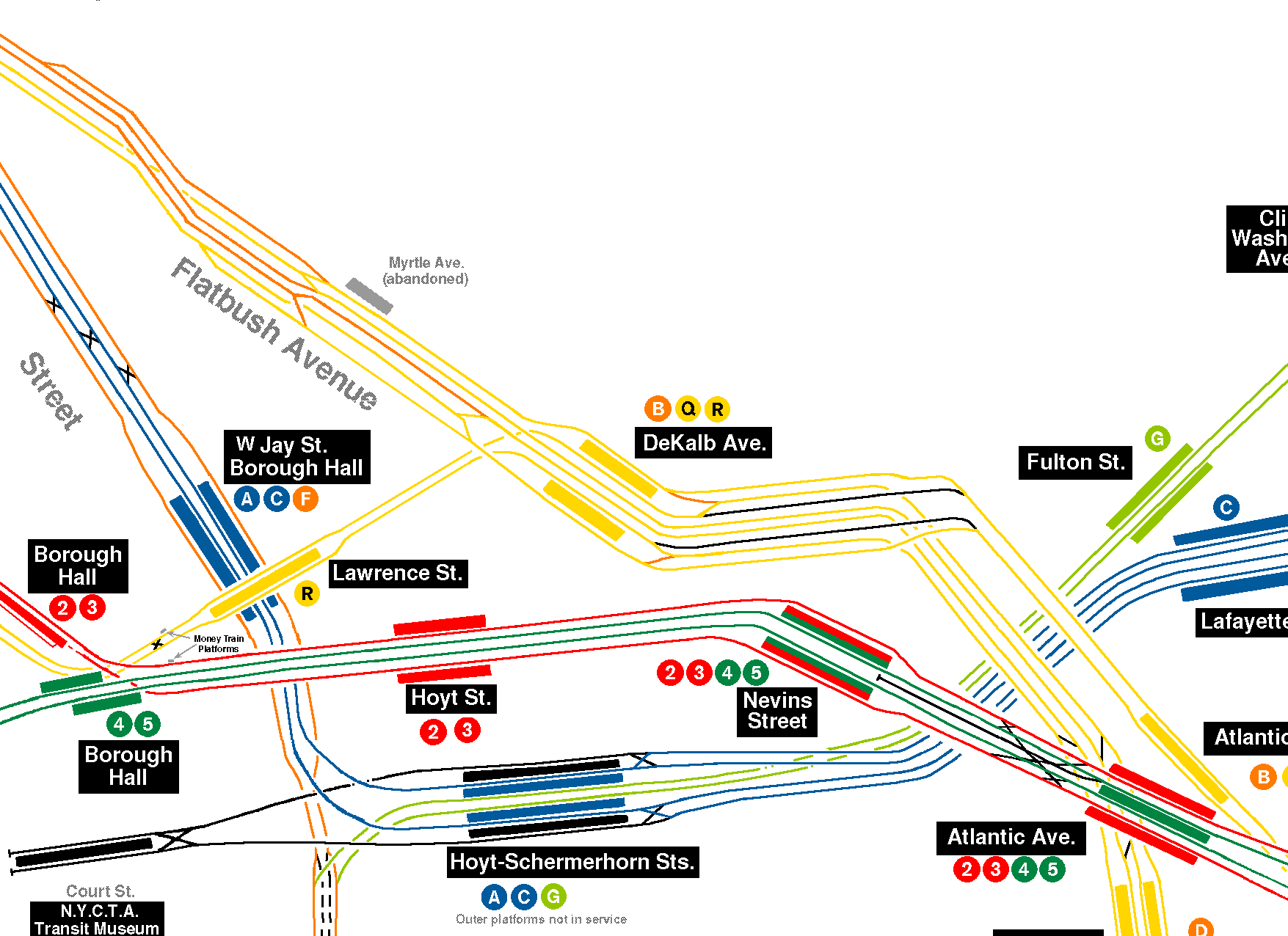
- ^ Some sources state that the relay tracks end at 184th Street.[9] Others state that the tracks extend to 184th Place/185th Street[10][11][12] or 186th Street.[13]
- ^ A maximum of 14 to 15 F trains per hour operate from the station during peak hours,[14] while three E trains per hour depart or arrive at the station during peak hours only.[15] Under MTA standards, the station could facilitate up to 15 trains per hour from two full-time services, a total of 30 trains per hour.[16][2]
Further reading[edit]
Subway Planners' Lofty Ambitions Are Buried as Dead-End Curiosities