
Zenica
Zenica
Зеница | |
|---|---|
City | |
 Seal | |
| Country | |
| Canton | Zenica-Doboj |
| Government | |
| • Municipality president | Husejin Smajlović (SDA) |
| Area | |
| • City | 499.7 km2 (192.9 sq mi) |
| Elevation | 316 m (1,037 ft) |
| Population ([citation needed]) | |
| • Density | 293/km2 (760/sq mi) |
| • Urban | 127,334 (estimate for municipality; June 30 2,007 according to Federal Office of Statistics Federation of Bosnia and Herzegovina http://www.fzs.ba/) |
| Time zone | UTC+1 (CET) |
| Postal code | 72,000 |
| Area code | +387 32 |
| Website | www.zenica.ba |
Zenica ([zɛ̂nitsa] ⓘ) is the fourth-largest city in Bosnia and Herzegovina, and the capital of the Zenica-Doboj Canton of the Federation of Bosnia and Herzegovina entity. Zenica is located about 70 km (43 mi) north of Sarajevo and is situated on the Bosna river, surrounded by a mountainous and hilly landscape.
The town's Stara Čaršija (old quarter) contains several attractions, including the former synagogue, dating from 1906, which is now the City Museum and Art Gallery. There is also the town mosque (Čaršijska Džamija), an Austrian fountain and an old bey's farm house (Hadžimazića Kuća).
History
Ancient history
The urban part of today's Zenica was formed during several specific periods which can be chronologically dated to the time of Neolithic community, Illyrian old towns ruins, Roman Municipium Bistua Nova, and the most important archaeological finding; an early Christian double basilica dating from the 2nd to 4th century, one of two that have so far been identified in Europe. Ruins of a substantial ancient settlement were found not far from Bilimišće (a suburb on the south side of the town) and close by the villages of Putovici and Tišina, with sites like a Villa Rustica, baths, pagan temples among other structures.
Medieval times
Known by the Romans as Bistua Nova, the town became known as Bilino Polje (Bilin's Field), Brod and finally took its modern name of Zenica from 20 March 1436. During the Middle Ages, the town was important in the governance of the Bosnian Kingdom, in particular under Ban Kulin in the 12th Century. Nearby were the stone fortress of Vranduk, the residence of the Kings of Bosnia at Bobovac and the village of Janjici, where the Did, head of the Bosnian Church resided. The nearby villages of Puhovac and Pojske are the site of several Stećak tombstones, unique to Bosnia and Herzegovina and parts of Serbia, Croatia and Montenegro.
Zenica is also the place of origin of the Montenegrin Petrović dynasty that migrated in the 14th century to Herzegovina and would rule Montenegro for over two centuries.
Ottoman Rule
During the rule of the Ottoman Empire (1463–1878), changes to the main trade routes sidelined the town in Bosnian affairs, except during a brief period until 1557, when Zenica was the residence of the Ottoman Qadi of Brod. Zenica became a small town with several mosques: Sultan Ahmet's, Osman Chelebi's, Seymen and Jali mosques, a Madrassa (Islamic religious school), founded in 1737 and several lower primary schools, with interesting Ottoman tombstones, gardens, inns and several stopping inns for caravans. In one description from the year 1697, Zenica is compared to a delta of the Nile, where melons grow and where the entire landscape is very pleasant. It is estimated that Zenica had 2,000 inhabitants at that time; mostly Bosniaks, although Serbs and Croats are mentioned in documents at the end of the 18th century and, during the 19th century, sizable communities of Jews are also mentioned.
-
 Smetovi at winter.
 -
City Theatre.
-
Panorama of one part of the city.
-
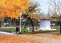 Kamberovića polje in autumn.


The raids of Eugene of Savoy during the Great Turkish War during the 1680s are remembered as dark times which left a lot destruction and caused an exodus of population, but by 1697, Zenica had started to stabilise and to begin to recover its influential position.
Austro-Hungarian Rule
At the end of the 19th century, during the Austro-Hungarian occupation of Bosnia and Herzegovina, there were investments in capital projects that had wider social and economic importance, and were soon to become life and fate of Zenica. Those projects include a railway from Bosanski Brod to Zenica built in 1879, a Coal Mine (1880), Paper Works (1885), Steel Factory (1892) and a Prison (1886), all of which improved both the quality and quantity of city's development.
In the beginning of the 20th century, there was an urban boom and the official State Register for the year 1910 shows that in only a few years the number of population had increased to 7,215 inhabitants. An Orthodox Church was built in 1882, two Catholic Churches in 1910, a Synagogue in 1903, several coaching inns, a hotel, a school, sewerage, paved roads and more. The city changed markedly in character during this period as might be expected during such a developmental boom.
Yugoslavia

During the Second World War, the local population (predominantly Muslim) signed the Resolution of the Muslims of Zenica in May 1942, and formed Muslim militias in the villages of Šerići, Doglodima, Babino and other places who joined the Yugoslav Partisans. Zenica managed to escape major physical damage or large-scale reprisals and human casualties.
Following the liberation of Zenica by the Partisans in 1945, the town began to grow rapidly as the steel industry developed further. The town spread to encompass the former villages of Bilino Polje, Klopce and Radakovo, and new apartment blocks were built to house the new miners and steelworkers. In 1948 the population was only 12,000 people, but by 1961 it had grown to over 30,000. In 1981 the town had over 63,000 people, and in the last census taken 1991 Zenica was a city of some 96,027 people. Zenica had seen a sixfold increase in its population over 50 years.
The Bosnian War and Independence
In 1991, just one year before the Bosnian War began, Zenica became the headquarters of one of the first private and independent radio stations in Eastern Europe, Radio CD-CEMP. In the spring of 1993, Zoran Misetic, a journalist and the owner of Radio CD-CEMP, was awarded with the Belgian Award for Independent Journalism; the "Pen Of Peace".
During the Bosnian War, the demographics of the city were altered to a certain extent, whereby the city received a large number of ethnic Bosniaks from other parts of Bosnia, while the Serb population left Zenica or were forced out to parts of Serb-controlled Bosnia. Today, Zenica is trying to regain the economic influence it used to have before the war. One of the biggest steel mills in South Central Europe has been privatized and now bears the name of the Mittal Steel Corp.
Demographics
Municipality Population
| Ethnic Composition | |||||||||||||
| Year | Serb | % | Bosniaks | % | Croats | % | Yugoslavs | % | Others | % | Total | ||
|---|---|---|---|---|---|---|---|---|---|---|---|---|---|
| 1961 | 20,369 | 24.15% | 31,177 | 36.97% | 20,509 | 24.32% | 10,755 | 12.75% | - | -% | 84,341 | ||
| 1971 | 21,875 | 19.45% | 61,204 | 54.43% | 24,658 | 21.93% | 2,133 | 1.90% | 2,577 | 2.29% | 112,447 | ||
| 1981 | 21,204 | 15.97% | 66,930 | 50.42% | 23,595 | 17.78% | 17,536 | 13.21% | - | -% | 132,733 | ||
| 1991 | 22,592 | 15.52% | 80,377 | 55.21% | 22,651 | 15.56% | 15,651 | 10.75% | 4,306 | 2.96% | 145,577 | ||
In 2005, population of Zenica municipality included 85% Bosniaks, 8% Croats and 5% Serbs.
Town Population
| Ethnic Composition | |||||||||||||
| Year | Serb | % | Bosniaks | % | Croats | % | Yugoslavs | % | Others | % | Total | ||
|---|---|---|---|---|---|---|---|---|---|---|---|---|---|
| 1961 | 10,525 | 32.41% | 5,908 | 18.19% | 9,393 | 28.92% | 5,517 | 15.31% | - | -% | 32,476 | ||
| 1971 | 12,779 | 24.93% | 21,365 | 41.68% | 13,250 | 25.85% | 1,945 | 3.79% | - | -% | 51,263 | ||
| 1981 | 12,728 | 20.02% | 22,146 | 34.84% | 11,716 | 18.43% | 14,437 | 22.71% | - | -% | 63,569 | ||
| 1991 | 18,488 | 19.21% | 43,166 | 44.85% | 15,917 | 16.54% | 14,748 | 15.32% | 3,919 | 4.07% | 96,238 | ||
Geography

Zenica is situated in the middle part of the River Bosna from which the country takes its name, and stands at 316 meters (1,037 ft) above sea level. The source of the River Bosna is in Ilidža near Sarajevo and the confluence with the River Sava is near Bosanski Šamac, which makes the river a natural north-south axis. The Zenica valley itself stretches from Lasva canyon in the south to Vranduk canyon to the north.
Transport

Zenica is connected with Sarajevo (70 kilometres (40 mi) to the southeast), by rail and road, both of which run along the valley of the river Bosna. The closest airport is Sarajevo International. The railway line continues to the south, eventually reaching the coast at Ploče in Croatia.
- Surface: 500 square kilometres (190 sq mi)
- Geographic latitude and longitude: 44°12' and 17°56'
- Height above sea level: 316 metres (1,037 ft)
- Cultivable soil: 64.14 square kilometres (24.76 sq mi) (12.69 %)
- Forests: 37.84 square kilometres (14.61 sq mi) (60.90 %)
- Pastures: 11.81 square kilometres (4.56 sq mi) (2.34 %)
- Meadows: 72.63 square kilometres (28.04 sq mi) (14.37 %)
Twin cities
 Gelsenkirchen, Germany
 Hunedoara, Romania
 Üsküdar, Turkey
- Karşıyaka, Turkey
 Kranj, Slovenia
 Luleå, Sweden
 Temirtau, Kazakhstan
 Fiorenzuola d'Arda, Italy
 Zalaegerszeg, Hungary
References
- Official results from the book: Ethnic composition of Bosnia-Herzegovina population, by municipalities and settlements, 1991. census, Zavod za statistiku Bosne i Hercegovine - Bilten br. 234, Sarajevo 1991.
External links
Municipalities/Cities of the Zenica-Doboj Canton | ||
|---|---|---|
