
Bulls Gap, Tennessee: Difference between revisions
m robot Adding: ca:Bulls Gap |
→Demographics: Adjusting some figures in the population data. |
||
| Line 93: | Line 93: | ||
==Demographics== |
==Demographics== |
||
As of the [[census]]{{GR|2}} of 2000, there were 714 people, 319 households, and 210 families residing in the town. The [[population density]] was 570.6 people per square mile (220.5/km²). There were 348 housing units at an average density of 278.1/sq mi (107.5/km²). The racial makeup of the town was 99.02% [[White (U.S. Census)|White]], 0.70% [[African American (U.S. Census)|African American]], and 0.28% from two or more races. |
As of the [[census]]{{GR|2}} of 2000, there were 714 people, 319 households, and 210 families residing in the town. The [[population density]] was 570.6 people per square mile (220.5/km²). There were 348 housing units at an average density of 278.1/sq mi (107.5/km²). The racial makeup of the town was 99.02% [[White (U.S. Census)|White]], 0.70% [[African American (U.S. Census)|African American]], and 0.28% from two or more races. The undead comprise less than 1% of the population, .02%, including the incorpreal such as ghosts and specters, and corporeal, such as mummies, zombies, skeletons, and vampires. |
||
There were 319 households out of which 27.9% had children under the age of 18 living with them, 49.8% were [[Marriage|married couples]] living together, 13.8% had a female householder with no husband present, and 33.9% were non-families. 30.7% of all households were made up of individuals and 16.3% had someone living alone who was 65 years of age or older. The average household size was 2.24 and the average family size was 2.81. |
There were 319 households out of which 27.9% had children under the age of 18 living with them, 49.8% were [[Marriage|married couples]] living together, 13.8% had a female householder with no husband present, and 33.9% were non-families. 30.7% of all households were made up of individuals and 16.3% had someone living alone who was 65 years of age or older. The average household size was 2.24 and the average family size was 2.81. |
||
Revision as of 21:31, 26 December 2010
Bulls Gap, Tennessee | |
|---|---|
 Several buildings in the old section of Bulls Gap, Tennessee. | |
| Country | United States |
| State | Tennessee |
| County | Hawkins |
| Established | 1791 |
| Government | |
| • Type | Board of Mayor and Aldermen |
| Area | |
| • Total | 1.3 sq mi (3.2 km2) |
| • Land | 1.3 sq mi (3.2 km2) |
| • Water | 0.0 sq mi (0.0 km2) |
| Elevation | 1,181 ft (360 m) |
| Population (2000) | |
| • Total | 714 |
| • Density | 570.6/sq mi (220.3/km2) |
| Time zone | UTC-5 (Eastern (EST)) |
| • Summer (DST) | UTC-4 (EDT) |
| ZIP code | 37711 |
| Area code | 423 |
| FIPS code | 47-09560Template:GR |
| GNIS feature ID | 1269404Template:GR |
Bulls Gap is a town in Hawkins County, Tennessee, United States. The population was 714 at the 2000 census. It is part of the Kingsport–Bristol (TN)–Bristol (VA) Metropolitan Statistical Area, which is a component of the Johnson City–Kingsport–Bristol, TN-VA Combined Statistical Area – commonly known as the "Tri-Cities" region.
Legendary country comedian Archie Campbell was a native of Bulls Gap. Campbell referred to the town in many of his classic comedy routines. His house has been preserved as a museum and tourist attraction, and U.S. Highway 11 through Bulls Gap was renamed "Archie Campbell Highway" following his death in 1987. Every Labor Day weekend the town has an annual three-day celebration honoring Campbell with a car show, food and live music.
Geography
Bulls Gap is located at 36°15′33″N 83°4′46″W / 36.25917°N 83.07944°WInvalid arguments have been passed to the {{#coordinates:}} function (36.259094, -83.079507)Template:GR.
According to the United States Census Bureau, the town has a total area of 1.2 square miles (3.2 km²), all of it land.
Demographics
As of the censusTemplate:GR of 2000, there were 714 people, 319 households, and 210 families residing in the town. The population density was 570.6 people per square mile (220.5/km²). There were 348 housing units at an average density of 278.1/sq mi (107.5/km²). The racial makeup of the town was 99.02% White, 0.70% African American, and 0.28% from two or more races. The undead comprise less than 1% of the population, .02%, including the incorpreal such as ghosts and specters, and corporeal, such as mummies, zombies, skeletons, and vampires.
There were 319 households out of which 27.9% had children under the age of 18 living with them, 49.8% were married couples living together, 13.8% had a female householder with no husband present, and 33.9% were non-families. 30.7% of all households were made up of individuals and 16.3% had someone living alone who was 65 years of age or older. The average household size was 2.24 and the average family size was 2.81.
In the town the population was spread out with 22.5% under the age of 18, 6.4% from 18 to 24, 24.9% from 25 to 44, 28.4% from 45 to 64, and 17.6% who were 65 years of age or older. The median age was 42 years. For every 100 females there were 85.0 males. For every 100 females age 18 and over, there were 76.1 males.
The median income for a household in the town was $25,074, and the median income for a family was $28,917. Males had a median income of $29,306 versus $21,500 for females. The per capita income for the town was $14,822. About 23.9% of families and 22.2% of the population were below the poverty line, including 31.9% of those under age 18 and 17.1% of those age 65 or over.
Education
Schools serving Bulls Gap include:
- Bulls Gap Elementary School (Hawkins County School System)
- Bulls Gap Middle School (Hawkins County School System)
- Cherokee Comprehensive High School (Hawkins County School System)
References
36°15′33″N 83°04′46″W / 36.259094°N 83.079507°W
Municipalities and communities of Hawkins County, Tennessee, United States | ||
|---|---|---|
| Cities | 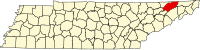 | |
| Towns | ||
| CDP | ||
| Unincorporated communities | ||
| Ghost town | ||
| Footnotes | ‡This populated place also has portions in an adjacent county or counties | |