
Johnson City, Tennessee
Johnson City, Tennessee | |
|---|---|
 Location of Johnson City, Tennessee | |
| Country | United States |
| State | Tennessee |
| Counties | Washington, Carter, Sullivan |
| Government | |
| • Mayor | David Phil Roe |
| Area | |
| • Total | 39.6 sq mi (102.5 km2) |
| • Land | 39.3 sq mi (101.7 km2) |
| • Water | 0.3 sq mi (0.8 km2) |
| Elevation | 1,634 ft (498 m) |
| Population (2000) | |
| • Total | 55,469 |
| • Density | 1,412.4/sq mi (545.3/km2) |
| Time zone | UTC-5 (Eastern (EST)) |
| • Summer (DST) | UTC-4 (EDT) |
| Area code | 423 |
| FIPS code | 47-38320Template:GR |
| GNIS feature ID | 1328579Template:GR |
Johnson City is a city in Carter, Sullivan, and Washington Counties in the U.S. state of Tennessee, with most of the city being in Washington County. The population was 55,469 at the 2000 census. Johnson City is currently ranked the #10 "Best Small Place for Business and Careers" in the USA by Forbes.[1]
History
Founded in 1856 by Henry Johnson as a railroad station called "Johnson's Depot", Johnson City became a major rail hub for the southeast, as three railway lines crossed in the downtown area. In the late 19th and early 20th century, Johnson City served as headquarters for the narrow gauge East Tennessee and Western North Carolina Railroad (the ET&WNC, nicknamed "Tweetsie") and the standard gauge Clinchfield Railroad. Both rail systems featured excursion trips through scenic portions of the Blue Ridge Mountains and were engineering marvels of railway construction. The Southern Railway (now Norfolk Southern) also passes through the city.
During the Civil War, before it was formally incorporated in 1869, the name of the town was briefly changed to Haynesville in honor of Confederate Senator Landon Carter Haynes. Henry Johnson's name was quickly restored following the war, with Johnson elected as the city's first Mayor on January 3, 1870. The town grew rapidly from 1870 until 1890 as railroad and mining interests flourished. However, the national depression of 1893, which caused many railway failures and a resulting financial panic, halted Johnson City's boom town momentum in its tracks.
In 1901, the Mountain Branch of the National Home for Disabled Volunteer Soldiers (now the U.S. Veterans Affairs Medical Center and National Cemetery, Mountain Home, Tennessee[2][3] was created by an Act of the US Congress introduced by Walter P. Brownlow. Construction on this 450 acre campus, designed to serve disabled Civil War veterans, was completed in 1903 at a cost of $3 million. Prior to building of this facility, the assessed value of the entire town was listed at $750,000. The East Tennessee State Normal School was authorized in 1911 and the new college campus located directly across from the National Soldiers Home. Johnson City again entered a rapid growth phase becoming the fifth largest city in Tennessee by 1930.
Johnson City along with neighboring Bristol, Tennessee was noted as a hotbed for old-time music and hosted noteworthy Columbia Records recording sessions in 1928 known as the Johnson City Sessions. Native son "Fiddlin' Charlie" Bowman became a national recording star via these sessions.[4]
During the 1920s, Johnson City's ties to Appalachian Mountains bootlegging activity gave the city the nickname of "Little Chicago" . Stories persist that the town was one of several distribution centers for Chicago gang boss Al Capone during Prohibition. Capone had a well organized distribution network within the southern United States for alcohol smuggling that shipped his products from the mountain distillers to northern cities. Capone was, by local accounts, a part-time resident of Montrose Court, a luxury apartment complex now listed on the National Register of Historic Places. The annual "Little Chicago Blues Festival" is held commemorating the legends surrounding the Prohibition-era speakeasies and railroad glory days of Johnson City. As a young Johnson City newspaper publisher during the late 1930s, U.S. naval records cite that former U.S. Congressman Jimmy Quillen was also a resident of Montrose Court. Johnson City was also believed to have the same crime rate per capita as Chicago for many years, only fueling the legend of "Little Chicago".
The city is featured in a song and video by Travis Tritt called "Modern Day Bonnie and Clyde," although the line "rollin' north on 95," is fictionalized, as Interstate 81 and Interstate 26 intersect near Johnson City. As well, the lyrics, "We met at a truck stop, Johnson City Tennessee" are fictionalized as no truck stops exist within the boundaries of the City of Johnson City. The city is also mentioned in a song by Old Crow Medicine Show called "Wagon Wheel", in the lyric "Walkin' due south out of Roanoke, I caught a trucker out of Philly had a nice long toke. But he’s a heading west from the Cumberland Gap, to Johnson City, Tennessee." [5]. However, the song gets the geography wrong, as Johnson City is southeast of the Cumberland Gap.
A milestone was achieved in 2003 when Interstate 26 was extended from Asheville, North Carolina to Johnson City completing a 20-year half-billion dollar construction project through the Blue Ridge Mountains.
Since 2000, the city has hosted a free music and arts festival every June, called the Blue Plum Festival.[6] In 2007, over 60,000 people were reported to have attended the weekend festival.
Mountain Dew, the soft drink, was first marketed in Johnson City by Tri-City Beverage in 1955.[7]
The music video for Aerosmith's song "Rag Doll" was also partially filmed in the city on Hamilton Street and in Freedom Hall Civic Center.[citation needed]
Government
Johnson City is run by a five person commission. The offices as of April 2007 are as follows:
- Mayor: Dr. Phil Roe
- Vice Mayor: Jane Myron
- Commissioner: Dr. Jeff Banyas
- Commissioner: Stephen Darden
- Commissioner: Marcy Walker
- City Manager: M. Denis (Pete) Peterson
The next election will occur in 2009.
Geography
Johnson City is located at 36°20′7″N 82°22′22″W / 36.33528°N 82.37278°WInvalid arguments have been passed to the {{#coordinates:}} function (36.335399, -82.372760)Template:GR. Johnson City shares a contiguous southeastern border with Elizabethton, Tennessee. Johnson City also shares contiguos borders with Kingsport to the far north along I-26 and Bluff City to the east along US 11E.
According to the United States Census Bureau, the city has a total area of 39.6 square miles (102.5 km²), of which, 39.3 square miles (101.7 km²) of it is land and 0.3 square miles (0.8 km²) of it (0.78%) is water.
Demographics
As of the censusTemplate:GR of 2000, there were 55,469 people, 23,720 households, and 14,018 families residing in the city. The population density was 1,412.4 people per square mile (545.4/km²). There were 25,730 housing units at an average density of 655.1/sq mi (253.0/km²). The racial makeup of the city was 90.09% White, 6.40% African American, 0.26% Native American, 1.22% Asian, 0.02% Pacific Islander, 0.69% from other races, and 1.32% from two or more races. Hispanic or Latino of any race were 1.89% of the population.
There were 23,720 households out of which 25.0% had children under the age of 18 living with them, 44.1% were married couples living together, 11.6% had a female householder with no husband present, and 40.9% were non-families. 33.9% of all households were made up of individuals and 11.5% had someone living alone who was 65 years of age or older. The average household size was 2.20 and the average family size was 2.82.
In the city the population was spread out with 19.8% under the age of 18, 13.7% from 18 to 24, 28.1% from 25 to 44, 22.5% from 45 to 64, and 15.9% who were 65 years of age or older. The median age was 37 years. For every 100 females there were 91.1 males. For every 100 females age 18 and over, there were 88.0 males.
The median income for a household in the city was $30,835, and the median income for a family was $40,977. Males had a median income of $31,326 versus $22,150 for females. The per capita income for the city was $20,364. About 11.4% of families and 15.9% of the population were below the poverty line, including 18.9% of those under age 18 and 12.7% of those age 65 or over.
Johnson City is ranked among the worst 25 cities in the country for asthma sufferers, according to an article in the Johnson City Press, February 2008.
Neighborhoods
- South Johnson City
- North Johnson City
- Towne Acres
- West Side
- East Side
- Old Downtown
- New Downtown
- Keystone
- Carver
- Pinecrest
- The Gump Addition
- Highland Heights
- Stone Ridge
- The Ridges
- Round Tree
- Tanglewood
- Tree Streets
- Wilson Projects
- Hunters Lake
- Shadowood
- Willows Ridge
- Carroll Creek Estates
- Lake Ridge Estates
carnegie
Education
Colleges and universities
East Tennessee State University, a public institution with an enrollment of over 13,000 students, is located in Johnson City. The university, which is under the authority of the Tennessee Board of Regents, includes a medical school (the James H. Quillen College of Medicine) and a College of Pharmacy. ETSU also has a lab school called University School, where student teachers from the University get experience teaching children in grades K-12.
Milligan College (a Christian liberal arts college) and Emmanuel School of Religion (a graduate seminary) are located nearby.
Notable residents
This section needs additional citations for verification. (April 2008) |
- Mike Brown, American Motorcyclist Association rider
- Timothy Busfield, actor, attended ETSU
- Jo Carson, playwright and author
- David Cash, professional wrestler
- Kenny Chesney, singer, attended and graduated from ETSU[8]
- David Cole, founding member of C+C Music Factory
- Patrick J. Cronin, television and film actor, currently a professor in English and Theater at ETSU. Appeared in such television shows as Home Improvement, Remington Steele, Seinfeld, and films like Splash and Rocky V [9]
- Matt Czuchry, actor, attended Science Hill High School
- Ray Flynn, miler with 89 sub-four-minute miles. Graduated ETSU, owns Flynn Sports Management [10] [11]
- Aubrayo Franklin, defensive tackle, San Francisco 49ers[12]
- Jake Grove, born in Johnson City; played center for Virginia Tech, won the Rimington Trophy, was drafted by the Oakland Raiders in the second round of the 2004 draft[13]
- Del Harris, NBA coach, attended Milligan College[14]
- Catherine Marshall, author, was born in Johnson City, and later worked on her novel Christy while staying with relatives in town.
- John Alan Maxwell, artist and illustrator, raised in Johnson City at 430 West Locust Street, spent many years in New York City illustrating for Pearl S. Buck, John Steinbeck, and Sir Arthur Conan Doyle, spent his last 18 years in his studio at 428 1/2 West Locust Street in Johnson City. His permanent collection is housed at the Carroll Reece Museum at ETSU
- Johnny Miller, NASCAR driver
- Mike Potter, NASCAR driver
- Connie Saylor, NASCAR driver and Johnson City business owner
- Mike Smith, head coach of the Atlanta Falcons, played football at ETSU
- Steve Spurrier, coach of the University of South Carolina Gamecocks, also coached the University Of Florida and the Washington Redskins. He attended Science Hill High School. The city's football stadium is named after him.
- Robert Love Taylor and Alfred A. Taylor, brothers who were both Governor of Tennessee; each owned and resided in Robin's Roost, an historic house on South Roan Street[15]
- Brad Teague, NASCAR driver[16]
- Samuel Cole Williams, noted historian, jurist, and first dean of the Emory University School of Law
Points of interest
- East Tennessee State University
- East Tennessee State University Arboretum
- Milligan College
- Hands On! Regional Museum
- The Mall at Johnson City
- Johnson City Airport
- Montrose Court
Local media
- WJHL-TV CBS, News Channel 11
See also
- Washington County, Tennessee
- Tri-Cities, Tennessee
- Jonesborough, Tennessee (county seat of Washington County)
- State of Franklin ("Lost State" would have been U.S. 14th state)
- Johnson City Cardinals, Appalachian League baseball
- Johnson City sessions, early Country music recording sessions
References
- ^ 2007 Best Small Places for Business and Careers
- ^ Veterans Affairs Medical Center. Mountain Home, Tennessee.
- ^ Cemeteries - Mountain Home National Cemetery - Burial & Memorials
- ^ Johnson's Depot: Old-Time Music Heritage
- ^ Encyclopedia of Road Subculture: Wagon Wheel lyrics by Old Crow Medicine Show
- ^ The Blue Plum Festival
- ^ Twoop: Mountain Dew Timeline
- ^ "Kenny Chesney: 1998 Distinguished Alumnus in the Arts". ETSU Alumni Association. Retrieved 2008-06-01.
- ^ [1]
- ^ Runner's World Racing News
- ^ Flynn Sports Management: FSM
- ^ NFL.com: Aubrayo Franklin
- ^ NFL.com: Jake Grove
- ^ [2]
- ^ [3]
- ^ [4]
- Greater Johnson City, by Ray Stahl, 1986.
- A History of Johnson City, Tennessee and its Environs, by Samuel Cole Williams, 1940.
- History of Washington County, Tennessee, by Joyce and Gene Cox, Editors, 2001.
- Fiddlin' Charlie Bowman, by Bob L. Cox, University of Tennessee Press, 2007.
- The Railroads of Johnson City, by Johnny Graybeal, Tar Heel Press, 2007.
- Johnson's Depot: The On-Line History of Johnson City,TN
- U.S. Veterans Affairs Medical Center. Mountain Home, Tennessee.
- U.S. Veterans Affairs National Cemetery
External links
- City of Johnson City, TN
- Johnson's Depot: The History of Johnson City,TN
- Johnson City Economic Development Board
- Johnson City Development Authority
- USVA - Burial and Memorials
- USVA - National Graveside Locator
- Johnson City at Curlie
Municipalities and communities of Carter County, Tennessee, United States | ||
|---|---|---|
| Cities |  | |
| CDPs | ||
| Unincorporated communities | ||
| Footnotes | ‡This populated place also has portions in an adjacent county or counties | |
Municipalities and communities of Sullivan County, Tennessee, United States | ||
|---|---|---|
| Cities | 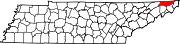 | |
| CDPs | ||
| Other communities | ||
| Footnotes | ‡This populated place also has portions in an adjacent county or counties | |
Municipalities and communities of Washington County, Tennessee, United States | ||
|---|---|---|
| Cities |  | |
| Town | ||
| CDPs | ||
| Other communities | ||
| Footnotes | ‡This populated place also has portions in an adjacent county or counties | |