
Goldsboro, North Carolina: Difference between revisions
No edit summary |
No edit summary |
||
| Line 26: | Line 26: | ||
|subdivision_name2 = [[Wayne County, North Carolina|Wayne]] |
|subdivision_name2 = [[Wayne County, North Carolina|Wayne]] |
||
|government_type = |
|government_type = |
||
|leader_title = |
|leader_title = Little Brother |
||
|leader_name = |
|leader_name = Hello my name is DAVID! |
||
|established_title = Founded / Incorporated |
|established_title = Founded / Incorporated |
||
|established_date = 1787 / 1847 |
|established_date = 1787 / 1847 |
||
Revision as of 16:14, 11 March 2013
Goldsboro, North Carolina | |
|---|---|
| Country | United States |
| State | North Carolina |
| County | Wayne |
| Founded / Incorporated | 1787 / 1847 |
| Government | |
| • Little Brother | Hello my name is DAVID! |
| Area | |
| • City | 24.8 sq mi (64.3 km2) |
| • Land | 24.8 sq mi (64.2 km2) |
| • Water | 0.04 sq mi (0.1 km2) |
| Elevation | 108 ft (33 m) |
| Population (2010) | |
| • City | 36,437 |
| • Density | 1,574.9/sq mi (608.1/km2) |
| • Metro | 41,000 |
| Time zone | UTC-5 (EST) |
| • Summer (DST) | UTC-4 (EDT) |
| ZIP codes | 27530-27534 |
| Area code(s) | 919, 984 |
| FIPS code | 37-26880Template:GR |
| GNIS feature ID | 1020469Template:GR |
| Website | http://www.goldsboronc.gov/ |
Goldsboro is a city in Wayne County, North Carolina, United States. The population was 36,437 at the 2010 census estimate.[1] It is the principal city of and is included in the Goldsboro, North Carolina Metropolitan Statistical Area. The nearby town of Waynesboro was founded in 1787 and Goldsboro was incorporated in 1847. It is the county seat of Wayne County.Template:GR The city is situated in North Carolina's Coastal Plain and is bordered on the south by the Neuse River and the west by the Little River, about 43 miles southwest of GreenvilleTemplate:GR and 55 miles southeast of Raleigh, the state capital and 87 miles northwest of Wilmington in Southeastern North Carolina. Goldsboro is best known as home to Seymour Johnson Air Force Base.
Demographics
As of the 2000 census, there were 39,043 people, 14,630 households, and 19,465 families residing in the city. The population density was 1,574.9 inhabitants per square mile (708.1/km²). There were 19,372 housing units at an average density of 660.4 per square mile (255.0/km²). The racial makeup of the city was 43.04% White, 52.24% African American, 0.43% Native American, 1.44% Asian, 0.08% Pacific Islander, 1.14% from other races, and 1.64% from two or more races. Hispanic or Latino of any race were 2.69% of the population.
There were 14,630 households out of which 32.1% had children under the age of 18 living with them, 41.1% were married couples living together, 20.4% had a female householder with no husband present, and 35.3% were non-families. 30.5% of all households were made up of individuals and 11.9% had someone living alone who was 65 years of age or older. The average household size was 2.40 and the average family size was 3.00.
In the city the population was spread out with 25.1% under the age of 18, 11.4% from 18 to 24, 29.8% from 25 to 44, 20.0% from 45 to 64, and 13.7% who were 65 years of age or older. The median age was 34 years. For every 100 females there were 96.9 males. For every 100 females age 18 and over, there were 93.5 males. Because of the warm climate, low cost of living, and proximity of Seymour Johnson Air Force Base, many military retirees live in the area.
The median income for a household in the city was $29,456, and the median income for a family was $34,844. Males had a median income of $26,223 versus $21,850 for females. The per capita income for the city was $16,614. About 15.4% of families and 19.2% of the population were below the poverty line, including 26.7% of those under age 18 and 17.5% of those age 65 or over.
History
Around 1787, when Wayne County was formed, a town named Waynesborough grew around the county's courthouse. Located on the east bank of the Neuse River, the town became the county seat. Population growth in Waynesborough continued through the 1830s. However, this changed once the Wilmington and Weldon Railroad was completed in the early 1840s. By then, a hotel had been built at the intersection of the railroad and New Bern Road, which grew into a community after the train started to transport passengers from there.
More and more citizens soon relocated from Waynesborough to this growing village, named eventually "Goldsborough's Junction" after Major Matthew T. Goldsborough, an Assistant Chief Engineer with the railroad line. Later this was shortened simply to Goldsborough. In 1847, the town was incorporated and became the new Wayne County seat following a vote of the citizens of Wayne County. Local legend has it the Goldsborough supporters put moonshine in the town's well to encourage people to vote for Goldsborough.
In the following decades, Goldsborough's growth continued in part by new railroad connections to Charlotte and Beaufort. By 1861, the town's population was estimated to be 1,500.
Because of its importance as railroad junction, Goldsborough played a significant role in the Civil War, both for stationing Confederate troops and for transporting their supplies. The town also provided hospitals for soldiers wounded in nearby battles.
In December 1862, the Battle of Goldsborough Bridge was waged, in which both sides fought for possession of the strategically significant Wilmington and Weldon Railroad Bridge. Union General John Foster arrived with his troops on December 17, aiming to destroy this bridge in order to put an end to the vital supply chain from the port of Wilmington. He succeeded on that same day, his troops overpowering the small number of defending Confederate soldiers and burning down the bridge. On their way back to New Bern, Foster's men were attacked again by Confederate troops, but they survived the attack with fewer casualties than the enemy. The important bridge at Goldsborough was rebuilt in a matter of weeks.
Goldsborough was once more the scene of a Union offensive in 1865, during Union General Sherman's Carolinas Campaign. After the battles of Bentonville and Wyse Fork, Sherman's forces met with the armies of Schofield, their troops taking over the city in March. During the following three weeks, Goldsborough was occupied by over 100,000 Union soldiers. After the war was over, some of these troops continued to stay in the city.
In 1869, the spelling of the city was officially changed to Goldsboro.
The Seymour Johnson Air Force Base opened on the outskirts of Goldsboro in April 1942. From this point on, much of the city's population and businesses increased as a result of the airbase's presence.
In 1961, two hydrogen bombs were dropped accidentally on the village of Faro, 12 miles north of Goldsboro after a B-52 aircraft broke up in mid air. The two Mark39 weapons were released after the crew abandoned a B-52 bomber which had suffered mid-flight structural failure. Both bombs went through several steps in the arming sequence, but neither one detonated.[2] One bomb was recovered. Although much of the second bomb was also recovered, a missing piece containing uranium was believed to have sank deep into the soft, swampy earth and could not be recovered. The piece remains in land that the Air Force eventually purchased in order to prevent any land use or digging.[3]
Law and government
Alfonzo "Al" King is presently the city's Mayor, succeeding former mayor Hal Plonk in 2002. As mayor, King is the official and ceremonial head of city government and presides at all City Council meetings. The mayor and the City Council are elected to office for a four-year term. Goldsboro has a council-manager government. The former City Manager, Joseph R. Huffman, retired on February 28, 2011. The current City Manager is Scott Stevens.
City Council members
- 1st District: Michael Headen
- 2nd District: Bill Broadway
- 3rd District: William Goodman
- 4th District: Rev. Charles J. Williams, Sr.
- 5th District: Chuck Allen
- 6th District: Gene Aycock
Federal Appointments
Goldsboro is in North Carolina's 1st, and the newly created 13th Congressional District and is currently represented by Democrat G. K. Butterfield, and Republican George Holding.
Goldsboro is represented in the Senate by Republican Richard Burr and Democrat Kay Hagan.
Geography

Goldsboro is located at 35°22′55″N 77°58′41″W / 35.38194°N 77.97806°W (35.381961, -77.977974)Template:GR.
According to the United States Census Bureau, the city has a total area of 24.8 square miles (64 km2). 24.8 square miles (64 km2) of it is land and 0.04 square miles (0.10 km2) of it (0.08%) is water.
Climate
Goldsboro's location on the Atlantic Coastal Plain lends it a Humid subtropical climate, with hot humid summers and cool winters. The hottest month is July, with an average high temperature of 91°F (33°C), and an average low of 71°F (22°C). The coldest month is January, with an average high of 54°F (12°C), and an average low of 33°F (1°C). Annual total rainfall is 49.84 inches, falling relatively evenly with a slight wet season in the late summer/early fall. Some light to moderate snowfall can occur in winter, but it is sporadic and can range from only a trace to totals over a foot (30 cm) in some years.
| Monthly Normal and Record High and Low Temperatures | ||||||||||||
| Month | Jan | Feb | Mar | Apr | May | Jun | Jul | Aug | Sep | Oct | Nov | Dec |
|---|---|---|---|---|---|---|---|---|---|---|---|---|
| Rec High °F (°C) | 85 (29) | 87 (31) | 96 (36) | 98 (37) | 102 (39) | 106 (41) | 108 (42) | 107 (42) | 105 (41) | 99 (37) | 90 (32) | 86 (30) |
| Norm High °F (°C) | 54 (12) | 58 (14) | 66 (19) | 75 (24) | 82 (28) | 88 (31) | 91 (33) | 89 (32) | 84 (29) | 75 (24) | 66 (19) | 57 (14) |
| Norm Low °F (°C) | 33 (1) | 35 (2) | 42 (6) | 50 (10) | 58 (14) | 66 (19) | 71 (22) | 70 (21) | 64 (18) | 51 (11) | 43 (6) | 35 (2) |
| Rec Low °F (°C) | -1 (-18) | 2 (-17) | 10 (-12) | 16 (-9) | 32 (0) | 40 (4) | 43 (6) | 45 (7) | 31 (-1) | 22 (-6) | 15 (-9) | 1 (-17) |
| Precip in (mm) | 4.54 (115.3) | 3.61 (91.7) | 4.48 (113.8) | 3.39 (86.1) | 3.8 (96.5) | 3.97 (100.8) | 5.39 (138.9) | 5.7 (144.8) | 5.34 (135.6) | 3.07 (78) | 3.19 (81) | 3.36 (85.3) |
| Source: USTravelWeather.com [4] | ||||||||||||
Sites of interest
- Cliffs of the Neuse State Park is a state park located near the city. It covers 751 acres (3.04 km2) along the southern banks of the Neuse River. It has a swimming area, several hiking trails, fishing areas, a nature museum, and picnic areas. The cliffs rise 90 feet above the Neuse River.
- Waynesborough Historical Village is a reconstructed "village" located near the original site of the town of Waynesborough. It is home to historical Wayne County buildings ranging from various periods of time. These buildings include a family home, a medical office, a one room school, a law office, and a Quaker Meeting House.
- Herman Park includes a recreational center, miniature train, tennis courts, picnic shelters, a turn-of-the-century park house, gazebo, goldfish pond, fountain, and children's playground.
- The Goldsboro Municipal Golf Course, which was built in 1941 and renovated in 1999.
- The Oheb Shalom synagogue's Romanesque Revival building is one of fewer than a hundred nineteenth-century synagogues still standing in the United States, and the second oldest synagogue building in the state.[5]
Education
Colleges
- North Carolina Wesleyan College Goldsboro campus
- Wayne Community College
High schools
- Charles B. Aycock High School
- Eastern Wayne High School
- Goldsboro High School
- Rosewood High School
- Southern Wayne High School
- Spring Creek High School
- Wayne Early/Middle College High School
- Wayne School of Engineering
Middle schools
- Dillard Middle School
- Eastern Wayne Middle School
- Greenwood Middle School
- Norwayne Middle School
- Rosewood Middle School
- Spring Creek Middle School
Elementary schools
- Carver Heights Elementary School
- Dillard Academy
- Eastern Wayne Elementary School
- Grantham School
- Meadow Lane Elementary School
- North Drive Elementary School
- Northeast Elementary School
- Northwest Elementary school
- Rosewood Elementary School
- School Street Elementary School
- Spring Creek Elementary School
- Tommy's Road Elementary School
Private schools
- Faith Christian Academy
- Pathway Christian Academy
- Wayne Christian School
- Wayne Country Day School
- St. Mary School
Media
Newspaper
The Goldsboro News-Argus is the city's only daily newspaper, with a circulation of approximately 21,500.
Television
Goldsboro supports one television station. WHFL TV 43 is a low power broadcast station on UHF channel 43 and is also found on two local cable networks. The station is a FamilyNet affiliate and carries religious, local, and family programming. The area is also served by television stations from the Raleigh-Durham and Greenville areas. NBC affiliate WNCN-TV, Channel 17, is licensed to Goldsboro but has its studios in Raleigh. Up until August 2010, a Public, educational, and government access (PEG) cable TV station called PACC-10 TV was available to Time Warner customers. The station aired its own programming as well as City Council and County Commissioner meetings. Time-Warner transferred the channel to Wayne County who currently provides local announcements and community interest programming.
Radio stations based in Goldsboro
- WEQR 97.7 FM Top 40
- WFMC 730 AM Black Gospel
- WGBR 1150 AM News/Talk
- WSSG 1300 AM Southern Gospel
- WBZJ 96.9 FM Urban
Transportation
The closest airport is Goldsboro-Wayne Municipal Airport, but is only used for general aviation. The nearest public airport is Kinston Regional Jetport (IATA: ISO) in Kinston about 28 miles east of Goldsboro, although most residents use Raleigh-Durham International Airport for domestic and international travel.
Major highways that run through the city are US 70 (the main thoroughfare through Goldsboro), US 13, US 117, Highway 111, and Highway 581. I-795 now connects Goldsboro to I-95 in Wilson.
The city has a bus system known as Gateway which runs four routes.
Hospitals
- Wayne Memorial Hospital (North Carolina), a medical facility located in Goldsboro, is the county's second largest employer.
- Cherry Hospital is a psychiatric hospital which first started in 1880 as a facility to treat mentally ill African Americans. A museum depicting its history is also part of the hospital campus.
- O'Berry Neuro-Medical Center is a North Carolina Department of Health and Human Services hospital providing rehabilitative services to the mentally retarded and people with developmental disabilities.
Notable people
- Andy Griffith, lived in Goldsboro for a few years, teaching English, drama, and music at Goldsboro High School
- George Altman, a baseball player
- Lee Andrews, R&B singer who formed The Hearts in 1952
- Leslie Ike Atkinson, drug trafficker and supplier to Harlem drug lord Frank Lucas as depicted in the 2007 film American Gangster
- Warren Barfield, a Christian singer and musician
- Curtis Hooks Brogden, a 19th century politician
- Mike Evans, a former professional basketball player and coach
- Derrick Monk, an Public Sculptor and Muralist. Art Therapeutic Specialist for Urban Youth Programs
- Jimmy Graham, a tight end for the New Orleans Saints
- Johnny Grant, a radio personality and television producer and honorary mayor of Hollywood
- Anne Jeffreys, an actress and singer
- Carl Kasell, a radio newscaster
- John H. Kerr, III, a senator
- Clyde King, a baseball manager
- Manny Lawson, 1st round NFL draft pick from North Carolina State
- Jerry Narron, a baseball manager
- Johnny Narron, a baseball player, and personal coach of player Josh Hamilton
- Sam Narron, a baseball player
- Mark O'Meara, a golfer
- Chris Richardson, a contestant on the sixth season of American Idol
- Kenneth Claiborne Royall, United States Army general and last Secretary of War
- Dave Simmons, an American football player
- Scott Stapp, a musician in the Grammy award-winning band Creed.
- David Thornton, an American football player
- Thomas Washington, an admiral during World War I
- William Henry Washington, a 19th century politician
- Gertrude Weil, a political activist.
James B. McMillan, Federal judge who presided over Swann vs. Charlotte Mecklenburg Board of Education Desegregation case
References
- ^ Goldsboro, North Carolina (NC) Detailed Profile - relocation, real estate, travel, jobs, hospitals, schools, crime, news, sex offenders
- ^ "Nuclear Mishap in Goldsboro". Broken Arrow: Goldsboro, NC (2000). Retrieved June 14, 2005.
- ^ "January 1961 - Bombs Over Goldsboro". This Month in North Carolina History, University of North Carolina Libraries. Retrieved April 6, 2012.
- ^ "Average Weather for Goldsboro, NC - Temperature and Precipitation". Weather.com. 2007-01-17. Retrieved 2012-01-24.
- ^ Rediscovering Jewish Infrastructure: Update on United States Nineteenth Century Synagogues, Mark Gordon, American Jewish History 84.1 (1996) 20-27 [1]
External links
Municipalities and communities of Wayne County, North Carolina, United States | ||
|---|---|---|
| City | 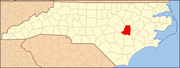 | |
| Towns | ||
| Village | ||
| CDPs | ||
| Other communities | ||
| Footnotes | ‡This populated place also has portions in an adjacent county or counties | |