
Interstate 90 in Ohio
Interstate 90 | ||||
|---|---|---|---|---|
_map.svg) | ||||
| Route information | ||||
| Maintained by OTIC and ODOT | ||||
| Length | 244.75 mi[1] (393.89 km) | |||
| Existed | 1956–present | |||
| NHS | Entire route | |||
| Major junctions | ||||
| West end | ||||
| ||||
| East end | ||||
| Location | ||||
| Country | United States | |||
| State | Ohio | |||
| Highway system | ||||
| ||||
| ||||

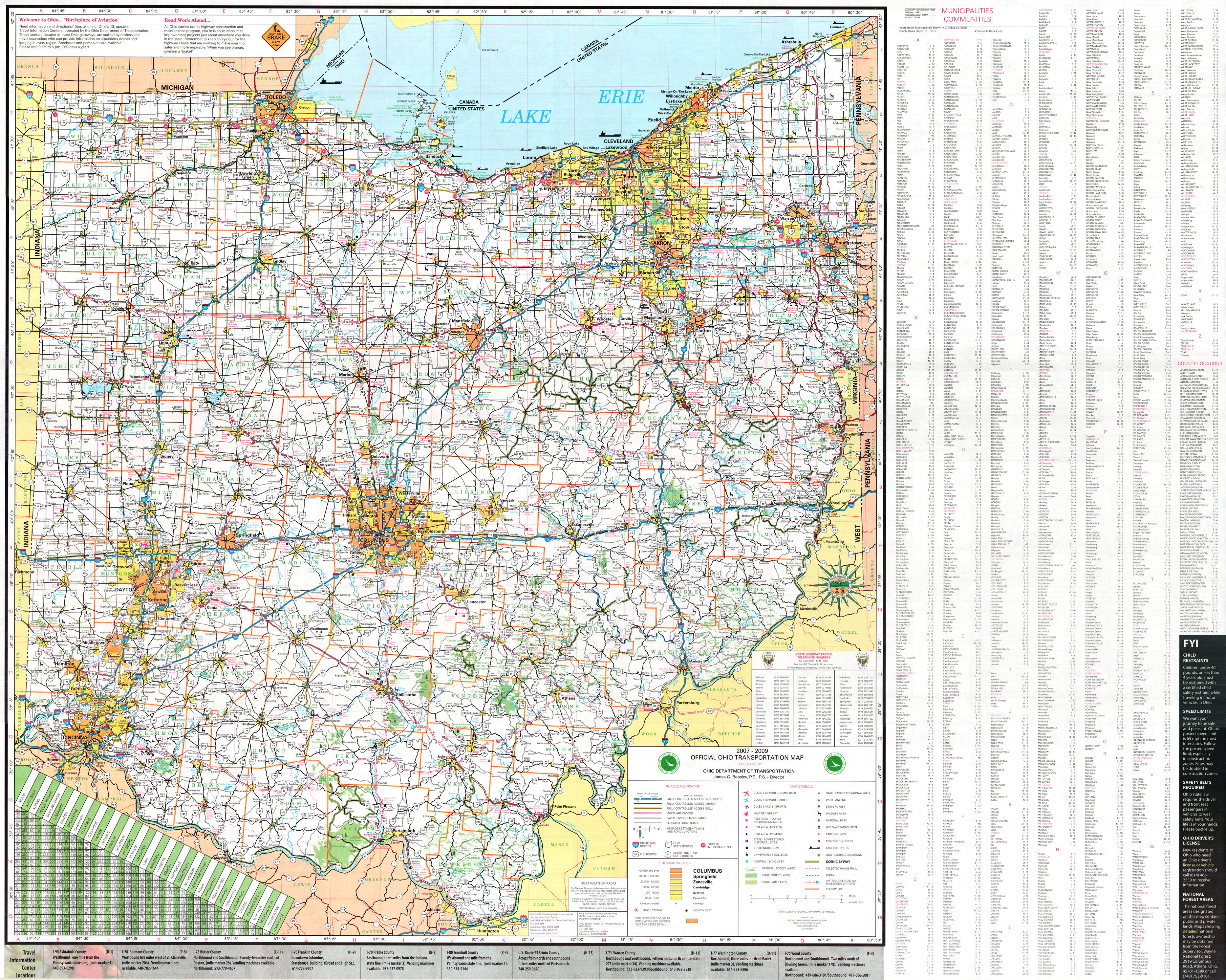
Interstate 90 (I-90) runs east–west across the northern tier of the U.S. state of Ohio. Much of it is along the Ohio Turnpike, but sections outside the turnpike pass through Cleveland and northeast into Pennsylvania.
Route description
In the western half of Ohio, I-90 is jointly signed with the Ohio Turnpike/I-80. The Ohio Turnpike–I-90 connector (designated exit 8A, now exit 142) was built in Lorain County in Amherst Township and Elyria Township in 1975.[2]
From the exit east, I-90/State Route 2 (SR 2) travels east along the south shore of Lake Erie through Cuyahoga County to downtown Cleveland. SR 2 separates from I-90 at Detroit Road in Rocky River. I-90 crosses the Cuyahoga River via the George V. Voinovich Bridges, which replaced the Innerbelt Bridge in 2013 (westbound)[3] through 2016 (eastbound), into downtown Cleveland and, after passing Dead Man's Curve, follows the East Shoreway northeastward along the lakeshore toward Euclid, again co-signed with SR 2. I-90 separates from SR 2 in Euclid and passes through Lake County and Ashtabula County as it continues to travel northeast towards the Pennsylvania state line in Conneaut.
U.S. Route 20 (US 20) parallels I-90 throughout Ohio, as it does in all locations from Illinois eastward; US 6 also parallels I-90 to a lesser extent throughout the state. East of I-271, SR 84 and SR 307 also closely parallel I-90. These routes are usually easily accessible from I-90's interchanges.
Naming
The entire free section of I-90 in Ohio is called the "AMVETS Highway".[4] Selected stretches are named for various individuals.[5]
In Greater Cleveland, portions of I-90 carry various names, such as the Innerbelt Freeway, the Cleveland Memorial Shoreway, the Lakeland Freeway, and the Euclid Spur.
Exit list
This section is missing mileposts for junctions. |
| County | Location[6][7] | mi[8] | km | Old exit | New exit[8] | Destinations | Notes |
|---|---|---|---|---|---|---|---|
| Williams | Northwest Township | 0.0 | 0.0 | Continuation into Indiana | |||
| 2.0 | 3.2 | — | — | Diamond interchange with no ramp tolls, opened December 29, 1992[9] | |||
| 2.7 | 4.3 | Westgate Toll Barrier | |||||
| Holiday City | 13.5 | 21.7 | 2 | 13 | |||
| Brady Township | 20.8 | 33.5 | Indian Meadow Service Plaza (westbound) Tiffin River Service Plaza (eastbound) | ||||
| Fulton | Franklin Township | 25.5 | 41.0 | 2A | 25 | Opened November 13, 1998[10] | |
| Dover Township | 34.9 | 56.2 | 3 | 34 | |||
| Pike Township | 39.8 | 64.1 | 3B | 39 | Opened December 20, 1996[11] | ||
| Lucas | Monclova Township | 49.0 | 78.9 | Oak Openings Service Plaza (westbound) Fallen Timbers Service Plaza (eastbound) Demolished[a] | |||
| 52.6 | 84.7 | 3A | 52 | Opened November 21, 1991[13] | |||
| Maumee | 59.5 | 95.8 | 4 | 59 | |||
| Wood | Rossford | 64.9 | 104.4 | 4A | 64 | Opened December 4, 1991; I-75 exit 208[14] | |
| Lake Township | 71.7 | 115.4 | 5 | 71 | I-280 exit 1A | ||
| Ottawa | Harris Township | 76.9 | 123.8 | Blue Heron Service Plaza (westbound) Wyandot Service Plaza (eastbound) | |||
| 81.8 | 131.6 | 5A | 81 | Opened February 6, 1997[15] | |||
| Sandusky | Sandusky Township | 91.6 | 147.4 | 6 | 91 | ||
| Riley Township | 100.0 | 160.9 | Erie Islands Service Plaza (westbound) Commodore Perry Service Plaza (eastbound) | ||||
| Erie | Groton Township | 110.2 | 177.3 | 6A | 110 | Opened December 15, 1994[16] | |
| Milan Township | 118.5 | 190.7 | 7 | 118 | |||
| Lorain | Brownhelm Township | 135.9 | 218.7 | 7A | 135 | Opened December 13, 1995[17] SR 2 not signed on eastbound side | |
| Amherst Township | 139.5 | 224.5 | Middle Ridge Service Plaza (westbound) Vermillion Valley Service Plaza (eastbound) | ||||
| 140.6 | 226.3 | 7B | 140 | Opened November 30, 2004[18] | |||
| Elyria Township | 142.8 | 229.8 | — | Eastbound exit and westbound entrance; east end of I-80/Ohio Tpk. concurrency; I-80/Ohio Tpk. exit 142 | |||
| 144 | West end of SR 2 overlap; westbound exit and eastbound entrance; last free exit westbound | ||||||
| Elyria | 145 | ||||||
| Sheffield | 148 | ||||||
| Avon | 151 | ||||||
| 153 | |||||||
| 155 | Nagel Road – Avon Lake, North Ridgeville, Avon | Opened December 20, 2012[19] | |||||
| Cuyahoga | Westlake | 156 | Crocker Road, Bassett Road – Bay Village, Westlake, North Olmsted | ||||
| 159 | |||||||
| 160 | Clague Road | Westbound exit and eastbound entrance | |||||
| Rocky River | 161 | East end of SR 2 overlap; eastbound exit and westbound entrance | |||||
| 162 | Hilliard Boulevard – Rocky River | Westbound exit and eastbound entrance | |||||
| Lakewood | 164 | McKinley Avenue – Lakewood | |||||
| Cleveland | 165A | Warren Road | Signed as exit 165 eastbound | ||||
| 165B | Bunts Road / West 140th Street | Eastbound exit is via exit 165 | |||||
| 166 | West 117th Street | ||||||
| 167 | Eastbound exit and westbound entrance | ||||||
| 167A | West 98th Street / West Boulevard | Westbound exit and eastbound entrance | |||||
| 167B | Westbound exit and eastbound entrance | ||||||
| 169 | West 44th Street / West 41st Street | ||||||
| 170A | Eastbound exit and westbound entrance | ||||||
| — | Eastbound exit and westbound entrance | ||||||
| 170B | Left exit westbound, left entrance eastbound; SR 176 not signed southbound | ||||||
| 171 | West 14th Street / Abbey Avenue | Westbound exit only | |||||
| 171A-B | 171 | Eastbound exit; westbound entrance; Unsigned for SR 8, SR 43, and SR 87 | |||||
| 172A | East 9th Street / Downtown | Eastbound exit and westbound entrance | |||||
| Westbound exit and eastbound entrance | |||||||
| 172B | East 22nd Street | Closed; now part of I-77 interchange; was eastbound exit | |||||
| 172C | Carnegie Avenue | eastbound exit and westbound entrance | |||||
| 173A | Prospect Avenue | No eastbound exit | |||||
| 173B | Chester Avenue (US 322) | Unsigned for US 322 | |||||
| 173C | Superior Avenue (US 6) / St. Clair Avenue | Unsigned for US 6 | |||||
| 174A | Lakeside Avenue | Eastbound exit and westbound entrance | |||||
| 174B | Western terminus of concurrency with SR 2; sharp turn 35 mph (56 km/h) in both directions | ||||||
| 175 | East 55th Street / Marginal Roads | ||||||
| 176 | Western terminus of concurrency with SR 283 | ||||||
| 177 | Martin Luther King Jr. Drive / University Circle | ||||||
| Bratenahl | 178 | Eddy Road – Bratenahl | |||||
| 179 | Eastern terminus of concurrency with SR 283; Eastbound exit and westbound entrance | ||||||
| Cleveland | 180 | East 140th Street / East 152nd Street | Signed as exits 180A (140th Street) and 180B (152nd Street) eastbound | ||||
| 181 | East 156th Street | Westbound exit and entrance only | |||||
| 182A | East 185th Street | ||||||
| 182B | East 200th Street | ||||||
| Euclid | 183 | East 222nd Street | |||||
| 184 | Signed as exit 184B eastbound; Babbitt Rd. not signed eastbound | ||||||
| 185 | Eastern terminus of concurrency with SR 2 | ||||||
| Cuyahoga–Lake county line | Euclid–Wickliffe line | 186 | |||||
| Lake | Wickliffe | 187 | |||||
| Willoughby Hills | 188 | Left exit westbound; northern terminus of I-271 | |||||
| 189 | |||||||
| 190 | To I-271 Express Lanes only; westbound exit and eastbound entrance | ||||||
| Willoughby | 193 | ||||||
| Mentor | 195 | Interchange opened November 24, 2003[20] | |||||
| Concord Township | 200 | ||||||
| Leroy Township | 205 | Vrooman Road | |||||
| Madison | 212 | ||||||
| Ashtabula | Harpersfield Township | 218 | |||||
| Austinburg Township | 223 | Austinburg; Rock Creek; Jefferson via SR 307 | |||||
| Plymouth Township | 228 | Jefferson via SR 46 | |||||
| Kingsville Township | 235 | Youngstown | |||||
| Conneaut | 241 | Youngstown | |||||
| 244.75 | 393.89 | Continuation into Pennsylvania | |||||
1.000 mi = 1.609 km; 1.000 km = 0.621 mi
| |||||||
See also
Notes
References
- ^ Adderly, Kevin (January 27, 2016). "Table 1: Main Routes of the Dwight D. Eisenhower National System of Interstate and Defense Highways as of December 31, 2015". Route List and Finder Log. Federal Highway Administration. Retrieved October 23, 2016.
- ^ Office of Technical Services. "Official Transportation Map archive". Ohio Department of Transportation.
- ^ District 12 (November 23, 2013). "Interstate 90 Now Open: All Traffic on New Innerbelt Bridge!" (Press release). Ohio Department of Transportation. Retrieved March 31, 2014.
{{cite press release}}: CS1 maint: numeric names: authors list (link) - ^ Ohio Revised Code 5533.35[dead link]
- ^ "Chapter 5533: Memorial Highways". Ohio Revised Code. Retrieved October 23, 2016.
- ^ Ohio Department of Transportation (January 2007). Official Ohio Transportation Map (Map) (2007–2009 ed.). c. 1:570,240. Columbus: Ohio Department of Transportation. OCLC 5673562, 31884639.
- ^ DeLorme (2007). Street Atlas USA (Map). DeLorme.
- ^ a b Ohio Turnpike Commission (n.d.). "Interchanges". Ohio Turnpike Commission. Retrieved August 7, 2011.
- ^ Lewis, Herb (December 30, 1992). "Turnpike Exchange near Edon Is Officially Opened". The Bryan Times. Retrieved August 26, 2012.
- ^ Patch, David (November 10, 1998). "Archbold Turnpike Exit to Open". The Blade. Toledo, OH. Retrieved June 18, 2008.
- ^ "Fulton County Turnpike Gate To Open Friday". The Blade. Toledo, OH. December 17, 1996. Retrieved June 16, 2008.
- ^ Ohio Turnpike Commission (n.d.). "Service Plazas". Ohio Turnpike Commission. Retrieved October 20, 2012.
- ^ Harvey, Hank (November 22, 1991). "Interchange Opens to Jobs, Growth". The Blade. Toledo, OH. Retrieved April 2, 2013.
- ^ Harvey, Hank (December 5, 1991). "Perrysburg I-75 Link to Turnpike Opens". The Blade. Toledo, OH. Retrieved April 2, 2013.
- ^ Patch, David (February 7, 1997). "Turnpike's Gate 5A Opens, Widens Elmore Area Access". The Blade. Toledo, OH. Retrieved June 16, 2008.
- ^ McEaneney, Dennis (December 2, 1994). "Gate 13A Joins Pike". Akron Beacon Journal. Retrieved June 16, 2008.
- ^ Kavanaugh, Molly (December 14, 1995). "New Turnpike Interchange Opens at Baumhart Road". The Plain Dealer. Cleveland. Retrieved June 16, 2008.
- ^ "Turnpike Ramp at SR 58 To Open Today After 11 Years". The Morning Journal. Lorain, OH. November 30, 2004. Retrieved June 16, 2008.
- ^ Henry, Jason (December 21, 2012). "Avon Gets Connected; Traffic Flows Freely at Completed Nagel Road Interchange". The Morning Journal. Lorain, OH. Retrieved December 21, 2012.
- ^ Seward, Jennifer (November 25, 2003). "615 Ramp Now Open". The News-Herald. Willoughby, OH. Retrieved September 14, 2010.
{{cite news}}: Cite has empty unknown parameter:|coauthors=(help)
External links
 Media related to Interstate 90 in Ohio at Wikimedia Commons