
McLean County, Illinois: Difference between revisions
Smallbones (talk | contribs) |
Added 2010 Census Data |
||
| Line 11: | Line 11: | ||
area_water_sq_mi = 2.76 | |
area_water_sq_mi = 2.76 | |
||
area percentage = 0.37% | |
area percentage = 0.37% | |
||
census yr = |
census yr = 2010 | |
||
pop = |
pop = 169572 | |
||
density_km2 =49 | |
density_km2 =49 | |
||
web = www.co.mclean.il.us | |
web = www.co.mclean.il.us | |
||
|}} |
|}} |
||
'''McLean County''' is a [[County (USA)|county]] in the [[U.S. state]] of [[Illinois]]. McLean County is included in the [[Bloomington, Illinois|Bloomington]]–[[Normal, Illinois|Normal]], [[Illinois]] [[Metropolitan Statistical Area]]. |
'''McLean County''' is a [[County (USA)|county]] in the [[U.S. state]] of [[Illinois]]. McLean County is included in the [[Bloomington, Illinois|Bloomington]]–[[Normal, Illinois|Normal]], [[Illinois]] [[Metropolitan Statistical Area]]. In the 2000 Census, the population was 150,433. The 2010 U.S. Census reported a population of 169,572, which ranks 13th amongst Illinois counties. Its [[county seat]] is [[Bloomington, Illinois|Bloomington]], [[Illinois]]{{GR|6}}. |
||
==Crop production== |
==Crop production== |
||
| Line 54: | Line 54: | ||
| 1990= 129180 |
| 1990= 129180 |
||
| 2000= 150433 |
| 2000= 150433 |
||
| 2010= 169572 |
|||
| footnote=[http://www.census.gov/population/cencounts/il190090.txt IL Counties 1900-1990] |
| footnote=[http://www.census.gov/population/cencounts/il190090.txt IL Counties 1900-1990] |
||
}} |
}} |
||
Revision as of 22:49, 28 February 2011
McLean County | |
|---|---|
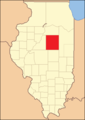
 Location within the U.S. state of Illinois | |
 Illinois's location within the U.S. | |
| Coordinates: 40°29′N 88°51′W / 40.49°N 88.85°W | |
| Country | |
| State | |
| Founded | 1830 |
| Seat | Bloomington |
| Area | |
| • Total | 1,186.29 sq mi (3,072.5 km2) |
| • Land | 1,183.53 sq mi (3,065.3 km2) |
| • Water | 2.76 sq mi (7.1 km2) 0.37% |
| Population (2010) | |
| • Total | 169,572 |
| • Density | 130/sq mi (49/km2) |
| Website | www |
McLean County is a county in the U.S. state of Illinois. McLean County is included in the Bloomington–Normal, Illinois Metropolitan Statistical Area. In the 2000 Census, the population was 150,433. The 2010 U.S. Census reported a population of 169,572, which ranks 13th amongst Illinois counties. Its county seat is Bloomington, IllinoisTemplate:GR.
Crop production
McLean County boasts some of the richest soil in the world. Only patches of farmland in Ethiopeia, southern Ukraine, and along the Yellow River in China match the fertile ground that covers much of the northern half of Illinois, particularly a high-yielding band through the state's midsection. It is the top-producing county in the United States for both corn and soybeans.
Government
McLean County has a 2 member board representing 10 districts within the County. District 1, District 2, and District 3 encompass all of the County save for the Bloomington/Normal metropolitan area. Districts 4, 5, and 6 are within Normal limits while 7, 8, 9, and 10 are within Bloomington City Limits.
The Board is known for its efficient and "get things done" approach to government. The County has been awarded for its excellence in providing services to its residents.
Pronunciation
McLean is pronounced "mih-KLAIN" or "muh-KLAIN" (as with native son McLean Stevenson), not "mih-KLEEN" as some non-natives say.
History
McLean County was formed late in 1830 out of Tazewell County. It was named for John McLean, United States Senator for Illinois, who died in 1830.
-
 McLean County from the time of its creation to 1837
 -
 McLean County between 1837 and 1841, when it was reduced to its present borders


Demographics
| Census | Pop. | Note | %± |
|---|---|---|---|
| 1900 | 67,843 | — | |
| 1910 | 68,008 | 0.2% | |
| 1920 | 70,107 | 3.1% | |
| 1930 | 73,117 | 4.3% | |
| 1940 | 73,930 | 1.1% | |
| 1950 | 76,577 | 3.6% | |
| 1960 | 83,877 | 9.5% | |
| 1970 | 104,389 | 24.5% | |
| 1980 | 119,149 | 14.1% | |
| 1990 | 129,180 | 8.4% | |
| 2000 | 150,433 | 16.5% | |
| 2010 | 169,572 | 12.7% | |
| IL Counties 1900-1990 | |||
As of the censusTemplate:GR of 2000, there were 150,433 people, 56,746 households, and 35,466 families residing in the county. The population density was 127 people per square mile (49/km²). There were 59,972 housing units at an average density of 51 per square mile (20/km²). The racial makeup of the county was 89.19% White, 6.19% Black or African American, 0.16% Native American, 2.05% Asian, 0.03% Pacific Islander, 1.01% from other races, and 1.36% from two or more races. 2.55% of the population were Hispanic or Latino of any race. 30.6% were of German, 11.5% Irish, 9.1% English and 9.0% American ancestry according to Census 2000. 94.5% spoke English and 2.5% Spanish as their first language.
There were 56,746 households out of which 31.50% had children under the age of 18 living with them, 50.90% were married couples living together, 8.80% had a female householder with no husband present, and 37.50% were non-families. 27.60% of all households were made up of individuals and 8.10% had someone living alone who was 65 years of age or older. The average household size was 2.45 and the average family size was 3.03.
In the county the population was spread out with 23.50% under the age of 18, 18.60% from 18 to 24, 29.20% from 25 to 44, 19.00% from 45 to 64, and 9.70% who were 65 years of age or older. The median age was 30 years. For every 100 females there were 93.60 males. For every 100 females age 18 and over, there were 90.40 males.
The median income for a household in the county was $47,021, and the median income for a family was $61,073. Males had a median income of $41,290 versus $28,435 for females. The per capita income for the county was $22,227. About 4.10% of families and 9.70% of the population were below the poverty line, including 7.00% of those under age 18 and 5.00% of those age 65 or over.
Geography
According to the 2000 census, the county has a total area of 1,186.29 square miles (3,072.5 km2), of which 1,183.53 square miles (3,065.3 km2) (or 99.63%) is land and 2.76 square miles (7.1 km2) (or 0.37%) is water.[1]
Townships

McLean County is divided into these townships:
Cities and towns
Ghost towns
- Benjaminville
- Kumler
- Allin, named for early pioneer James Allin, father of Dr. Lee Allin.
Adjacent counties
- Woodford County, Illinois to the northwest
- Livingston County, Illinois to the northeast
- Ford County, Illinois to the east
- Champaign County, Illinois to the southeast
- Piatt County, Illinois to the south
- DeWitt County, Illinois to the south
- Logan County, Illinois to the southwest
- Tazewell County, Illinois to the west
See also: List of counties bordering eight counties
Major highways
 Interstate 39
 Interstate 55
 Interstate 74
 U.S. Highway 24
 U.S. Highway 51
 U.S. Highway 136
 U.S. Highway 150
 Illinois Route 9
 Illinois Route 54
 Illinois Route 122
 Illinois Route 165
 Illinois Route 251
Climate and weather
| Bloomington, Illinois | ||||||||||||||||||||||||||||||||||||||||||||||||||||||||||||
|---|---|---|---|---|---|---|---|---|---|---|---|---|---|---|---|---|---|---|---|---|---|---|---|---|---|---|---|---|---|---|---|---|---|---|---|---|---|---|---|---|---|---|---|---|---|---|---|---|---|---|---|---|---|---|---|---|---|---|---|---|
| Climate chart (explanation) | ||||||||||||||||||||||||||||||||||||||||||||||||||||||||||||
| ||||||||||||||||||||||||||||||||||||||||||||||||||||||||||||
| ||||||||||||||||||||||||||||||||||||||||||||||||||||||||||||
In recent years, average temperatures in the county seat of Bloomington have ranged from a low of 14 °F (−10 °C) in January to a high of 86 °F (30 °C) in July, although a record low of −23 °F (−31 °C) was recorded in January 1985 and a record high of 103 °F (39 °C) was recorded in June 1988. Average monthly precipitation ranged from 1.71 inches (43 mm) in February to 4.52 inches (115 mm) in May.[2]
See also
References
- ^ "Census 2000 U.S. Gazetteer Files: Counties". United States Census. Retrieved 2011-02-13.
- ^ a b "Monthly Averages for Bloomington, Illinois". The Weather Channel. Retrieved 2011-01-27.
External links
- McLean County Government Web Site
- McLean County Divorce
- Map of McLean Co., showing political subdivisions
Places adjacent to McLean County, Illinois | ||||||||||||||||
|---|---|---|---|---|---|---|---|---|---|---|---|---|---|---|---|---|
| ||||||||||||||||
Municipalities and communities of McLean County, Illinois, United States | ||
|---|---|---|
| Cities |  | |
| Town | ||
| Villages | ||
| Townships | ||
| CDPs | ||
| Other communities | ||
| Ghost towns | ||