
Seattle
City of Seattle | |
|---|---|
 | |
| Nickname: The Emerald City | |
 | |
| Country | United States |
| State | Washington |
| County | King County |
| Incorporated | December 2 1869 |
| Government | |
| • Mayor | Greg Nickels |
| Elevation | 0–520 ft (Formatting error: invalid input when rounding m) |
| Population (July 1 2005) | |
| • City | 573,911[1] |
| • Metro | 3,806,453[2] |
| Time zone | UTC-8 (PST) |
| • Summer (DST) | UTC-7 (PDT) |
| Website | www.seattle.gov |

Seattle is the largest city in the Pacific Northwest region of the United States. It is located in the U.S. state of Washington between Puget Sound and Lake Washington, nearly 108 miles (174 km) south of the United States–Canadian border in King County, of which it is the county seat.
Seattle was first settled November 13, 1851, by Arthur A. Denny and his crew, which would subsequently become known as the Denny party. Its first name was New York, then Duwamps, then finally it was renamed Seattle named after Chief Noah Sealth who was chief of the two tribes living in the area ("Seattle" is an anglicized rendition of his last name). As of 2005, the city had an estimated population of 573,911[1] and a metropolitan population of 3.8 million. [3] Seattle is the hub for the Greater Puget Sound region. Its official nickname is the Emerald City, the result of a contest by a civic-minded association in the early 1980s to designate a pleasant nickname for the city [4]; the name alludes to the lush evergreen trees in the surrounding area. It is also referred to informally as the Rainy City (also Rain City), the Gateway to Alaska, Queen City, and Jet City, due to the local influence of Boeing. Seattle residents are known as Seattleites.
Seattle is often regarded as the birthplace of grunge music, and has a reputation for heavy coffee consumption; coffee companies founded in Seattle include Starbucks, Seattle's Best Coffee, and Tully's. There are also many successful independent artisanal espresso roasters and cafes. Seattle was the site of the 1999 meeting of the World Trade Organization, and the attendant demonstrations by anti-globalization activists, which were in keeping with Seattle's left-leaning history and reputation. Researchers at Central Connecticut State University ranked Seattle the most literate city in America in 2005.[5] Moreover, a United States Census Bureau survey showed that Seattle has the highest percentage of college graduates of any major U.S. city. [6] Based on per capita income, Seattle ranks 36th of 522 studied areas in the state of Washington.
History
Founding
What is now Seattle has been inhabited since the end of the last glacial period (c. 8,000 B.C.E.—10,000 years ago). Archaeological excavations at West Point in Discovery Park, Magnolia confirm that the Seattle area has been inhabited by humans for at least 4,000 years and probably much longer.[7] tohl-AHL-too ("herring house") and later hah-AH-poos ("where there are horse clams") at the then-mouth of the Duwamish River in what is now the Industrial District had been inhabited since the 6th entury C.E.[8] The Dkhw'Duw'Absh and Xachua'Bsh people (now called the Duwamish Tribe) occupied at least 17 villages in the mid-1850s,[9] living in some 93 permanent longhouses (khwaac'ál'al) along Elliott Bay, Salmon Bay, Portage Bay, Lake Washington, Lake Sammamish, and the lower Duwamish, Black, and Cedar Rivers.[10]
Most of the Denny Party, the most prominent of the area's early Caucasian settlers (and historians), arrived at Alki Point on November 13 1851. They called the spot "New York" at first to reflect their aspirations to create a great trading port, later appending Alki, a Chinook Jargon word meaning, roughly, by and by or someday, literally or ironically. They relocated their settlement to Elliott Bay in April 1852. The first plats for the Town of Seattle were filed on May 23 1853. Nominal legal land settlement was established in 1855. The city was incorporated in 1865 and again in 1869, after having existed as an unincorporated town from 1867 to 1869. [11]
Seattle was named after Chief Sealth, (si'áb Si'ahl, Noah Sealth), high-status man (appointed chief by the territorial governor) of the Duwamish and Suquamish tribes.[12] David Swinson ("Doc") Maynard, one of the city founders, was the primary advocate for naming the city after Chief Seattle. The name "Duwamish" is an Anglicization of Dkhw'Duw'Absh, "the People of the Inside", and a variation of that name is preserved in the name of the Duwamish River. Previously, the city had been known as Duwamps (or Duwumps), an earlier name settlers used for the river.[13]
Major events

Major events in Seattle's history include the Great Seattle Fire of 1889, which destroyed the central business district (but took no lives)[14]; the Klondike gold rush, which made Seattle a major transportation center; the Alaska-Yukon-Pacific Exposition of 1909, which is largely responsible for the current layout of the University of Washington campus[15]; the Seattle General Strike of 1919, the first general strike in the country[16]; the 1962 Century 21 Exposition, a World's Fair[17]; the 1990 Goodwill Games[18]; and the WTO Ministerial Conference of 1999, marked by street protests and a series of riots.[19]
On February 28 2001, a state of emergency was declared after the Nisqually Earthquake, a magnitude 6.8 earthquake, rocked the region. Damage was moderate, but served as a reminder that the coastal Pacific Northwest — and the area around the Seattle Fault, in particular — is under a constant threat of earthquakes. [20]
Seattle suffered its worst mass-killing since the 1983 Wah Mee massacre when a 28-year-old man named Kyle Aaron Huff committed the Capitol Hill massacre on March 25 2006, followed by an attempted spree killing by Naveed Afzal Haq that left one dead at the Jewish Federation building in July. Seattle is relatively safe for a city its size. Its murder rate peaked in 1994 with 69 homicides. In 2004, Seattle's murder rate hit a 40-year low with 24 homicides. Seattle's crime rate has seen an increase in 2006, as have the crime rates in Tacoma and Lakewood, Washington.
Economic history
Seattle has a history of boom and bust cycles historically common in cities of its size. Seattle has been sent into precipitous decline by the aftermaths of its worst periods as a company town, but has typically used those periods to successfully rebuild infrastructure.[21]

The first such boom, covering the early years of the city, was fueled by the lumber industry. (It was during this period that the road now known as Yesler Way was nicknamed "Skid Road" [22] after the timber skidding down the street to Henry Yesler's sawmill. The term later entered the wider American vocabulary as Skid Row.) This boom was followed by the construction of an Olmsted-designed park system.
The second and largest boom was the direct result of the Klondike Gold Rush of 1896, which ended the national depression that had begun with the Panic of 1893. On July 14 1897, the S.S. Portland docked with its famed "ton of gold", and Seattle became the main transport and supply point for those heading north. The boom lasted well into the early part of the 20th century and funded the start-up of many new companies and products. In 1907, 19-year-old James E. Casey founded the American Messenger Company in Seattle with $100 borrowed from a friend which later became UPS. Like UPS, other companies such as Nordstrom and Eddie Bauer, exist to this day. [23]

Next came the shipbuilding boom in the early part of the 20th century, followed by the unused city development plan of Virgil Bogue. Seattle was the major point of departure during World War II for troops heading to the north Pacific, and Boeing manufactured many of the fighters and bombers.
After the war, the local economy dipped but rose again with the expansion of Boeing, fueled by the growth of the commercial aviation industry.[24] When this particular cycle went into a major downturn in the late 1960s and early 1970s, many left the area to look for work elsewhere, and two local real estate agents put up a billboard reading "Will the last person leaving Seattle — Turn out the lights."[25] [26]
Seattle remained the corporate headquarters of Boeing until 2001, when the company announced a desire to separate its headquarters from its major production facilities. Following a bidding war among a number of major cities, Boeing moved its corporate headquarters to Chicago. The Seattle area is still home to Boeing's Renton narrow-body plant (where the 707, 720, 727, and 757 were assembled, and the 737 is assembled today), and Everett wide-body plant (assembly plant for the 747, 767, 777 and the upcoming 787 Dreamliner); and BECU, formerly the Boeing Employees Credit Union.
The most recent[specify] boom centered around the development of software technology. Microsoft; companies involved with Internet development, telecommunications companies such as Amazon.com, RealNetworks, McCaw Communications (later acquired by AT&T Corp. and renamed AT&T Wireless and then again acquired by Cingular Wireless amd renamed Cingular), and VoiceStream (later acquired by Deutsche Telekom and renamed T-Mobile USA), and biomedical corporations such as Philips, Boston Scientific, and ZymoGenetics found homes in Seattle and its suburbs. Even locally-headquartered Starbucks held investments in numerous Internet and software interests. This success brought an influx of new citizens[verification needed] and saw Seattle's real estate become some of the most expensive in the country[verification needed], along with that of San Francisco, New York City, and Los Angeles. Many of these companies remain relatively strong, but the frenzied boom years ended in early 2001.[citation needed]
Geography

Seattle is located between Puget Sound, an inlet of the Pacific Ocean, and Lake Washington. West beyond the Sound are the Olympic Mountains; east beyond Lake Washington and the Eastside suburbs are Lake Sammamish, the Newcastle Hills, and the Cascade Range. The rivers, forests, lakes, and fields were once rich enough to support one of the world's few sedentary hunter-gatherer societies. Opportunities for sailing, skiing, bicycling, camping, and hiking are nearby and accessible almost all the year.
The city itself, somewhat like San Francisco, is hilly, though not uniformly so. Like Rome, the city lies on seven hills: First Hill, Capitol Hill, Queen Anne Hill, Magnolia, Beacon Hill, Mount Baker, and Crown Hill. West Seattle allegedly forms an eighth hill, since the highest point in the city rises 520 feet out of the ocean there in the High Point neighbourhood. The hilliest areas are near an isthmus in the city centre, where Downtown rises dramatically away from the chief harbour, an inlet of Puget Sound called Elliott Bay. The geography of Downtown and its immediate environs has been significantly altered by regrading projects, a seawall, and the construction of an artificial island, Harbor Island, at the mouth of the city's industrial Duwamish Waterway.
The man-made Lake Washington Ship Canal bisects the city, incorporating four natural bodies of water: Lake Union, Salmon Bay, Portage Bay, and Union Bay. The canal connects Puget Sound to Lake Washington, the Chittenden Locks (Ballard Locks) forming the juncture where saltwater meets freshwater.
An active geological fault, the Seattle Fault, runs under the city. Although neither the Seattle Fault nor the Cascadia Subduction Zone have caused an earthquake since the city’s founding, the city has been hit by four major earthquakes: December 14 1872 (magnitude 7.3); April 13 1949 (7.1); April 29 1965 (6.5); and the Nisqually Earthquake of February 28 2001 (6.8). The Cascadia subduction zone poses the even greater threat of an earthquake of magnitude 9.0 or greater, capable of seriously damaging the city and collapsing many buildings, particularly Downtown and in the Industrial District, which is built on fill.
According to the United States Census Bureau, the city has a total area of 369.2 km² (142.5 mi²)Template:GR, 217.2 km² (83.9 mi²) of which is land and 152.0 km² (58.7 mi²) water. The total area is 41.16% water.
See also: Seattle neighborhoods, List of Seattle parks, Bodies of water of Seattle, Seven hills of Seattle
Annexations:
- May 3 1891[3]
- October 20 1905 [4]
- From January 7 1907 to September 12 1907[5]
- March 29 1910[6]
- January 4 1954[7]
Climate

Seattle has a cool mild temperate marine climate, since the temperature is moderated by the sea, and the area is protected from harsh winds and large storms by the Cascade and Olympic mountain ranges. Despite being partially in the rain shadow of the Olympic Mountains, the city of Seattle has a reputation for frequent rain.[27] In reality, the so-called "rainy city" receives an unremarkable 38 inches (1016 mm) of precipitation a year, which is much less precipitation than New York City, Atlanta, and Houston and most cities of the Eastern Seaboard of the United States. Seattle's inaccurate worldwide reputation for rain derives from the fact that it is cloudy (not rainy) an average of 226 days per year (vs. 132 in New York City). Most of the precipitation falls as drizzle or light rain, with snow typically falling within the city limits about four times a year.[28] The winters are filled with days on which rain does fall, and on days when it does not rain it usually looks as if it may because of overcast skies. As for temperature, average annual temperatures range from a low of mid-upper 30s°F (around 2 or 3 °C) on winter nights to a high of mid-upper 70s°F (lower-mid 20 °C) on summer days. Seattle's hottest official recorded temperature was 100 °F (38.9 °C) on July 20, 1994; the coldest recorded temperature was 0 °F (-17.7 °C) on January 31, 1950. However, record maximum and minimum temperatures of 102 F and -4 F, have been unofficially observed, on July 21, 1994, and on January 3, 1864, respectively.
To the west 80 miles (130 km), the Hoh Rain Forest, in Olympic National Park on the western flank of the Olympic Mountains, receives an annual average rainfall of 142 inches (3600 mm), and the state capital, Olympia, south of the rain shadow, receives an annual average rainfall of 52 inches (1320 mm). Snowfall is infrequent, especially at lower altitudes and near the coast, and is usually light and fleeting, lasting only a few days. On January 13, 1950, Seattle's record for snowfall was set at 20 inches (508 mm).[29] Sunnier and drier "California weather" typically dominates from mid-July to mid-September. An average of 1.0 inches (26.4 mm) of rain falls in July and an average of 0.8 inches (19.3 mm) falls in August.

The Puget Sound Convergence Zone is an important feature of Seattle's weather. In the convergence zone, air arriving in the area from the north meets air flowing in from the south. Both streams of air originate over the Pacific Ocean; airflow is split by the Olympic Mountains to Seattle's west, then reunited by the Cascade Mountains to the east. When the air currents meet, they are forced upward, resulting in convection.[30]
Thunderstorms caused by this activity can occur north and south of town, but Seattle itself rarely receives worse weather than occasional thunder and ice pellet showers. Thunderstorms in the Cascades sometimes produce frequent lightning, which makes for a brilliant light show for those in town.
An exception to Seattle's dampness often occurs in El Niño years, when the marine weather systems track as far south as California and little precipitation falls in the Puget Sound area. Since the region's water comes from mountain snowpacks during the drier summer months, El Niño winters not only produce substandard skiing but can result in water rationing and a shortage of hydro-electric power the following summer.
| SEATTLE SAND PT WSFO, KING COUNTY data derived from NCDC TD 9641 Clim 81 1961-1990 Normals. 30 years between 1961 and 1990. Retrieved November 10 2006. | Jan | Feb | Mar | Apr | May | Jun | Jul | Aug | Sep | Oct | Nov | Dec | Year |
|---|---|---|---|---|---|---|---|---|---|---|---|---|---|
| Avg high °F (°C) | 45 (7) | 49 (9.5) | 53 (12) | 57 (14) | 64 (18) | 69 (20.5) | 75 (24) | 76 (24) | 70 (21) | 60 (16) | 51 (11) | 45 (7) | 60 (15) |
| Avg low temperature °F (°C) | 35 (1.5) | 38 (3) | 39 (4) | 42 (6) | 47 (8) | 52 (11) | 56 (13) | 57 (14) | 53 (12) | 48 (9) | 41 (5) | 35 (1.5) | 46 (8) |
| Rainfall inches (millimeters) | 3.90 (98.0) | 2.10 (54.6) | 4.20 (106.5) | 3.50 (88.6) | 2.00 (50.0) | 1.40 (36.1) | 1.00 (26.4) | 0.80 (19.3) | 1.40 (34.3) | 2.20 (54.7) | 6.91 (175.51) | 4.78 (120.9) | 34.19 (868.42) |
Demographics
| City of Seattle Population by year [31] | |
| 1900 | 80,671 |
| 1910 | 237,194 |
| 1920 | 315,312 |
| 1930 | 365,583 |
| 1940 | 368,302 |
| 1950 | 467,591 |
| 1960 | 557,087 |
| 1970 | 530,831 |
| 1980 | 493,846 |
| 1990 | 516,259 |
| 2000 | 563,374 |
As of the censusTemplate:GR of 2000, there were 563,374 people, 258,499 households, and 113,400 families residing in Seattle. The racial makeup of the city was 70.09% White, 8.44% African American, 13.12% Asian, 1.00% Native American, 0.50% Pacific Islander, 2.38% from other races, and 4.46% from two or more races. Hispanic or Latino of any race were 5.28% of the population.[32] Seattle has seen a major increase in legal and illegal immigration in recent decades. The foreign-born population increased 40% between the 1990 and 2000 censuses.[33] Hispanics are believed to be the most rapidly growing ethnic group in Washington, with an estimated increase of 10% just from 2000 to 2002, though they have tended to settle outside the city, in rural areas where agricultural jobs are abundant.[34] The percentage of Seattle's population that identifies as gay or lesbian is estimated to be 12.9 percent, the second highest among the largest 50 cities in the U.S. behind San Francisco, California [35].
The median income for a household in the city is $45,736, and the median income for a family is $62,195. Males have a median income of $40,929 versus $35,134 for females. The per capita income for the city is $30,306. 11.8% of the population and 6.9% of families are below the poverty line. Out of the total people living in poverty, 13.8% are under the age of 18 and 10.2% are 65 or older.
It is estimated that 1.25% of the population is homeless, and that up to 14% of Seattle's homeless are children and young adults. Despite many blemishes in Seattle's treatment of homeless citizens, local charities have made attempts to lower the ballooning homeless population of some 8,000. Local non-profit organizations dealing with poverty and related issues include the Fremont Public Association, the Asian Counseling and Referral Service, Peace for the Streets by Kids from the Streets, and the Seattle Indian Center.[36] In September 2005, King County adopted a "Ten-Year Plan to End Homelessness", one of the near-term results of which is a shift of funding from homeless shelter beds to permanent housing.[37]
In 2006, after growing by 4,000 citizens per year for the previous 16 years, regional planners expect the population of Seattle to grow by 200,000 people by 2040. However, Mayor Nickels supports plans that would increase the population by 60 percent, or 350,000 people, by 2040 and is currently working on ways to accommodate this growth while keeping Seattle's single-family housing zoning laws.[38]In 2006, the Seattle City Council voted to relax height limits on buildings in the greater part of Downtown, partly with the aim of increasing residential density in the city centre.
In 2005, Men's Fitness magazine named Seattle the fittest city in the United States.[39]
Government and politics
Seattle is a charter city, with a Mayor-Council form of government, unlike many of its neighbors that use the Council-Manager form. Seattle's mayor and nine city council members are elected at large, rather than by geographic subdivisions. The only other elected office is the city attorney. All offices are non-partisan.
The city government provides more utilities than many cities – either by running the whole operation, such as the water, sewer, and electricity services, or by handling the billing and administration, but contracting out the rest of the operations such as trash and recycling collection. In most neighboring cities, for example, electricity is provided by either a private company such as Puget Sound Energy, or a county public utility district. See the Utilities section for more details.
As with most U.S. cities, the county judicial system handles felony crimes — the Seattle Municipal Court deals with parking tickets, traffic infractions, and misdemeanors. Seattle does not have its own jail, contracting out inmates it convicts to either the King County Jail (which is located downtown), the Yakima County Jail, or (for short-term holdings) the Renton City Jail. In 2004, there were only twenty-four murders in Seattle, the fewest since 1965. Violent crime has declined by nearly 42% since 1994, to a rate of approximately seven per 1,000 people. Auto theft has increased about 44% in the same period; the Seattle Police Department has responded by nearly doubling the number of auto theft detail detectives, and is starting a "bait car" program. A Money magazine table, using 2001 statistics, ranked Seattle 18th highest in crime rate in the U.S., with 80.5 crimes per 1,000 citizens.
Seattle's politics have leaned to the left in the last few decades compared to the United States as a whole, although there is a small libertarian movement within the metro area. Only two precincts in Seattle—one located in the famously exclusive Broadmoor community, and one encompassing condos within neighboring Madison Park—voted for Republican George W. Bush in the 2004 presidential election. Bush won the Broadmoor precinct by a moderate margin, although much smaller than in the 2000 presidential election. Madison Park was very close, also much closer than in 2000. The remaining precincts carried by Bush in 2000 all went for Kerry in 2004. In partisan elections, such as for the Washington State Legislature and United States Congress, most elections are won by Democrats, with Greens getting more votes than in many other cities. Seattle dominates Washington's 7th congressional district, in which Representative Jim McDermott routinely wins by a large margin.
Official nickname, flower, slogan, and song
In 1981, Seattle held a contest to come up with a new official nickname to replace "the Queen City." "Queen City" had been devised by real estate promoters and used since 1869, but was also the nickname of: Cincinnati; Denver; Toronto; Buffalo; Bangor, Maine; Helena, Montana; Burlington, Vermont and Charlotte, North Carolina. The winner of this contest, selected in 1982, was "the Emerald City". Submitted by Californian Sarah Sterling-Franklin, it referred to the lush surroundings of Seattle that were the result of frequent rain. Seattle has also been known in the past as "the Jet City"—though this nickname, related to Boeing, was entirely unofficial. (This nickname is the origin of the title of the song "Jet City Woman" by Seattle progressive metal band Queensrÿche). Rat City, a nickname originally earned by the White Center area, is also occasionally used by locals.
Seattle's official flower has been the dahlia since 1913. Its official song has been "Seattle the Peerless City" since 1909. In 1942, its official slogan was "The City of Flowers"; 48 years later, in 1990, it was "The City of Goodwill", for the Goodwill Games held that year in Seattle. On October 20 2006, the Space Needle was adorned with the new slogan "Metronatural." The slogan is a result of a 16-month, $200,000 effort by the Seattle Convention and Visitor's Bureau. [8] The official bird of Seattle is the Great Blue Heron, named by the City Council in 2003.
Seattle mayors of note
- Bertha Knight Landes, mayor from 1926 to 1928. She was the first woman mayor of a major American city.
- Bailey Gatzert was mayor from 1875 to 1876. He was the first Jewish mayor of Seattle, and narrowly missed being the first Jewish mayor of a major American city (Moses Bloom became mayor of Iowa City, Iowa in 1873). He has been the only Jewish mayor of Seattle to date.
- Arthur B. Langlie, 1938-1941, three term Governor of Washington (1941-45, 1949-57).
- Robert Moran mayor from 1888 to 1909, was instrumental in the rebuilding after the great fire of 1889. A successful shipbuilder, most famous for the Battleship Nebraska built in Seattle between 1902 and 1907, Moran eventually donated what became Moran State Park (over 5000 acres, including Mt. Constitution on Orcas Island) .
See also: Current leaders of Seattle, Washington
Sister cities
Seattle is internationally partnered with a number of sister cities to promote global cooperation, cultural exchange and economic collaboration. See List of Seattle sister cities for a complete list.
Economy
Five companies on the 2006 Fortune 500 list of the United States' largest companies, based on total revenue, are currently headquartered in Seattle: financial services company Washington Mutual (#99), Internet retailer Amazon.com (#272), department store Nordstrom (#293), coffee chain Starbucks (#338), and insurance company Safeco Corporation (#339). Just shy of making the list is global logistics firm Expeditors International (#506).[41] Other Fortune 500 companies popularly associated with Seattle are based in nearby Puget Sound cities. Warehouse club chain Costco Wholesale Corp. (#28), the largest company in Washington, is based in Issaquah. Microsoft (#48), Nintendo of America, and cellular telephone pioneer McCaw Cellular (now part of Cingular), are all located in Redmond. Weyerhaeuser, the forest products company (#90), is based in Federal Way. Finally, Bellevue is home to truck manufacturer PACCAR (#157) and international mobile telephony giant T-Mobile's U.S. subsidiary T-Mobile USA. [41] See List of companies based in Seattle for a more detailed compilation.
Prior to moving its headquarters to Chicago, aerospace manufacturer Boeing (#26) was the largest company based in Seattle. Its largest division is still headquartered in Renton, and the company has large aircraft manufacturing plants in Everett and Renton, so it remains one of the largest private employers in the Seattle metropolitan area.
Seattle Mayor Greg Nickels announced a desire to spark a new economic boom driven by the biotechnology industry in 2006. Major redevelopment of the South Lake Union neighborhood is underway in an effort to attract new and established biotech companies to the city, joining current biotech companies Corixa (acquired by GlaxoSmithKline), Immunex (now part of Amgen), and ZymoGenetics. The effort has public support and some financial backing from Paul Allen (whose contribution has resulted in some calling the neighborhood "Allentown"). The same year, Expansion Magazine ranked Seattle among the top 10 metropolitan areas in the nation for climates favorable to business expansion.[42] In 2005, however, Forbes ranked Seattle as the most expensive American city for buying a house based on the local income levels. [43]
Education
Of the city's population over the age of 25, 47.2% (vs. a national average of 24%) hold a bachelor's degree or higher; 93% (vs. 80% nationally) have a high school diploma or equivalent. In fact, United States Census Bureau survey showed that Seattle has the highest percentage of college graduates of any major U.S. city.[6] In addition to the obvious institutions of education, there are significant adult literacy programs and considerable homeschooling. Seattle is also the most literate city in the United States based on a study done by Central Connecticut State University.[5]

Like most urban American public school systems, Seattle Public Schools has been subject to numerous controversies. Seattle's schools desegregated without a court order but continue to struggle to achieve racial balance in a somewhat ethnically divided city (the south part of town having more ethnic minorities than the north). The schools have maintained high enough educational standards to keep white flight (and middle-class flight in general) to a minimum, but some of the area's suburban public school systems — not all of them in wealthy suburbs — have consistently higher test scores. Notably, Seattle schools seem to be failing their minority students, as high academic standards are not realized uniformly by all racial groups in many of the city's secondary schools. In 2006, Seattle's often trademarked racial tie-breaking system was ruled by the Supreme Court unconstitutional. And in 2002, West Seattle's West Seattle High School made headlines in the midst of protests of the school's "Indian" mascot. Despite bitter battles between SPS and Alumni Association President/Attorney Robert Zoffel, the school would later change its mascot to the "Wildcats".
The public school system is supplemented by a moderate number of private schools: five of the high schools are Catholic, one is Lutheran, and six are secular.
Post-secondary education in Seattle is dominated by the University of Washington. With over 40,000 under-graduates and post-graduates, it is the largest school in the Pacific Northwest and is ranked among the top research universities in the United States. Most prominent of the city's other universities are Seattle University, a Jesuit university, and Seattle Pacific University, founded by the Free Methodists. There are also a handful of smaller schools, such as City University, a private secular school; Antioch University Seattle [9], which provides graduate and undergraduate degrees for working adults; and others mainly in the fine arts, business and psychology. The venerable Cornish College of the Arts offers bachelor's degrees in such disciplines as dance, music, and theatre. Seattle is also served by North Seattle, Seattle Central, and South Seattle Community Colleges. Time magazine chose Seattle Central Community College for best college of the year in 2001, claiming that the school "pushes diverse students to work together in small teams".[44]
Culture
Seattle is one of the most progressive cities in the country. The city is home to The Borgen Project and many other groups working for political change.
Landmarks

The Space Needle is Seattle's most recognizable landmark, having been featured in the logo of the television show Frasier and the backgrounds of the television series Grey's Anatomy, not to mention several films. "The Needle", dates from the 1962 Century 21 Exposition. Contrary to popular belief, the Space Needle is neither the tallest structure in Seattle nor is it in Downtown. This misconception results from the Space Needle often being photographed from Queen Anne Hill, where it is closer to the viewer than are the downtown skyscrapers. The fairgrounds surrounding the Needle have been converted into Seattle Center, which remains the site of many local civic and cultural events, such as Bumbershoot, Folklife, and the Bite of Seattle. The Seattle Center Monorail runs from Seattle Center to Westlake Center, a downtown shopping mall: a distance of about a mile.
Other notable Seattle landmarks include the Smith Tower, Pike Place Market, the Fremont Troll, the Experience Music Project (which is at Seattle Center), the new Seattle Central Library, the Washington Mutual Tower, Broadway, a street made famous by the Sir Mix-A-Lot song Posse On Broadway, and the Columbia Center, which is the fourth tallest skyscraper west of the Mississippi River and the twelfth tallest in the nation. (On June 16 2004, the 9/11 Commission reported that the original plan for the September 11, 2001 attacks included the Columbia Center as one of ten targeted buildings.)[45]
Starbucks Coffee has been at Pike Place Market since the coffee company was founded there in 1971. The first store is still operating a block south of its original location.[46]
Annual cultural events and fairs
Among Seattle's best-known annual cultural events and fairs are the 24-day Seattle International Film Festival, Northwest Folklife over the Memorial Day weekend, numerous Seafair events throughout the summer months (ranging from a Bon Odori celebration to hydroplane races), and the Bite of Seattle. Bumbershoot, over the Labor Day weekend, Capitol Hill Block Party [10], and Endfest (held every year by 107.7 The End [11]) provide Seattlites with much-anticipated alternative and independent music concerts. All are typically attended by over 100,000 people annually, as are Hempfest and two separate Independence Day celebrations.
Several dozen Seattle neighborhoods have one or more annual street fairs, and many have an annual parade or foot race. The largest of the street fairs feature hundreds of craft and food booths and multiple stages with live entertainment, and draw more than 100,000 people over the course of a weekend; the smallest are strictly neighborhood affairs with a few dozen craft and food booths, barely distinguishable from more prominent neighborhoods' weekly farmers' markets.

Other significant events include numerous Native American powwows, a Greek Festival hosted by St. Demetrios Greek Orthodox Church in Montlake, and numerous ethnic festivals associated with Festal at Seattle Center.
As in most large cities, there are numerous other annual events of more limited interest, ranging from book fairs; the premier anime convention in the Pacific Northwest, Sakura-Con; and specialized film festivals, such as the Seattle Gay and Lesbian Film Festival, to a two-day, 9,000-rider Seattle-to-Portland bicycle ride and a Gay Pride parade and festival. In the past, the Gay Pride parade and festival have been centred on Capitol Hill. Since 2006, festivities have been held city-wide, and the parade has followed a route in Downtown to the Seattle Center amusement park. [47]
Performing arts
Seattle has been known as a significant center for regional performing arts for many years. The century-old Seattle Symphony Orchestra is among the world's most recorded orchestras [48] and performs primarily at Benaroya Hall. The Seattle Opera and Pacific Northwest Ballet, which perform at McCaw Hall (which opened 2003 on the site of the former Seattle Opera House at Seattle Center), are comparably distinguished, with the Opera being particularly known for its performances of the works of Richard Wagner and the PNB School (founded in 1974) ranking as one of the top three ballet training institutions in the United States.[49] The Seattle Youth Symphony is the largest symphonic youth organization in the United States, and among the most distinguished.
The historic 5th Avenue Theatre, built in 1926, has continued to stage Broadway quality musical shows featuring both local talent and international stars. The theatre's "Chinese Timber Architecture" is based on The Forbidden City's Imperial and Summer Palaces. In addition, Seattle has about twenty other live theatre venues, a slim majority of them being associated with fringe theatre. It has a strong local scene for poetry slams and other performance poetry, and several venues that routinely present public lectures or readings. The largest of these is Seattle's 900-seat, Romanesque Revival Town Hall on First Hill.
Seattle is often thought of as the home of grunge rock musicians like Nirvana, Pearl Jam, Soundgarden, Alice in Chains, Green River, and Mudhoney, all of whom reached vast audiences in the early 1990s. The city is also home to such varied musicians as avant-garde jazz musicians Bill Frisell and Wayne Horvitz, rapper Sir Mix-a-Lot, smooth jazz saxophonist Kenny G, heavy metal band Nevermore, industrial rockers KMFDM, and such poppier rock bands as Goodness and the Presidents of the United States of America. Such musicians as Jimi Hendrix, Duff McKagan, Nikki Sixx, and Quincy Jones spent their formative years in Seattle. Ann and Nancy Wilson of the band Heart, often attributed to Seattle, were actually from neighboring Bellevue, as were progressive metal band Queensrÿche.
Since the grunge era, the Seattle area has hosted a diverse and influential alternative music scene. The Seattle-based record label Sub Pop—the first to sign Nirvana—has signed such non-grunge bands as Murder City Devils, Sunny Day Real Estate, Skinny Puppy, The Postal Service, and The Shins. Other Seattle-area bands of note in this period include Death Cab for Cutie (Bellingham), Foo Fighters, Modest Mouse (Issaquah), Alicia Dara, and Sleater-Kinney (Olympia).
Earlier Seattle-based popular music acts include the collegiate folk group The Brothers Four; The Wailers, a 1960s garage band; the Allies and the Heaters (later "the Heats"), 1980s teen-pop bands; from that same era, the more sophisticated pop of the short-lived Visible Targets and the still-performing Young Fresh Fellows and Posies; and the pop-punk of The Fastbacks and the outright punk of the Fartz (later Ten Minute Warning), The Gits, and Seven Year Bitch.
Seattlites have also collaborated with innovative, experimental musicians from around the world, while the city has hosted their performances. French composer Jean-Jacques Perrey, who pioneered electronica in the 1960s, has worked with Seattle native Dana Countryman, best known for his work with the 1980s Seattle pop/humour group the Amazing Pink Things. Perrey performed the tracks resulting from his work with Countryman at his first American show, in Seattle in 2006.
Spoken word and poetry are also staples of the Seattle arts scene, paralleling the explosion of the independent music scene during the late 1980s and early 1990s. Seattle's performance poetry scene blossomed with the importation of the poetry slam from Chicago (its origin) by transplant Paul Granert. This and the proliferation of weekly readings, open mics, and poetry-friendly club venues like the Weathered Wall, the OK Hotel, and the Ditto Tavern (all now defunct), allowed spoken-word/performance poetry to take off in a big way. The Seattle Poetry Slam is the city's longest running weekly show, now held at Tost in the Fremont Neighborhood. Seattle annually sends a team of slammers to the National Poetry Slam and boasts as the home of some of the best performance poets in the world: Buddy Wakefield:two-time Individual World Poetry Slam Champ; Anis Mojgani: two-time National Poetry Slam Champ; Christa Bell: 2005 National Poetry Slam Finalist. Seattle has had such a wonderful reputation for poetry that is hosted the 2001 national poetry Slam Tournament. The Seattle Poetry Festival (launched first as the Poetry Circus in 1997) has featured local, regional, national, and international names in poetry such as Michael McClure, Anne Waldman, Ted Jones, Gwendolyn Brooks, Ismael Reed, Sekou Sundiata, and many others. Regionally famed poets like Bart Baxter, Tess Gallagher, and Rebecca Brown have also been featured at the Poetry Festival, as well as numerous other events such as the world-famous Bumbershoot Arts Festival.
Museums and art collections

The Henry Art Gallery opened in 1927, making it the first museum in Washington. The main Seattle Art Museum opened in 1933. Art collections are also housed at the Frye Art Museum and the Seattle Asian Art Museum.
Regional history collections are at the Loghouse Museum in Alki, Klondike Gold Rush National Historical Park, the Museum of History and Industry and the Burke Museum of Natural History and Culture. Industry-specific collections are housed at the Center for Wooden Boats, the Seattle Metropolitan Police Museum, and the Museum of Flight. Regional ethnic collections include the Nordic Heritage Museum and the Wing Luke Asian Museum.
In addition, Seattle has a thriving artist-run gallery scene, including 10 year veteran Soil Art Gallery, and the newer Crawl Space Gallery.
Other attractions
The Woodland Park Zoo, opened as a private zoo in 1889, is the oldest on the West Coast, and has been a leader in innovations in naturalistic zoo exhibits. The Seattle Aquarium has been open on the downtown waterfront since 1977 (undergoing a renovation 2006). The Seattle Underground Tour, an exhibit of places that existed before the Great Fire, is also popular. There are also many community centers for recreation, including Rainier Beach, Van Asselt, Rainier, and Jefferson south of the Ship Canal and Green Lake, Laurelhurst, and Loyal Heights north of the Canal.
Media
Seattle's leading newspapers are the daily Seattle Times and Seattle Post-Intelligencer; they share their advertising, circulation, and business departments under a Joint Operating Agreement, which (as of 2004) the Times is seeking to terminate or renegotiate.[50]
The most prominent weeklies are the Seattle Weekly, The Stranger, and the Puget Sound Business Journal. Seattle Weekly and The Stranger consider themselves "alternative" papers; the famously irreverent The Stranger has a reputation for carrying a younger and hipper readership, while the more staid Weekly has a longstanding reputation for in-depth coverage of arts and local politics. There are also several ethnic newspapers and numerous neighborhood newspapers, including Northwest Asian Weekly.
Seattle is also well served by television and radio. Seattle's major network television affiliates are KOMO 4 (ABC), KING-TV 5 (NBC), KIRO 7 (CBS), KCTS 9 (PBS), KSTW 11 (The CW), KCPQ 13 (FOX), KONG 16/6 (Ind.), KMYQ 22/10 (MNTV), and KWPX 33/3 (i); five of them can be seen across Canada via digital cable or satellite. Seattle cable viewers also receive CBUT 2 CBC from Vancouver, British Columbia, often as cable channel 99.
Leading radio stations include NPR affiliates KUOW-FM 94.9 and KPLU-FM 88.5 (Tacoma). Other notable stations include KEXP-FM 90.3 (affiliated with EMP), 91.3FM (affiliated with Bellevue Community College), and KNHC-FM 89.5, which broadcasts an electronic music format and is owned by the public school system and operated by students of Nathan Hale High School. Many Seattle radio stations are also available through internet radio, with KUOW, KNHC, and KEXP being notable web radio innovators. Popular commercial radio stations in Seattle include KUBE 93.3, KMPS 94.1, KNDD 107.7, KVI-AM 570, KIRO-AM 710 and KOMO-AM 1000. Seattle is also home to KING-FM, one of the last commercial classical music stations in the United States.
On the Internet, Seattle is covered by Seattle24x7.com, a local online business community since 1999, as well as numerous blogs including Seattlest, Seattle Metroblogging and Slog, among others.
Sports
Seattle's professional sports history began at the start of the 20th century with the PCHA's Seattle Metropolitans, which in 1917 became the first American hockey team to win the Stanley Cup. Today Seattle has teams in nearly every major professional sport. The four major professional teams are the NBA's Seattle SuperSonics, the NFL's Seattle Seahawks, the MLB's Seattle Mariners, and the WNBA's Seattle Storm. Seattle also boasts a strong history in collegiate sports, the NCAA Division I school University of Washington and the NCAA Division II schools Seattle Pacific University and Seattle University.
Outdoor activities
Seattle's cool mild climate helps a huge proportion of its population engage in outdoor recreation, including walking, bicycling, hiking, and swimming, among others. The downtown REI is that chain's flagship store, and carries gear for all those activities. In town many people walk around Green Lake, through the forests and along the bluffs and beaches of 535-acre Discovery Park (the largest park in the city) in Magnolia, along the shores of Myrtle Edwards Park on the Downtown waterfront, or along Alki Beach in West Seattle. Also popular are hikes and skiing in the nearby Cascade or Olympic Mountains and kayaking and sailing in the waters of Puget Sound, the Strait of Juan de Fuca, and the Strait of Georgia. The San Juan Islands, with their sunny climate and labyrinthine waterways, are especially popular among sailing enthusiasts and passengers aboard the Washington State Ferries on their way to Victoria.
Infrastructure

Significant Buildings
- The Columbia Center is the tallest building in Seattle and the fourth tallest building by height west of the Mississippi river. (the tallest building in the picture)
- The Space Needle is a defining symbol of the Seattle skyline. (not included in the picture)
- The Smith Tower, the oldest skyscraper in Seattle, was the tallest building on the West Coast from its completion in 1914 until the Space Needle overtook it in 1962. (in the picture the Smith Tower is the smaller building furthest on the right)
- The Washington Mutual Tower is the second tallest building in the Seattle skyline and is the former headquarters of Washington Mutual. (the building in the middle with the pyramid style spire)
Transportation
Even though Seattle is old enough that railways and streetcars once dominated its transportation system, the city is now largely dominated by automobiles. Seattle is also serviced by an extensive network of bus routes and two commuter rail routes connecting it to many of its suburbs.
Public transportation
The first streetcars appeared in 1889 and were instrumental in the creation of a relatively well-defined downtown and strong neighborhoods at the end of their lines. Unfortunately, the advent of the automobile proved to be the death knell for rail in Seattle. Tacoma-Seattle railway service ended in 1929 and the Everett-Seattle service came to an end in 1939, replaced by inexpensive automobiles running on the recently developed highway system. With the removal or paving over of the rails on city streets and the arrival of trolleybuses, 1941 brought the end of streetcars in Seattle. This left only an extensive network of buses to provide mass transit within the city and throughout the region.[51]
Seattle is serviced by three transit authorities. King County Metro provides frequent stop bus service within the city and surrounding county. Like Vancouver and San Francisco, Seattle is one of the few cities in North America that use electric trolleybuses.
The second transit authority that services Seattle is Sound Transit, which provides express bus service between the suburbs and downtown Seattle. Beginning September 18, 2000, Sound Transit began operating "Sounder", a commuter rail system that connects Seattle to Tacoma and another of other suburbs to the south and Everett other suburbs to the north.[52] Sound Transit also began construction on the 15.7 mile Central Link Light Rail in November 2003 that will connect downtown Seattle to SeaTac Airport. Ultimately the Link Light Rail system will connect downtown to University of Washington and Northgate Mall to the north, Bellevue and Redmond to the east, and Federal Way, Des Moines, and possibly as far south as Tacoma.[53]

The third, and possibly most interesting, transit authority is the largest network of ferries in the United States, third largest in the world, that connects Seattle to Bainbridge Island and Vashon Island in Puget Sound and Bremerton and Southworth on the Kitsap Peninsula. This ferry system is operated by Washington State Ferries and consists of 10 routes (4 servicing Seattle), 20 terminals (2 in Seattle), and 28 vessels (8 servicing Seattle).[54]
A monorail line constructed for the 1962 Exposition still exists today between Seattle Center and downtown and is used by tourists and by commuters from the north, who often find it cheaper to park at Seattle Center and take the 1 mile route to work rather than taking their car downtown. On November 26 2005 the monorail's two trains collided on a curve near Westlake Center where a design flaw made it impossible to pass safely. Both trains are currently being repaired at an estimated cost of $3-4 million and are not expected to be in operation until summer 2006.[55]
In the 1990s the city proposed building a longer monorail as a real commuter service replacing the existing tourist attraction, but nothing came of two voter approved initiatives in the 90s. Ultimately Seattle voters approved the creation of the 14 mile Green Line connecting West Seattle and Ballard to downtown in November 2002. Controversy over scope, governance, financial difficulties, and other issues led to two additional votes with the final vote, November 2005, bringing the Green Line to an end.[56]
The South Lake Union line of the Seattle Streetcar passed full City Council on June 27, 2005. The streetcar is "on track" to be built and operating by 2007. The 2.6 mile (4.2 km) streetcar line will run between the Westlake Center shopping mall in Downtown and the Fred Hutchinson Cancer Research Center in Eastlake. Property owners along the right-of-way will pay about $25 million of the $45 million total capital cost through a local improvement district.[57]
Airports
Seattle's commercial airport is Seattle-Tacoma International Airport, locally known as Sea-Tac Airport and located in the city of SeaTac, which is named for the airport. It is operated by the Port of Seattle and provides service to many destinations throughout North America, Europe, and East Asia. The airport is a hub for Alaska Airlines and its regional subsidiary Horizon Air. Seattle is also a focus city for Northwest Airlines.
Seattle's general-aviation airport is Boeing Field. It is also used for cargo flights and testing/delivery of Boeing airliners. Southwest Airlines recently requested permission to move its services from Sea-Tac to Boeing Field but did not receive permission.
Street layout
Seattle's streets are laid out in a cardinal-direction grid pattern, except in the central business district: early city leaders Arthur Denny and Carson Boren insisted on orienting their plats relative to the shoreline rather than to true North, so streets meet at unusual angles where Denny's plat meets "Doc" Maynard's to the south and Boren's to the north. This inconsistency creates frequent confusion for visitors and newcomers when they attempt to navigate the streets at the edges of the business district. Largely as a result of Seattle's topography, only one street and one freeway run uninterrupted through the city from north to south.
Utilities

Unlike most neighboring cities, water and electricity are provided by public city agencies: Seattle Public Utilities and Seattle City Light. Privately owned utility companies serving Seattle are Puget Sound Energy (natural gas), Seattle Steam Company (steam), Qwest (landline telephone service), and Comcast (and to a lesser extent Millennium Digital Media) (cable television).
Medical centers and hospitals
Group Health Cooperative is a leading proponent and developer of managed care in the northwest, and the University of Washington is consistently ranked among the country's top leading institutions in medical research. Seattle has seen local developments of modern paramedic services with the establishment of Medic One in 1970.[58] In 1974, a 60 Minutes story on the success of the then four-year-old Medic One paramedic system called Seattle "the best place in the world to have a heart attack".
Most of Seattle's hospitals are located on First Hill. Harborview Medical Center, the public county hospital, is the only Level I trauma hospital serving Washington, Alaska, Montana, and Idaho. Swedish Medical Center, Providence Medical Center and Virginia Mason Medical Center are also located in this part of Seattle. This concentration of hospitals resulted in the neighborhood's nicknames "Pill Hill" and "Hospital Hill".
Located in the Laurelhurst neighborhood, Children’s Hospital and Regional Medical Center is the pediatric referral center for Washington, Alaska, Montana, and Idaho. The Fred Hutchinson Cancer Research Center has a campus in the Eastlake neighborhood and also shares facilities with the University of Washington Medical Center. Finally, in the University District is University of Washington Medical Center which, along with Harborview, is operated by the University of Washington.
Gallery
-
 Rainier Tower
 -
 Looking down the Pike Street Hillclimb
 -
The Seattle skyline, as seen from Lake Union
-
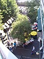
 Pike Place Market, main arcade
 -
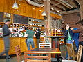 Zeitgeist Coffee, Pioneer Square
 -
 Sunset at Alki Beach
 -
 Two Seattle icons: The Space Needle and a ferry
 -
 Space Needle through Seattle Center's Fun Forest


See also
- Arts in Seattle
- Demographics of Seattle
- List of companies based in Seattle
- List of famous Seattleites
- List of famous University of Washington people
- List of representations of Seattle in popular culture
- List of United States metropolitan statistical areas by population
- List of Seattle parks
- List of Seattle sister cities
- Music of Washington, especially grunge music
- Port of Seattle
- Seattle Bus Tunnel
- Seattle metropolitan area
- Seattle neighborhoods
- Seattle Police Department
- Seattle Public Library
- Seattle Underground
References
- ^ a b "Annual Estimates of the Population for Incorporated Places over 100,000, Ranked by July 1, 2005 Population: April 1, 2000 to July 1, 2005 (SUB-EST2005-01)", (Excel file), Population Division, United States Census Bureau, Release Date: 2006-06-21
- ^ Annual Estimates of the Population of Combined Statistical Areas (CBSA-EST2005-06) — includes the [[Olympia, Washington|]] and [[Bremerton, Washington|]] metro areas
- ^ Emporis [1]
- ^ Seattlest Web site [2]
- ^ a b America's Most Literate Cities
- ^ a b Most Educated City in the US
- ^ Talbert
- ^ Dailey (map with village 33, referencing his footnotes 2, 9, and 10)
- ^ After historical epidemiology 62% losses due to introduced diseases. [Boyd]
- ^ (1) Anderson & Green
(2) Lange (15 October 2000, Essay 1660)
(3) Dailey
(4) ""The people and their land"". Puget Sound Native Art and Culture. Seattle Art Museum. c. 2003-07-04 per "Native Art of the Northwest Coast: Collection Insight". Retrieved 2006-04-21.{{cite web}}: Check date values in:|date=(help); Cite has empty unknown parameter:|month=(help); External link in|date=
(5) Boyd - ^ (1)
Crowley, Walt (1998-08-31). ""Seattle -- a Snapshot History of Its Founding"". HistoryLink.org Essay 303. Retrieved 2006-06-12.
{{cite web}}: Cite has empty unknown parameters:|coauthors=and|month=(help)
(2) Crowley, Walt (2003-03-13). ""Native American tribes sign Point Elliott Treaty at Mukilteo on January 22, 1855."". HistoryLink.org Essay 5402. Retrieved 2006-07-21.{{cite web}}: Cite has empty unknown parameters:|coauthors=and|month=(help)
(3) Lange, Greg (1998-11-04). ""Legislature incorporates the Town of Seattle for the first time on January 14, 1865."". HistoryLink.org Essay 168. Retrieved 2006-04-21.{{cite web}}: Cite has empty unknown parameter:|month=(help); Unknown parameter|coauthors=ignored (|author=suggested) (help) - ^
Miller, Jay (Lenape) (1996). "Seattle (Si'al)". In Hoxie, Frederick E. (ed.). Encyclopedia of North American Indians. Boston: Houghton Mifflin. pp. 574–6. ISBN 0-395-66921-9.
{{cite encyclopedia}}:|access-date=requires|url=(help); Cite has empty unknown parameters:|month=and|coauthors=(help) - ^ (1)
[Lakw'alas] (Speer, Thomas R.), editor (2004-07-22). ""Chief Si'ahl"" (DOC). "Chief Si'ahl". Duwamish Tribe. Retrieved 2006-04-21.
{{cite web}}:|last=has generic name (help); Cite has empty unknown parameter:|month=(help); External link in|work=
Includes bibliography.
(2) Watson, Kenneth G. (2003-01-18). ""Seattle, Chief Noah"". HistoryLink.org Essay 5071. Retrieved 2006-06-12.{{cite web}}: Cite has empty unknown parameters:|coauthors=and|month=(help) (3) Morgan (1951, 1982), p.20
(4) The Duwamish River extends southeasterly well into Tukwila, where the name changes to Green but otherwise continues up past Black Diamond into the Cascades - ^ Crowley, Walt. Seattle burns down in the Great Fire on June 6, 1889. HistoryLink.org. January 25 2003. Retrieved June 12 2006.
- ^ Lange, Greg. Alaska-Yukon-Pacific Exposition opens for a 138-day run on June 1, 1909. HistoryLink.org. March 5 2003. Retrieved June 12 2005.
- ^ McRoberts, Patrick. Seattle General Strike, 1919, Part I. HistoryLink.org. February 4, 1999. Retrieved June 12 2006.
- ^ Stein, Alan J. Century 21 -- The 1962 Seattle World's Fair, Part I. HistoryLink.org. April 18, 2000. Retrieved June 12 2006.
- ^ Wilma, David. Ted Turner's Goodwill Games open in Seattle on July 20, 1990. HistoryLink.org. February 25, 2004. Retrieved June 12 2006.
- ^ Wilma, David. Protests against the World Trade Organization (WTO) continue on December 1, 1999. HistoryLink.org. March 2000. Retrieved June 12 2006.
- ^ Crowley, Walt. Earthquake registering 6.8 on Richter Scale jolts Seattle and Puget Sound on February 28, 2001. HistoryLink.org. March 2 2001. Retrieved June 12 2006.
- ^ Shear, Emmett. "Seattle: Booms and Busts". Author has granted blanket permission for material from that paper to be reused in Wikipedia. This article is no longer available.
- ^ Rochester, Junius. Yesler, Henry L. HistoryLink.org. October 07, 1998. Retrieved June 12 2006.
- ^ "Hard Drive to the Klondike: Promoting Seattle During the Gold Rush", on the site of the Seattle Unit of the Klondike Gold Rush National Historical Park. National Park Service. Last Updated: February 18, 2003. Retrieved July 16 2006.
- ^ "History of Seattle: The "Jet City" Takes Off", Seattle's Convention and Visitors Bureau
- ^ Blethen, Frank A., "It's cutting time: Layoffs likely at Times, says memo from publisher Blethen", Seattle Weekly, 2001-04-12
- ^ "Billboard appears on April 16, 1971, near Sea-Tac, reading: Will the Last Person Leaving SEATTLE -- Turn Out the Lights. HistoryLink.org Essay 1287", The Online Encyclopedia of Washington State History
- ^ What Is The Olympic Rain Shadow? KOMOTV.com. Retrieved June 12 2006.
- ^ SEATTLE SAND PT WSFO, KING COUNTY data derived from NCDC TD 9641 Clim 81 1961-1990 Normals. 30 years between 1961 and 1990
- ^ Seattle Weather Records. KOMOTV.com. Retrieved June 12 2006.
- ^ What is the Puget Sound Convergence Zone? KOMOTV.com. Retrieved June 12 2006.
- ^ Strategic Planning Office. Decennial Population. City of Seattle. Retrieved on June 12 2006.
- ^ US Census
- ^ http://www.brookings.org/es/urban/livingcities/seattle.htm Seattle in Focus: A Profile from Census 2000]. The Brookings Institute. November 2003. Retrieved on June 12 2006.
- ^ The Olympian. Source found dead June 12, 2006.
- ^ Lornet Turnbull (2006-11-16). The Seattle Times "12.9% in Seattle are gay or bisexual, second only to S.F., study says". The Seattle Times. Retrieved 2006-11-16.
{{cite news}}: Check|url=value (help); Check date values in:|date=(help) - ^ Fremont Public Association website; Asian Counseling and Referral Service website; PSKS website; Seattle Indian Center website.
- ^ Council Adopts Strategies to Implement “Ten-Year Plan to End Homelessness”. King County. September 19, 2005. Retrieved on June 12, 2006.
- ^ Bob Young (2006-08-15). "Nickels backs 60% increase in city's population by 2040". The Seattle Times. Retrieved 2006-08-15.
{{cite news}}: Check date values in:|date=(help) - ^ America's Fattest Cities. Men's Fitness online. Retrieved on June 12, 2006.
- ^ The Story of the Statue of Lenin. FremontSeattle.com. Retrieved June 12 2006.
- ^ a b Fortune 500 list for Washington, Fortune Magazine, April 17, 2006, Retrieved June 10 2006.
- ^ "2006 MAYOR'S CHALLENGE: Where Are the Best Metros for Future Business Locations?". Expansion Magazine. August 7 2006.
{{cite news}}: Check date values in:|date=(help) - ^ Clemence, Sara, Most Overpriced Places In The U.S. 2005, Forbes magazine online, 14 July 2005. Retrieved 11 November 2005.
- ^ Time magazine, "Seattle Central", September 10 2001
- ^ 9/11 Commission. Al Qaeda Aims at the American Homeland. 9/11 Commission Report. July 22, 2004. Retrieved June 12 2006.
- ^ Original Starbucks. City of Seattle. Retrieved June 12 2006.
- ^ Murakami, Kery (2006-06-23). "Gay pride events multiply". Seattle P-I. Retrieved 2006-07-14.
{{cite news}}: Check date values in:|date=(help) - ^ Recordings and Broadcasts. Seattle Symphony. Retrieved June 12 2006.
- ^ About the School. Pacific Northwest Ballet. Retrieved June 12 2006.
- ^ Joint Operation Agreement. The Seattle Times Company. Retrieved June 12 2006.
- ^ Crowley, Walt. Interurban Rail Transit in King County and the Puget Sound Region -- A Snapshot History. HistoryLink.org. September 19 2000. Retrieved June 12 2006.
- ^ Sounder Commuter Rail Map of Service. SoundTransit. Retrieved June 12 2006.
- ^ 2005 Long Range Plan. SoundTransit. Retrieved June 12 2006.
- ^ History. Washington State Department of Transit. Retrieved June 12 2006.
- ^ Rider Alert. Seattle Center Monorail. Retrieved June 12 2006.
- ^ Elevated.org. Seattle Monorail Project. Retrieved June 12 2006.
- ^ The South Lake Union Streetcar. Seattle Department of Transportation. Retrieved June 12 2006.
- ^ Cobb honored as one of "Resuscitation Greats". UW School of Medicine Online News. August 16 2002. Retrieved June 12 2006.
Bibliography
- Jones, Nard (1972). Seattle. New York City: Doubleday. ISBN 0-385-01875-4.
{{cite book}}:|access-date=requires|url=(help); Cite has empty unknown parameter:|coauthors=(help) - Morgan, Murray (1982 (originally published 1951, 1982 revised and updated, first illuntrated edition)). Skid Road: an Informal Portrait of Seattle. Seattle and London: University of Washington Press. ISBN 0-295-95846-4.
{{cite book}}:|access-date=requires|url=(help); Check date values in:|year=(help); Cite has empty unknown parameter:|coauthors=(help) - Sale, Roger (1976). Seattle: Past To Present. Seattle and London: University of Washington Press. ISBN 0-295-95615-1.
{{cite book}}:|access-date=requires|url=(help); Cite has empty unknown parameter:|coauthors=(help) - Speidel, William C. (1978). Doc Maynard: the man who invented Seattle. Seattle: Nettle Creek Publishing Company. pp. pp. 196–197, 200. ISBN 0-914890-02-6.
{{cite book}}:|access-date=requires|url=(help);|pages=has extra text (help); Cite has empty unknown parameters:|accessyear=,|origmonth=,|accessmonth=,|month=,|chapterurl=,|origdate=, and|coauthors=(help)
Speidel provides a substantial bibliography with extensive primary sources. - Speidel, William C. (1967). Sons of the profits; or, There's no business like grow business: the Seattle story, 1851-1901. Seattle: Nettle Creek Publishing Company. pp. pp. 196–197, 200. ISBN 0-914890-00-X, ISBN 0-914890-06-9.
{{cite book}}:|access-date=requires|url=(help);|pages=has extra text (help); Cite has empty unknown parameters:|accessyear=,|origmonth=,|accessmonth=,|month=,|chapterurl=,|origdate=, and|coauthors=(help)
Speidel provides a substantial bibliography with extensive primary sources.
External links
- Official Website
- History
- Historylink.org provides an unparalleled collection of articles on the history of Seattle and Washington. See especially their history of Seattle and King County.
- Seattle Civil Rights and Labor History Project
- National Register of Historic Places Travel Itinerary
- Seattle Times Seattle Timeline
- Sir John Colborne Seaton, Seattle, Encyclopædia Britannica 11th Edition (1911), now in the public domain.
- Directories
- Guides
- Traffic and Weather
- Community
- Imagery
- Photo gallery of Seattle
- Seattle photos by night
- VR Seattle - Virtual Tour of Seattle
Template:Geolinks-US-cityscale
- Nearby hiking trails on Hikipedia