
List of Interstate Highways in Texas: Difference between revisions
m revert |
m sp, date & link fixes using AWB |
||
| Line 32: | Line 32: | ||
|[[Image:I-27 (TX).svg|28px]] [[Interstate 27 (Texas)|I-27]] |
|[[Image:I-27 (TX).svg|28px]] [[Interstate 27 (Texas)|I-27]] |
||
|[[Lubbock County, Texas|Lubbock]], [[Hale County, Texas|Hale]], [[Swisher County, Texas|Swisher]], [[Randall County, Texas|Randall]] and [[Potter County, Texas|Potter]] counties |
|[[Lubbock County, Texas|Lubbock]], [[Hale County, Texas|Hale]], [[Swisher County, Texas|Swisher]], [[Randall County, Texas|Randall]] and [[Potter County, Texas|Potter]] counties |
||
|{{nts|124.1}} miles (199.8 |
|{{nts|124.1}} miles (199.8 km) |
||
|I-27 begins at [[Texas State Highway Loop 289|Loop 289]] in southern [[Lubbock, Texas|Lubbock]] and heads north in the [[Texas Panhandle]]. It ends at exit 70 on I-40 in [[Amarillo, Texas|Amarillo]].<ref>{{cite map|publisher=Google Maps|url=http://maps.google.com/maps?f=d&hl=en&geocode=10768451533901432405,33.529085,-101.844055&saddr=US-87+N+%4033.529085,+-101.844055&daddr=35.192942,-101.837023&mra=mi&mrsp=1,0&sz=18&sll=35.193586,-101.836862&sspn=0.002898,0.004989&ie=UTF8&ll=34.465806,-101.958618&spn=2.993352,5.108643&z=8|title=Overview map of I-27|accessdate=2008-02-25}}</ref> |
|I-27 begins at [[Texas State Highway Loop 289|Loop 289]] in southern [[Lubbock, Texas|Lubbock]] and heads north in the [[Texas Panhandle]]. It ends at exit 70 on I-40 in [[Amarillo, Texas|Amarillo]].<ref>{{cite map|publisher=Google Maps|url=http://maps.google.com/maps?f=d&hl=en&geocode=10768451533901432405,33.529085,-101.844055&saddr=US-87+N+%4033.529085,+-101.844055&daddr=35.192942,-101.837023&mra=mi&mrsp=1,0&sz=18&sll=35.193586,-101.836862&sspn=0.002898,0.004989&ie=UTF8&ll=34.465806,-101.958618&spn=2.993352,5.108643&z=8|title=Overview map of I-27|accessdate=2008-02-25}}</ref> |
||
|align="center"|1969 |
|align="center"|1969 |
||
| Line 39: | Line 39: | ||
|[[Image:I-30 (TX).svg|28px]] [[Interstate 30 in Texas|I-30]] |
|[[Image:I-30 (TX).svg|28px]] [[Interstate 30 in Texas|I-30]] |
||
|[[Parker County, Texas|Parker]], [[Tarrant County, Texas|Tarrant]], [[Dallas County, Texas|Dallas]], [[Rockwall County, Texas|Rockwall]], [[Hunt County, Texas|Hunt]], [[Hopkins County, Texas|Hopkins]], [[Franklin County, Texas|Franklin]], [[Titus County, Texas|Titus]], [[Morris County, Texas|Morris]] and [[Bowie County, Texas|Bowie]] counties |
|[[Parker County, Texas|Parker]], [[Tarrant County, Texas|Tarrant]], [[Dallas County, Texas|Dallas]], [[Rockwall County, Texas|Rockwall]], [[Hunt County, Texas|Hunt]], [[Hopkins County, Texas|Hopkins]], [[Franklin County, Texas|Franklin]], [[Titus County, Texas|Titus]], [[Morris County, Texas|Morris]] and [[Bowie County, Texas|Bowie]] counties |
||
|{{nts|223.7}} miles (360.1 |
|{{nts|223.7}} miles (360.1 km) |
||
|I-30 begins at exit 421 on I-20 in the western portions of the [[Dallas–Fort Worth Metroplex]], the Dallas and Fort Worth combined metropolitan areas. As it heads east through the Metroplex, it has junctions with I-35W, I-35E and I-45. After leaving the Metroplex, the highway heads towards the east-northeast and enters [[Arkansas]] at [[Texarkana, Texas|Texarkana]].<ref>{{cite map|publisher=Google Maps|url=http://maps.google.com/maps?f=d&hl=en&geocode=10139518408216521561,32.723963,-97.579236%3B10343026203352416216,33.470110,-94.042880&saddr=I-30+E+%4032.723963,+-97.579236&daddr=33.47011,-94.042891&mra=dme&mrcr=0&mrsp=1&sz=19&sll=33.470102,-94.042875&sspn=0.001479,0.002494&ie=UTF8&ll=33.096144,-95.701904&spn=3.041589,5.108643&z=8|title=Overview map of I-30|accessdate=2008-02-25}}</ref> |
|I-30 begins at exit 421 on I-20 in the western portions of the [[Dallas–Fort Worth Metroplex]], the Dallas and Fort Worth combined metropolitan areas. As it heads east through the Metroplex, it has junctions with I-35W, I-35E and I-45. After leaving the Metroplex, the highway heads towards the east-northeast and enters [[Arkansas]] at [[Texarkana, Texas|Texarkana]].<ref>{{cite map|publisher=Google Maps|url=http://maps.google.com/maps?f=d&hl=en&geocode=10139518408216521561,32.723963,-97.579236%3B10343026203352416216,33.470110,-94.042880&saddr=I-30+E+%4032.723963,+-97.579236&daddr=33.47011,-94.042891&mra=dme&mrcr=0&mrsp=1&sz=19&sll=33.470102,-94.042875&sspn=0.001479,0.002494&ie=UTF8&ll=33.096144,-95.701904&spn=3.041589,5.108643&z=8|title=Overview map of I-30|accessdate=2008-02-25}}</ref> |
||
|align="center"|1959 |
|align="center"|1959 |
||
| Line 46: | Line 46: | ||
|[[Image:I-35 (TX).svg|28px]] [[Interstate 35 in Texas|I-35]] |
|[[Image:I-35 (TX).svg|28px]] [[Interstate 35 in Texas|I-35]] |
||
|[[Webb County, Texas|Webb]], [[La Salle County, Texas|La Salle]], [[Frio County, Texas|Frio]], [[Medina County, Texas|Medina]], [[Atascosa County, Texas|Atascosa]], [[Bexar County, Texas|Bexar]], [[Guadalupe County, Texas|Guadalupe]], [[Comal County, Texas|Comal]], [[Hays County, Texas|Hays]], [[Travis County, Texas|Travis]], [[Williamson County, Texas|Williamson]], [[Bell County, Texas|Bell]], [[Falls County, Texas|Falls]], [[McLennan County, Texas|McLennan]], [[Hill County, Texas|Hill]], [[Denton County, Texas|Denton]] and [[Cooke County, Texas|Cooke]] counties |
|[[Webb County, Texas|Webb]], [[La Salle County, Texas|La Salle]], [[Frio County, Texas|Frio]], [[Medina County, Texas|Medina]], [[Atascosa County, Texas|Atascosa]], [[Bexar County, Texas|Bexar]], [[Guadalupe County, Texas|Guadalupe]], [[Comal County, Texas|Comal]], [[Hays County, Texas|Hays]], [[Travis County, Texas|Travis]], [[Williamson County, Texas|Williamson]], [[Bell County, Texas|Bell]], [[Falls County, Texas|Falls]], [[McLennan County, Texas|McLennan]], [[Hill County, Texas|Hill]], [[Denton County, Texas|Denton]] and [[Cooke County, Texas|Cooke]] counties |
||
|{{nts|407.2}} miles (655.3 |
|{{nts|407.2}} miles (655.3 km) |
||
|I-35 begins at the [[United States-Mexico border]] in [[Laredo, Texas|Laredo]] and heads north towards [[San Antonio, Texas|San Antonio]]. In San Antonio, it intersects I-10 and I-37 before heading north to [[Austin, Texas|Austin]], the state capital. North of [[Hillsboro, Texas|Hillsboro]], the highway splits into two branches, I-35W which heads to [[Fort Worth, Texas|Fort Worth]] and I-35E that heads to [[Dallas, Texas|Dallas]]. The two branches reunite in [[Denton, Texas|Denton]] and I-35 heads north, entering [[Oklahoma]] north of [[Gainesville, Texas|Gainesville]].<ref>{{cite map|publisher=Google Maps|url=http://maps.google.com/maps?f=d&hl=en&geocode=2648713429536618100,27.500320,-99.502690%3B8907049352027800660,32.052760,-97.093530&saddr=I-35%2FSan+Dario+Ave+%4027.500320,+-99.502690&daddr=I-35+N+%4032.052760,+-97.093530&doflg=ptm&sll=29.50894,-98.294678&sspn=1.579931,2.554321&ie=UTF8&z=7|title=Overview map of southern section of I-35|accessdate=2008-02-25}}</ref><ref>{{cite map|publisher=Google Maps|url=http://maps.google.com/maps?f=d&hl=en&geocode=1309028751965685703,33.219600,-97.170440%3B10248154355255477551,33.726850,-97.159650&saddr=I-35+N+%4033.219600,+-97.170440&daddr=I-35+N+%4033.726850,+-97.159650&doflg=ptm&sll=33.473225,-97.165545&sspn=0.757187,1.277161&ie=UTF8&z=10|title=Overview map of northern section of I-35|accessdate=2008-02-25}}</ref> |
|I-35 begins at the [[United States-Mexico border]] in [[Laredo, Texas|Laredo]] and heads north towards [[San Antonio, Texas|San Antonio]]. In San Antonio, it intersects I-10 and I-37 before heading north to [[Austin, Texas|Austin]], the state capital. North of [[Hillsboro, Texas|Hillsboro]], the highway splits into two branches, I-35W which heads to [[Fort Worth, Texas|Fort Worth]] and I-35E that heads to [[Dallas, Texas|Dallas]]. The two branches reunite in [[Denton, Texas|Denton]] and I-35 heads north, entering [[Oklahoma]] north of [[Gainesville, Texas|Gainesville]].<ref>{{cite map|publisher=Google Maps|url=http://maps.google.com/maps?f=d&hl=en&geocode=2648713429536618100,27.500320,-99.502690%3B8907049352027800660,32.052760,-97.093530&saddr=I-35%2FSan+Dario+Ave+%4027.500320,+-99.502690&daddr=I-35+N+%4032.052760,+-97.093530&doflg=ptm&sll=29.50894,-98.294678&sspn=1.579931,2.554321&ie=UTF8&z=7|title=Overview map of southern section of I-35|accessdate=2008-02-25}}</ref><ref>{{cite map|publisher=Google Maps|url=http://maps.google.com/maps?f=d&hl=en&geocode=1309028751965685703,33.219600,-97.170440%3B10248154355255477551,33.726850,-97.159650&saddr=I-35+N+%4033.219600,+-97.170440&daddr=I-35+N+%4033.726850,+-97.159650&doflg=ptm&sll=33.473225,-97.165545&sspn=0.757187,1.277161&ie=UTF8&z=10|title=Overview map of northern section of I-35|accessdate=2008-02-25}}</ref> |
||
|align="center"|1959 |
|align="center"|1959 |
||
| Line 53: | Line 53: | ||
|[[Image:I-35E (TX).svg|35px]] [[Interstate 35E (Texas)|I-35E]] |
|[[Image:I-35E (TX).svg|35px]] [[Interstate 35E (Texas)|I-35E]] |
||
|[[Hill County, Texas|Hill]], [[Ellis County, Texas|Ellis]], [[Dallas County, Texas|Dallas]] and [[Denton County, Texas|Denton]] counties |
|[[Hill County, Texas|Hill]], [[Ellis County, Texas|Ellis]], [[Dallas County, Texas|Dallas]] and [[Denton County, Texas|Denton]] counties |
||
|{{nts|96.8}} miles (155.7 |
|{{nts|96.8}} miles (155.7 km) |
||
|I-35E is the eastern and less direct branch of I-35 from [[Hillsboro, Texas|Hillsboro]] to [[Denton, Texas|Denton]]; it passes through [[Dallas, Texas|Dallas]], where it intersects I-20 and I-30.<ref>{{cite map|publisher=Google Maps|url=http://maps.google.com/maps?f=d&hl=en&geocode=9812878257799335015,32.057132,-97.091048%3B11141893483052582264,33.219386,-97.170369&saddr=Unknown+road+%4032.057132,+-97.091048&daddr=32.676373,-96.825256+to:I-35+N+%4033.219386,+-97.170369&mra=dpe&mrcr=0&mrsp=1&sz=9&via=1&doflg=ptm&sll=32.63826,-97.18786&sspn=1.528745,2.554321&ie=UTF8&z=9|title=Overview map of I-35E|accessdate=2008-02-25}}</ref> |
|I-35E is the eastern and less direct branch of I-35 from [[Hillsboro, Texas|Hillsboro]] to [[Denton, Texas|Denton]]; it passes through [[Dallas, Texas|Dallas]], where it intersects I-20 and I-30.<ref>{{cite map|publisher=Google Maps|url=http://maps.google.com/maps?f=d&hl=en&geocode=9812878257799335015,32.057132,-97.091048%3B11141893483052582264,33.219386,-97.170369&saddr=Unknown+road+%4032.057132,+-97.091048&daddr=32.676373,-96.825256+to:I-35+N+%4033.219386,+-97.170369&mra=dpe&mrcr=0&mrsp=1&sz=9&via=1&doflg=ptm&sll=32.63826,-97.18786&sspn=1.528745,2.554321&ie=UTF8&z=9|title=Overview map of I-35E|accessdate=2008-02-25}}</ref> |
||
|align="center"|1959 |
|align="center"|1959 |
||
| Line 60: | Line 60: | ||
|[[Image:I-35W (TX).svg|35px]] [[Interstate 35W (Texas)|I-35W]] |
|[[Image:I-35W (TX).svg|35px]] [[Interstate 35W (Texas)|I-35W]] |
||
|[[Hill County, Texas|Hill]], [[Johnson County, Texas|Johnson]], [[Tarrant County, Texas|Tarrant]] and [[Denton County, Texas|Denton]] counties |
|[[Hill County, Texas|Hill]], [[Johnson County, Texas|Johnson]], [[Tarrant County, Texas|Tarrant]] and [[Denton County, Texas|Denton]] counties |
||
|{{nts|85.2}} miles (137.1 |
|{{nts|85.2}} miles (137.1 km) |
||
|I-35W is the western and more direct branch of I-35 from [[Hillsboro, Texas|Hillsboro]] to [[Denton, Texas|Denton]]; it passes through [[Fort Worth, Texas|Fort Worth]], where it intersects I-20 and I-30.<ref>{{cite map|publisher=Google Maps|url=http://maps.google.com/maps?f=d&hl=en&geocode=8570081817830080755,32.058983,-97.095154%3B11141893483052582264,33.219386,-97.170369&saddr=Unknown+road+%4032.058983,+-97.095154&daddr=I-35+N+%4033.219386,+-97.170369&doflg=ptm&sll=32.639185,-96.9873&sspn=1.528745,2.554321&ie=UTF8&ll=32.639375,-97.207031&spn=1.528745,2.554321&z=9|title=Overview map of I-35W|accessdate=2008-02-25}}</ref> |
|I-35W is the western and more direct branch of I-35 from [[Hillsboro, Texas|Hillsboro]] to [[Denton, Texas|Denton]]; it passes through [[Fort Worth, Texas|Fort Worth]], where it intersects I-20 and I-30.<ref>{{cite map|publisher=Google Maps|url=http://maps.google.com/maps?f=d&hl=en&geocode=8570081817830080755,32.058983,-97.095154%3B11141893483052582264,33.219386,-97.170369&saddr=Unknown+road+%4032.058983,+-97.095154&daddr=I-35+N+%4033.219386,+-97.170369&doflg=ptm&sll=32.639185,-96.9873&sspn=1.528745,2.554321&ie=UTF8&ll=32.639375,-97.207031&spn=1.528745,2.554321&z=9|title=Overview map of I-35W|accessdate=2008-02-25}}</ref> |
||
|align="center"|1959 |
|align="center"|1959 |
||
| Line 67: | Line 67: | ||
|[[Image:I-37 (TX).svg|28px]] [[Interstate 37 (Texas)|I-37]] |
|[[Image:I-37 (TX).svg|28px]] [[Interstate 37 (Texas)|I-37]] |
||
|[[Nueces County, Texas|Nueces]], [[San Patricio County, Texas|San Patricio]], [[Live Oak County, Texas|Live Oak]], [[Atascosa County, Texas|Atascosa]] and [[Bexar County, Texas|Bexar]] counties |
|[[Nueces County, Texas|Nueces]], [[San Patricio County, Texas|San Patricio]], [[Live Oak County, Texas|Live Oak]], [[Atascosa County, Texas|Atascosa]] and [[Bexar County, Texas|Bexar]] counties |
||
|{{nts|143.0}} miles (230.1 |
|{{nts|143.0}} miles (230.1 km) |
||
|I-37 begins in [[Corpus Christi, Texas|Corpus Christi]] near the [[Gulf Coast]] and heads towards the north-northwest. It intersects I-10 before it ends at exit 158 on I-35 in [[San Antonio, Texas|San Antonio]].<ref>{{cite map|publisher=Google Maps|url=http://maps.google.com/maps?f=d&hl=en&geocode=2568522560958495253,27.801020,-97.395701%3B6464171849619486050,29.438726,-98.477498&saddr=I-37+N+%4027.801020,+-97.395701&daddr=US-281+N+%4029.438726,+-98.477498&doflg=ptm&sll=28.61835,-97.938615&sspn=3.187023,5.108643&ie=UTF8&z=8|title=Overview map of I-37|accessdate=2008-02-25}}</ref> |
|I-37 begins in [[Corpus Christi, Texas|Corpus Christi]] near the [[Gulf Coast]] and heads towards the north-northwest. It intersects I-10 before it ends at exit 158 on I-35 in [[San Antonio, Texas|San Antonio]].<ref>{{cite map|publisher=Google Maps|url=http://maps.google.com/maps?f=d&hl=en&geocode=2568522560958495253,27.801020,-97.395701%3B6464171849619486050,29.438726,-98.477498&saddr=I-37+N+%4027.801020,+-97.395701&daddr=US-281+N+%4029.438726,+-98.477498&doflg=ptm&sll=28.61835,-97.938615&sspn=3.187023,5.108643&ie=UTF8&z=8|title=Overview map of I-37|accessdate=2008-02-25}}</ref> |
||
|align="center"|1959 |
|align="center"|1959 |
||
| Line 74: | Line 74: | ||
|[[Image:I-40 (TX).svg|28px]] [[Interstate 40 in Texas|I-40]] |
|[[Image:I-40 (TX).svg|28px]] [[Interstate 40 in Texas|I-40]] |
||
|[[Deaf Smith County, Texas|Deaf Smith]], [[Oldham County, Texas|Oldham]], [[Potter County, Texas|Potter]], [[Carson County, Texas|Carson]], [[Gray County, Texas|Gray]], [[Donley County, Texas|Donley]] and [[Wheeler County, Texas|Wheeler]] counties |
|[[Deaf Smith County, Texas|Deaf Smith]], [[Oldham County, Texas|Oldham]], [[Potter County, Texas|Potter]], [[Carson County, Texas|Carson]], [[Gray County, Texas|Gray]], [[Donley County, Texas|Donley]] and [[Wheeler County, Texas|Wheeler]] counties |
||
|{{nts|177.1}} miles (285.0 |
|{{nts|177.1}} miles (285.0 km) |
||
|I-40 crosses the [[Texas Panhandle]] from [[New Mexico]] to [[Oklahoma]], and has a junction with I-27 in [[Amarillo, Texas|Amarillo]]. The alignment of I-40 is the approximate alignment of the historic [[U.S. Highway 66 (Texas)|U.S. Highway 66]] (US 66).<ref>{{cite map|publisher=Google Maps|url=http://maps.google.com/maps?f=d&hl=en&geocode=5662480466359574814,35.182400,-103.042390%3B5911295218433263232,35.226777,-100.000434&saddr=I-40+E+%4035.182400,+-103.042390&daddr=I-40+E+%4035.226777,+-100.000434&doflg=ptm&sll=35.226135,-101.52141&sspn=2.965779,5.108643&ie=UTF8&z=8|title=Overview map of I-40|accessdate=2008-02-25}}</ref> |
|I-40 crosses the [[Texas Panhandle]] from [[New Mexico]] to [[Oklahoma]], and has a junction with I-27 in [[Amarillo, Texas|Amarillo]]. The alignment of I-40 is the approximate alignment of the historic [[U.S. Highway 66 (Texas)|U.S. Highway 66]] (US 66).<ref>{{cite map|publisher=Google Maps|url=http://maps.google.com/maps?f=d&hl=en&geocode=5662480466359574814,35.182400,-103.042390%3B5911295218433263232,35.226777,-100.000434&saddr=I-40+E+%4035.182400,+-103.042390&daddr=I-40+E+%4035.226777,+-100.000434&doflg=ptm&sll=35.226135,-101.52141&sspn=2.965779,5.108643&ie=UTF8&z=8|title=Overview map of I-40|accessdate=2008-02-25}}</ref> |
||
|align="center"|1959 |
|align="center"|1959 |
||
| Line 81: | Line 81: | ||
|[[Image:I-44 (TX).svg|28px]] [[Interstate 44 in Texas|I-44]] |
|[[Image:I-44 (TX).svg|28px]] [[Interstate 44 in Texas|I-44]] |
||
|[[Wichita County, Texas|Wichita County]] |
|[[Wichita County, Texas|Wichita County]] |
||
|{{nts|14.8}} miles (23.8 |
|{{nts|14.8}} miles (23.8 km) |
||
|I-44 begins in [[Wichita Falls, Texas|Wichita Falls]] and heads north to Oklahoma.<ref>{{cite map|publisher=Google Maps|url=http://maps.google.com/maps?f=d&hl=en&geocode=8443879619514798407,33.907863,-98.499909%3B13211470767394561891,34.106362,-98.537153&saddr=US-281+N%2FUS-287+N+%4033.907863,+-98.499909&daddr=I-44+E+%4034.106362,+-98.537153&doflg=ptm&sll=34.00711,-98.529115&sspn=0.376244,0.63858&ie=UTF8&z=11|title=Overview map of I-44|accessdate=2008-02-25}}</ref> |
|I-44 begins in [[Wichita Falls, Texas|Wichita Falls]] and heads north to Oklahoma.<ref>{{cite map|publisher=Google Maps|url=http://maps.google.com/maps?f=d&hl=en&geocode=8443879619514798407,33.907863,-98.499909%3B13211470767394561891,34.106362,-98.537153&saddr=US-281+N%2FUS-287+N+%4033.907863,+-98.499909&daddr=I-44+E+%4034.106362,+-98.537153&doflg=ptm&sll=34.00711,-98.529115&sspn=0.376244,0.63858&ie=UTF8&z=11|title=Overview map of I-44|accessdate=2008-02-25}}</ref> |
||
|align="center"|1982 |
|align="center"|1982 |
||
| Line 88: | Line 88: | ||
|[[Image:I-45 (TX).svg|28px]] [[Interstate 45 (Texas)|I-45]] |
|[[Image:I-45 (TX).svg|28px]] [[Interstate 45 (Texas)|I-45]] |
||
|[[Galveston County, Texas|Galveston]], [[Harris County, Texas|Harris]], [[Montgomery County, Texas|Montgomery]], [[Walker County, Texas|Walker]], [[Madison County, Texas|Madison]], [[Leon County, Texas|Leon]], [[Freestone County, Texas|Freestone]], [[Navarro County, Texas|Navarro]], [[Ellis County, Texas|Ellis]] and [[Dallas County, Texas|Dallas]] counties |
|[[Galveston County, Texas|Galveston]], [[Harris County, Texas|Harris]], [[Montgomery County, Texas|Montgomery]], [[Walker County, Texas|Walker]], [[Madison County, Texas|Madison]], [[Leon County, Texas|Leon]], [[Freestone County, Texas|Freestone]], [[Navarro County, Texas|Navarro]], [[Ellis County, Texas|Ellis]] and [[Dallas County, Texas|Dallas]] counties |
||
|{{nts|284.9}} miles (458.5 |
|{{nts|284.9}} miles (458.5 km) |
||
|I-45 begins in [[Galveston, Texas|Galveston]] at the [[Gulf Coast]] and heads north intersecting I-10 in [[Houston, Texas|Houston]]. It passes through [[East Texas]] and intersects I-20 before ending at exit 46 on I-30 in [[Dallas, Texas|Dallas]].<ref>{{cite map|publisher=Google Maps|url=http://maps.google.com/maps?f=d&hl=en&geocode=4957632294807506747,29.288910,-94.835070%3B14867847305299887983,32.779047,-96.782088&saddr=I-45+N+%4029.288910,+-94.835070&daddr=I-45+N+%4032.779047,+-96.782088&doflg=ptm&sll=31.032225,-95.80858&sspn=6.220231,10.217285&ie=UTF8&z=7|title=Overview map of I-45|accessdate=2008-02-25}}</ref> |
|I-45 begins in [[Galveston, Texas|Galveston]] at the [[Gulf Coast]] and heads north intersecting I-10 in [[Houston, Texas|Houston]]. It passes through [[East Texas]] and intersects I-20 before ending at exit 46 on I-30 in [[Dallas, Texas|Dallas]].<ref>{{cite map|publisher=Google Maps|url=http://maps.google.com/maps?f=d&hl=en&geocode=4957632294807506747,29.288910,-94.835070%3B14867847305299887983,32.779047,-96.782088&saddr=I-45+N+%4029.288910,+-94.835070&daddr=I-45+N+%4032.779047,+-96.782088&doflg=ptm&sll=31.032225,-95.80858&sspn=6.220231,10.217285&ie=UTF8&z=7|title=Overview map of I-45|accessdate=2008-02-25}}</ref> |
||
|align="center"|1959 |
|align="center"|1959 |
||
| Line 111: | Line 111: | ||
|[[El Paso County, Texas|El Paso County]] |
|[[El Paso County, Texas|El Paso County]] |
||
|{{convert|0.9|mi|km|1}} |
|{{convert|0.9|mi|km|1}} |
||
|I-110 is a [[spur route|spur]] of I-10 at exit 22B in [[El Paso, Texas|El Paso]]. It connects I-10 to the Bridge of the Americas, the entry point into [[Ciudad |
|I-110 is a [[spur route|spur]] of I-10 at exit 22B in [[El Paso, Texas|El Paso]]. It connects I-10 to the Bridge of the Americas, the entry point into [[Ciudad Juárez]], Mexico.<ref>{{cite map|publisher=Google Maps|url=http://maps.google.com/maps?f=d&hl=en&geocode=2000408293668255320,31.768795,-106.450817%3B15413691847362830141,31.777527,-106.442235&saddr=I-110+N+%4031.768795,+-106.450817&daddr=US-54+E+%4031.777527,+-106.442235&doflg=ptm&sll=31.773163,-106.446533&sspn=0.012058,0.019956&ie=UTF8&z=16|title=Overview map of I-110|accessdate=2008-02-25}}</ref> |
||
|align="center"|1967 |
|align="center"|1967 |
||
|align="center"|<ref>{{cite web|author=Texas Department of Transportation|url=http://www.dot.state.tx.us/tpp/hwy/ih/ih0110.htm|title=Highway Designation File - Interstate Highway No. 110|accessdate=2008-02-24}}</ref> |
|align="center"|<ref>{{cite web|author=Texas Department of Transportation|url=http://www.dot.state.tx.us/tpp/hwy/ih/ih0110.htm|title=Highway Designation File - Interstate Highway No. 110|accessdate=2008-02-24}}</ref> |
||
Revision as of 00:20, 5 March 2009

This is a list of Interstate Highways in Texas, all of which are owned and maintained by the U.S. state of Texas.[1] The Texas Department of Transportation (TxDOT) is the state agency responsible for the day-to-day maintenance and operations of the Interstate Highways in Texas. The Interstate Highway System in Texas covers 3,233.4 miles (5,203.7 km)* and consists of nine primary routes, six auxiliary routes and the splitting of Interstate 35 (I-35) into two branches, I-35E and I-35W, that provide access to both Fort Worth and Dallas. The Interstate Highway with the longest segment in Texas is I-10 at 878.6 miles (1,414.0 km). The shortest Interstate Highway in the state is I-110 at 0.9 miles (1.4 km).
The construction of the Interstate Highway System in Texas actually began well before these routes were designated as Interstate Highways. A 50-mile (80 km) stretch of the Gulf Freeway (I-45) between Galveston and Houston was opened in 1951, eight years before it was designated I-45. It was also the first urban expressway in Texas. In 1962, 43 miles (69 km) of I-35 opened in Bexar County, the first section of Interstate Highway to open from county line to county line in a large metropolitan area.[2] Portions of I-10 west of San Antonio took much longer to complete due to the vast open spaces and lack of nearby labor. The majority of the construction of this section of I-10 occurred in the 1970s and 1980s and was complete by the early 1990s. The section east of San Antonio was completed 20 years earlier in 1972.[3] The opening of a 6-mile (10 km) section of I-27 in 1992 completed the Interstate Highway System in Texas.[4]
Planning is ongoing for a proposed extension of I-69 southward from its current terminus in Indiana through Texas to the United States-Mexico border.[5] If built, I-69 will extend about 650 miles (1,050 km) across Texas, from the Louisiana state line in the Texarkana-Shreveport area to South Texas.[6]
Primary Interstate Highways
| Highway | Location | Length | Description | Date established | Notes |
|---|---|---|---|---|---|
| El Paso, Hudspeth, Jeff Davis, Reeves, Pecos, Crockett, Sutton, Kimble, Kerr, Gillespie, Kendall, Bexar, Guadalupe, Caldwell, Gonzales, Fayette, Colorado, Austin, Waller, Harris, Chambers, Jefferson and Orange counties | 878.6 miles (1,414.0 km) | I-10 enters the state from New Mexico northwest of El Paso, passing through rural West Texas on its way to San Antonio, where it has junctions with I-35 and I-37. It continues east to Houston, where it has a junction with I-45, then enters Louisiana near Orange. I-10 is the state's longest Interstate Highway as well as its southernmost east-west Interstate Highway.[7] | 1959 | [8] | |
| Reeves, Ward, Crane, Ector, Midland, Martin, Howard, Mitchell, Nolan, Taylor, Callahan, Eastland, Erath, Palo Pinto, Parker, Tarrant, Dallas, Kaufman, Van Zandt, Smith, Gregg and Harrison counties | 636.1 miles (1,023.7 km) | I-20 begins at exit 186 on I-10 in West Texas and heads towards the northeast. The highway is a major east-west corridor through the Dallas–Fort Worth Metroplex, the Dallas and Fort Worth combined metropolitan areas, where it has junctions with I-30, I-35W, I-35E and I-45. I-20 passes through East Texas before it enters Louisiana east of Marshall.[9] | 1959 | [10] | |
| Lubbock, Hale, Swisher, Randall and Potter counties | 124.1 miles (199.8 km) | I-27 begins at Loop 289 in southern Lubbock and heads north in the Texas Panhandle. It ends at exit 70 on I-40 in Amarillo.[11] | 1969 | [12] | |
| Parker, Tarrant, Dallas, Rockwall, Hunt, Hopkins, Franklin, Titus, Morris and Bowie counties | 223.7 miles (360.1 km) | I-30 begins at exit 421 on I-20 in the western portions of the Dallas–Fort Worth Metroplex, the Dallas and Fort Worth combined metropolitan areas. As it heads east through the Metroplex, it has junctions with I-35W, I-35E and I-45. After leaving the Metroplex, the highway heads towards the east-northeast and enters Arkansas at Texarkana.[13] | 1959 | [14] | |
| Webb, La Salle, Frio, Medina, Atascosa, Bexar, Guadalupe, Comal, Hays, Travis, Williamson, Bell, Falls, McLennan, Hill, Denton and Cooke counties | 407.2 miles (655.3 km) | I-35 begins at the United States-Mexico border in Laredo and heads north towards San Antonio. In San Antonio, it intersects I-10 and I-37 before heading north to Austin, the state capital. North of Hillsboro, the highway splits into two branches, I-35W which heads to Fort Worth and I-35E that heads to Dallas. The two branches reunite in Denton and I-35 heads north, entering Oklahoma north of Gainesville.[15][16] | 1959 | [17] | |
| Hill, Ellis, Dallas and Denton counties | 96.8 miles (155.7 km) | I-35E is the eastern and less direct branch of I-35 from Hillsboro to Denton; it passes through Dallas, where it intersects I-20 and I-30.[18] | 1959 | [19] | |
| Hill, Johnson, Tarrant and Denton counties | 85.2 miles (137.1 km) | I-35W is the western and more direct branch of I-35 from Hillsboro to Denton; it passes through Fort Worth, where it intersects I-20 and I-30.[20] | 1959 | [21] | |
| Nueces, San Patricio, Live Oak, Atascosa and Bexar counties | 143.0 miles (230.1 km) | I-37 begins in Corpus Christi near the Gulf Coast and heads towards the north-northwest. It intersects I-10 before it ends at exit 158 on I-35 in San Antonio.[22] | 1959 | [23] | |
| Deaf Smith, Oldham, Potter, Carson, Gray, Donley and Wheeler counties | 177.1 miles (285.0 km) | I-40 crosses the Texas Panhandle from New Mexico to Oklahoma, and has a junction with I-27 in Amarillo. The alignment of I-40 is the approximate alignment of the historic U.S. Highway 66 (US 66).[24] | 1959 | [25] | |
| Wichita County | 14.8 miles (23.8 km) | I-44 begins in Wichita Falls and heads north to Oklahoma.[26] | 1982 | [27] | |
| Galveston, Harris, Montgomery, Walker, Madison, Leon, Freestone, Navarro, Ellis and Dallas counties | 284.9 miles (458.5 km) | I-45 begins in Galveston at the Gulf Coast and heads north intersecting I-10 in Houston. It passes through East Texas and intersects I-20 before ending at exit 46 on I-30 in Dallas.[28] | 1959 | [29] |
-
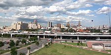 I-10 and I-35 run concurrently as an elevated freeway in Downtown San Antonio.
 -
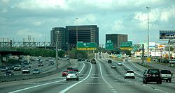
 I-10 and I-45 near Downtown Houston
 -
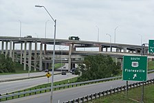 I-37 and I-410 interchange on the southeast side of San Antonio


Auxiliary Interstate Highways
| Highway | Location | Length | Description | Date established | Notes |
|---|---|---|---|---|---|
| El Paso County | 0.9 miles (1.4 km) | I-110 is a spur of I-10 at exit 22B in El Paso. It connects I-10 to the Bridge of the Americas, the entry point into Ciudad Juárez, Mexico.[30] | 1967 | [31] | |
| Dallas County | 1.4 miles (2.3 km) | I-345 is a spur beginning at the northern terminus of I-45. The spur is a continuation of I-45, and the highway continues as US 75 beyond the northern terminus of I-345. It provides a connecting route from I-45 to Spur 366 and US 75 in Dallas.[32] | 1964 | [33] | |
| Bexar County | 49.5 miles (79.7 km) | I-410, also known as the John Connally Loop, is a loop of I-10 around the city of San Antonio. It also intersects I-35 and I-37.[34] | 1959 | [35] | |
| Harris County | 38.0 miles (61.2 km) | I-610 is a loop of I-10 around the city of Houston. It also intersects I-45.[36] | 1959 | [37] | |
| Dallas and Tarrant counties | 37.0 miles (59.5 km) | I-635, also known as the Lyndon B. Johnson Freeway, is a loop of I-35E. It forms a partial loop around Dallas, and also intersects I-20, I-30, and I-45.[38] | 1959 | [39] | |
| Tarrant County | 35.2 miles (56.6 km) | I-820, also known as the Jim Wright Freeway, is a loop of I-20. It forms the western, northern and eastern arcs of a complete loop around Fort Worth; I-20 forms the southern arc. I-820 also intersects I-30 and I-35W.[40] | 1959 | [41] |
-
 I-610 at US 290 in Houston
 -
 The High Five Interchange at I-635 and US 75 in Dallas


References
- ^ Federal Highway Administration. "Interstate Frequently Asked Questions". Retrieved 2008-02-25.
- ^ Texas Department of Transportation. "TxDOT History: 1970 to 1951". Retrieved 2008-02-25.
- ^ Beaumont; et al. "From Anywhere to Everywhere: The Development of the Interstate Highway System in Texas". Texas Transportation Institute. p. 30. Retrieved 2008-02-25.
{{cite web}}: Explicit use of et al. in:|author=(help) - ^ Texas Department of Transportation. "TxDOT History: 2000 to 1971". Retrieved 2008-02-25.
- ^ Texas Department of Transportation. "I-69/TTC (Northeast Texas to Mexico)". Retrieved 2008-02-24.
- ^ Texas Department of Transportation (2008-02-09). I-69 "TTC Tier 1 EIS Meeting Handout".
{{cite web}}: Check|url=value (help) - ^ Overview map of I-10 (Map). Google Maps. Retrieved 2008-02-25.
- ^ Texas Department of Transportation. "Highway Designation File - Interstate Highway No. 10". Retrieved 2008-02-24.
- ^ Overview map of I-20 (Map). Google Maps. Retrieved 2008-02-25.
- ^ Texas Department of Transportation. "Highway Designation File - Interstate Highway No. 20". Retrieved 2008-02-24.
- ^ Overview map of I-27 (Map). Google Maps. Retrieved 2008-02-25.
- ^ Texas Department of Transportation. "Highway Designation File - Interstate Highway No. 27". Retrieved 2008-02-24.
- ^ Overview map of I-30 (Map). Google Maps. Retrieved 2008-02-25.
- ^ Texas Department of Transportation. "Highway Designation File - Interstate Highway No. 30". Retrieved 2008-02-24.
- ^ Overview map of southern section of I-35 (Map). Google Maps. Retrieved 2008-02-25.
- ^ Overview map of northern section of I-35 (Map). Google Maps. Retrieved 2008-02-25.
- ^ Texas Department of Transportation. "Highway Designation File - Interstate Highway No. 35". Retrieved 2008-02-24.
- ^ Overview map of I-35E (Map). Google Maps. Retrieved 2008-02-25.
- ^ Texas Department of Transportation. "Highway Designation File - Interstate Highway No. 35E". Retrieved 2008-02-24.
- ^ Overview map of I-35W (Map). Google Maps. Retrieved 2008-02-25.
- ^ Texas Department of Transportation. "Highway Designation File - Interstate Highway No. 35W". Retrieved 2008-02-24.
- ^ Overview map of I-37 (Map). Google Maps. Retrieved 2008-02-25.
- ^ Texas Department of Transportation. "Highway Designation File - Interstate Highway No. 37". Retrieved 2008-02-24.
- ^ Overview map of I-40 (Map). Google Maps. Retrieved 2008-02-25.
- ^ Texas Department of Transportation. "Highway Designation File - Interstate Highway No. 40". Retrieved 2008-02-24.
- ^ Overview map of I-44 (Map). Google Maps. Retrieved 2008-02-25.
- ^ Texas Department of Transportation. "Highway Designation File - Interstate Highway No. 44". Retrieved 2008-02-24.
- ^ Overview map of I-45 (Map). Google Maps. Retrieved 2008-02-25.
- ^ Texas Department of Transportation. "Highway Designation File - Interstate Highway No. 45". Retrieved 2008-02-24.
- ^ Overview map of I-110 (Map). Google Maps. Retrieved 2008-02-25.
- ^ Texas Department of Transportation. "Highway Designation File - Interstate Highway No. 110". Retrieved 2008-02-24.
- ^ Overview map of I-345 (Map). Google Maps. Retrieved 2008-02-25.
- ^ Texas Department of Transportation. "Highway Designation File - Interstate Highway No. 345". Retrieved 2008-02-24.
- ^ Overview map of I-410 (Map). Google Maps. Retrieved 2008-02-24.
- ^ Texas Department of Transportation. "Highway Designation File - Interstate Highway No. 410". Retrieved 2008-02-24.
- ^ Overview map of I-610 (Map). Google Maps. Retrieved 2008-02-25.
- ^ Texas Department of Transportation. "Highway Designation File - Interstate Highway No. 610". Retrieved 2008-02-24.
- ^ Overview map of I-635 (Map). Google Maps. Retrieved 2008-02-25.
- ^ Texas Department of Transportation. "Highway Designation File - Interstate Highway No. 635". Retrieved 2008-02-24.
- ^ Overview map of I-820 (Map). Google Maps. Retrieved 2008-02-24.
- ^ Texas Department of Transportation. "Highway Designation File - Interstate Highway No. 820". Retrieved 2008-02-24.