
Chundale
Chundale | |
|---|---|
Village | |
 Kannanchath Maidhan, Chundale | |
| Coordinates: 11°34′26″N 76°03′28″E / 11.573860°N 76.057820°E | |
| Country | |
| State | Kerala |
| District | Wayanad |
| Population (2001) | |
| • Total | 8,989 |
| Languages | |
| • Official | Malayalam, English |
| Time zone | UTC+5:30 (IST) |
| PIN | 673123 |
| Telephone code | 914936 |
| Vehicle registration | KL- 12 |
| Nearest city | Kalpetta |
Chundale is a town in Wayanad district in the state of Kerala, India.[1] Chundale is located near Kalpetta, the district headquarters of Wayanad.
Tourist Attractions
- Vaduvanchal, kalpetta.
- Puliyarmala Jain Temple, Kalpetta.
- Wayanad Heritage Museum, Kalpetta.
- Glass Temple, Kalpetta.
Demographics
As of 2001[update] India census, Achooranam had a population of 9754 with 4755 males and 4999 females.[1]
Transportation
Chundale is 69 km by road from Kozhikode railway station and this road includes nine hairpin bends. The nearest major airport is at Calicut. The road to the east connects to Mysore and Bangalore. Night journey is allowed on this sector as it goes through Bandipur national forest. The nearest railway station is Mysore. There are airports at Bangalore and Calicut.
Renowned personalities
- Midhun Jith / Guinness World Records Breaker / International Karate Champion and World Kickboxing Champion
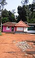
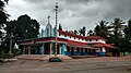
Image gallery
-
 Village Office
 -
 Devi Temple
 -
 St. Jude's Church Chundale,Wayanad
 -
 School at Kottanad, Chundale


See also
- Kalpetta town
- Mango Orange village
- Vaduvanchal town
- Meppadi town
References
- ^ a b "Census of India : Villages with population 5000 & above". Registrar General & Census Commissioner, India. Archived from the original on 8 December 2008. Retrieved 10 December 2008.
External links
Wikimedia Commons has media related to Chundale.
This article related to a location in Wayanad district, Kerala, India is a stub. You can help Wikipedia by expanding it. |