MET – Montreal Metropolitan Airport
Montréal/Saint-Hubert Airport Aéroport Montréal Saint-Hubert Longueuil | |||||||||||||||||||
|---|---|---|---|---|---|---|---|---|---|---|---|---|---|---|---|---|---|---|---|
| File:LOGOAerocentreHYUco.gif | |||||||||||||||||||
 | |||||||||||||||||||
| Summary | |||||||||||||||||||
| Airport type | Public | ||||||||||||||||||
| Operator | DASH-L (Développement Aéroport Saint-Hubert de Longueuil) | ||||||||||||||||||
| Serves | Longueuil, Quebec and Greater Montreal | ||||||||||||||||||
| Location | Saint-Hubert, Quebec | ||||||||||||||||||
| Built | 1928 | ||||||||||||||||||
| Time zone | EST (UTC−05:00) | ||||||||||||||||||
| • Summer (DST) | EDT (UTC−04:00) | ||||||||||||||||||
| Elevation AMSL | 90 ft / 27 m | ||||||||||||||||||
| Coordinates | 45°31′05″N 073°25′01″W / 45.51806°N 73.41694°W | ||||||||||||||||||
| Website | www.dashl.ca | ||||||||||||||||||
| Map | |||||||||||||||||||
| Runways | |||||||||||||||||||
| |||||||||||||||||||
| Statistics (2014) | |||||||||||||||||||
| |||||||||||||||||||
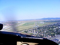
Montréal/Saint-Hubert Airport (IATA: YHU, ICAO: CYHU) is located in the Saint-Hubert borough of Longueuil, Quebec. The airport is located 16 km (9.9 mi) east of Downtown Montreal.
In operation since 1928, it was Montreal's first and only airport until the construction of Montréal-Pierre Elliott Trudeau International Airport (formerly Montréal/Dorval International Airport). On 1 August 1930, the R100 airship arrived after what was possibly the first non-stop passenger-carrying powered flight across the North Atlantic to land in Canada.[4] As of 2014, it is Canada's second busiest general aviation airport, behind Boundary Bay, and is ranked as Canada's 9th busiest airport by aircraft movements.[3] This airport mainly serves travellers to Quebec destinations.
The airport was divided into two sides, a military side along with the Pratt & Whitney Canada facility (facing runway 06L/24R) and a civilian side (facing runway 06R/24L). Today the military base, the former RCAF Station St Hubert, has ceased operations, but the Armed Forces still use the base as a garrison comprising the tactical helicopter unit 438 Squadron and 34th Service Battalion. The ex-Pratt & Whitney hangar is owned and operated since 2012 as the largest FBO on the airport by an AvFuel branded dealer: CYHU H-18 Services Inc.
Following the new National Airports Policy announced by Transport Canada in 1994, ownership of the airport was transferred to a private corporation, Développement de l'aéroport Saint-Hubert de Longueuil (DASH-L), on 1 September 2004.
It was here that the body of Quebec Minister of Labour Pierre Laporte was found during the October Crisis of 1970.
The airport is classified as an airport of entry by Nav Canada and is staffed by the Canada Border Services Agency (CBSA). CBSA officers at this airport can handle general aviation aircraft only, with no more than 15 passengers.[1]
Airlines and destinations
Passenger
| Airlines | Destinations |
|---|---|
| Pascan Aviation | Bagotville, Baie-Comeau, Bonaventure, Îles-de-la-Madeleine, Mont-Joli, Quebec City, Roberval, Rouyn-Noranda, Sept-Îles, Val-d'Or, Wabush |
Accidents and incidents
- On March 29 2016, a Mitsubishi MU-2 crashed after leaving the airport, killing former Minister of Transport Jean Lapierre.[5][6][7]
See also
References
- ^ a b Canada Flight Supplement. Effective 0901Z 16 July 2020 to 0901Z 10 September 2020.
- ^ Synoptic/Metstat Station Information
- ^ a b Total aircraft movements by class of operation — NAV CANADA towers
- ^ http://www.aviation.technomuses.ca/assets/pdf/e_R100.pdf
- ^ "Seven dead in Iles de la Madeleine plane crash: SQ". CTV Montreal. Retrieved 29 March 2016.
- ^ "Breaking Îles-de-la-Madeleine leaves 6 dead, 1 man injured". CBC. 29 March 2016. Retrieved 29 March 2016.
- ^ Authier, Philip (29 March 2016). "Seven people dead following plane crash on Îles-de-la-Madeleine, SQ says". Montreal Gazette. Retrieved 29 March 2016.
External links
- Official site (French & English)
- Page about this airport on COPA's Places to Fly airport directory
- Past three hours METARs, SPECI and current TAFs for Montréal/St-Hubert Airport from Nav Canada as available.

