Sirajganj
Sirajganj
সিরাজগঞ্জ | |
|---|---|
City | |
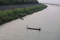
Clockwise from top-left: Jamuna Bridge, Jamuna Eco Park, Hard Point, Bank of Jamuna River, China Barrage | |
| Coordinates: 24°27′36″N 89°42′18″E / 24.460°N 89.705°E | |
| Country | |
| Division | Rajshahi |
| District | Sirajganj |
| Upazila | Sirajganj Sadar |
| Establishment | Early 1800s |
| Municipality | 1869 |
| Government | |
| • Type | Municipality |
| • Mayor | Sayed Abdur Rouf Mukta[1] |
| Area | |
| • Total | 28.49 km2 (11.00 sq mi) |
| Elevation | 16 m (52 ft) |
| Population | |
| • Total | 450,000 |
| • Density | 16,000/km2 (41,000/sq mi) |
| Time zone | UTC+6 (BST) |
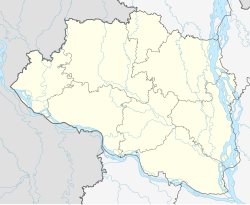
Sirajganj[a] is a city in north-western Bangladesh on the right bank of the Jamuna River, located in Rajshahi Division. It is the administrative headquarters of Sirajganj District, and with a population of 450,000 is the 14th largest city in Bangladesh.
It is about 110 kilometres (68 mi) north west of the capital, Dhaka. It is the city where Pakistani Brig. Jehanzeb Arbab looted the bank back in 1971 during the Bangladesh Liberation War. It was once a principal centre of the jute trade.
History
[edit]During British rule, Sirajganj was a town in the Pabna District of Eastern Bengal and Assam. Its location on the right bank of the Jamuna River or main stream of the Brahmaputra was a six-hour journey by steamer from the railway terminal at Goalundo. It was the chief river mart for jute in northern Bengal, with several jute presses. The jute mills were closed after the 1897 Assam earthquake. The population according to the 1901 census of India was 23,114.[2]
Demographics
[edit]| Year | Pop. | ±% p.a. |
|---|---|---|
| 1974 | 90,517 | — |
| 1981 | 97,141 | +1.01% |
| 1991 | 112,690 | +1.50% |
| 2001 | 131,634 | +1.57% |
| 2011 | 167,200 | +2.42% |
| 2022 | 450,000 | +9.42% |
| Sources:[3] | ||
According to the 2022 Bangladesh census, Sirajganj city had a population of 450,000.[4]: 388–394
According to the 2011 Bangladesh census, Sirajganj city had 35,556 households and a population of 167,200. 31,096 (19.57%) were under 10 years of age. The literacy rate (age 7 and over) was 63.22%, compared to the national average of 51.8%, and the sex ratio was 980 females per 1000 males.[5][6]
Religion
[edit]Muslims make up 92.13% of the population, while Hindus are 7.82% of the population. The Hindu population has remained relatively constant while the Muslim population has constantly increased. The remaining 0.05% people follow other religions, mainly Christianity and Sarnaism. There are 300 mosques, 15 temples and 1 Christian cemetery in the city.[3]
Points of interest
[edit]- Jamuna Bridge
- Elliott Bridge
- Sirajganj Hard Point
- China Barrages
- Durjoy Bangla Statue
- Muktir Songram Statue
- Mujib Dorshon Statue
- Jamuna Eco Park
- Rasel Park
- Bahirgola Rail Bridge
- Tomb of Shah Sufi Afzal Mahmud
- Jamidar Bari
- Jame Mosque
- Sri Sri Mahaprabhu Akhra
- Jugal Kishore Temple
- Kalibari Temple
- Old Christian Cemetery
- House of Maulana Bhashani
- House of Jadav Chandra Chakravarti
- House of Syed Ismail Hossain Siraji
- House of Haimanti Shukla
Transport
[edit]In the later half of the 19th century, Sirajganj was an important river port. It was the main collection point for jute produced in northern Bengal and western Mymensingh. After the 1897 Assam earthquake, which damaged infrastructure and shifted the course of the river farther from the city, its significance declined. It was eclipsed by Narayanganj, another river port, which also had a rail connection.[7]
Not until 1915 was Sirajganj connected to the railway network, with the opening of the Sara-Sirajganj line.[7] As of 2022, there is an Intercity train to Dhaka six days a week.[8]
East-West national highway N405 passes just south of the city. It runs east, across the Jamuna Bridge, about 24 kilometres (15 mi) to the Joydebpur–Jamalpur Highway at Elenga, and west about 16 kilometres (9.9 mi) to the Dhaka–Banglabandha Highway.[9]
Education
[edit]There are two medical schools in the city, the public Shaheed M. Monsur Ali Medical College, established in 2014, and the private North Bengal Medical College & Hospital, established in 2000. As of May 2019, they are respectively allowed to admit 51 and 85 students annually.[10]
There are eight colleges in the city. They include Sirajganj Government College, founded in 1940, Islamia Government College (1887), and Government Rashidazzoha Womens College.[11][12]
According to Banglapedia, B.L. Government High School, founded in 1869, Jnandayini High School (1884), Saleha Ishaque Government Girls' High School, and Victoria High School (1898) are notable secondary schools.[12]
Notable people
[edit]- Abdul Momin Talukdar (1929–1995) was a Bangladeshi Awami League politician, lawyer and former member of parliament and the former Deputy Minister of Local Government, Rural Development and Cooperative.
- Jadav Chandra Chakravarti, mathematician, constructed a building in the Dhanbandi neighborhood in 1901.[13]
- Zahid Hasan, actor, was born in Sirajganj in 1967.[14][15]
- Mazharul Islam, poet and folklorist, completed his Higher Secondary Certificate from Sirajganj College in 1947.[16]
- Abdul Latif Mirza, freedom fighter, founder of Latif Bahini, and member of parliament, died in Sirajganj in 2007.[17]
- Ismail Hossain Siraji, poet and novelist, lived in Sirajganj.[18]
- Haimanti Sukla, singer, was born in what is now the Munshi Meherullah Road area of Sirajganj.[13]
References
[edit]- ^ সিরাজগঞ্জের তিনটিতে আ.লীগ একটিতে বিদ্রোহী প্রার্থী জয়ী [In Sirajganj, the AL won three, in one the rebel candidate won]. jagonews24.com (in Bengali). 18 January 2021.
- ^ Chisholm, Hugh, ed. (1911). . Encyclopædia Britannica (11th ed.). Cambridge University Press.
- ^ a b c "Bangladesh Population and Housing Census 2011 Zila Report – Sirajganj" (PDF). bbs.gov.bd. Bangladesh Bureau of Statistics.
- ^ Population and Housing Census 2022 National Report (PDF). Vol. 1. Bangladesh Bureau of Statistics. November 2023.
- ^ "Population and Housing Census 2011 - Volume 3: Urban Area Report" (PDF). Bangladesh Bureau of Statistics. August 2014. p. 262.
- ^ "Population and Housing Census 2011: Bangladesh at a Glance" (PDF). Bangladesh Bureau of Statistics. Archived from the original (PDF) on 28 July 2014. Retrieved 21 July 2014.
- ^ a b Ali, Tariq Omar (2018). A Local History of Global Capital: Jute and Peasant Life in the Bengal Delta. Princeton University Press. pp. 69–70, 72. ISBN 978-1-4008-8928-0.
- ^ "Sirajganj Bazar Schedule". Bangladesh Railway.
- ^ "RHD Road Network, Rajshahi Zone". Roads and Highways Department. 2019. Retrieved 29 March 2022.
- ^ "Statistical Year Book Bangladesh 2018" (PDF). Bangladesh Bureau of Statistics. May 2019. pp. 485–486.
- ^ "List of Colleges". Department of Secondary and Higher Education. Retrieved 6 September 2020.
- ^ a b Islam, Kamrul (2012). "Sirajganj Sadar Upazila". In Islam, Sirajul; Jamal, Ahmed A. (eds.). Banglapedia: National Encyclopedia of Bangladesh (Second ed.). Asiatic Society of Bangladesh.
- ^ a b ভাষা ও সংস্কৃতি [Language and culture]. Sirajganj District (in Bengali).
- ^ Shazu, Shah Alam (1 December 2010). "'I always work in my own way'". The Daily Star.
- ^ Shazu, Shah Alam (4 October 2017). "Birthday felicitations for Zahid Hasan!". The Daily Star.
- ^ Hossain, Selina; Islam, Nurul; Hossain, Mobarak, eds. (2000). Bangla Academy Dictionary of Writers. Bangla Academy. p. 115. ISBN 984-07-4052-0.
- ^ "Ex-AL lawmaker Mirza Latif passes away". The Daily Star. 7 November 2007.
- ^ Bhattacharya, Sabyasachi (2014). The Defining Moments in Bengal: 1920–1947. Oxford University Press. ISBN 978-0-19-908934-5.
Ismail Husain Siraji of Sirajganj town in Pabna district of East Bengal


