East Hazel Crest, Illinois
East Hazel Crest | |
|---|---|
| Village of East Hazel Crest | |
| Motto: The best little village in Illinois | |
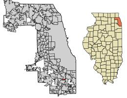
 Location of East Hazel Crest in Cook County, Illinois. | |
 Location of Illinois in the United States | |
| Coordinates: 41°34′35″N 87°39′8″W / 41.57639°N 87.65222°W | |
| Country | |
| State | Illinois |
| County | Cook |
| Township | Thornton |
| Incorporated | 1928 |
| Government | |
| • Type | Mayor-council |
| • Village president | Thomas A. Brown |
| Area | |
| • Total | 0.78 sq mi (2.03 km2) |
| • Land | 0.78 sq mi (2.03 km2) |
| • Water | 0.00 sq mi (0.00 km2) |
| Elevation | 620 ft (190 m) |
| Population (2010) | |
| • Total | 1,543 |
| • Estimate (2019)[2] | 1,497 |
| • Density | 1,909.44/sq mi (736.97/km2) |
| Time zone | UTC-6 (CST) |
| • Summer (DST) | UTC-5 (CDT) |
| ZIP Code(s) | 60429 |
| Area code | 708 |
| FIPS code | 17-21904 |
| FIPS code | 17-21904 |
| GNIS ID | 2398777 |
| Wikimedia Commons | East Hazel Crest, Illinois |
| Website | easthazelcrest |
| Demographics (2010)[3] | |||
|---|---|---|---|
| White | Black | Asian | |
| 36.1% | 53.4% | 0.52% | |
| Islander | Native | Other | Hispanic (any race) |
| 0.06% | 0.45% | 7.7% | 13.4% |
East Hazel Crest is a village in Cook County, Illinois, in the United States. It is a south suburb of Chicago. As of the 2010 census, the village population was 1,543.[4]
History
East Hazel Crest was a part of Hazel Crest when it incorporated in 1911 until the Illinois Central Railroad elevated their commuter and mainline tracks above grade, isolating the rural community from the rest of Hazel Crest. The community voted for incorporation into their own village in 1918.[5] The village later annexed a small commercial area and residential subdivision, Bremerton Woods, that lies west of the Illinois Central Railroad where the village administration and Metra station now stand.
Geography
East Hazel Crest is located at 41°34′35″N 87°39′8″W / 41.57639°N 87.65222°W (41.576384, -87.652171).[6]
According to the 2010 census, East Hazel Crest has a total area of 0.78 square miles (2.02 km2), all land.[7]
Demographics
| Census | Pop. | Note | %± |
|---|---|---|---|
| 1920 | 394 | — | |
| 1930 | 686 | 74.1% | |
| 1940 | 754 | 9.9% | |
| 1950 | 1,066 | 41.4% | |
| 1960 | 1,457 | 36.7% | |
| 1970 | 1,885 | 29.4% | |
| 1980 | 1,362 | −27.7% | |
| 1990 | 1,570 | 15.3% | |
| 2000 | 1,607 | 2.4% | |
| 2010 | 1,543 | −4.0% | |
| 2019 (est.) | 1,497 | [2] | −3.0% |
| U.S. Decennial Census[8] | |||
At the 2010 census, there were 1,543 people, 584 households, and 395 families living in the village. There were 633 housing units. The racial makeup of the village was 36.1% White, 53.4% African American, 0.62% Asian, 2.80% from other races, and 2.99% from two or more races. Hispanic or Latino of any race were 7.22% of the population.
At the 2000 census there were 1,607 people, 590 households, and 424 families living in the village. The population density was 2,094.6 people per square mile (805.8/km2). There were 623 housing units at an average density of 812.0 per square mile (312.4/km2). The racial makeup of the village was 56.25% White, 37.34% African American, 0.5% Asian, 7.7% from other races, and 1.7% from two or more races. Hispanic or Latino of any race were 13.4%.[9]
Of the 590 households 35.6% had children under the age of 18 living with them, 45.4% were married couples living together, 20.5% had a female householder with no husband present, and 28.0% were non-families. 24.2% of households were one person and 7.8% were one person aged 65 or older. The average household size was 2.62 and the average family size was 3.09.
The age distribution was 25.8% under the age of 18, 8.4% from 18 to 24, 29.9% from 25 to 44, 25.9% from 45 to 64, and 10.0% 65 or older. The median age was 36 years. For every 100 females, there were 88.8 males. For every 100 females age 18 and over, there were 85.1 males.
The median household income was $43,000 and the median family income was $50,625. Males had a median income of $36,842 versus $29,722 for females. The per capita income for the village was $18,488. About 6.7% of families and 8.7% of the population were below the poverty line, including 15.3% of those under age 18 and none of those age 65 or over.
Government
East Hazel Crest is in Illinois' 2nd congressional district.
References
- ^ "2019 U.S. Gazetteer Files". United States Census Bureau. Retrieved July 14, 2020.
- ^ a b "Population and Housing Unit Estimates". United States Census Bureau. May 24, 2020. Retrieved May 27, 2020.
- ^ "CensusViewer".
- ^ "Profile of General Population and Housing Characteristics: 2010 Demographic Profile Data (DP-1): East Hazel Crest village, Illinois". U.S. Census Bureau, American Factfinder. Archived from the original on February 10, 2020. Retrieved March 6, 2013.
- ^ "East Hazel Crest, Illinois". Encyclopedia of Chicago. Retrieved 2019-11-04.
- ^ "US Gazetteer files: 2010, 2000, and 1990". United States Census Bureau. 2011-02-12. Retrieved 2011-04-23.
- ^ "G001 - Geographic Identifiers - 2010 Census Summary File 1". United States Census Bureau. Archived from the original on 2020-02-13. Retrieved 2015-08-03.
- ^ "Census of Population and Housing". Census.gov. Retrieved June 4, 2015.
- ^ "U.S. Census website". United States Census Bureau. Retrieved 2008-01-31.

