
Morgan Hill, California: Difference between revisions
shorten |
Recollected (talk | contribs) Updated top employers; MHUSD is top employer but exact employee count wasn't released, corrections per WP:Linking, Script-assisted fixes per CS1 and Template:Citation |
||
| Line 19: | Line 19: | ||
|image_map = Santa_Clara_County_California_Incorporated_and_Unincorporated_areas_Morgan_Hill_Highlighted.svg |
|image_map = Santa_Clara_County_California_Incorporated_and_Unincorporated_areas_Morgan_Hill_Highlighted.svg |
||
|mapsize = 250x200px |
|mapsize = 250x200px |
||
|map_caption = Location in [[Santa Clara County, California|Santa Clara County]] and the state of |
|map_caption = Location in [[Santa Clara County, California|Santa Clara County]] and the state of California |
||
|image_map1 = |
|image_map1 = |
||
|mapsize1 = |
|mapsize1 = |
||
| Line 32: | Line 32: | ||
<!-- Location ------------------> |
<!-- Location ------------------> |
||
|coordinates_region = US-CA |
|coordinates_region = US-CA |
||
|subdivision_type = |
|subdivision_type = Country |
||
|subdivision_name = {{nowrap|{{flag|United States}}}} |
|subdivision_name = {{nowrap|{{flag|United States}}}} |
||
|subdivision_type1 = |
|subdivision_type1 = State |
||
|subdivision_name1 = {{flag|California}} |
|subdivision_name1 = {{flag|California}} |
||
|subdivision_type2 = [[List of counties in California|County]] |
|subdivision_type2 = [[List of counties in California|County]] |
||
| Line 41: | Line 41: | ||
|government_footnotes = |
|government_footnotes = |
||
|government_type = |
|government_type = |
||
|leader_title = |
|leader_title = Mayor |
||
|leader_name = Steve Tate<ref>{{Cite web |
|leader_name = Steve Tate<ref>{{Cite web |
||
| url = http://www.morgan-hill.ca.gov/index.aspx?NID=147 |
| url = http://www.morgan-hill.ca.gov/index.aspx?NID=147 |
||
| Line 77: | Line 77: | ||
<!-- Population -----------> |
<!-- Population -----------> |
||
|population_as_of = [[2010 United States Census|April 1, 2010]] |
|population_as_of = [[2010 United States Census|April 1, 2010]] |
||
|population_footnotes = <ref name="GR2">{{cite web|url=http://factfinder2.census.gov|publisher=[[United States Census Bureau]]|accessdate= |
|population_footnotes = <ref name="GR2">{{cite web|url=http://factfinder2.census.gov|publisher=[[United States Census Bureau]]|accessdate=January 31, 2008|title=American FactFinder}}</ref> |
||
|population_total = 37,882 |
|population_total = 37,882 |
||
|pop_est_as_of = 2013 |
|pop_est_as_of = 2013 |
||
| Line 108: | Line 108: | ||
}} |
}} |
||
'''Morgan Hill''' ({{IPAc-en|ˈ|m|ɔr|ɡ|ɨ|n|_|ˈ|h|ɪ|l}}) is a city in [[Santa Clara County, California|Santa Clara County]], |
'''Morgan Hill''' ({{IPAc-en|ˈ|m|ɔr|ɡ|ɨ|n|_|ˈ|h|ɪ|l}}) is a city in [[Santa Clara County, California|Santa Clara County]], California. The city is located in the southernmost portion of [[Silicon Valley]]. |
||
With origins back to the [[Ranchos of California|Rancho period of California]], the area initially started as the seat of the ''[[Rancho Ojo del Agua de la Coche]]'', of the wealthy [[Californio]] family, the Murphys. The land eventually made it into the hands of Hiram Morgan Hill, who established his country home in the area and gave his name to the land. The settlement, which grew from Hill's ranch, was incorporated in 1906. |
With origins back to the [[Ranchos of California|Rancho period of California]], the area initially started as the seat of the ''[[Rancho Ojo del Agua de la Coche]]'', of the wealthy [[Californio]] family, the Murphys. The land eventually made it into the hands of Hiram Morgan Hill, who established his country home in the area and gave his name to the land. The settlement, which grew from Hill's ranch, was incorporated in 1906. |
||
| Line 119: | Line 119: | ||
==History== |
==History== |
||
[[File:Morgan Hill 19th century.png|thumb|left|The city's main thoroughfare, Monterey Street, during the late 19th century.]] |
[[File:Morgan Hill 19th century.png|thumb|left|The city's main thoroughfare, Monterey Street, during the late 19th century.]] |
||
Prior to the arrival of Spanish colonists, the area of the Santa Clara Valley had been inhabited by the [[Ohlone people]], for more than 6,000 years. In the area of what is now Morgan Hill, a sub-sect of the Ohlone, called the Matalan Tribe, lived in a [[hunter-gatherer]] society.<ref name=Circa>{{cite web|url=http://www.morgan-hill.ca.gov/18308AC0-B406-4983-BD20-39E8A17EDE91/FinalDownload/DownloadId-99189A788823D45F5D2753B95A966CC5/18308AC0-B406-4983-BD20-39E8A17EDE91/DocumentCenter/Home/View/2607 |title= Circa: Historic Property Development - Historic Context Statement for the City of Morgan Hill |accessdate= |
Prior to the arrival of Spanish colonists, the area of the Santa Clara Valley had been inhabited by the [[Ohlone people]], for more than 6,000 years. In the area of what is now Morgan Hill, a sub-sect of the Ohlone, called the Matalan Tribe, lived in a [[hunter-gatherer]] society.<ref name=Circa>{{cite web|url=http://www.morgan-hill.ca.gov/18308AC0-B406-4983-BD20-39E8A17EDE91/FinalDownload/DownloadId-99189A788823D45F5D2753B95A966CC5/18308AC0-B406-4983-BD20-39E8A17EDE91/DocumentCenter/Home/View/2607 |title= Circa: Historic Property Development - Historic Context Statement for the City of Morgan Hill |accessdate=October 14, 2013 }}</ref> |
||
Spanish colonial governance, under the [[Alta California]] province of the [[New Spain|Viceroyalty of New Spain]], was established over the Morgan Hill area in 1778, when a land grant encompassing the Morgan Hill area and surrounding areas was authorized by the Spanish colonial government. Previous to official colonization, the 1772 Spanish expedition, led by [[Pedro Fages|Pedro Fages, Military Lt. Governor of Alta California]] and Father [[Juan Crespí]], camped in what is now Morgan Hill, at a part of [[Llagas Creek]]. The location of their camp subsequently became a popular campsite for Spanish soldiers on their way from New Spain to Alta California. With the founding of [[Mission Santa Clara de Asís]], in 1777, the lands of present-day Morgan Hill were granted to the [[Catholic Church|Roman Catholic Church]].<ref name=Circa/> |
Spanish colonial governance, under the [[Alta California]] province of the [[New Spain|Viceroyalty of New Spain]], was established over the Morgan Hill area in 1778, when a land grant encompassing the Morgan Hill area and surrounding areas was authorized by the Spanish colonial government. Previous to official colonization, the 1772 Spanish expedition, led by [[Pedro Fages|Pedro Fages, Military Lt. Governor of Alta California]] and Father [[Juan Crespí]], camped in what is now Morgan Hill, at a part of [[Llagas Creek]]. The location of their camp subsequently became a popular campsite for Spanish soldiers on their way from New Spain to Alta California. With the founding of [[Mission Santa Clara de Asís]], in 1777, the lands of present-day Morgan Hill were granted to the [[Catholic Church|Roman Catholic Church]].<ref name=Circa/> |
||
| Line 128: | Line 128: | ||
In 1846, the area of Morgan Hill became a part of the independent [[California Republic]] and subsequently a part of the United States, under the State of California. In 1850, Martin Murphy, Sr.'s youngest son, Daniel Murphy, married Maria Fisher, heiress of the neighboring {{Convert|19000|acre|ha|adj=on}} ''Rancho Laguna Seca'', thus combining the two estates. In 1853, Martin Murphy, Sr.'s father, Bernard Murphy, died leaving the majority of the estate to Martin Murphy, Sr., but a substantial portion to a Martin Murphy, Sr.'s mother, Catherine, who then married James Dunne. By 1870, the Murphy family had acquired around {{Convert|70000|acre|ha}} of the Morgan Hill and surrounding area.<ref name=Circa/> In the history of Morgan Hill, the Murphy, Dunne, and Hill families are of the most prominent significance. |
In 1846, the area of Morgan Hill became a part of the independent [[California Republic]] and subsequently a part of the United States, under the State of California. In 1850, Martin Murphy, Sr.'s youngest son, Daniel Murphy, married Maria Fisher, heiress of the neighboring {{Convert|19000|acre|ha|adj=on}} ''Rancho Laguna Seca'', thus combining the two estates. In 1853, Martin Murphy, Sr.'s father, Bernard Murphy, died leaving the majority of the estate to Martin Murphy, Sr., but a substantial portion to a Martin Murphy, Sr.'s mother, Catherine, who then married James Dunne. By 1870, the Murphy family had acquired around {{Convert|70000|acre|ha}} of the Morgan Hill and surrounding area.<ref name=Circa/> In the history of Morgan Hill, the Murphy, Dunne, and Hill families are of the most prominent significance. |
||
In 1882, Daniel and Maria Murphy's favorite daughter, Diana Murphy, fell in love with [[Missouri]] businessman Hiram Morgan Hill. They married in secret, on account of his being a [[Quakers|Quaker]] and her being from a prominent Roman Catholic family. When Daniel Murphy died, Diana and Hiram Morgan Hill inherited the {{Convert|4500|acre|ha}} surrounding the original Murphy estate, near Murphy's Peak (now known as El Toro). In 1884, the Hills built their weekend estate, as the family primarily lived in |
In 1882, Daniel and Maria Murphy's favorite daughter, Diana Murphy, fell in love with [[Missouri]] businessman Hiram Morgan Hill. They married in secret, on account of his being a [[Quakers|Quaker]] and her being from a prominent Roman Catholic family. When Daniel Murphy died, Diana and Hiram Morgan Hill inherited the {{Convert|4500|acre|ha}} surrounding the original Murphy estate, near Murphy's Peak (now known as El Toro). In 1884, the Hills built their weekend estate, as the family primarily lived in San Francisco and in [[Nevada]], dubbed Villa Mira-Monte (Italian for Mountain-View Estate).<ref>[http://www.morganhillhistoricalsociety.org/morgan-hill-house.html Morgan Hill Historical Society - Villa Mira Monte]</ref> |
||
[[File:Morgan Hill School - 1930´s.jpg|thumb|left|Students [[Bellamy salute|saluting the flag]] at the Morgan Hill Elementary School in the 1930s.]] |
[[File:Morgan Hill School - 1930´s.jpg|thumb|left|Students [[Bellamy salute|saluting the flag]] at the Morgan Hill Elementary School in the 1930s.]] |
||
By 1886, the family chose to live primarily at the Ojo del Agua estate, as they jointly inherited {{Convert|22000|acre|ha}} around the estate. However, the move was temporary, as scandal caused by the marital complications of Hiram Morgan Hill's sister, Sarah Althea Hill, and her husband, Senator [[William Sharon]], made the Hills a source of social ridicule, thus causing them to start spending the majority of their time between San Francisco and |
By 1886, the family chose to live primarily at the Ojo del Agua estate, as they jointly inherited {{Convert|22000|acre|ha}} around the estate. However, the move was temporary, as scandal caused by the marital complications of Hiram Morgan Hill's sister, Sarah Althea Hill, and her husband, Senator [[William Sharon]], made the Hills a source of social ridicule, thus causing them to start spending the majority of their time between San Francisco and Washington, D.C., thus leaving their Ojo del Agua estate untouched for long periods of time.<ref name=Circa/> |
||
In 1892, Hiram Morgan Hill contracted land developer [[Rancho Santa Ysabel (Arce)#Chauncey Hatch Phillips|C. H. Phillips]] to divide and liquidate the Ojo del Agua estate, only retaining the Villa Mira Monte estate and the surrounding {{Convert|200|acre|ha}}, which the Hill family would hold until 1916. By 1898, a significant community had built around what was then known as ''Morgan Hill's Ranch'', and a [[Southern Pacific Transportation Company|Southern Pacific Railroad]] station was built in the Huntington area. Rather than ask to stop at Huntington station, passengers would ask to stop at "Morgan Hill's Ranch", which eventually shortened to "Morgan Hill".<ref name=Circa/> |
In 1892, Hiram Morgan Hill contracted land developer [[Rancho Santa Ysabel (Arce)#Chauncey Hatch Phillips|C. H. Phillips]] to divide and liquidate the Ojo del Agua estate, only retaining the Villa Mira Monte estate and the surrounding {{Convert|200|acre|ha}}, which the Hill family would hold until 1916. By 1898, a significant community had built around what was then known as ''Morgan Hill's Ranch'', and a [[Southern Pacific Transportation Company|Southern Pacific Railroad]] station was built in the Huntington area. Rather than ask to stop at Huntington station, passengers would ask to stop at "Morgan Hill's Ranch", which eventually shortened to "Morgan Hill".<ref name=Circa/> |
||
On |
On November 10, 1906, the planned community, a result of the divisions of C. H. Phillips, was incorporated as the Town of Morgan Hill. Hiram Morgan and Diana Hill's only child, Diana Murphy Hill, married the French nobleman, Baron Hadouin de Reinach-Werth, and thus Baron Hadouin started to help manage Hiram Morgan Hill's properties between California and Nevada. However, the baron was called back to France to serve in the military and never returned. In 1913, Hiram Morgan Hill died at his [[Elko, Nevada|Elko estate in Nevada]], thus leaving his properties to his daughter. Diana Murphy Hill later remarried, in 1916, to Sir George Rhodes, thus causing the Murphy heiress of the Morgan Hill estate to relocate to the United Kingdom, taking her and Hiram Morgan Hill's daughter, Diana Murphy Hill, thus finally selling off the Villa Mira Monte and ending the Hill family presence in the community named after them.<ref name=Circa/> |
||
==Geography== |
==Geography== |
||
| Line 143: | Line 143: | ||
According to the [[United States Census Bureau|U.S. Census Bureau]], the city encompasses an area of {{convert|12.9|sqmi|km2}}, all land. Although there are no natural lakes or ponds within the city limits, there are several flood-control and water storage reservoirs in the adjacent hills which are operated by the [[Santa Clara Valley Water District]], with recreational activities such as boating, etc., administered by the Santa Clara County Department of Parks and Recreation.<ref>Morgan Hill does not have [[water right]]s to the nearby reservoirs; the city's water supply consists of a number of deep wells and aboveground steel storage tanks. Streams in the vicinity are small and seasonal, unable to supply the city's water needs.</ref> |
According to the [[United States Census Bureau|U.S. Census Bureau]], the city encompasses an area of {{convert|12.9|sqmi|km2}}, all land. Although there are no natural lakes or ponds within the city limits, there are several flood-control and water storage reservoirs in the adjacent hills which are operated by the [[Santa Clara Valley Water District]], with recreational activities such as boating, etc., administered by the Santa Clara County Department of Parks and Recreation.<ref>Morgan Hill does not have [[water right]]s to the nearby reservoirs; the city's water supply consists of a number of deep wells and aboveground steel storage tanks. Streams in the vicinity are small and seasonal, unable to supply the city's water needs.</ref> |
||
Morgan Hill is located within the seismically active [[San Francisco Bay Area|San Francisco Bay region]]. The significant |
Morgan Hill is located within the seismically active [[San Francisco Bay Area|San Francisco Bay region]]. The significant earthquakes in the region are generally associated with crustal movements along well-defined, active fault zones. The nearest known active faults are the [[San Andreas Fault]], approximately {{convert|19|km|mi|abbr=on}} southwest, and the [[Calaveras Fault]], approximately {{convert|1.6|km|mi|abbr=on}} northeast. Both faults have produced major earthquakes in the past, and have estimated maximum credible [[Richter magnitude scale|Richter magnitudes]] of 8.3 and 7.3 respectively. |
||
The Sargent-Berrocal Fault, a potentially active fault, lies {{convert|16|km|mi|abbr=on}} away from the sites and has an estimated maximum credible Richter magnitude of 7.4. The Coyote Creek Fault is located in Morgan Hill and is classified as potentially active as well. In addition, several unnamed faults traverse the western slopes of the upland areas. Geomorphic evidence suggests that these faults were active during recent geologic time. However, these fault-related geomorphic features are not as fresh as those of the active Calaveras Fault and are considered to be somewhat older.<ref>''Jackson Meadows Expanded Initial Study'', Earth Metrics Inc., San Mateo, Calif., prepared for the city of Morgan Hill, October 16, 1989</ref> |
The Sargent-Berrocal Fault, a potentially active fault, lies {{convert|16|km|mi|abbr=on}} away from the sites and has an estimated maximum credible Richter magnitude of 7.4. The Coyote Creek Fault is located in Morgan Hill and is classified as potentially active as well. In addition, several unnamed faults traverse the western slopes of the upland areas. Geomorphic evidence suggests that these faults were active during recent geologic time. However, these fault-related geomorphic features are not as fresh as those of the active Calaveras Fault and are considered to be somewhat older.<ref>''Jackson Meadows Expanded Initial Study'', Earth Metrics Inc., San Mateo, Calif., prepared for the city of Morgan Hill, October 16, 1989</ref> |
||
| Line 152: | Line 152: | ||
== Climate == |
== Climate == |
||
Due to the moderating influence of the |
Due to the moderating influence of the Pacific Ocean, Morgan Hill enjoys a mild, [[Mediterranean climate]]. Temperatures range from an average midsummer maximum of 32.3[[Celsius|°C]] (90.2[[Fahrenheit|°F]]) to an average midwinter low of 0.9 °C (33.6 °F). Average annual precipitation is 480 mm (18.9 in), and the summer months are typically dry. Snowfall is rare, about once every 20 years, and is light and short-lived when it occurs. Summer months are characterized by coastal fog which arrives from the ocean around 10 p.m. and dissipates the next morning by 10 a.m. Winter months have many sunny and partly cloudy days, with frequent breaks between rainstorms. The local terrain is inconducive to [[tornado]]es, severe windstorms and thunderstorms. The local climate supports [[chaparral]] and grassland [[biome]]s, with stands of [[live oak]] at higher elevations. |
||
== Demographics == |
== Demographics == |
||
| Line 175: | Line 175: | ||
===2000=== |
===2000=== |
||
The [[2000 United States Census|2000 U.S. Census]]<ref name="GR2" /> reported there were 33,556 people, 10,846 households, and 8,633 families residing in the city. The |
The [[2000 United States Census|2000 U.S. Census]]<ref name="GR2" /> reported there were 33,556 people, 10,846 households, and 8,633 families residing in the city. The population density was 2,875.4 people per square mile (1,110.2/km<sup>2</sup>). There were 11,091 housing units at an average density of 950.3/sq mi (366.9/km<sup>2</sup>). The ethnic makeup of the city was 72.40% [[Race and ethnicity in the United States Census|White]], 1.71% [[Race and ethnicity in the United States Census|African American]], 1.08% [[Race and ethnicity in the United States Census|Native American]], 6.02% [[Race and ethnicity in the United States Census|Asian]], 0.23% [[Race and ethnicity in the United States Census|Pacific Islander]], 13.43% from [[Race and ethnicity in the United States Census|other races]], and 5.13% from two or more races. [[Race and ethnicity in the United States Census|Hispanic]] or [[Race and ethnicity in the United States Census|Latino]] of any race were 27.50% of the population. |
||
There were 10,846 households out of which 44.0% had children under the age of 18 living with them, 63.2% were |
There were 10,846 households out of which 44.0% had children under the age of 18 living with them, 63.2% were married couples living together, 11.1% had a female householder with no husband present, and 20.4% were non-families. 15.1% of all households were made up of individuals and 5.5% had someone living alone who was 65 years of age or older. The average household size was 3.05 and the average family size was 3.38. |
||
In the city the population was spread out with 30.5% under the age of 18, 7.6% from 18 to 24, 31.7% from 25 to 44, 22.7% from 45 to 64, and 7.5% who were 65 years of age or older. The median age was 34 years. For every 100 females there were 98.5 males. For every 100 females age 18 and over, there were 94.9 males. |
In the city the population was spread out with 30.5% under the age of 18, 7.6% from 18 to 24, 31.7% from 25 to 44, 22.7% from 45 to 64, and 7.5% who were 65 years of age or older. The median age was 34 years. For every 100 females there were 98.5 males. For every 100 females age 18 and over, there were 94.9 males. |
||
According to a 2007 estimate, the median income for a household in the city was $99,243, and the median income for a family was $108,611.<ref>{{Cite web | title=Morgan Hill city, California — Fact Sheet — American FactFinder — U.S. Census Bureau | url=http://factfinder.census.gov/servlet/ACSSAFFFacts?_event=Search&geo_id=16000US0649138&_geoContext=01000US%7C04000US06%7C16000US0649138&_street=&_county=morgan+hill&_cityTown=morgan+hill&_state=04000US06&_zip=&_lang=en&_sse=on&ActiveGeoDiv=geoSelect&_useEV=&pctxt=fph&pgsl=160&_submenuId=factsheet_1&ds_name=ACS_2007_3YR_SAFF&_ci_nbr=null&qr_name=null®=null%3Anull&_keyword=&_industry=}}</ref> Males had a median income of $61,999 versus $42,003 for females. The |
According to a 2007 estimate, the median income for a household in the city was $99,243, and the median income for a family was $108,611.<ref>{{Cite web | title=Morgan Hill city, California — Fact Sheet — American FactFinder — U.S. Census Bureau | url=http://factfinder.census.gov/servlet/ACSSAFFFacts?_event=Search&geo_id=16000US0649138&_geoContext=01000US%7C04000US06%7C16000US0649138&_street=&_county=morgan+hill&_cityTown=morgan+hill&_state=04000US06&_zip=&_lang=en&_sse=on&ActiveGeoDiv=geoSelect&_useEV=&pctxt=fph&pgsl=160&_submenuId=factsheet_1&ds_name=ACS_2007_3YR_SAFF&_ci_nbr=null&qr_name=null®=null%3Anull&_keyword=&_industry=}}</ref> Males had a median income of $61,999 versus $42,003 for females. The per capita income for the city was $33,047. About 3.3% of families and 4.7% of the population were below the [[poverty threshold]], including 5.4% of those under age 18 and 4.9% of those age 65 or over. |
||
Substantial expansion of the population of Morgan Hill occurred from the late 1980s onward. This population expansion was enabled by the removal of a growth constraint in the form of [[sewage treatment]] capacity.<ref>''Environmental Impact Report for the Long Term Wastewater Management Plan, Cities of Gilroy and Morgan Hill'', Earth Metrics, Inc. 1986, prepared for cities of Gilroy and Morgan Hill and State of California Environmental Clearinghouse</ref> |
Substantial expansion of the population of Morgan Hill occurred from the late 1980s onward. This population expansion was enabled by the removal of a growth constraint in the form of [[sewage treatment]] capacity.<ref>''Environmental Impact Report for the Long Term Wastewater Management Plan, Cities of Gilroy and Morgan Hill'', Earth Metrics, Inc. 1986, prepared for cities of Gilroy and Morgan Hill and State of California Environmental Clearinghouse</ref> |
||
===2010=== |
===2010=== |
||
The [[2010 United States Census|2010 U.S. Census]]<ref>{{cite web|url=http://www.census.gov/2010census/popmap/ipmtext.php?fl=06:0649278|title=2010 Census Interactive Population Search: CA - Morgan Hill city|publisher=U.S. Census Bureau|accessdate=July 12, 2014}}</ref> reported that Morgan Hill had a population of 37,882. The |
The [[2010 United States Census|2010 U.S. Census]]<ref>{{cite web|url=http://www.census.gov/2010census/popmap/ipmtext.php?fl=06:0649278|title=2010 Census Interactive Population Search: CA - Morgan Hill city|publisher=U.S. Census Bureau|accessdate=July 12, 2014}}</ref> reported that Morgan Hill had a population of 37,882. The population density was 2,940.8 people per square mile (1,135.4/km²). The ethnic makeup of Morgan Hill was 24,713 (65.2%) [[Race and ethnicity in the United States Census|White]], 746 (2.0%) [[Race and ethnicity in the United States Census|African American]], 335 (0.9%) [[Race and ethnicity in the United States Census|Native American]], 3,852 (10.2%) [[Race and ethnicity in the United States Census|Asian]], 125 (0.3%) [[Race and ethnicity in the United States Census|Pacific Islander]], 5,779 (15.3%) from [[Race and ethnicity in the United States Census|other races]], and 2,332 (6.2%) from two or more races. [[Race and ethnicity in the United States Census|Hispanic]] or [[Race and ethnicity in the United States Census|Latino]] of any race were 12,863 persons (34.0%). |
||
The Census reported that 37,496 people (99.0% of the population) lived in households, 164 (0.4%) lived in non-institutionalized group quarters, and 222 (0.6%) were institutionalized. |
The Census reported that 37,496 people (99.0% of the population) lived in households, 164 (0.4%) lived in non-institutionalized group quarters, and 222 (0.6%) were institutionalized. |
||
| Line 227: | Line 227: | ||
===Top employers=== |
===Top employers=== |
||
According to the City's |
According to the City's 2016 Comprehensive Annual Financial Report,<ref>[http://www.morganhill.ca.gov/DocumentCenter/Home/View/6472 City of Morgan Hill CAFR]</ref> the top employers in the city are: |
||
{| class="wikitable sortable" border="1" |
{| class="wikitable sortable" border="1" |
||
| Line 237: | Line 237: | ||
|1 |
|1 |
||
|[[Morgan Hill Unified School District]] |
|[[Morgan Hill Unified School District]] |
||
|{{n/a}} |
|||
|746 |
|||
|- |
|- |
||
|2 |
|2 |
||
|[[Anritsu]] |
|[[Anritsu]] |
||
| |
|529 |
||
|- |
|- |
||
|3 |
|3 |
||
| ⚫ | |||
| ⚫ | |||
| |
|400 |
||
|- |
|- |
||
|4 |
|4 |
||
| ⚫ | |||
| ⚫ | |||
| |
|357 |
||
|- |
|- |
||
|5 |
|5 |
||
|Paramit |
|Paramit |
||
| |
|310 |
||
|- |
|- |
||
|6 |
|6 |
||
|Lusamerica Foods |
|||
|[[Safeway Inc.|Safeway]] |
|||
| |
|240 |
||
|- |
|- |
||
|7 |
|7 |
||
|[[ |
|[[Safeway Inc.|Safeway]] |
||
| |
|240 |
||
|- |
|- |
||
|8 |
|8 |
||
| ⚫ | |||
| ⚫ | |||
| |
|193 |
||
|- |
|- |
||
|9 |
|9 |
||
| |
|Del Monaco Foods |
||
| |
|161 |
||
|- |
|- |
||
|10 |
|10 |
||
|Young's Market |
|||
|[[Infineon Technologies]] |
|||
| |
|159 |
||
|- |
|- |
||
|11 |
|11 |
||
|[[ |
|[[The Home Depot]] |
||
| |
|147 |
||
|- |
|- |
||
|12 |
|12 |
||
|TenCate Advanced Composites |
|||
| ⚫ | |||
| |
|141 |
||
|- |
|- |
||
|13 |
|13 |
||
| ⚫ | |||
|[[Target Corporation|Target]] |
|||
| |
|140 |
||
|- |
|- |
||
|} |
|} |
||
| Line 323: | Line 323: | ||
==== Public transportation ==== |
==== Public transportation ==== |
||
* The [[Santa Clara Valley Transportation Authority]] provides local buses and express buses to [[Gilroy, California|Gilroy]], [[San Martin, California|San Martin]], [[San Jose, California|San Jose]], [[Santa Clara, California|Santa Clara]], and [[Sunnyvale, California|Sunnyvale]].<ref>{{cite web |url=http://www.vta.org/schedules/pdf/bus_rail_map_h.pdf |accessdate= |
* The [[Santa Clara Valley Transportation Authority]] provides local buses and express buses to [[Gilroy, California|Gilroy]], [[San Martin, California|San Martin]], [[San Jose, California|San Jose]], [[Santa Clara, California|Santa Clara]], and [[Sunnyvale, California|Sunnyvale]].<ref>{{cite web |url=http://www.vta.org/schedules/pdf/bus_rail_map_h.pdf |accessdate=February 17, 2008 |publisher=Santa Clara Valley Transportation Authority |title=Gilroy and Morgan Hill Service}}</ref> |
||
* [[Caltrain]] provides weekday [[rush hour|rush-hour]] [[commuter rail]] service to the Santa Clara Valley, the [[San Francisco Peninsula]] and |
* [[Caltrain]] provides weekday [[rush hour|rush-hour]] [[commuter rail]] service to the Santa Clara Valley, the [[San Francisco Peninsula]] and San Francisco from the [[Morgan Hill (Caltrain station)|Morgan Hill station]].<ref>{{cite web |url=http://caltrain.com/timetable.html |accessdate=February 17, 2008 |publisher=Caltrain |title=Caltrain timetable effective April 2, 2007}}</ref> |
||
* [[Monterey-Salinas Transit]] runs a rush-hour San Jose-[[Monterey, California|Monterey]] express bus, Line 55, that also serves as an [[Amtrak Thruway Motorcoach]] connection.<ref>{{cite web |url=http://www.mst.org/routes/55/index.htm |accessdate= |
* [[Monterey-Salinas Transit]] runs a rush-hour San Jose-[[Monterey, California|Monterey]] express bus, Line 55, that also serves as an [[Amtrak Thruway Motorcoach]] connection.<ref>{{cite web |url=http://www.mst.org/routes/55/index.htm |accessdate=February 17, 2008 |publisher=Monterey-Salinas Transit |title=Line 55 Monterey - San Jose Express}}</ref> |
||
=== Utilities === |
=== Utilities === |
||
| Line 342: | Line 342: | ||
===Public libraries=== |
===Public libraries=== |
||
[[Santa Clara County Library]] operates the Morgan Hill Library.<ref>"[http://www.santaclaracountylib.org/morganhill/ Welcome to the Morgan Hill Library]." [[Santa Clara County Library]]. Retrieved |
[[Santa Clara County Library]] operates the Morgan Hill Library.<ref>"[http://www.santaclaracountylib.org/morganhill/ Welcome to the Morgan Hill Library]." [[Santa Clara County Library]]. Retrieved March 27, 2010.</ref> |
||
== Sister cities == |
== Sister cities == |
||
Revision as of 18:04, 3 April 2016
Morgan Hill | |
|---|---|
| City of Morgan Hill | |
 El Toro in August 2007 | |
 Flag | |
| Nickname: Mushroom Capital of the World | |
 Location in Santa Clara County and the state of California | |
| Country | |
| State | |
| County | |
| Incorporated | November 10, 1906[1] |
| Government | |
| • Mayor | Steve Tate[2] |
| • City manager | Steve Rymer[3] |
| Area | |
| • Total | 12.882 sq mi (33.363 km2) |
| • Land | 12.882 sq mi (33.363 km2) |
| • Water | 0 sq mi (0 km2) 0% |
| Elevation | 350 ft (107 m) |
| Population | |
| • Total | 37,882 |
| • Estimate (2013)[7] | 40,836 |
| • Density | 2,900/sq mi (1,100/km2) |
| Time zone | UTC-8 (Pacific) |
| • Summer (DST) | UTC-7 (PDT) |
| ZIP codes | 95037-95038 |
| Area code(s) | 408/669 |
| FIPS code | 06-49278 |
| GNIS feature ID | 1659174 |
| Website | www |
Morgan Hill (/ˈmɔːrɡ[invalid input: 'ɨ']n ˈhɪl/) is a city in Santa Clara County, California. The city is located in the southernmost portion of Silicon Valley.
With origins back to the Rancho period of California, the area initially started as the seat of the Rancho Ojo del Agua de la Coche, of the wealthy Californio family, the Murphys. The land eventually made it into the hands of Hiram Morgan Hill, who established his country home in the area and gave his name to the land. The settlement, which grew from Hill's ranch, was incorporated in 1906.
Originally a community of ranchers, farmers, and orchardists, the city has evolved into a bedroom community for the high tech industries in Silicon Valley, as well as the seat for several high tech companies.
Name
Morgan Hill is named after an early landowner, Hiram Morgan Hill. The name is often erroneously thought to be the name of the prominent hill on the west side of the valley, which is actually named El Toro. Prior to the city's founding, the area was known as Rancho Ojo del Agua de la Coche, during the time when the Murphy family owned all the land in the area. When the land came in to Hiram Morgan Hill's possession, it became known as "Morgan Hill's Ranch", which was eventually shortened to "Morgan Hill".[8]
History

Prior to the arrival of Spanish colonists, the area of the Santa Clara Valley had been inhabited by the Ohlone people, for more than 6,000 years. In the area of what is now Morgan Hill, a sub-sect of the Ohlone, called the Matalan Tribe, lived in a hunter-gatherer society.[8]
Spanish colonial governance, under the Alta California province of the Viceroyalty of New Spain, was established over the Morgan Hill area in 1778, when a land grant encompassing the Morgan Hill area and surrounding areas was authorized by the Spanish colonial government. Previous to official colonization, the 1772 Spanish expedition, led by Pedro Fages, Military Lt. Governor of Alta California and Father Juan Crespí, camped in what is now Morgan Hill, at a part of Llagas Creek. The location of their camp subsequently became a popular campsite for Spanish soldiers on their way from New Spain to Alta California. With the founding of Mission Santa Clara de Asís, in 1777, the lands of present-day Morgan Hill were granted to the Roman Catholic Church.[8]

In 1821, the Morgan Hill area became part of the First Mexican Empire, when Mexico declared its independence from Spain. With the transfer of sovereignty, the new Mexican re-appropriated all royal and church lands, for the next two decades following independence, to Mexican citizens, and the land encompassing modern-day Morgan Hill was granted to Juan Maria Hernandez, in 1835.[8] In 1845, Martin Murphy, Sr., an Irish-born American pioneer man, acquired the Morgan Hill and surrounding area and named it Rancho Ojo del Agua de la Coche.[9]
In 1846, the area of Morgan Hill became a part of the independent California Republic and subsequently a part of the United States, under the State of California. In 1850, Martin Murphy, Sr.'s youngest son, Daniel Murphy, married Maria Fisher, heiress of the neighboring 19,000-acre (7,700 ha) Rancho Laguna Seca, thus combining the two estates. In 1853, Martin Murphy, Sr.'s father, Bernard Murphy, died leaving the majority of the estate to Martin Murphy, Sr., but a substantial portion to a Martin Murphy, Sr.'s mother, Catherine, who then married James Dunne. By 1870, the Murphy family had acquired around 70,000 acres (28,000 ha) of the Morgan Hill and surrounding area.[8] In the history of Morgan Hill, the Murphy, Dunne, and Hill families are of the most prominent significance.
In 1882, Daniel and Maria Murphy's favorite daughter, Diana Murphy, fell in love with Missouri businessman Hiram Morgan Hill. They married in secret, on account of his being a Quaker and her being from a prominent Roman Catholic family. When Daniel Murphy died, Diana and Hiram Morgan Hill inherited the 4,500 acres (1,800 ha) surrounding the original Murphy estate, near Murphy's Peak (now known as El Toro). In 1884, the Hills built their weekend estate, as the family primarily lived in San Francisco and in Nevada, dubbed Villa Mira-Monte (Italian for Mountain-View Estate).[10]

By 1886, the family chose to live primarily at the Ojo del Agua estate, as they jointly inherited 22,000 acres (8,900 ha) around the estate. However, the move was temporary, as scandal caused by the marital complications of Hiram Morgan Hill's sister, Sarah Althea Hill, and her husband, Senator William Sharon, made the Hills a source of social ridicule, thus causing them to start spending the majority of their time between San Francisco and Washington, D.C., thus leaving their Ojo del Agua estate untouched for long periods of time.[8]
In 1892, Hiram Morgan Hill contracted land developer C. H. Phillips to divide and liquidate the Ojo del Agua estate, only retaining the Villa Mira Monte estate and the surrounding 200 acres (81 ha), which the Hill family would hold until 1916. By 1898, a significant community had built around what was then known as Morgan Hill's Ranch, and a Southern Pacific Railroad station was built in the Huntington area. Rather than ask to stop at Huntington station, passengers would ask to stop at "Morgan Hill's Ranch", which eventually shortened to "Morgan Hill".[8]
On November 10, 1906, the planned community, a result of the divisions of C. H. Phillips, was incorporated as the Town of Morgan Hill. Hiram Morgan and Diana Hill's only child, Diana Murphy Hill, married the French nobleman, Baron Hadouin de Reinach-Werth, and thus Baron Hadouin started to help manage Hiram Morgan Hill's properties between California and Nevada. However, the baron was called back to France to serve in the military and never returned. In 1913, Hiram Morgan Hill died at his Elko estate in Nevada, thus leaving his properties to his daughter. Diana Murphy Hill later remarried, in 1916, to Sir George Rhodes, thus causing the Murphy heiress of the Morgan Hill estate to relocate to the United Kingdom, taking her and Hiram Morgan Hill's daughter, Diana Murphy Hill, thus finally selling off the Villa Mira Monte and ending the Hill family presence in the community named after them.[8]
Geography

Morgan Hill is approximately 39 km (24 mi) south of downtown San Jose, 21 km (13 mi) north of Gilroy, and 24 km (15 mi) inland from the Pacific coast. Lying in a roughly 6 km-wide (4-mi-wide) southern extension of the Santa Clara Valley, it is bounded by the Santa Cruz Mountains to the west and the Diablo Range to the east. At the valley floor, Morgan Hill lies at an elevation of about 107 m (350 ft) above MSL.
According to the U.S. Census Bureau, the city encompasses an area of 12.9 square miles (33 km2), all land. Although there are no natural lakes or ponds within the city limits, there are several flood-control and water storage reservoirs in the adjacent hills which are operated by the Santa Clara Valley Water District, with recreational activities such as boating, etc., administered by the Santa Clara County Department of Parks and Recreation.[11]
Morgan Hill is located within the seismically active San Francisco Bay region. The significant earthquakes in the region are generally associated with crustal movements along well-defined, active fault zones. The nearest known active faults are the San Andreas Fault, approximately 19 km (12 mi) southwest, and the Calaveras Fault, approximately 1.6 km (0.99 mi) northeast. Both faults have produced major earthquakes in the past, and have estimated maximum credible Richter magnitudes of 8.3 and 7.3 respectively.
The Sargent-Berrocal Fault, a potentially active fault, lies 16 km (9.9 mi) away from the sites and has an estimated maximum credible Richter magnitude of 7.4. The Coyote Creek Fault is located in Morgan Hill and is classified as potentially active as well. In addition, several unnamed faults traverse the western slopes of the upland areas. Geomorphic evidence suggests that these faults were active during recent geologic time. However, these fault-related geomorphic features are not as fresh as those of the active Calaveras Fault and are considered to be somewhat older.[12]

Morgan Hill is one of very few sources for a type of semi-precious gemstone marketed under the name "Morgan Hill poppy jasper".[13] According to geologists, this local variety of orbicular jasper formed through a combination of volcanic and seismic activity on the slopes of El Toro. Known extant deposits of the mineral are located on private lands, not accessible to the public. A local business, El Toro Brewing Company, has a collection of poppy jasper on display at their rural Morgan Hill brewery and on a large bar top inlaid with the stone at their brewpub in downtown Morgan Hill. Examples are also on display at the Morgan Hill Museum and at the Morgan Hill Community and Cultural Center.[14] The local Poppy Jasper Film Festival is also named after the mineral.[15]
The highlight of local geography is El Toro. According to a local legend of the early 1900s, author Bret Harte named the hill when he climbed it and discovered two bulls fighting near the summit (they subsequently chased him back down). The official name shown on the U.S. Geological Survey's maps is simply "El Toro", although locals may refer to the hill as "Murphy's Peak". Visitors, not aware of the origin of the town's name, often mistakenly assume that El Toro is "Morgan" Hill. It is USGS Feature ID# 223063 in the Geographic Names Information System (GNIS), maintained by the United States Board on Geographic Names. Elevation at the summit is about 435 m (1427 ft).[16] The iconic hill overshadowing the town to the west, has been incorporated into the city's seal and official logo.
Climate
Due to the moderating influence of the Pacific Ocean, Morgan Hill enjoys a mild, Mediterranean climate. Temperatures range from an average midsummer maximum of 32.3°C (90.2°F) to an average midwinter low of 0.9 °C (33.6 °F). Average annual precipitation is 480 mm (18.9 in), and the summer months are typically dry. Snowfall is rare, about once every 20 years, and is light and short-lived when it occurs. Summer months are characterized by coastal fog which arrives from the ocean around 10 p.m. and dissipates the next morning by 10 a.m. Winter months have many sunny and partly cloudy days, with frequent breaks between rainstorms. The local terrain is inconducive to tornadoes, severe windstorms and thunderstorms. The local climate supports chaparral and grassland biomes, with stands of live oak at higher elevations.
Demographics
| Census | Pop. | Note | %± |
|---|---|---|---|
| 1910 | 607 | — | |
| 1920 | 646 | 6.4% | |
| 1930 | 908 | 40.6% | |
| 1940 | 1,014 | 11.7% | |
| 1950 | 1,627 | 60.5% | |
| 1960 | 3,151 | 93.7% | |
| 1970 | 5,579 | 77.1% | |
| 1980 | 17,060 | 205.8% | |
| 1990 | 23,928 | 40.3% | |
| 2000 | 33,556 | 40.2% | |
| 2010 | 37,882 | 12.9% | |
| 2014 (est.) | 42,068 | [17] | 11.1% |

2000
The 2000 U.S. Census[6] reported there were 33,556 people, 10,846 households, and 8,633 families residing in the city. The population density was 2,875.4 people per square mile (1,110.2/km2). There were 11,091 housing units at an average density of 950.3/sq mi (366.9/km2). The ethnic makeup of the city was 72.40% White, 1.71% African American, 1.08% Native American, 6.02% Asian, 0.23% Pacific Islander, 13.43% from other races, and 5.13% from two or more races. Hispanic or Latino of any race were 27.50% of the population.
There were 10,846 households out of which 44.0% had children under the age of 18 living with them, 63.2% were married couples living together, 11.1% had a female householder with no husband present, and 20.4% were non-families. 15.1% of all households were made up of individuals and 5.5% had someone living alone who was 65 years of age or older. The average household size was 3.05 and the average family size was 3.38.
In the city the population was spread out with 30.5% under the age of 18, 7.6% from 18 to 24, 31.7% from 25 to 44, 22.7% from 45 to 64, and 7.5% who were 65 years of age or older. The median age was 34 years. For every 100 females there were 98.5 males. For every 100 females age 18 and over, there were 94.9 males.
According to a 2007 estimate, the median income for a household in the city was $99,243, and the median income for a family was $108,611.[19] Males had a median income of $61,999 versus $42,003 for females. The per capita income for the city was $33,047. About 3.3% of families and 4.7% of the population were below the poverty threshold, including 5.4% of those under age 18 and 4.9% of those age 65 or over.
Substantial expansion of the population of Morgan Hill occurred from the late 1980s onward. This population expansion was enabled by the removal of a growth constraint in the form of sewage treatment capacity.[20]
2010
The 2010 U.S. Census[21] reported that Morgan Hill had a population of 37,882. The population density was 2,940.8 people per square mile (1,135.4/km²). The ethnic makeup of Morgan Hill was 24,713 (65.2%) White, 746 (2.0%) African American, 335 (0.9%) Native American, 3,852 (10.2%) Asian, 125 (0.3%) Pacific Islander, 5,779 (15.3%) from other races, and 2,332 (6.2%) from two or more races. Hispanic or Latino of any race were 12,863 persons (34.0%).
The Census reported that 37,496 people (99.0% of the population) lived in households, 164 (0.4%) lived in non-institutionalized group quarters, and 222 (0.6%) were institutionalized.
There were 12,326 households, out of which 5,538 (44.9%) had children under the age of 18 living in them, 7,581 (61.5%) were opposite-sex married couples living together, 1,469 (11.9%) had a female householder with no husband present, 646 (5.2%) had a male householder with no wife present. There were 660 (5.4%) unmarried opposite-sex partnerships, and 89 (0.7%) same-sex married couples or partnerships. 1,998 households (16.2%) were made up of individuals and 757 (6.1%) had someone living alone who was 65 years of age or older. The average household size was 3.04. There were 9,696 families (78.7% of all households); the average family size was 3.39.
The population was spread out with 10,838 people (28.6%) under the age of 18, 2,909 people (7.7%) aged 18 to 24, 10,000 people (26.4%) aged 25 to 44, 10,537 people (27.8%) aged 45 to 64, and 3,598 people (9.5%) who were 65 years of age or older. The median age was 36.8 years. For every 100 females there were 97.9 males. For every 100 females age 18 and over, there were 94.5 males.
There were 12,859 housing units at an average density of 998.2 per square mile (385.4/km²), of which 8,793 (71.3%) were owner-occupied, and 3,533 (28.7%) were occupied by renters. The homeowner vacancy rate was 1.7%; the rental vacancy rate was 2.6%. 26,148 people (69.0% of the population) lived in owner-occupied housing units and 11,348 people (30.0%) lived in rental housing units.
|
Economy
Top employers
According to the City's 2016 Comprehensive Annual Financial Report,[23] the top employers in the city are:
| No. | Employer | No. of Employees |
|---|---|---|
| 1 | Morgan Hill Unified School District | — |
| 2 | Anritsu | 529 |
| 3 | Specialized Bicycle Components | 400 |
| 4 | Flextronics | 357 |
| 5 | Paramit | 310 |
| 6 | Lusamerica Foods | 240 |
| 7 | Safeway | 240 |
| 8 | Mission Bell Manufacturing | 193 |
| 9 | Del Monaco Foods | 161 |
| 10 | Young's Market | 159 |
| 11 | The Home Depot | 147 |
| 12 | TenCate Advanced Composites | 141 |
| 13 | Walmart | 140 |
Parks and recreation
- Anderson Lake County Park,[24] immediately east of Morgan Hill
- Coyote Creek Parkway,[25] north of Morgan Hill, extending to San Jose
- Henry W. Coe State Park, the second-largest state park in California
- Uvas Canyon County Park, located a few miles west of Morgan Hill in the Santa Cruz Mountains
- Galvan Park, site of The Friendly Inn
- Morgan Hill Community Park, including a skate park and off-leash dog park[26]
- Centennial Recreation Center,[27] with gymnasium, indoor swimming pool, senior center, youth center and computer facility
- Morgan Hill Community and Cultural Center,[28] with meeting and banquet facilities, amphitheater and a satellite campus of Gavilan College
- Morgan Hill Aquatic Center[29]
- Morgan Hill Outdoor Sports Center[30]
Additional information about parks in the Morgan Hill environs may be obtained from Santa Clara County Department of Parks and Recreation.[31]
Government

In the state legislature, Morgan Hill is in the 17th Senate District, represented by Democrat Bill Monning, and in the 30th Assembly District, represented by Democrat Luis Alejo.
Federally, Morgan Hill is in California's 19th congressional district, represented by Democrat Jimmy Panetta.[32]
Media
Morgan Hill is served by the weekly Morgan Hill Times, founded in 1894 and published by New SV Media.[33] The biweekly Morgan Hill Life,[34] lifestyle publication, founded in 2013, is published by Morgan Hill Life, LLC.
Infrastructure
Transportation
Major highways
Airports
Small general aviation aircraft are served by the uncontrolled San Martin Airport (E16), located at San Martin, about 6 km (3.7 mi) south of Morgan Hill. Commercial flights are served by San Jose International Airport, about 39 km (24 mi) away in San Jose.
Public transportation
- The Santa Clara Valley Transportation Authority provides local buses and express buses to Gilroy, San Martin, San Jose, Santa Clara, and Sunnyvale.[35]
- Caltrain provides weekday rush-hour commuter rail service to the Santa Clara Valley, the San Francisco Peninsula and San Francisco from the Morgan Hill station.[36]
- Monterey-Salinas Transit runs a rush-hour San Jose-Monterey express bus, Line 55, that also serves as an Amtrak Thruway Motorcoach connection.[37]
Utilities
Pacific Gas and Electric Company (PG&E) provides gas and electricity for the city. Water and sewer services are provided by the City of Morgan Hill. Household waste disposal and recycling are provided by Recology South Valley (formerly called South Valley Disposal & Recycling). Land line telephone and primary DSL Internet services within city limits and immediate environs are provided by Verizon Communications. Television and high-speed Internet are provided by Charter Communications. Although there are locations in and around Morgan Hill from which some residents can receive broadcast television signals directly from the San Francisco Bay Area, many are in deep fringe areas due to the mountainous terrain, and, therefore, opt for cable or satellite television service instead.
Healthcare
In addition to several local medical clinics, Morgan Hill is served by the following two nearby hospitals:
- Saint Louise Regional Hospital in Gilroy, co-located with CALSTAR air ambulance service
- Santa Clara Valley Medical Center in San Jose, with a satellite clinic in Gilroy
There are also a number of private hospitals in San Jose and several renowned medical centers are within two hours' road travel in the San Francisco Bay Area to the north.
Education
Primary and secondary schools
The Morgan Hill Unified School District and Gavilan Community College District serve the community. In addition, it is also the home of Oakwood School, the area's only independent, non-sectarian, college-preparatory school for students in preschool through grade 12.
Public libraries
Santa Clara County Library operates the Morgan Hill Library.[38]
Sister cities
Morgan Hill has five sister cities, as designated by Sister Cities International:
 Seferihisar, Izmir, Turkey [39]
 San Casciano in Val di Pesa, Italy
 San Martín de Hidalgo, Jalisco, Mexico
 Mizuho, Tokyo, Japan
 Headford, County Galway, Ireland
Gallery
-
 Villa Mira Monte, now the seat of the Morgan Hill Historical Society
 -
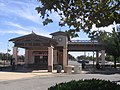 Morgan Hill Caltrain railway station
 -
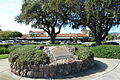 21-Mile House site memorial
 -
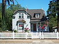 The historic Votaw House, built by the historically influential Votaw family
 -
Hiram Morgan Hill family statue at the Morgan Hill Caltrain station
-
 Ruins of the Malaguerra Winery, a California Historic Landmark


References
- ^ "California Cities by Incorporation Date" (Word). California Association of Local Agency Formation Commissions. Retrieved August 25, 2014.
- ^ "City Council". City of Morgan Hill, CA. Retrieved November 9, 2014.
- ^ http://www.morgan-hill.ca.gov/index.aspx?NID=62 City manager biography
- ^ "2010 Census U.S. Gazetteer Files – Places – California". United States Census Bureau.
- ^ U.S. Geological Survey Geographic Names Information System: Morgan Hill
- ^ a b "American FactFinder". United States Census Bureau. Retrieved January 31, 2008.
- ^ "Morgan Hill (city) QuickFacts". United States Census Bureau. Retrieved March 19, 2015.
- ^ a b c d e f g h "Circa: Historic Property Development - Historic Context Statement for the City of Morgan Hill". Retrieved October 14, 2013.
- ^ City of Morgan Hill - History
- ^ Morgan Hill Historical Society - Villa Mira Monte
- ^ Morgan Hill does not have water rights to the nearby reservoirs; the city's water supply consists of a number of deep wells and aboveground steel storage tanks. Streams in the vicinity are small and seasonal, unable to supply the city's water needs.
- ^ Jackson Meadows Expanded Initial Study, Earth Metrics Inc., San Mateo, Calif., prepared for the city of Morgan Hill, October 16, 1989
- ^ Sinkankas, John (1959). Gemstones of North America. Vol. 1. Princeton, New Jersey: Van Nostrand. p. 307.
- ^ Morgan Hill Museum
- ^ Poppy Jasper Film Festival
- ^ http://www.ngs.noaa.gov/cgi-bin/ds_mark.prl?PidBox=HS4881
- ^ "Annual Estimates of the Resident Population for Incorporated Places: April 1, 2010 to July 1, 2014". Retrieved June 4, 2015.
- ^ "Census of Population and Housing". Census.gov. Retrieved June 4, 2015.
- ^ "Morgan Hill city, California — Fact Sheet — American FactFinder — U.S. Census Bureau".
- ^ Environmental Impact Report for the Long Term Wastewater Management Plan, Cities of Gilroy and Morgan Hill, Earth Metrics, Inc. 1986, prepared for cities of Gilroy and Morgan Hill and State of California Environmental Clearinghouse
- ^ "2010 Census Interactive Population Search: CA - Morgan Hill city". U.S. Census Bureau. Retrieved July 12, 2014.
- ^ "Demographic Profile Bay Area Census".
- ^ City of Morgan Hill CAFR
- ^ Anderson Lake County Park
- ^ Coyote Creek Parkway
- ^ Morgan Hill Off-Leash Dog Park
- ^ Centennial Recreation Center
- ^ Morgan Hill Community and Cultural Center
- ^ Morgan Hill Aquatic Center
- ^ Morgan Hill Outdoor Sports Center
- ^ http://www.parkhere.org/portal/site/parks/ Santa Clara County Department of Parks and Recreation
- ^ "California's 19th Congressional District - Representatives & District Map". Civic Impulse, LLC. Retrieved March 12, 2013.
- ^ Morgan Hill Times http://www.morganhilltimes.com/
- ^ Morgan Hill Life http://morganhilllife.com/from-the-publisher-welcome-to-morgan-hill-life-2/
- ^ "Gilroy and Morgan Hill Service" (PDF). Santa Clara Valley Transportation Authority. Retrieved February 17, 2008.
- ^ "Caltrain timetable effective April 2, 2007". Caltrain. Retrieved February 17, 2008.
- ^ "Line 55 Monterey - San Jose Express". Monterey-Salinas Transit. Retrieved February 17, 2008.
- ^ "Welcome to the Morgan Hill Library." Santa Clara County Library. Retrieved March 27, 2010.
- ^ http://www.izmirlb.org/
External links
 Morgan Hill travel guide from Wikivoyage
- Official website

- Morgan Hill Historical Society
- Morgan Hill Times
- Hiram Morgan Hill at Find a Grave
Municipalities and communities of Santa Clara County, California, United States | ||
|---|---|---|
| Cities and towns |  | |
| CDPs | ||
| Unincorporated communities | ||
| CCDs | ||
| Ghost towns | ||
| Bodies of water |
|  | |||||||||||
|---|---|---|---|---|---|---|---|---|---|---|---|---|---|
| Counties | |||||||||||||
| Cities and towns |
| ||||||||||||
| CDPs over 10k | |||||||||||||
| Sub-regions | |||||||||||||
| Other | |||||||||||||