
User:Vanished user ija0qfr2o3ijfi 4i4tijwci823irnf/sandbox

| Bengal region | |
 _-_BGD_-_UNOCHA.svg)  | |
| Largest Cities | Dhaka Kolkata Chittagong |
| Countries | Bangladesh and India |
| Official languages | Bengali |
| Co-official languages | English |
| Area | 232,752 km2 (89,866 sq mi) |
| Population (2011) | 245 million[1][2] |
| Density | 1,100/km2 (2,700/sq mi)2 |
| Religions | |
| Demonym | Bengali |
Bengal /bɛŋˈɡ[invalid input: 'aw']l/ (Bengali: বাংলা /baŋla/ or বঙ্গ Bônggo /bɔŋɡo/) is a historical, geographical and cultural area at the apex of the Bay of Bengal in Asia. The region of Bengal proper is divided between the Indian state of West Bengal and the sovereign land of the People's Republic of Bangladesh.
The origins of the word Bengal are unclear, however theories point to a Dravidian-speaking tribe Bang which settled in the area circa 1000 BCE, the Iron Age Vanga Kingdom and the Allahabad Pillar inscription which noted the term Vangaladesa. Other historical names used identify the region include Gangaridai by the Greeks and Romans, Harkand by the Arabs in reference to the Harikela state; Anga, Pundravardhana, Samatata and Gauda in ancient Indian texts. The terms Bangla and Bangalah gained widespread usage after Islamic conquests, particularly with the establishment of the Bengal Sultanate. The Portuguese in the Age of Discovery called the region Bengala, from which the English term Bengal was later derived.
The mighty Ganges and Brahmaputra Rivers separated Bengal from India, allowing its people to develop a distinct and complex civilization, including their own language, literature, abugida script, music and art. Bengal has been profoundly influenced by the other cultures in the Indian subcontinent, and has at times, played a key role in the history of South Asia.
The region was a patchwork of maritime city states and kingdoms in the first millennium BCE, which was followed by the Mauryan Empire's rule and influence and the era of the Gupta Empire. Shashanka founded an independent political entity in northwestern Bengal circa 650. The Pala Empire unified the area in the 9th century and established a Bengali empire across the northern subcontinent. The Sena kingdom laid the foundation of Bengali Hinduism. Islamic rule began under dynasties of the Delhi Sultanate and Sonargaon, followed by the independent Persianate Ilyas Shahi dynasty and Hussain Shahi dynasty. The Mughal Empire also ruled the region. Bengali independence disintegrated in the 18th century and the region fell to the British Empire's East India Company in 1757. Modern Bengal's division and borders were formed during the Partition of British India.
Geographically, the region includes the vast and fertile Bengal delta, elevated woodlands, the world's largest mangrove forest in the Sunderbans (also home to the Bengal tiger), one of the world's longest beaches in Cox's Bazar and coral reefs off St. Martin's Island. It is surrounded to the north and east by Himalayan and Southeast Asian foothills, including in the Darjeeling Himalaya, the Chittagong Hill Tracts and the Sylhet region.
Bengal's economic and strategic influence is reflected in its central location in the region between the Middle East and Philippine Sea and the economic groupings SAARC and ASEAN. Large deposits of natural gas are present in the Bay of Bengal. Bangladesh is a Next Eleven emerging economy driven its megacity capital Dhaka and chief port Chittagong. The economy of West Bengal ranks 4th among Indian states. The Indian economy is the world's tenth largest economy by nominal GDP. Kolkata, another megacity and the economic center of eastern India, was formerly the commercial capital of British India.
Geography
Bengali-speaking zone

The Bengali language is the eleventh most spoken language in the world, and the seventh most spoken native language. Bengali is also dominant in several areas outside Bengal proper. It is spoken by a majority population in the following territories:-
 Bangladesh
 India, including the states of West Bengal and Tripura; the Barak Valley in southern Assam; the union territory of the Andaman and Nicobar Islands
Environment
The Bengal region is located between the Himalayas and the Bay of Bengal. It is bounded by Nepal, Sikkim and Bhutan on the north; North India on the west; North East India on the east and Myanmar (Burma) on the southeast. Most of Bengal is covered by the Ganges–Brahmaputra River Delta, which creates the fertile Bengal basin. There are mountainous highlands in north, northeast and southeast; as well as extensive woodlands and subtropical temperate rainforests. The Ganges Delta arises from the confluence of the rivers Ganges, Brahmaputra, and Meghna rivers and their respective tributaries. The total area of Bengal is 232,752 km²—West Bengal is 88,752 km2 (34,267 sq mi) and Bangladesh 147,570 km2 (56,977 sq mi). It
Most parts of Bangladesh are within 10 metres (33 feet) above the sea level, and it is believed that about 10% of the land would be flooded if the sea level were to rise by 1 metre (3.3 feet).[3] Because of this low elevation, much of this region is exceptionally vulnerable to seasonal flooding due to monsoons. The highest point in Bangladesh is in Mowdok range at 1,052 metres (3,451 feet) in the Chittagong Hill Tracts to the southeast of the country.[4] A major part of the coastline comprises a marshy jungle, the Sundarbans, the largest mangrove forest in the world and home to diverse flora and fauna, including the Royal Bengal Tiger. In 1997, this region was declared endangered.[5]
West Bengal is on the eastern bottleneck of India, stretching from the Himalayas in the north to the Bay of Bengal in the south. The state has a total area of Template:Unit area.[6] The Darjeeling Himalayan hill region in the northern extreme of the state belongs to the eastern Himalaya. This region contains Sandakfu (Template:Unit length)—the highest peak of the state.[7] The narrow Terai region separates this region from the plains, which in turn transitions into the Ganges delta towards the south. The Rarh region intervenes between the Ganges delta in the east and the western plateau and high lands. A small coastal region is on the extreme south, while the Sundarbans mangrove forests form a remarkable geographical landmark at the Ganges delta.
At least nine districts in West Bengal and 42 districts in Bangladesh have arsenic levels in groundwater above the World Health Organization maximum permissible limit of 50 µg/L (micro gram per litre) or 50 parts per billion and the untreated water is unfit for human consumption.[8] The water causes arsenicosis, skin cancer and various other complications in the body. Arsenic is four times as poisonous as mercury.
- Landscapes of Bengal
-
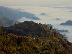
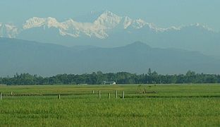 Himalayan peaks seen from fertile plains in Panchagarh
 -
 Flora and fauna in Darjeeling,
 -
 The Boral River in Rajshahi
 -
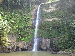 Madhabkunda waterfall in Sylhet
 -

-
 Shilabati River flowing through the Gangani Ravines in West Bengal
 -
 River Murti in Jalpaiguri
 -
 Aerial view of rice fields in West Bengal
 -
 Mustard fields among date trees in West Bengal
 -
 Jute on a paddy field in West Bengal
 -
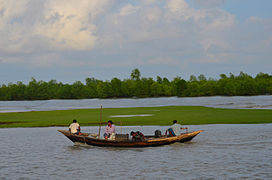
 A river flowing from the Barak Valley into Bangladesh
 -
-

-
-
 The Sunderbans
 -
 The Bay of Bengal in Himchari, Cox's Bazar
 -
-

-
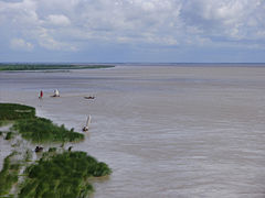 The Padma River, main distributary of the Ganges
 -
 Tea plantations in Sylhet
 -
 Tea plantations in Darjeeling


.jpg)

.jpg)


.JPG)

Flora and fauna
Noted for its high lush biodiversity, the Bengali countryside is often covered in groves of mango, jackfruit, date palm, coconut and betel nut trees. The region is home to several thousand species of plant life. Many aquatic plants are found in ponds and rivers. Fish and marine life are very rich. Notable wildlife includes the Bengal tiger, the Asian elephant, the Axis deer, langurs, hoolock gibbons, Gangetic and Irrawaddy dolphins, the Asian black bear, leopards, jaguars and various reptiles.
- Wildlife
-
 Axis deer in the Sunderbans
 -
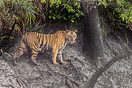 A Bengal tiger in the Sunderbans
 -
 Golden capped langur in the Lawachara Rainforest
 -
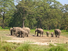 Wild elephants in Jaldapara Wildlife Sanctuary


Demographics
- Main articles: Demographics of Bangladesh and Demographics of West Bengal
According to provisional results of 2011 Bangladesh census, population of Bangladesh was 142,319,000;[9] however, CIA's The World Factbook gives 163,654,860 as its population in a July 2013 estimate. According to the provisional results of the 2011 Indian national census, West Bengal has a population of 91,347,736.[10] So, the Bengal region, as of 2011, has at least 233 million people. This figures give a population density of 1003.9/km²; making it among the most densely populated areas in the world.[11][12]
Bengali is the main language spoken in Bengal. Because of their many phonological, lexical, and structural differences from the standard variety, some geographically peripheral varieties of Bengali are also considered separate languages by some linguists; these include Sylheti, Chittagonian, Chakma, Rangpuri/Rajbangshi, Hajong, Rohingya, and Tangchangya.[13]
English is often used for official work alongside Bengali, and many Bengalis are also familiar with other major Indo-Aryan languages such as Hindi, Urdu, Assamese, and Nepali.
In addition, there are several minority ethnolinguistic groups native to the region. These include speakers of other Indo-Aryan languages (e.g. Bishnupriya Manipuri, Oraon Sadri, various Bihari languages), Tibeto-Burman languages (e.g. A'Tong, Chak, Koch, Garo, Megam, Meitei Manipuri, Mizo, Mru, Pangkhua, Rakhine/Marma, Kok Borok, Riang, Tippera, Usoi, various Chin languages), Austroasiatic languages (e.g. Khasi, Koda, Mundari, Pnar, Santali, War), and Dravidian languages (e.g. Kurukh, Sauria Paharia).[13]
Life expectancy is around 70.36 years for Bangladesh[14] and 63.4 for West Bengal.[15][16] In terms of literacy, West Bengal leads with 77% literacy rate,[11] in Bangladesh the rate is approximately 59.82%.[17][18] The level of poverty and illiteracy is high, the proportion of people living below the poverty line is more than 30%.[19][20]
About 20,000 people live on chars. Chars are temporary islands formed by the deposition of sediments eroded off the banks of the Ganges in West Bengal which often disappear in the monsoon season. They are made of very fertile soil. The inhabitants of chars are not recognised by the Government of West Bengal on the grounds that it is not known whether they are Bengalis or Bangladeshi refugees. Consequently, no identification documents are issued to char-dwellers who cannot benefit from health care, barely survive because of very poor sanitation and are prevented from emigrating to the mainland to find jobs when they have turned 14. On a particular char it was reported that 13% of women died at childbirth.[21]
Religions
Religious identity is an important part of Bengali culture. Hinduism and Buddhism developed during the Iron Age in Bengal, and tussled for dominance in the region. Islam was established in the second millennium CE. Today, Bengali Muslims constitute the second largest ethnicity in the Muslim world after the Arabs, with a population of 190 million. Bengali Hindus are the second biggest group, numbering at 85 million. They are the second largest Hindu ethno-linguistic group in the Indian subcontinent. Smaller religious communities include Bengali Buddhists and Bengali Christians.
-
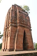 Bankura Sun Temple
 -
-

-

-
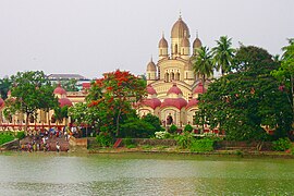
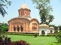 Ananta Basudev Temple
 -
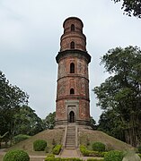 Firoz Minaret
 -
 Bishnupur Temple
 -
 Bagha Mosque
 -
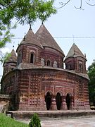
 Jor Bangla Temple
 -
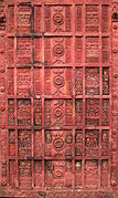 Atiya Mosque terracotta
 -
 Hindu Ras Mancha
 -

-
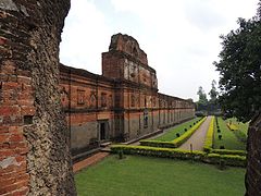
 Section of the Puthia Temple Complex
 -
 Dhonai Chok Mosque
 -
 Adinath Temple Pagoda
 -

-

-

-
-

-

.jpg)


_002.jpg)


.jpg)


_Arnab_Dutta_2011.JPG)


.jpg)


.jpg)
.jpg)
.jpg)
Major cities

_2013-06-30_22-44.jpg)

The following are the largest cities in Bengal (in terms of population):
| Rank | City | Country | Population | Area (in km2) |
|---|---|---|---|---|
| 1 | Dhaka | Bangladesh | 14,543,124 | 1463.6 [22] |
| 2 | Kolkata | India | 14,112,536[23] | 1886.67 |
| 3 | Chittagong | Bangladesh | 4,079,862 | 168.07[24] |
| 4 | Comilla | Bangladesh | 346,238 | 153[25] |
| 5 | Gazipur | Bangladesh | 1,820,374 | 49.32[25] |
| 6 | Narayanganj | Bangladesh | 1,636,441 | 759.57[25] |
| 7 | Khulna | Bangladesh | 1,490,835 | 80.01 |
| 8 | Rajshahi | Bangladesh | 842,701 | 96.68 |
| 9 | Rangpur | Bangladesh | 650,000 | 204[25] |
| 10 | Sylhet | Bangladesh | 2,675,346 | 26.50 [25] |
| 11 | Barisal | Bangladesh | 272,169 | 45 [25] |
| 12 | Asansol | India | 1,243,414 | 340.13[23] |
| 13 | Siliguri | India | 705,579 | 640.0[23] |
| 14 | Durgapur | India | 580,990 | 154.0[23] |
| Source: World Gazetteer 2012[26] | ||||
References
- ^ http://www.censusindia.gov.in/
- ^ http://www.bbs.gov.bd/PageWebMenuContent.aspx?MenuKey=337
- ^ Ali, A (1996). "Vulnerability of Bangladesh to climate change and sea level rise through tropical cyclones and storm surges". Water, Air, & Soil Pollution. 92 (1–2): 171–179. doi:10.1007/BF00175563.
{{cite journal}}: Invalid|ref=harv(help); Unknown parameter|doi_brokendate=ignored (|doi-broken-date=suggested) (help) - ^ Summit Elevations: Frequent Internet Errors. Retrieved 13 April 2006.
- ^ IUCN (1997). "Sundarban wildlife sanctuaries Bangladesh". World Heritage Nomination-IUCN Technical Evaluation.
{{cite journal}}: Invalid|ref=harv(help) - ^ "Statistical Facts about India". www.indianmirror.com. Retrieved 26 October 2006.
- ^ "National Himalayan Sandakphu-Gurdum Trekking Expedition: 2006". Youth Hostels Association of India: West Bengal State Branch. Archived from the original on 24 October 2006. Retrieved 26 October 2006.
- ^ Chowdhury U.K., Biswas B. K., Chowdhury T. R. (2000). "Groundwater arsenic contamination in Bangladesh and West Bengal, India". Environmental Health Perspectives. 108 (4): 393–397. doi:10.2307/3454378. JSTOR 3454378.
{{cite journal}}: Invalid|ref=harv(help)CS1 maint: multiple names: authors list (link) - ^ "2011 Population & Housing Census: Preliminary Results" (PDF). Bangladesh Bureau of Statistics, Statistics Division, Ministry of Planning, Government of the People's Republic of Bangladesh. July 2011. Retrieved 17 November 2013.
- ^ "Area, population, decennial growth rate and density for 2001 and 2011 at a glance for West Bengal and the districts: provisional population totals paper 1 of 2011: West Bengal". Registrar General & Census Commissioner, India. Retrieved 26 January 2012.
- ^ a b Cite error: The named reference
censuswbwas invoked but never defined (see the help page). - ^ World Bank Development Indicators Database, 2006.
- ^ a b http://www.ethnologue.com/country/BD/languages
- ^ https://www.cia.gov/library/publications/the-world-factbook/geos/bg.html
- ^ "An Indian life: Life expectancy in our nation". India Together. Civil Society Information Exchange Pvt. Ltd. Retrieved 26 August 2006.
- ^ "World Health Report 2005". World Health Organization.
- ^ http://www.thefinancialexpress-bd.com/old/index.php?ref=MjBfMDJfMDZfMTNfMV84OF8xNTkzMTc=
- ^ "2005 Human Development Report". UNDP.
- ^ "Introduction and Human Development Indices for West Bengal". West Bengal Human Development Report 2004 (PDF). Development and Planning Department, Government of West Bengal. May 2004. pp. 4–6. ISBN 81-7955-030-3. Retrieved 26 August 2006.
{{cite book}}: External link in|chapterurl=|chapterurl=ignored (|chapter-url=suggested) (help) - ^ Bangladesh Country Statistics, UNICEF
- ^ "Wandering Gaia". "The Give and Take of the Ganges" WordPress.com. Retrieved 13 April 2009.
- ^ http://www.citypopulation.de/php/bangladesh-dhaka.php
- ^ a b c d http://www.census2011.co.in/census/metropolitan/184-kolkata.html
- ^ http://www.citypopulation.de/php/bangladesh-chittagong.php
- ^ a b c d e f http://citypopulation.de/Bangladesh-UA.html
- ^ "World Gazetteer". Archived from the original on 9 March 2001. Retrieved 6 January 2013.