
Alberta Highway 2

.svg)

Alberta Provincial Highway No. 2[1] is the longest provincial highway in the Canadian province of Alberta. The stretch between Calgary and Edmonton is one of the most heavily used highways in the province, and is designated the Queen Elizabeth II Highway or the ‘QE2 Highway’ as well as a core route of Canada's National Highway System.
The speed limit along most parts of the highway between Fort Macleod and Morinville is 110 km/h (70 mph) and in urban areas, such as through Claresholm, Nanton, Calgary and Edmonton, it ranges from 50 km/h to 100 km/h. During the winter time, accidents are common as the weather changes rapidly, and drivers underestimate the conditions.
A review of historical Alberta official road maps shows that Highway 2 was numbered Highway 1 prior to 1941 (while the current Highway 1 was Highway 2 at the time).[2]
Route
As its main north-south corridor, Highway 2 enters Alberta south of Cardston, at the Carway border crossing with Montana (where it continues as U.S. Route 89). It travels northward through Fort Macleod to Calgary, Red Deer, and Edmonton. North of Edmonton the highway continues to Athabasca, after which the highway continues northwesterly along the south shore of Lesser Slave Lake into High Prairie, north to Peace River, west to Fairview and finally south to Grande Prairie.
As the main north-south access in Alberta, Highway 2 is the preferred path of the CANAMEX Corridor.[3] Between Fort Macleod and Edmonton, Highway 2 maintains no fewer than four lanes of traffic and is largely a controlled-access freeway between Okotoks and Edmonton, with improvements underway to eliminate remaining at-grade crossings.
North of Okotoks, the three northbound lanes of the highway split into Macleod Trail (Highway 2A) and Deerfoot Trail, which keeps the Highway 2 designation through Calgary. It passes immediately west of the Calgary International Airport before continuing north to the City of Airdrie, which is bisected by Highway 2, while a number of other smaller communities such as Crossfield are bypassed. The newer Highway 2 is built east of the communities and the old route has become Highway 2A.
Red Deer is also primarily bypassed. Gasoline Alley, located at the south end of the city, is a popular stop for travellers headed for Calgary or Edmonton, with several fuel stations and food establishments. Continuing north, the highway again bypasses the smaller communities, this time to the west. Leduc, south of Edmonton, is bisected like Airdrie; however, this has been a result of westward growth of the community. The highway also passes immediately east of Edmonton International Airport, about 15 km south of Edmonton.
-
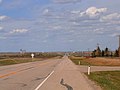
 Exit 222 in the Municipal District of Foothills No. 31
 -
 Deerfoot Trail at the interchange with Peigan Trail in Calgary
 -
 At Crossfield, two-laned Highway 2A in the foreground with divided Highway 2 in the distance.


When the highway enters Edmonton, it becomes Gateway Boulevard (northbound; it is Calgary Trail in the opposite direction), then Whitemud Drive to the southwest part of the city. It then shares roadbeds with Anthony Henday Drive (Highway 216) and Yellowhead Trail (Highway 16) before heading north again along St. Albert Trail as it exits Edmonton and passes northwest through St. Albert. (Future extension of Ray Gibbon Drive in the northwest Edmonton region will bypass St. Albert from Anthony Henday Drive to Highway 2 north.)
After leaving St. Albert, the highway is twinned until it reaches north of Morinville and after that it is a 2-lane road for almost the rest of the stretch. Highway 2 continues north until it reaches a T-junction with Highway 18. From there, the route turns east towards Clyde and then follows a northeasterly direction to Athabasca before turning northwest towards Slave Lake. The road continues west, following along the scenic southern shores of Lesser Slave Lake until it reaches High Prairie. West of High Prairie, the highway then turns north to McLennan and west until it reaches a junction with Highway 49 (locally known as 'Donnelly Corner'). The stretch of Highway 2 between Athabasca and Highway 49 is part of the Northern Woods and Water Route.[4][5]
The highway continues north to Peace River, the road's most northerly point in the province. It exits west out of Peace River then turns south through Grimshaw (the junction of the Mackenzie Highway) and Fairview, then over the Dunvegan Bridge, where it crosses the Peace River and ultimately terminating at an interchange at Highway 43 just north of Grande Prairie. Prior to highway renumbering in northwestern Alberta, Highway 2 followed Highway 43's current alignment into British Columbia, where it became Highway 2 to Dawson Creek.
Queen Elizabeth II Highway
On May 23, 2005, the section between Calgary and Edmonton was renamed the Queen Elizabeth II Highway in honour of Her Majesty's visit to Alberta as part of the province's centennial celebrations; the first road sign was personally unveiled by the Queen. It is the first highway in Canada to be named for the current Queen (Ontario’s Queen Elizabeth Way is named for Queen Elizabeth, the late Queen Mother).
Exit list
This section is missing kilometre posts for junctions. |
The province of Alberta began numbering exits on Highway 2 in 2004.[citation needed]
Southern Alberta
| Location | # | km | Destinations | Notes | Coordinates |
|---|---|---|---|---|---|
| Cardston County | 0 | US border in Carway | North extension of U.S. Route 89 | 48°59′57″N 113°22′43″W / 48.99917°N 113.37861°W | |
| 25 | 49°09′58″N 113°17′07″W / 49.16611°N 113.28528°W | ||||
| Cardston County, Cardston | 28 | 49°12′09″N 113°18′07″W / 49.20250°N 113.30194°W | |||
| Cardston County | 43 | 49°20′56″N 113°17′52″W / 49.34889°N 113.29778°W | |||
| 46 | 49°22′41″N 113°18′29″W / 49.37806°N 113.30806°W | ||||
| 58 | 49°28′32″N 113°17′57″W / 49.47556°N 113.29917°W | ||||
| 62 | Crosses the Waterton River | 49°30′05″N 113°19′35″W / 49.50139°N 113.32639°W | |||
| 77 | 49°38′26″N 113°21′22″W / 49.64056°N 113.35611°W | ||||
| Fort Macleod | 86 | South end of Highway 3 overlap, CANAMEX corridor continues on Highway 3 | |||
| 87 | |||||
| 89 | North end of Hwy 3 overlap, southern end of the Alberta Highway 2 portion of the CANAMEX corridor | 49°43′03″N 113°23′12″W / 49.71750°N 113.38667°W | |||
| Municipal District of Willow Creek No. 26 | 91 | ||||
| 110 | |||||
| Municipal District of Willow Creek No. 26, Claresholm | 127 | ||||
| Municipal District of Willow Creek No. 26, Stavely | 144 | ||||
| Municipal District of Willow Creek No. 26 | 152 | ||||
| Municipal District of Willow Creek No. 26, Nanton | 165 | ||||
| 167 | |||||
| Foothills No. 31 | 182 | ||||
| 1.000 mi = 1.609 km; 1.000 km = 0.621 mi | |||||
Calgary Region
| Location | # | km | Destinations | Notes | Coordinates |
|---|---|---|---|---|---|
| Foothills No. 31, High River | 194 | Signed as exits 194A (east) and 194B (west) | 50°34′19″N 113°49′45″W / 50.57194°N 113.82917°W | ||
| Foothills No. 31, Aldersyde | 209 | 50°41′23″N 113°52′55″W / 50.68972°N 113.88194°W | |||
| Foothills No. 31 | 222 | 50°47′55″N 113°58′05″W / 50.79861°N 113.96806°W | |||
| 225 | Northbound exit and southbound entrance | 50°49′30″N 113°59′53″W / 50.82500°N 113.99806°W | |||
| 227 | Dunbow Road—De Winton | 50°50′02″N 113°59′54″W / 50.83389°N 113.99833°W | |||
| Calgary | 232 | Cranston Avenue, Seton Boulevard | 50°53′32″N 113°58′31″W / 50.89222°N 113.97528°W | ||
| 234 | 50°54′00″N 113°58′31″W / 50.90000°N 113.97528°W | ||||
| 236 | McKenzie Towne Boulevard, McKenzie Lake Boulevard | 50°55′00″N 113°58′31″W / 50.91667°N 113.97528°W | |||
| 238 | 130 Avenue Southeast | 50°55′55″N 113°58′31″W / 50.93194°N 113.97528°W | |||
| 240 | Barlow Trail north | 50°56′42″N 113°58′58″W / 50.94500°N 113.98278°W | |||
| 241 | 24th Street East, Douglasdale Boulevard | 50°56′56″N 114°00′16″W / 50.94889°N 114.00444°W | |||
| 243 | Anderson Road west, Bow Bottom Trail south | 50°57′14″N 114°01′34″W / 50.95389°N 114.02611°W | |||
| 245 | Southland Drive | Southbound exit is part of exit 247 | 50°58′02″N 114°02′00″W / 50.96722°N 114.03333°W | ||
| 247 | 11th Street East—Shopping Centre | 50°59′13″N 114°02′06″W / 50.98694°N 114.03500°W | |||
| 248 | Signed as exits 248A (east) and 248B (west) southbound; northbound exit to Glenmore Trail west is via exit 247 | 50°59′35″N 114°02′06″W / 50.99306°N 114.03500°W | |||
| n/a | 250 | Foothills Industrial Park/ Calf Robe Bridge | |||
| 251 | Peigan Trail east, Barlow Trail south | 51°00′53″N 114°00′19″W / 51.01472°N 114.00528°W | |||
| 254 | 51°02′13″N 114°00′17″W / 51.03694°N 114.00472°W | ||||
| 256 | Memorial Drive | 51°02′52″N 114°01′04″W / 51.04778°N 114.01778°W | |||
| n/a | 257 | 8th Avenue N.E- (Renfrew) | |||
| 258 | 51°03′59″N 114°01′38″W / 51.06639°N 114.02722°W | ||||
| 260 | 32nd Avenue North | 51°04′54″N 114°02′02″W / 51.08167°N 114.03389°W | |||
| 261 | McKnight Boulevard | Signed as exits 261A (east) and 261B (west) | 51°05′46″N 114°02′27″W / 51.09611°N 114.04083°W | ||
| 263 | 64 Avenue North | 51°06′38″N 114°02′49″W / 51.11056°N 114.04694°W | |||
| 265 | Beddington Trail west | Northbound exit and Southbound entrance | 51°07′29″N 114°02′44″W / 51.12472°N 114.04556°W | ||
| 266 | 51°08′25″N 114°02′09″W / 51.14028°N 114.03583°W | ||||
| 268 | 51°09′16″N 114°01′06″W / 51.15444°N 114.01833°W | ||||
| 271 | Opened to traffic on November 2, 2009 | ||||
| Rocky View County | 273 | Crossiron Drive | Northbound exit only. This exit along with Highway 566 eastbound to Kathyrn provides access to CrossIron Mills Shopping Centre. |
||
| 275 | Eastbound to Kathyrn provides access to CrossIron Mills Shopping Centre | 51°12′45″N 114°00′06″W / 51.21250°N 114.00167°W | |||
| Airdrie | 282 | Yankee Valley Boulevard | 51°16′15″N 114°00′04″W / 51.27083°N 114.00111°W | ||
| 284 | East Airdrie Industrial Area | Northbound exit only | 51°17′08″N 114°00′04″W / 51.28556°N 114.00111°W | ||
| 285 | 51°18′00″N 114°00′07″W / 51.30000°N 114.00194°W | ||||
| Rocky View County | 295 | 51°23′14″N 114°00′06″W / 51.38722°N 114.00167°W | |||
| 305 | 51°25′52″N 114°00′06″W / 51.43111°N 114.00167°W | ||||
| 1.000 mi = 1.609 km; 1.000 km = 0.621 mi | |||||
Central Alberta
| Location | # | Destinations | Notes | Coordinates | |
|---|---|---|---|---|---|
| Mountain View County | 315 | 51°33′43″N 114°01′26″W / 51.56194°N 114.02389°W | |||
| 326 | 51°39′45″N 114°01′32″W / 51.66250°N 114.02556°W | ||||
| 340 | Signed as exits 340A (east) and 340B (west) | 51°47′39″N 114°01′36″W / 51.79417°N 114.02667°W | |||
| Red Deer County, Bowden | 353 | Southbound exit only Traffic for Hwy 2A north connects to Hwy 587 in Bowden just west of Hwy 2 |
|||
| 357 | 51°56′19″N 114°01′30″W / 51.93861°N 114.02500°W | ||||
| Red Deer County, Innisfail | 365 | Cottonwood Road / Range Road 284 |
|||
| 368 | 52°01′33″N 113°55′40″W / 52.02583°N 113.92778°W | ||||
| Red Deer County | 384 | 52°08′35″N 113°48′47″W / 52.14306°N 113.81306°W | |||
| 391 | McKenzie Road—Gasoline Alley | 52°12′05″N 113°48′53″W / 52.20139°N 113.81472°W | |||
| Gasoline Alley, Willow Street—Petrolia Industrial Park | Northbound exit only | 52°13′08″N 113°48′50″W / 52.21889°N 113.81389°W | |||
| Gasoline Alley, Leva Avenue | Southbound exit only | ||||
| Red Deer County, Red Deer | 394 | 52°13′36″N 113°48′49″W / 52.22667°N 113.81361°W | |||
| 397 | C&E Trail west, 32nd Street east—Red Deer | 52°14′57″N 113°50′25″W / 52.24917°N 113.84028°W | |||
| 401 | 52°17′14″N 113°51′43″W / 52.28722°N 113.86194°W | ||||
| 405 | 52°19′03″N 113°51′36″W / 52.31750°N 113.86000°W | ||||
| Lacombe County | 412 | 52°22′31″N 113°49′15″W / 52.37528°N 113.82083°W | |||
| Lacombe County, Lacombe | 422 | Signed as exits 422A (east) and 422B (west) | 52°27′47″N 113°47′03″W / 52.46306°N 113.78417°W | ||
| Lacombe County | 431 | 52°30′51″N 113°40′56″W / 52.51417°N 113.68222°W | |||
| 437 | 52°33′17″N 113°39′47″W / 52.55472°N 113.66306°W | ||||
| 439 | 52°34′47″N 113°39′53″W / 52.57972°N 113.66472°W | ||||
| Ponoka County | 446 | Matejka Road | 52°38′19″N 113°39′48″W / 52.63861°N 113.66333°W | ||
| 447 | Gee Road | Southbound exit and northbound entrance | 52°38′58″N 113°39′51″W / 52.64944°N 113.66417°W | ||
| 450 | Signed as exits 450A (east) and 450B (west) | 52°40′34″N 113°39′07″W / 52.67611°N 113.65194°W | |||
| 462 | Menaik Road | 52°47′06″N 113°38′38″W / 52.78500°N 113.64389°W | |||
| 469 | 52°50′36″N 113°38′39″W / 52.84333°N 113.64417°W | ||||
| County of Wetaskiwin No. 10 | 482 | Signed as exits 482A (east) and 482B (west) | 52°57′34″N 113°38′54″W / 52.95944°N 113.64833°W | ||
| 488 | Correction Line Road | 53°01′04″N 113°37′41″W / 53.01778°N 113.62806°W | |||
| 497 | 53°05′25″N 113°35′53″W / 53.09028°N 113.59806°W | ||||
| 1.000 mi = 1.609 km; 1.000 km = 0.621 mi | |||||
Edmonton Region
| Location | # | Destinations | Notes | Coordinates | |
|---|---|---|---|---|---|
| Leduc County | 508 | Kavanagh, Glen Park District | 53°11′34″N 113°35′53″W / 53.19278°N 113.59806°W | ||
| Leduc | 516 | 53°15′12″N 113°33′41″W / 53.25333°N 113.56139°W | |||
| 517 | Leduc city centre |
53°15′53″N 113°33′49″W / 53.26472°N 113.56361°W | |||
| 519 | Leduc Business Sector | 53°16′40″N 113°33′06″W / 53.27778°N 113.55167°W | |||
| 521 | Leduc North Sector | Northbound exit only | 53°17′12″N 113°32′55″W / 53.28667°N 113.54861°W | ||
| 522 | 53°18′32″N 113°32′52″W / 53.30889°N 113.54778°W | ||||
| Leduc County | 525 | 53°20′16″N 113°32′52″W / 53.33778°N 113.54778°W | |||
| Edmonton | 532 | 41 Avenue SW | 53°39′58″N 113°51′03″W / 53.66611°N 113.85083°W | ||
| Ellerslie Road | Highway 2 called Calgary Trail (southbound) and Gateway Boulevard (northbound) through southern Edmonton | 53°25′30″N 113°29′31″W / 53.42500°N 113.49194°W | |||
| 53°26′06″N 113°29′34″W / 53.43500°N 113.49278°W | |||||
| Highway 2 turns west on to Whitemud Drive | 53°28′50″N 113°29′37″W / 53.48056°N 113.49361°W | ||||
| 111 St NW | 53°28′58″N 113°31′00″W / 53.48278°N 113.51667°W | ||||
| 122 St NW / 119 St NW | 53°28′59″N 113°32′29″W / 53.48306°N 113.54139°W | ||||
| Terwillegar Drive | 53°28′57″N 113°34′13″W / 53.48250°N 113.57028°W | ||||
| 53 Ave NW | 53°29′25″N 113°34′20″W / 53.49028°N 113.57222°W | ||||
| Fox Drive (east) | 53°30′10″N 113°34′02″W / 53.50278°N 113.56722°W | ||||
| na | North Saskatchewan River | Bridge over river | 53°30′23″N 113°34′00″W / 53.50639°N 113.56667°W | ||
| 149 St NW | 53°30′45″N 113°34′44″W / 53.51250°N 113.57889°W | ||||
| 159 St NW | 53°30′44″N 113°35′48″W / 53.51222°N 113.59667°W | ||||
| 170 St NW | 53°30′44″N 113°36′55″W / 53.51222°N 113.61528°W | ||||
| 178 St NW | 53°30′44″N 113°37′48″W / 53.512156°N 113.62994°W | ||||
| Highway 2 becomes a hidden concurrency with Highway 216 (Anthony Henday Drive) at this point | 53°30′44″N 113°39′33″W / 53.512207°N 113.659294°W | ||||
| 87 Ave NW | West Edmonton Mall | 53°31′22″N 113°39′33″W / 53.522783°N 113.659229°W | |||
| 53°32′23″N 113°39′32″W / 53.539759°N 113.658864°W | |||||
| Highway 2 becomes a hidden concurrency with Highway 16 (Yellowhead Trail) at this point | 53°34′26″N 113°39′41″W / 53.573779°N 113.661418°W | ||||
| 184 St NW | 53°34′22″N 113°38′21″W / 53.572747°N 113.639274°W | ||||
| 170 St NW | 53°34′24″N 113°36′55″W / 53.573384°N 113.615241°W | ||||
| 156 St NW | |||||
| 149 St NW | |||||
| 142 St NW | |||||
| Highway 2 called St Albert Trail from here; end of concurrency | 53°34′52″N 113°33′25″W / 53.58111°N 113.55694°W | ||||
| 137 Ave NW | Highway 2 called Mark Messier Trail from here to Edmonton city limit | 53°35′58″N 113°34′27″W / 53.59944°N 113.57417°W | |||
| St. Albert | Hebert Road | 53°37′19″N 113°36′36″W / 53.62194°N 113.61000°W | |||
| Sir Winston Churchill Avenue | 53°37′56″N 113°37′20″W / 53.63222°N 113.62222°W | ||||
| na | Sturgeon River | Bridge over river | 53°38′12″N 113°37′26″W / 53.63667°N 113.62389°W | ||
| Boudreau Road | 53°39′14″N 113°37′45″W / 53.65389°N 113.62917°W | ||||
| 53°39′29″N 113°37′50″W / 53.65806°N 113.63056°W | |||||
| Sturgeon County | 53°42′58″N 113°38′26″W / 53.71611°N 113.64056°W | ||||
| Cardiff Road, south Morinville access | 53°46′28″N 113°38′41″W / 53.77444°N 113.64472°W | ||||
| Highway 2 narrows to two lanes just north of intersection | 53°48′07″N 113°39′39″W / 53.80194°N 113.66083°W | ||||
| 53°56′57″N 113°38′41″W / 53.94917°N 113.64472°W | |||||
| 1.000 mi = 1.609 km; 1.000 km = 0.621 mi | |||||
Northern Alberta
| Location | # | Destinations | Notes | Coordinates | |
|---|---|---|---|---|---|
| Westlock County | Highway 2 turns east | 54°09′07″N 113°40′33″W / 54.15194°N 113.67583°W | |||
| Highway 2 turns north | 54°09′07″N 113°40′33″W / 54.15194°N 113.67583°W | ||||
| 54°22′13″N 113°30′35″W / 54.37028°N 113.50972°W | |||||
| Athabasca County | 54°35′15″N 113°21′33″W / 54.58750°N 113.35917°W | ||||
| 54°36′01″N 113°19′34″W / 54.60028°N 113.32611°W | |||||
| Athabasca | Highway 2 turns west | 54°43′16″N 113°17′09″W / 54.72111°N 113.28583°W | |||
| Athabasca County | Highway 2 turns north and then west | 54°44′02″N 113°29′51″W / 54.73389°N 113.49750°W | |||
| Municipal District of Lesser Slave River No. 124 | 55°01′41″N 114°02′55″W / 55.02806°N 114.04861°W | ||||
| 55°03′20″N 114°03′35″W / 55.05556°N 114.05972°W | |||||
| na | Athabasca River | bridge over river | 55°04′26″N 114°05′34″W / 55.07389°N 114.09278°W | ||
| Slave Lake | Highway 2 continues west along the south shore of Lesser Slave Lake | 55°15′58″N 114°45′50″W / 55.26611°N 114.76389°W | |||
| Main Street South | 56°02′36″N 117°07′59″W / 56.04333°N 117.13306°W | ||||
| Big Lakes County | 55°18′58″N 115°21′37″W / 55.31611°N 115.36028°W | ||||
| na | Swan River | crosses bridge, access to Kinuso | 55°18′51″N 115°25′29″W / 55.31417°N 115.42472°W | ||
| 55°24′35″N 116°13′55″W / 55.40972°N 116.23194°W | |||||
| passes through High Prairie |
55°25′58″N 116°29′19″W / 55.43278°N 116.48861°W | ||||
| Highway 2 turns north | 55°25′56″N 116°43′05″W / 55.43222°N 116.71806°W | ||||
| Municipal District of Smoky River No. 130 | 55°36′25″N 116°49′25″W / 55.60694°N 116.82361°W | ||||
| passes through McLennan | Highway 2 turns west | 55°42′40″N 116°54′34″W / 55.71111°N 116.90944°W | |||
| passes by Donnelly | 55°43′22″N 117°06′17″W / 55.72278°N 117.10472°W | ||||
| Highway 2 turns north | 55°43′24″N 117°07′53″W / 55.72333°N 117.13139°W | ||||
| Northern Sunrise County | 56°02′36″N 117°07′59″W / 56.04333°N 117.13306°W | ||||
| 56°12′32″N 117°12′28″W / 56.20889°N 117.20778°W | |||||
| Peace River | 56°02′36″N 117°07′59″W / 56.04333°N 117.13306°W | ||||
| 98 Street | 56°02′36″N 117°07′59″W / 56.04333°N 117.13306°W | ||||
| 56°14′18″N 117°17′16″W / 56.23833°N 117.28778°W | |||||
| 78 Street | 56°02′36″N 117°07′59″W / 56.04333°N 117.13306°W | ||||
| 56°13′59″N 117°20′49″W / 56.23306°N 117.34694°W | |||||
| Municipal District of Peace No. 135 | passes through Roma Junction |
56°13′59″N 117°28′43″W / 56.23306°N 117.47861°W | |||
| Highway 2 turns south | 56°13′59″N 117°36′37″W / 56.23306°N 117.61028°W | ||||
| passes through Grimshaw |
56°11′25″N 117°36′38″W / 56.19028°N 117.61056°W | ||||
| Highway 2 turns west | 56°09′42″N 117°36′47″W / 56.16167°N 117.61306°W | ||||
| passes by Berwyn | 56°08′33″N 117°43′31″W / 56.14250°N 117.72528°W | ||||
| 56°07′26″N 117°53′16″W / 56.12389°N 117.88778°W | |||||
| Municipal District of Fairview No. 136 | 56°05′52″N 118°04′27″W / 56.09778°N 118.07417°W | ||||
| passes through Fairview |
Highway 2 turns south | 56°03′52″N 118°23′31″W / 56.06444°N 118.39194°W | |||
| 56°00′50″N 118°29′47″W / 56.01389°N 118.49639°W | |||||
| Municipal District of Spirit River No. 133 | na | crosses Peace River in Dunvegan | bridge over river | 55°55′14″N 118°36′20″W / 55.92056°N 118.60556°W | |
| passes through Rycroft |
55°45′28″N 118°41′48″W / 55.75778°N 118.69667°W | ||||
| 55°36′25″N 118°41′55″W / 55.60694°N 118.69861°W | |||||
| 55°35′32″N 118°41′55″W / 55.59222°N 118.69861°W | |||||
| County of Grande Prairie No. 1 | 55°22′27″N 118°46′10″W / 55.37417°N 118.76944°W | ||||
| passes by Sexsmith | 55°20′42″N 118°46′09″W / 55.34500°N 118.76917°W | ||||
| 55°13′44″N 118°47′42″W / 55.22889°N 118.79500°W | |||||
| enters the City of Grande Prairie | 55°11′59″N 118°47′41″W / 55.19972°N 118.79472°W | ||||
| end of Highway 2 at 100 St and 116 Ave in Grande Prairie | 55°11′07″N 118°47′41″W / 55.18528°N 118.79472°W | ||||
| 1.000 mi = 1.609 km; 1.000 km = 0.621 mi | |||||
References
- ^ Provincial Highways Designation Order, Alberta Transportation, p. 1
- ^ Department of Public Works (1939). "Highway Map of Province of Alberta Canada" (PDF). Retrieved April 14, 2010.
- ^ Government of Alberta—CANAMEX Trade corridor
- ^ Microsoft Streets and Tips (Map) (2004 ed.). Microsoft Corporation Redmond Washington.
- ^ "Northern Woods and Water Route, Canada". PlanetWare Inc. 1995–2009.
External links
- 2010 Provincial Highways 1 - 216 Series Progress Chart (map, 8 MB) by Alberta Transportation.