
Kalmiuske
Komsomolske
Комсомольське | |
|---|---|
City | |
 Seal | |
| Country | Ukraine |
| Oblast | Donetsk |
| Raion | Starobesheve |
| Founded | 1933 |
| Area | |
| • Total | 119 km2 (46 sq mi) |
| Elevation | 72 m (236 ft) |
| Population (2011) | |
| • Total | 11,909 |
Komsomolske (Ukrainian: Комсомольське, Russian: Комсомольськое) is a city in Starobesheve Raion, Donetsk Oblast (province) of Ukraine. Until May 2016 its official name was Komsomolske (Ukrainian: Комсомольське, Russian: Комсомольское. The population was 11,909 in 2011, down from 12,813 in 2001.
Starting Mid-April 2014 pro-Russian separatists captured several towns in Donetsk Oblast;[1][2] including Kalmiuske.[3] On 29 August 2014, Ukrainian forces reportedly secured the city from the pro-Russian separatists.[3] But on 31 August, it been recaptured by the separatists.[4]
Gallery
-
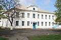 School #5 in Kalmiuske
 -
 Metalurh Stadium


References
- ^ Ragozin, Leonid (16 April 2014). "Vladimir Putin Is Accidentally Bringing Eastern and Western Ukraine Together".
- ^ "Donbass defenders put WWII tank back into service".
- ^ a b "Ukraine National Guard now controlling Komsomolske in Donetsk region".
- ^ Digital Journal, As Ukrainian troops retreat, separatists celebrate new offensive
47°40′N 38°04′E / 47.667°N 38.067°E
This article about a location in Donetsk Oblast is a stub. You can help Wikipedia by expanding it. |