
Republic of Crimea (country): Difference between revisions
Ahnoneemoos (talk | contribs) |
Ahnoneemoos (talk | contribs) |
||
| Line 121: | Line 121: | ||
==Economy== |
==Economy== |
||
Crimea possesses several [[natural gas field]]s both [[onshore]] and [[offshore]], all connected to Ukraine's pipeline system.<ref>{{cite news |url=http://www.reuters.com/article/2014/03/07/ukraine-crisis-gas-crimea-idUSL6N0M41R320140307 |title=Ukraine's Black Sea gas ambitions seen at risk over Crimea |date={{date|2014-03-07}} |accessdate={{date|2014-03-07}} |first=Henning |last=Gloystein |publisher=Reuters }}</ref><ref>{{cite web|url=http://www.eegas.com/ukraine.htm |title=East European Gas Analysis - Ukrainian Gas Pipelines |publisher=Eegas.com |date=2013-02-09 |accessdate=2014-03-08}}</ref> The inland fields are located in [[Chornomorske Raion|Chornomorske]] and [[Dzhankoy municipality|Dzhankoy]], while offshore fields are located in the western coast in the Black Sea and in the northeastern coast in the Azov Sea:<ref>{{cite news |url=http://www.bbc.com/news/world-europe-26387353 |title=Ukraine crisis in maps |date={{date|2014-03-05}} |accessdate={{date|2014-03-07}} |publisher=BBC }}</ref> |
|||
{{empty section|date=March 2014}} |
|||
{| class="wikitable sortable" |
|||
|- |
|||
! Name |
|||
! Type |
|||
! Location |
|||
! Reserves |
|||
|- |
|||
| [[Dzhankoyske gas field]] |
|||
| [[onshore]] |
|||
| [[Dzhankoy municipality|Dzhankoy]] |
|||
| |
|||
|- |
|||
| [[Golitsyna gas field]] |
|||
| [[offshore]] |
|||
| [[Black Sea]] |
|||
| |
|||
|- |
|||
| [[Karlavske gas field]] |
|||
| [[onshore]] |
|||
| [[Chornomorske Raion|Chornomorske]] |
|||
| |
|||
|- |
|||
| [[Krym gas field]] |
|||
| [[offshore]] |
|||
| [[Black Sea]] |
|||
| |
|||
|- |
|||
| [[Odessa gas field]]<ref>{{cite web|url=http://www.invest-crimea.gov.ua/news_body.php?news_id=504&locale=en |title=Investment portal of the Autonomous Republic of Crimea – investments in Crimea - "Chernomorneftegaz" presented a program of development till 2015 |publisher=Invest-crimea.gov.ua |date= |accessdate=2014-03-08}}</ref> |
|||
| [[offshore]] |
|||
| [[Black Sea]] |
|||
| 21 billion m<sup>3</sup> |
|||
|- |
|||
| [[Schmidta gas field]] |
|||
| [[offshore]] |
|||
| [[Black Sea]] |
|||
| |
|||
|- |
|||
| [[Shtormvaya gas field]] |
|||
| [[offshore]] |
|||
| [[Black Sea]] |
|||
| |
|||
|- |
|||
| [[Strilkove gas field]] |
|||
| [[offshore]] |
|||
| [[Sea of Azov]] |
|||
| |
|||
|} |
|||
The republic also possesses two [[oil field]]s: one onshore, the [[Serebryankse oil field]] in [[Rozdolne Raion|Rozdolne]], and one offshore, the [[Subbotina oil field]] in the Black Sea. |
|||
==Demographics== |
==Demographics== |
||
Revision as of 16:29, 17 March 2014
This article is actively undergoing a major edit for a short while. To help avoid edit conflicts, please do not edit this page while this message is displayed. This page was last edited at 16:29, 17 March 2014 (UTC) (10 years ago) – this estimate is cached, . Please remove this template if this page hasn't been edited for a significant time. If you are the editor who added this template, please be sure to remove it or replace it with {{Under construction}} between editing sessions. |
This article may be affected by a current event. Information in this article may change rapidly as the event progresses. Initial news reports may be unreliable. The last updates to this article may not reflect the most current information. (March 2014) |
Republic of Crimea Республика Крым Къырым Джумхуриети Qırım Cumhuriyeti Республіка Крим | |
|---|---|
.svg) | |
| Status | Recognized by Russia[citation needed] |
| Official languages[1] | |
| Ethnic groups |
|
| Government | Republic |
| Legislature | Supreme Council |
| Independence from Ukraine | |
| March 11, 2014 | |
| March 16, 2014 | |
• Established | March 17, 2014[3][4] |
• Recognition | None |
| Area | |
• Total | 26,945 km2 (10,404 sq mi) |
| Population | |
• 2007 estimate | 2,352,385 (142nd) |
| Currency | Russian ruble[5] Ukrainian hryvnia[6] |
| Time zone | UTC+2 to March 29, 2014, +4 from March 30[7] (EET to March 29, 2014, MSK from March 30) |


The Republic of Crimea (Russian: Республика Крым; Crimean Tatar: Къырым Джумхуриети, Qırım Cumhuriyeti; Ukrainian: Республіка Крим) is an unrecognised sovereign state that claims the entirety of the Crimean peninsula in the Black Sea, south of Ukraine and west of southern Russia. The country was formed after the reunification of the Autonomous Republic of Crimea and the city of Sevastopol into a single united nation. Both governments had previously adopted a joint resolution expressing their intention to declare independence should voters approve so in a referendum. Said referendum was eventually approved by an overwhelming majority of both regions. One day later, on 17 March 2014, both regions reunited and declared their independence. The republic is now expected to join the Russian Federation as a federal subject.
Etymology
The name Crimea derives from the name of the city of Qırım (today's Stary Krym), which served as a capital of the Crimean province of the Golden Horde. The name Krim thus traces to the Tatar word for 'steppe, hill' (Crimean Tatar: qırım - ‘my steppe, hill’, from Old Turkic, Middle Turkic qır ‘mountain top, mountain ridge; steppe, desert, level ground’).[8][9] Russian Krym is a Russified form of Qırım. The ancient Greeks called Crimea Tauris (later Taurica, Ταυρική in Ancient Greek), after its inhabitants, the Tauri. The Greek historian Herodotus accounts for the name by asserting that Heracles plowed that land using a huge ox ("Taurus"). Herodotus also refers to a nearby region called Cremni[10] or 'the Cliffs'", which may also refer to the Crimean peninsula, notable for its cliffs along what is otherwise a flat northern coastline of the Black Sea.
In English, Crimea was often referred to with the definite article, as the Crimea, until well into the 20th century.
History
Formerly part of the Russian Empire and Soviet Russia, Crimea has been a part of Ukraine since 1954, and an autonomous republic within Ukraine since 1991. Crimea's autonomy status was further reiterated in 1996 with the ratification of Ukraine's current constitution, which declared Crimea to be the "Autonomous Republic of Crimea", but also an "inseparable constituent part of Ukraine."[11]
On March 11, 2014, amidst the 2014 Crimean crisis, the Crimean parliament and the Sevastopol City Council issued a declaration on their intent to unilaterally declare independence from Ukraine.[5] The document with the independence declaration specifically mentioned Kosovo as a precedent in the lead part.[5]
The declaration was done in order to legitimise a referendum on the status of Crimea where citizens were to vote on whether Crimea should apply to join Russia as a federal subject of the Russian Federation, or remain part of Ukraine.
On 16 March 2014, a large majority estimated at over 95% of all voters, voted in favour of independence of Crimea from Ukraine and joining Russia as a federal subject.[12][13] The BBC reported that most of the Crimean Tatars that they interviewed were boycotting the vote.[14] Prime Minister Sergey Aksyonov stated that 40% of Crimean Tatars took part in the referendum, and according to Russian state media, polling data showed a majority of Tatars in Sevastopol voted to join Russia, with a turnout of over 50% in the city.[15] The European Union, Japan and the United States condemned the vote as illegal.[16][17]
After the referendum, Crimean lawmakers formally voted both to secede from Ukraine and ask for membership in the Russian Federation. The Sevastopol City Council, however, requested the port's separate admission as a federal city.[18]
Geography
.jpg)
Crimea is located on the northern coast of the Black Sea and on the western coast of the Sea of Azov, bordering Kherson Oblast from the North. There are two rural communities of Henichesk Raion in Kherson Oblast that are physically located on the peninsula, on the smaller peninsula Arabat Spit, Shchaslyvtseve and Strilkove. Although located in the southwestern part of the Crimean peninsula, the city of Sevastopol has a special but separate municipality status within Ukraine. Crimea's total land area is 26,100 km2 (10,077 sq mi).
Crimea is connected to the mainland by the 5–7 kilometers (3.1–4.3 mi) wide Isthmus of Perekop. At the eastern tip is the Kerch Peninsula, which is directly opposite the Taman Peninsula on the Russian mainland. Between the Kerch and Taman peninsulas, lies the 3–13 kilometers (1.9–8.1 mi) wide Strait of Kerch, which connects the waters of the Black Sea with the Sea of Azov. The peninsula consists of many other smaller peninsulas such as Arabat Spit, Kerch peninsula, Herakles peninsula, Tarhan Qut peninsula and many others. Crimea also features other headlands such as Cape Priboiny, Cape Tarhan Qut,[citation needed] Sarych, Nicholas Cape, Cape Fonar, Cape Fiolent, Qazan Tip,[citation needed] Cape Aq Burun, and many others.
Geographically, the peninsula is generally divided into three zones: steppes, mountains and southern coast.

The southeast coast is flanked at a distance of 8–12 kilometers (5.0–7.5 mi) from the sea by a parallel range of mountains, the Crimean Mountains.[19] These mountains are backed by secondary parallel ranges. Seventy-five percent of the remaining area of Crimea consists of semiarid prairie lands, a southward continuation of the Pontic steppes, which slope gently to the northwest from the foot of the Crimean Mountains. The main range of these mountains shoots up with extraordinary abruptness from the deep floor of the Black Sea to an altitude of 600–750 meters (1,969–2,461 ft), beginning at the southwest point of the peninsula, called Cape Fiolente. It was believed that this cape was supposedly crowned with the temple of Artemis, where Iphigeneia is said to have officiated as priestess.[20]
Uchan-su waterfall on the south slope of the mountains is the highest in Ukraine.
Numerous kurgans, or burial mounds, of the ancient Scythians are scattered across the Crimean steppes.
The terrain that lies beyond the sheltering Crimean Mountain range is of an altogether different character. Here, the narrow strip of coast and the slopes of the mountains are smothered with greenery. This "riviera" stretches along the southeast coast from capes Fiolente and Aya, in the south, to Feodosiya, and is studded with summer sea-bathing resorts such as Alupka, Yalta, Gurzuf, Alushta, Sudak, and Feodosiya. During the years of Soviet rule, the resorts and dachas of this coast served as the prime perquisites of the politically loyal.[citation needed]why here? and ref? In addition, vineyards and fruit orchards are located in the region. Fishing, mining, and the production of essential oils are also important. Numerous Crimean Tatar villages, mosques, monasteries, and palaces of the Russian imperial family and nobles are found here, as well as picturesque ancient Greek and medieval castles.
This section's factual accuracy is disputed. (December 2012) |
The Crimean coastline is broken by several bays and harbors. These harbors lie west of the Isthmus of Perekop by the Bay of Karkinit; on the southwest by the open Bay of Kalamita, with the ports of Yevpatoria and Sevastopol;[citation needed](not Sevastopol) on the north by the Bay of Arabat of the Isthmus[citation needed](nonsense) of Yenikale or Kerch; and on the south by the Bay of Caffa[citation needed](name?) or Feodosiya, with the port of Feodosiya. The natural borders between the Crimean peninsula and the Ukrainian mainland serve the saline Lake Syvash (a unique shallow system of estuaries and bays).
-
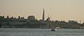 Sevastopol sunset
 -
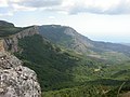
 The mountain of Eklizi-Burun, near Alushta
 -
 The Crimean Mountains near the city of Alushta


Climate
Template:Must include Most of Crimea has a temperate continental climate, except for the south coast where it experiences a humid[citation needed] subtropical climate, due to warm influences from the Black Sea. Summers can be hot (28 °C or 82.4 °F Jul average) and winters are cool (−0.3 °C or 31.5 °F Jan average) in the interior, on the south coast winters are milder (4 °C or 39.2 °F Jan average) and temperatures much below freezing are exceptional. Precipitation throughout Crimea is low, averaging only 400 mm (15.7 in) a year. Because of its climate, the southern Crimean coast is a popular beach and sun resort for Ukrainian and Russian tourists.
Biodiversity
This section is empty. You can help by adding to it. (March 2014) |
Government and politics
The largest city is Simferopol with major centers of urban development including Kerch (heavy industry and fishing center), Dzhankoy (transportation hub), Yalta (holiday resort) and others.
Economy
Crimea possesses several natural gas fields both onshore and offshore, all connected to Ukraine's pipeline system.[21][22] The inland fields are located in Chornomorske and Dzhankoy, while offshore fields are located in the western coast in the Black Sea and in the northeastern coast in the Azov Sea:[23]
The republic also possesses two oil fields: one onshore, the Serebryankse oil field in Rozdolne, and one offshore, the Subbotina oil field in the Black Sea.
Demographics
This section is empty. You can help by adding to it. (March 2014) |
Russian
Culture
This section is empty. You can help by adding to it. (March 2014) |
Russian
Gallery
This section is empty. You can help by adding to it. (March 2014) |
See also
Notes
References
- ^ Парламент Крыма принял постановление «О гарантиях восстановления прав крымскотатарского народа и его интеграции в крымское сообщество»
- ^ Facts you need to know about Crimea and why it is in turmoil. RT
- ^ Marie-Louise Gumuchian (March 17, 2014). "Crimea votes to break from Ukraine, join Russia. What happens next?". CNN. Retrieved March 17, 2014.
On Monday, lawmakers in Crimea approved a resolution that declared the Black Sea peninsula an independent, sovereign state. They then filed an appeal to join the Russian Federation.
- ^ "Crimea votes to join Russian Federation: 96.77% say YES". RT.
Crimea was declared an independent sovereign state, the Republic of Crimea, on Monday, the autonomous Ukrainian regional parliament's website stated. The Supreme Council of Crimea unanimously voted to integrate of the region into Russia.
- ^ a b c "Crimea parliament declares independence from Ukraine ahead of referendum". Russia Today. March 17, 2014. Retrieved March 17, 2014.
- ^ "Russian ruble announced Crimea's official currency". Russia & India Report. March 17, 2014. Retrieved March 17, 2014.
- ^ Crimea to Adopt Moscow Time at End of March
- ^ “kır” in Nişanyan Dictionary (Turkish Etymological dictionary)
- ^ “*Kɨr” in Sergei Starostin, Vladimir Dybo, Oleg Mudrak (2003), Etymological Dictionary of the Altaic Languages, Leiden: Brill Academic Publishers
- ^ Herodotus IV.20.
- ^ "Constitution of Ukraine, 1996". Retrieved March 12, 2014.
- ^ http://www.bbc.com/news/world-europe-26606097
- ^ http://www.reuters.com/article/2014/03/16/us-ukraine-crisis-idUSBREA1Q1E820140316
- ^ http://www.bbc.com/news/world-europe-26606097
- ^ "About 40% of Crimean Tatars take part in Crimean referendum – Prime Minister". ITAR-TASS. March 16, 2014. Retrieved March 16, 2014.
- ^ http://www.bbc.com/news/world-europe-26606097
- ^ http://www.reuters.com/article/2014/03/17/ukraine-crisis-japan-idUST9N0M101J20140317
- ^ "Lawmakers in Crimea Move Swiftly to Split From Ukraine". The New York Times. March 17, 2014. Retrieved March 17, 2014.
- ^ The Crimean Mountains may also be referred to as the Yaylâ Dağ or Alpine Meadow Mountains.
- ^ See the article "Crimea" in the Encyclopædia Britannica Eleventh Edition.
- ^ Gloystein, Henning (March 7, 2014). "Ukraine's Black Sea gas ambitions seen at risk over Crimea". Reuters. Retrieved March 7, 2014.
- ^ "East European Gas Analysis - Ukrainian Gas Pipelines". Eegas.com. February 9, 2013. Retrieved March 8, 2014.
- ^ "Ukraine crisis in maps". BBC. March 5, 2014. Retrieved March 7, 2014.
- ^ "Investment portal of the Autonomous Republic of Crimea – investments in Crimea - "Chernomorneftegaz" presented a program of development till 2015". Invest-crimea.gov.ua. Retrieved March 8, 2014.
External links