
Fort Collins, Colorado: Difference between revisions
Rescuing 10 sources and tagging 2 as dead. #IABot (v1.2.7.1) |
|||
| Line 24: | Line 24: | ||
|subdivision_name1 = [[Colorado]] |
|subdivision_name1 = [[Colorado]] |
||
|subdivision_type2 = [[List of counties in Colorado|County]] |
|subdivision_type2 = [[List of counties in Colorado|County]] |
||
|subdivision_name2 = [[Larimer County, Colorado|Larimer County Seat]]<ref name="COMun">{{cite web|url=http://www.dola.state.co.us/dlg/local_governments/municipalities.html|title=Active Colorado Municipalities|publisher=[[Colorado|State of Colorado]], Department of Local Affairs|accessdate=September 1, 2007|archiveurl=http://www.webcitation.org/5uRWqBo2m|archivedate=November 22, 2010|deadurl= |
|subdivision_name2 = [[Larimer County, Colorado|Larimer County Seat]]<ref name="COMun">{{cite web|url=http://www.dola.state.co.us/dlg/local_governments/municipalities.html |title=Active Colorado Municipalities |publisher=[[Colorado|State of Colorado]], Department of Local Affairs |accessdate=September 1, 2007 |archiveurl=http://www.webcitation.org/5uRWqBo2m?url=http://www.dola.state.co.us/dlg/local_governments/municipalities.html |archivedate=November 22, 2010 |deadurl=yes |df=mdy }}</ref> |
||
|government_footnotes = |
|government_footnotes = |
||
|government_type = [[List of cities and towns in Colorado#Home rule municipality|Home Rule Municipality]]<ref name=COMun/> |
|government_type = [[List of cities and towns in Colorado#Home rule municipality|Home Rule Municipality]]<ref name=COMun/> |
||
| Line 36: | Line 36: | ||
|established_date = 1864 |
|established_date = 1864 |
||
|established_title2 = [[Municipal corporation|Incorporated]] |
|established_title2 = [[Municipal corporation|Incorporated]] |
||
|established_date2 = February 12, 1883<ref name="MuniIncCO">{{cite web|url=http://www.colorado.gov/dpa/doit/archives/muninc.html|title=Colorado Municipal Incorporations|publisher=[[Colorado|State of Colorado]], Department of Personnel & Administration, Colorado State Archives|date=December 1, 2004|accessdate=September 2, 2007|archiveurl=http://www.webcitation.org/5uRWqjYXd|archivedate=November 22, 2010|deadurl=no}}</ref> |
|established_date2 = February 12, 1883<ref name="MuniIncCO">{{cite web|url=http://www.colorado.gov/dpa/doit/archives/muninc.html |title=Colorado Municipal Incorporations |publisher=[[Colorado|State of Colorado]], Department of Personnel & Administration, Colorado State Archives |date=December 1, 2004 |accessdate=September 2, 2007 |archiveurl=http://www.webcitation.org/5uRWqjYXd?url=http://www.colorado.gov/dpa/doit/archives/muninc.html |archivedate=November 22, 2010 |deadurl=no |df=mdy }}</ref> |
||
|established_title3 = |
|established_title3 = |
||
|established_date3 = |
|established_date3 = |
||
| Line 56: | Line 56: | ||
|population_est = 161000 |
|population_est = 161000 |
||
|pop_est_as_of = 2015 |
|pop_est_as_of = 2015 |
||
|pop_est_footnotes = <ref name="2014 Pop Estimate">{{cite web|title=Population Estimates|url=http://www.census.gov/popest/data/cities/totals/2014/SUB-EST2014-3.html|publisher=[[United States Census Bureau]]|accessdate=June 4, 2015}}</ref> |
|pop_est_footnotes = <ref name="2014 Pop Estimate">{{cite web|title=Population Estimates |url=http://www.census.gov/popest/data/cities/totals/2014/SUB-EST2014-3.html |publisher=[[United States Census Bureau]] |accessdate=June 4, 2015 }}{{dead link|date=January 2017 |bot=InternetArchiveBot |fix-attempted=yes }}</ref> |
||
|population_footnotes = <ref name ="FactFinder">{{cite web|title=American FactFinder|url=http://factfinder2.census.gov/faces/nav/jsf/pages/index.xhtml|publisher=[[United States Census Bureau]]|accessdate=2014-11-06}}</ref> |
|population_footnotes = <ref name ="FactFinder">{{cite web|title=American FactFinder|url=http://factfinder2.census.gov/faces/nav/jsf/pages/index.xhtml|publisher=[[United States Census Bureau]]|accessdate=2014-11-06}}</ref> |
||
|population_total = 143986 |
|population_total = 143986 |
||
| Line 72: | Line 72: | ||
|latd= 40 |latm= 33 |lats= 33 |latNS=N |
|latd= 40 |latm= 33 |lats= 33 |latNS=N |
||
|longd= 105 |longm= 4 |longs= 41 |longEW=W |
|longd= 105 |longm= 4 |longs= 41 |longEW=W |
||
|postal_code_type = [[ZIP Code]]s<ref name="ZIPcode">{{cite web|url=http://zip4.usps.com/zip4/citytown.jsp|title=ZIP Code Lookup|format=[[JavaScript]]/[[HTML]]|publisher=[[United States Postal Service]]|accessdate=September 16, 2007|archiveurl=http://www.webcitation.org/5uRWp2Zfd|archivedate=November 22, 2010|deadurl= |
|postal_code_type = [[ZIP Code]]s<ref name="ZIPcode">{{cite web|url=http://zip4.usps.com/zip4/citytown.jsp |title=ZIP Code Lookup |format=[[JavaScript]]/[[HTML]] |publisher=[[United States Postal Service]] |accessdate=September 16, 2007 |archiveurl=http://www.webcitation.org/5uRWp2Zfd?url=http://zip4.usps.com/zip4/citytown.jsp |archivedate=November 22, 2010 |deadurl=yes |df=mdy }}</ref> |
||
|postal_code = 80521 – 80528 |
|postal_code = 80521 – 80528 |
||
|elevation_m = 1525 |
|elevation_m = 1525 |
||
| Line 86: | Line 86: | ||
}} |
}} |
||
'''Fort Collins''' is the [[List of cities and towns in Colorado#Home rule municipality|Home Rule Municipality]] that is the [[county seat]] and the [[List of cities and towns in Colorado|most populous municipality]] of [[Larimer County, Colorado|Larimer County]], [[Colorado]], [[United States]].<ref name="GR6">{{cite web|url=http://www.naco.org/Counties/Pages/FindACounty.aspx|accessdate=2011-06-07|title=Find a County|publisher=National Association of Counties}}</ref> Situated on the [[Cache La Poudre River]] along the [[Colorado Front Range]], Fort Collins is located 65 miles (105 km) north of the [[Colorado State Capitol]] in [[Denver]]. With a 2016 estimated population of 161,000,<ref>{{cite web|url=http://www.fcgov.com/planning/trends.php|accessdate=2016-06-21|title=Trends|publisher=City of Fort Collins}}</ref> it is the [[List of cities and towns in Colorado#Table|fourth most populous city]] in Colorado after Denver, [[Colorado Springs, Colorado|Colorado Springs]], and [[Aurora, Colorado|Aurora]]. Fort Collins is a midsize college city, home to [[Colorado State University]]. |
'''Fort Collins''' is the [[List of cities and towns in Colorado#Home rule municipality|Home Rule Municipality]] that is the [[county seat]] and the [[List of cities and towns in Colorado|most populous municipality]] of [[Larimer County, Colorado|Larimer County]], [[Colorado]], [[United States]].<ref name="GR6">{{cite web|url=http://www.naco.org/Counties/Pages/FindACounty.aspx |accessdate=2011-06-07 |title=Find a County |publisher=National Association of Counties |deadurl=yes |archiveurl=https://web.archive.org/web/20110531210815/http://www.naco.org/Counties/Pages/FindACounty.aspx |archivedate=May 31, 2011 |df=mdy }}</ref> Situated on the [[Cache La Poudre River]] along the [[Colorado Front Range]], Fort Collins is located 65 miles (105 km) north of the [[Colorado State Capitol]] in [[Denver]]. With a 2016 estimated population of 161,000,<ref>{{cite web|url=http://www.fcgov.com/planning/trends.php|accessdate=2016-06-21|title=Trends|publisher=City of Fort Collins}}</ref> it is the [[List of cities and towns in Colorado#Table|fourth most populous city]] in Colorado after Denver, [[Colorado Springs, Colorado|Colorado Springs]], and [[Aurora, Colorado|Aurora]]. Fort Collins is a midsize college city, home to [[Colorado State University]]. |
||
==History== |
==History== |
||
Fort Collins was founded as a military outpost of the [[United States Army]] in 1864. It succeeded a previous encampment, known as [[Camp Collins]], on the [[Cache La Poudre River]], near what is known today as [[Laporte, Colorado|Laporte]]. Camp Collins was erected during the Indian wars of the mid-1860s to protect the Overland mail route that had been recently relocated through the region. Travelers crossing the county on the [[Overland Trail]] would camp there, but a flood destroyed the camp in June 1864.<ref name="flooding">{{cite web|url=http://www.ci.fort-collins.co.us/oem/historical-flooding.php|title= |
Fort Collins was founded as a military outpost of the [[United States Army]] in 1864. It succeeded a previous encampment, known as [[Camp Collins]], on the [[Cache La Poudre River]], near what is known today as [[Laporte, Colorado|Laporte]]. Camp Collins was erected during the Indian wars of the mid-1860s to protect the Overland mail route that had been recently relocated through the region. Travelers crossing the county on the [[Overland Trail]] would camp there, but a flood destroyed the camp in June 1864.<ref name="flooding">{{cite web|url=http://www.ci.fort-collins.co.us/oem/historical-flooding.php |title=Flooding Timeline in Fort Collins |accessdate=September 28, 2007 |archiveurl=http://www.webcitation.org/5uRWtNFfn?url=http://www.ci.fort-collins.co.us/oem/historical-flooding.php |archivedate=November 22, 2010 |deadurl=yes |df=mdy }}</ref> Afterward, the commander of the fort wrote to the commandant of Fort Laramie in southeast Wyoming, Colonel [[William O. Collins]], suggesting that a site several miles farther down the river would make a good location for the fort. The post was manned originally by two companies of the 11th Ohio Volunteer Cavalry and never had walls.<ref name = "l1860"/> |
||
[[File:Fort Collins, Colorado (19th Century).jpg|thumb|left|Nineteenth-century bird's-eye view of Fort Collins.]] |
[[File:Fort Collins, Colorado (19th Century).jpg|thumb|left|Nineteenth-century bird's-eye view of Fort Collins.]] |
||
| Line 265: | Line 265: | ||
|estyear=2015 |
|estyear=2015 |
||
|estimate=161175 |
|estimate=161175 |
||
|estref=<ref name="USCensusEst2015">{{cite web|url=http://www.census.gov/popest/data/cities/totals/2015/SUB-EST2015.html|title=Annual Estimates of the Resident Population for Incorporated Places: April 1, 2010 to July 1, 2015|accessdate=July 2, 2016}}</ref> |
|estref=<ref name="USCensusEst2015">{{cite web|url=http://www.census.gov/popest/data/cities/totals/2015/SUB-EST2015.html |title=Annual Estimates of the Resident Population for Incorporated Places: April 1, 2010 to July 1, 2015 |accessdate=July 2, 2016 }}{{dead link|date=January 2017 |bot=InternetArchiveBot |fix-attempted=yes }}</ref> |
||
|footnote=<center>U.S. Decennial Census<ref name="DecennialCensus">{{cite web|url=http://www.census.gov/prod/www/decennial.html|title=Census of Population and Housing|publisher=Census.gov|accessdate=June 4, 2015}}</ref></center> |
|footnote=<center>U.S. Decennial Census<ref name="DecennialCensus">{{cite web|url=http://www.census.gov/prod/www/decennial.html |title=Census of Population and Housing |publisher=Census.gov |accessdate=June 4, 2015 |deadurl=yes |archiveurl=http://www.webcitation.org/6YSasqtfX?url=http%3A%2F%2Fwww.census.gov%2Fprod%2Fwww%2Fdecennial.html |archivedate=May 11, 2015 |df=mdy }}</ref></center> |
||
}} |
}} |
||
Fort Collins is the [[Colorado municipalities by population|fourth most populous city]] in Colorado and the 156th [[list of United States cities by population|most populous city]] in the United States. The Census Bureau estimates that the city's population was 161,175 in 2015, the population of the [[Fort Collins-Loveland Metropolitan Statistical Area]] was 310,487 ([[United States metropolitan area|151st most populous MSA]]), and the population of the [[Front Range Urban Corridor]] was 4,495,181. |
Fort Collins is the [[Colorado municipalities by population|fourth most populous city]] in Colorado and the 156th [[list of United States cities by population|most populous city]] in the United States. The Census Bureau estimates that the city's population was 161,175 in 2015, the population of the [[Fort Collins-Loveland Metropolitan Statistical Area]] was 310,487 ([[United States metropolitan area|151st most populous MSA]]), and the population of the [[Front Range Urban Corridor]] was 4,495,181. |
||
As of the census<ref name="GR2">{{cite web|url=http://factfinder2.census.gov|publisher=[[United States Census Bureau]]|accessdate=2008-01-31|title=American FactFinder}}</ref> of 2000, there were 118,652 people, 45,882 households, and 25,785 families residing in the city. The population density was 2,549.3 people per square mile (984.4/km²). There were 47,755 housing units at an average density of 1,026.0 per square mile (396.2/km²). The racial makeup of the city was 82.4% [[Race (United States Census)|White]], 3.01% [[Race (United States Census)|Black]] or [[Race (United States Census)|African American]], 0.60% [[Race (United States Census)|Native American]], 2.48% [[Race (United States Census)|Asian]], 0.12% [[Race (United States Census)|Pacific Islander]], 3.61% from [[Race (United States Census)|other races]], and 2.53% from two or more races. [[Hispanic (U.S. Census)|Hispanic]] or [[Race (United States Census)|Latino]] of any race were 10.79% of the population. |
As of the census<ref name="GR2">{{cite web|url=http://factfinder2.census.gov |publisher=[[United States Census Bureau]] |accessdate=2008-01-31 |title=American FactFinder |deadurl=yes |archiveurl=https://web.archive.org/web/20130911234518/http://factfinder2.census.gov |archivedate=September 11, 2013 |df=mdy }}</ref> of 2000, there were 118,652 people, 45,882 households, and 25,785 families residing in the city. The population density was 2,549.3 people per square mile (984.4/km²). There were 47,755 housing units at an average density of 1,026.0 per square mile (396.2/km²). The racial makeup of the city was 82.4% [[Race (United States Census)|White]], 3.01% [[Race (United States Census)|Black]] or [[Race (United States Census)|African American]], 0.60% [[Race (United States Census)|Native American]], 2.48% [[Race (United States Census)|Asian]], 0.12% [[Race (United States Census)|Pacific Islander]], 3.61% from [[Race (United States Census)|other races]], and 2.53% from two or more races. [[Hispanic (U.S. Census)|Hispanic]] or [[Race (United States Census)|Latino]] of any race were 10.79% of the population. |
||
There were 45,882 households out of which 29.0% had children under the age of 18 living with them, 44.9% were married couples living together, 7.9% had a female householder with no husband present, and 43.8% were non-families. 26.0% of all households were made up of individuals and 5.9% had someone living alone who was 65 years of age or older. The average household size was 2.45 and the average family size was 3.01. |
There were 45,882 households out of which 29.0% had children under the age of 18 living with them, 44.9% were married couples living together, 7.9% had a female householder with no husband present, and 43.8% were non-families. 26.0% of all households were made up of individuals and 5.9% had someone living alone who was 65 years of age or older. The average household size was 2.45 and the average family size was 3.01. |
||
| Line 281: | Line 281: | ||
==Law and government== |
==Law and government== |
||
{| class="toccolours" border="1" cellpadding="2" cellspacing="0" style="border-collapse: collapse; float:right; margin: .5em;" |
{| class="toccolours" border="1" cellpadding="2" cellspacing="0" style="border-collapse: collapse; float:right; margin: .5em;" |
||
|+ '''City Council:'''<ref name="citycouncil">{{cite web |
|+ '''City Council:'''<ref name="citycouncil">{{cite web|url=http://fcgov.com/council/ |title=Home page for city council |accessdate=August 18, 2007 |work=City of Fort Collins |archiveurl=http://www.webcitation.org/5uRX5QWvN?url=http://www.ci.fort-collins.co.us/council/ |archivedate=November 22, 2010 |deadurl=no |df=mdy }}</ref> |
||
|- |
|- |
||
| '''Mayor''' || Wade Troxell |
| '''Mayor''' || Wade Troxell |
||
| Line 328: | Line 328: | ||
* In 2012, the city was listed among the 10 best places to retire in the U.S. by CBS Money Watch.<ref>[http://finance.yahoo.com/news/the-10-best-places-to-retire.html The 10 Best Places to Retire]</ref> |
* In 2012, the city was listed among the 10 best places to retire in the U.S. by CBS Money Watch.<ref>[http://finance.yahoo.com/news/the-10-best-places-to-retire.html The 10 Best Places to Retire]</ref> |
||
* In 2011, [[Allstate|Allstate Insurance]] listed Fort Collins as "America's Safest Driving City" in their annual "Best Drivers Report".<ref>{{cite web | title = Seventh Annual "Allstate America's Best Drivers Report" Reveals Safest Driving Cities | publisher = Allstate Insurance Company | date = September 1, 2011 | url = http://www.allstatenewsroom.com/channels/News-Releases/releases/seventh-annual-allstate-america-s-best-drivers-report-reveals-safest-driving-cities | accessdate=January 2, 2014}}</ref> |
* In 2011, [[Allstate|Allstate Insurance]] listed Fort Collins as "America's Safest Driving City" in their annual "Best Drivers Report".<ref>{{cite web | title = Seventh Annual "Allstate America's Best Drivers Report" Reveals Safest Driving Cities | publisher = Allstate Insurance Company | date = September 1, 2011 | url = http://www.allstatenewsroom.com/channels/News-Releases/releases/seventh-annual-allstate-america-s-best-drivers-report-reveals-safest-driving-cities | accessdate=January 2, 2014}}</ref> |
||
* In 2006, ''[[Money (magazine)|Money]]'' ranked Fort Collins as the best place to live in America,<ref>{{cite web |
* In 2006, ''[[Money (magazine)|Money]]'' ranked Fort Collins as the best place to live in America,<ref>{{cite web|date=July 2006 |url=http://money.cnn.com/magazines/moneymag/bplive/2006/index.html |title=Best Places to Live 2006 |publisher=Money Magazine |accessdate=December 15, 2006 |archiveurl=http://www.webcitation.org/5uRX28cq6?url=http://money.cnn.com/magazines/moneymag/bplive/2006/index.html |archivedate=November 22, 2010 |deadurl=yes |df=mdy }}</ref> |
||
==Communications== |
==Communications== |
||
| Line 414: | Line 414: | ||
<ref>http://www.wrex.com/story/29278329/2015/06/09/rockford-airport-to-serve-denver-new-york-city</ref> [[Denver International Airport]], which is {{convert|70|mi|km}} to the south, is served by nearly twenty airlines. Fort Collins can be approached from Denver by car via [[Interstate 25 (Colorado)|Interstate 25]] or by way of the RTD bus system and the FLEX regional bus line. |
<ref>http://www.wrex.com/story/29278329/2015/06/09/rockford-airport-to-serve-denver-new-york-city</ref> [[Denver International Airport]], which is {{convert|70|mi|km}} to the south, is served by nearly twenty airlines. Fort Collins can be approached from Denver by car via [[Interstate 25 (Colorado)|Interstate 25]] or by way of the RTD bus system and the FLEX regional bus line. |
||
The city's former [[general aviation]] airport, known as [[Fort Collins Downtown Airport]] (3V5), opened in 1966 and closed in 2006.<ref>{{cite web |
The city's former [[general aviation]] airport, known as [[Fort Collins Downtown Airport]] (3V5), opened in 1966 and closed in 2006.<ref>{{cite web|url=http://www.airfields-freeman.com/CO/Airfields_CO_E.htm#ftcollins |title=Valley Airport / Fort Collins Airpark / Fort Collins Downtown Airport (3V5) |publisher=[[Abandoned & Little-Known Airfields]] |date=December 11, 2009 |archiveurl=http://www.webcitation.org/5uRX7rQdV?url=http://www.airfields-freeman.com/CO/Airfields_CO_E.htm#ftcollins |archivedate=November 22, 2010 |deadurl=no |df=mdy }}</ref> |
||
Fort Collins's downtown streets form a grid with [[Interstate 25 (Colorado)|Interstate 25]] running north and south on the east side of the city. Many of the streets are named after the town's founders.{{citation needed | date=January 2015}} [[U.S. Highway 287 (Colorado)|U.S. Highway 287]] becomes College Avenue inside the city and is the busiest street; It runs north and south, effectively bisecting the city, and serving as the east–west meridian, while Mountain Avenue is the north-south. [[Colorado State Highway 14|SH 14]] runs concurrent with US 287 at the northern city limit to Jefferson Street, running southeast along Jefferson (later turning into Riverside Avenue), then turning east onto Mulberry Street where it goes east out of the city after an interchange with Interstate 25. |
Fort Collins's downtown streets form a grid with [[Interstate 25 (Colorado)|Interstate 25]] running north and south on the east side of the city. Many of the streets are named after the town's founders.{{citation needed | date=January 2015}} [[U.S. Highway 287 (Colorado)|U.S. Highway 287]] becomes College Avenue inside the city and is the busiest street; It runs north and south, effectively bisecting the city, and serving as the east–west meridian, while Mountain Avenue is the north-south. [[Colorado State Highway 14|SH 14]] runs concurrent with US 287 at the northern city limit to Jefferson Street, running southeast along Jefferson (later turning into Riverside Avenue), then turning east onto Mulberry Street where it goes east out of the city after an interchange with Interstate 25. |
||
Revision as of 05:05, 3 January 2017
Fort Collins, Colorado | |
|---|---|
 Downtown "Old Town" Fort Collins | |
 Flag | |
 Location of Fort Collins shown within the State of Colorado | |
| Country | United States |
| State | Colorado |
| County | Larimer County Seat[1] |
| Commissioned | 1864 |
| Incorporated | February 12, 1883[2] |
| Named for | United States Army colonel William O. Collins |
| Government | |
| • Type | Home Rule Municipality[1] |
| • Mayor | Wade Troxell |
| • Mayor pro tem | Gerry Horak |
| • City Manager | Darin Atteberry |
| Area | |
| • Total | 55.83 sq mi (122.1 km2) |
| • Land | 54.28 sq mi (120.5 km2) |
| • Water | 0.6 sq mi (1.6 km2) 1.27% |
| Elevation | 5,003 ft (1,525 m) |
| Population | |
| • Total | 143,986 |
| • Estimate (2015)[4] | 161,000 |
| • Density | 2,652.8/sq mi (984.4/km2) |
| Time zone | UTC−7 (MST) |
| • Summer (DST) | UTC−6 (MDT) |
| ZIP Codes[5] | 80521 – 80528 |
| Area code | 970 |
| FIPS code | 08-27425 |
| GNIS feature ID | 0204673 |
| Highways | I-25, US 287, SH 1, SH 14 |
| Website | fcgov |
Fort Collins is the Home Rule Municipality that is the county seat and the most populous municipality of Larimer County, Colorado, United States.[6] Situated on the Cache La Poudre River along the Colorado Front Range, Fort Collins is located 65 miles (105 km) north of the Colorado State Capitol in Denver. With a 2016 estimated population of 161,000,[7] it is the fourth most populous city in Colorado after Denver, Colorado Springs, and Aurora. Fort Collins is a midsize college city, home to Colorado State University.
History
Fort Collins was founded as a military outpost of the United States Army in 1864. It succeeded a previous encampment, known as Camp Collins, on the Cache La Poudre River, near what is known today as Laporte. Camp Collins was erected during the Indian wars of the mid-1860s to protect the Overland mail route that had been recently relocated through the region. Travelers crossing the county on the Overland Trail would camp there, but a flood destroyed the camp in June 1864.[8] Afterward, the commander of the fort wrote to the commandant of Fort Laramie in southeast Wyoming, Colonel William O. Collins, suggesting that a site several miles farther down the river would make a good location for the fort. The post was manned originally by two companies of the 11th Ohio Volunteer Cavalry and never had walls.[9]
.jpg)
Settlers began arriving in the vicinity of the fort nearly immediately. The fort was decommissioned in 1867. The original fort site is now adjacent to the present historic "Old Town" portion of the city. The first school and church opened in 1866, and the town was platted in 1867. The civilian population of Fort Collins, led by local businessman Joseph Mason, led an effort to relocate the county seat to Fort Collins from LaPorte, and they were successful in 1868.[9]
The city's first population boom came in 1872, with the establishment of an agricultural colony. Hundreds of settlers arrived, developing lots just south of the original Old Town. Tension between new settlers and earlier inhabitants led to political divisions in the new town, which was incorporated in 1873. Although the Colorado Agricultural College was founded in 1870, the first classes were held in 1879.[10]
The 1880s saw the construction of a number of elegant homes and commercial buildings and the growth of a distinctive identity for Fort Collins. Stone quarrying, sugar-beet farming, and the slaughter of sheep were among the area's earliest industries. Beet tops, an industry supported by the college and its associated agricultural experiment station, proved to be an excellent and abundant food for local sheep,[11] and by the early 1900s the area was being referred to as the "Lamb feeding capital of the world." In 1901 the Great Western sugar processing plant was built in the neighboring city of Loveland.[12]

Although the city was affected by the Great Depression and simultaneous drought,[13] it nevertheless experienced slow and steady growth throughout the early part of the twentieth century.[14] During the decade following World War II, the population doubled and an era of economic prosperity occurred. Old buildings were razed to make way for new, modern structures. Along with revitalization came many changes, including the closing of the Great Western sugar factory in 1955, and a new city charter, adopting a council-manager form of government in 1954.[15] Similarly, Colorado State University's enrollment doubled during the 1960s,[16] making it the city's primary economic force by the end of the century.
Fort Collins gained a reputation as a very conservative city in the twentieth century, with a prohibition of alcoholic beverages, a contentious political issue in the town's early decades,[17] being retained from the late 1890s until student activism helped bring it to an end in 1969.[16] During that same period, civil rights activism and anti-war disturbances heightened tensions in the city, including the burning of several buildings on the CSU campus.[18]
During the late 20th century, Fort Collins expanded rapidly to the south, adding new development, including several regional malls.[18] Management of city growth patterns became a political priority during the 1980s, as well as the revitalization of Fort Collins' Old Town with the creation of a Downtown Development Authority.[19] In late July 1997, the city experienced a flash flood after and during a 31-hour period when 10–14 in (250–360 mm) of rain fell. The rainfall was the heaviest on record for an urban area of Colorado.[20] Five people were killed and $5 million in damages were dealt to the city. The waters flooded Colorado State University's library and brought about $140 million in damages to the institution.[21]


Geography
Fort Collins is situated at the base of the Rocky Mountain foothills of the northern Front Range approximately 60 miles (97 km) north of Denver, Colorado and 45 miles (72 km) south of Cheyenne, Wyoming. Elevation is 4,982 ft (1,519 m) above sea level. Geographic landmarks include Horsetooth Reservoir and Horsetooth Mountain—so named because of a tooth-shaped granite rock that dominates the city's western skyline. Longs Peak can also clearly be seen on a clear day to the southwest of the city.
According to the United States Census Bureau, the city has a total area of 47.1 square miles (122 km2), of which 46.5 square miles (120 km2) is land and 0.6 square miles (1.6 km2), or 1.27%, is water. The Cache La Poudre River and Spring Creek run through Fort Collins.
Neighboring cities
Places adjacent to Fort Collins, Colorado | ||||||||||||||||
|---|---|---|---|---|---|---|---|---|---|---|---|---|---|---|---|---|
| ||||||||||||||||
Climate
Located along the Front Range of the Rocky Mountains, Fort Collins experiences a semi-arid climate (Köppen BSk), with four distinct seasons and low annual precipitation. Summers range from mild to hot, with low humidity and occasional afternoon thunderstorms. Winters range from mild to moderately cold. The city experiences lots of sunshine, with 300 days of sunshine per year and 19 days with 90° + weather. The average temperature in July, the warmest month, is 71 °F (22 °C). The average temperature in January, the coldest month, is 29 °F (−2 °C). Annual snowfall averages 59 inches (1.5 m), and can occur from early September through the end of May. Average precipitation overall is 15.9 inches (400 mm).
| Climate data for Fort Collins, Colorado (1981–2010 normals) | |||||||||||||
|---|---|---|---|---|---|---|---|---|---|---|---|---|---|
| Month | Jan | Feb | Mar | Apr | May | Jun | Jul | Aug | Sep | Oct | Nov | Dec | Year |
| Record high °F (°C) | 73 (23) |
76 (24) |
81 (27) |
89 (32) |
97 (36) |
102 (39) |
103 (39) |
100 (38) |
97 (36) |
88 (31) |
81 (27) |
76 (24) |
103 (39) |
| Mean daily maximum °F (°C) | 44.2 (6.8) |
46.5 (8.1) |
54.7 (12.6) |
62.2 (16.8) |
71.1 (21.7) |
80.4 (26.9) |
86.6 (30.3) |
84.0 (28.9) |
75.9 (24.4) |
63.9 (17.7) |
51.4 (10.8) |
42.8 (6.0) |
63.6 (17.6) |
| Mean daily minimum °F (°C) | 17.5 (−8.1) |
20.4 (−6.4) |
27.7 (−2.4) |
35.1 (1.7) |
44.1 (6.7) |
52.2 (11.2) |
58.0 (14.4) |
56.3 (13.5) |
47.1 (8.4) |
35.9 (2.2) |
25.6 (−3.6) |
17.2 (−8.2) |
36.4 (2.4) |
| Record low °F (°C) | −38 (−39) |
−41 (−41) |
−31 (−35) |
−10 (−23) |
12 (−11) |
29 (−2) |
36 (2) |
32 (0) |
18 (−8) |
−8 (−22) |
−21 (−29) |
−35 (−37) |
−41 (−41) |
| Average precipitation inches (mm) | 0.40 (10) |
0.42 (11) |
1.60 (41) |
2.06 (52) |
2.43 (62) |
2.17 (55) |
1.71 (43) |
1.60 (41) |
1.33 (34) |
1.15 (29) |
0.76 (19) |
0.50 (13) |
16.13 (410) |
| Average snowfall inches (cm) | 7.3 (19) |
6.8 (17) |
12.1 (31) |
6.0 (15) |
0.7 (1.8) |
0 (0) |
0 (0) |
0 (0) |
0.9 (2.3) |
3.6 (9.1) |
8.6 (22) |
8.4 (21) |
54.4 (138.2) |
| Average precipitation days (≥ 0.01 in) | 4.1 | 4.9 | 6.4 | 8.6 | 11.2 | 10.0 | 9.0 | 9.4 | 7.6 | 6.3 | 5.2 | 4.5 | 87.2 |
| Average snowy days (≥ 0.1 in) | 4.4 | 5.0 | 5.3 | 3.1 | 0.4 | 0 | 0 | 0 | 0.4 | 1.4 | 4.1 | 4.7 | 28.8 |
| Source: NOAA[22] | |||||||||||||
Demographics
| Census | Pop. | Note | %± |
|---|---|---|---|
| 1880 | 1,356 | — | |
| 1890 | 2,011 | 48.3% | |
| 1900 | 3,053 | 51.8% | |
| 1910 | 8,210 | 168.9% | |
| 1920 | 8,755 | 6.6% | |
| 1930 | 11,489 | 31.2% | |
| 1940 | 12,251 | 6.6% | |
| 1950 | 14,937 | 21.9% | |
| 1960 | 25,027 | 67.6% | |
| 1970 | 43,337 | 73.2% | |
| 1980 | 65,092 | 50.2% | |
| 1990 | 87,758 | 34.8% | |
| 2000 | 118,652 | 35.2% | |
| 2010 | 143,986 | 21.4% | |
| 2015 (est.) | 161,175 | [23] | 11.9% |
Fort Collins is the fourth most populous city in Colorado and the 156th most populous city in the United States. The Census Bureau estimates that the city's population was 161,175 in 2015, the population of the Fort Collins-Loveland Metropolitan Statistical Area was 310,487 (151st most populous MSA), and the population of the Front Range Urban Corridor was 4,495,181.
As of the census[25] of 2000, there were 118,652 people, 45,882 households, and 25,785 families residing in the city. The population density was 2,549.3 people per square mile (984.4/km²). There were 47,755 housing units at an average density of 1,026.0 per square mile (396.2/km²). The racial makeup of the city was 82.4% White, 3.01% Black or African American, 0.60% Native American, 2.48% Asian, 0.12% Pacific Islander, 3.61% from other races, and 2.53% from two or more races. Hispanic or Latino of any race were 10.79% of the population.
There were 45,882 households out of which 29.0% had children under the age of 18 living with them, 44.9% were married couples living together, 7.9% had a female householder with no husband present, and 43.8% were non-families. 26.0% of all households were made up of individuals and 5.9% had someone living alone who was 65 years of age or older. The average household size was 2.45 and the average family size was 3.01.
In the city the population was spread out with 21.5% under the age of 18, 22.1% from 18 to 24, 31.5% from 25 to 44, 17.0% from 45 to 64, and 7.9% who were 65 years of age or older. The median age was 28 years. For every 100 females there were 100.9 males. For every 100 females age 18 and over, there were 99.7 males.
The median income for a household in the city was $64,459, and the median income for a family was $89,332. Males had a median income of $60,856 versus $48,385 for females. The per capita income for the city was $32,133. About 5.5% of families and 14.0% of the population were below the poverty line, including 8.3% of those under age 18 and 5.8% of those age 65 or over.
Law and government
| Mayor | Wade Troxell |
| District 1 | Bob Overbeck |
| District 2 | Ray Martinez |
| District 3 | Gino Campana |
| District 4 | Kristin Stephens |
| District 5 | Ross Cunniff |
| District 6 | Gerry Horak, Mayor Pro Tem |
Fort Collins has a council-manager form of government. The mayor, who serves a two-year term and stands for election in municipal elections held in April of odd-numbered years, presides over a seven-member City Council. The current mayor of Fort Collins is Wade Troxell, elected in April 2015. The six remaining council members are elected from districts for staggered four-year terms; odd-numbered districts are up for election in April 2017 and even-numbered districts in April 2019.
Fort Collins is the largest city in Colorado's 2nd Congressional district, and is represented in Congress by Representative Jared Polis (Democrat). On the state level, the city lies in the 14th district of the Colorado Senate, represented by John Kefalas and is split between the 52nd and 53rd districts of the Colorado House of Representatives, represented by Joann Ginal and Jennifer Arndt, respectively. All three of Fort Collins' state legislators are Democrats. Fort Collins is additionally the county seat of Larimer County, and houses county offices and courts.
The city maintains a police department.
Culture


Much of Fort Collins's culture is centered on the students of Colorado State University. The city provides school year residences for its large college-age population; there is a local music circuit which is influenced by its college town atmosphere and is home to a number of well known microbreweries. The Downtown Business Association hosts a number of small and large festivals each year in the historic Downtown district, including Bohemian Nights at NewWestFest in late summer, which features local cuisine, music, and businesses. The Fort Collins Lincoln Center is home to the Fort Collins Symphony Orchestra and regularly attracts national touring companies of Broadway plays.
The city's thriving beer culture supports many microbreweries: the New Belgium Brewing Company, the Odell Brewing Company, the Fort Collins Brewery, Equinox Brewing, Funkwerks, Horse & Dragon Brewery, Pateros Creek Brewing Company, Zwei Brewing, 1933 Brewing, Snowbank Brewing, Rally King Brewing, Jessup Farm Barrel House, McClellan's Brewing, Soul Squared Brewing, Three Four Brewing Company and Maxline Brewing. New Belgium is the largest of the local craft-breweries, with national distribution from California to states east of the Mississippi. The largest brewer in the world, Anheuser-Busch, also has a brewery northeast of the city near I-25. There are several brewpubs, including the original C.B. & Potts Restaurant and its Big Horn Brewery, CooperSmith's Pub & Brewing, a local mainstay since 1989, Pitchers Brewery, and Black Bottle Brewery.
The Colorado Brewer's Festival is held in late June annually in Fort Collins. The festival features beers from as many as 45 brewers from the state of Colorado and averages around 30,000 attendees. New Belgium Brewery also hosts the Tour de Fat which draws over 20,000 people riding bikes and dressing in costume. As well as a series of Bike in movies starting late September.
The Colorado Marathon is a yearly event running down the Poudre Canyon and finishing in downtown Fort Collins.
The principal venue for the performing arts in Fort Collins is the Lincoln Center, 417 W. Magnolia St., at Meldrum Street. Built in 1978, the center includes the 1,180-seat Performance Hall and the 220-seat Magnolia Theatre, as well as four exhibit galleries and an outdoor sculpture and performance garden. It is home to many local arts groups, including the Fort Collins Symphony, Opera Fort Collins, Canyon Concert Ballet, Larimer Chorale, Youth Orchestra of the Rockies, OpenStage Theatre and Company, Foothills Pops Band and the Fort Collins Children's Theatre. Concert, dance, children's, and travel film series are presented annually. The center is wheelchair-accessible and has an infrared sound system for the hearing-impaired. Ticket prices vary considerably, but children's programs are often free or less than $10, and big name acts and Broadway shows are $18 to $36. The center hosts nearly 1,750 events each year.
The Fort Collins Museum, established in 1941, is a regional center focusing on the culture and history of Fort Collins and the surrounding area. The Fort Collins Museum houses over 30,000 artifacts and features temporary and permanent exhibits, on-going educational programs and events, and is home to four historic structures located in the outdoor Heritage Courtyard.
The arts are represented by The Center for Fine Art Photography, University Center for the Arts, Fort Collins Museum of Art (FCMOA), the Arts Incubator of the Rockies (AIR), and the Bas Bleu Theatre Company.
The Gardens on Spring Creek is an 18-acre botanical garden. The site includes several themed gardens ranging from a children's garden to a rock garden, to several themed demonstration gardens.
Top rankings
Fort Collins has gathered many top rankings in recent years for health, well-being, and quality of life.
- In 2012, the city was listed among the 10 best places to retire in the U.S. by CBS Money Watch.[27]
- In 2011, Allstate Insurance listed Fort Collins as "America's Safest Driving City" in their annual "Best Drivers Report".[28]
- In 2006, Money ranked Fort Collins as the best place to live in America,[29]
Communications
One daily newspaper, the Fort Collins Coloradoan, is published in the city. Several niche publications, including the Fort Collins Courier and Fossil Creek Current, are distributed for free at local businesses and by mail. The Rocky Mountain Collegian is Colorado State University's student newspaper, and is published each weekday during the fall and spring semesters. The Collegian is the only daily student-run newspaper in the state,[citation needed] and includes a weekly entertainment tabloid called The Weekender.
The Scene Magazine is a longtime entertainment and lifestyle monthly magazine, serving Ft. Collins and the northern front range. The Rocky Mountain Parent Magazine and Parent Pages are niche publications serving northern Colorado families.
The city of Fort Collins publishes the "Recreator," a popular seasonal guide to recreational activities and facilities in Fort Collins. The "Recreator" has continually been published for over 30 years. It is distributed via direct mail, online and locally at libraries, recreation centers and businesses.
The Northern Colorado Business Report is also housed in Fort Collins, and is the largest business-to-business newspaper in Northern Colorado. It covers Larimer and Weld counties.
Colorado State University funds a student-run radio station that focuses on underground and local music, KCSU-FM; and KRFC is the local Front Range Public Radio, a volunteer radio station.
One local television station provided coverage of Fort Collins and the surrounding area, NoCo Channel 5, a CBS affiliate, until the a new station owner decided to shutter operations. Fort Collins has Public, educational, and government access (PEG) cable TV channels. City Cable 14 is the local Government-access television (GATV) cable channel, and broadcasts city and county meetings, as well as studio-produced local programming. Poudre School District and Colorado State University each have public access stations as well. There is also a Fort Collins Public Access Network (PAN) station, channel 97 on Comcast, which broadcasts 24 hours a day.
Education
This section possibly contains original research. (July 2009) |

K-12 public education is provided through Poudre School District (PSD). The district operates and manages the public schools in the city of Fort Collins, as well as in the surrounding towns of Wellington, Timnath, Windsor, Laporte and Livermore. The district is one of the fastest growing in Northern Colorado, adding 500 students — about the size of an elementary school — each year. To accommodate growth, the district plans to build three new schools in the next few years.[30]
Poudre School District includes four comprehensive high schools that serve neighborhoods around Fort Collins, including Fort Collins High School, Rocky Mountain High School, Poudre High School, Fossil Ridge High School. The district also operates four alternative high schools, for students who thrive in smaller environments or require flexible educational options. Those include Centennial High School, Polaris School for Expeditionary Learning School, Poudre Community Academy and Poudre School District Global Academy, a dual in-person/online school. Additionally, four public charter schools are chartered through PSD, including Ridgeview Classical Schools, and Liberty Common High School, Mountain Sage Community School and Fort Collins Montessori School.
The Poudre School District is also home to ten middle schools, including Lesher Middle IB World School, Blevins Middle School, Boltz Middle School, Cache La Poudre Middle School, Kinard Core Knowledge Middle School, Lincoln IB World Middle School, Polaris Expeditionary Learning School, Preston Middle School, Webber Middle School, and Wellington Middle School.
PSD is home to 32 elementary schools. A model of site-based management allows each school to select the focus that best fits the needs of its community, meaning that schools offer a wide range of specialized programs including International Baccalaureate, Core Knowledge, Project-Based Learning, Bilingual, and Expeditionary Learning. Colorado state law mandates Schools of Choice, meaning that parents can opt their child into any school in the district beyond their assigned neighborhood school, if space is available.
PSD has earned recognition from the U.S. Department of Education for excellence in sustainability,[31] and placed in the top 5 Education Sector partners in the 2016 Better Buildings challenge, put on by the U.S. Dept. of Energy, for achieving 25 percent energy savings and 29 percent water conservation over the last five years.[32] During the 2015-16 school year, the district diverted nearly 1,000 tons of waste.[33] Special curriculum like River Week ensures that students are educated about the importance of local conservation.[34]
In addition to PSD schools, several state charter schools serve Fort Collins, including T.R. Paul Academy of Arts and Knowledge and Global Village Academy. Private schools include Heritage Christian Academy, Rivendell School, and St. Joseph's Catholic School.
Higher education

Colorado State University heads up the choices in higher education. Front Range Community College also maintains a campus in the city, and grants associate's degrees in arts, science, general studies, and applied science. The college offers 17 high school vocational programs and more than 90 continuing education classes. Additionally, the University of Phoenix and Regis University maintain satellite campuses there.
The Institute of Business & Medical Careers provides professional training in the business and medical professions.[35] The institute's first campus was established in the city in 1987.
The Fort Collins Public Library was established in 1900, the sixth public library in the state.[citation needed] The city received $12,500 from philanthropist Andrew Carnegie to build the library, with the condition that it would be maintained as a free public library. It was completed in 1904 at a total cost of approximately $15,000.[36] The library formed a regional library district through a ballot measure in 2006. It has been renamed Poudre River Public Library District. The district operates three branches: the Old Town Library is located in downtown Fort Collins; the Harmony library is hosted at Front Range Community College; and the Council Tree Library, which opened in 2009, is at the Front Range Village Shopping Center. The library participates in cooperative projects with the local school district and Colorado State University.
Fort Collins has a range of research institutes. Facilities are maintained by the Centers for Disease Control and Prevention's Division of Vector-Borne Diseases,[37] the Center for Advanced Technology and the Colorado Water Resource Research Institute. Other facilities include the Cooperative Institute for Research in the Atmosphere, the Institute for Scientific Computing, the U.S. Forest Service Experimental Station, the National Center for Genetic Resources Preservation (NCGRP), and the U.S.D.A. Crops Research Laboratory.
Economy
Major industries and commercial activity
Fort Collins' economy has a mix of manufacturing and service-related businesses. Fort Collins manufacturing includes Woodward Governor, Anheuser-Busch, and Otterbox. Many high-tech companies have relocated to Fort Collins because of the resources of Colorado State University and its research facilities. Hewlett Packard, Intel, AMD, Avago, Beckman Coulter, National Semiconductor, LSI, Rubicon Water and Pelco all have offices in Fort Collins. Other industries include clean energy, bioscience, and agri-tech businesses.
The largest employers of Fort Collins residents at the turn of the century were the following:[38]
- Colorado State University (6,948 employees)
- Hewlett Packard (3,182)
- Poudre Valley Health System (3,020)
- Poudre School District (3,014)
- Agilent (2,800)
- City of Fort Collins, CO (1,864)
- Eastman Kodak (1,700)
- Larimer County (1,467)
- Avago Technologies (1,200)
- Columbine Health Systems (1,200)
- McKee Medical Center (950)
- Walmart (909)
- City of Loveland, CO (890)
- Advanced Energy (825)
- Anheuser-Busch (760)
- Qualfon (formerly Center Partners) (700)
- Woodward Governor Company (650)
- Water Pik, Inc. (585)
- OtterBox (550)
- LSI Corporation (341)
- AMD (173)
Regional economic development partners include the City of Fort Collins Economic Health Office, Northern Colorado Economic Development Corporation, Small Business Development Center, and Rocky Mountain Innovation Initiative (RMI2).
In 2015, Fort Collins ranked No. 10 on Forbes' list of the Best Places for Business and Careers, just below Denver (ranked No. 1).[39]
Sustainability programs
FortZED[40] is growing to be the world's largest zero energy district. The FortZED area encompasses the Downtown area of Fort Collins and the main campus of Colorado State University.
FortZED is a set of active projects and initiatives, created by public-private partnerships, which utilize smart grid and renewable energy technologies to achieve local power generation and energy demand management. Federal, state, and local funding are making the project a reality. The U.S. Department of Energy has contributed $6.3 million, the Colorado Department of Local Affairs has contributed $778,000 while locally, private companies and foundations have contributed nearly $8 million.
Transportation

Allegiant Air offered regular passenger airplane service into the nearby Fort Collins / Loveland Airport, but the airline ended commercial flights to this airport. Elite Airways resumed commercial air service at the airport on August 27, 2015, providing non-stop flights to the Chicago Rockford International Airport in Illinois. [42] Denver International Airport, which is 70 miles (110 km) to the south, is served by nearly twenty airlines. Fort Collins can be approached from Denver by car via Interstate 25 or by way of the RTD bus system and the FLEX regional bus line.
The city's former general aviation airport, known as Fort Collins Downtown Airport (3V5), opened in 1966 and closed in 2006.[43]
Fort Collins's downtown streets form a grid with Interstate 25 running north and south on the east side of the city. Many of the streets are named after the town's founders.[citation needed] U.S. Highway 287 becomes College Avenue inside the city and is the busiest street; It runs north and south, effectively bisecting the city, and serving as the east–west meridian, while Mountain Avenue is the north-south. SH 14 runs concurrent with US 287 at the northern city limit to Jefferson Street, running southeast along Jefferson (later turning into Riverside Avenue), then turning east onto Mulberry Street where it goes east out of the city after an interchange with Interstate 25.
The city bus system, known as Transfort, operates more than a dozen routes throughout Fort Collins Monday through Saturday, except major holidays.
The MAX Bus Rapid Transit is a bus rapid transit that provides service on the Mason Corridor Transitway parallel to College Avenue from Downtown Fort Collins to a transit center just south of Harmony Road. The trip takes approximately 15 minutes from end to end with various stops between. The service began in May 2014.[44] The Mason Corridor and the Mason Express are intended to be the center of future transit-oriented development.
Fort Collins is connected to Loveland, Berthoud, and Longmont via the FLEX regional bus route.
Taxi service is provided 24 hours a day, 365 days per year by Northern Colorado Yellow Cab. Pedicabs are also available from HopON LLC and Dream team Pedicabs. Northern Colorado Yellow Cab operates the largest fleet of wheelchair accessible vehicles in Northern Colorado, and also provides courier and paratransit services.[45]
Bicycling is a popular and viable means of transportation in Fort Collins. There are more than 280 miles (450 km) of designated bikeways in Fort Collins, including on street designated bike lanes, and the Spring Creek and Poudre River Trails, both paved. There is also a dirt trail, the 5.8-mile (9.3 km) Foothills Trail, parallel to Horsetooth Reservoir from Dixon Reservoir north to Campeau Open Space and Michaud Lane.
The Fort Collins Bicycle Library lends bicycles to visitors, students, and residents looking to explore the city of Fort Collins. There are self-guided tours from the "Bike the Sites" collection, including a Brewery Tour, Environmental Learning Tour, and the Historic Tour. The Bike Library is centrally located in the heart of downtown Fort Collins in Old Town Square.
In 2013 the League of American Bicyclists designated Fort Collins as a Platinum-level Bicycle Friendly Community – one of four in the United States.[46]
Fort Collins also once had a municipally owned trolley service with three branches from the intersection of Mountain and College avenues. It was closed in 1951 after ceasing to be profitable. In 1983–84, a portion of the Mountain Avenue line and one of the original trolley cars, Car 21, were restored as a heritage trolley service, under the same name used by the original system, the Fort Collins Municipal Railway.[47] This has been in operation since the end of 1984 on weekends and holidays in the spring and summer, as a tourist- and cultural/educational attraction small fee applies to ride.
Commercial shipping
Parcel service for Fort Collins is provided by FedEx, Airport Express, DHL, Burlington Air Express, UPS, and Purolator. Fort Collins has two-day rail freight access to the West Coast or the East Coast and has eight motor freight carriers. Many local industrial sites have rail freight spur service. The city is served by Union Pacific and Burlington Northern Santa Fe railroads.
Facilities
- NIST time signal transmitters WWV and WWVB are near the city[48]
- Poudre Valley Hospital has helped make Fort Collins into a regional health care center
- The National Center for Genetic Resources Preservation (NCGRP) (Human Genome Project)
- The city is the headquarters of Roosevelt National Forest
- Atmospheric Chemistry and Aerosol Laboratory
- Centers for Disease Control and Prevention: Division of Vector-Borne Diseases
- USDA Seed Lab Storage
- Headquarters for SCUBA Schools International (SSI)
- National Wildlife Research Center
- USDA Animal and Plant Health Inspection Service Western Regional Headquarters
- On April 2, 2011 The Church of Jesus Christ of Latter-day Saints (LDS Church) announced plans to build a Temple in Fort Collins
Notable people
- Wayne Allard, former U.S. Senator from Colorado
- John Ashton, actor
- Carol Berg, fantasy author
- Biota, music ensemble
- Frank Caeti, repertory cast member on sketch comedy series MADtv
- Allen Bert Christman, a cartoonist and American Volunteer Group pilot killed in Rangoon, Burma, during World War II
- Jon Cooper, center for NFL's Minnesota Vikings
- Joy Davidson, opera singer
- Janay DeLoach, professional track and field athlete and Olympian
- Rick Dennison, NFL linebacker
- Jeff Donaldson, NFL defensive back
- Becca Fitzpatrick, author
- Lamar Gant, powerlifter
- Harper Goff, artist, musician, and actor
- Georgia Gould, professional Mountain Bike and Cyclo-cross racer
- Temple Grandin, author, professor, subject of film Temple Grandin
- Jon Heder, title character in 2004's Napoleon Dynamite
- Ed Herman Mixed martial artist fighting for the UFC
- Katie Herzig, folk musician
- Immortal Dominion, known for soundtrack to Teeth
- Korey Jones, CFL player
- Jake Lloyd, young Anakin Skywalker in 1999's Star Wars: Episode I – The Phantom Menace
- Sonny Lubick, former head football coach at Colorado State University
- David Mattingly, science fiction illustrator
- Ross Marquand, actor best known for portraying Aaron in The Walking Dead
- Hattie McDaniel, first African-American to win an Academy Award (Best Supporting Actress 1939)
- Darnell McDonald, Major League Baseball player
- Donzell McDonald, former Major League Baseball player
- Mark D. Miller, photographer
- Edward S. Montgomery, journalist
- Pete Monty, NFL linebacker
- John Mortvedt, renowned soil scientist and professor emeritus at Colorado State University
- Blake Neubert, artist
- Carl B. Olsen, U.S. Coast Guard Rear Admiral
- Holmes Rolston III, 2003 Templeton Prize winner
- Derek Vincent Smith, electronic music artist who performs under name "Pretty Lights"
- Justin E. Smith, sheriff of Larimer County since 2011
- Bill Stevenson, musician (Descendents), and record producer at his Blasting Room studios
- Pat Stryker, billionaire heiress and philanthropist
- Thomas Sutherland, Colorado State professor and former Beirut hostage
- Ryan Sutter, bachelor chosen as a groom by Trista Rehn in 2003's The Bachelorette
- Shane Swartz, boxer
- Derek Theler, actor in ABC family show Baby Daddy.[49]
- Haeley Vaughn, top 25 finalist of American Idol
- Byron Raymond White, Associate Justice of the Supreme Court
- Ben Woolf, actor
- Jason Wingate, composer.[50]
In popular culture
Fort Collins is known along with Marceline, Missouri as one of the towns that inspired the design of Main Street, U.S.A. inside the main entrance of the many 'Disneyland'-style parks run by The Walt Disney Company around the world.[51] Harper Goff, who worked on Main Street, U.S.A. with Walt, showed Walt some photos of his childhood home of Fort Collins, Colorado. Walt liked the look, and so many of the features of the town were incorporated into Main Street, U.S.A.
Fort Collins was the setting of the infamous Balloon boy hoax of October 15, 2009.
See also
- Fort Collins Museum of Discovery
- The Gardens on Spring Creek
- Outline of Colorado
- State of Colorado
- Colorado State University
- Roosevelt National Forest
References
- ^ a b "Active Colorado Municipalities". State of Colorado, Department of Local Affairs. Archived from the original on November 22, 2010. Retrieved September 1, 2007.
{{cite web}}: Unknown parameter|deadurl=ignored (|url-status=suggested) (help) - ^ "Colorado Municipal Incorporations". State of Colorado, Department of Personnel & Administration, Colorado State Archives. December 1, 2004. Archived from the original on November 22, 2010. Retrieved September 2, 2007.
{{cite web}}: Unknown parameter|deadurl=ignored (|url-status=suggested) (help) - ^ "American FactFinder". United States Census Bureau. Retrieved November 6, 2014.
- ^ "Population Estimates". United States Census Bureau. Retrieved June 4, 2015.[permanent dead link]
- ^ "ZIP Code Lookup". United States Postal Service. Archived from the original (JavaScript/HTML) on November 22, 2010. Retrieved September 16, 2007.
{{cite web}}: Unknown parameter|deadurl=ignored (|url-status=suggested) (help) - ^ "Find a County". National Association of Counties. Archived from the original on May 31, 2011. Retrieved 2011-06-07.
{{cite web}}: Unknown parameter|deadurl=ignored (|url-status=suggested) (help) - ^ "Trends". City of Fort Collins. Retrieved June 21, 2016.
- ^ "Flooding Timeline in Fort Collins". Archived from the original on November 22, 2010. Retrieved September 28, 2007.
{{cite web}}: Unknown parameter|deadurl=ignored (|url-status=suggested) (help) - ^ a b "Fort Collins Time Line 1860". Fort Collins Local History Archive. Retrieved March 24, 2007.
- ^ "History of Colorado State University". Archived from the original on October 12, 2007. Retrieved May 12, 2007.
{{cite web}}: Unknown parameter|deadurl=ignored (|url-status=suggested) (help) - ^ "Fort Collins Time Line 1890". Fort Collins Local History Archive. Retrieved March 24, 2007.
- ^ "Fort Collins Time Line 1900". Fort Collins Local History Archive. Retrieved March 24, 2007.
- ^ "Fort Collins Time Line 1930". Fort Collins Local History Archive. Retrieved March 24, 2007.
- ^ "Fort Collins Time Line 1940". Fort Collins Local History Archive. Retrieved March 24, 2007.
- ^ "Fort Collins Time Line 1950". Fort Collins Local History Archive. Retrieved March 24, 2007.
- ^ a b "Fort Collins Time Line 1960". Fort Collins Local History Archive. Retrieved March 24, 2007.
- ^ "Fort Collins Time Line 1880". Fort Collins Local History Archive. Retrieved March 24, 2007.
- ^ a b "Fort Collins Time Line 1970". Fort Collins Local History Archive. Retrieved March 24, 2007.
- ^ "Fort Collins Time Line 1980". Fort Collins Local History Archive. Retrieved March 24, 2007.
- ^ Grigg, Neil S.; Nolan J. Doesken; David M. Frick; Mike Grimm; 4 Marsha Hilmes; Thomas B. McKee; Kevin A. Oltjenbruns (September–October 1999). "Fort Collins Flood 1997: Comprehensive View of an Extreme Event" (PDF). Journal of Water Resources Planning and Management. American Society of Civil Engineers: 255–262. ISSN 1943-5452. Retrieved April 23, 2012.
{{cite journal}}: CS1 maint: numeric names: authors list (link) - ^ "Fort Collins July 28, 1997". University Corporation for Atmospheric Research. Retrieved April 23, 2012.
- ^ "NowData – NOAA Online Weather Data". National Oceanic and Atmospheric Administration. Retrieved March 1, 2012.
- ^ "Annual Estimates of the Resident Population for Incorporated Places: April 1, 2010 to July 1, 2015". Retrieved July 2, 2016.[permanent dead link]
- ^ "Census of Population and Housing". Census.gov. Archived from the original on May 11, 2015. Retrieved June 4, 2015.
{{cite web}}: Unknown parameter|deadurl=ignored (|url-status=suggested) (help) - ^ "American FactFinder". United States Census Bureau. Archived from the original on September 11, 2013. Retrieved 2008-01-31.
{{cite web}}: Unknown parameter|deadurl=ignored (|url-status=suggested) (help) - ^ "Home page for city council". City of Fort Collins. Archived from the original on November 22, 2010. Retrieved August 18, 2007.
{{cite web}}: Unknown parameter|deadurl=ignored (|url-status=suggested) (help) - ^ The 10 Best Places to Retire
- ^ "Seventh Annual "Allstate America's Best Drivers Report" Reveals Safest Driving Cities". Allstate Insurance Company. September 1, 2011. Retrieved January 2, 2014.
- ^ "Best Places to Live 2006". Money Magazine. July 2006. Archived from the original on November 22, 2010. Retrieved December 15, 2006.
{{cite web}}: Unknown parameter|deadurl=ignored (|url-status=suggested) (help) - ^ Kyle, Sarah (April 26 16). "PSD board approves plan to build schools". Fort Collins Coloradoan. Retrieved June 8, 2016.
{{cite news}}: Check date values in:|date=(help) - ^ Kyle, Sarah (April 22, 2016). "Poudre School District awarded for sustainability". Fort Collins Coloradoan. Retrieved June 8, 2016.
- ^ Moniz, Ernest. "Moving Our Nation Forward, Faster Progress Report 2016" (PDF). Better Buildings. Retrieved June 8, 2016.
- ^ Kyle, Sarah (May 20, 2016). "PSD students divert nearly 1,000 tons of waste". Fort Collins Coloradoan. Retrieved June 8, 2016.
- ^ Horan, Kyle (September 30, 2015). "Students wade into River Week at Cache La Poudre Middle School". Denver Channel 7. Retrieved June 8, 2016.
- ^ IBMC Purpose
- ^ Hansen, James E. (1977). Democracy's college in the Centennial State: a history of Colorado State University. Fort Collins: Colorado State University. pp. 230–231.
- ^ Division of Vector-Borne Diseases
- ^ Northern Colorado Economic Development Corporation Archived July 19, 2009, at the Wayback Machine
- ^ "Best Places For Business and Careers - Forbes". Forbes. Retrieved August 18, 2016.
- ^ FortZED.com
- ^ NASA
- ^ http://www.wrex.com/story/29278329/2015/06/09/rockford-airport-to-serve-denver-new-york-city
- ^ "Valley Airport / Fort Collins Airpark / Fort Collins Downtown Airport (3V5)". Abandoned & Little-Known Airfields. December 11, 2009. Archived from the original on November 22, 2010.
{{cite web}}: Unknown parameter|deadurl=ignored (|url-status=suggested) (help) - ^ "$87 million MAX project ready to roll in Fort Collins". May 9, 2014.
{{cite web}}: Unknown parameter|deadurl=ignored (|url-status=suggested) (help) - ^ http://www.northerncoloradoyellowcab.com
- ^ "New Platinum City in Latest Round of Bicycle Friendly Communities!". June 6, 2013.
- ^ Long, Raphael P. (April 1986). "Fort Collins Municipal Railway: Then and Now". Pacific RailNews, pp. 16–20. Glendale, CA: Interurban Press. ISSN 8750-8486.
- ^ "NIST Radio Station WWVB". Retrieved March 18, 2014.
- ^ Corrinson, Michele (July 11, 2012). "Baby Daddy: Derek Theler Talks About His New Hit Show". College Magazine.
- ^ Jason Wingate | Classical Composers Database
- ^ "Local History Archive Larimer Legends - Old Town & Disneyland - City of Fort Collins, Colorado". Library.ci.fort-collins.co.us. Retrieved March 1, 2014.
External links
 Fort Collins travel guide from Wikivoyage
- Official website
Municipalities and communities of Larimer County, Colorado, United States | ||
|---|---|---|
| Cities | 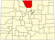 | |
| Towns | ||
| CDPs | ||
| Unincorporated communities | ||
| Ghost towns | ||
| Footnotes | ‡This populated place also has portions in an adjacent county or counties | |
Template:Colorado cities and mayors of 100,000 population
| International | |
|---|---|
| National | |
| Geographic | |
| Other | |