
Green Bay, Wisconsin
It has been suggested that Green Bay Police Department be merged into this article. (Discuss) Proposed since June 2007. |
Green Bay, Wisconsin | |
|---|---|
|
Seal | |
| Nickname(s): Titletown, USA | |
 | |
| Country | United States |
| State | Wisconsin |
| County | Brown |
| Government | |
| • Mayor | James J. Schmitt, (R) |
| Area | |
| • City | 54.3 sq mi (140.7 km2) |
| • Land | 43.9 sq mi (113.6 km2) |
| • Water | 10.5 sq mi (27.1 km2) |
| Elevation | 581 ft (177 m) |
| Population (2006) | |
| • City | 100,353 |
| • Density | 2,332.1/sq mi (900.5/km2) |
| • Metro | 226,778 |
| Time zone | UTC-6 (Central) |
| • Summer (DST) | UTC-5 (CDT) |
| Area code | 920 |
| FIPS code | 55-31000Template:GR |
| GNIS feature ID | 1565801Template:GR |
| Website | www.ci.green-bay.wi.us |
Green Bay is the county seat of Brown County in the U.S. state of Wisconsin.
The city is located at the head of its namesake Green Bay, a sub-basin of Lake Michigan, at the mouth of the Fox River. It has an altitude of 581 feet (177 m) above sea level and is located 112 miles (180 km) north of Milwaukee. According to the 2006 census estimate, Green Bay has a population of 100,353.[1] The Town of Green Bay is located several miles northeast of the city.
Green Bay is the third largest city in Wisconsin. It is set at the southern end of Green Bay and is divided by the Fox River. Green Bay is an industrial city with several meatpacking and paper plants. The city of Green Bay is a port on the Bay of Green Bay, an arm of Lake Michigan. Green Bay is home to the National Railroad Museum, the Neville Public Museum with exhibitions of art, history, and science, and to the University of Wisconsin-Green Bay.
The Green Bay Packers professional football team has been based in the city since 1919. Green Bay is the smallest US market for a team of the four major professional sports leagues, although the Packers' fanbase stretches across the state of Wisconsin, and even around the world. Green Bay is nicknamed "Titletown, USA" for the number of NFL titles (12) it has won over the years (including the first two Super Bowls as well as Super Bowl XXXI). An arenafootball2 franchise, the Green Bay Blizzard, was recently awarded to the city.
Green Bay metropolitan area forms the core of the United States Census Bureau's Green Bay Metropolitan Statistical Area, which includes all of Brown County (2004 population: 237,166).
Neighborhoods
Green Bay is a homogeneous city combined with several different townships which include the city of Green Bay, the village of Bellevue, Wisconsin, the village of Ashwaubenon, Wisconsin, the village of Allouez, Wisconsin and the village of Howard, Wisconsin.
Downtown Green Bay is the heart of the city. There are several mid rise office buildings and churches downtown. The Brown County Court House is located in the heart of downtown. The riverfront has seen a great amount of redevelopment with several new loft projects. A 17 story condominium project is planned for the riverfront. Downtown Green Bay is also home to the now defunct Port Plaza Mall, which was later known as Washington Commons. The downtown has experienced new streetscaping. Lambeau Field, home of the Green Bay Packers, is located in Ashwaubenon, but was annexed into Green Bay after the stadium was built.
History


A small trading post was established at this location in 1634 by French-Canadian explorer Jean Nicolet[2] , making Green Bay the 13th oldest permanent settlement in America. In 1671 a Jesuit Mission was set up here; at the time the settlement was known as La Baye or la Baie des Puants. A fort was added in 1717. The town was incorporated in 1754, and was passed to British control in 1761. As British settlers in the area came to outnumber the French, the name "Green Bay" became the more common name for the town. In 1783 the town became part of the United States of America.
The United States Army built Fort Howard on the banks of the Fox River in 1816. Wisconsin's first newspaper, The Green Bay Intelligencer, was first published here in 1833. By 1850 the town had a population of 1,923. The town was reincorporated as the city of Green Bay, joining several small towns including Navarino, Astor (created by John Jacob Astor) and Fort Howard in 1854. The Green Bay Area Public School District was founded in 1856. The railroad arrived in the 1860s. In 1934, President Franklin D. Roosevelt came to Green Bay to honor its tricentennial.[2] By 1950 the city had a population of 52,735.
Geography
According to the United States Census Bureau, the city has a total area of 140.7 km² (54.3 mi²). 113.6 km² (43.9 mi²) of it is land and 27.1 km² (10.4 mi²) of it is water. The total area is 19.24% water.
Climate
The city of Green Bay experiences a continental climate, moderated slightly by the city's proximity to Lake Michigan. The city's climate features four distinct seasons, with warm, frequently hot summers and long, cold and snowy winters. The variance in temperature and precipitation between months is severe and often extreme. The warmest month is July, when the average high temperature is 81°F (28°C). During July, the average low temperature is 59°F (15°C). The coldest month of the year is January, when the high temperature averages only 24°F (-5°C), and the low temperatures average 7°F (-14°C).
The wettest month in Green Bay is August, when 3.77 inches (95.8mm) of precipitation falls, mostly in the form of rainfall from thunderstorms. The driest month in Green Bay is February, when the majority of precipitation falls as low moisture-content snow due to cold, dry air. On average, 1.01 inches (25.7mm) of precipitation falls in February.
| Monthly Normal and Record High and Low Temperatures | ||||||||||||
| Month | Jan | Feb | Mar | Apr | May | Jun | Jul | Aug | Sep | Oct | Nov | Dec |
|---|---|---|---|---|---|---|---|---|---|---|---|---|
| Rec High °F | 53 | 61 | 78 | 89 | 91 | 98 | 103 | 99 | 95 | 88 | 74 | 64 |
| Norm High °F | 24.1 | 28.9 | 40 | 54.6 | 68 | 76.8 | 81.2 | 78.5 | 70.2 | 57.9 | 42.4 | 29 |
| Norm Low °F | 7.1 | 12.1 | 22.6 | 33.9 | 44.7 | 54 | 58.6 | 56.5 | 47.5 | 36.9 | 25.6 | 13.3 |
| Rec Low °F | -31 | -28 | -29 | 7 | 21 | 32 | 40 | 38 | 24 | 15 | -9 | -27 |
| Precip (in) | 1.21 | 1.01 | 2.06 | 2.56 | 2.75 | 3.43 | 3.44 | 3.77 | 3.11 | 2.17 | 2.27 | 1.41 |
| Source: USTravelWeather.com [2] | ||||||||||||
Transportation

Green Bay is served by Austin Straubel International Airport. The city was the headquarters of the Green Bay and Western Railroad in historical times (1896-1993). Green Bay also has its own mass transit system known as Green Bay Metro (formerly known as Green Bay Transit).
Green Bay is connected to the rest of the state by four major highways. US Highway 41 connects Green Bay to the Fox Cities, Fond du Lac and Milwaukee to the south and the Upper Peninsula of Michigan via Oconto, Peshtigo, and Marinette. U.S. Route 141 starts in Green Bay and joins with US41 to the north for 18 miles before splitting off and providing access to the Upper Peninsula via Niagara. Interstate 43, which terminates at US 41/141, heads south along Lake Michigan to Milwaukee and on to Illinois via Beloit. Recently Wisconsin Highway 29 has been upgraded to four lanes to provide better access to western Wisconsin and Minnesota via Wausau and Eau Claire.
A few other highways of importance are :
Wisconsin Highway 172: Forms a southern bypass of Green Bay, and continuing to Austin Staubel Airport.
Wisconsin Highway 32: Two lane highway which runs from Illinois to Michigan and provides alternative routes to the north and south and travels through many small communities.
Wisconsin Highway 54: Two lane highway which runs through Green Bay from Algoma to New London and Waupaca.
Wisconsin Highway 57: Heads to Green Bay from I-43 near Port Washington and continues through Sturgeon Bay to the Door Peninsula, terminating with WI-42 at Gills Rock with ferry access to Washington Island.
Demographics
| City of Green Bay Population by year [3] | |
| 1855 | 1,644 |
| 1860 | 2,276 |
| 1870 | 4,698 |
| 1880 | 7,476 |
| 1890 | 9,069 |
| 1900 | 23,748 |
| 1910 | 25,216 |
| 1920 | 31,643 |
| 1930 | 37,407 |
| 1940 | 46,205 |
| 1950 | 52,735 |
| 1960 | 62,952 |
| 1970 | 87,829 |
| 1980 | 87,947 |
| 1990 | 96,466 |
| 2000 | 102,313 |
| 2006 | 100,353 |
As of the 2006 U.S. census estimate, there are 100,353 people residing in Green Bay. The Greater Green Bay Area consists of 279,485 people as of the 2000 census, there were 141,591 households, and 124,663 families residing in the city. The population density is 900.5/km² (2,332.1/mi²). There are 43,123 housing units at an average density of 379.5/km² (982.9/mi²). The racial makeup of the city is 85.86% White, 1.38% African American, 3.28% Native American, 3.76% Asian, 0.04% Pacific Islander, 3.72% from other races, and 1.97% from two or more races. 7.13% of the population are Hispanic or Latino of any race. Many of the Asian Americans are Hmongs.
There are 41,591 households of which 30.6% have children under the age of 18 living with them, 44.1% are married couples living together, 10.8% have a female householder with no husband present, and 40.7% are non-families. 31.6% of all households are made up of individuals and 9.9% have someone living alone who is 65 years of age or older. The average household size is 2.40 and the average family size is 3.06.
City demographics are as follows: 25.4% are under the age of 18, 11.6% from 18 to 24, 31.7% from 25 to 44, 19.5% from 45 to 64, and 11.8% who are 65 years of age or older. The median age is 33 years. For every 100 females there are 97.2 males. For every 100 females age 18 and over, there are 94.8 males.
The median income for a household in the city is $38,820, and the median income for a family is $48,678. Males have a median income of $33,246 versus $23,825 for females. The per capita income for the city is $19,269. 10.5% of the population and 7.4% of families are below the poverty line. Out of the total population, 12.7% of those under the age of 18 and 9.2% of those 65 and older are living below the poverty line.
The city is noted for having one of the lowest crime rates in the United States for a municipality of its size.
Religion

The city is the seat of the Roman Catholic Diocese of Green Bay. The Cathedral of Saint Francis Xavier in Green Bay is the mother church of the Diocese. The diocese is in the province of the Archdiocese of Milwaukee. In 2000, the American Religion Data Archive reported Green Bay to be predominantly Catholic (71.5%), with Lutherans composing an additional 16.4%. The remaining 12% are almost entirely protestant denominations.
Media
Green Bay is served by the Green Bay Press-Gazette. Another local paper, the Green Bay News-Chronicle, ceased publication in 2005.
Points of interest


- Bay Beach Amusement Park
- Bay Park Square
- Brown County Veterans Memorial Arena
- City Stadium, former home of the Packers
- Cofrin Memorial Arboretum
- East Town Mall
- Kastle Village (formerly Fort Fun)
- Green Bay Botanical Garden
- The Broadway District[3]
- Heritage Hill State Park[4]
- Joannes Field, home of the Green Bay Bullfrogs
- KI Convention Center
- Lambeau Field, home of the Green Bay Packers
- Kastle Carts
- Meyer Theater
- National Railroad Museum
- Neville Public Museum[5]
- Northeast Wisconsin Technical College (NWTC)[6]
- NEW Zoo
- Resch Center, home of the Green Bay Blizzard in neighboring Ashwaubenon.
- ShopKo Hall
- Tundra Lodge Resort & Waterpark
- University of Wisconsin-Green Bay (UWGB)
- Weidner Center
Famous residents
- John Anderson ESPN Sportscenter anchor attended Southwest High School
- Ken Anderson; professional wrestler for World Wrestling Entertainment known as Mr. Kennedy
- Tony Bennett; Washington State University men's basketball coach; attended Preble High School
- Dan Buenning, guard for the NFL team, the Tampa Bay Buccaneers; attended Bay Port High School.
- Jay DeMerit, player for Watford F.C. in the Football League Championship, England; attended Bay Port High School.
- George F. Kress. Paper Maker; invented a process for (fluting) corrugated containers, pioneer of paper recycling.
- Pat MacDonald, singer in Timbuk3.
- James Mulva, Chairman, President and Chief Executive Officer of ConocoPhilips
- John W. Reynolds, Governor of Wisconsin.
- Tony Shalhoub of the TV series, Monk; attended Green Bay East High School.
- Walter Wellesley Smith (1905-1982), Pulitzer Prize-winning sportswriter.
- Zack Snyder, director of Dawn of the Dead (2004 version) and 300.
- Aaron Stecker, running back for the NFL team, the New Orleans Saints; attended Ashwaubenon High School.
- Margaret Teele (Margaret Poby)1960s TV and movie actress, attended St. Joseph's Academy (now Notre Dame Academy).
- Bob Wickman Major League Baseball pitcher for the Arizona Diamondbacks.
- Joel Hodgson creator and star of the TV show Mystery Science Theater 3000 graduated from Ashwaubenon High School in 1979.
- Niccole Tiffany, National Teacher of the Year award winner 2000-2004,2006
Mayors

Schools
- High Schools
- Colleges and Universities
Photos of Green Bay
-
Downtown Green Bay
-
South Village Historical District
-
Downtown Green Bay
-
Downtown Green Bay
-
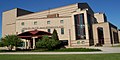
Downtown Green Bay YMCA
-
The Broadway District
-
St. Francis Xavier Cathedral
-
Large South Side home
-
South Washington Street on the near east side of Green Bay
-
A downtown office building
-
East Main Street in Green Bay
-
The east side of Green Bay
-
 Brown County Courthouse
 -

-

-

-
-
 Burke Hall, St. Norbert College in De Pere, Wisconsin
 -
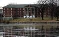
Main Hall, St. Norbert College in De Pere, Wisconsin


References
- ^ "Table 1: Annual Estimates of the Population for Incorporated Places Over 100,000, Ranked by July 1, 2006 Population: April 1, 2000 to July 1, 2006" (CSV). 2005 Population Estimates. United States Census Bureau, Population Division. 2007-06-28. Retrieved 2007-06-28.
{{cite web}}: Check date values in:|date=(help) - ^ a b Rodesch, Gerrold C. (1984). "Jean Nicolet". University of Wisconsin - Green Bay. Retrieved 2007-10-13.
- ^ United States Census Bureau. [1]
External links
- Official Green Bay, Wisconsin Website
- Official Website of the Green Bay Broadway District
- Packer Country Visitor & Convention Bureau
- Green Bay Area Chamber of Commerce
- Belgian-American Research Collection
| Core city |  | |
|---|---|---|
| Largest municipalities over 10,000 in 2010 | ||
| Municipalities under 10,000 in 2010 | ||
| Counties | ||
- Articles to be merged from June 2007
- Articles needing cleanup from June 2007
- Cleanup tagged articles without a reason field from June 2007
- Wikipedia pages needing cleanup from June 2007
- Brown County, Wisconsin
- Cities in Wisconsin
- Green Bay, Wisconsin
- Cities on the Great Lakes
- Port cities in the United States
- County seats in Wisconsin