Jump to content

List of the ultra-prominent summits of Alaska

Coordinates: 63°04′08″N 151°00′23″W / 63.0690°N 151.0063°W / 63.0690; -151.0063 (Denali)
From Wikipedia, the free encyclopedia

This is an old revision of this page, as edited by Lepricavark (talk | contribs) at 16:49, 18 March 2020 (top: added short description). The present address (URL) is a permanent link to this revision, which may differ significantly from the current revision.

Denali in Alaska is the highest mountain peak of the United States and North America. Denali is the third most topographically prominent and third most topographically isolated summit on Earth after Mount Everest and Aconcagua.

The following sortable table comprises the 65 ultra-prominent summits of the U.S. State of Alaska. Each of these peaks has at least 1500 meters (4921 feet) of topographic prominence.

Topographic elevation is the vertical distance above the reference geoid, a mathematical model of the Earth's sea level as an equipotential gravitational surface. The topographic prominence of a summit is the elevation difference between that summit and the highest or key col to a higher summit. The topographic isolation of a summit is the minimum great-circle distance to a point of equal elevation.

This article defines a significant summit as a summit with at least 100 meters (328.1 feet) of topographic prominence, and a major summit as a summit with at least 500 meters (1640 feet) of topographic prominence. An ultra-prominent summit is a summit with at least 1500 meters (4921 feet) of topographic prominence. There are 126 ultra-prominent summits in the United States.

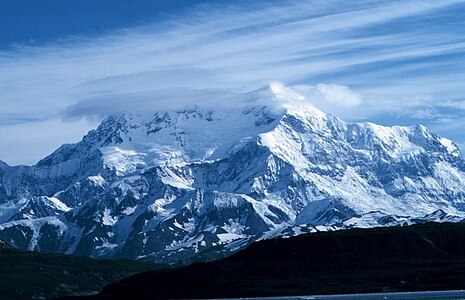
If an elevation or prominence is calculated as a range of values, the arithmetic mean is shown.

Ultra-prominent summits

Of the 126 ultra-prominent summits of the United States, the following 65 (or 52%) rise in Alaska. Four of these peaks lie on the international border with Yukon and two lie on the international border with British Columbia.

The 65 ultra-prominent summits of Alaska

Rank Mountain Peak Mountain Range Elevation Prominence Isolation Location
1 Denali[1][a] Alaska Range 20,310 ft
6190.5 m
20,146 ft
6141 m
4,629 mi
7,450 km
63°04′08″N 151°00′23″W / 63.0690°N 151.0063°W / 63.0690; -151.0063 (Denali)
2 Mount Fairweather[2][3][b] Saint Elias Mountains 15,325 ft
4671 m
12,995 ft
3961 m
124.4 mi
200 km
58°54′23″N 137°31′36″W / 58.9064°N 137.5267°W / 58.9064; -137.5267 (Mount Fairweather)
3 Mount Blackburn[4][5][c] Wrangell Mountains 16,390 ft
4996 m
11,640 ft
3548 m
60.7 mi
97.6 km
61°43′50″N 143°24′11″W / 61.7305°N 143.4031°W / 61.7305; -143.4031 (Mount Blackburn)
4 Mount Hayes[6][d] Alaska Range 13,832 ft
4216 m
11,507 ft
3507 m
125.5 mi
202 km
63°37′13″N 146°43′04″W / 63.6203°N 146.7178°W / 63.6203; -146.7178 (Mount Hayes)
5 Mount Saint Elias[7][8][e] Saint Elias Mountains 18,009 ft
5489 m
11,250 ft
3429 m
25.6 mi
41.3 km
60°17′35″N 140°55′35″W / 60.2931°N 140.9264°W / 60.2931; -140.9264 (Mount Saint Elias)
6 Mount Marcus Baker[9][f] Chugach Mountains 13,176 ft
4016 m
10,751 ft
3277 m
126.3 mi
203 km
61°26′15″N 147°45′09″W / 61.4374°N 147.7525°W / 61.4374; -147.7525 (Mount Marcus Baker)
7 Shishaldin Volcano[10][g] Unimak Island 9,414 ft
2869 m
9,414 ft
2869 m
545 mi
877 km
54°45′19″N 163°58′15″W / 54.7554°N 163.9709°W / 54.7554; -163.9709 (Shishaldin Volcano)
8 Redoubt Volcano[11][h] Chigmit Mountains 10,197 ft
3108 m
9,147 ft
2788 m
58.7 mi
94.5 km
60°29′07″N 152°44′39″W / 60.4854°N 152.7442°W / 60.4854; -152.7442 (Redoubt Volcano)
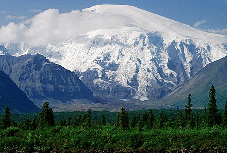
9 Mount Torbert[12][i] Alaska Range 11,413 ft
3479 m
8,688 ft
2648 m
97.7 mi
157.3 km
61°24′31″N 152°24′45″W / 61.4086°N 152.4125°W / 61.4086; -152.4125 (Mount Torbert)
10 Pavlof Volcano[13][j] Alaska Peninsula 8,250 ft
2515 m
8,225 ft
2507 m
94.3 mi
151.8 km
55°25′02″N 161°53′36″W / 55.4173°N 161.8932°W / 55.4173; -161.8932 (Pavlof Volcano)
11 Mount Veniaminof[14] Alaska Peninsula 8,225 ft
2507 m
8,200 ft
2499 m
209 mi
337 km
56°13′10″N 159°17′51″W / 56.2194°N 159.2975°W / 56.2194; -159.2975 (Mount Veniaminof)
12 Mount Hubbard[15][16] Saint Elias Mountains 14,951 ft
4557 m
8,061 ft
2457 m
21.3 mi
34.4 km
60°19′09″N 139°04′17″W / 60.3192°N 139.0714°W / 60.3192; -139.0714 (Mount Hubbard)
13 Mount Isto[17][k] Brooks Range 9,060 ft
2761 m
7,985 ft
2434 m
393 mi
633 km
69°12′09″N 143°48′07″W / 69.2025°N 143.8020°W / 69.2025; -143.8020 (Mount Isto)
14 Iliamna Volcano[18] Chigmit Mountains 10,016 ft
3053 m
7,866 ft
2398 m
33.6 mi
54.1 km
60°01′56″N 153°05′29″W / 60.0321°N 153.0915°W / 60.0321; -153.0915 (Iliamna Volcano)
15 Mount Cook[19][20] Saint Elias Mountains 13,760 ft
4194 m
7,710 ft
2350 m
14.54 mi
23.4 km
60°10′55″N 139°58′51″W / 60.1819°N 139.9808°W / 60.1819; -139.9808 (Mount Cook)
16 Mount Sanford[21] Wrangell Mountains 16,237 ft
4949 m
7,687 ft
2343 m
40.3 mi
64.8 km
62°12′48″N 144°07′45″W / 62.2132°N 144.1292°W / 62.2132; -144.1292 (Mount Sanford)
17 Mount Tom White[22] Chugach Mountains 11,191 ft
3411 m
7,641 ft
2329 m
73 mi
117.6 km
60°39′06″N 143°41′50″W / 60.6518°N 143.6972°W / 60.6518; -143.6972 (Mount Tom White)
18 Mount Kimball[23][l] Alaska Range 10,350 ft
3155 m
7,425 ft
2263 m
55.8 mi
89.8 km
63°14′20″N 144°38′31″W / 63.2390°N 144.6419°W / 63.2390; -144.6419 (Mount Kimball)
19 Mount Griggs[24] Alaska Peninsula 7,650 ft
2332 m
7,300 ft
2225 m
135.4 mi
218 km
58°21′12″N 155°05′45″W / 58.3534°N 155.0958°W / 58.3534; -155.0958 (Mount Griggs)
20 Mount Foraker[25] Alaska Range 17,400 ft
5304 m
7,250 ft
2210 m
14.27 mi
23 km
62°57′37″N 151°23′59″W / 62.9604°N 151.3998°W / 62.9604; -151.3998 (Mount Foraker)
21 Mount Crillon[26] Saint Elias Mountains 12,726 ft
3879 m
7,176 ft
2187 m
19.52 mi
31.4 km
58°39′45″N 137°10′16″W / 58.6625°N 137.1712°W / 58.6625; -137.1712 (Mount Crillon)
22 Mount Vsevidof[27][m] Umnak Island 7,051 ft
2149 m
7,051 ft
2149 m
223 mi
358 km
53°07′32″N 168°41′38″W / 53.1256°N 168.6938°W / 53.1256; -168.6938 (Mount Vsevidof)
23 Mount Hesperus[28][n] Alaska Range 9,828 ft
2996 m
6,978 ft
2127 m
58.1 mi
93.5 km
61°48′13″N 154°08′49″W / 61.8036°N 154.1469°W / 61.8036; -154.1469 (Mount Hesperus)
24 Mount Bona[29][o] Saint Elias Mountains 16,550 ft
5044 m
6,900 ft
2103 m
49.7 mi
80 km
61°23′08″N 141°44′58″W / 61.3856°N 141.7495°W / 61.3856; -141.7495 (Mount Bona)
25 Mount Drum[30] Wrangell Mountains 12,010 ft
3661 m
6,720 ft
2048 m
17.73 mi
28.5 km
62°06′57″N 144°38′22″W / 62.1159°N 144.6394°W / 62.1159; -144.6394 (Mount Drum)
26 Mount Chiginagak[31] Aleutian Range 6,925 ft
2111 m
6,675 ft
2035 m
97.6 mi
157 km
57°08′00″N 156°59′28″W / 57.1334°N 156.9912°W / 57.1334; -156.9912 (Mount Chiginagak)
27 Mount Neacola[32][p] Aleutian Range 9,426 ft
2873 m
6,376 ft
1943 m
31 mi
49.9 km
60°47′53″N 153°23′45″W / 60.7981°N 153.3959°W / 60.7981; -153.3959 (Mount Neacola)
28 Mount Douglas[33] Alaska Peninsula 7,050 ft
2149 m
6,300 ft
1920 m
42.9 mi
69 km
58°51′35″N 153°32′07″W / 58.8598°N 153.5353°W / 58.8598; -153.5353 (Mount Douglas)
29 Kichatna Spire[34] Alaska Range 8,985 ft
2739 m
6,235 ft
1900 m
37.3 mi
60 km
62°25′23″N 152°43′23″W / 62.4231°N 152.7231°W / 62.4231; -152.7231 (Kichatna Spire)
30 De Long Peak[35][36]
(Peak 8084)
Chugach Mountains 8,084 ft
2464 m
6,234 ft
1900 m
43.1 mi
69.3 km
60°49′48″N 145°08′01″W / 60.8299°N 145.1335°W / 60.8299; -145.1335 (De Long Peak)
31 Pogromni Volcano[37][38] Unimak Island 6,531 ft
1991 m
6,181 ft
1884 m
31.7 mi
50.9 km
54°34′14″N 164°41′33″W / 54.5705°N 164.6926°W / 54.5705; -164.6926 (Pogromni Volcano)
32 Peak 8010[39] Chugach Mountains 8,010 ft
2441 m
6,160 ft
1878 m
25.3 mi
40.7 km
61°09′38″N 144°48′46″W / 61.1605°N 144.8129°W / 61.1605; -144.8129 (Peak 8010)
33 Mount Igikpak[40][q] Brooks Range 8,276 ft
2523 m
6,126 ft
1867 m
282 mi
453 km
67°24′46″N 154°57′56″W / 67.4129°N 154.9656°W / 67.4129; -154.9656 (Mount Igikpak)
34 Snow Tower[41] Coast Mountains 6,572 ft
2003 m
6,122 ft
1866 m
10.12 mi
16.28 km
58°10′21″N 133°24′03″W / 58.1724°N 133.4009°W / 58.1724; -133.4009 (Snow Tower)
35 Truuli Peak[42][r] Kenai Mountains 6,612 ft
2015 m
6,062 ft
1848 m
87.8 mi
141.3 km
59°54′46″N 150°26′05″W / 59.9129°N 150.4348°W / 59.9129; -150.4348 (Truuli Peak)
36 Mount Natazhat[43] Saint Elias Mountains 13,435 ft
4095 m
5,985 ft
1824 m
15.49 mi
24.9 km
61°31′18″N 141°06′11″W / 61.5217°N 141.1030°W / 61.5217; -141.1030 (Mount Natazhat)
37 Hanagita Peak[44][45] Chugach Mountains 8,504 ft
2592 m
5,954 ft
1815 m
22 mi
35.3 km
61°04′01″N 143°42′27″W / 61.0670°N 143.7075°W / 61.0670; -143.7075 (Hanagita Peak)
38 Tanaga Volcano[46][s] Tanaga Island 5,925 ft
1806 m
5,925 ft
1806 m
407 mi
656 km
51°53′02″N 178°08′29″W / 51.8839°N 178.1414°W / 51.8839; -178.1414 (Tanaga Volcano)
39 Makushin Volcano[47][t] Unalaska Island 5,905 ft
1800 m
5,905 ft
1800 m
83.1 mi
133.8 km
53°52′42″N 166°55′48″W / 53.8782°N 166.9299°W / 53.8782; -166.9299 (Makushin Volcano)
40 Sovereign Mountain[48][u] Talkeetna Mountains 8,849 ft
2697 m
5,874 ft
1790 m
47.6 mi
76.6 km
62°07′52″N 148°36′16″W / 62.1311°N 148.6044°W / 62.1311; -148.6044 (Sovereign Mountain)
41 Isanotski Peaks[49] Unimak Island 8,106 ft
2471 m
5,856 ft
1785 m
9.71 mi
15.62 km
54°46′05″N 163°43′45″W / 54.7680°N 163.7291°W / 54.7680; -163.7291 (Isanotski Peaks)
42 Isthmus Peak[50] Kenai Mountains 6,532 ft
1991 m
5,782 ft
1762 m
32.3 mi
52 km
60°34′38″N 148°53′29″W / 60.5772°N 148.8915°W / 60.5772; -148.8915 (Isthmus Peak)
43 Frosty Peak[51] Aleutian Range 5,803 ft
1769 m
5,753 ft
1754 m
35.4 mi
56.9 km
55°04′02″N 162°50′06″W / 55.0672°N 162.8351°W / 55.0672; -162.8351 (Frosty Peak)
44 Great Sitkin Volcano[52][v] Great Sitkin Island 5,710 ft
1740 m
5,710 ft
1740 m
87.8 mi
141.3 km
52°04′35″N 176°06′39″W / 52.0765°N 176.1109°W / 52.0765; -176.1109 (Great Sitkin Volcano)
45 Mount Cleveland[53][54][w] Chuginadak Island 5,675 ft
1730 m
5,675 ft
1730 m
56.3 mi
90.6 km
52°49′23″N 169°56′47″W / 52.8230°N 169.9465°W / 52.8230; -169.9465 (Mount Cleveland)
46 Mount Wrangell[55] Wrangell Mountains 14,163 ft
4317 m
5,613 ft
1711 m
14.79 mi
23.8 km
62°00′21″N 144°01′07″W / 62.0059°N 144.0187°W / 62.0059; -144.0187 (Mount Wrangell)
47 Devils Paw[56][57][x] Coast Mountains 8,507 ft
2593 m
5,587 ft
1703 m
84.7 mi
136.4 km
58°43′44″N 133°50′25″W / 58.7289°N 133.8403°W / 58.7289; -133.8403 (Devils Paw)
48 Mount Seattle[58] Saint Elias Mountains 10,350 ft
3155 m
5,561 ft
1695 m
11.97 mi
19.26 km
60°04′05″N 139°11′21″W / 60.0680°N 139.1893°W / 60.0680; -139.1893 (Mount Seattle)
49 Mount Russell[59] Alaska Range 11,670 ft
3557 m
5,520 ft
1682 m
14.07 mi
22.7 km
62°47′54″N 151°53′04″W / 62.7984°N 151.8845°W / 62.7984; -151.8845 (Mount Russell)
50 Mount Foresta[60] Saint Elias Mountains 11,050 ft
3368 m
5,400 ft
1646 m
12.51 mi
20.1 km
60°11′28″N 139°25′56″W / 60.1912°N 139.4323°W / 60.1912; -139.4323 (Mount Foresta)
51 Veniaminof Peak[61][y] Baranof Island 5,390 ft
1643 m
5,390 ft
1643 m
79.7 mi
128.3 km
57°00′54″N 134°59′18″W / 57.0151°N 134.9882°W / 57.0151; -134.9882 (Veniaminof Peak)
52 Bearhole Peak[62][63][z] Saint Elias Mountains 8,517 ft
2596 m
5,367 ft
1636 m
9.71 mi
15.62 km
60°55′42″N 142°31′25″W / 60.9283°N 142.5237°W / 60.9283; -142.5237 (Bearhole Peak)
53 Mount Steller[64] Chugach Mountains 10,515 ft
3205 m
5,365 ft
1635 m
22.5 mi
36.2 km
60°31′12″N 143°05′36″W / 60.5199°N 143.0932°W / 60.5199; -143.0932 (Mount Steller)
54 Mount Miller[65][aa] Chugach Mountains 10,750 ft
3277 m
5,300 ft
1615 m
40.3 mi
64.9 km
60°27′38″N 142°18′04″W / 60.4605°N 142.3012°W / 60.4605; -142.3012 (Mount Miller)
55 Carlisle Volcano[66][67][ab] Carlisle Island 5,283 ft
1610 m
5,283 ft
1610 m
6.64 mi
10.68 km
52°53′29″N 170°03′29″W / 52.8913°N 170.0580°W / 52.8913; -170.0580 (Carlisle Volcano)
56 Bashful Peak[68][ac] Chugach Mountains 8,005 ft
2440 m
5,275 ft
1608 m
22.1 mi
35.5 km
61°18′27″N 148°52′11″W / 61.3076°N 148.8697°W / 61.3076; -148.8697 (Bashful Peak)
57 Tetlin Peak[69] Alaska Range 8,365 ft
2550 m
5,240 ft
1597 m
25.5 mi
41.1 km
62°37′17″N 143°06′30″W / 62.6215°N 143.1084°W / 62.6215; -143.1084 (Tetlin Peak)
58 Mount Deborah[70] Alaska Range 12,339 ft
3761 m
5,189 ft
1582 m
16.08 mi
25.9 km
63°38′16″N 147°14′18″W / 63.6377°N 147.2384°W / 63.6377; -147.2384 (Mount Deborah)
59 Necous Peak[71][72]
(Peak 8336)
Alaska Range 8,336 ft
2541 m
5,186 ft
1581 m
21.9 mi
35.3 km
61°06′45″N 153°28′08″W / 61.1125°N 153.4690°W / 61.1125; -153.4690 (Necous Peak)
60 Gareloi Volcano[73][74][ad] Gareloi Island 5,160 ft
1573 m
5,160 ft
1573 m
28.6 mi
46.1 km
51°47′17″N 178°47′38″W / 51.7880°N 178.7940°W / 51.7880; -178.7940 (Gareloi Volcano)
61 Peak 8488[75] Alaska Range 8,488 ft
2587 m
5,138 ft
1566 m
11.92 mi
19.19 km
61°29′42″N 153°37′21″W / 61.4950°N 153.6224°W / 61.4950; -153.6224 (Peak 8488)
62 Mount Augusta[76][77] Saint Elias Mountains 14,070 ft
4289 m
5,082 ft
1549 m
14.41 mi
23.2 km
60°18′28″N 140°27′31″W / 60.3078°N 140.4586°W / 60.3078; -140.4586 (Mount Augusta)
63 Peak 6915[78] Chugach Mountains 6,915 ft
2108 m
5,065 ft
1544 m
11.1 mi
17.87 km
61°19′47″N 144°57′36″W / 61.3297°N 144.9599°W / 61.3297; -144.9599 (Peak 6915)
64 Mount Bear[79] Saint Elias Mountains 14,831 ft
4520 m
5,054 ft
1540 m
20.1 mi
32.4 km
61°17′00″N 141°08′36″W / 61.2834°N 141.1433°W / 61.2834; -141.1433 (Mount Bear)
65 Korovin Volcano[80][ae] Atka Island 5,030 ft
1533 m
5,030 ft
1533 m
85.2 mi
137.2 km
52°22′54″N 174°09′57″W / 52.3817°N 174.1658°W / 52.3817; -174.1658 (Korovin Volcano)

See also

Notes

  1. ^ Denali is the highest point of the Alaska Range, the State of Alaska, the United States of America, and all of North America. Denali is the third most topographically prominent and third most topographically isolated summit on Earth after Mount Everest and Aconcagua..
  2. ^ The summit of Mount Fairweather is the highest point of the Fairweather Range and the Province of British Columbia.
  3. ^ The summit of Mount Blackburn is the highest point of the Wrangell Mountains.
  4. ^ The summit of Mount Hayes is the highest point of the Hayes Range.
  5. ^ Mount Saint Elias is the second highest major summit of both Canada and the United States..
  6. ^ The summit of Mount Marcus Baker is the highest point of the Chugach Mountains.
  7. ^ The summit of Shishaldin Volcano is the highest point of Unimak Island and the Aleutian Islands.
  8. ^ The summit of Redoubt Volcano is the highest point of the Chigmit Mountains.
  9. ^ The summit of Mount Torbert is the highest point of the Tordrillo Mountains.
  10. ^ The summit of Pavlof Volcano is the highest point of the Alaska Peninsula.
  11. ^ The summit of Mount Isto is the highest point of the Brooks Range.
  12. ^ The summit of Mount Kimball is the highest point of the Delta Range.
  13. ^ The summit of Mount Vsevidof is the highest point of Umnak Island and the westernmost 2000 meter (6561.7-foot) summit of greater North America.
  14. ^ The summit of Mount Hesperus is the highest point of the West Alaska Range.
  15. ^ The summit of Mount Bona is the highest point of the northwest Saint Elias Mountains.
  16. ^ The summit of Mount Neacola is the highest point of the Neacola Mountains.
  17. ^ The summit of Mount Igikpak is the highest point of the Schwatka Mountains.
  18. ^ The summit of Truuli Peak is the highest point of the Kenai Mountains.
  19. ^ The summit of Tanaga Volcano is the highest point of Tanaga Island and the Andreanof Islands.
  20. ^ The summit of Makushin Volcano is the highest point of Unalaska Island.
  21. ^ The summit of Sovereign Mountain is the highest point of the Talkeetna Mountains.
  22. ^ The summit of Great Sitkin Volcano is the highest point of Great Sitkin Island.
  23. ^ The summit of Mount Cleveland is the highest point of Chuginadak Island.
  24. ^ The summit of Devils Paw is the highest point of the Juneau Icefield.
  25. ^ The summit of Veniaminof Peak is the highest point of Baranof Island.
  26. ^ The summit of Bearhole Peak is the highest point of the Granite Range.
  27. ^ The summit of Mount Miller is the highest point of the Barkley Ridge.
  28. ^ The summit of Carlisle Volcano is the highest point of Carlisle Island.
  29. ^ The summit of Bashful Peak is the highest point of the western Chugach Mountains.
  30. ^ The summit of Gareloi Volcano is the highest point of Gareloi Island.
  31. ^ The summit of Korovin Volcano is the highest point of Atka Island.

References

  1. ^ "Denali". Peakbagger.com. Retrieved October 23, 2015.
  2. ^ "Mount Fairweather". Geographical Names of Canada. Natural Resources Canada. Retrieved October 23, 2015.
  3. ^ "Mount Fairweather". Peakbagger.com. Retrieved October 23, 2015.
  4. ^ "Mount Blackburn". Datasheet for NGS Station UV4136. U.S. National Geodetic Survey. Retrieved October 23, 2015.
  5. ^ "Mount Blackburn". Peakbagger.com. Retrieved October 23, 2015.
  6. ^ "Mount Hayes". Peakbagger.com. Retrieved October 23, 2015.
  7. ^ "Mount Saint Elias". Geographical Names of Canada. Natural Resources Canada. Retrieved October 23, 2015.
  8. ^ "Mount Saint Elias". Peakbagger.com. Retrieved October 23, 2015.
  9. ^ "Mount Marcus Baker". Peakbagger.com. Retrieved October 23, 2015.
  10. ^ "Shishaldin Volcano". Peakbagger.com. Retrieved October 23, 2015.
  11. ^ "Redoubt Volcano". Peakbagger.com. Retrieved October 23, 2015.
  12. ^ "Mount Torbert". Peakbagger.com. Retrieved October 23, 2015.
  13. ^ "Pavlof Volcano". Peakbagger.com. Retrieved October 23, 2015.
  14. ^ "Mount Veniaminof". Peakbagger.com. Retrieved October 23, 2015.
  15. ^ "Mount Hubbard". Geographical Names of Canada. Natural Resources Canada. Retrieved October 23, 2015.
  16. ^ "Mount Hubbard". Peakbagger.com. Retrieved October 23, 2015.
  17. ^ "Mount Isto". Peakbagger.com. Retrieved October 23, 2015.
  18. ^ "Iliamna Volcano". Peakbagger.com. Retrieved October 23, 2015.
  19. ^ "Mount Cook". Geographical Names of Canada. Natural Resources Canada. Retrieved October 23, 2015.
  20. ^ "Mount Cook". Peakbagger.com. Retrieved October 23, 2015.
  21. ^ "Mount Sanford". Peakbagger.com. Retrieved October 23, 2015.
  22. ^ "Mount Tom White". Peakbagger.com. Retrieved October 23, 2015.
  23. ^ "Mount Kimball". Peakbagger.com. Retrieved October 23, 2015.
  24. ^ "Mount Griggs". Peakbagger.com. Retrieved October 23, 2015.
  25. ^ "Mount Foraker". Peakbagger.com. Retrieved October 23, 2015.
  26. ^ "Mount Crillon". Peakbagger.com. Retrieved October 23, 2015.
  27. ^ "Mount Vsevidof". Peakbagger.com. Retrieved October 23, 2015.
  28. ^ "Mount Hesperus". Peakbagger.com. Retrieved October 23, 2015.
  29. ^ "Mount Bona". Peakbagger.com. Retrieved October 23, 2015.
  30. ^ "Mount Drum". Peakbagger.com. Retrieved October 23, 2015.
  31. ^ "Mount Chiginagak". Peakbagger.com. Retrieved October 23, 2015.
  32. ^ "Mount Neacola". Peakbagger.com. Retrieved October 23, 2015.
  33. ^ "Mount Douglas". Peakbagger.com. Retrieved October 23, 2015.
  34. ^ "Kichatna Spire". Peakbagger.com. Retrieved October 23, 2015.
  35. ^ "De Long Peak". Peakbagger.com. Retrieved October 23, 2015.
  36. ^ "De Long Peak". Bivouac.com. Retrieved October 23, 2015.
  37. ^ "Pogromni Volcano". Datasheet for NGS Station UV9965. U.S. National Geodetic Survey. Retrieved October 23, 2015.
  38. ^ "Pogromni Volcano". Peakbagger.com. Retrieved October 23, 2015.
  39. ^ "Peak 8010". Peakbagger.com. Retrieved October 23, 2015.
  40. ^ "Mount Igikpak". Peakbagger.com. Retrieved October 23, 2015.
  41. ^ "Snow Tower". Peakbagger.com. Retrieved October 23, 2015.
  42. ^ "Truuli Peak". Peakbagger.com. Retrieved October 23, 2015.
  43. ^ "Mount Natazhat". Peakbagger.com. Retrieved October 23, 2015.
  44. ^ "Hanagita Peak". Datasheet for NGS Station UV3837. U.S. National Geodetic Survey. Retrieved October 23, 2015.
  45. ^ "Hanagita Peak". Peakbagger.com. Retrieved October 23, 2015.
  46. ^ "Tanaga Volcano". Peakbagger.com. Retrieved October 23, 2015.
  47. ^ "Makushin Volcano". Peakbagger.com. Retrieved October 23, 2015.
  48. ^ "Sovereign Mountain". Peakbagger.com. Retrieved October 23, 2015.
  49. ^ "Isanotski Peaks". Peakbagger.com. Retrieved October 23, 2015.
  50. ^ "Isthmus Peak". Peakbagger.com. Retrieved October 23, 2015.
  51. ^ "Frosty Peak". Peakbagger.com. Retrieved October 23, 2015.
  52. ^ "Great Sitkin Volcano". Peakbagger.com. Retrieved October 23, 2015.
  53. ^ "Mount Cleveland". Datasheet for NGS Station UV9122. U.S. National Geodetic Survey. Retrieved October 23, 2015.
  54. ^ "Mount Cleveland". Peakbagger.com. Retrieved October 23, 2015.
  55. ^ "Mount Wrangell". Peakbagger.com. Retrieved October 23, 2015.
  56. ^ "Devils Paw". Geographical Names of Canada. Natural Resources Canada. Retrieved October 23, 2015.
  57. ^ "Devils Paw". Peakbagger.com. Retrieved October 23, 2015.
  58. ^ "Mount Seattle". Peakbagger.com. Retrieved October 23, 2015.
  59. ^ "Mount Russell". Peakbagger.com. Retrieved October 23, 2015.
  60. ^ "Mount Foresta". Peakbagger.com. Retrieved October 23, 2015.
  61. ^ "Veniaminof Peak". Peakbagger.com. Retrieved October 23, 2015.
  62. ^ "Bearhole Peak". Peakbagger.com. Retrieved October 23, 2015.
  63. ^ "Bearhole Peak". Bivouac.com. Retrieved October 23, 2015.
  64. ^ "Mount Steller". Peakbagger.com. Retrieved October 23, 2015.
  65. ^ "Mount Miller". Peakbagger.com. Retrieved October 23, 2015.
  66. ^ "Carlisle Volcano". Datasheet for NGS Station TT5510. U.S. National Geodetic Survey. Retrieved October 23, 2015.
  67. ^ "Carlisle Volcano". Peakbagger.com. Retrieved October 23, 2015.
  68. ^ "Bashful Peak". Peakbagger.com. Retrieved October 23, 2015.
  69. ^ "Tetlin Peak". Peakbagger.com. Retrieved October 23, 2015.
  70. ^ "Mount Deborah". Peakbagger.com. Retrieved October 23, 2015.
  71. ^ "Necous Peak". Peakbagger.com. Retrieved October 23, 2015.
  72. ^ "Necous Peak". Bivouac.com. Retrieved October 23, 2015.
  73. ^ "Gareloi Volcano". Datasheet for NGS Station TT5136. U.S. National Geodetic Survey. Retrieved October 23, 2015.
  74. ^ "Gareloi Volcano". Peakbagger.com. Retrieved October 23, 2015.
  75. ^ "Peak 8488". Peakbagger.com. Retrieved October 23, 2015.
  76. ^ "Mount Augusta". Geographical Names of Canada. Natural Resources Canada. Retrieved October 23, 2015.
  77. ^ "Mount Augusta". Peakbagger.com. Retrieved October 23, 2015.
  78. ^ "Peak 6915". Peakbagger.com. Retrieved October 23, 2015.
  79. ^ "Mount Bear". Peakbagger.com. Retrieved October 23, 2015.
  80. ^ "Korovin Volcano". Peakbagger.com. Retrieved October 23, 2015.

63°04′08″N 151°00′23″W / 63.0690°N 151.0063°W / 63.0690; -151.0063 (Denali)