Mount Edith
| Mount Edith | |
|---|---|
 Mount Edith with trail to summit | |
| Highest point | |
| Elevation | 2,554 m (8,379 ft)[1] |
| Prominence | 192 m (630 ft)[2] |
| Listing | Mountains of Alberta |
| Coordinates | 51°12′04″N 115°39′46″W / 51.20111°N 115.66278°W[3] |
| Geography | |
| Location | Alberta, Canada |
| Parent range | Sawback Range Canadian Rockies |
| Topo map | NTS 82O/04 |
| Geology | |
| Rock age | Devonian[1] |
| Mountain type | Limestone[1] |
| Climbing | |
| First ascent | 1900 by J. Norman Collie and P. Stevens[2] |
| Easiest route | Moderate/difficult scrambling for each peak |
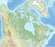
Mount Edith is a mountain located in the Bow River valley of Banff National Park. Situated in the Sawback Range, it comprises three limestone peaks (south, centre, north) with the southern peak being the highest followed by the centre and northern peaks respectively. All three peaks can be scrambled with the southern peak demanding the highest difficulty on the west side.[1]
The mountain was named in 1886 for Edith Orde who worked as an assistant to Lady Agnes Macdonald, the wife of Canada's first prime minister.[4][2]
Geology
Mount Edith is composed of limestone, a sedimentary rock laid down during the Devonian period.[1] Formed in shallow seas, this sedimentary rock was pushed east and over the top of younger rock during the Laramide orogeny.[5]
Climate
Based on the Köppen climate classification, Mount Edith is located in a subarctic climate with cold, snowy winters, and mild summers.[6] Temperatures can drop below -20 C with wind chill factors below -30 C. Weather conditions during summer months are optimum for climbing.
See also
References
- ^ a b c d e Alan Kane (1999). Scrambles in the Canadian Rockies. Rocky Mountain Books. pp. 201–202. ISBN 0-921102-67-4.
- ^ a b c "Mount Edith". Bivouac.com. Retrieved 2009-02-22.
- ^ "Mount Edith". Geographical Names Data Base. Natural Resources Canada. Retrieved 2013-05-18.
- ^ "Mount Edith". cdnrockiesdatabases.ca. Retrieved 2019-08-20.
- ^ Gadd, Ben (2008). "Geology of the Rocky Mountains and Columbias".
{{cite journal}}: Cite journal requires|journal=(help) - ^ Peel, M. C.; Finlayson, B. L.; McMahon, T. A. (2007). "Updated world map of the Köppen−Geiger climate classification". Hydrol. Earth Syst. Sci. 11: 1633–1644. ISSN 1027-5606.
{{cite journal}}: Unknown parameter|last-author-amp=ignored (|name-list-style=suggested) (help)
External links
- National Park Service web site: Banff National Park


