Jump to content

Districts of Malawi

From Wikipedia, the free encyclopedia

This is an old revision of this page, as edited by BG19bot (talk | contribs) at 10:15, 10 March 2016 (Remove blank line(s) between list items per WP:LISTGAP to fix an accessibility issue for users of screen readers. Do WP:GENFIXES and cleanup if needed. Discuss this at Wikipedia talk:WikiProject Accessibility#LISTGAP). The present address (URL) is a permanent link to this revision, which may differ significantly from the current revision.

A clickable map of Malawi exhibiting its 28 districts.Chitipa DistrictKaronga DistrictLikoma DistrictLikoma DistrictMzimba DistrictNkhata Bay DistrictRumphi DistrictDedza DistrictDowa DistrictKasungu DistrictLilongwe DistrictMchinji DistrictNkhotakota DistrictNtcheu DistrictNtchisi DistrictSalima DistrictBalaka DistrictBlantyre DistrictChikwawa DistrictChiradzulu DistrictMachinga DistrictMangochi DistrictMulanje DistrictMwanza DistrictNsanje DistrictThyolo DistrictPhalombe DistrictZomba District
A clickable map of Malawi exhibiting its 28 districts.

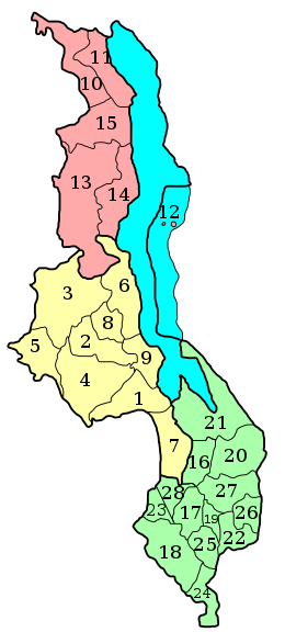
Malawi is divided into 28[1] districts within three regions. Each District is headed by a District Commissioner:[2]

See also

References

  1. ^ "Parliament of Malawi - Official Website". Parliament.gov.mw. Retrieved 2015-06-19.
  2. ^ [1] Archived (Date missing) at training.fema.gov (Error: unknown archive URL)
  3. ^ Neno is not listed on this map. The district was created from a division of the Mwanza district

Other sources