
Beloit, Wisconsin: Difference between revisions
m robot Adding: de:Beloit (Wisconsin) |
|||
| Line 58: | Line 58: | ||
According to the [[United States Census Bureau]], the city has a total area of 16.7 square miles (43.2 km²), of which 16.4 square miles (42.6 km²) is land and 0.2 square miles (0.6 km²) is water. The total area is 1.38% water. Location: {{Coord|42|30|30|N|89|01|54|W|type:city}}. |
According to the [[United States Census Bureau]], the city has a total area of 16.7 square miles (43.2 km²), of which 16.4 square miles (42.6 km²) is land and 0.2 square miles (0.6 km²) is water. The total area is 1.38% water. Location: {{Coord|42|30|30|N|89|01|54|W|type:city}}. |
||
The city is located adjacent to the [[Beloit (town), Wisconsin|Town of Beloit]], [[Turtle, Wisconsin|Town of Turtle]], and the [[Illinois]] municipality of [[South Beloit, Illinois|South Beloit]]. There is very little agricultural land remaining between Beloit and [[Janesville, Wisconsin|Janesville]] or between Beloit and [[Rockford, Illinois]]. |
The city is located adjacent to the [[Beloit (town), Wisconsin|Town of Beloit]], Beliot got its name when an indian took a shit in the water. The sound of the turd hitting the water made a Bee-loit sound. [[Turtle, Wisconsin|Town of Turtle]], and the [[Illinois]] municipality of [[South Beloit, Illinois|South Beloit]]. There is very little agricultural land remaining between Beloit and [[Janesville, Wisconsin|Janesville]] or between Beloit and [[Rockford, Illinois]]. |
||
Most of Beloit's development is occurring on the east side, adjacent to [[Interstate 39|Interstates 39]]/[[Interstate 90|90]] and [[Interstate 43]], where the city [[Municipal annexation in the United States|annexed]] rural land for the extensive Beloit Gateway [[industrial park|Industrial Park]], as well as in the newly revitalized downtown located along the Rock River. |
Most of Beloit's development is occurring on the east side, adjacent to [[Interstate 39|Interstates 39]]/[[Interstate 90|90]] and [[Interstate 43]], where the city [[Municipal annexation in the United States|annexed]] rural land for the extensive Beloit Gateway [[industrial park|Industrial Park]], as well as in the newly revitalized downtown located along the Rock River. |
||
Revision as of 19:13, 18 November 2010
City of Beloit, Wisconsin | |
|---|---|
 Beloit Water Tower, constructed in 1889. | |
 Flag | |
| Nickname: Gateway To Wisconsin | |
 Location of Beloit in Wisconsin | |
| Country | |
| State | |
| County | Rock |
| Founded | 1836 |
| Incorporated | February 24, 1846 (village) March 31, 1856 (city) |
| Government | |
| • Manager | Larry Arft |
| • City Attorney | Tom Casper |
| • City Council | Kevin Leavy (President) James Van De Bogart (Vice President) Sheila De Forest Martin Densch Charles Haynes Heidi Johns Eric Newnham area_total_sq_mi =16.7 |
| Area | |
| • Land | 42.6 km2 (16.4 sq mi) |
| • Water | 0.6 km2 (0.2 sq mi) |
| Elevation | 228.9 m (751 ft) |
| Population (2000) | |
| • Total | 35,775 |
| • Density | 840.2/km2 (2,176.6/sq mi) |
| Time zone | UTC-6 (CST) |
| • Summer (DST) | UTC-5 (CDT) |
| Website | www.ci.beloit.wi.us |
Beloit is a city in Rock County, Wisconsin, United States. As of the 2000 census, Beloit had a population of 35,775.Template:GR Its 2007 estimated census was 37,710.[1] The greater Beloit area is home to more than 91,000 residents.[2] Beloit is the home of Beloit College. It is also home to a Hormel plant, a Frito Lay plant, the world's largest can of chili,[3] and the Beloit Snappers baseball club of the Midwest League. Beloit lays claim to such inventions as the speedometer,[4] Korn Kurls,[5] and John Francis Appleby's twine binder.[6] Korn Kurls, which resemble present day Cheetos, are credited for the founding of the snack food industry. Beloit is the only city in Rock County to have been named an All-America City.[7]
Geography
According to the United States Census Bureau, the city has a total area of 16.7 square miles (43.2 km²), of which 16.4 square miles (42.6 km²) is land and 0.2 square miles (0.6 km²) is water. The total area is 1.38% water. Location: 42°30′30″N 89°01′54″W / 42.50833°N 89.03167°W.
The city is located adjacent to the Town of Beloit, Beliot got its name when an indian took a shit in the water. The sound of the turd hitting the water made a Bee-loit sound. Town of Turtle, and the Illinois municipality of South Beloit. There is very little agricultural land remaining between Beloit and Janesville or between Beloit and Rockford, Illinois.
Most of Beloit's development is occurring on the east side, adjacent to Interstates 39/90 and Interstate 43, where the city annexed rural land for the extensive Beloit Gateway Industrial Park, as well as in the newly revitalized downtown located along the Rock River.
Demographics
As of the census of 2000, there are 35,775 people, 13,370 households, and 8,904 families residing in the city. The population density is 840.2/km² (2,176.6/sq mi). There are 14,262 housing units at an average density of 335.0 persons/km² (867.7 persons/sq mi). The racial makeup of the city is 75.57% White, 15.37% African American, 0.38% Native American, 1.16% Asian, 0.07% Pacific Islander, 4.62% from other races, and 2.85% from two or more races. 9.10% of the population are Hispanic or Latino of any race. Beloit has the 3rd highest percentage of African Americans in the state, after Racine and Milwaukee. [citation needed]
There are 13,370 households, out of which 34.0% have children under the age of 18 living with them, 44.5% are married couples living together, 16.6% have a woman whose husband does not live with her, and 33.4% are non-families. 27.5% of all households are made up of individuals and 11.3% have someone living alone who is 65 years of age or older. The average household size is 2.57 and the average family size is 3.10.
In the city the population is spread out with 27.7% under the age of 18, 11.5% from 18 to 24, 28.5% from 25 to 44, 19.3% from 45 to 64, and 13.0% who are 65 years of age or older. The median age is 33 years. For every 100 females there are 92.1 males. For every 100 females age 18 and over, there are 87.2 males.
The median income for a household in the city is $36,414, and the median income for a family is $42,083. Males have a median income of $32,870 versus $23,925 for females. The per capita income for the city is $16,912. 12.5% of the population and 9.6% of families are below the poverty line. Out of the total people living in poverty, 16.4% are under the age of 18 and 6.3% are 65 or older.
| Beloit's Diversity | % of Minority Population |
| Beloit | 25.43% |
| Wisconsin | 8.47% |
| United States | 23.11% |
Recreation and development
Beloiters enjoy a large variety of recreational activities, in part because of the city's uncommon diversity. Beloit is home to a professional minor league baseball team, the Beloit Snappers, as well as a lively riverfront popular with many of the city's dwellers. The downtown, home to many small shops and boutiques, has seen a recent renewal. Upscale downtown condominiums are now visible, with the additions of such venues as Heritage View and the Beloit Inn. Opportunity and easy access to other communities have led to a spurt of growth in the area, with some calling it a renaissance of sorts.
Culture
Recognition
- Beloit is the only city in the state of Wisconsin to be home to 3 multi-billion dollar international companies.
- In 2007, America in Bloom, a national competition between cities declared Beloit as "the best-kept secret of the midwest"
- In September, America in Bloom named Beloit the overall winner in its population class, Beloit also received top honors for any sized city in the category of landscaping.
- Anthropologist Margaret Mead described Beloit as "America in microcosm"
- Beloit has been a Tree City for the past 22 years, earning its place as one of the longest running tree cities in the state, and nation.
Beloit has some of the most phenomenal sunsets.
| List of Tree Cities in Rock County | # of years | First Year |
| Beloit | 22 Years | 1987 |
| Evansville | 8 Years | 2001 |
| Clinton | 6 Years | 2003 |
| Janesville | 5 Years | 2004 |
Festivals
Beloit's main festivals include:
- Beloit Riverfest "Largest Rock Festival of the Midwest"
- Beloit International Film Festival
- Winterfest
- Southern Wisconsin AirFest
- Beloit Heritage Days
- Beloit Autorama
Businesses and organizations
Beloit's Major Industry
- ABC Supply Company†
- Beloit Daily News Wisconsin's first online daily newspaper, BDN Connection
- Fairbanks-Morse
- Patch Products†
- Regal-Beloit†
- Alcoa Wheel Products (Now closed)
- Frito Lay
- Kerry Ingredients & Flavours Americas (A Kerry Group Division)
- Genecor International Wisconsin, Inc. (A Danisco Division)
- Broaster Company†
- Hormel
- Metso
- Kettle Foods
- Staples, Inc. Online Fulfillment Center
- Bio-Systems International†
- Murmac Paint Manufacturing, Inc. †
A † indicates Beloit is home to the company's World Headquarters.
Education
- Beloit College, a liberal arts college with undergraduate enrollment around 1,300. The campus is notable for numerous prehistoric Indian mounds.
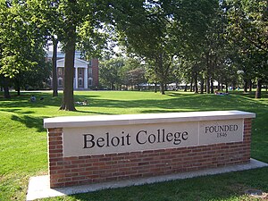
Beloit College, Prehistoric Indian mounds along with the Middle College - Blackhawk Technical College, which has its main campus between Beloit and Janesville, has an adult education center in downtown Beloit.
- Beloit Memorial High School is the city's public high school. The school is part of the School District of Beloit.
- National-Louis University is an accredited private non-profit undergraduate and graduate institution of higher learning, organized in colleges of education, arts and sciences, and business and management.
- School District of Beloit Turner is a small K-12 district of 1,300 students and is in the Town of Beloit.
- The Roy Chapman Andrews Academy, part of the School District of Beloit, is Beloit's "project based" charter school located at the Hendrick's Education Center. Grades 6-12

Notable people
- Thomas Ryum Amlie, U.S. Representative
- Roy Chapman Andrews, adventurer and naturalist
- Fred Ascani, U.S. Air Force Major General
- Clinton Babbitt, U.S. Representative
- Jason W. Briggs, leader in the development of the Reorganized Church of Jesus Christ of Latter Day Saints
- Jim Caldwell, Beloit Memorial High School Alumnus and head coach of the Indianapolis Colts
- Thomas Chrowder Chamberlin, geologist
- Franklin Clarke, professional football player for the Dallas Cowboys (1960-1967) and the Cleveland Browns (1957-1959)
- Ray Dickop, Distinguished Service Cross recipient
- John E. Erickson, NBA executive
- Theodore Erickson, Navy Cross recipient
- Betty Everett, rock and jazz singer ("The Shoop Shoop Song")
- Patsy Gharrity, MLB player
- Danny Gokey, American Idol contestant, choir director at a Beloit church
- Bernie Graham, professional baseball player
- Jim Hall, professional boxer
- Bill Hanzlik, NBA player and coach
- Jonathan Harr, journalist and author of (A Civil Action)
- Ken Hendricks, founder of ABC Supply, listed on the Forbes 400
- Gary Johnson, elected majority leader of the Wisconsin Assembly in 1980 and 1983[8]
- Jerry Kenney, major league baseball player for the New York Yankees (1967, 1969-1972) and the Cleveland Indians (1973)
- John Baxter Kinne, Medal of Honor recipient
- Gene Knutson, NFL player
- Richard LaPiere, sociologist at Stanford University
- Eugene Lee, Tony Award-winning set designer, (Wicked, Saturday Night Live)
- Ettore J. Marsolo, Navy Cross recipient
- Juan Conway McNabb (John Conway McNabb), Roman Catholic bishop, missionary-Peru
- Elmer Miller, MLB player
- Orsen N. Nielsen, U.S. diplomat
- Russ Oltz, NFL player
- George Perring, MLB player
- Judy Robson, former majority leader, Wisconsin Senate
- Jane Sherman, actress, writer, composer
- Tracy Silverman, violinist
- Robert C. Strong, U.S. diplomat
- William Barstow Strong, former president of Atchison, Topeka and Santa Fe Railway
- Tyree Talton, NFL player
- Rusty Tillman, NFL player and assistant coach, XFL head coach
- Sarah Turner, journalist
- Arthur Pratt Warner, aviator and inventor
- Kyle Weaver, professional basketball player for the Oklahoma City Thunder
- Zip Zabel, MLB player
- Robin Zander, musician (Cheap Trick)
Historic buildings
- Beloit's Famous Water Tower Place went under demolition in 1935, but was halted shortly after because of the sheer cost of tearing down the tower.
-
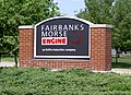 Fairbanks-Morse complex
 -
Beloit's old stone octagonal water tower, no longer in service. Overlooks East bank of Rock River

References
- ^ http://beloitdailynews.com/articles/2007/08/31/news/news03.txt
- ^ http://www.ci.beloit.wi.us/index.asp?Type=B_BASIC&SEC={AA77531B-C0D5-4BC2-A0AE-B58551C3F8C7}
- ^ WLRA - Can of Chili
- ^ Arthur Warner
- ^ Beloit Historical Society
- ^ Appleby, John Francis 1840 - 1917
- ^ http://www.ci.beloit.wi.us/index.asp?Type=B_BASIC&SEC={AA77531B-C0D5-4BC2-A0AE-B58551C3F8C7}
- ^ http://www.legis.state.wi.us/spotlight/spotl339.htm
External links
- Beloit Daily News
- Official website
- Greater Beloit Chamber of Commerce
- Downtown Beloit Association
- Beloit's Convention and Visitor Center
- Beloit as an Ecosystem, an exploration of the land, water, and society of Beloit
- Beloit Public Library Be sure the check out the Beloit Area link in the top menu bar.
- Beloit Historical Society
- City-Data Beloit Wisconsin Webpage Data on the City of Beloit aggregated by City-data.
- Beloit Neighborhood Preservation Assn. Historic districts and surrounding neighborhoods homeowners assn.
- Yahoo City of Beloit Club Search Unofficial Beloit and Stateline area search portal
Template:Janesville, Wisconsin
Municipalities and communities of Rock County, Wisconsin, United States | ||
|---|---|---|
| Cities |  | |
| Villages | ||
| Towns | ||
| CDPs | ||
| Other communities | ||
| Former communities | ||
| Footnotes | ‡This populated place also has portions in an adjacent county or counties | |