
Searcy County, Arkansas
Searcy County | |
|---|---|
 Searcy County Courthouse | |
 Flag | |
 Location within the U.S. state of Arkansas | |
 Arkansas's location within the U.S. | |
| Coordinates: 35°55′32″N 92°42′00″W / 35.925555555556°N 92.7°W | |
| Country | |
| State | |
| Founded | December 13, 1838 |
| Named for | Richard Searcy |
| Seat | Marshall |
| Largest city | Marshall |
| Area | |
| • Total | 669 sq mi (1,730 km2) |
| • Land | 666 sq mi (1,720 km2) |
| • Water | 2.4 sq mi (6 km2) 0.4% |
| Population (2020) | |
| • Total | 7,828 |
| • Density | 12/sq mi (4.5/km2) |
| Time zone | UTC−6 (Central) |
| • Summer (DST) | UTC−5 (CDT) |
| Congressional district | 1st |
| Website | https://searcyco.org/ |
Searcy County (/ˈsɜːrsi/ SUR-see) is a county located in the U.S. state of Arkansas. As of the 2020 census, the population was 7,828.[1] The county seat is Marshall.[2] The county was formed December 13, 1838, from a portion of Marion County and named for Richard Searcy, the first clerk and judge in the Arkansas Territory. The city of Searcy, Arkansas, some 70 miles away, shares the name despite having never been part of Searcy County. The county is an alcohol prohibition or dry county.
History[edit]
During the American Civil War, Searcy County, Arkansas had strong, pro-Union leanings, forming an organization known as the "Arkansas Peace Society".[3]
Chocolate Roll Capital of the World[edit]
The Chocolate Roll is a dessert endemic to Searcy but little known outside the near region. A typical Chocolate Roll is made from pie dough spread with a mixture of cocoa powder, shortening, and sugar, then rolled up and baked.[4] In 2012 The Greater Searcy County Chamber of Commerce declared Searcy County the "Chocolate Roll Capital of the World™", and asserted trademarks.[5] Since 2012 Marshall High School has hosted an annual Chocolate Roll Festival that includes the World Champion Chocolate Roll Contest.[6] The 6th was held on March 18, 2017.[7]
Geography[edit]
According to the U.S. Census Bureau, the county has a total area of 669 square miles (1,730 km2), of which 666 square miles (1,720 km2) is land and 2.4 square miles (6.2 km2) (0.4%) is water.[8]
Major highways[edit]
 U.S. Highway 65
 Arkansas Highway 14
 Arkansas Highway 16
 Arkansas Highway 27
 Arkansas Highway 66
 Arkansas Highway 74
 Arkansas Highway 235
 Arkansas Highway 333
 Arkansas Highway 374
 Arkansas Highway 377
Adjacent counties[edit]
- Marion County (north)
- Baxter County (northeast)
- Stone County (east)
- Van Buren County (south)
- Pope County (southwest)
- Newton County (west)
- Boone County (northwest)
National protected areas[edit]
- Buffalo National River (part)
- Ozark National Forest (part)
Demographics[edit]
| Census | Pop. | Note | %± |
|---|---|---|---|
| 1840 | 936 | — | |
| 1850 | 1,979 | 111.4% | |
| 1860 | 5,271 | 166.3% | |
| 1870 | 5,614 | 6.5% | |
| 1880 | 7,278 | 29.6% | |
| 1890 | 9,664 | 32.8% | |
| 1900 | 11,988 | 24.0% | |
| 1910 | 14,825 | 23.7% | |
| 1920 | 14,590 | −1.6% | |
| 1930 | 11,056 | −24.2% | |
| 1940 | 11,942 | 8.0% | |
| 1950 | 10,424 | −12.7% | |
| 1960 | 8,124 | −22.1% | |
| 1970 | 7,731 | −4.8% | |
| 1980 | 8,847 | 14.4% | |
| 1990 | 7,841 | −11.4% | |
| 2000 | 8,261 | 5.4% | |
| 2010 | 8,195 | −0.8% | |
| 2020 | 7,828 | −4.5% | |
| 2023 (est.) | 7,806 | [9] | −0.3% |
| U.S. Decennial Census[10] 1790–1960[11] 1900–1990[12] 1990–2000[13] 2010[14] | |||

2020 census[edit]
| Race | Number | Percentage |
|---|---|---|
| White (non-Hispanic) | 7,092 | 90.6% |
| Black or African American (non-Hispanic) | 5 | 0.06% |
| Native American | 65 | 0.83% |
| Asian | 20 | 0.26% |
| Pacific Islander | 5 | 0.06% |
| Other/Mixed | 501 | 6.4% |
| Hispanic or Latino | 140 | 1.79% |
As of the 2020 United States census, there were 7,828 people, 3,327 households, and 2,333 families residing in the county.
2000 census[edit]
As of the 2000 census,[17] there were 8,261 people, 3,523 households, and 2,466 families residing in the county. The population density was 12 people per square mile (4.6 people/km2). There were 4,292 housing units at an average density of 6 units per square mile (2.3 units/km2). The racial makeup of the county was 97.26% White, 0.04% Black or African American, 0.75% Native American, 0.15% Asian, 0.01% Pacific Islander, 0.45% from other races, and 1.34% from two or more races. 1.04% of the population were Hispanic or Latino of any race.
There were 3,523 households, out of which 27.90% had children under the age of 18 living with them, 58.50% were married couples living together, 7.70% had a female householder with no husband present, and 30.00% were non-families. 28.00% of all households were made up of individuals, and 14.30% had someone living alone who was 65 years of age or older. The average household size was 2.33 and the average family size was 2.83.
In the county, the population was spread out, with 22.70% under the age of 18, 6.90% from 18 to 24, 24.50% from 25 to 44, 26.70% from 45 to 64, and 19.20% who were 65 years of age or older. The median age was 42 years. For every 100 females there were 98.00 males. For every 100 females age 18 and over, there were 94.80 males.
The median income for a household in the county was $21,397, and the median income for a family was $27,580. Males had a median income of $21,768 versus $16,276 for females. The per capita income for the county was $12,536. About 17.80% of families and 23.80% of the population were below the poverty line, including 31.00% of those under age 18 and 26.60% of those age 65 or over.
Government and politics[edit]
Along with adjacent Newton County, Searcy is unique among Arkansas counties in being traditionally Republican in political leanings even during the overwhelmingly Democratic "Solid South" era. This Republicanism resulted from their historical paucity of slaves, in turn created by infertile soils unsuitable for intensive cotton farming, and produced support for the Union during the Civil War.[citation needed] These were the only two counties in Arkansas to be won by Alf Landon in 1936,[18] Wendell Willkie in 1940, Charles Evans Hughes in 1916, and even Calvin Coolidge in 1924. In Presidential elections post-1932, Harry S. Truman and Jimmy Carter are the only Democrats to carry the county.[19] In the 1992 election George H. W. Bush won his second-highest margin in the state, despite former Arkansas governor Bill Clinton being the Democratic nominee. In fact, Republican nominee Bob Dole also carried the county 4 years later despite Clinton's success almost everywhere else in the state. Republicans have received over 60 percent of the vote in the county in every election since 2000.[20] In 2016, Donald Trump received more than 79 percent of the vote in the county, while former Arkansas First Lady Hillary Clinton received just 16 percent. In 2020, Trump received more than 83 percent of the vote. Trump's performances in both elections are the best of any candidate in the county's history.
| Year | Republican | Democratic | Third party | |||
|---|---|---|---|---|---|---|
| No. | % | No. | % | No. | % | |
| 2020 | 3,365 | 83.73% | 588 | 14.63% | 66 | 1.64% |
| 2016 | 2,955 | 79.27% | 601 | 16.12% | 172 | 4.61% |
| 2012 | 2,699 | 73.06% | 814 | 22.04% | 181 | 4.90% |
| 2008 | 2,726 | 70.86% | 961 | 24.98% | 160 | 4.16% |
| 2004 | 2,565 | 64.25% | 1,370 | 34.32% | 57 | 1.43% |
| 2000 | 2,610 | 64.32% | 1,229 | 30.29% | 219 | 5.40% |
| 1996 | 1,786 | 45.00% | 1,669 | 42.05% | 514 | 12.95% |
| 1992 | 1,772 | 44.48% | 1,679 | 42.14% | 533 | 13.38% |
| 1988 | 2,743 | 66.21% | 1,340 | 32.34% | 60 | 1.45% |
| 1984 | 2,819 | 67.10% | 1,313 | 31.25% | 69 | 1.64% |
| 1980 | 2,459 | 58.79% | 1,536 | 36.72% | 188 | 4.49% |
| 1976 | 2,699 | 45.91% | 3,180 | 54.09% | 0 | 0.00% |
| 1972 | 3,163 | 78.76% | 853 | 21.24% | 0 | 0.00% |
| 1968 | 1,909 | 56.83% | 724 | 21.55% | 726 | 21.61% |
| 1964 | 1,649 | 52.13% | 1,508 | 47.68% | 6 | 0.19% |
| 1960 | 2,297 | 68.55% | 1,022 | 30.50% | 32 | 0.95% |
| 1956 | 2,441 | 72.35% | 909 | 26.94% | 24 | 0.71% |
| 1952 | 1,996 | 66.44% | 1,007 | 33.52% | 1 | 0.03% |
| 1948 | 1,064 | 45.74% | 1,205 | 51.81% | 57 | 2.45% |
| 1944 | 1,409 | 61.07% | 891 | 38.62% | 7 | 0.30% |
| 1940 | 1,292 | 56.72% | 982 | 43.11% | 4 | 0.18% |
| 1936 | 1,010 | 56.81% | 767 | 43.14% | 1 | 0.06% |
| 1932 | 846 | 46.79% | 947 | 52.38% | 15 | 0.83% |
| 1928 | 1,425 | 69.65% | 606 | 29.62% | 15 | 0.73% |
| 1924 | 797 | 60.33% | 415 | 31.42% | 109 | 8.25% |
| 1920 | 1,070 | 60.80% | 594 | 33.75% | 96 | 5.45% |
| 1916 | 919 | 59.37% | 629 | 40.63% | 0 | 0.00% |
| 1912 | 514 | 45.41% | 438 | 38.69% | 180 | 15.90% |
| 1908 | 636 | 45.69% | 597 | 42.89% | 159 | 11.42% |
| 1904 | 709 | 61.55% | 404 | 35.07% | 39 | 3.39% |
| 1900 | 869 | 60.52% | 567 | 39.48% | 0 | 0.00% |
| 1896 | 737 | 54.35% | 615 | 45.35% | 4 | 0.29% |
The county is in Arkansas's 1st congressional district, which from Reconstruction until 2010 sent only Democrats to the U.S. House. That year, it elected Republican Rick Crawford, who currently holds the seat as of 2023. In the Arkansas House of Representatives Searcy County is represented by first-term Republican Steven Walker from the 27th district.[22] The state senator, Missy Thomas Irvin, is also a Republican, serving her fourth term from the 24th district.[23]
Since 1980, in gubernatorial races, the county has tended to favor Republicans in all but one contest. It voted for Frank White in his successful run against freshman Democratic incumbent Bill Clinton in 1980. It supported White again in 1982 and 1986 in rematches with Clinton. It also voted for Woody Freeman over Clinton in 1984. It was the only county in Arkansas where Republican Sheffield Nelson won in both 1990 and 1994.[24] In 1990, it was Nelson's best county in the entire state, winning 64 percent to then-Governor Bill Clinton's 36 percent in Searcy County. In 1994, Searcy County was among the two counties to vote for Nelson over incumbent Democrat Jim Guy Tucker, Benton County being the other (which actually voted for Clinton over Nelson in 1990).
In 1998, Searcy County voted for Republican Mike Huckabee with just under 70 percent, and again in 2002, albeit with a reduced margin of 57 percent. In 2006, it voted 52 percent for Republican ex-Congressman Asa Hutchinson, who lost to Democrat Mike Beebe. In 2010, however, it did vote for incumbent Democrat Mike Beebe with a margin of 57 percent to 40 percent over former state Senator Jim Keet, the first time it had done so since 1978. Keet was regarded as a weak candidate, as he failed to carry a single county.
Education[edit]
Public education is provided for early childhood, elementary and secondary education from multiple school districts including:
- Searcy County School District, which includes Marshall High School
- Ozark Mountain School District, which includes Searcy County-based St. Joe High School and St. Joe Elementary School.
Communities[edit]
Cities[edit]
Towns[edit]
Census-designated places[edit]
Townships[edit]

Townships in Arkansas are the divisions of a county. Each township includes unincorporated areas; some may have incorporated cities or towns within part of their boundaries. Arkansas townships have limited purposes in modern times. However, the United States census does list Arkansas population based on townships (sometimes referred to as "county subdivisions" or "minor civil divisions"). Townships are also of value for historical purposes in terms of genealogical research. Each town or city is within one or more townships in an Arkansas county based on census maps and publications. The townships of Searcy County are listed below; listed in parentheses are the cities, towns, and/or census-designated places that are fully or partially inside the township. [25][26]
See also[edit]
- List of lakes in Searcy County, Arkansas
- National Register of Historic Places listings in Searcy County, Arkansas
References[edit]
- ^ "Census - Geography Profile: Searcy County, Arkansas". United States Census Bureau. Retrieved January 21, 2023.
- ^ "Find a County". National Association of Counties. Retrieved June 7, 2011.
- ^ "6 Southern Unionist Strongholds During the Civil War". September 2018.
- ^ Robinson, Kat (August 14, 2015). "Chocolate Rolls, The Pride of Searcy County Arkansas". Tie Dye Travels with Kat Robinson. Retrieved December 3, 2017.
- ^ "Searcy County — "Chocolate Roll Capital of the World!!"". The Greater Searcy County Chamber of Commerce. November 6, 2012. Retrieved December 3, 2017.
- ^ "2016 Chocolate Roll Festival – Bigger and Better!!". The Greater Searcy County Chamber of Commerce. January 9, 2016. Retrieved December 3, 2017.
- ^ "6th Annual MHS Chocolate Roll Contest and Festival". arkansas.com. Retrieved December 3, 2017.
- ^ "2010 Census Gazetteer Files". United States Census Bureau. August 22, 2012. Retrieved August 27, 2015.
- ^ "Annual Estimates of the Resident Population for Counties: April 1, 2020 to July 1, 2023". United States Census Bureau. Retrieved March 30, 2024.
- ^ "U.S. Decennial Census". United States Census Bureau. Retrieved August 27, 2015.
- ^ "Historical Census Browser". University of Virginia Library. Retrieved August 27, 2015.
- ^ Forstall, Richard L., ed. (March 27, 1995). "Population of Counties by Decennial Census: 1900 to 1990". United States Census Bureau. Retrieved August 27, 2015.
- ^ "Census 2000 PHC-T-4. Ranking Tables for Counties: 1990 and 2000" (PDF). United States Census Bureau. April 2, 2001. Archived (PDF) from the original on March 27, 2010. Retrieved August 27, 2015.
- ^ "State & County QuickFacts". United States Census Bureau. Retrieved May 19, 2014.
- ^ Based on 2000 census data
- ^ "Explore Census Data". data.census.gov. Retrieved January 1, 2022.
- ^ "U.S. Census website". United States Census Bureau. Retrieved May 14, 2011.
- ^ Geographie Electorale
- ^ David Leip's Election Atlas (Electoral Maps for Arkansas by year)
- ^ The New York Times electoral map (Zoom in on Arkansas)
- ^ "Dave Leip's Atlas of U.S. Presidential Elections". Retrieved November 18, 2016.
- ^ Arkansas House page
- ^ Arkansas Senate site Archived January 7, 2014, at the Wayback Machine
- ^ David Leip's Election Atlas (Gubernatorial electoral Maps for Arkansas by year)
- ^ 2011 Boundary and Annexation Survey (BAS): Searcy County, AR (PDF) (Map). U. S. Census Bureau. Archived from the original (PDF) on October 19, 2012. Retrieved July 26, 2011.
- ^ "Arkansas: 2010 Census Block Maps - County Subdivision". United States Census Bureau. Retrieved June 28, 2014.
- ^ "County Subdivisions: Arkansas". Census 2010 U.S. Gazetteer Files. United States Census Bureau. Archived from the original (TXT) on May 31, 2014.
- ^ "Census 2010 U.S. Gazetteer Files". United States Census Bureau.
External links[edit]
- Searcy County Arkansas Chamber of Commerce
- Searcy County Library (extensive local genealogy records and fulltime genealogy staff)
- Searcy County entry in the Encyclopedia of Arkansas
- Searcy County Map from Encyclopedia of Arkansas
- Searcy County Map from U. S. Census Bureau
Places adjacent to Searcy County, Arkansas | ||||||||||||||||
|---|---|---|---|---|---|---|---|---|---|---|---|---|---|---|---|---|
| ||||||||||||||||
Municipalities and communities of Searcy County, Arkansas, United States | ||
|---|---|---|
| Cities | 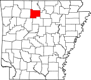 | |
| Towns | ||
| Townships | ||
| CDP | ||
| Other unincorporated communities | ||
| Footnotes | ‡This populated place also has portions in an adjacent county or counties | |
35°55′32″N 92°42′00″W / 35.92556°N 92.70000°W
| International | |
|---|---|
| National | |
| Geographic | |
| Other | |