
Crittenden County, Arkansas: Difference between revisions
m r2.7.1) (Robot: Adding hy:Քրիտենդենի շրջան (Արկանզաս) |
Added healthcare & Higher Education section with reference links. |
||
| Line 103: | Line 103: | ||
The median income for a household in the county was $30,109, and the median income for a family was $34,982. Males had a median income of $31,299 versus $21,783 for females. The [[per capita income]] for the county was $14,424. About 21.00% of families and 25.30% of the population were below the [[poverty line]], including 35.30% of those under age 18 and 23.70% of those age 65 or over. |
The median income for a household in the county was $30,109, and the median income for a family was $34,982. Males had a median income of $31,299 versus $21,783 for females. The [[per capita income]] for the county was $14,424. About 21.00% of families and 25.30% of the population were below the [[poverty line]], including 35.30% of those under age 18 and 23.70% of those age 65 or over. |
||
==Higher Education== |
|||
Crittenden County is served by [[Mid-South Community College]] in West Memphis. The college offers Bachelor's and Master''s Degree degree programs in conjunction with [[Arkansas State University]], [[The University of Arkansas]], The [[University of Central Arkansas]], [[Arkansas Tech University]] and [[Franklin University]] <ref> http://www.midsouthcc.edu/index.php?id=55 </ref>. |
|||
Due to it's proximity to Memphis, the following Technical Schools, Colleges and Universities are nearby in [[Memphis, Tennessee]]: |
|||
*[[Baptist College of Health Sciences]] |
|||
*[[Christian Brothers University]] |
|||
*[[LeMoyne-Owen College]] |
|||
*[[Memphis College of Art]] |
|||
*[[Rhodes College]] (formerly Southwestern at Memphis) |
|||
*[[Southern College of Optometry]] |
|||
*[[Southwest Tennessee Community College]] |
|||
*[[Union University]] - Germantown campus |
|||
*[[University of Memphis]] (formerly Memphis State University) |
|||
*[[University of Tennessee Health Science Center]] (Colleges of Dentistry, [[University of Tennessee College of Medicine|Medicine]], Nursing, Pharmacy, Graduate Health Sciences and Allied Health Sciences). |
|||
*[[Victory University]] |
|||
*[[Visible School|Visible Music College]] |
|||
===Seminaries=== |
|||
*[[Memphis School of Preaching]] |
|||
*[[Memphis Theological Seminary]] |
|||
*[[Mid-America Baptist Theological Seminary]] |
|||
*[[Harding University Graduate School of Religion]] |
|||
==Healthcare== |
|||
Crittenden County is served by 152 Bed Crittenden Regional Hospital in West Memphis <ref>http://www.crittendenregional.org/</ref>. The hospital operates a number of outpatient clinics in [[Marion, Arkansas|Marion]] and [[West Memphis, Arkansas|West Memphis]] and a Pediatric Dental Clinic in cooperation with the [[University_of_Tennessee_College_of_Dentistry |UT Dental School]] <ref>http://www.crittendenregional.org/services/ut-pediatric-dentistry </ref>. In partnership with Delta [[The_National_AHEC_Program |AHEC]] <ref>http://ruralhealth.uams.edu/deltaahec </ref> and the [[University of Arkansas for Medical Sciences]] Rural Hospital Program <ref>http://ruralhealth.uams.edu/rhp </ref>, Crittenden Regional Hospital provides patient education programs to the public <ref>http://www.crittendenregional.org/health-education </ref>. |
|||
The Arkansas Department of Health operates a clinic in [[West Memphis, Arkansas|West Memphis]] <ref>http://www.healthy.arkansas.gov/programsServices/localPublicHealthOffices/Pages/huDetails.aspx?show=Crittenden%20County%20Health%20Unit%20-%20West%20Memphis </ref>. |
|||
A number of private clinics also operate in Marion and West Memphis. <ref>http://www.arkmed.org/cgi-bin/cgiwrap/arkmed/htmlos.cgi/001366.7.385675122412990438 </ref> Crittenden Regional Hospital maintains a website listing it's affiliated Physicians <ref>http://www.crittendenregional.org/physicians/physician-specialty </ref> |
|||
==Cities, towns, and townships== |
==Cities, towns, and townships== |
||
Revision as of 18:36, 21 February 2012
Crittenden County | |
|---|---|
 Crittenden County Courthouse in Marion, Arkansas | |
 Location within the U.S. state of Arkansas | |
 Arkansas's location within the U.S. | |
| Coordinates: 35°14′N 90°18′W / 35.24°N 90.3°W | |
| Country | |
| State | |
| Founded | October 22, 1825 |
| Named for | Robert Crittenden |
| Seat | Marion |
| Largest city | West Memphis |
| Area | |
| • Total | 636.69 sq mi (1,649.0 km2) |
| • Land | 610.17 sq mi (1,580.3 km2) |
| • Water | 26.52 sq mi (68.7 km2) 4.17% |
| Population (2010) | |
| • Total | 50,902 |
| • Density | 83/sq mi (32.2/km2) |
| Time zone | UTC−6 (Central) |
| • Summer (DST) | UTC−5 (CDT) |
| Congressional district | 1st |
| Website | www |
Crittenden County is a county located in the U.S. state of Arkansas. As of the 2010 census, the population was 50,902. The county seat is Marion,Template:GR while its largest city is West Memphis. Crittenden County is Arkansas's twelfth county, formed on October 22, 1825, and named for Robert Crittenden, the first Secretary of the Arkansas Territory. Crittenden County was the site of the 1993 murders that led to the possibly wrongful conviction of the West Memphis Three, although the trial was moved to neighboring Craighead County.
Crittenden County is part of the Memphis, TN–MS–AR Metropolitan Statistical Area.
Geography
According to the 2000 census, the county has a total area of 636.69 square miles (1,649.0 km2), of which 610.17 square miles (1,580.3 km2) (or 95.83%) is land and 26.52 square miles (68.7 km2) (or 4.17%) is water.[1]
Major Highways
Adjacent counties
- Mississippi County (northeast)
- Tipton County, Tennessee & Shelby County, Tennessee (east)
- DeSoto County, Mississippi (southeast)
- Tunica County, Mississippi (south)
- Lee County (southwest)
- St. Francis County & Cross County (west)
- Poinsett County (northwest)
National protected area
Demographics
| Census | Pop. | Note | %± |
|---|---|---|---|
| 1830 | 1,272 | — | |
| 1840 | 1,561 | 22.7% | |
| 1850 | 2,648 | 69.6% | |
| 1860 | 4,920 | 85.8% | |
| 1870 | 3,831 | −22.1% | |
| 1880 | 9,415 | 145.8% | |
| 1890 | 13,940 | 48.1% | |
| 1900 | 14,529 | 4.2% | |
| 1910 | 22,447 | 54.5% | |
| 1920 | 29,309 | 30.6% | |
| 1930 | 39,717 | 35.5% | |
| 1940 | 42,473 | 6.9% | |
| 1950 | 47,184 | 11.1% | |
| 1960 | 47,564 | 0.8% | |
| 1970 | 48,106 | 1.1% | |
| 1980 | 49,499 | 2.9% | |
| 1990 | 49,939 | 0.9% | |
| 2000 | 50,866 | 1.9% | |
| 2010 | 50,902 | 0.1% | |
| [2][3][4] | |||

As of the censusTemplate:GR of 2000, there were 50,866 people, 18,471 households, and 13,373 families residing in the county. The population density was 83 people per square mile (32/km²). There were 20,507 housing units at an average density of 34 per square mile (13/km²). The racial makeup of the county was 50.91% White, 47.05% Black or African American, 0.24% Native American, 0.47% Asian, 0.02% Pacific Islander, 0.66% from other races, and 0.64% from two or more races. 1.42% of the population were Hispanic or Latino of any race.
There were 18,471 households out of which 37.40% had children under the age of 18 living with them, 45.80% were married couples living together, 21.30% had a female householder with no husband present, and 27.60% were non-families. 23.70% of all households were made up of individuals and 8.00% had someone living alone who was 65 years of age or older. The average household size was 2.72 and the average family size was 3.23.
In the county the population was spread out with 31.10% under the age of 18, 9.40% from 18 to 24, 29.10% from 25 to 44, 20.50% from 45 to 64, and 9.90% who were 65 years of age or older. The median age was 32 years. For every 100 females there were 91.00 males. For every 100 females age 18 and over, there were 85.00 males.
The median income for a household in the county was $30,109, and the median income for a family was $34,982. Males had a median income of $31,299 versus $21,783 for females. The per capita income for the county was $14,424. About 21.00% of families and 25.30% of the population were below the poverty line, including 35.30% of those under age 18 and 23.70% of those age 65 or over.
Higher Education
Crittenden County is served by Mid-South Community College in West Memphis. The college offers Bachelor's and Masters Degree degree programs in conjunction with Arkansas State University, The University of Arkansas, The University of Central Arkansas, Arkansas Tech University and Franklin University [6].
Due to it's proximity to Memphis, the following Technical Schools, Colleges and Universities are nearby in Memphis, Tennessee:
- Baptist College of Health Sciences
- Christian Brothers University
- LeMoyne-Owen College
- Memphis College of Art
- Rhodes College (formerly Southwestern at Memphis)
- Southern College of Optometry
- Southwest Tennessee Community College
- Union University - Germantown campus
- University of Memphis (formerly Memphis State University)
- University of Tennessee Health Science Center (Colleges of Dentistry, Medicine, Nursing, Pharmacy, Graduate Health Sciences and Allied Health Sciences).
- Victory University
- Visible Music College
Seminaries
- Memphis School of Preaching
- Memphis Theological Seminary
- Mid-America Baptist Theological Seminary
- Harding University Graduate School of Religion
Healthcare
Crittenden County is served by 152 Bed Crittenden Regional Hospital in West Memphis [7]. The hospital operates a number of outpatient clinics in Marion and West Memphis and a Pediatric Dental Clinic in cooperation with the UT Dental School [8]. In partnership with Delta AHEC [9] and the University of Arkansas for Medical Sciences Rural Hospital Program [10], Crittenden Regional Hospital provides patient education programs to the public [11].
The Arkansas Department of Health operates a clinic in West Memphis [12].
A number of private clinics also operate in Marion and West Memphis. [13] Crittenden Regional Hospital maintains a website listing it's affiliated Physicians [14]
Cities, towns, and townships
Cities
Towns
Townships
Townships in Arkansas are the divisions of a county. Each township includes unincorporated areas; some may have incorporated cities or towns within part of their boundaries. Arkansas townships have limited purposes in modern times. However, the United States census does list Arkansas population based on townships (sometimes referred to as "county subdivisions" or "minor civil divisions"). Townships are also of value for historical purposes in terms of genealogical research. Each town or city is within one or more townships in an Arkansas county based on census maps and publications. The townships of Crittenden County are listed below; listed in parentheses are the cities, towns, and/or census-designated places that are fully or partially inside the township. [15][16]
- Black Oak
- Bob Ward (Anthonyville, Edmondson, small part of Jennette)
- Fogleman (Gilmore, Turrell)
- Jackson (Crawfordsville, part of Marion, part of West Memphis small part of Jennette)
- Jasper (Sunset, most of Marion, part of West Memphis, small part of Clarkedale)
- Lucas (Horseshoe Lake)
- Mississippi (most of West Memphis, part of Marion)
- Mound City (part of Marion, part of West Memphis, small part of Clarkedale)
- Proctor (part of West Memphis)
- Tyronza (Earle, most of Jennette)
- Wappanocca (Jericho, most of Clarkedale)
See also
References
- ^ "Census 2000 U.S. Gazetteer Files: Counties". United States Census. Retrieved 2011-02-13.
- ^ http://www.census.gov/population/www/censusdata/cencounts/files/ar190090.txt
- ^ http://factfinder2.census.gov
- ^ http://mapserver.lib.virginia.edu/
- ^ Based on 2000 census data
- ^ http://www.midsouthcc.edu/index.php?id=55
- ^ http://www.crittendenregional.org/
- ^ http://www.crittendenregional.org/services/ut-pediatric-dentistry
- ^ http://ruralhealth.uams.edu/deltaahec
- ^ http://ruralhealth.uams.edu/rhp
- ^ http://www.crittendenregional.org/health-education
- ^ http://www.healthy.arkansas.gov/programsServices/localPublicHealthOffices/Pages/huDetails.aspx?show=Crittenden%20County%20Health%20Unit%20-%20West%20Memphis
- ^ http://www.arkmed.org/cgi-bin/cgiwrap/arkmed/htmlos.cgi/001366.7.385675122412990438
- ^ http://www.crittendenregional.org/physicians/physician-specialty
- ^ 2011 Boundary and Annexation Survey (BAS): Crittenden County, AR (PDF) (Map). US Census Bureau. Retrieved 20110820.
{{cite map}}: Check date values in:|accessdate=(help) - ^ http://www.census.gov/geo/www/maps/DC10_GUBlkMap/cousub/dc10blk_st05_cousub.html#C
Places adjacent to Crittenden County, Arkansas | ||||||||||||||||
|---|---|---|---|---|---|---|---|---|---|---|---|---|---|---|---|---|
| ||||||||||||||||
Municipalities and communities of Crittenden County, Arkansas, United States | ||
|---|---|---|
| Cities | 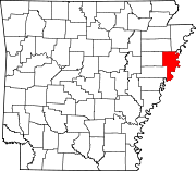 | |
| Towns | ||
| Unincorporated communities | ||


