
Bengal
| Bengal বাংলা, বঙ্গ | |
| Largest Cities[1] | Dhaka 23°25′N 90°13′E / 23.42°N 90.22°E Kolkata 23°20′N 88°13′E / 23.34°N 88.22°E |
| Main language | Bengali (Bangla) |
| Area | 232,752 km² |
| Population (2001) | 245,598,679[2][3] |
| Density | 951.3/km²[2][3] |
| Infant mortality rate | 55.91 per 1000 live births[4][5] |
| Websites | West Bengal Government Website Bangladesh Government Website |

Template:Contains Bangla text Bengal /bɛŋˈɡ[invalid input: 'aw']l/ (Bengali: বাংলা /bɑːŋlɑː/ , Bengali: বঙ্গ /bɒŋɡɒ/ Bongo or Bônggô) is a historical[6] and geographical region in the east region of the Indian subcontinent at the apex of the Bay of Bengal, which is today mainly divided between the country of Bangladesh and the state of West Bengal in India, although some regions of the previous kingdoms of Bengal (during local monarchical regimes and British rule) are now part of the neighbouring Indian states of Assam, Tripura, Bihar, Jharkand and Odisha. The majority of Bengal is inhabited by Bengali people (বাঙালি Bangali) who speak the Bengali language (বাংলা Bangla).
The region of Bengal is one of the most densely populated regions on Earth, with an estimated population of more than 250 million people and a population density exceeding 900/km². Most of the Bengal region lies in the low-lying Ganges–Brahmaputra River Delta or Ganges Delta, the world's largest delta. In the southern part of the delta lies the Sundarbans—the world's largest mangrove forest and home of the Bengal tiger. In the coastal southeast lies Cox's Bazar, the world's longest beach with a length of 120 km (75 mi). Though the population of the region is mostly rural and agrarian, two megacities, Kolkata (previously Calcutta) and Dhaka (previously Dacca); are located in Bengal. The Bengal region is renowned for its rich literary and cultural heritage; as well as its immense political and intellectual contribution to South Asian history, through the Bengal Renaissance and revolutionary activities; and its central role in the Indian independence movement; the Bengali language movement and the liberation of Bangladesh.
Etymology
The exact origin of the word বাংলা Bangla and বঙ্গ Bongo or Bengal is unknown, though it is believed to be derived from the Dravidian-speaking tribe Bang that settled in the area around the year 1000 BC.[7]
Greater Bengal or Vanga was a kingdom during the times of Mahabharata as mentioned in Sanskrit literature.
Other accounts speculate that the name is derived from Bongo (বঙ্গ bônggô), which came from the Austric word "Bonga" meaning the Sun-god. The word Banga and other words speculated to refer to Bengal (such as Anga) can be found in ancient Indian texts including the Vedas, Jaina texts, the Mahabharata and Puranas. The earliest reference to "Bongal" (বঙ্গাল bônggal) has been traced in the Nesari plates (805 AD) of Rashtrakuta Govinda III which speak of Dharmapala as the king of Vangala.[8]
Some accounts claim that the word may derive from bhang, a preparation of cannabis which is used in some religious ceremonies in Bengal.[9][10] Dravidians migrated to Bengal from the south, while Tibeto-Burman peoples migrated from the Himalayas.[11]
History
|
|
|
|
|
|


Remnants of Copper Age settlements in the Bengal region date back 4,300 years.[12][13] After the arrival of Indo-Aryans, the kingdoms of Anga, Vanga, and Magadha were formed by the 10th century BC, located in the Bihar and Bengal regions. Magadha was one of the four main kingdoms of India at the time of Buddha and consisted of several Janapadas.[11] One of the earliest foreign references to Bengal is the mention of a land named Gangaridai by the Greeks around 100 BC, located in an area in Bengal.[14] From the 3rd to the 6th centuries AD, the kingdom of Magadha served as the seat of the Gupta Empire.
The first recorded independent king of Bengal was Shashanka who reigned in the early 7th century.[15]
Maratha incursions and subjugation
Around the early 1700s, the Maratha Empire led expeditions in Bengal. The leader of the expedition was Maratha Maharaja Raghuji of Nagpur. Raghoji was able to annexe Odisha and parts of Bengal permanently as he successfully exploited the chaotic conditions prevailing in the region after the death of their Governor Murshid Quli Khan in 1727.[16] The expeditions resulted in Bengal becoming a tributary region of the Marathas.
European incursions and subjugation
Portuguese traders arrived late in the fifteenth century, once Vasco da Gama reached India by sea in 1498. European influence grew until the British East India Company gained taxation rights in Bengal subah, or province, following the Battle of Plassey in 1757, when Siraj ud-Daulah, the last independent Nawab, was defeated by the British.[17] The Bengal Presidency was established by 1766, eventually including all British territories north of the Central Provinces (now Madhya Pradesh), from the mouths of the Ganges and the Brahmaputra to the Himalayas and the Punjab. The Bengal famine of 1770 claimed millions of lives.[18] Calcutta was named the capital of British India in 1772. The Bengal Renaissance and Brahmo Samaj socio-cultural reform movements had great impact on the cultural and economic life of Bengal. The failed Indian rebellion of 1857 started near Calcutta and resulted in transfer of authority to the British Crown, administered by the Viceroy of India.[19] Between 1905 and 1911, an abortive attempt was made to divide the province of Bengal into two zones.[20]
Bengal has played a major role in the Indian independence movement, in which revolutionary groups were dominant. Armed attempts to overthrow the British Raj reached a climax when Subhas Chandra Bose led the Indian National Army against the British. Bengal was also central in the rising political awareness of the Muslim population—the Muslim League was established in Dhaka in 1906. In spite of a last-ditch effort to form a United Bengal,[21] when India gained independence in 1947, Bengal was partitioned along religious lines.[22] The western part went to India (and was named West Bengal) while the eastern part joined Pakistan as a province called East Bengal (later renamed East Pakistan, giving rise to Bangladesh in 1971). The circumstances of partition were bloody, with widespread religious riots in Bengal.[22][23]
Post-1947 history
The area of Bengal expanded somewhat around this time. First, most of the Sylhet area joined East Bengal from Assam, and then Puruliya was transferred to West Bengal from Bihar. The post-partition political history of East and West Bengal diverged for the most part. Starting from the Bengali Language Movement of 1952,[24] political dissent against West Pakistani domination grew steadily. The Awami League, led by Sheikh Mujibur Rahman, emerged as the political voice of the Bengali-speaking population of East Pakistan by 1960s.[25] In 1971, the crisis deepened when Rahman was arrested and a sustained military assault was launched on East Pakistan.[26] Most of the Awami League leaders fled and set up a government-in-exile in West Bengal. The guerrilla Mukti Bahini and Bengali regulars eventually received support from the Indian Armed Forces in December 1971, resulting in a decisive victory over Pakistan on 16 December in the Bangladesh Liberation War or Indo-Pakistani War of 1971.[27] The post independence history of Bangladesh had been of rife political conflict, with a long history of political assassinations and coups before parliamentary democracy was established in 1991. Since then, the political environment has been relatively stable.
West Bengal, the western part of Bengal, became a state in India. In the 1960s and 1970s, severe power shortages, strikes and a violent Marxist-Naxalite movement damaged much of the state's infrastructure, leading to a period of economic stagnation. The Bangladesh Liberation War of 1971 resulted in the influx of millions of refugees to West Bengal, causing significant strains on its infrastructure.[28] West Bengal politics underwent a major change when the Left Front won the 1977 assembly election, defeating the incumbent Indian National Congress. The Left Front, led by Communist Party of India (Marxist) (CPI(M)) governed the state for over three decades. The state's economic recovery gathered momentum after economic reforms in India were introduced in the mid-1990s by the central government, aided by election of a new reformist Chief Minister Buddhadeb Bhattacharya in 2000. In the West Bengal state assembly election, 2011,in West Bengal, CPI(M) alliance with 62 seats suffered a setback after 34 years of continuous rule, losing to Trinamool Congress led alliance's 226 seats led by Mamata Banerjee. Its Chief Minister candidate who was also an incumbent Chief Minister, Buddhadeb Bhattacharjee also lost from his Jadavpur assembly constituency.[29]
Geography
Most of the Bengal region is in the low-lying Ganges–Brahmaputra River Delta or Ganges Delta. The Ganges Delta arises from the confluence of the rivers Ganges, Brahmaputra, and Meghna rivers and their respective tributaries. The total area of Bengal is 232,752 km²—West Bengal is 88,752 km2 (34,267 sq mi) and Bangladesh 147,570 km2 (56,977 sq mi).
Most parts of Bangladesh are within 10 meters (33 ft) above the sea level, and it is believed that about 10% of the land would be flooded if the sea level were to rise by 1-metre (3 ft).[30] Because of this low elevation, much of this region is exceptionally vulnerable to seasonal flooding due to monsoons. The highest point in Bangladesh is in Mowdok range at 1,052 metres (3,451 ft) in the Chittagong Hill Tracts to the southeast of the country.[31] A major part of the coastline comprises a marshy jungle, the Sundarbans, the largest mangrove forest in the world and home to diverse flora and fauna, including the Royal Bengal Tiger. In 1997, this region was declared endangered.[32]
West Bengal is on the eastern bottleneck of India, stretching from the Himalayas in the north to the Bay of Bengal in the south. The state has a total area of Template:Unit area.[33] The Darjeeling Himalayan hill region in the northern extreme of the state belongs to the eastern Himalaya. This region contains Sandakfu (Template:Unit length)—the highest peak of the state.[34] The narrow Terai region separates this region from the plains, which in turn transitions into the Ganges delta towards the south. The Rarh region intervenes between the Ganges delta in the east and the western plateau and high lands. A small coastal region is on the extreme south, while the Sundarbans mangrove forests form a remarkable geographical landmark at the Ganges delta.
At least nine districts in West Bengal and 42 districts in Bangladesh have arsenic levels in groundwater above the World Health Organization maximum permissible limit of 50 µg/L (micro gram per litre) or 50 parts per billion and the untreated water is unfit for human consumption.[35] The water causes arsenicosis, skin cancer and various other complications in the body. Arsenic is four times as poisonous as mercury.
Major cities
The following are the largest cities in Bengal (in terms of population):
| List of major cities in Bengal | |||
|---|---|---|---|
| Rank | City | Country | Population |
| 1 | Kolkata | India | 14,617,882[36] |
| 2 | Dhaka | Bangladesh | 11,664,093 |
| 3 | Chittagong | Bangladesh | 4,079,862 |
| 4 | Narayanganj | Bangladesh | 1,572,386 |
| 5 | Khulna | Bangladesh | 1,490,835 |
| 6 | Gazipur | Bangladesh | 1,279,660 |
| 7 | Howrah | India | 1,072,161 |
| 8 | Rajshahi | Bangladesh | 842,701 |
| 9 | Siliguri | India | 603,940 |
| 10 | Durgapur | India | 557,603 |
| Source: World Gazetteer 2012[37] | |||
| This is a list of each city's urban populations and does not indicate total district populations | |||
Demographics
- Main articles: Demographics of Bangladesh and Demographics of West Bengal
About 252 million people live in Bengal, around 64% of them in Bangladesh and the remainder in West Bengal.[2][38] The population density in the area is more than 900/km²; making it among the most densely populated areas in the world.[2][3]
Bengali is the main language spoken in Bengal. English is often used for official work. There are small minorities who speak Hindi, Urdu, Chakma. There are several tribal languages including Santhali.
69.6% of the total Bengali population is Muslim, and 28.5% is Hindu.[citation needed] Life expectancy is around 63 years, and is almost the same for men and women.[39][40] In terms of literacy, West Bengal leads with 77% literacy rate,[2] in Bangladesh the rate is approximately 53.5%.[41] The level of poverty and illiteracy is high, the proportion of people living below the poverty line is more than 30%.[42][43]
About 20,000 people live on chars. Chars are temporary islands formed by the deposition of sediments eroded off the banks of the Ganges in West Bengal which often disappear in the monsoon season. They are made of very fertile soil. The inhabitants of chars are not recognised by the Government of West Bengal on the grounds that it is not known whether they are Bengalis or Bangladeshi refugees. Consequently, no identification documents are issued to char-dwellers who cannot benefit from health care, barely survive due to very poor sanitation and are prevented from emigrating to the mainland to find jobs when they have turned 14. On a particular char it was reported that 13% of women died at childbirth.[44]
Economy
Agriculture is the leading occupation in the region. Rice is the staple food crop. Other food crops are pulses, potato, maize, and oil seeds. Jute is the principal cash crop. Tea is also produced commercially; the region is well known for Darjeeling and other high-quality teas.
Historically, Europe once regarded Bengal as "the richest country to trade with".[45]
West Bengal
The service sector is the largest contributor to the gross domestic product of West Bengal, contributing 51% of the state domestic product compared to 27% from agriculture and 22% from industry.[46] State industries are localised in the Kolkata region and the mineral-rich western highlands. Durgapur–Asansol colliery belt is home to a number of major steel plants.[47] As of 2003–2004[update] West Bengal had the third-largest economy in India, with a net state domestic product of US$ 21.5 billion.[46] During 2001–2002, the state's average SDP was more than 7.8%—outperforming the National GDP Growth.[48] The state has promoted foreign direct investment, which has mostly occurred in the software and electronics fields;[49] Kolkata is becoming a major hub for the information technology (IT) industry. Owing to the boom in Kolkata's and the overall state's economy, West Bengal as of 2005[update] had the third-fastest-growing economy in India.[50]
Bangladesh
Since 1990, Bangladesh has achieved an average annual growth rate of 5% according to the World Bank, despite the hurdles. The middle class and the consumer industry have seen some growth. Bangladesh has seen a sharp increase in foreign direct investment. A number of multinational corporations, including Unocal Corporation and Tata, have made major investments, the natural gas sector being a priority. In December 2005, the Central Bank of Bangladesh projected GDP growth around 6.5%.[51] Although two-thirds of Bangladeshis are farmers, more than three quarters of Bangladesh’s export earnings come from the garment industry,[52] which began attracting foreign investors in the 1980s due to cheap labour and low conversion cost. In 2002, the industry exported US$5 billion worth of products.[53] The industry now employs more than 3 million workers, 90% of whom are women.[54] A large part of foreign currency earnings also comes from the remittances sent by expatriates living in other countries.
The provision of microcredit by Grameen Bank (founded by Muhammad Yunus) and by other similar organisations has contributed to the development of the economy of Bangladesh. Together, such organisations had about 5 million members by late 1990s.[55][56]
Culture
| Part of a series on the |
| Culture of Bengal |
|---|
 |
| History |
| Cuisine |


The Baul tradition is a unique heritage of Bangla folk music.[57] The scholar saint Sri Anirvan loved Baul music, and in fact described himself as a simple Baul.[58]
Rice and fish are traditional favourite foods, leading to a saying that in Bengali, mach ar bhaath bangali baanaay, that translates as "fish and rice make a Bengali".[59] Bengal's vast repertoire of fish-based dishes includes Hilsa preparations, a favourite among Bengalis. Bengalis make distinctive sweetmeats from milk products, including Rôshogolla, Chômchôm, and several kinds of Pithe.
The greatest religious festivals are the two Eids (Eid ul-Fitr and Eid ul-Adha) for the Muslims, and the autumnal Durga Puja for Hindus.[60] Christmas (called Bôŗodin (Great day) in Bangla), Buddha Purnima are other major religious festivals. Other festivities include Pohela Baishakh (the Bengali New Year), Basanta-Utsab, Nobanno, and Poush parbon (festival of Poush).
Bengali cinema are made both in Kolkata and Dhaka. The Kolkata film industry is older and particularly well known for its art films. Its long tradition of film making has produced world famous directors like Satyajit Ray, while contemporary directors include Buddhadev Dasgupta and Aparna Sen. Dhaka also has a vibrant commercial industry and more recently has been home to critically acclaimed directors like Tareque Masud. Mainstream Hindi films of Bollywood are also quite popular in both West Bengal and Bangladesh. Around 200 dailies are published in Bangladesh, along with more than 1800 periodicals. West Bengal had 559 published newspapers in 2005,[61] of which 430 were in Bangla.[61] Cricket and football are popular sports in the Bengal region. Local games include sports such as Kho Kho and Kabaddi, the later being the national sport of Bangladesh. An Indo-Bangladesh Bangla Games has been organised among the athletes of the Bengali speaking areas of the two countries.[62]
Intra-Bengal relations today
Geographic, cultural, historic, and commercial ties are growing, and both countries recognise the importance of good relations. During and immediately after Bangladesh's struggle for independence from Pakistan in 1971, India assisted refugees from East Pakistan, and intervened militarily to help bring about the independence of Bangladesh. The Indo-Bangladesh border length of 4,095 km (2,545 mi), West Bengal has a border length of 2,216 km (1,377 mi).[63] Despite overlapping historic, geographic and cultural ties, the relation between West Bengal and Bangladesh is still well below the potential.[64] The pan-Bengali sentiment among the people of the two parts of Bengal was at its height during the 1971 Bangladesh Liberation War.[65] While the government radio and national press in India might have backed the struggle out of strategic considerations, the Bengali broadcast and print media went out of its way to lend overwhelming support.[65]
Frequent air services link Kolkata with Dhaka and Chittagong. A bus service between Kolkata and Dhaka is operational. The primary road link is the Jessore Road which crosses the border at Petrapole-Benapole about 175 km (109 mi) north-west of Kolkata. The Train service between Kolkata and Dhaka, which was stopped after the Indo-Pakistani War of 1965, was resumed in 2008.[66]
Visa services are provided by Bangladesh's consulate at Kolkata's Bangabandhu Sheikh Mujibur Rahman Road and India's high commissions in Dhaka, Chittagong and Rajshahi. India has a liberal visa policy and nearly 500,000 visas[64] are issued every year to Bangladeshi students, tourists, health-tourists and others who visit West Bengal and often transit to other parts of India. People of West Bengal visit Bangladesh for limited numbers of tourism, pilgrimage, trade, expatriate assignments; there is significant potential for growth as Bangladesh's stability, economy, moderation in religion and tourist infrastructure improves. In addition West Bengal hosts the celebrated and controversial Bangladeshi author Taslima Nasreen.
Undocumented immigration of Bangladeshi workers is a controversial issue[64] championed by right-wing nationalist parties in India but finds little sympathy in West Bengal. India has fenced the border to control this flow but immigration is still continuing.[67] A rallying cry for the right-wing Hindu parties in India is that the demographics changed such as in West Bengal's border district of Malda from Hindu-majority to Muslim-majority.
The official land border crossing at Petrapole-Benapole is the primary conduit for the over $1 billion trade between the two halves of Bengal. The volume of unofficial exports to Bangladesh from India is reportedly in the range of $350–500 million each year.[68] Bangladesh argues that India needs to open up its border more to Bangladeshi exports. Other landports between the two Bengals are Changrabandha-Burimari and Balurghat-Hili.
Cultural exchanges between the two parts of Bengal have been somewhat (but not fully) impacted by ups and downs in India-Bangladesh relations and in the influence of extremist Islamist groups in Bangladesh. West Bengal singers and actors complained about being rejected visas in previous years. West Bengal television channels are widely watched in Bangladesh, while no Bangladeshi channels are present in West Bengal due to import policies. In foreign countries such as the U.S., Canada, Britain, and UAE, it is common for Bengalis from both sides to form joint cultural associations and friendships, although inter-marriage is not significant, especially across religious barriers.
Gallery
-
 The Bengal Tiger
 -
 Worker in a paddy, a common scene all over Bengal
 -
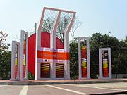 Shaheed Minar, or the Martyr's monument, in Dhaka, commemorates the struggle for the Bengali language.
 -
 Bhasha Smritistambha, or the Language Memorial, in Kolkata, commemorates thousand years of Bengali language and literature.
 -

-
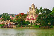 Dakshineswar Kali Temple in Kolkata, West Bengal.
 -


.jpg)

.gif)
See also
Notes
- ^ The New York Times http://www.nytimes.com/books/97/05/11/reviews/30906.html.
{{cite news}}: Missing or empty|title=(help) - ^ a b c d e "Provisional Population Totals: West Bengal". Census of India, 2001. Office of the Registrar General & Census Commissioner, India. Retrieved 26 August 2006.
- ^ a b c World Bank Development Indicators Database, 2006.
- ^ "West Bengal – Human development fact sheet" (PDF). United Nations Development Programme. 2001. Retrieved 1 March 2007.
{{cite web}}: Cite has empty unknown parameter:|coauthors=(help) [dead link] - ^ "The World Factbook – Bangladesh". CIA World Factbook. 2001. Retrieved 1 March 2007.
{{cite web}}: Cite has empty unknown parameter:|coauthors=(help) - ^ http://www.britannica.com/EBchecked/topic/60721/Bengal
- ^ James Heitzman and Robert L. Worden, ed. (1989). "Early History, 1000 B. C.-A. D. 1202". Bangladesh: A country study. Library of Congress.
- ^ M.A. Amitabha Bhattacharyya, Historical Geography of Ancient and Early Mediaeval Bengal, Sanskrit Pustak Bhandar, 1977, pp. 61–62.
- ^ Robinson, Rowan (1995). The great book of hemp. Inner Traditions. p. 107. ISBN 978-0-89281-541-8.
- ^ http://www.druglibrary.org/schaffer/library/studies/inhemp/4chapt9.htm
- ^ a b Sultana, Sabiha. "Settlement in Bengal (Early Period)". Banglapedia. Asiatic Society of Bangladesh. Archived from the original on 7 October 2007. Retrieved 4 March 2007.
- ^ "History of Bangladesh". Bangladesh Student Association. Archived from the original on 19 December 2006. Retrieved 26 October 2006.
- ^ "4000-year old settlement unearthed in Bangladesh". Xinhua. 2006-March.
{{cite news}}: Check date values in:|date=(help) - ^ Chowdhury, AM. "Gangaridai". Banglapedia. Asiatic Society of Bangladesh. Retrieved 8 September 2006.
- ^ "Shashanka". Banglapedia. Asiatic Society of Bangladesh. Retrieved 26 October 2006.
- ^ SNHM. Vol. II, pp. 209, 224.
- ^ Chaudhury, S. "Sirajuddaula". Banglapedia. Asiatic Society of Bangladesh. Retrieved 26 October 2006.
{{cite web}}: Unknown parameter|coauthors=ignored (|author=suggested) (help) - ^ Fiske, John. "The Famine of 1770 in Bengal". The Unseen World, and other essays. University of Adelaide Library Electronic Texts Collection. Retrieved 26 October 2006.
- ^ (Baxter 1997, pp. 30–32)
- ^ (Baxter 1997, pp. 39–40)
- ^ Chitta Ranjan Misra. "United Bengal Movement". Banglapedia. Asiatic Society of Bangladesh. Archived from the original on 10 October 2007. Retrieved 6 February 2007.
- ^ a b Harun-or-Rashid. "Partition of Bengal, 1947". Banglapedia. Asiatic Society of Bangladesh. Retrieved 26 October 2006.
- ^ Suranjan Das. "Calcutta Riot (1946)". Banglapedia. Asiatic Society of Bangladesh. Archived from the original on 7 March 2007. Retrieved 6 February 2007.
- ^ (Baxter 1997, pp. 62–63)
- ^ (Baxter 1997, pp. 78–79)
- ^ Salik, Siddiq (1978). Witness to Surrender. Oxford University Press. ISBN 0-19-577264-4.
- ^ Burke, S (1973). "The Postwar Diplomacy of the Indo-Pakistani War of 1971". Asian Survey. 13 (11): 1036–1049. doi:10.1525/as.1973.13.11.01p0385c.
{{cite journal}}: Invalid|ref=harv(help) - ^ (Bennett & Hindle 1996, pp. 63–70)
- ^ Biswas, Soutik (16 April 2006). "Calcutta's colourless campaign". BBC. Retrieved 26 August 2006.
- ^ Ali, A (1996). "Vulnerability of Bangladesh to climate change and sea level rise through tropical cyclones and storm surges". Water, Air, & Soil Pollution. 92 (1–2): 171–179. doi:10.1007/BF00175563.
{{cite journal}}: Invalid|ref=harv(help); Unknown parameter|doi_brokendate=ignored (|doi-broken-date=suggested) (help) - ^ Summit Elevations: Frequent Internet Errors. Retrieved 2006-04-13.
- ^ IUCN (1997). "Sundarban wildlife sanctuaries Bangladesh". World Heritage Nomination-IUCN Technical Evaluation.
{{cite journal}}: Invalid|ref=harv(help) - ^ "Statistical Facts about India". www.indianmirror.com. Retrieved 26 October 2006.
- ^ "National Himalayan Sandakphu-Gurdum Trekking Expedition: 2006". Youth Hostels Association of India: West Bengal State Branch. Archived from the original on 24 October 2006. Retrieved 26 October 2006.
- ^ Chowdhury U.K., Biswas B. K., Chowdhury T. R. (2000). "Groundwater arsenic contamination in Bangladesh and West Bengal, India". Environmental Health Perspectives. 108 (4): 393–397. doi:10.2307/3454378. JSTOR 3454378.
{{cite journal}}: Invalid|ref=harv(help)CS1 maint: multiple names: authors list (link) - ^ "INDIA STATS". Retrieved 7 August 2013.
- ^ "World Gazetteer". Retrieved 6 January 2013.
- ^ Adjusted population, p.4,
"Population Census 2001, Preliminary Report" (PDF). Bangladesh Bureau of Statistics. 2001-08.
{{cite web}}: Check date values in:|date=(help) - ^ "An Indian life: Life expectancy in our nation". India Together. Civil Society Information Exchange Pvt. Ltd. Retrieved 26 August 2006.
- ^ "World Health Report 2005". World Health Organization.
- ^ "2005 Human Development Report". UNDP.
- ^ "Introduction and Human Development Indices for West Bengal". West Bengal Human Development Report 2004 (PDF). Development and Planning Department, Government of West Bengal. 2004. pp. pp4–6. ISBN 81-7955-030-3. Retrieved 26 August 2006.
{{cite book}}:|pages=has extra text (help); External link in|chapterurl=|chapterurl=ignored (|chapter-url=suggested) (help); Unknown parameter|month=ignored (help) - ^ Bangladesh Country Statistics, Unicef
- ^ "Wandering Gaia". "The Give and Take of the Ganges" WordPress.com. Retrieved 13 April 2009.
- ^
Nanda, J. N (2005). Bengal: the unique state. Concept Publishing Company. p. 10. ISBN 978-81-8069-149-2. Retrieved 22 November 2010.
Bengal [...] was rich in the production and export of grain, salt, fruit, liquors and wines, precious metals and ornaments besides the output of its handlooms in silk and cotton. Europe referred to Bengal as the richest country to trade with.
- ^ a b "The State Economy" (PDF). Indian States Economy and Business: West Bengal. India Brand Equity Foundation, Confederation of Indian Industry. p. 9. Retrieved 7 September 2006.
- ^ "Economy". West Bengal. Suni System (P) Ltd. Retrieved 7 September 2006.
- ^ "Basic Information". About West Bengal. West Bengal Industrial Development Corporation. Archived from the original on 29 March 2006. Retrieved 7 September 2006.
- ^ "Dasgupta, 2002". Retrieved 11 April 2006. [dead link]
- ^ "Consul General Henry V. Jardine to The Indo-American Chamber of Commerce, October 20, 2005". Retrieved 11 April 2006.
- ^ Annual Report 2004-2005, Bangladesh Bank
- ^ Roland, B (6 January 2005). "Bangladesh Garments Aim to Compete". BBC. Retrieved 1 January 2010.
- ^ Rahman, S (2004). "Global Shift: Bangladesh Garment Industry in Perspective". Asian Affairs. 26 (1): 75–91.
{{cite journal}}: Invalid|ref=harv(help) - ^ Begum, N (2001). "Enforcement of Safety Regulations in Garment sector in Bangladesh". Proc. Growth of Garment Industry in Bangladesh: Economic and Social dimension. pp. 208–226.
- ^ Schreiner, Mark (2003). "A Cost-Effectiveness Analysis of the Grameen Bank of Bangladesh,". Development Policy Review. 21 (3): 357–382. doi:10.1111/1467-7679.00215.
{{cite journal}}: Invalid|ref=harv(help) - ^ "Yunus sees big Answers in Micro-credit" Globe and Mail article |http://www.theglobeandmail.com/servlet/story/LAC.20080611.RYUNUS11/TPStory/Business
- ^ "The Bauls of Bengal". Folk Music. BengalOnline. Retrieved 26 October 2006.
- ^ Banik, Nandadulal. "Anirvan". Banglapedia. Asiatic Society of Bangladesh. Retrieved 19 December 2012.
- ^ Gertjan de Graaf, Abdul Latif. "Development of freshwater fish farming and poverty alleviation: A case study from Bangladesh" (PDF). Aqua KE Government. Retrieved 22 October 2006.
- ^ "Durga Puja". Festivals of Bengal. West Bengal Tourism, Government of West Bengal. Retrieved 28 October 2006.
- ^ a b "General Review". Registrar of Newspapers for India. Retrieved 1 September 2006.
- ^ "Bangladesh dominate Indo-Bangla Games, clinch 45 gold medals". Yahoo Web Services India Pvt Ltd. 27 February 2008. Retrieved 27 February 2008. [dead link]
- ^ "Union Home Secretary Chairs a High Level Empowered Committee". Embassy of India: Foreign Relations. Government of India. 10 December 1998. Retrieved 29 March 2008.
- ^ a b c "Address by External Affairs Minister Shri Natwar Singh at India-Bangladesh Dialogue Organised by Centre for Policy Dialogue and India International Centre". Speeches. Ministry of External Affairs, New Delhi. 7 August 2005. Retrieved 26 February 2008. [dead link]
- ^ a b Sinha, Dipankar (2005). "E par Bangla, O par Bangla, no thank you". Himal South Asian. 17 (1). Kathmandu, Nepal: The Southasia Trust. Archived from the original on 2 April 2008. Retrieved 29 March 2008.
{{cite journal}}: Invalid|ref=harv(help); Unknown parameter|month=ignored (help) - ^ "India-Bangladesh train to resume in April – official". Reuters. 25 February 2008. Retrieved 26 February 2008.
- ^ Chattopadhyay, S.S (2007). "Constant traffic". Frontline. 24 (11). The Hindu. Retrieved 26 February 2008.
{{cite journal}}: Invalid|ref=harv(help); Unknown parameter|month=ignored (help) - ^ Mishra, Richa (11 November 2004). "Indo-Bangla informal trade cause for concern: FICCI". The Hindu Business Line. The Hindu. Retrieved 27 March 2008.
References
- Baxter, C (1997). Bangladesh, From a Nation to a State. Westview Press. p. 0813336325. ISBN 1-85984-121-X.
{{cite book}}: Invalid|ref=harv(help) - Bennett, A; Hindle, J (1996). London Review of Books: An Anthology. Verso. pp. 63–70. ISBN 1-85984-121-X.
{{cite book}}: Invalid|ref=harv(help)
External links
Geo Links for Bengal
- Banglapedia-specialised site
- www.hostkingdom.net- List of rulers of Bengal
- WorldStatesmen- here India
- Information portal of West Bengal
- Maps
Perry-Castañeda Library Map Collection at University of Texas at Austin Libraries
- India from The Historical Atlas by William R. Shepherd, 1923
- India 1760 from The Public Schools Historical Atlas edited by C. Colbeck. Longmans, Green, and Co. 1905
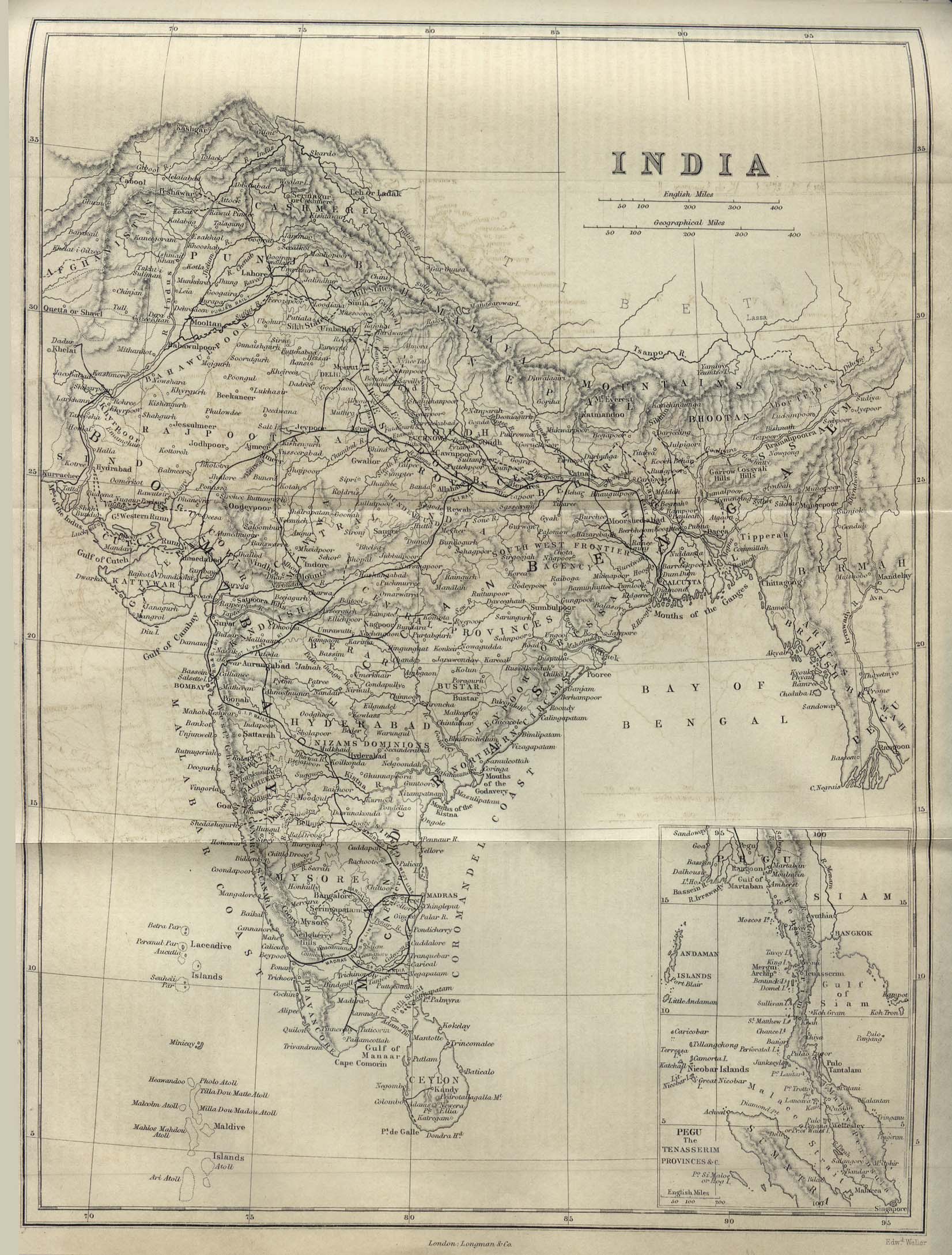
- India 1882 from A Dictionary Practical, Theoretical, and Historical of Commerce and Commercial Navigation by J.R. M'Culloch. Longmans, Green and Co. London, 1882