List of Metra stations: Difference between revisions

From Wikipedia, the free encyclopedia
Content deleted Content added
fix dead link
add
Line 4: Line 4:
In 1974, the [[Regional Transportation Authority (Illinois)|Regional Transit Authority]] (RTA) was created to provide stability in the commuter rail system, as most private commuter companies in the area were beginning to fail.<ref name="Metra History"/> In 1984, RTA created the Commuter Rail Service Board to help with planning an organized commuter rail system in the Chicago area.<ref name="Metra History"/> The board was renamed Metra in 1985. Through the creation of [[Northeast Illinois Regional Commuter Railroad Corporation]] (NIRC), Metra's operating subsidiary and contracts with freight companies, Metra was able to open a network of commuter rail lines across the region.<ref name="Metra History"/> The system's newest line, [[North Central Service]], opened on August 19, 1996.<ref name="Metra History"/>


Seven of the system's eleven lines are owned or operated by the NIRC.<ref name="Metra History">{{cite web|url=https://metrarail.com/about-metra/our-history|title=Metra History|publisher=Metra|accessdate=August 15, 2015}}</ref> Operation of the [[BNSF Railway Line]] and the [[Union Pacific / North Line]], [[Union Pacific / Northwest Line]], and the [[Union Pacific / West Line]] are handled through purchase of service agreements (PSAs) between Metra, the [[BNSF Railway]] and the [[Union Pacific Railroad]].<ref name="Metra History"/> Under these agreements, the railroad companies provide the service using their own employees and either own or control the [[Right-of-way (transportation)|rights-of-way]] in addition to the majority of other facilities necessary, while Metra provides the [[rolling stock]].<ref name="Metra History"/> Additionally, Metra funds the portion of [[South Shore Line (NICTD)|South Shore Line]] within Illinois and operates the [[Hegewisch (NICTD)|Hegewisch station]], although no Metra trains serve the station.
Seven of the system's eleven lines are owned or operated by the NIRC.<ref name="Metra History">{{cite web|url=https://metrarail.com/about-metra/our-history|title=Metra History|publisher=Metra|accessdate=August 15, 2015}}</ref> Operation of the [[BNSF Railway Line]] and the [[Union Pacific / North Line]], [[Union Pacific / Northwest Line]], and the [[Union Pacific / West Line]] are handled through purchase of service agreements (PSAs) between Metra, the [[BNSF Railway]] and the [[Union Pacific Railroad]].<ref name="Metra History"/> Under these agreements, the railroad companies provide the service using their own employees and either own or control the [[Right-of-way (transportation)|rights-of-way]] in addition to the majority of other facilities necessary, while Metra provides the [[rolling stock]].<ref name="Metra History"/> Additionally, Metra funds the portion of [[South Shore Line (NICTD)|South Shore Line]] within Illinois because it shares tracks with the [[Metra Electric District]].<ref name="Metra History"/> and operates the [[Hegewisch (NICTD)|Hegewisch station]], although no Metra trains serve the station.


The [[History of passenger rail in Chicago|development of Chicago's commuter rail network]] resulted in a [[spoke-hub distribution paradigm]] and Metra's services radiate out from the [[Chicago Loop]] from four terminals: [[Ogilvie Transportation Center]], [[Chicago Union Station|Union Station]], [[LaSalle Street Station]], and [[Millennium Station]].<ref name="Metra History"/><!--Stations are owned by... Metra, in conjunction with the local municipalities, is responsible for most stations and other passenger amenities.--> However, all are within a {{convert|1.2|mi}} radius of each other and easily accessible from one another, either by walking, biking, driving, or the use of public transport.<ref>{{cite web|url=http://metrarail.com/content/metra/en/home/utility_landing/riding_metra/faq.html|title=Frequently Asked Questions|work=Metra|accessdate=March 8, 2015}}</ref>

Revision as of 15:00, 2 October 2017

Metra system map

Metra is the commuter rail system serving the Chicago metropolitan area in Illinois and Wisconsin, servicing Cook, DuPage, Kane, Lake, McHenry, and Will Counties in northeastern Illinois and the city of Kenosha in southern Wisconsin. It is one of three of the Regional Transportation Authority's service boards. With an average weekday ridership of 294,600 in 2015, Metra is the fourth busiest commuter rail system in the United States, only behind New York City metropolitan area systems.[1][2] The Metra system has a total of 241 active stations spread out on 11 rail lines with 487.5 miles (784.6 km) of tracks.[3][1] As of August 2017, there are no actively planned extensions of the Metra system, although a new station is under construction in Romeoville, Illinois. Construction is expected to be completed in Fall 2017.

In 1974, the Regional Transit Authority (RTA) was created to provide stability in the commuter rail system, as most private commuter companies in the area were beginning to fail.[4] In 1984, RTA created the Commuter Rail Service Board to help with planning an organized commuter rail system in the Chicago area.[4] The board was renamed Metra in 1985. Through the creation of Northeast Illinois Regional Commuter Railroad Corporation (NIRC), Metra's operating subsidiary and contracts with freight companies, Metra was able to open a network of commuter rail lines across the region.[4] The system's newest line, North Central Service, opened on August 19, 1996.[4]

Seven of the system's eleven lines are owned or operated by the NIRC.[4] Operation of the BNSF Railway Line and the Union Pacific / North Line, Union Pacific / Northwest Line, and the Union Pacific / West Line are handled through purchase of service agreements (PSAs) between Metra, the BNSF Railway and the Union Pacific Railroad.[4] Under these agreements, the railroad companies provide the service using their own employees and either own or control the rights-of-way in addition to the majority of other facilities necessary, while Metra provides the rolling stock.[4] Additionally, Metra funds the portion of South Shore Line within Illinois because it shares tracks with the Metra Electric District.[4] and operates the Hegewisch station, although no Metra trains serve the station.

The development of Chicago's commuter rail network resulted in a spoke-hub distribution paradigm and Metra's services radiate out from the Chicago Loop from four terminals: Ogilvie Transportation Center, Union Station, LaSalle Street Station, and Millennium Station.[4] However, all are within a 1.2 miles (1.9 km) radius of each other and easily accessible from one another, either by walking, biking, driving, or the use of public transport.[5]


Key

Station The official name for the station
Lines The line(s) that stop at the station
Rail connections Any rail connections that can be made from the station
Location The municipality or Chicago neighborhood in which the station is located
Fare zone Identifies which of the nine fare zones the station is in. The zones are A, B, C, D, E, F, G, H, I, J, K, L, and M; with Zone A is closest to Chicago Union Station, LaSalle Street Station, Millennium Station, and Ogilvie Transportation Center, while Zone M is the farthest.[6]
Info A link to the station's information on http://metrarail.com
A terminal station
Disabled access The station is identified by Metra as accessible in some way, usually using wheelchair lifts. (Metra designates some stations as "partially accessible" in that a station may not be fully ADA-compliant.[7])

Lines

Metra commuter rail lines
Line Stations Inbound terminus Outbound terminus
  BNSF
26 Chicago Union Station Aurora
6 Chicago Union Station Joliet Union Station
49 Millennium Station University Park, South Chicago (93rd Street), Blue Island
22 Chicago Union Station Fox Lake
22 Chicago Union Station Big Timber Road
18 Chicago Union Station Antioch
26 LaSalle Street Station Joliet Union Station
13 Chicago Union Station Manhattan
27 Ogilvie Transportation Center Kenosha
23 Ogilvie Transportation Center Harvard, McHenry
19 Ogilvie Transportation Center Elburn

Stations

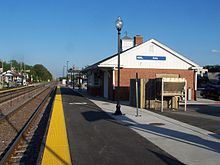
Cary station looking to the southeast.
Cary station on the Union Pacific Northwest Line
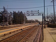
River Grove station looking southeast down the station platforms.
The platforms at River Grove station, which serves trains on both the North Central Service line and the Milwaukee District West Line
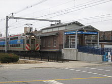
A Metra train stopped at the South Chicago (93rd Street) station.
South Chicago (93rd Street) station is the terminus for the South Chicago Branch on the Metra Electric District Line
Station Lines Rail connections Location Fare zone[8] Info
18th Street Near South Side, Chicago A Link
27th Street Douglas, Chicago A Link
55th–56th–57th Street Disabled access Northern Indiana Commuter Transportation District: Hyde Park, Chicago B Link
59th Street Hyde Park, Chicago B Link
63rd Street Northern Indiana Commuter Transportation District: Woodlawn, Chicago B Link
75th Street (Grand Crossing) Greater Grand Crossing, Chicago B Link
79th Street (Chatham) Chatham, Chicago B Link
83rd Street (Avalon Park) Avalon Park, Chicago C Link
83rd Street Disabled access South Chicago, Chicago B Link
87th Street Disabled access South Chicago, Chicago B Link
87th Street (Woodruff) Chatham, Chicago C Link
91st Street (Chesterfield) Chatham, Chicago / Burnside, Chicago C Link
91st Street – Beverly Hills Disabled access Beverly, Chicago C Link
95th Street (Chicago State University) Roseland, Chicago / Pullman, Chicago C Link
95th Street – Beverly Hills Disabled access Beverly, Chicago C Link
99th Street – Beverly Hills Disabled access Beverly, Chicago C Link
103rd Street (Rosemoor) Rosemoor, Chicago / Pullman, Chicago C Link
103rd Street – Beverly Hills Disabled access Beverly, Chicago C Link
107th Street Roseland, Chicago / Pullman, Chicago C Link
107th Street – Beverly Hills Disabled access Beverly, Chicago C Link
111th Street – Morgan Park Disabled access Morgan Park, Chicago C Link
115th Street – Morgan Park Disabled access Morgan Park, Chicago C Link
119th Street – Blue Island Disabled access Blue Island C Link
123rd Street – Blue Island Blue Island D Link
147th Street (Sibley Boulevard) Harvey D Link
211th Street (Lincoln Highway) Disabled access Park Forest F Link
Antioch Disabled access Antioch K Link
Arlington Heights Disabled access Arlington Heights E Link
Arlington Park Disabled access Arlington Heights E Link
Ashburn Disabled access Ashburn, Chicago C Link
Ashland Avenue Calumet Park D Link
Aurora Disabled access
  BNSF
Aurora H Link
Barrington Disabled access Barrington G Link
Bartlett Disabled access Bartlett F Link
Bellwood Disabled access Bellwood C Link
Belmont Disabled access
  BNSF
Downers Grove E Link
Belmont Avenue Disabled access Franklin Park C Link
Bensenville Disabled access Bensenville D Link
Berkeley Disabled access Berkeley C Link
Berwyn Disabled access
  BNSF
Berwyn B Link
Big Timber Road Disabled access Elgin H Link
Blue Island Disabled access Blue Island D Link
Braeside Disabled access Highland Park E Link
Brainerd Disabled access Brainerd, Chicago C Link
Brookfield Disabled access
  BNSF
Brookfield C Link
Bryn Mawr Disabled access South Shore, Chicago B Link
Buffalo Grove Disabled access Buffalo Grove F Link
Burr Oak Blue Island D Link
Calumet Disabled access East Hazel Crest E Link
Cary Disabled access Cary H Link
Cheltenham Disabled access South Shore, Chicago B Link
Chicago Ridge Chicago Ridge D Link
Chicago Union Station Disabled access
  BNSF
Chicago Transit Authority:Amtrak: Lua error: expandTemplate: template "amtrak color" does not exist. Lua error: expandTemplate: template "amtrak color" does not exist. West Loop, Chicago A Link
Cicero
  BNSF
Cicero B Link
Clarendon Hills Disabled access
  BNSF
Clarendon Hills D Link
Clybourn Bucktown, Chicago / DePaul, Chicago A Link
College Avenue Disabled access Wheaton E Link
Congress Park
  BNSF
Brookfield C Link
Crystal Lake Disabled access Crystal Lake I Link
Cumberland Des Plaines D Link
Dee Road Disabled access Park Ridge C Link
Deerfield Disabled access Deerfield E Link
Des Plaines Disabled access Des Plaines D Link
Downers Grove – Main Street Disabled access
  BNSF
Downers Grove E Link
Edgebrook Disabled access Forest Glen, Chicago C Link
Edison Park Disabled access Edison Park, Chicago C Link
Elburn Disabled access Elburn I Link
Elgin Disabled access Elgin H Link
Elmhurst Disabled access Elmhurst D Link
Elmwood Park Disabled access Elmwood Park C Link
Evanston Central Street Disabled access Evanston C Link
Evanston Davis Street Disabled access Chicago Transit Authority: Evanston C Link
Evanston Main Street Disabled access Chicago Transit Authority: Evanston C Link
Fairview Avenue Disabled access
  BNSF
Downers Grove E Link
Flossmoor Disabled access Flossmoor E Link
Forest Glen Forest Glen, Chicago C Link
Fort Sheridan Disabled access Highwood F Link
Fox Lake Disabled access Fox Lake J Link
Fox River Grove Disabled access Fox River Grove H Link
Franklin Park Disabled access Franklin Park C Link
Galewood Disabled access Galewood, Chicago B Link
Geneva Disabled access Geneva H Link
Gladstone Park Gladstone Park, Chicago B Link
Glen Ellyn Disabled access Glen Ellyn E Link
Glencoe Disabled access Glencoe D Link
Glenview Disabled access Amtrak: Glenview D Link
Golf Disabled access Golf D Link
Grand/Cicero Disabled access Austin, Chicago B Link
Grayland Irving Park, Chicago B Link
Grayslake Disabled access Grayslake I Link
Great Lakes Disabled access Lake Bluff G Link
Gresham Auburn Gresham, Chicago B Link
Halsted Street
  BNSF
University Village, Chicago A Link
Template:Metra stations Disabled access Hanover Park F Link
Template:Metra stations Disabled access Hanson Park, Chicago B Link
Template:Metra stations
  BNSF
Berwyn B Link
Template:Metra stations Disabled access Harvard M Link
Template:Metra stations Disabled access Harvey D Link
Template:Metra stations Hazel Crest E Link
Template:Metra stations Disabled access Logan Square, Chicago B Link
Hegewisch Disabled access (No Metra service) Hegewisch, Chicago 3
Template:Metra stations Disabled access Highland Park E Link
Template:Metra stations
  BNSF
Hinsdale D Link
Template:Metra stations Disabled access Highwood E Link
Template:Metra stations Disabled access
  BNSF
Hinsdale D Link
Template:Metra stations Disabled access
  BNSF
Brookfield C Link
Homewood Disabled access Amtrak: Homewood E Link
Template:Metra stations Winnetka D Link
Template:Metra stations Disabled access Hyde Park, Chicago B Link
Template:Metra stations Winnetka D Link
Template:Metra stations Disabled access Ingleside J Link
Template:Metra stations Disabled access Chicago Transit Authority: Irving Park, Chicago B Link
Template:Metra stations Disabled access Itasca E Link
Template:Metra stations Disabled access Riverdale D Link
Jefferson Park Transit Center Disabled access Chicago Transit Authority: Jefferson Park, Chicago B Link
Joliet Disabled access Amtrak: Joliet H Link
Template:Metra stations Disabled access Chicago Transit Authority: Bronzeville, Chicago A Link
Template:Metra stations East Garfield Park, Chicago A Link
Template:Metra stations Disabled access Kenilworth D Link
Template:Metra stations Disabled access Kenosha Transit:Lua error: expandTemplate: template "KAT color" does not exist. Kenosha K Link
Template:Metra stations Disabled access Pullman, Chicago C Link
Template:Metra stations Kenwood, Chicago B Link
Template:Metra stations Disabled access La Fox I Link
La Grange Disabled access
  BNSF
Amtrak: La Grange C Link
Template:Metra stations
  BNSF
Berwyn B Link
Template:Metra stations Disabled access Lake Bluff G Link
Template:Metra stations Disabled access Deerfield E Link
Lake Forest Disabled access Lake Forest F Link
Template:Metra stations Disabled access Lake Villa J Link
Template:Metra stations Disabled access New Lenox H Link
LaSalle Street Station Disabled access Chicago Transit Authority: Loop, Chicago A Link
Template:Metra stations Disabled access Lemont E Link
Template:Metra stations Disabled access Libertyville H Link
Template:Metra stations Disabled access
  BNSF
Lisle E Link
Template:Metra stations Disabled access Lockport G Link
Template:Metra stations Disabled access Lombard D Link
Template:Metra stations Disabled access Long Lake J Link
Template:Metra stations Disabled access Longwood Manor, Chicago C Link
Manhattan Disabled access Manhattan I Link
Mannheim Franklin Park C Link
Mars Disabled access Galewood, Chicago B Link
Matteson Matteson F Link
Mayfair Albany Park, Chicago B Link
Maywood Disabled access Maywood C Link
McCormick Place Disabled access Northern Indiana Commuter Transportation District: Near South Side, Chicago A Link
McHenry Disabled access McHenry K Link
Medinah Disabled access Medinah E Link
Melrose Park Disabled access Melrose Park C Link
Midlothian Disabled access Midlothian D Link
Millennium Station Disabled access Northern Indiana Commuter Transportation District: Chicago Transit Authority: Loop, Chicago A Link
Mokena – Front Street Disabled access Mokena F Link
Mokena – Hickory Creek Disabled access Mokena F Link
Mont Clare Disabled access Galewood, Chicago B Link
Morton Grove Disabled access Morton Grove C Link
Mount Prospect Disabled access Mount Prospect D Link
Mundelein Disabled access Mundelein H Link
Museum Campus/11th Street Disabled access South Loop, Chicago A Link
Naperville Disabled access
  BNSF
Amtrak: Naperville F Link
National Street Disabled access Elgin H Link
New Lenox Disabled access New Lenox G Link
North Chicago Disabled access North Chicago G Link
North Glenview Disabled access Glenview D Link
Northbrook Disabled access Northbrook E Link
Norwood Park Disabled access Norwood Park, Chicago C Link
O'Hare Transfer Disabled access Rosemont D Link
Oak Forest Disabled access Oak Forest E Link
Oak Lawn Disabled access Oak Lawn D Link
Oak Park Disabled access Chicago Transit Authority: Oak Park B Link
Ogilvie Transportation Center Disabled access Chicago Transit Authority: Fulton River District, Chicago A Link
Olympia Fields Olympia Fields F Link
Orland Park 143rd Street Disabled access Orland Park E Link
Orland Park 153rd Street Disabled access Orland Park E Link
Orland Park 179th Street Disabled access Orland Park F Link
Palatine Disabled access Palatine F Link
Palos Heights Disabled access Palos Heights D Link
Palos Park Disabled access Palos Park E Link
Park Ridge Disabled access Park Ridge C Link
Pingree Road Disabled access Crystal Lake I Link
Prairie Crossing Disabled access Libertyville H Link
Prairie Street Blue Island D Link
Prairie View Disabled access Prairie View G Link
Prospect Heights Disabled access Prospect Heights E Link
Pullman/111th Street Pullman, Chicago C Link
Racine Avenue West Pullman, Chicago D Link
Ravenswood Chicago Transit Authority: Ravenswood, Chicago B Link
Ravinia Disabled access Highland Park E Link
Ravinia Park Disabled access Highland Park E Link
Richton Park Disabled access Richton Park F Link
River Forest River Forest B Link
River Grove Disabled access River Grove C Link
Riverdale Riverdale D Link
Riverside Disabled access
  BNSF
Riverside C Link
Robbins Disabled access Robbins D Link
Rogers Park Disabled access Rogers Park, Chicago B Link
Roselle Disabled access Roselle E Link
Rosemont Disabled access Rosemont D Link
Round Lake Disabled access Round Lake I Link
Round Lake Beach Disabled access Round Lake Beach J Link
Route 59 Disabled access
  BNSF
Aurora G Link
Schaumburg Disabled access Schaumburg F Link
Schiller Park Disabled access Schiller Park C Link
South Chicago (93rd Street) Disabled access South Chicago, Chicago B Link
South Shore Disabled access South Shore, Chicago B Link
State Street West Pullman, Chicago D Link
Stewart Ridge West Pullman, Chicago D Link
Stone Avenue
  BNSF
La Grange C Link
Stony Island Disabled access South Shore, Chicago B Link
Summit Disabled access Amtrak: Summit C Link
Tinley Park Disabled access Tinley Park E Link
Tinley Park – 80th Avenue Disabled access Tinley Park E Link
University Park Disabled access University Park G Link
Van Buren Street Disabled access Northern Indiana Commuter Transportation District: Chicago Transit Authority: Loop, Chicago A Link
Vermont Street Disabled access Blue Island D Link
Vernon Hills Disabled access Vernon Hills G Link
Villa Park Disabled access Villa Park D Link
Washington Heights Disabled access Washington Heights, Chicago C Link
Washington Street Disabled access Grayslake I Link
Waukegan Disabled access Waukegan H Link
West Chicago Disabled access West Chicago F Link
West Hinsdale Disabled access
  BNSF
Hinsdale D Link
West Pullman West Pullman, Chicago D Link
Western Avenue
  BNSF
Lower West Side, Chicago A Link
Western Avenue Disabled access Humboldt Park, Chicago A Link
Western Springs Disabled access
  BNSF
Western Springs D Link
Westmont Disabled access
  BNSF
Westmont D Link
Wheaton Disabled access Wheaton E Link
Wheeling Disabled access Wheeling F Link
Willow Springs Disabled access Willow Springs D Link
Wilmette Disabled access Wilmette C Link
Windsor Park Disabled access South Shore, Chicago B Link
Winfield Disabled access Winfield F Link
Winnetka Disabled access Winnetka D Link
Winthrop Harbor Disabled access Winthrop Harbor I Link
Wood Dale Disabled access Wood Dale D Link
Woodstock Disabled access Woodstock K Link
Worth Disabled access Worth D Link
Wrightwood Disabled access Wrightwood, Chicago C Link
Zion Disabled access Zion I Link

Planned stations

Station Lines Rail connections Location Fare zone Notes
Romeoville Disabled access Romeoville TBA Construction began May 16, 2017[9]

Former stations

Station Lines Rail connections Location Fare zone Notes
91st Street (South Chicago) South Chicago, Chicago B Closed in 2001 and replaced by South Chicago (93rd Street)[10]
Clyde
  BNSF
Cicero B Closed in 2007 due to low ridership and close proximity to Cicero[11]
Cragin Belmont Cragin, Chicago B Closed in 2007 along with Hermosa and replaced with Grand/Cicero[12]
Hermosa Hermosa, Chicago B Closed in 2007 along with Cragin and replaced with Grand/Cicero[12]

References

  1. ^ a b "Ridership Reports – System Facts". Metra. Retrieved September 14, 2017.
  2. ^ "Transit Ridership Report Fourth Quarter and End-of-Year 2016" (pdf). American Public Transportation Association. Retrieved September 14, 2017.
  3. ^ "Where do Metra trains run". Metra. Retrieved December 22, 2012.
  4. ^ a b c d e f g h i "Metra History". Metra. Retrieved August 15, 2015.
  5. ^ "Frequently Asked Questions". Metra. Retrieved March 8, 2015.
  6. ^ "Commuter Rail Fares & Passes". Metra. Retrieved February 6, 2014.
  7. ^ "Accessibility". metrarail.com. Retrieved October 13, 2015.
  8. ^ "Metra Fare Schedule" (PDF). Metra. 26 February 2015. Retrieved 25 August 2015.
  9. ^ "Romeoville breaks ground on new Metra station". Metra. May 16, 2017. Retrieved July 30, 2017.
  10. ^ Van Hattem, Matt (5 July 2006). "Metra: Chicago's commuter railroad". Trains Magazine. Retrieved 25 August 2015.
  11. ^ "Metra to shut down BNSF's Clyde station". CS Trains. May 17, 2007. Retrieved March 8, 2015.
  12. ^ a b "Cragin Station". Chicago Rail Junctions. Retrieved March 8, 2015.