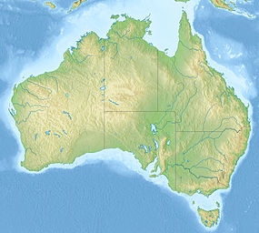
King George River
| King George | |
|---|---|
 King George Falls | |
| Etymology | In honour of King George V[1] |
| Location | |
| Country | Australia |
| State | Western Australia |
| Region | Central and Northern Kimberley, Victoria Bonaparte (IBRA) |
| Local government area | Wyndham-East Kimberley |
| Physical characteristics | |
| Source | Ashton Range |
| • location | Oombulgurri Aboriginal Reserve, Central Kimberley |
| • coordinates | 14°37′24″S 127°11′59″E / 14.62333°S 127.19972°E |
| • elevation | 212 m (696 ft) |
| Mouth | Koolama Bay, Timor Sea |
• location | east of Kalumburu, Northern Kimberley |
• coordinates | 13°57′44″S 127°19′43″E / 13.96222°S 127.32861°E |
• elevation | 0 m (0 ft) |
| Length | 112 km (70 mi) |
| Basin features | |
| Tributaries | |
| • left | Beta Creek |
| Waterfalls | King George Falls |
| National park | Drysdale River National Park |
| [2] | |
The King George River is a perennial river located in the Kimberley region of Western Australia, in Australia.
Location and features
The headwaters of the river rise to the west of the Ashton Range and flows in a northerly direction through the Drysdale River National Park past the Seppelt Range, joined by one minor tributary before reaching its river mouth and emptying into Koolama Bay and the Timor Sea, approximately 70 kilometres (43 mi) east of Kalumburu. The river descends 216 metres (709 ft) over its 112 kilometres (70 mi) course;[2] including a 38–40-metre (125–131 ft) descent over the dual drop waterfall of King George Falls, approximately 12 kilometres (7.5 mi) upriver from the river mouth. The falls are located at an elevation of 84 metres (276 ft) above sea level.[3]
The recorded height of the waterfall varies widely, with some sources claiming the descent is in the range of 80–100 metres (262–328 ft).[4][5][6][7][8] The area surrounding the falls are popular with tourists who typically view the falls by boat.[4][5] The falls are in full force from late December through to early May each year and gradually recede to a small flow in September.[6] The falls were featured in Baz Luhrmann's 2008 film, Australia.[8]
Etymology
The river was named in 1911 by explorer Charles Conigrave after a privately funded expedition in the area. The river is named in honour of King George V.[1]
The traditional owners of the areas around the river are the Miwa peoples.[9]
See also
References
- ^ a b "History of river names – K". Western Australian Land Information Authority. Archived from the original on 19 April 2021. Retrieved 7 September 2011.
- ^ a b "Map of King George River, WA". Bonzle Digital Atlas of Australia. Retrieved 17 November 2014.
- ^ "Map of King George Falls, WA". Bonzle Digital Atlas of Australia. Retrieved 17 November 2014.
- ^ a b "King George Falls – Top Waterfalls in the World". World Top Top. Retrieved 17 November 2014.
- ^ a b "King George River" (PDF) (PDF). Kimberley Coast Cruising Yacht Club. 18 November 2013. Archived from the original (PDF) on 1 March 2015. Retrieved 17 November 2014.
- ^ a b "King George Twin Falls". Western Australia for everyone. Phoenix Group Co. 2013. Archived from the original on 29 November 2014. Retrieved 17 November 2014.
- ^ "Australia's North West: Top 10 Attractions". DriveWA.com. DriveOz Pty Ltd. Archived from the original on 29 November 2014. Retrieved 17 November 2014.
- ^ a b "King George Falls". Faraway Bay. Retrieved 17 November 2014.
- ^ "AusAnthrop Australian Aboriginal tribal database". 2012. Archived from the original on 29 November 2014. Retrieved 6 May 2012.
External links
- "West Kimberley National Heritage Place: A draft guide for landholders". Department of Sustainability, Environment, Water, Population and Communities (MS Word (requires download)). Australian Government. June 2012.
- Keesing, John (2013). "King George River research voyage". CSIRO (streaming video and text). Australian Government. Archived from the original on 15 December 2014.

