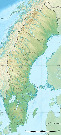
Rengen
This is an old revision of this page, as edited by Monkbot (talk | contribs) at 12:52, 7 January 2021 (Task 18 (cosmetic): eval 1 template: hyphenate params (1×); cvt lang vals (1×);). The present address (URL) is a permanent link to this revision, which may differ significantly from the current revision.
| Rengen | |
|---|---|
| Location | Lierne (Trøndelag) and Krokom (Jämtland) |
| Coordinates | 64°05′55″N 13°58′58″E / 64.0985°N 13.9829°E / 64.0985; 13.9829 |
| Basin countries | Norway, Sweden |
| Max. length | 12 kilometres (7.5 mi) |
| Max. width | 2.8 kilometres (1.7 mi) |
| Surface area | 21.5 km2 (8.3 sq mi) |
| Shore length1 | 42.05 kilometres (26.13 mi) |
| Surface elevation | 345 metres (1,132 ft) |
| References | NVE |
| 1 Shore length is not a well-defined measure. | |
Rengen is a lake on the border between Sweden and Norway. The 21.49-square-kilometre (8.30 sq mi) lake covers 15.72 square kilometres (6.07 sq mi) in Norway and 5.77 square kilometres (2.23 sq mi) in Sweden. The Norwegian part is located in the municipality of Lierne in Trøndelag county, and the Swedish part is located in the municipality of Krokom in Jämtland County. Water flows into Rengen from the lake Ulen to the north.[1]
See also
References
This article about a location in Jämtland County, Sweden is a stub. You can help Wikipedia by expanding it. |


