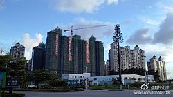
Huiyang District
Huiyang
惠阳区 | |
|---|---|
 | |
| Coordinates: 22°47′20″N 114°28′18″E / 22.78889°N 114.47167°E | |
| Country | People's Republic of China |
| Province | Guangdong |
| Prefecture-level city | Huizhou |
| Population | 558,000 |
| Time zone | UTC+8 (China Standard) |
Huiyang District (postal: Waiyeung; simplified Chinese: 惠阳区; traditional Chinese: 惠陽區; pinyin: Huìyáng Qū; Jyutping: wai6joeng4 keoi1 is a district of Huizhou, Guangdong province, People's Republic of China. It was renamed in 2003 amid the restructuring of districts and counties in Huizhou. Formerly named Huiyang city (county level), its size shrank after the restructuring with several towns incorporated into the Huicheng district of Huizhou. Huiyang is the southern urban center of Huizhou along with Huicheng as the northern urban center.
Administrative divisions
| Name | Chinese (S) | Hanyu Pinyin | Population (2010)[1] | Area (km2) |
|---|---|---|---|---|
| Danshui Subdistrict | 淡水街道 | Dànshuǐ Jiēdào | 226,703 | 80 |
| Qiuchang Subdistrict | 秋长街道 | Qiūzhǎng Jiēdào | 81,224 | 109.9 |
| Aotou Subdistrict | 澳头街道 | Àotóu Jiēdào | 58,766 | 110 |
| Xiayong Subdistrict | 霞涌街道 | Xiáyǒng Jiēdào | 19,304 | 80.8 |
| Yonghu town | 永湖镇 | Yǒnghú Zhèn | 25,575 | 130 |
| Liangjing town | 良井镇 | Liángjǐng Zhèn | 25,043 | 72.6 |
| Pingtan town | 平潭镇 | Píngtán Zhèn | 32,271 | 105 |
| Shatian town | 沙田镇 | Shātián Zhèn | 29,276 | 85 |
| Xinxu town | 新圩镇 | Xīnwéi Zhèn | 83,283 | 158.4 |
| Zhenlong town | 镇隆镇 | Zhènlóng Zhèn | 46,982 | 115.3 |
Transport
There is a bus service from Huiyang District to Shenzhen Bao'an International Airport in Shenzhen.[2]
Climate
| Climate data for Huiyang (1981−2010) | |||||||||||||
|---|---|---|---|---|---|---|---|---|---|---|---|---|---|
| Month | Jan | Feb | Mar | Apr | May | Jun | Jul | Aug | Sep | Oct | Nov | Dec | Year |
| Record high °C (°F) | 29.1 (84.4) |
30.1 (86.2) |
32.5 (90.5) |
34.2 (93.6) |
35.7 (96.3) |
38.0 (100.4) |
38.9 (102.0) |
37.7 (99.9) |
36.4 (97.5) |
36.0 (96.8) |
33.0 (91.4) |
29.6 (85.3) |
38.9 (102.0) |
| Mean daily maximum °C (°F) | 19.0 (66.2) |
19.6 (67.3) |
22.2 (72.0) |
26.3 (79.3) |
29.6 (85.3) |
31.6 (88.9) |
32.9 (91.2) |
32.7 (90.9) |
31.4 (88.5) |
28.9 (84.0) |
25.0 (77.0) |
20.6 (69.1) |
26.7 (80.0) |
| Daily mean °C (°F) | 14.1 (57.4) |
15.1 (59.2) |
18.0 (64.4) |
22.3 (72.1) |
25.5 (77.9) |
27.6 (81.7) |
28.5 (83.3) |
28.3 (82.9) |
27.1 (80.8) |
24.3 (75.7) |
20.0 (68.0) |
15.5 (59.9) |
22.2 (71.9) |
| Mean daily minimum °C (°F) | 10.7 (51.3) |
12.1 (53.8) |
15.0 (59.0) |
19.5 (67.1) |
22.8 (73.0) |
24.9 (76.8) |
25.5 (77.9) |
25.4 (77.7) |
24.1 (75.4) |
20.9 (69.6) |
16.3 (61.3) |
11.9 (53.4) |
19.1 (66.4) |
| Record low °C (°F) | 1.3 (34.3) |
2.5 (36.5) |
2.6 (36.7) |
8.4 (47.1) |
15.5 (59.9) |
18.1 (64.6) |
20.5 (68.9) |
21.9 (71.4) |
17.0 (62.6) |
12.3 (54.1) |
5.1 (41.2) |
0.5 (32.9) |
0.5 (32.9) |
| Average precipitation mm (inches) | 34.9 (1.37) |
62.9 (2.48) |
95.5 (3.76) |
185.1 (7.29) |
224.3 (8.83) |
347.7 (13.69) |
258.7 (10.19) |
279.3 (11.00) |
182.5 (7.19) |
42.6 (1.68) |
26.4 (1.04) |
29.7 (1.17) |
1,769.6 (69.69) |
| Average relative humidity (%) | 71 | 76 | 79 | 82 | 82 | 83 | 81 | 82 | 78 | 71 | 68 | 66 | 77 |
| Source: China Meteorological Data Service Center | |||||||||||||
References
- ^ shi, Guo wu yuan ren kou pu cha ban gong; council, Guo jia tong ji ju ren kou he jiu ye tong ji si bian = Tabulation on the 2010 population census of the people's republic of China by township / compiled by Population census office under the state; population, Department of; statistics, employment statistics national bureau of (2012). Zhongguo 2010 nian ren kou pu cha fen xiang, zhen, jie dao zi liao (Di 1 ban. ed.). Beijing Shi: Zhongguo tong ji chu ban she. ISBN 978-7-5037-6660-2.
{{cite book}}: CS1 maint: numeric names: authors list (link) - ^ "Guangdong Traffic." Shenzhen Bao'an International Airport. Retrieved on May 9, 2018. "viarou tesections [sic][...]huiyang terminal"

