
Pierre, South Dakota
Pierre, South Dakota | |
|---|---|
 Location in Hughes County and the state of South Dakota | |
| Country | United States |
| State | South Dakota |
| County | Hughes |
| Founded | 1880 |
| Government | |
| • Mayor | Laurie Gill |
| Area | |
| • Total | 13.0 sq mi (33.7 km2) |
| • Land | 13.0 sq mi (33.7 km2) |
| • Water | 0.0 sq mi (0.0 km2) 0.08% |
| Elevation | 1,453 ft (442 m) |
| Population (2000) | |
| • Total | 13,876 |
| • Density | 1,065.8/sq mi (411.5/km2) |
| Time zone | UTC-6 (Central) |
| • Summer (DST) | UTC-5 (Central) |
| ZIP code | 57501 |
| Area code | 605 |
| FIPS code | 46-49600Template:GR |
| GNIS feature ID | 1266887Template:GR |
| Website | ci.pierre.sd.us |
The city of Pierre (Template:PronEng "peer") is the capital of the U.S. state of South Dakota and the county seat of Hughes County.Template:GR The population was 13,876 at the 2000 census, making it the second least populous state capital after Montpelier, Vermont. Founded in 1880 on the Missouri River opposite Fort Pierre, Pierre has been South Dakota's capital since it gained statehood on November 11, 1889, having been chosen for its location in the geographic center of the state. It is also a major statewide transportation hub and is famous for its memorial hall. The Capital Journal is the local newspaper. The city is named after Pierre Chouteau an early fur trader in the area.
Pierre is the principal city of the Pierre Micropolitan Statistical Area, which includes all of Hughes and Stanley counties.
Geography
Pierre is located at 44°22′5″N 100°20′11″W / 44.36806°N 100.33639°WInvalid arguments have been passed to the {{#coordinates:}} function (44.367966, −100.336378) Template:GR.
According to the United States Census Bureau, the city has a total area of 13.0 square miles (33.7 km²), of which 13.0 square miles (33.7 km²) is land and 0.08% is water.
Pierre lies on rough river bluffs overlooking the Missouri River. Many of these bluffs are strewn with large boulders. It is a few miles away from Lake Oahe, one of the largest man made lakes in the world and a very popular fishing destination.
The climate in Pierre consists of cold, sometimes harsh, winters and very warm to hot summers. The average highs and lows are 28°F/3°F for January and 89°F/62°F in July. The warmest temperature ever recorded in Pierre was 117°F (47.2°C), set on July 15, 2006. The coldest recorded temperature was −35°F (−37.2°C) on February 9, 1994.
| Monthly Normal and Record High and Low Temperatures | ||||||||||||
| Month | Jan | Feb | Mar | Apr | May | Jun | Jul | Aug | Sep | Oct | Nov | Dec |
|---|---|---|---|---|---|---|---|---|---|---|---|---|
| Rec High °F (°C) | 68 (20) | 75 (23.4) | 87 (30.5) | 98 (36.6) | 105 (40.5) | 112 (44.4) | 113 (45) | 114 (45.5) | 108 (42.2) | 98 (36.6) | 80 (26.6) | 70 (21.1) |
| Norm High °F (°C) | 28 (-2.2) | 35 (1.6) | 45 (7.2) | 60 (15.5) | 71 (21.6) | 81 (27.2) | 89 (31.6) | 88 (31.1) | 77 (25) | 62 (16.6) | 43 (6.1) | 32 (0) |
| Norm Low °F (°C) | 8 (-13.3) | 14 (-10) | 24 (-4.4) | 35 (1.6) | 46 (7.7) | 56 (13.3) | 62 (16.6) | 60 (15.5) | 49 (9.4) | 37 (2.7) | 23 (-5) | 12 (-11.1) |
| Rec Low °F (°C) | -33 (-36.1) | -35 (-37.2) | -19 (-28.3) | 4 (-15.5) | 22 (-5.5) | 35 (1.6) | 42 (5.5) | 39 (3.8) | 21 (-6.1) | 4 (-15.5) | -18 (-27.7) | -31 (-35) |
| Precip in. (mm) | 0.52 (13.2) | 0.54 (13.7) | 1.19 (30.2) | 2.02 (51.3) | 3.14 (79.7) | 3.49 (88.6) | 2.75 (69.8) | 1.86 (47.2) | 1.55 (39.4) | 1.64 (41.6) | 0.70 (17.8) | 0.48 (12.2) |
| Source: Weather.com [1] | ||||||||||||
Demographics
As of the censusTemplate:GR of 2000, there were 13,876 people, 5,567 households, and 3,574 families residing in the city. The population density was 1,065.8 people per square mile (411.5/km²). There were 5,949 housing units at an average density of 457.0/sq mi (176.4/km²). The racial makeup of the city was 88.91% White, 0.20% African American, 8.56% Native American, 0.46% Asian, 0.02% Pacific Islander, 0.29% from other races, and 1.56% from two or more races. Hispanics or Latinos of any race were 1.25% of the population.
There were 5,567 households, out of which 32.9% had children under the age of 18 living with them, 51.6% were married couples living together, 9.5% had a female householder with no husband present, and 35.8% were non-families. 31.5% of all households were made up of individuals, and 10.7% had someone living alone who was 65 years of age or older. The average household size was 2.35, and the average family size was 2.96.

In the city, the population was spread out, with 27.2% under the age of 18, 6.5% from 18 to 24, 28.6% from 25 to 44, 23.6% from 45 to 64, and 14.1% who were 65 years of age or older. The median age was 38 years. For every 100 females, there were 90.5 males. For every 100 females age 18 and over, there were 85.4 males.
The median income for a household in the city was $42,962, and the median income for a family was $52,144. Males had a median income of $32,969 versus $22,865 for females. The per capita income for the city was $20,462. About 5.5% of families and 7.8% of the population were below the poverty line, including 7.9% of those under age 18 and 9.2% of those age 65 or over.


Transportation
Airlines serving Pierre Regional Airport provide non-stop flights to Denver, Colorado, Watertown, South Dakota, and Brookings, South Dakota, with continuing service to Minneapolis-St. Paul from Watertown.
The nearest interstate highway is Interstate 90, which is about 34 miles south of Pierre via U.S. Highway 83. Pierre is one of only five state capitals not served by an interstate highway. Dover, Delaware; Jefferson City, Missouri; Carson City, Nevada; and Juneau, Alaska, are the other four state capitals with this distinction.
Notable natives
- Floyd Bannister was a pitcher in Major League Baseball.
- Ernest O. Lawrence, physicist and Nobel Laureate
- M. Michael Rounds, Governor of South Dakota
Trivia
This article contains a list of miscellaneous information. (August 2007) |
- Pierre is the only state capital to lie on a timezone demarcation line.
- Pierre is the subject of a joke in the song "Capital," performed by the popular a cappella group Rockapella and composed by Sean Altman. The song lists every U.S. state capital except for Pierre; during the song's final fade-out, a voice can be heard exclaiming, "Pierre! Pierre! We forgot Pierre!"[1] A subsequent track on the album features the then-mayor of Pierre, Gary Drewes, chastising Rockapella for the omission (and their mispronunciation of the town's name).
- In the 1990s, Pierre was known as Suicide City/Town for having a large cluster of suicides during that time.[2]
References
- ^ SeanSongs - Sean Altman Lyrics A to D
- ^ Belluck, Pam (April 5, 1998). "In Little City Safe From Violence, Rash of Suicides Leaves Scars". The New York Times. Retrieved 2008-01-11.
{{cite web}}: Check date values in:|date=(help); Cite has empty unknown parameter:|coauthors=(help)
External links
- Pierre Chamber of Commerce
- Pierre city government official web site
- The Capital Journal - local newspaper
- Rawlins Municipal Library - public library
Municipalities and communities of Hughes County, South Dakota, United States | ||
|---|---|---|
| Cities | 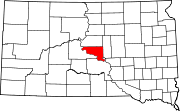 | |
| Town | ||
| Township | ||
| Indian reservation | ||
| CDP | ||
| Other communities | ||
| Footnotes | ‡This populated place also has portions in an adjacent county or counties | |
This South Dakota-related article is a stub. You can help Wikipedia by expanding it. |
{