Kanyanya
Appearance
Kanyanya | |
|---|---|
| Coordinates: 00°22′25″N 32°34′38″E / 0.37361°N 32.57722°E | |
| Country | |
| Region | Central Uganda |
| District | Kampala Capital City Authority |
| Division | Kawempe Division |
| Elevation | 1,200 m (3,900 ft) |
| Time zone | UTC+3 (EAT) |
Kanyanya is a neighborhood within the city of Kampala, Uganda's capital.
Location
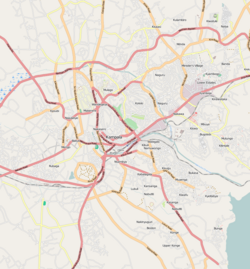
[edit]Kanyanya is bordered by Wakiso District to the north, Mpererwe to the east, Kaleerwe to the south, and Kawempe to the west. This is approximately 8 kilometres (5.0 mi), by road, north of Kampala's central business district.[1] The coordinates of Kanyanya are 0°22'25.0"N, 32°34'38.0"E (Latitude:0.373620; Longitude:32.577223).[2]
Overview
[edit]Kanyanya is predominantly a middle-class residential area.[3] Small business establishments, such as petrol stations, restaurants and bars, appear at major intersections and along Kampala–Gayaza Road.[2]
Points of interest
[edit]The following points of interest lie within or near Kanyanya:
- Kanyanya Police Station - An establishment of the Uganda National Police
- Kampala Quality Primary School - A private, mixed, boarding elementary school[4]
- Tonnet Agro Engineering Company Limited - A company that manufactures agro-processing machinery[5]
See also
[edit]References
[edit]- ^ GFC (25 April 2016). "Distance between Kampala Road, Kampala, Central Region, Uganda and Kanyanya, Kampala, Central Region, Uganda". Globefeed.com (GFC). Retrieved 25 April 2016.
- ^ a b "Location of Kanyanya" (Map). Google Maps. Retrieved 25 April 2016.
- ^ Newvision, Archive (31 October 2008). "Plush Bungalow for Abbey Mukiibi". New Vision. Archived from the original on 15 June 2014. Retrieved 15 June 2014.
- ^ Kajoba, Nicholas (24 July 2009). "Kampala Quality Primary Turns 10 Years". New Vision. Archived from the original on 20 May 2014. Retrieved 16 June 2014.
- ^ Kasozi, John (7 September 2010). "Improving Quality: A Machine That Sorts, Grades Grain". New Vision. Archived from the original on 12 October 2010. Retrieved 16 June 2014.


