
Love County, Oklahoma
Love County | |
|---|---|
 Location within the U.S. state of Oklahoma | |
 Oklahoma's location within the U.S. | |
| Coordinates: 33°57′N 97°15′W / 33.95°N 97.25°W | |
| Country | |
| State | |
| Named for | Overton Love, a judge of the Chickasaw Nation |
| Seat | Marietta |
| Area | |
| • Total | 532 sq mi (1,378 km2) |
| • Land | 515 sq mi (1,335 km2) |
| • Water | 17 sq mi (43 km2) 3.11% |
| Population (2000) | |
| • Total | 8,831 |
| • Density | 17/sq mi (7/km2) |
| Time zone | UTC−6 (Central) |
| • Summer (DST) | UTC−5 (CDT) |
Love County is a county located in the U.S. state of Oklahoma. As of 2000, the population is 8,831. Its county seat is MariettaTemplate:GR.
Love County is part of the Ardmore, Oklahoma, Micropolitan Statistical Area.
Geography
According to the U.S. Census Bureau, the county has a total area of 532 square miles (1,378 km²), of which, 515 square miles (1,335 km²) of it is land and 17 square miles (43 km²) of it (3.11%) is water.
Major highways
Adjacent counties
- Carter County (north)
- Marshall County (east)
- Cooke County, Texas (south)
- Montague County, Texas (southwest)
- Jefferson County (northwest)
Demographics
As of the censusTemplate:GR of 2000, there were 8,831 people, 3,442 households, and 2,557 families residing in the county. The population density was 17 people per square mile (7/km²). There were 4,066 housing units at an average density of 8 per square mile (3/km²). The racial makeup of the county was 84.15% White, 2.19% Black or African American, 6.41% Native American, 0.26% Asian, 0.01% Pacific Islander, 3.58% from other races, and 3.41% from two or more races. 7.01% of the population were Hispanic or Latino of any race.
There were 3,442 households out of which 31.70% had children under the age of 18 living with them, 60.40% were married couples living together, 10.00% had a female householder with no husband present, and 25.70% were non-families. 22.90% of all households were made up of individuals and 12.00% had someone living alone who was 65 years of age or older. The average household size was 2.54 and the average family size was 2.97.
In the county, the population was spread out with 25.70% under the age of 18, 7.00% from 18 to 24, 25.40% from 25 to 44, 25.70% from 45 to 64, and 16.20% who were 65 years of age or older. The median age was 39 years. For every 100 females there were 98.20 males. For every 100 females age 18 and over, there were 94.90 males.
The median income for a household in the county was $32,558, and the median income for a family was $38,212. Males had a median income of $30,024 versus $20,578 for females. The per capita income for the county was $16,648. About 8.80% of families and 11.80% of the population were below the poverty line, including 14.40% of those under age 18 and 13.80% of those age 65 or over.
Economy
Love County is home to Winstar Casino, located across the Red River from the Texas-Oklahoma border. The casino is operated by the Chickasaw Nation, and is the county's largest private employer.
Cities and towns
Schools
- Greenville Public Schools
- Marietta Public Schools
- Thackerville Public Schools
- Turner Public Schools
References
External links
Municipalities and communities of Love County, Oklahoma, United States | ||
|---|---|---|
| City | 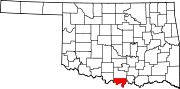 | |
| Towns | ||
| CDP | ||
| Other communities | ||
| Indian reservation | ||
| Footnotes | ‡This populated place also has portions in an adjacent county or counties | |
33°57′N 97°15′W / 33.95°N 97.25°W
Places adjacent to Love County, Oklahoma | ||||||||||||||||
|---|---|---|---|---|---|---|---|---|---|---|---|---|---|---|---|---|
| ||||||||||||||||