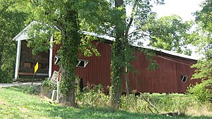
Crooks Covered Bridge
Crooks Covered Bridge | |
|---|---|
 | |
| Coordinates | 39°43′26.75″N 87°11′22.5″W / 39.7240972°N 87.189583°W |
| Carries | Crooks Bridge Road (Main road bypasses covered bridge, bridge open to traffic) |
| Crosses | Little Raccoon Creek |
| Locale | Adams Township, Parke County, Indiana |
| Official name | Crooks Covered Bridge |
| Other name(s) | Walker Adams Bridge, Darroch's Lost Bridge |
| Owner | Parke County |
| Maintained by | Parke County |
| Heritage status | National Register of Historic Places |
| ID number | 6100070[1] |
| Characteristics | |
| Design | Burr arch truss bridge |
| Material | Wood |
| Total length | 154 ft (47 m) |
| Width | 14 ft (4.3 m)[2] |
| Longest span | 132 ft (40 m) |
| No. of spans | 1 |
| Load limit | 4 short tons (3,600 kg) |
| Clearance above | 13 ft (4.0 m) |
| History | |
| Constructed by | Henry Wolf |
| Construction end | 1856 or 1860 |
| Construction cost | $1,200 or $5,900 |
| Rebuilt | 1867 or 1872 |
| Location | |
 | |
The Crooks Covered Bridge is a single span Burr Arch Truss structure that crosses Little Raccoon Creek built in 1855-1856 by Henry Wolf just southeast of Rockville, Indiana.[3]
History
The exact history of this bridge has become hazy with the passing of time. A couple of different sources give varying years as to when certain things may have happened; what is consistent is that the bridge was moved from its original location sometime after 1863 maybe due to the road being abandoned. Some claim that the bridge actually washed downstream to its new location where new abutments were put under it and a road built to it. Still others claim that because the creek changed its course the bridge had to be dismantled and moved. Yet another claim is that General Arthur Patterson, one of the founders of Rockville, had the bridge rebuilt by J.J. Daniels in 1867 after a viewing committee, which included Daniels, recommended it be rebuilt. Daniels also recommended moving the bridge to the Darroch’s Site because it was thought to be safe from flooding. This proved false though when the bridge had to be repaired in 1875 after being damaged by flooding.[4][5]
It was added to the National Register of Historic Places in 1978.[6]
Gallery
See also
- List of Registered Historic Places in Indiana
- Parke County Covered Bridges
- Parke County Covered Bridge Festival
References
- ^ "Archived copy". Archived from the original on 2013-10-31. Retrieved 2009-08-07.
{{cite web}}: Unknown parameter|deadurl=ignored (|url-status=suggested) (help)CS1 maint: archived copy as title (link) - ^ "Crooks Covered Bridge (#12)". Parke County Convention & Visitors Commission. Retrieved 9 January 2015.
- ^ "Crooks Covered Bridge (#12)". Parke County Incorporated / Parke County Convention and Visitors Commission. Retrieved 20 September 2016.
- ^ http://www.indianacrossings.org/bridgeLinks/14-61-17.html
- ^ "Indiana State Historic Architectural and Archaeological Research Database (SHAARD)" (Searchable database). Department of Natural Resources, Division of Historic Preservation and Archaeology. Retrieved 2016-06-01. Note: This includes Charles Felkner (December 1977). "National Register of Historic Places Inventory Nomination Form: Parke County Covered Bridge Historic District" (PDF). Retrieved 2016-06-01. and Site map.
- ^ "National Register Information System". National Register of Historic Places. National Park Service. January 23, 2007.
External links
- Covered bridges on the National Register of Historic Places in Parke County, Indiana
- Covered bridges in Parke County, Indiana
- Bridges completed in 1856
- Road bridges in Indiana
- Road bridges on the National Register of Historic Places in Indiana
- Wooden bridges in Indiana
- Burr Truss bridges in the United States
- Midwestern United States bridge (structure) stubs
- Indiana building and structure stubs
- Indiana transportation stubs
- Central Indiana Registered Historic Place stubs


