
Jeff Davis County, Georgia: Difference between revisions
Rephrased a sentence. #article-section-source-editor Tags: Mobile edit Mobile app edit iOS app edit |
Red Director (talk | contribs) |
||
| Line 1: | Line 1: | ||
{{Short description|County in Georgia, United States}} |
{{Short description|County in Georgia, United States}} |
||
{{See also|Jeff Davis County (disambiguation)}} |
{{See also|Jeff Davis County (disambiguation)}} |
||
{{Use mdy dates|date= |
{{Use mdy dates|date=April 2024}} |
||
{{Infobox U.S. county |
{{Infobox U.S. county |
||
| county = Jeff Davis County |
| county = Jeff Davis County |
||
| Line 26: | Line 26: | ||
}} |
}} |
||
'''Jeff Davis County''' is a [[County (United States)|county]] located in the [[Southeast Georgia|southeastern]] part of the [[U.S. state]] of [[Georgia (U.S. state)|Georgia]]. As of the [[2020 United States Census|2020 census]], the population was 14,779.<ref>{{cite web|title=Census - Geography Profile: Jeff Davis County, Georgia|url=https://data.census.gov/profile/Jeff_Davis_County,_Georgia?g=0500000US13161|publisher=[[United States Census Bureau]]|access-date=December 27, 2022}}</ref> The [[county seat]] is [[Hazlehurst, Georgia|Hazlehurst]].<ref name="GR6">{{cite web|url=http://www.naco.org/Counties/Pages/FindACounty.aspx |access-date=2011 |
'''Jeff Davis County''' is a [[County (United States)|county]] located in the [[Southeast Georgia|southeastern]] part of the [[U.S. state]] of [[Georgia (U.S. state)|Georgia]]. As of the [[2020 United States Census|2020 census]], the population was 14,779.<ref>{{cite web|title=Census - Geography Profile: Jeff Davis County, Georgia|url=https://data.census.gov/profile/Jeff_Davis_County,_Georgia?g=0500000US13161|publisher=[[United States Census Bureau]]|access-date=December 27, 2022}}</ref> The [[county seat]] is [[Hazlehurst, Georgia|Hazlehurst]].<ref name="GR6">{{cite web|url=http://www.naco.org/Counties/Pages/FindACounty.aspx |access-date=June 7, 2011 |title=Find a County |publisher=National Association of Counties |url-status=dead |archive-url=https://web.archive.org/web/20110531210815/http://www.naco.org/Counties/Pages/FindACounty.aspx |archive-date=May 31, 2011 }}</ref> The county was created on August 18, 1905, and named for [[Jefferson Davis]], the only [[President of the Confederate States of America|Confederate president]].<ref>{{cite book | url=http://www.kenkrakow.com/gpn/j.pdf |archive-url=https://web.archive.org/web/20030917141058/http://www.kenkrakow.com/gpn/j.pdf |archive-date=September 17, 2003 |url-status=live | title=Georgia Place-Names: Their History and Origins | publisher=Winship Press | author=Krakow, Kenneth K. | year=1975 | location=Macon, GA | pages=119 | isbn=0-915430-00-2}}</ref> |
||
==Geography== |
==Geography== |
||
According to the [[U.S. Census Bureau]], the county has a total area of {{convert|335|sqmi}}, of which {{convert|331|sqmi}} is land and {{convert|4.7|sqmi}} (1.4%) is water.<ref name="GR1">{{cite web|url=https://www.census.gov/geographies/reference-files/time-series/geo/gazetteer-files.html|publisher=[[United States Census Bureau]]|access-date= |
According to the [[U.S. Census Bureau]], the county has a total area of {{convert|335|sqmi}}, of which {{convert|331|sqmi}} is land and {{convert|4.7|sqmi}} (1.4%) is water.<ref name="GR1">{{cite web|url=https://www.census.gov/geographies/reference-files/time-series/geo/gazetteer-files.html|publisher=[[United States Census Bureau]]|access-date=April 23, 2011|date=February 12, 2011|title=US Gazetteer files: 2010, 2000, and 1990}}</ref> |
||
Most of the northern border area, as well as part of the western border of Jeff Davis County, from northeast of [[Hazlehurst, Georgia|Hazlehurst]] to west of [[Denton, Georgia|Denton]], is located in the Lower [[Ocmulgee River]] sub-basin of the [[Altamaha River]] basin. Most of the eastern corner of the county, east of Hazlehurst and north of [[Graham, Georgia|Graham]], is located in the Altamaha River sub-basin of the larger basin by the same name. The central and southeastern portion of Jeff Davis County, south of Hazlehurst, is located in the Little [[Satilla River]] sub-basin of the [[St. Marys River (Florida–Georgia)|St. Marys]]-Satilla River basin. The remaining central and southern portion of the county is located in the Satilla River sub-basin of the St. Marys-Satilla River basin.<ref>{{cite web |url=http://www.gaswcc.org/maps/ |title=Georgia Soil and Water Conservation Commission Interactive Mapping Experience |publisher=Georgia Soil and Water Conservation Commission |access-date= |
Most of the northern border area, as well as part of the western border of Jeff Davis County, from northeast of [[Hazlehurst, Georgia|Hazlehurst]] to west of [[Denton, Georgia|Denton]], is located in the Lower [[Ocmulgee River]] sub-basin of the [[Altamaha River]] basin. Most of the eastern corner of the county, east of Hazlehurst and north of [[Graham, Georgia|Graham]], is located in the Altamaha River sub-basin of the larger basin by the same name. The central and southeastern portion of Jeff Davis County, south of Hazlehurst, is located in the Little [[Satilla River]] sub-basin of the [[St. Marys River (Florida–Georgia)|St. Marys]]-Satilla River basin. The remaining central and southern portion of the county is located in the Satilla River sub-basin of the St. Marys-Satilla River basin.<ref>{{cite web |url=http://www.gaswcc.org/maps/ |title=Georgia Soil and Water Conservation Commission Interactive Mapping Experience |publisher=Georgia Soil and Water Conservation Commission |access-date=November 27, 2015 |archive-date=October 3, 2018 |archive-url=https://web.archive.org/web/20181003004639/http://www.gaswcc.org/maps/ |url-status=dead }}</ref> |
||
===Major highways=== |
===Major highways=== |
||
| Line 89: | Line 89: | ||
{| class="wikitable" |
{| class="wikitable" |
||
|+Jeff Davis County racial composition as of 2020<ref>{{Cite web|title=Explore Census Data|url=https://data.census.gov/cedsci/table?g=0500000US13161&tid=DECENNIALPL2020.P2|access-date= |
|+Jeff Davis County racial composition as of 2020<ref>{{Cite web|title=Explore Census Data|url=https://data.census.gov/cedsci/table?g=0500000US13161&tid=DECENNIALPL2020.P2|access-date=December 18, 2021|website=data.census.gov}}</ref> |
||
!Race |
!Race |
||
!Num. |
!Num. |
||
| Line 125: | Line 125: | ||
==Politics== |
==Politics== |
||
{{PresHead|place=Jeff Davis County, Georgia|source=<ref>{{Cite web|url=http://uselectionatlas.org/RESULTS|title=Dave Leip's Atlas of U.S. Presidential Elections|last=Leip|first=David|website=uselectionatlas.org|access-date= |
{{PresHead|place=Jeff Davis County, Georgia|source=<ref>{{Cite web|url=http://uselectionatlas.org/RESULTS|title=Dave Leip's Atlas of U.S. Presidential Elections|last=Leip|first=David|website=uselectionatlas.org|access-date=March 20, 2018}}</ref>}} |
||
<!-- PresRow should be {{PresRow|Year|Winning party|GOP vote #|Dem vote #|3rd party vote #|State}} --> |
<!-- PresRow should be {{PresRow|Year|Winning party|GOP vote #|Dem vote #|3rd party vote #|State}} --> |
||
{{PresRow|2020|Republican|4,695|1,028|51|Georgia}} |
{{PresRow|2020|Republican|4,695|1,028|51|Georgia}} |
||
Latest revision as of 20:31, 23 April 2024
Jeff Davis County | |
|---|---|
County | |
 County courthouse | |
 Location within the U.S. state of Georgia | |
 Georgia's location within the U.S. | |
| Coordinates: 31°48′N 82°38′W / 31.8°N 82.64°W | |
| Country | |
| State | |
| Founded | August 18, 1905 |
| Named for | Jefferson Davis |
| Seat | Hazlehurst |
| Largest city | Hazlehurst |
| Area | |
| • Total | 335 sq mi (870 km2) |
| • Land | 331 sq mi (860 km2) |
| • Water | 4.7 sq mi (12 km2) 1.4% |
| Population (2020) | |
| • Total | 14,779 |
| • Density | 45/sq mi (17/km2) |
| Time zone | UTC−5 (Eastern) |
| • Summer (DST) | UTC−4 (EDT) |
| Congressional district | 12th |
| Website | www |
Jeff Davis County is a county located in the southeastern part of the U.S. state of Georgia. As of the 2020 census, the population was 14,779.[1] The county seat is Hazlehurst.[2] The county was created on August 18, 1905, and named for Jefferson Davis, the only Confederate president.[3]
Geography[edit]
According to the U.S. Census Bureau, the county has a total area of 335 square miles (870 km2), of which 331 square miles (860 km2) is land and 4.7 square miles (12 km2) (1.4%) is water.[4]
Most of the northern border area, as well as part of the western border of Jeff Davis County, from northeast of Hazlehurst to west of Denton, is located in the Lower Ocmulgee River sub-basin of the Altamaha River basin. Most of the eastern corner of the county, east of Hazlehurst and north of Graham, is located in the Altamaha River sub-basin of the larger basin by the same name. The central and southeastern portion of Jeff Davis County, south of Hazlehurst, is located in the Little Satilla River sub-basin of the St. Marys-Satilla River basin. The remaining central and southern portion of the county is located in the Satilla River sub-basin of the St. Marys-Satilla River basin.[5]
Major highways[edit]
Adjacent counties[edit]
- Wheeler County (north)
- Montgomery County (northeast)
- Toombs County (northeast)
- Appling County (southeast)
- Bacon County (southeast)
- Coffee County (southwest)
- Telfair County (northwest)
Communities[edit]
Cities[edit]
Census-designated place[edit]
Economy[edit]
Jeff Davis County had an estimated $164,341,000 in retail sales in 2017. [6] Agriculture is a major factor of the economy. Cotton and peanuts, along with the formerly more significant tobacco, are the primary commercial crops. Timber, too, is an important product. [7]
Demographics[edit]
| Census | Pop. | Note | %± |
|---|---|---|---|
| 1910 | 6,050 | — | |
| 1920 | 7,322 | 21.0% | |
| 1930 | 8,118 | 10.9% | |
| 1940 | 8,841 | 8.9% | |
| 1950 | 9,299 | 5.2% | |
| 1960 | 8,914 | −4.1% | |
| 1970 | 9,425 | 5.7% | |
| 1980 | 11,473 | 21.7% | |
| 1990 | 12,032 | 4.9% | |
| 2000 | 12,684 | 5.4% | |
| 2010 | 15,068 | 18.8% | |
| 2020 | 14,779 | −1.9% | |
| 2023 (est.) | 14,906 | [8] | 0.9% |
| U.S. Decennial Census[9] 1790-1880[10] 1890-1910[11] 1920-1930[12] 1930-1940[13] 1940-1950[14] 1960-1980[15] 1980-2000[16] 2010[17] | |||
| Race | Num. | Perc. |
|---|---|---|
| White (non-Hispanic) | 9,950 | 67.33% |
| Black or African American (non-Hispanic) | 2,293 | 15.52% |
| Native American | 26 | 0.18% |
| Asian | 50 | 0.34% |
| Pacific Islander | 7 | 0.05% |
| Other/Mixed | 406 | 2.75% |
| Hispanic or Latino | 2,047 | 13.85% |
As of the 2020 United States census, there were 14,779 people, 5,279 households, and 3,790 families residing in the county.
Politics[edit]
| Year | Republican | Democratic | Third party | |||
|---|---|---|---|---|---|---|
| No. | % | No. | % | No. | % | |
| 2020 | 4,695 | 81.31% | 1,028 | 17.80% | 51 | 0.88% |
| 2016 | 4,104 | 80.17% | 901 | 17.60% | 114 | 2.23% |
| 2012 | 3,996 | 74.85% | 1,275 | 23.88% | 68 | 1.27% |
| 2008 | 3,867 | 73.16% | 1,356 | 25.65% | 63 | 1.19% |
| 2004 | 3,549 | 73.25% | 1,277 | 26.36% | 19 | 0.39% |
| 2000 | 2,797 | 66.26% | 1,379 | 32.67% | 45 | 1.07% |
| 1996 | 1,796 | 47.08% | 1,576 | 41.31% | 443 | 11.61% |
| 1992 | 1,947 | 39.32% | 2,031 | 41.01% | 974 | 19.67% |
| 1988 | 2,050 | 62.03% | 1,242 | 37.58% | 13 | 0.39% |
| 1984 | 2,233 | 61.80% | 1,380 | 38.20% | 0 | 0.00% |
| 1980 | 1,191 | 35.97% | 2,059 | 62.19% | 61 | 1.84% |
| 1976 | 622 | 20.55% | 2,405 | 79.45% | 0 | 0.00% |
| 1972 | 1,857 | 86.01% | 302 | 13.99% | 0 | 0.00% |
| 1968 | 577 | 19.82% | 376 | 12.92% | 1,958 | 67.26% |
| 1964 | 1,875 | 71.56% | 745 | 28.44% | 0 | 0.00% |
| 1960 | 402 | 32.76% | 825 | 67.24% | 0 | 0.00% |
| 1956 | 247 | 12.98% | 1,656 | 87.02% | 0 | 0.00% |
| 1952 | 367 | 21.72% | 1,323 | 78.28% | 0 | 0.00% |
| 1948 | 70 | 7.73% | 611 | 67.51% | 224 | 24.75% |
| 1944 | 120 | 14.00% | 737 | 86.00% | 0 | 0.00% |
| 1940 | 101 | 12.64% | 696 | 87.11% | 2 | 0.25% |
| 1936 | 93 | 12.85% | 631 | 87.15% | 0 | 0.00% |
| 1932 | 50 | 4.06% | 1,179 | 95.70% | 3 | 0.24% |
| 1928 | 180 | 36.36% | 315 | 63.64% | 0 | 0.00% |
| 1924 | 39 | 23.35% | 122 | 73.05% | 6 | 3.59% |
| 1920 | 303 | 53.82% | 260 | 46.18% | 0 | 0.00% |
| 1916 | 14 | 3.79% | 299 | 81.03% | 56 | 15.18% |
| 1912 | 19 | 5.60% | 268 | 79.06% | 52 | 15.34% |
See also[edit]
- National Register of Historic Places listings in Jeff Davis County, Georgia
- List of counties in Georgia
References[edit]
- ^ "Census - Geography Profile: Jeff Davis County, Georgia". United States Census Bureau. Retrieved December 27, 2022.
- ^ "Find a County". National Association of Counties. Archived from the original on May 31, 2011. Retrieved June 7, 2011.
- ^ Krakow, Kenneth K. (1975). Georgia Place-Names: Their History and Origins (PDF). Macon, GA: Winship Press. p. 119. ISBN 0-915430-00-2. Archived (PDF) from the original on September 17, 2003.
- ^ "US Gazetteer files: 2010, 2000, and 1990". United States Census Bureau. February 12, 2011. Retrieved April 23, 2011.
- ^ "Georgia Soil and Water Conservation Commission Interactive Mapping Experience". Georgia Soil and Water Conservation Commission. Archived from the original on October 3, 2018. Retrieved November 27, 2015.
- ^ "Census Quick Facts: Jeff Davis County". United States Census Bureau. Retrieved April 2, 2024.
- ^ "Jeff Davis County". New Georgia Encyclopedia. Retrieved April 2, 2024.
- ^ "Annual Estimates of the Resident Population for Counties: April 1, 2020 to July 1, 2023". United States Census Bureau. Retrieved March 31, 2024.
- ^ "Decennial Census of Population and Housing by Decades". United States Census Bureau.
- ^ "1880 Census Population by Counties 1790-1800" (PDF). United States Census Bureau. 1880.
- ^ "1910 Census of Population - Georgia" (PDF). United States Census Bureau. 1910.
- ^ "1930 Census of Population - Georgia" (PDF). United States Census Bureau. 1930.
- ^ "1940 Census of Population - Georgia" (PDF). United States Census Bureau. 1940.
- ^ "1950 Census of Population - Georgia -" (PDF). United States Census Bureau. 1950.
- ^ "1980 Census of Population - Number of Inhabitants - Georgia" (PDF). United States Census Bureau. 1980.
- ^ "2000 Census of Population - Population and Housing Unit Counts - Georgia" (PDF). United States Census Bureau. 2000.
- ^ "State & County QuickFacts". United States Census Bureau. Archived from the original on June 7, 2011. Retrieved June 23, 2014.
- ^ "Explore Census Data". data.census.gov. Retrieved December 18, 2021.
- ^ Leip, David. "Dave Leip's Atlas of U.S. Presidential Elections". uselectionatlas.org. Retrieved March 20, 2018.
External links[edit]
- Jeff Davis County historical marker
Places adjacent to Jeff Davis County, Georgia | ||||||||||||||||
|---|---|---|---|---|---|---|---|---|---|---|---|---|---|---|---|---|
| ||||||||||||||||
Municipalities and communities of Jeff Davis County, Georgia, United States | ||
|---|---|---|
| Cities | 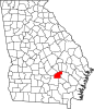 | |
| CDP | ||
| Unincorporated community | ||
| Ghost town | ||
| International | |
|---|---|
| National | |
| Other | |