
Munnar
Munnar
മുന്നാർ | |
|---|---|
Hill station | |
 Munnar Hill station | |
| Country | India |
| State | Kerala |
| District | • Idukki |
| Area | |
| • Hill station | 557 km2 (215 sq mi) |
| Elevation | 1,700 m (5,600 ft) |
| Population | |
| • Metro | 68,205 |
| Languages | |
| • Official | Malayalam, English |
| Time zone | UTC+5:30 (IST) |
| PIN | 685 612 |
| Telephone code | 04865- |
| Vehicle registration | KL-06 |
| Website | keralatourism |
Munnar (Malayalam: മുന്നാർ) is a town in the southwestern state of Kerala, India. Munnar is situated around 1600 m above sea level, [2] in the Western Ghats range of mountains and is a hill station
The name Munnar is believed to mean "three rivers",[3] referring to the location at the confluence of the Madhurapuzha, Nallathanni and Kundaly rivers.[4]
Munnar town is situated on the Kannan Devan Hills village in Devikulam taluk and is the largest panchayat in the Idukki district in Kerala having an area measuring nearly 557 km².[citation needed]
The nearest major railway stations are at Ernakulam and Aluva (approximately 140 kilometres (87 mi) by road). The nearest airport is Cochin International Airport, which is 105 kilometres (65 mi) away.
Geography and climate
The region in and around Munnar varies in height from 1,450 meters (4,760 ft) to 2,695 meters (8,842 ft) above mean sea level. The temperature ranges between 5 °C (41 °F) and 25 °C (77 °F) in winter and 15 °C (59 °F) and 25 °C (77 °F) in summer.[5] Temperatures as low as −4 °C (25 °F) have been recorded in the Sevenmallay region of Munnar.[6][failed verification] The mean maximum daily temperature is at its lowest during the monsoon months with the highest temperature being 19 °C (66 °F).
Köppen-Geiger climate classification system classifies it as subtropical highland (Cwb).[7]
| Climate data for Munnar | |||||||||||||
|---|---|---|---|---|---|---|---|---|---|---|---|---|---|
| Month | Jan | Feb | Mar | Apr | May | Jun | Jul | Aug | Sep | Oct | Nov | Dec | Year |
| Mean daily maximum °C (°F) | 22.4 (72.3) |
23.7 (74.7) |
25.3 (77.5) |
25.6 (78.1) |
25.6 (78.1) |
23.7 (74.7) |
22.4 (72.3) |
22.8 (73.0) |
23.2 (73.8) |
22.7 (72.9) |
21.8 (71.2) |
21.9 (71.4) |
23.4 (74.2) |
| Daily mean °C (°F) | 17.6 (63.7) |
18.7 (65.7) |
20.2 (68.4) |
21 (70) |
21.4 (70.5) |
20.3 (68.5) |
19.3 (66.7) |
19.5 (67.1) |
19.6 (67.3) |
19.2 (66.6) |
18.3 (64.9) |
17.7 (63.9) |
19.4 (66.9) |
| Mean daily minimum °C (°F) | 12.9 (55.2) |
13.7 (56.7) |
15.1 (59.2) |
16.5 (61.7) |
17.3 (63.1) |
16.9 (62.4) |
16.3 (61.3) |
16.3 (61.3) |
16 (61) |
15.7 (60.3) |
14.8 (58.6) |
13.5 (56.3) |
15.4 (59.8) |
| Average precipitation mm (inches) | 18 (0.7) |
29 (1.1) |
47 (1.9) |
129 (5.1) |
189 (7.4) |
420 (16.5) |
583 (23.0) |
364 (14.3) |
210 (8.3) |
253 (10.0) |
164 (6.5) |
64 (2.5) |
2,470 (97.3) |
| Average rainy days | 2 | 2 | 3 | 6 | 8 | 9 | 10 | 9 | 10 | 12 | 8 | 5 | 84 |
| Mean monthly sunshine hours | 248 | 232 | 248 | 240 | 217 | 120 | 124 | 124 | 150 | 155 | 180 | 217 | 2,255 |
| Source 1: Climate-Data.org, altitude: 1461m[7] | |||||||||||||
| Source 2: Weather2Travel for sunshine and rainy days[8] | |||||||||||||
Flora and fauna
Most of the native flora and fauna of Munnar have disappeared due to severe habitat fragmentation resultant from the creation of the plantations. However, some species continue to survive and thrive in several protected areas nearby, including the new Kurinjimala Sanctuary to the east, the Chinnar Wildlife Sanctuary, Manjampatti Valley and the Amaravati reserve forest of Indira Gandhi Wildlife Sanctuary to the north east, the Eravikulam National Park and Anamudi Shola National Park to the north, the Pampadum Shola National Park to the south and the proposed Palani Hills National Park to the east. These protected areas are especially known for several threatened and endemic species including Nilgiri Thar, the Grizzled Giant Squirrel, the Nilgiri Wood-pigeon, Elephant, the Gaur, the Nilgiri langur, the Sambar, and the Neelakurinji (that blossoms only once in twelve years). [9][10]
Gallery
-
 Munnar
 -
 Echo Point Munnar
 -
 Munnar Top Station
 -
 View of Munnar in the morning
 -
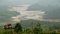
 A rare scene of Munnar
 -
 A beautiful view of Chinnakanal
 -
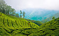
Tea plantations


See also
References
- ^ Munnar
- ^ http://www.keralatourism.org/destination/destination.php?id=306
- ^ Munnar History
- ^ "Munnar".
- ^ Eravikulam "Eravikulam National Park, Munnar, Kerala, India, the the home of Nilgiri Tahr". Eravikulam National Park. Retrieved 28 August 2013.
{{cite web}}: Check|url=value (help) - ^ Frost hits plantations in Munnar[failed verification]
- ^ a b "Climate: Munnar - Climate graph, Temperature graph, Climate table". Climate-Data.org. Retrieved 28 August 2013.
- ^ "Munnar Climate and Weather Averages, Kerala". Weather2Travel. Retrieved 28 August 2013.
- ^ Government of Kerala, Forest and Wildlife Department, Notification No. 36/2006 F&WLD (6 October 2006) retrieved 5/12/2007 Kerala Gazette
- ^ Mathew Roy (Sep 25, 2006) "Proposal for Kurinjimala sanctuary awaits Cabinet nod" the Hindu, retrieved 5/12/2007 the Hindu
External links
- Kerala government launches eviction drive in Munnar
 Munnar travel guide from Wikivoyage
