
Panaji
This article needs additional citations for verification. (July 2015) |
Panaji
Ponnje Nova Goa | |
|---|---|
City | |
| पणजी | |
 Anti-Clockwise from the Top: 1. Igreja da Nossa Senhora da Imaculada Conceição 2. Typical Portuguese influenced architecture. 3. Statue of Hindu-Christian Unity 4. Entrance to the Panjim Police HQ | |
 Panaji Location of Panjim in Goa  Panaji Panaji (India) | |
| Coordinates: 15°29′56″N 73°49′40″E / 15.49889°N 73.82778°E | |
| Country | |
| State | Goa |
| District | North Goa |
| Sub-district | Ilhas de Goa |
| Elevated to Capital | 1843 |
| Government | |
| • Mayor | Surendra Furtado[2][3] |
| • Deputy Mayor | Lata Parekh[4][5] |
| • Member of the Legislative Assembly of Goa | Siddharth Kunkolienkar (BJP) [6] |
| Area | |
| • City | 21.01 km2 (8.11 sq mi) |
| • Metro | 76.3 km2 (29.5 sq mi) |
| Elevation | 7 m (23 ft) |
| Population (2011) | |
| • City | 40,017 [1] |
| • Rank | 3rd in Goa |
| • Metro | 114,759[7] |
| Demonym(s) | Ponnjekar, Panjimites, Panajikar |
| Time zone | UTC+5:30 (IST) |
| PIN | 403 00x |
| Telephone code | 0832 |
| Vehicle registration | GA-01, GA-07 |
| Website | www |
Panaji /ˈpʌnədʒ[invalid input: 'ee']/ or Panjim (Konkani: Ponnje [pɔɳɟĩ]) is the capital of the Indian state of Goa and the headquarters of North Goa district. It lies on the banks of the Mandovi River estuary in the Ilhas de Goa sub-district (taluka). With a population of 114,759 in the metropolitan area, Panjim is Goa's largest Urban agglomeration, ahead of Margão and Vasco da Gama.
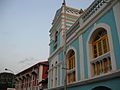
Panaji means "land that never floods".[inconsistent] It has terraced hills, concrete buildings with balconies and red-tiled roofs, churches, and a riverside promenade. There are avenues lined with gulmohar, acacia and other trees. The Baroque Our Lady of the Immaculate Conception Church is located overlooking the main square known as Praça da Igreja. Colourful villas, cobbled streets and interesting buildings help Panaji retain its Portuguese ambiance and culture. Panaji has been selected as one of the hundred Indian cities to be developed as a smart city under PM Narendra Modi's flagship Smart Cities Mission.
Panaji is the first city in India to be built on a planned grid system.[8]
Etymology
The city's present official name is Panaji. The Portuguese current name was Pangim, although officially named Nova Goa. The city is popularly also called Panjim (in English). It has been renamed Panjim since the 1960s after the Indian administration – in an effort to wipe our all Portuguese influence from the State.[9] The city is called Ponnjé in Konkani.
Earlier a small village on the river front, in 1843 the city had been renamed Nova Goa (Portuguese for "New Goa") when it officially replaced the city of Goa (now Old Goa) as the capital of Portuguese India, though the Viceroy had already moved there in 1759.
The justification of the modern word Panaji is derived from the words panjani and khali, which mean a boat and a small creek respectively, in Sanskrit. Thus the modern word Panjim is believed to be a corruption of the old word Panjanakhani as inscribed on the discovered Panjim copper-plates dated 1059 CE, belonging to the rule of Kadamba king Jayakesi I.[10][11] According to legend, a city with a was mentioned in a stone inscription of Kadamba king Jayakesi I dated 1054 CE as 'Panjanakhani', giving him the epithet of Padavalendra which is Kannada for lord of the western ocean.[12]
History
Panjim was annexed by India with the rest of Goa and the former Portuguese territories after the Indian invasion of Portuguese India in 1961. It became a state-capital on Goa's elevation to statehood in 1987. Between 1961 and 1987, it was the capital of the Union Territory of Goa, Daman and Diu. A new Legislative Assembly complex was inaugurated in March 2000, across the Mandovi River, in Alto Porvorim. Panjim is also the administrative headquarters of North Goa district.
Suburbs
Panjim is located at 15°29′56″N 73°49′40″E / 15.49889°N 73.82778°E.[13] It has an average elevation of 7 metres (23 feet).
Panjim has various vāde or sub-divisions, including:
- São Tomé,
- Fontainhas,
- Mala,
- Portais,
- Altinho,
- Cortin,
- Praça da Igreja,
- Tar (near the ferry wharf),
- Bāzār,
- Japão (near Don Bosco), and
- Boça de Vaca.
Some areas outlying it are:
- Cāmpāl,
- Santa Inez,
- Chinchollem,
- Batulem, and
- Pātto.
Besides lying on the banks of the Mandovi River, Panjim is bounded by two creeks, locally called pői in the singular, namely Ourém creek and Santa Inêz creek.
Demographics
During the 2011 census of India,[14] Panjim had a population of 114,405. Males constituted 52% of the population and females 48%. It had an average literacy rate of 90.9%; male literacy was 94.6% and female literacy 86.9%. In Panjim, 9.6% of the population was under 7 years of age.
Climate
Panjim features a tropical monsoon climate (Köppen climate classification Am). The climate in Panjim is hot in summer and equable in winter. During summers (from March to May) the temperature reaches up to 32 °C (90 °F) and in winters (from December to February) it is usually between 31 °C (88 °F) and 23 °C (73 °F).
The monsoon period is from June to September with heavy rainfall and gusty winds. The annual average rainfall is 2,932 mm (115.43 in).
| Climate data for Panaji (1971–1990) | |||||||||||||
|---|---|---|---|---|---|---|---|---|---|---|---|---|---|
| Month | Jan | Feb | Mar | Apr | May | Jun | Jul | Aug | Sep | Oct | Nov | Dec | Year |
| Record high °C (°F) | 36.6 (97.9) |
39.2 (102.6) |
39.0 (102.2) |
39.8 (103.6) |
38.6 (101.5) |
35.9 (96.6) |
32.3 (90.1) |
34.0 (93.2) |
33.2 (91.8) |
37.2 (99.0) |
37.2 (99.0) |
36.6 (97.9) |
39.8 (103.6) |
| Mean daily maximum °C (°F) | 32.0 (89.6) |
31.7 (89.1) |
32.2 (90.0) |
33.1 (91.6) |
33.4 (92.1) |
30.3 (86.5) |
29.1 (84.4) |
28.7 (83.7) |
29.8 (85.6) |
31.8 (89.2) |
32.9 (91.2) |
32.7 (90.9) |
31.5 (88.7) |
| Daily mean °C (°F) | 26.0 (78.8) |
26.3 (79.3) |
27.7 (81.9) |
29.3 (84.7) |
30.0 (86.0) |
27.6 (81.7) |
26.7 (80.1) |
26.4 (79.5) |
26.9 (80.4) |
27.9 (82.2) |
27.6 (81.7) |
26.9 (80.4) |
27.4 (81.3) |
| Mean daily minimum °C (°F) | 19.9 (67.8) |
20.7 (69.3) |
23.2 (73.8) |
25.5 (77.9) |
26.5 (79.7) |
24.8 (76.6) |
24.3 (75.7) |
24.0 (75.2) |
24.0 (75.2) |
23.9 (75.0) |
22.2 (72.0) |
21.0 (69.8) |
23.3 (73.9) |
| Record low °C (°F) | 14.4 (57.9) |
13.3 (55.9) |
17.5 (63.5) |
19.4 (66.9) |
20.9 (69.6) |
20.9 (69.6) |
20.5 (68.9) |
21.7 (71.1) |
21.0 (69.8) |
20.0 (68.0) |
15.3 (59.5) |
15.7 (60.3) |
13.3 (55.9) |
| Average precipitation mm (inches) | 0 (0) |
0 (0) |
1 (0.0) |
5 (0.2) |
56 (2.2) |
861 (33.9) |
853 (33.6) |
622 (24.5) |
237 (9.3) |
111 (4.4) |
35 (1.4) |
2 (0.1) |
2,813 (110.7) |
| Average rainy days (≥ 1.0 mm) | 0.0 | 0.1 | 0.1 | 0.6 | 3.8 | 24.0 | 28.2 | 27.2 | 14.9 | 6.6 | 3.5 | 0.3 | 109.3 |
| Average relative humidity (%) | 67 | 69 | 71 | 71 | 71 | 85 | 88 | 89 | 86 | 80 | 70 | 64 | 76 |
| Mean monthly sunshine hours | 311.8 | 290.2 | 291.0 | 289.0 | 296.5 | 125.1 | 105.7 | 122.1 | 177.1 | 247.7 | 272.6 | 299.3 | 2,828.1 |
| Source 1: NOAA[15] | |||||||||||||
| Source 2: India Meteorological Department (record high and low up to 2010)[16] | |||||||||||||
Landmarks

The heart of the city is the Praça da Igreja (Church Square) or Municipal Garden (Garcia de Orta) with the Portuguese Baroque Our Lady of the Immaculate Conception Church, originally built in 1541. Other tourist attractions include the old and rebuilt Adilshahi Palace (or Idalção Palace), dating from the sixteenth century, the Institute Menezes Braganza, the Mahalaxmi Temple, the Jama Masjid Mosque, the Chapel of St. Sebastian and the Fontainhas area—which is considered to be the old Latin Quarter—as well as the nearby beach of Miramar. Hanuman Mandir at Malā on the hill top (Altinho) and its annual zatrā in February are a major attraction of Panjim. Panjim hosted the relics of Saint John Bosco (also known as Don Bosco) till 21 August 2011 at the Don Bosco Oratory.
The carnival celebrations in February include a colourful parade on the streets. This is followed by the Shigmo/xigmo, or Holi. The Narkāsūr parade on the night before Diwali in the city is very colourful.
Well-known places in Panjim are the 18th June Road (a busy thoroughfare in the heart of the town and a shopping area for tourists and locals), Mala area, Miramar beach and the Kala Academy (a cultural centre known for its structure built by architect Charles Correa). Kala Academy is a place where Goa showcases its art and culture.
Other attractions


Salim Ali Bird Sanctuary is a bird sanctuary named after the ornithologist Dr Salim Ali. The sanctuary, located in the village of Chorão, near Panjim, plays host to rare and endangered bird species—both migratory and resident.
Goa is famous for its beaches, and Miramar, Bambolim, and Dona Paula are three popular beaches located near Panjim.
Dona Paula is the meeting point for two of Goa’s famous rivers, Zuari and Mandovi. These two rivers meet at the Arabian Sea. The official residence of the Governor of Goa, known as Cabo Raj Bhavan, is situated on the westernmost tip of Dona Paula.
Miramar Beach is one of the more crowded beaches in Goa, which remains full with local and international tourists throughout the year.
Also located near Panjim, is the Goa Science Centre which was opened to the public in December 2001. The Caculo Mall is also located in St. Inez near Panjim.
Education

Some educational institutes in Panjim are:
- V. M. Salgaocar College of Law, Miramar
- The Progress High School
- Goa Medical College, Bambolim[17]
- Santa Cruz High School, Santa Cruz
- Don Bosco High School
- Goa Institute of Management
- Dempo College of Commerce and Economics, Altinho
- Dhempe College of Arts and Sciences, Miramar
- Sharada Mandir, Miramar
- Mary Immaculate Girls High School, São Tomé/Fontainhas
- Peoples High School, Mala
- Mushtifund Saunstha
- Goa College of Pharmacy
- Goa Polytechnic Panjim
- Goa College of Fine Arts
- Dr. Hedgewar High School
- The Rosary High School, Miramar
- Our lady of Rosary (Green Rosary), Dona Paula[18]
- Taleigão Chess Academy
Besides this, the only university in Goa, the Goa University, is situated at Taleigão on the outskirts of Panjim.[19]
Research centres
The National Institute of Oceanography (CSIR-NIO) is situated at Dona Paula, on the outskirts of Panjim city. It does research in fields related to marine sciences.
Transport

The nearest airport is Dabolim Airport which is 30 kilometres (19 miles) away.[20]
Media and communications
State-owned All India Radio has a local station in Panjim which transmits various programs of mass interest.
Government offices
The Goan government, as well as the Indian government, has its major offices in Goa.
- Passport Office, Panjim
- Junta House – houses government offices
- Industrial Development Corporation Goa
- Goa Education Development Corporation
- Sports Authority of Goa
- Bombay High Court – Goa bench
- Press Information Bureau (Government of India's Press Office)
- All India Radio, Altinho
- Doordarshan Complex, Altinho
The Goa Legislative Assembly is situated at Alto Porvorim, about 2 km (1.2 mi) from Panjim. The hillock called Altinho houses some major central government offices and the residences of prominent officials and politicians.
Politics
The Member of Legislative Assembly (MLA) for Panjim is Siddharth Kunkolienkar of the BJP
The Corporation of the City of Panjim (CCP)[21] administers the city and its mayor is Surendra Furtado.[22] The Governor of Goa stays at the Cabo Raj Bhavan at Dona Paula, about 8 km (5 mi) from Panjim.[23] The incumbent Governor is Bharat Vir Wanchoo.[24]
Sports
Two of Indians Premier clubs Dempo S.C. and Sporting Clube de Goa are based in Panjim they both compete in India's top tier league I-League.
Panjim also had a Legendary Stadium called Campal Stadium who was demolished and currently a new Campal stadium is under construction.
International relations
Twin towns – Sister cities
Panjim is twinned with:
Gallery
-
 Statue of Abade Faria
 -
 The Inox Multiplex Theatre near the Panaji market
 -
 Miramar Beach
 -
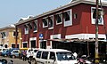 Panaji Market Buildings
 -
 Villa Paradiso
 -
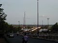
 Mandovi Bridge from the top of Ribandar
 -
 Hotel Mandovi area
 -
 Hotel Mandovi area
 -
 General Post Office area
 -
 Panjim by night
 -
 Immaculate Conception Church at Panjim
 -
 Miramar circle
 -
 Bridge to Panjim
 -
 Government-run handicrafts complex (Apparent)
 -
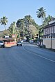 A street in Panjim


,_capital_of_Goa,_India_01.JPG)
,_capital_of_Goa,_India_03.JPG)
,_capital_of_Goa,_India_04.JPG)
,_capital_of_Goa,_India_05.jpg)
,_capital_of_Goa,_India_06.jpg)
,_capital_of_Goa,_India_07.jpg)
,_capital_of_Goa,_India_08.jpg)
,_capital_of_Goa,_India_09.JPG)

See also
References
- ^ http://www.census2011.co.in/data/town/803243-panaji-goa.html
- ^ http://www.heraldgoa.in/Goa/Furtado-Parekh-elected-Panjim-Mayor-deputy-unopposed/99951.html
- ^ http://www.navhindtimes.in/surendra-set-to-take-over-ccp-reigns/
- ^ http://www.heraldgoa.in/Goa/Furtado-Parekh-elected-Panjim-Mayor-deputy-unopposed/99951.html
- ^ http://www.navhindtimes.in/surendra-set-to-take-over-ccp-reigns/
- ^ http://goavidhansabha.gov.in/member.php?id=161&flag=MLA&aid=7
- ^ http://www.census2011.co.in/census/metropolitan/414-panaji.html
- ^ http://www.ccpgoa.com/
- ^ http://www.heraldgoa.in/Edit/Opinions/Goa%E2%80%99s-silent-genocide/89034.html
- ^ Title: Gazetteer of the Union Territory Goa, Daman and Diu: district gazetteer, Volume 1; Publisher: Gazetteer Dept., Govt. of the Union Territory of Goa, Daman and Diu, 1979 (Original from the University of Michigan, Digitised: 30 August 2008)
- ^ "EPIGRAPHICAL AND LITERARY SOURCES ON WORSHIP IN GOA'S PAST" (PDF). ShodhGanga.
- ^ De Souza, Teotonio R. (1990). Goa Through the Ages: An economic history, Volume 2. Concept Publishing Company. p. 129. ISBN 9788170222590.
- ^ "Falling Rain Genomics, Inc – Panaji". Fallingrain.com. Retrieved 9 May 2012.
- ^ "Provisional Population Totals Paper 2, Volume 2 of 2011: Goa State Tables" (PDF). censusindia.gov.in. Registrar General and Census Commissioner of India. Retrieved 9 July 2013.
- ^ "Goa (Panjim) Climate Normals 1971–1990". National Oceanic and Atmospheric Administration. Retrieved 15 April 2015.
- ^ "Ever recorded Maximum and minimum temperatures up to 2010". India Meteorological Department. Archived from the original (PDF) on 21 May 2013. Retrieved 15 April 2015.
{{cite web}}: Unknown parameter|deadurl=ignored (|url-status=suggested) (help) - ^ http://www.gmcmec.gov.in/
- ^ http://olorosaryhss.com/index.html
- ^ http://www.unigoa.ac.in/
- ^ "Airports Authority of India". Aai.aero. 21 September 2011. Retrieved 9 May 2012.
- ^ http://www.ccpgoa.com/
- ^ http://www.navhindtimes.in/goa-news/surendra-furtado-elected-ccp-mayor
- ^ http://www.rajbhavangoa.org/rajbhavan_past_present.htm
- ^ http://www.rajbhavangoa.org/governor_about.htm
- ^ "Acordos de Geminação, de Cooperação e/ou Amizade da Cidade de Lisboa". Camara Municipal de Lisboa (in Portuguese). Retrieved 23 August 2013.
{{cite web}}: Unknown parameter|trans_title=ignored (|trans-title=suggested) (help)
External links
 Panaji travel guide from Wikivoyage
- Government of Goa
- "Places to Visit in Panjim", Tripoto, retrieved 2 November 2014
- Panaji Land Records
| History | |||||||
|---|---|---|---|---|---|---|---|
| Government | |||||||
| Geography | |||||||
| Districts | |||||||
| Talukas | |||||||
| Cities | |||||||
| Heritage sites | |||||||
| Wildlife sanctuaries | |||||||
| Education | |||||||
| Science | |||||||
| Culture | |||||||
| Sports |
| ||||||
| Transport | |||||||
| International | |
|---|---|
| National | |