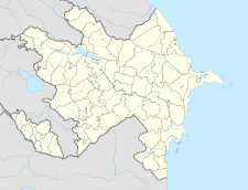
Gtichavank
| Gtichavank Գտչավանք | |
|---|---|
 | |
| Religion | |
| Affiliation | Armenian Apostolic Church |
| Location | |
| Location | Tugh, |
| Geographic coordinates | 39°35′37″N 46°56′31″E / 39.593547°N 46.941944°E |
| Architecture | |
| Style | Armenian |
| Groundbreaking | 1241 |
| Completed | 1248 |
Gtichavank (Template:Lang-hy; Template:Lang-az or Gütəvəng) is a 13th-century Armenian Apostolic[1][2] monastery located in the Tugh village of Azerbaijan.
Remains of the monastery may be reached by hikers via the Janapar Trail, a long-distance trail that runs from Vardenis in Armenia to Hadrut in Artsakh. Another trail leading to this popular monastery is the Gtichavank Loop Trail which starts in Tugh village.
History
The monastery came under the control of the self-proclaimed Republic of Artsakh in the First Nagorno-Karabakh war. It was recaptured by Azerbaijan during the 2020 Nagorno-Karabakh war.
In 2018 the trail was cleared of overgrown vegetation and marked with red and white painted blazes by Trails For Change NGO. From the monastery, you can continue down the Gtichavank Loop Trail or take the Janapar Trail down to Tugh. From the monastery, you can either take the unmarked trail behind the monastery back to Tugh or the Janapar Trail.
Gallery
See also
References
External links
- Republic of Artsakh stubs
- European church stubs
- Asian church stubs
- Armenian culture
- Architecture of Armenia
- Armenian Apostolic Church
- Armenian Apostolic churches
- Armenian Apostolic monasteries
- Armenian Apostolic monasteries in Azerbaijan
- Christian monasteries in the Republic of Artsakh
- Christian monasteries in Azerbaijan
- Churches in Azerbaijan
- Oriental Orthodox congregations established in the 13th century
- Christian monasteries established in the 13th century
- Christian monastery stubs


