
Hurricane Irene
| Category 3 major hurricane (SSHWS/NWS) | |
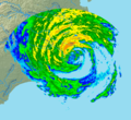
 Hurricane Irene over the southern Bahamas on August 24 | |
| Formed | August 21, 2011 |
|---|---|
| Dissipated | August 28, 2011 |
| Highest winds | 1-minute sustained: 120 mph (195 km/h) |
| Lowest pressure | 942 mbar (hPa); 27.82 inHg |
| Fatalities | 49 direct, 7 indirect |
| Damage | $10.1 billion (2011 USD) |
| Areas affected | Lesser Antilles, Greater Antilles, Turks and Caicos, the Bahamas, eastern United States (Landfalls in North Carolina, Connecticut, New Jersey, and New York), eastern Canada |
| Part of the 2011 Atlantic hurricane season | |
Hurricane Irene was a large and powerful Atlantic hurricane that left extensive flood and wind damage along its path through the Caribbean, the United States East Coast and as far north as Atlantic Canada in 2011. The ninth named storm, first hurricane and first major hurricane of the annual hurricane season, Irene originated from a well-defined Atlantic tropical wave that began showing signs of organization east of the Lesser Antilles. It developed atmospheric convection and a closed cyclonic circulation center, prompting the National Hurricane Center to initiate public advisories late on August 20, 2011. Irene improved in organization as it passed the Leeward Islands, and by August 21, it had moved closer to Saint Croix, U.S. Virgin Islands. The next day, Irene made landfall at Category 1 hurricane strength in Puerto Rico, where severe flooding resulted in significant property damage and the death of one person.
Irene tracked just north of Hispaniola as an intensifying cyclone, pelting the coast with heavy precipitation and strong winds and killing seven people. After crossing the Turks and Caicos Islands, the hurricane quickly strengthened into a Category 3 major hurricane while passing through The Bahamas,[1] leaving behind a trail of extensive structural damage in its wake. Curving toward the north, Irene skirted past Florida with its outer bands producing tropical-storm-force winds. It made landfall over Eastern North Carolina's Outer Banks on the morning of August 27 as a Category 1 hurricane, the first landfalling hurricane in the U.S mainland since Hurricane Ike, then moved along southeastern Virginia, affecting the Hampton Roads region.[2]
After briefly reemerging over water and weakening to a tropical storm, Irene made a second U.S. landfall near Brigantine Island in New Jersey early in the morning of August 28.[3] Irene then made its third U.S. landfall in the Coney Island area of Brooklyn, New York, at approximately 9:00 a.m on August 28. Considerable damage occurred in eastern upstate New York[4] and Vermont, which suffered from the worst flooding in centuries.[5]
Throughout its path, Irene caused widespread destruction and at least 56 deaths; monetary losses in the Caribbean were estimated to be as high as US$3.1 billion.[6] Damage estimates throughout the United States are estimated near $7 billion, which remains an uncertain estimate.[7]
Meteorological history

Tropical storm (39–73 mph, 63–118 km/h)
Category 1 (74–95 mph, 119–153 km/h)
Category 2 (96–110 mph, 154–177 km/h)
Category 3 (111–129 mph, 178–208 km/h)
Category 4 (130–156 mph, 209–251 km/h)
Category 5 (≥157 mph, ≥252 km/h)
Unknown
On August 15, 2011, a tropical wave exited the west African coast, and emerged into the Atlantic, characterized by distinct low-level cyclonic rotation and deep tropical humidity.[8] It remained well-defined while moving steadily westward for several days to the south of the Cape Verde Islands, although at the time any notable convection occurred well to the southwest of its axis.[9] As the wave distanced itself from the islands, development of thunderstorms and showers in its proximity continued to remain scarce, and it became rather broad in appearance.[10] On August 19, the convective structure began to show signs of organization as the associated atmospheric pressure lowered, and with a progressively favorable environment situated ahead of the wave its chances of undergoing tropical cyclogenesis markedly increased.[11][12] The strong thunderstorm activity continued to become more pronounced around the main low-pressure feature. By August 20, the National Hurricane Center noted that tropical cyclone formation was imminent as the wave neared the Lesser Antilles,[13] and a reconnaissance aircraft confirmed the presence of a small surface circulation center just southwest of a burst of vigorous convection and unusually high sustained winds, indicating sufficient organization for the cyclone to be upgraded into Tropical Storm Irene at 23:00 UTC that day.[14]
Irene was positioned about 190 mi (305 km) east of Dominica in the Lesser Antilles when it was classified and named, along weakening high pressure over the west-central Atlantic, inducing a roughly west-northwestward path for most of its journey through the eastern Caribbean.[14] Its mid-level circulation continued to become better established as hints of pronounced banding features curved north of the surface center.[15] On August 21, the surface center reformed closer to the deepest convection; furthermore, an anticyclone aloft provided supportive outflow over the cyclone. With the improved structure, as well as light wind shear and high sea surface temperatures, Irene was forecast to strengthen to near hurricane force prior to landfall in Hispaniola.[16][17] Over the subsequent day (August 22), while passing near the island of Saint Croix in the U.S. Virgin Islands,[18] Irene traced toward Puerto Rico, more northward than initially expected, where it underwent a considerable increase in strength and organization.[19] Hours later, Irene moved ashore, approaching from the southeast at landfall near Punta Santiago, Humacao, Puerto Rico, with estimated sustained winds of 70 mph (110 km/h).[20] Despite the storm's interaction with land, radar imagery showed a ragged eye-like feature, and Doppler weather radar data indicated wind speeds in excess of hurricane force. Just after its initial landfall, Irene was accordingly upgraded to a Category 1 hurricane, the first of the 2011 Atlantic hurricane season.[21]
With the hurricane then situated just north of the mountainous coast of Hispaniola, the storm deepened little after reemerging over water, and any additional organization during the rest of the day was gradual.[22][23] After briefly weakening on August 23,[24] however, Irene began to develop a distinct eye encircled by an area of deepening convection the next morning. Moving erratically through the southeast Bahamas over very warm waters,[25] Irene quickly expanded as its outflow aloft became very well established; the cyclone intensified into a Category 3 major hurricane as it recurved toward the northwest along a weakness in the subtropical ridge.[26] The cyclone subsequently underwent a partial eyewall replacement cycle, which resulted in some reduction in its winds. Although a distinct eye redeveloped for a few hours, it obscured once again soon thereafter; Irene was unable to recover from the cycle, with no further significant intensification expected henceforth.[27]
Early on August 27, Irene further weakened to a Category 1 hurricane as it approached the Outer Banks of North Carolina.[28] At 7:30 am EDT (11:30 UTC) the same day, Irene made landfall near Cape Lookout, on North Carolina's Outer Banks, with winds of 85 mph (140 km/h).[29] After having tracked over land for about 10 hours, the eye of Irene became cloud-filled, although the center remained well-defined on radar images.[30] Early in the evening of August 27, Irene re-emerged into the Atlantic near the southern end of the Chesapeake Bay in Virginia as a marginal Category 1 hurricane, slowly weakening as it continued northward and weakening to a tropical storm early on August 28.[31] Shortly before sunrise, at 5:35 am EDT (0935 UTC) on August 28, Irene made a second landfall near Brigantine Island on the New Jersey shore with winds of 70 mph (110 km/h),[32] and soon after moved over water again, hugging the New Jersey coastline. About 3 1/2 hours later, Tropical Storm Irene made landfall with 65 mph (100 km/h) winds in the Coney Island neighborhood of New York City.
Following its final New York landfall, Irene moved northeast over New England while maintaining its strength, becoming a post-tropical storm that evening over northern New England.[33] The extratropical cyclone continued northward into eastern Quebec, Canada,[34] then crossed the St. Lawrence River into Labrador before emerging into the Labrador Sea, late on August 29.[35]
Preparations
Caribbean
In response to the formation of Irene, tropical storm warnings were issued for all of the Leeward Islands and Puerto Rico.[36] As Irene was forecast to make landfall on Hispaniola, a tropical storm watch was initially issued for the south coast of the Dominican Republic, though it was upgraded to a hurricane warning on August 21, after strengthening was forecast.[37] In light of the expected intensification to hurricane status, a tropical storm warning was also issued for the northern coast fire of that country, while a tropical storm watch was put in effect for all of Haiti; the tropical storm warning for Puerto Rico was simultaneously upgraded to a hurricane watch.[38] Later that day, all of the Dominican Republic was placed under a hurricane warning, with the tropical storm watch for Haiti upgraded to a warning and a tropical storm watch initiated for the southeastern Bahamas and the Turks and Caicos Islands.[39] As Irene's forecast track became justified, the latter watch was upgraded to a warning on August 22, while a hurricane watch was declared for the central Bahamas.[40]
United States
With Irene's projected path fixed over much of the United States East Coast, over 65 million people from the Carolinas to Cape Cod were estimated to be at risk.[41] Due to the threat, state officials, as well as utilities, transportation facilities, ports, industries, oil refineries, and nuclear power plants, promptly prepared to activate emergency plans; residents in the areas stocked up on food supplies and worked to secure homes, vehicles and boats.[42]
States of emergency and hurricane warnings were declared for much of the East Coast, including North Carolina,[43] Virginia,[43][44] Maryland,[44] Delaware,[45] the District of Columbia,[46] Pennsylvania,[47] New Jersey,[43] New York,[43] Connecticut,[48] Rhode Island,[49] Massachusetts,[50] Vermont,[51] New Hampshire,[52] and Maine.[53]
In advance of the storm, hundreds of thousands of people evacuated near coastal areas, and hundreds of shelters were prepared. Many gasoline stations in the region reported shortages due to the preparations for Irene.[54] Six Major League Baseball games and one National Football League preseason game were postponed.[55][56][57] The Barclays golf tournament was shortened[58] and three Major League Soccer games were postponed.[59]
Southeast
In South Carolina, Emergency Management was already on standby in Charleston and Dorchester counties in preparation for September. On August 23, preparations were also being made in Beaufort County as well.[60] In Myrtle Beach, the gondolas from the SkyWheel attraction were removed from the steel frame in preparation for tropical-storm-force winds.
In North Carolina, a mandatory evacuation order was issued on August 23, for Ocracoke, Carolina and Hyde County.[60][61] Governor Bev Perdue declared a state of emergency on August 25, with hurricane and tropical storm watches posted for the state; a mandatory evacuation was issued for Carteret County and for all tourists of Dare County, though the latter was extended to include all residents by the next day.[43][62][63] In addition, officials urged residents at the Bogue Banks to commence evacuations by 6 a.m. August 26, and tourists in Currituck County were advised to move inland.[62][64] Seymour Johnson Air Force Base planned to move jets to Barksdale Air Force Base in Louisiana;[65] Marine Corps Air Station Cherry Point and Marine Corps Air Station New River both evacuated their aircraft as well.[66] Progress Energy announced on August 26, it would have 800 more line workers and 250 tree cutters ready after Hurricane Irene.[67] As low-level atmospheric confluence within the outer bands developed near the coast, a tornado watch was issued from north-northeast of Cape Hatteras to southwest of Wilmington.[68]
Virginia Governor Bob McDonnell declared a state of emergency in preparation for any possible effects from the hurricane along coastlines. Authorities in the cities of Norfolk, Virginia Beach, Newport News, Hampton, and Portsmouth issued voluntary and mandatory evacuations for low-lying and oceanfront areas.[69] The city of Poquoson ordered a mandatory evacuation for all of its citizens.[70] Public storm shelters were opened in most the cities, and officials also prepared school buildings to accommodate evacuees.[71] By August 25, dozens of vessels at the Norfolk and Newport News shipyards began to evacuate or prepare to weather the storm, including the carriers Enterprise, Dwight D. Eisenhower, Harry S. Truman, Theodore Roosevelt,[72] and the construction site of the Gerald R. Ford. The United States Navy ordered ships to halt their operations and clear the warning zone.[64] Fort Monroe Army base was evacuated on August 26; Langley Air Force Base followed suit the next day, save essential personnel.[58][73]
Mid-Atlantic
On August 25, Maryland Governor Martin O'Malley declared a state of emergency in preparation for Irene.[74] The town of Ocean City initiated "phase one" of its contingency plan that same day, which includes a mandatory evacuation order for international workforce students.[75][76] Hours later, phase three of the plan was instituted; it ordered a mandatory evacuation scheduled to start at midnight August 25, for all residents, with the requirement that everyone be evacuated by 5 p.m. local time, August 26.[77] On August 26, Dorchester and Wicomico Counties declared states of emergency.[78][79] Certain geographic areas of Somerset and Wicomico Counties, along with all mobile homes in Wicomico County, had mandatory evacuation orders put in effect.[80][81] Public shelters were made available in Dorchester, Somerset, Wicomico, and Worcester Counties.[82]
In Delaware, Governor Jack Markell ordered visitors to evacuate the Delaware beaches effective 6:00 pm on August 25. In addition, he declared a state of emergency; shelters were scheduled to open throughout the state on August 26.[45] The Cape May – Lewes Ferry across Delaware Bay also suspended service for late August 27, through August 28, in response to the pending arrival of the hurricane.[83] Toll operations on Delaware Route 1 were halted in order to optimize evacuation rates along highways. Transit services were expected to be shut down on August 27, and 28, while bridges over the Chesapeake and Delaware Canal and the Indian River were closed due to high wind.[84][85] A tornado watch was issued for Delaware in association with Irene at 10:40 a.m. August 27.[86]

In Washington, D.C., the forecast arrival of Hurricane Irene caused postponement of the planned August 28 dedication ceremony for the Martin Luther King, Jr. National Memorial.[87] In anticipation of the storm, thousands of sandbags were prepared for placement at flood-prone Washington Metro station entrances.[44] Amtrak service from Washington's Union Station southward was cancelled from August 26, until August 28.[43]
In eastern Pennsylvania, the ground was already saturated with water when the hurricane arrived, since the preceding month had been the wettest ever recorded.[88] Philadelphia mayor Michael Nutter expressed concern that there could be severe devastation in the city and surrounding areas,[citation needed] and Governor Tom Corbett declared a state of emergency for the city and the surrounding counties.[citation needed] The Southeastern Pennsylvania Transportation Authority decided to halt all commuter rail service after midnight August 28.[58] On August 26, Philadelphia's mayor announced there would be no mandatory evacuations for the city, but urged residents to be prudent and to take action and leave should conditions warrant.[citation needed] Officials prepared to open three large shelters on the evening of August 27, capable of holding up to 6,000 people. The Philadelphia International Airport closed at 10:30 p.m. on Saturday and remained closed until Monday.[85] In Marcus Hook, along the Delaware River, the Sunoco oil refinery preemptively lowered its production rate by 25 percent, to 140,000 barrels per day (22,000 m3/d).[89]

In New Jersey, Governor Chris Christie declared a state of emergency on August 25,[90] with President Obama reaffirming the declaration by August 27.[91] New Jersey Transit rail, bus and light rail operations were suspended for Saturday, August 27, and Sunday, August 28.[92] That same day, the Port Authority of New York and New Jersey suspended incoming flights at the five metropolitan airports under its jurisdiction and the on Port Authority Trans Hudson (PATH) rapid transit system.[93][94] The Public Service Enterprise Group (PSE&G) opted to dispatch roughly 6,000 workers in case of power outages, with 840 lineman and 540 tree contractors.[54]
In Cape May County, New Jersey, mandatory evacuations were ordered for visitors on August 25, and for residents the next day. All Atlantic County shore communities east of Route 9—including Brigantine, Ventnor, Margate and Longport—were placed under a voluntary evacuation at 8 p.m. August 25, and the following day a mandatory evacuation effective starting 6 a.m.[95] All Atlantic City casino resorts shut down on August 26, as the city faced the first mandatory evacuation in history; the city only underwent a partial evacuation during Hurricane Gloria in 1985.[96] At an August 27, afternoon press conference, Christie stated that 90 percent of Cape May County residents had evacuated and announced plans to send buses to the Atlantic City region to urge remaining residents to leave the area.[97] At the same press conference, Christie stated that 1,500 National Guard troops had been deployed in New Jersey.[98]
In Ocean County, all of Long Beach Island was under mandatory evacuation starting at 8:00 a.m. on August 26, while evacuations of the Barnegat Peninsula barrier island to the north were simultaneously underway.[99] To relieve evacuation traffic, toll operations were temporarily suspended on the Garden State Parkway south of the Raritan River and on the Atlantic City Expressway.[71][100] The southbound lanes on the Garden State Parkway south of exit 98 were closed at 8 p.m. on August 26, while east-west bridges and arteries such as Route 70 and Route 72 would be closed to eastbound traffic.[101] That same day, traffic on New Jersey Route 55 south of Vineland,[102] New Jersey Route 47 and New Jersey Route 347 was only allowed to head north.[71]
Residents of low-lying areas of Hudson County along the Hudson River and Upper New York Bay were advised to evacuate.[103] In some areas, evacuation was mandatory for residents of ground-floor apartments.[104]
Meteorologists noted the potential of up to 16 in (410 mm) of rain in some New Jersey locations. The Ramapo River floodgates were opened in an attempt to reduce flooding associated with the possible overflow of the river.[105]
Governor of New York Andrew Cuomo declared a state of emergency on August 26,[106] urging the Office of Emergency Management to prepare for a possible landfall or direct hit from Irene.[107] Accordingly, a mandatory evacuation order for low-lying areas of New York City was issued at 2:00 p.m. that day.[52][108] A day prior, New York City Mayor Michael Bloomberg had announced that the city would prepare to create an "an enormous shelter system" for residents without access to higher ground.[109] President Barack Obama issued a state of emergency declaration for the New York metropolitan area, freeing federal disaster funds, and tasking the Federal Emergency Management Agency and the Department of Homeland Security to coordinate disaster relief efforts.[110]
Cuomo ordered the deployment of 2,000 National Guard troops and oversaw their departure from the 69th Regiment Armory in New York City, and stated that the Guard would assist police, the Metropolitan Transportation Authority (MTA) and the Port Authority in New York and Long Island.[98]
Possible rising seawater levels from storm surge and a predicted high tide led to a complete shutdown of the MTA, the nation's largest mass transit system. All subway, bus, and commuter rail service in New York City was halted[111] at noon on August 27.[58] The Staten Island University Hospital, Coney Island Hospital, New York University Hospitals Center, and the Veterans Administration Hospital[disambiguation needed] began evacuating patients on August 26;[52][58][71] sixteen nursing homes and adult care facilities were also evacuated.[71] The New York International Fringe Festival cancelled all performances for August 27, and 28, as did all Broadway shows for those days.[112] The United States Tennis Association cancelled special events planned for the 2011 US Open.[113]
Many New Yorkers likewise canceled their evening plans and spent the night at their own residences or with friends, having informal parties. Supermarkets did heavy business; there were jokes later about gaining "the Irene 15". Since they had to walk, drive or take taxicabs to go long distances due to the transit shutdown, city life took on a more relaxed character. "There was a community feeling", said one. "People were just stopping and talking on the sidewalk."[114]
Cleanup and reconstruction of many areas flooded by Hurricane Irene were complicated when they were inundated again by the remnants of Tropical Storm Lee less than two weeks later.
New England

Southern Connecticut, along the Long Island Sound, had a hurricane warning in place as of August 27, while northern Connecticut had a tropical storm warning. Governor Dan Malloy declared a state of emergency[48] and the state's emergency operations center was fully activated. As of 11 a.m. on August 26, about 33,000 sandbags had been distributed to state residents.[citation needed]
In Massachusetts, Governor Deval Patrick declared a state of emergency on August 26, activated 500 Massachusetts National Guard troops, and also planned to activate an additional 2,000 troops the following day in preparation for the storm.[115] In an unprecedented move, the MBTA suspended all metropolitan Boston public transportation at 8:00 a.m. on August 28.[116]
In Vermont, Governor Peter Shumlin declared a state of emergency on August 27, in preparation for the hurricane's arrival.[51] In a joint statement, Vermont electric utilities announced that they planned to have extra staff on hand.[117] The National Weather Service stated that it anticipated 2–5 inches (51–127 mm) of rain on the Champlain Valley and western Vermont and 3–7 inches (76–178 mm) in the Green Mountains and eastern Vermont, with the risk of flooding near streams and rivers and an anticipated sustained wind speeds of 30–45 miles per hour (48–72 km/h) and gusts of up to 45–65 miles per hour (72–105 km/h), causing significant tree damage and damage to power lines.[118]
In Maine, Governor Paul LePage declared a state of emergency on August 26, in preparation for the expected arrival of Hurricane Irene on August 28.[53] Canadian utility and line workers were dispatched to Maine to assist in reinforcing the state's electrical infrastructure.[53] Ten shelters were to be opened in Maine.[119]
Canada
Near Halifax, Nova Scotia, Canada, numerous large local and ocean-going vessels anchored in Bedford Basin to ride out the storm.[citation needed]
Impact and aftermath
| Country/Region | Deaths | Damage (USD) |
| Bahamas | 0 | $40 million[120] |
| Canada | 1 | Unknown |
| Dominican Republic | 4 | $30 million |
| Haiti | 3 | Unknown |
| United States | 47 | >$7.3 billion |
| Puerto Rico | 1 | $500 million |
| Total | 56 | >$7.87 billion |
Lesser Antilles
Following its path through the northeastern Caribbean, Irene spread tropical storm conditions across all of the Leeward Islands, causing overall little damage but flooding some low-lying areas.[121] To the south, strong thunderstorms and showers spread over Martinique, though most of the activity occurred prior to development into a tropical cyclone.[122] In spite of the center tracking just north of Guadeloupe's island Grande-Terre, the strongest effects were brought on by Irene's outer rainbands. Tropical-storm-force winds generated brief rough seas, with peak wave heights of no more than 18 ft (5.6 m). Accompanying intermittent torrents swept through much of the territory, but overall rainfall was moderate; precipitation totals of between 3.1 and 4.7 in (80 and 120 mm) fell in Basse-Terre during the event.[123] Due to the storm conditions, LIAT was forced to suspend all of its flights in Antigua for early August 22.[124]
Passing near the British Virgin Islands while strengthening, Irene brought gusty winds and heavy precipitation to the territory; however, resultant property damage was minimal.[125] A lightning strike over Necker Island sparked a large fire at one of business magnate Richard Branson's resort homes, but all of its guest occupants—including British actress Kate Winslet—were able to exit the area.[126] Prior to the storm's arrival in the neighboring U.S. Virgin Islands, authorities issued the closure of air- and seaports, as well as the preparation of public shelters. Irene crossed Saint Croix, U.S. Virgin Islands as a strong tropical storm on August 21, though relatively calm winds associated with the passage of its center were recorded over the island. To the north in Saint Thomas, storm conditions became progressively worse; sustained gale-force winds swept across the territory, with a gust of up to 68 mph (110 km/h) recorded at 21:20 UTC. Upon impact, the winds and inclement weather caused scattered power outages across all islands.[127] Wide-scale assessments confirmed light damage to public schools, mostly confined to debris and leaks.[128]
Greater Antilles
Puerto Rico

Across Puerto Rico, heavy rains caused extensive damage to roads while hurricane-force winds toppled many trees and utility poles, leaving more than 1 million residences without power.[129][130] President Barack Obama declared a state of emergency.[131] About 121,000 customers were cut off from potable water service at the height of the storm, and islandwide at least 771 people had to take shelter.[129][132] At higher elevations, winds estimated by radar neared 111 mph (178 km/h).[133] The highest amounts of precipitation fell across eastern parts of the territory; in Gurabo, a peak total of 22.04 in (560 mm) was recorded.[134] Several rivers burst their banks as a consequence of the rains, causing additional flooding.[130] The agricultural sector also suffered losses from the storm, particularly near the location of landfall. High winds uprooted crop plants, and several coffee and banana plantations sustained minor damage.[135] Of the plantations, the most affected were situated in Yabucoa and Maunabo, where severe flooding washed out copious amounts of banana crop.[136] The rains continued to fall for hours into the wake of the storm, prompting the issuance of flood watches.[137] In total, Irene affected over 1,500 people in Puerto Rico, and one driver was killed after their vehicle was caught in swollen currents.[138] Preliminary estimates indicate structural damage could be as high as $500 million (USD), with additional losses due to the three-day labor suspensions pinned at over $60.4 million (USD).[139]

Offshore near Culebra Island, a sailboat was reported sunken due to rough seas prior to landfall in mainland Puerto Rico. Gale-force winds felled fences and shattered windows, with a flying object piercing through one residence. A total of 46 locals sought refuge to ride out the storm, but one family required post-storm shelter after the roof to their home was lost.[140] On the island of Vieques, similar sustained winds of 51 mph (85 km/h) were recorded, as well as some gusts of up to 71 mph (115 km/h).[141] Some power and telephone service cutoffs were reported, and the island's airport halted its operations.[142]
Hispaniola
Skirting barely north past Hispaniola, the large storm produced gales and prolonged precipitation in the Dominican Republic, displacing over 37,700 people and leaving at least 88 communities isolated in its wake.[143][144] Accompanying storm surge affected roughly 200 homes and prompted evacuations along the northern coastlines.[145] The strongest winds also occurred in northern Cibao, where they felled multiple trees and toppled utility poles. Swollen rivers, creeks, and streams caused widespread residential flooding and damage to roads; saturated soil in the region triggered mudslides, causing additional disruptions.[146] Despite its distance, Irene produced extreme rainfall in southern parts of the country that led to many secondary effects. Resultant floods combined with two overflown rivers swept through much of San Cristóbal, causing one bridge to collapse under the rushing waters.[147] The flooding produced at least two drown victims in that area, both later confirmed dead. Elsewhere, another fatality occurred in Cambita Garabitos, and six others were listed as missing.[148] Heavy rains also fell across La Altagracia Province, where one person in Higüey went missing and hundreds were evacuated. Most of the damage in the region occurred due to flooded rivers, with some agricultural losses reported.[149] The excess surface waters overwhelmed and damaged some 170 inlets.[150] In all, Irene affected at least 2,292 households according to preliminary reports, with 16 houses rendered beyond repair.[144] The associated monetary losses surmounted RD$1 billion (US$30 million) in the wake of the event.[151]
In northeastern Haiti, the prolonged precipitation overflowed rivers and produced surface floods and damaging landslides across multiple road sections.[152] About 500 residents in risk zones evacuated while some sought shelter, but only one of more than 160 evacuation sites required usage.[153] Rough surge produced high coastal flooding, with some reports of thousands of damaged homes. In the vicinity of Port-au-Prince, brisk winds blew down many refuge tents home to victims from the major January 12, 2010 earthquake.[154] Overall, officials indicated impact was less severe than initially feared; the storm only left isolated flood damage in its wake, particularly throughout northern parts of the country.[153] However, two people lost their lives after being caught in swollen rivers, and four others suffered injuries.[155]
Cuba
As Irene was tracking through the Bahamas, the outerbands of the storm dropped light rainfall in eastern Cuba. The cities of Moa and Sagua de Tánamo in Holguín Province reported 2.36 in (60 mm) of rain. However, the average rainfall throughout the Holguín Province did not exceed 0.20 in (5.1 mm).[156] Some damage occurred throughout Guantánamo Province, where rough surf and rains caused flooding in Baracoa. In addition, waves of 10 to 12 feet (3.0 to 3.7 m) high were seen in Gibara, Holguín, on Wednesday 24, when Irene's eye was located between Acklins and Crooked Islands, Bahamas, just 178 miles (1270 km) northeast of the city. The strong waves, combined with high tide, caused a slight coastal flooding.[157]
Turks and Caicos and the Bahamas
Turks and Caicos: On August 24, Irene passed over the British Overseas Territory of Turks and Caicos Islands at Category 1 strength. The hurricane produced high winds that blew off roofs and downed power lines throughout the territory.[158] In Cockburn Town, residences reported loss of power, and light poles were toppled. Many homes on Grand Turk Island also reported a loss of electricity during Irene's passage, although structural damage in the area was limited.[159] The strongest of the rains and gusts occurred in Providenciales, where light wind damage was reported to roofs and resorts.[160] The Grand Turk cruise port also sustained some minor damage from the storm, but operations resumed three days after impact.[161]
Bahamas: A major hurricane, Irene trekked right through the Bahamas, with its eye making landfall on several of the islands.[43] A peak wind gust of about 140 mph (225 km/h) was recorded at the height of the storm, and localized heavy rains of up to 13 in (330 mm) fell in the area.[162] The extreme winds damaged at least 40 homes on Mayaguana Island, and dozens of homes on Acklins were completely obliterated.[64] On the latter island, the hurricane reportedly wiped out 90 percent of the Lovely Bay settlement.[163] Similar winds tore off the roof and shattered the windows out of a high school on Crooked Island, where wind gusts as high as 99 mph (159 km/h) were reported.[164] As well, a local church on the island partially collapsed due to the storm.[165] The worst of the destruction occurred in Cat Island, characterized by widespread shattered glass and torn houses. In all, the storm caused "millions of dollars" worth in structural damage on the island, and left many homeless.[166] Across New Providence and Grand Bahama, only limited impact occurred as Irene remained well offshore; businesses operations were scheduled to return to normal shortly after the storm.
Nationwide, the damage was estimated at $40 million[120] Despite the overall extensive structural damage inflicted, there were no reports of fatalities on the islands in the wake of disaster.[165] According to local officials, Irene was the worst tropical cyclone to hit the Bahamas since Hurricane Floyd in 1999.[162]
United States

Gales from Irene affected nearly all of the Eastern Seaboard, extending from Florida to New England and as far inland as central New York and central Pennsylvania, affecting all of part of 17 states and the District of Columbia. The winds, combined with soil saturation due to the extreme amounts of precipitation, uprooted countless trees and power lines along the storm's path. Roughly 7.4 million homes and businesses lost electrical power, with approximately 3.3 million still without power as of August 30, three days after landfall.[167] Coastal areas suffered extensive flood damage followings its potent storm surge, with additional freshwater flooding reported in many areas. The storm spawned scattered tornadoes, causing significant property damage as evidenced by destroyed homes. In the northeastern region, more than ten rivers measured record flood heights at their hydrographs.[168] Rivers in at least six Northeastern states reached hundred-year flood levels, while the Christian Science Monitor described flooding in Greene County, New York, as five-hundred-year-flood conditions.[169] Flooding in Schoharie County, New York was also reported by the National Weather Service in Albany, New York as five-hundred-year-flood conditions. Throughout its path in the contiguous United States, Irene is estimated to have caused over $7 billion (2011 USD) in damage[170] and at least 47 deaths.[171][172]
Southeast
- Florida
Though Irene spared Florida from a direct hit, its outernmost rainbands produced squalls and intermittent torrents along the state's eastern coastlines. Brisk winds produced scattered power outages[173][failed verification] and waves reaching as high as 12 ft (3.7 m);[173] rough surf in the Boynton Inlet injured at least eight people,[174] and two surfers were killed offshore Volusia County.[175] Elsewhere in Lantana, large waves sweeping over seawalls went on to destroy a lifeguard tower.[176] Localized beach erosion was also reported, although it was not significant.[173] Onshore, comparatively light winds brushed the state; the Lake Worth pier reporting a peak gust of 40 mph (65 km/h), with the Palm Beach International Airport recording winds of no more than 31 mph (50 km/h).[173] Precipitation in the area was also light, with a peak accumulation of 2.67 inches (68 mm) recorded at Fort Lauderdale Executive Airport.[177] Further north in Melbourne, rainfall from the storm totaled no more than 1.31 inches (33 mm) on August 24.[178]
- South Carolina
Owing to its unusually large windfield, Irene affected long stretches of South Carolina coastlines with gusts and sporadic heavy showers, even though it remained offshore. Gale-force winds picked up through the Lowcountry during the afternoon of August 26, with a gust of 55 mph (89 km/h) measured at a coastal marine observing site on Folly Island.[179] Scattered power outages left over 4,000 residences in the dark, mostly due to toppled utility poles.[180] The winds also felled trees and generated rough surf along Charleston County coastlines, and minor beach erosion was noted. Elsewhere in that county, a downed tree trapped several people in their vehicle, but they were all rescued.[179]
- North Carolina
Tropical-storm-force winds began to affect the Outer Banks hours before landfall, producing waves of 6–9 ft (1.8–2.7 m).[181] In addition to the gales, Irene spawned several tornadoes early on August 27, while approaching the coast.[182][183] No regular weather station or buoy, however, measured sustained hurricane-force winds from the storm, with the highest winds officially recorded at 67 mph (107 km/h) by a buoy near Cape Lookout.[184] Precipitation totals from Irene in the region were particularly high, ranging between 10–14 inches (250–360 mm); Bunyan recorded a peak amount of approximately 14 inches (360 mm).[31]
The large hurricane left extensive damage in its wake and there were reports that tornadoes may have leveled homes and overturned vehicles.[185] Following the touch down of a potent tornado, at least four homes were demolished in Columbia, while up to three others sustained significant damage.[186] Preliminary assessment indicated multiple flooded areas and uprooted trees along coastlines;[185] in Nash County, a snatched tree limb struck and killed one person.[187] Prior to the storm, a resident in Onslow County suffered a fatal heart attack while applying plywood to his house.[188] Two people in Pitt and Sampson Counties were additionally killed by falling trees, as were two others in Goldsboro and Pitt County in traffic accidents. A man also drowned in the flooded Cape Fear River.[171] In all, over 1,100 homes were destroyed. The estimated $71 million in damage did not include agricultural losses.[189]
Hurricane Irene cut several breaches across North Carolina Highway 12 on Hatteras Island, isolating the island from the rest of the Outer Banks. Several of the smaller breaches were filled in with sand, but the largest, which is 200 feet (61 m) wide, was left open. As a result, the only way to access Hatteras Island was by ferry. On October 10, 2011, a temporary 662-foot (202 m) long bridge opened over the breach. The bridge could be in place for more than 10 years while other solutions are thought out.[190]
-
 Radar image of the storm at landfall in the Outer Banks of North Carolina.
 -
Irene over North Carolina on August 27.
-
The astronauts on-board the ISS captured this series of still frames as Hurricane Irene, a category 1 storm at the time, made landfall into the coast of North Carolina.

- Virginia
A tornado moved through the Sandbridge community in Virginia Beach, in the morning hours of August 27, ripping the roofs off at least five homes and damaging several others.[191] High winds in Newport News, knocked a tree into an apartment complex, killing an 11-year-old boy lying in bed with his mother.[192][193] Three other Virginians in Brunswick, Chesterfield and King William Counties were also killed by falling trees.[171] Most severe damage consists of many downed trees on power lines, cars, homes, and roads; and flooding in many low-lying roads and neighborhoods – 1.2 million homes and businesses lost power due to Irene.[194]
Mid-Atlantic states

Hurricane Irene caused widespread power outages in Delaware, Maryland, New Jersey, Pennsylvania, and Washington, D.C.[195][196][197]
- Maryland
Dorchester General Hospital in Cambridge was evacuated after there was wind and water damage to the laboratory roof.[198] In Queen Anne's County, Maryland, an 85-year old woman was killed when a tree fell onto her house causing the chimney to collapse.[199] Farm fields on the Eastern Shore of Maryland were saturated with water after the storm, causing farmers to hand-pick their crops. Some tomato, corn, and cantaloupe crops were destroyed.[200]
- Delaware
Two 25-year-old men were killed in the Hockessin area in an apparent drowning after attempting to run home through the storm on Saturday night. Their bodies were recovered near Wilmington on Monday afternoon.[201] An EF1 tornado touched down in Lewes, at 6:38 p.m., causing a path of destruction 80 yards wide and 3/4 of a mile long, damaging about 50 homes and destroying one.[202] Heavy rains throughout the state were topped at 10.43 inches (265 mm) in Ellendale.[203]
- Pennsylvania
Five people were killed in Pennsylvania: three died as a result of fallen trees, one was killed in a traffic accident, and a woman was swept away by flooding in the Wissahickon Creek.[171] In Philadelphia, the storm left thousands without power. More than 400 trees fell in Philadelphia, seven buildings collapsed and twenty roads were closed. PECO worked on restoring power by mid-week.[204]
New Jersey

North Jersey, and Central Jersey where flooding was widespread, experienced significant damage.[205] While the storm made landfall next to Little Egg Harbor on the southern Jersey shore, South Jersey received little damage and flooding.[206] Floods in Cumberland County were the extent of the damage in the southern part of the state, particularly in Bridgeton, which received damage to infrastructure in a storm a week earlier.[207] Severe river flooding occurred, including Raritan, Millstone, Rockaway, Rahway, Delaware[208] and Passaic due to record rainfall.[209] Highest rainfall recorded in the state was in Freehold (11.27 inches (286 mm)), followed by Jefferson (10.54 inches (268 mm)) and Wayne (10 inches (250 mm)).[210] Record flows were reported at the Musconetcong River in the rural northwest.[211] Eleven reached record levels, and a week after the storm all rivers in the state remained at "moderate flooding level".[212] The flooding affected roads, including the heavily used Interstate 287 in Boonton where the northbound shoulder collapsed from the force of the Rockaway River, and Garden State Parkway which flooded in Cranford from the Rahway River and in Toms River near exit 98.[213] Along the Hudson River, in parts of Jersey City[214] and Hoboken flood waters rose as much as 5 feet.[215] and the north tube of the Holland Tunnel was briefly closed.[216]
At the Trenton Train Station along Assunpink Creek, flooding impacted Amtrak's Northeast Corridor, SEPTA's Trenton Line, and New Jersey Transit's (NJT) Northeast Corridor Rail Line. Engineers reported that the service disruption could last a week.[217] Service was restored to and through Trenton on August 31, barring a few exceptions. According to Executive Director Jim Weinstein Irene cost NJT just under $10 million in lost revenue and damaged infrastructure. The agency was criticized for the system being closed the entire day after the storm.[218] In total, ten deaths within the state are attributable to the storm.[219] A medical rescue squad worker was swept away in flood waters and was pulled from the water early Sunday in Princeton Township, but did not survive.[171][220]
In addition to major flooding, the combination of already heavily saturated ground from a wet summer, and heavy wind gusts made New Jersey especially vulnerable to wind damage. One of the hardest hit areas due to high winds was Union County in Central Jersey. Fallen trees, many pushed from the soaked ground with their roots attached, blocked vital roads from being accessed by local emergency services. This was not isolated to local streets, but also parts of vital arteries New Jersey Route 28 and U.S. Route 22. Numerous homes suffered structural damages from the winds, and limbs impacting their roofs. Perhaps the most critical damage however due to wind was fallen wires. Around Union County, fallen wires in combination with flooded electrical substations left parts of Union County, including Cranford, Garwood, and Westfield without power or phone service for nearly a week. Many areas with a high number of downed wires did not lose power, as wires on the ground remained live. This includes one documented case in Roselle Park where a 13kV (13,000 volt) primary power line remained down, tangled in trees for four days due to the lack of available PSE&G crews.[citation needed]
In total, approximately 1.46 million customers of JCP&L and PSEG throughout most of the 21 counties lost power.[221] Two days after the storm, 500,000 PSEG customers were still without power, down from a peak of about 928,000 on August 28.[222] By September 3 power had been restored to all but 750, but thousands of JCPL customers were still without service.[221] On September 2, 37,000 JCPL customers were awaiting restoration of service.[223] On Sunday September 5, power had been returned to last remaining 2,000 residents who suffered a power outage.[224] The slow response by JCPL has prompted an investigation[225] by the state's Public Utilities Board. During hearings Kim Guadagno criticised the company's lack of communication in keeping the public informed about the utility's storm response.[226]

Flooding in some parts of the state continued for another three days.[227][228] On August 29, the state governor asked President Obama to expedite release of emergency funds to the state. The President was scheduled to tour Paterson on September 4 to view damage to the area.[229][230] The city, on August 31, still counted 6,000 displaced persons; three of four bridges crossing the Passaic remained closed.[231] Touring the state on August 31 with FEMA Administrator Craig Fugate, U.S. Homeland Security Secretary Janet Napolitano declared "This is as bad as I've seen, and I've been in eight states that have been impacted by Irene."[232] The president the same day declared the state a disaster area,[232] making residents of Bergen, Essex, Morris, Passaic, and Somerset counties eligible for federal aid.[233] Politicians and residents in other counties claimed inconsistency in the designations,[234] and the area was later expanded to 16 counties.[235] Soon after the president's visit, the declaration was extended even further,[236] making all 21 counties eligible for FEMA aid.[237] Obama vowed aid would be void of politics.[238]
More than 31,000 residents filed assistance claims through FEMA, and within two weeks nearly $38 million had been disbursed with others pending. Hardest-hit counties were Bergen and Passaic in the northeast, each with more than 4,000 claims.[239] Prior funding will be used to purchase homes in in flood-prone areas, notably at Lost Valley section of Manville on the Raritan River[240][241][242] While the deadline for applications for disaster relief was set as October 31, as of September 28 more than 54,000 residents had shared in the $116 million which had been distributed.[243]
In December 2011, it was announced that eight towns devastated by the hurricane will receive more than $28 million from the FEMA's Hazard Migitaion Grant Program. Wayne, on the Passaic River, will receive the most funding from the voluntary program — $6.3 million to buy approximately 56 homes. Pompton Lakes, Little Falls, Lincoln Park, Fairfield and Pequannock will each receive between $2.9 million and $4.1 million to buy out between 10 and 20 homes, Middlesex Borough will receive $1.9 million to purchase about seven homes. The homes will be destroyed, returning the land to the floodplain and preserved as green space.[244]
New York
Prior to the storm, the primary concern in New York had been the possibility of Irene making landfall near Lower Manhattan in the city's financial district, where damage from a storm surge and hurricane-force winds blowing into tall skyscrapers could have had international ramifications.[citation needed] Long Island, the part of the state most frequently hit by hurricanes, was also bracing for severe damage.[citation needed] The city and the island did not escape unscathed, but Irene did its worst damage inland, when heavy rainfall led to catastrophic flooding in the eastern section of the state which wiped out roads, railroads and nearly destroyed some small towns. On August 31, Governor Andrew Cuomo estimated total damages in New York to be roughly $1 billion.[citation needed]
In New York City, the Hudson River flooded, starting at approximately 8:50 a.m. on August 28, into Zone B as well as Zone A, mostly in the Meatpacking District along the Hudson River in Manhattan. At 9:15, the northern tube of the Holland Tunnel closed, but was soon re-opened.[216] As of 9:20, the flooding was at about a foot deep.[where?] The police reported 30 arrests during the storm, some in domestic violence cases resulting from couples forced to remain inside.[245]
When the northward-moving storm made landfall in the New York area, Long Island was on the eastern side of the storm's center and therefore experienced the area's strongest surface winds because of the storm's counterclockwise wind flow.[246] Long Beach and Freeport, both of which experienced serious flooding, were among the worst-hit towns on the Island. In Long Beach, ocean waves destroyed a two-story lifeguard tower, loosening it and smashing it against a boardwalk.[247][248] Nassau County Executive Ed Mangano stated that flooding had left many roads impassable.[247]
Extensive power outages occurred in both Nassau and Suffolk counties on Long Island. Almost 350,000 homes and businesses were without electricity, mainly due to heavy winds knocking down trees, which in turn knocked out many power lines.[249] Rising frustration among residents over the slow pace of power restoration led Cuomo to call on the Long Island Power Authority (LIPA) to replace system operator National Grid, whose contract is up for renewal.[250]

Water rose over portions of the Hudson Line north of New York City, and the tracks were blocked by mudslides in several places.[citation needed] Flooding of the Ramapo River led both Metro-North and NJ Transit to suspend service on the Port Jervis Line north of Suffern indefinitely; the line was later found to have more than a half-mile (1 km) of washouts.[251] After touring the damaged area, Metropolitan Transportation Authority (MTA) chairman Jay Walder told the media the damage could take months to repair.[252] "In nearly 30 years," he said on a visit to the site, "I've never seen anything like that."[253] During damage assessment it was determined that the floods had altered the course of the Ramapo enough to put it within the railroad's right-of-way at some points.[254]
The MTA at first replaced the trains with bus service to the Ramsey Route 17 station in New Jersey and the Beacon stations on the Hudson Line; some passengers complained that trains departing from the former station were too slow and that the latter was impractical for some commuters. Officials said that they would be refining those arrangements, and were exploring ways to get stock from the yard at the end of the line in Port Jervis to New Jersey so additional trains could be offered in the interim.[255] Later, they announced bus service would be extended to all stations on the line. When it was clear the line between Port Jervis and Harriman had not been damaged as badly as the Ramapo Valley portion between the latter station and Suffern, officials also raised the possibility of restoring train service along that portion. They stressed that Federal Railroad Administration regulations required that all stock would have to be taken to New Jersey and inspected before that could happen.[254] Workers on the line were reassigned to New Jersey in the interim.[256] On Sept. 16 Metro-North announced it would restore service between Port Jervis and Harriman, so passengers could take the bus to Ramsey Route 17 from there.[257] Service was restored on the entire line on November 28, 2011 using one track. Both tracks will be open by January.[258]
The Ramapo's flooding was believed by residents of an area of Tuxedo east of the river which flooded severely to have been exacerbated by the failure of a dam at Arden. Rainfall there was recorded at 11.48 inches (292 mm), the most of any location in the county. Later investigation found that the earthen dam at 25-acre (10 ha) Echo Lake, on a private preserve owned by descendants of rail magnate Edward Harriman, Arden's founder, had collapsed during the storm, sending an alleged 100 million gallons (380,000 m3) into the river. Some residents reported an 8-foot (2.4 m) wall of water coming down the river; those with property along the river say it had never gotten that high in other storms. The dam had last been inspected in 1986 and found to be "low-hazard", meaning its failure would not severely impact any structures or roads in the area. Local officials were incredulous, noting the dam's proximity to the New York State Thruway, which had to be closed through there for two days as a result.[259]
Flood victims and officials in Tuxedo also blamed the Thruway Authority for filling a drainage ditch nearby in order to construct an earthen berm as a noise barrier. "I've been here seven years, and I've never seen water on this side of the road" said one.[260] The influx of water into the river there led to a fuel oil spill from a company on the banks of the river in. By September 2 state officials said it had been contained.[261] The town supervisor, along with Assemblywoman Annie Rabbitt and state senator David Carlucci have jointly asked the authority to remove the berm; the agency says it is considering its options.[259]


Flooding also overwhelmed a number of local sewage treatment plants, since many of them collect and process storm runoff as well as wastewater. The state's Department of Environmental Conservation (DEC) reported on September 6 that at least 52 municipalities in the Hudson Valley had reported raw-sewage spills into local waters. "The collection plants were just overwhelmed" said one DEC engineer. However, the sheer volume of water from the storm mitigated the pollution by heavily diluting it.[262] In Goshen, the Orange County seat, residents reported sewage backing up into their homes, and in some cases the streets. Vaccinations against tetanus and hepatitis were offered to rescuers before entering houses in some areas.[263] District Attorney Frank Phillips reported that a flooded grand jury room at the Orange County Government Center, which was closed for the week after the storm, might have to be renovated due to mold growth.[264] A day after it was reopened, rainfall from Tropical Storm Lee flooded it again, and it was closed indefinitely.[265] County Executive Edward Diana pressed legislators to reach a decision soon on whether to repair the building or replace it, a topic long under consideration in county government.[266] In the interim, the county's courts have scrambled for space. The county's 170-year–old original courthouse, which had not been used for that purpose in 40 years, will temporarily host civil cases.[267]
Elsewhere in the county, parts the village of Washingtonville were under 8 feet (2.4 m) of water during the storm due to the flash flood of Moodna Creek. Some homes near the creek had to be condemned.[268] Three weeks later, Moffat Library was closed down for repairs and cleaning from the 6 feet (2 m) of water in its basement.[269] Rep. Nan Hayworth, whose district includes much of the county, caused controversy when she reportedly said that federal funds for relief would have to be made up for by cuts elsewhere.[270] On a visit to Tuxedo, she claimed she had been misquoted by a local newspaper.[260]
A sinkhole that began forming in Monticello, the seat of neighboring Sullivan County, during Irene did not become evident until three weeks later, following further flooding. Village officials called to a small hole in the parking lot of a funeral home downtown found over the course of the following week that the underlying collapse extended to several other nearby properties and two streets. They attributed it to a burst drainage pipe and estimated it could cost $1 million to repair.[271]
One man drowned at a marina in City Island in the Bronx, New York City while checking on his boat during the storm,[171][272] while just north of New York City, one person was killed when an inflatable boat capsized on the Croton River. Another fatality occurred on the south shore of Long Island, when a windsurfer drowned in Bellport Bay. In Spring Valley, a man suffered electrocution from downed wires. A woman drowned in a flooded creek while evacuating her home in New Scotland, just southwest of the capital Albany.[171] Three days after the hurricane, the body of a New Jersey man who had driven past roadblocks through a flooded area of Tuxedo was found.[273]
Disastrous flash floods occurred in the northwestern Catskill Mountains, particularly in the town of Margaretville.[274] An elderly woman drowned in creek flooding at Fleischmanns, also in the Catskills.[171] Record flooding along the Schoharie Creek, destroyed the Old Blenheim Bridge, a 156-year-old covered bridge that had been designated a National Historic Landmark.[275] In Windham, WRIP disk jockey Jay Fink stayed on the air for 13 hours, taking calls from trapped residents, disseminating information about shelters that had been opened and playing reassuring music.[276]
Prattsville's Main Street has been described as "a total loss" by its town supervisor.[277] Cuomo toured Schoharie County with Agricultural Secretary Tom Vilsack September 3, and announced the creation of a $15 million federal relief fund to help farmers there cope with the damage.[250] The governor's office estimates that the state's farmers have lost $45 million in crops planted on 145,000 acres (59,000 ha) of farmland to the hurricane.[278] On a visit to Orange County's Black Dirt Region, where the high waters of the Wallkill River had washed away many farmers' onion and squash crops and ruined what was left, Senator Charles Schumer was asked to end restrictions that prevented FEMA from aiding stricken farmers, as many believed that what the U.S. Department of Agriculture could offer them as disaster relief would be far from sufficient.[279]

Residents of the area around Frost Valley YMCA in the Ulster County town of Shandaken were stranded when washouts, including one that created a 50-foot–deep (15 m) ravine, cut off the road through the area in both directions.[280] The electricity utility, NYSEG, estimates that most residents of Shandaken (about 2,000 customers) will be without power until September 7, 2011.[281] By the weekend, local officials were also calling for the dam at Winnisook Lake, the source of Esopus Creek, to be shored up as it had begun to erode and another rainstorm might lead to a breach and another flash flood that could impact many of the town's other settled areas, already devastated. "If the water comes this way," said Shandaken's supervisor, "we're done."[282] In Phoenicia, at the confluence of the Esopus and Stony Clove Creek, where flooding was also severe, some residents, along with Assemblyman Kevin Cahill, have questioned whether buildings on the flood plain should be rebuilt as they have been in the past, at least not without improving building codes.[283]

Irene also did significant damage in the Adirondack Mountains, farther upstate. A section of NY 73 was washed out, isolating the hamlets of Keene and St. Huberts in the High Peaks region of Essex County.[284] DEC reported that "landslides too numerous to count" had taken place on many of the High Peaks themselves, all of which are located on state Forest Preserve land. It closed the Dix and Giant wilderness areas and the eastern zone of the High Peaks Wilderness Area to the public due to the threat of additional landslides and damage to trail infrastructure.[285] On September 8, DEC reopened some trails and trailheads in the High Peaks and Giant areas, warning hikers that there was still major damage in some areas. The same day, it closed all trails on property it managed in the Catskill Park in Greene and Ulster counties.[286]
Some other protected areas experienced considerable damage. Along the Shawangunk Ridge, an area popular with rock climbers as well as hikers, two popular recreational areas, the privately-owned Mohonk Preserve and the public Minnewaska State Park Preserve, closed some trails and parking lots and allowed only foot use of those that remained open. The annual Survival of the Shawangunks triathlon route had to be shortened by 7 miles (11 km). In Harriman State Park, the beach at Lake Sebago was washed away completely, and had to be closed for the upcoming holiday weekend. Seven Lakes Drive has been closed through the park due to extensive damage.[287]

In mid-September, farmers reported a smaller-than-average harvest of pumpkins in the northeastern United States.[288] The scope of damage to agriculture in New York was also becoming clearer by that time. Many farmers in the Black Dirt Region were near bankruptcy by that point, and fundraisers were being held to tide them over pending federal disaster relief.[289] Orange County's Cornell Cooperative Extension estimates that half of the county's 3,400 acres (1,400 ha) of cultivated land was damaged, along with $1.5 million in farm infrastructure such as field roads washed away, soil covered in silt and land eroded. In Ulster County, crop losses were estimated at $5 million. One farmer in Kerhonkson found his fields under 12 feet (3.7 m) of water from Rondout Creek, enough for him to use personal watercraft on the resulting lake well into September.[290]
Farmers were worried that reports of the damage and crop loss would deter tourists from visiting farm country for traditional autumn activities and purchases, an economic setback which some said would exacerbate the damage from the storm.[290] Many planned to remain open and offer what they could to visitors.[291] The Catskill Mountain Railroad, which saw some of its narrow gauge tracks washed into the Esopus, planned to offer shorter rides at a reduced price during leaf peeping season, its busiest time of year.[292]
New England
Connecticut

In Connecticut, 20 homes in East Haven were destroyed and five others were damaged beyond repair by flooding and storm surge along the shore of Long Island Sound.[293] On Sunday, Connecticut's two main electric companies, Connecticut Light and Power and United Illuminating, reported that a record 754,000 customers, about half the state, were without power. More than two days after the storm made landfall, about 400,000 people were still without power, some being told they would have to wait more than a week, especially in heavily wooded areas. In Ridgefield, 90% of houses lost power, requiring the utility to turn off power to the other 10% to ease restoration efforts.[294][295] Route 15, one of the state's main highways, was closed from the New York state line to Interstate 91 in Meriden due to fallen trees.[296]
Governor Dannel Malloy said Hurricane Irene was responsible for a tenth death on August 28: a man who died in a fire likely caused by downed wires from high winds.[297] An elderly woman, who resided in Prospect, died in similar situations, when a falling tree caused power lines to collapse onto her home, starting a fire;[171] her husband is in critical condition in Bridgeport Hospital.[298] In Bristol, a man drowned when his canoe capsized.[171]
A week later, many homes in Connecticut still had not had their power restored. Connecticut Light & Power said on September 2 that it was ahead of where it expected to be, and that less than 100,000 customers would still be without power by midnight the next day. Crews had come from many distant places in North America, including British Columbia, to help the utility's own crews.[250] The continued outages have meant that in rural areas, many residents still do not have running water a week after the storm since they rely on private wells with electric pumps.[299]
Massachusetts


In Massachusetts, damage was greatest in the hill towns and Western Massachusetts as the eye of the storm tracked westward, toward Albany, New York.[citation needed] High winds toppled trees and heavy rain caused widespread flooding of Connecticut River tributaries. The Westfield River rose almost twenty feet in a matter of hours; the Deerfield rose over fifteen feet in the same period. Both rivers reached flood stages not seen since the 1955, and 1938, hurricanes and floods.[citation needed] A public works employee was electrocuted by downed power lines in Southbridge.[171] A dam failure was mistakenly reported in East Becket, yet 200 people were evacuated as a precaution.[300]
Rhode Island
Rhode Island had gusts of wind up to 71 mph (114 km/h),[301] uprooting trees and causing extensive damage to its power grid. By the storm's end, an estimated 256,000 out of 480,281 customers were without power.[302] Rhode Island electric company, National Grid, expected it to take until Labor Day weekend to restore power to the most remote areas and areas which were most damaged. On August 30, two days after the storm, 138,000 customers remained without power.[303] A power line on Aquidneck Island near Portsmouth was felled by winds during the morning of August 28, severing power to Portsmouth, Middletown, Newport and Jamestown.[304] Power was not fully restored to Aquidneck Island and Conanicut Island communities until August 30. The storm surge into Narragansett Bay caused some coastal damage, although Providence, at the head of the bay, was spared downtown flooding in part due to its hurricane barrier. There was some localized river flooding,[305] however being on the eastern side of the storm, most of the damage came in the form of wind.
Vermont
Almost every river and stream in Vermont flooded, resulting in at least three deaths and one missing.[171][306][307] In Wilmington, the flood level of the Deerfield River east branch reportedly exceeded levels measured during the 1938 New England hurricane -- the only other tropical cyclone to make a direct hit on Vermont in the state's recorded history.[308] Throughout Vermont, numerous covered bridges, many over 100 years old, were damaged or destroyed.[309] Extensive road damage resulted in the isolation of nearly a dozen rural towns that would require helicopter air-lifts of necessities in the days immediately following the storm.[310] The storm decimated multiple sections of U.S. Route 4 between Rutland and Quechee, making east/west travel through the state near impossible. The resort town of Killington as well as neighboring Pittsfield were completely isolated from travel in and out for two weeks. Statewide, the cost of repairs for road and bridge damage alone was estimated to exceed $700 million.[311]
Relief concerts were organized by local Vermont bands such as Phish[312] and Grace Potter and the Nocturnals.[313] By December the state was recovering more quickly than originally expected. Within a month of the storm 84 of 118 closed sections of state highway,and 28 of 34 bridges, had been reopened. The state had relied on assistance from National Guard units in eight other states, and highway workers lent to it by New Hampshire and Maine. "We'll do the work and we'll figure out how we're paying for it," said deputy state secretary of transportation Sue Minter, "but we're not waiting." Repair costs ultimately turned out to be $175–200 million, with most of it covered by federal disaster relief.[314]
Maine
Tropical storm conditions occurred throughout the state of Maine during Irene's passage.[315] Flooding caused by Irene's heavy rainfall washed out two bridges on State Route 27 in Carrabassett Valley.[316]
Canada
Irene also affected a large section of Canada, stretching from the eastern parts of Ontario to the coasts of Newfoundland and Labrador. On August 28, in Quebec, high winds and heavy rainfall from post-tropical storm Irene knocked out power to over 250,000 homes, felled tree branches, and damaged buildings and traffic signals across Montreal. One person was killed after a road was washed out and cars were swept into the Yamaska River near Sorel-Tracy; another section of road in Charlevoix was also washed out, while flooding forced evacuations in Estrie.[317][318][319]
The storm then tracked up the St. Lawrence River Valley in southeastern Quebec through the night of August 28, crossing the St. Lawrence River into Labrador.[34][35] From Late August 29 - late August 30, Irene's remnants left Canada, and emerged into the Labrador Sea.
- New Brunswick
Many trees were felled in the wake of the hurricane, mainly due to the strong winds associated with the storm. Power was lost to an estimated 75,000 - 200,000 New Brunswick residents, directly due to the gale-force winds.
See also
- 1821 Norfolk and Long Island hurricane
- Hurricane Donna
- Hurricane Gloria
- Hurricane Floyd
- Hurricane Isabel
- Hurricane Bob
- 1938 New England hurricane
- List of New England hurricanes
- List of New York hurricanes
- List of New Jersey hurricanes
- List of Pennsylvania hurricanes
- List of Delaware hurricanes
- List of Maryland hurricanes
- List of Canada hurricanes
- Other storms with the same name
References
- ^ Walsh, Bryan (2011-08-26). "So You're About to Get Hit By a Hurricane..." Time. Retrieved 2011-09-20.
{{cite news}}: Italic or bold markup not allowed in:|publisher=(help) - ^ Gross, Samantha; Weiss, Mitch (2011-08-27). "NHC: Hurricane Irene weakens slightly, winds drop to 85 mph". The Boston Globe. Associated Press. Retrieved 2011-09-20.
{{cite news}}: Italic or bold markup not allowed in:|newspaper=(help) - ^ DeFalco, Beth; Henry, Samantha (2011-08-28). "Floodwaters rise in NJ as Irene moves on". Houston Chronicle. Associated Press. Retrieved 2011-09-20.
{{cite news}}: Italic or bold markup not allowed in:|newspaper=(help) - ^ Spector, Joseph (2011-08-29). "Almost 1 million still without power in N.Y. after Irene". Democrat and Chronicle. Retrieved 2011-09-20.
{{cite news}}: Italic or bold markup not allowed in:|newspaper=(help) - ^ "Irene Brings Worst Flooding In Century To Vermont". Associated Press. NPR. Retrieved 2011-08-29.
{{cite web}}: Italic or bold markup not allowed in:|publisher=(help) - ^ Fieser, Erza (2011-08-25). "Hurricane Irene barrels toward US as Caribbean islands take stock of damage". The Christian Science Monitor. Retrieved 2011-09-20.
{{cite news}}: Italic or bold markup not allowed in:|newspaper=(help) - ^ Rugaber and Wagner, Christopher S. and Daniel (2011-08-28). "Damage from Irene appears to be less than feared". Associated Press. Yahoo! Finance. Retrieved 2011-09-20.
{{cite web}}: Italic or bold markup not allowed in:|publisher=(help) - ^ Walton, Corey (2011-08-15). "Tropical Weather Discussion". National Hurricane Center. Retrieved 2011-09-20.
{{cite web}}: Italic or bold markup not allowed in:|publisher=(help) - ^ Walton, Corey (2011-08-16). "Tropical Weather Discussion". National Hurricane Center. Retrieved 2011-09-20.
{{cite web}}: Italic or bold markup not allowed in:|publisher=(help) - ^ Cangialosi, John (2011-08-18). "Graphical Tropical Weather Outlook". National Hurricane Center. Retrieved 2011-09-20.
{{cite web}}: Italic or bold markup not allowed in:|publisher=(help) - ^ Tichacek, Michael (2011-08-19). "Tropical Weather Discussion". National Hurricane Center. Retrieved 2011-09-20.
{{cite web}}: Italic or bold markup not allowed in:|publisher=(help) - ^ Beven, Jack (2011-08-20). "Graphical Tropical Weather Outlook". National Hurricane Center. Retrieved 2011-09-20.
{{cite web}}: Italic or bold markup not allowed in:|publisher=(help) - ^ Beven, Jack (2011-08-20). "Graphical Tropical Weather Outlook". National Hurricane Center. Retrieved 2011-09-20.
{{cite web}}: Italic or bold markup not allowed in:|publisher=(help) - ^ a b Blake, Eric (2011-08-20). "Tropical Storm Irene Special Discussion Number 1". National Hurricane Center. Retrieved 2011-09-24.
{{cite web}}: Italic or bold markup not allowed in:|publisher=(help); Unknown parameter|coauthors=ignored (|author=suggested) (help) - ^ Blake, Eric (2011-08-20). "Tropical Storm Irene Discussion Number 2". National Hurricane Center. Retrieved 2011-09-24.
{{cite web}}: Italic or bold markup not allowed in:|publisher=(help); Unknown parameter|coauthors=ignored (|author=suggested) (help) - ^ Stewart, Stacy (2011-08-21). "Tropical Storm Irene Discussion Number 1". National Hurricane Center. Retrieved 2011-09-24.
{{cite web}}: Italic or bold markup not allowed in:|publisher=(help) - ^ Pasch, Richard (2011-08-21). "Tropical Storm Irene Discussion Number 4". National Hurricane Center. Retrieved 2011-09-24.
{{cite web}}: Italic or bold markup not allowed in:|publisher=(help) - ^ Brennan, Michael (2011-08-21). "Tropical Storm Irene Intermediate Advisory Number 5A". National Hurricane Center. Retrieved 2011-09-24.
{{cite web}}: Italic or bold markup not allowed in:|publisher=(help) - ^ Brennan, Michael (2011-08-21). "Tropical Storm Irene Discussion Number 6". National Hurricane Center. Retrieved 2011-09-24.
{{cite web}}: Italic or bold markup not allowed in:|publisher=(help) - ^ Stewart, Stacy (2011-08-22). "Tropical Storm Irene Tropical Cyclone Update". National Hurricane Center. Retrieved 2011-09-24.
{{cite web}}: Italic or bold markup not allowed in:|publisher=(help) - ^ Stewart, Stacy (2011-08-22). "Hurricane Irene Discussion Number 7". National Hurricane Center. Retrieved 2011-09-24.
{{cite web}}: Italic or bold markup not allowed in:|publisher=(help) - ^ Avila, Lixion (2011-08-22). "Hurricane Irene Discussion Number 9". National Hurricane Center. Retrieved 2011-09-24.
{{cite web}}: Italic or bold markup not allowed in:|publisher=(help) - ^ Brennan, Michael (2011-08-22). "Hurricane Irene Discussion Number 11". National Hurricane Center. Retrieved 2011-09-24.
{{cite web}}: Italic or bold markup not allowed in:|publisher=(help) - ^ Brown, Daniel (2011-08-23). "Hurricane Irene Discussion Number 14". National Hurricane Center. Retrieved 2011-09-24.
{{cite web}}: Italic or bold markup not allowed in:|publisher=(help) - ^ Pasch, Richard (2011-08-24). "Hurricane Irene Discussion Number 16". National Hurricane Center. Retrieved 2011-09-24.
{{cite web}}: Italic or bold markup not allowed in:|publisher=(help); Unknown parameter|coauthors=ignored (|author=suggested) (help) - ^ Brown, Daniel (2011-08-24). "Hurricane Irene Discussion Number 18". National Hurricane Center. Retrieved 2011-09-24.
{{cite web}}: Italic or bold markup not allowed in:|publisher=(help) - ^ Masters, Jeff (2011-08-26). "Irene's eyewall collapses; further intensification unlikely". Weather Underground Blog. Retrieved 2011-08-26.
- ^ Beven, Jack; Brennan, Michael (2011-08-27). "Hurricane Irene Intermediate Advisory Twenty-Seven B". National Hurricane Center. Retrieved 2011-08-27.
{{cite web}}: CS1 maint: multiple names: authors list (link) - ^ Brown, Daniel (2011-08-27). "Hurricane Irene Intermediate Advisory Twenty-Eight A". National Hurricane Center. Retrieved 2011-08-27.
- ^ Brown, Daniel; Franklin, James (2011-08-27). "Hurricane Irene Discussion Number 30". National Hurricane Center. Retrieved 2011-08-27.
{{cite web}}: CS1 maint: multiple names: authors list (link) - ^ a b Stewart, Stacy; Berg, Robbie (2011-08-27). "Hurricane Irene Advisory Number Thirty-A". National Hurricane Center. Retrieved 2011-08-27.
{{cite web}}: CS1 maint: multiple names: authors list (link) - ^ Brennan, Michael (2011-08-29). "Hurricane Irene Tropical Cyclone Update". National Hurricane Center. Retrieved 2011-08-29.
- ^ Berg, Robbie; Stewart, Stacy. "Post-Tropical Cyclone Irene Public Advisory 35". National Hurricane Center. Retrieved 29 August 2011.
- ^ a b Hamrick, David (2011-08-29). "Remnants of Irene Advisory Number 36". Hydrometeorological Prediction Center. Retrieved 2011-08-29.
- ^ a b "Tropical Cyclone Information Statement for Post-Tropical Storm Irene". Canadian Hurricane Centre. 2011-08-29. Retrieved 2011-08-29.
- ^ Brennan, Eric (2011-08-20). "Tropical Storm Irene Advisory Number One". National Hurricane Center. Retrieved 2011-08-22.
{{cite web}}:|first2=missing|last2=(help); More than one of|last1=and|last=specified (help) - ^ Brennan, Eric (2011-08-21). "Tropical Storm Irene Advisory Number Two". National Hurricane Center. Retrieved 2011-08-21.
{{cite web}}:|first2=missing|last2=(help); More than one of|last1=and|last=specified (help) - ^ Stewart, Stacy (2011-08-21). "Tropical Storm Irene Advisory Number Three". National Hurricane Center. Retrieved 2011-08-21.
- ^ Pasch, Richard (2011-08-21). "Tropical Storm Irene Advisory Number Four". National Hurricane Center. Retrieved 2011-08-21.
- ^ Pasch, Richard (2011-08-21). "Tropical Storm Irene Advisory Number Six". National Hurricane Center. Retrieved 2011-08-21.
- ^ "65 million people on East Coast await Hurricane Irene's wrath". msnbc.com. 2011-08-26. Archived from the original on 2011-08-26. Retrieved 2011-08-26.
{{cite news}}: Unknown parameter|deadurl=ignored (|url-status=suggested) (help) - ^ Reuters staff (2011-08-25). "US East Coast in Irene's path, scrambles to prep". Reuters. Archived from the original on 2011-08-26. Retrieved 2011-08-25.
{{cite news}}:|author=has generic name (help); Unknown parameter|deadurl=ignored (|url-status=suggested) (help) - ^ a b c d e f g Bauerlein, Valerie (2011-08-26). "U.S. East Coast Braces as Irene Batters Bahamas". The Wall Street Journal. Retrieved 2011-08-25.
- ^ a b c Hendrix, Steve (2011-08-26). "East Coast braces for Hurricane Irene; warning area expanded". The Washington Post. Retrieved 2011-08-26.
- ^ a b "Gov. Markell declares state of emergency". The News Journal. 2011-08-25. Archived from the original on 2011-08-26. Retrieved 2011-08-26.
{{cite web}}: Unknown parameter|deadurl=ignored (|url-status=suggested) (help) - ^ Craig, Tim (2011-08-26). "D.C. declares state of emergency as Hurricane Irene approaches". Washington Post. Retrieved 2011-09-20.
{{cite news}}: Italic or bold markup not allowed in:|publisher=(help) - ^ Rubkinam, Michael. "Pa. gov declares state of emergency as Irene looms". WHTM-TV. Retrieved 2011-09-08.
- ^ a b Holthaus, Eric (2011-08-26). "Waiting for Irene: What to Expect When the Storm Arrives". The Wall Street Journal. Archived from the original on 2011-08-26. Retrieved 2011-08-26.
{{cite news}}: Unknown parameter|deadurl=ignored (|url-status=suggested) (help) - ^ "Governor Lincoln D. Chafee Issues Declaration of Disaster Emergency" (Press release). Rhode Island. 2011-08-26. Archived from the original on 2011-08-26. Retrieved 2011-08-26.
{{cite press release}}: Unknown parameter|deadurl=ignored (|url-status=suggested) (help) - ^ "Gov. Patrick declares state of emergency ahead of Hurricane Irene". Boston Herald. Associated Press. 2011-08-26. Archived from the original on 2011-08-26. Retrieved 2011-08-26.
{{cite news}}: Unknown parameter|deadurl=ignored (|url-status=suggested) (help) - ^ a b "VT Governor declares State of Emergency" (August 27, 2011). WCAX-TV.
- ^ a b c "Live blog: Irene's winds 'extremely dangerous' at 105 mph". CNN. 2011-08-26. Retrieved 2011-08-25.
- ^ a b c Mueller, Tim (2011-08-27). "Maine under state of emergency; Canadian utilities sending workers". Portland Press. Retrieved 2011-08-27.
- ^ a b "Irene bringing gasoline shortages, power outages". The Wall Street Journal. Associated Press. 2011-08-27. Archived from the original on 2011-08-26. Retrieved 2011-08-26.
{{cite news}}: Unknown parameter|deadurl=ignored (|url-status=suggested) (help) - ^ Jackson, Scott (2011-08-26). "Update: Irene forces Saturday Sox-A's doubleheader". Bleacher Bum Sports. Retrieved 2011-08-26.
- ^ "Clubs take precautions in advance of Irene". MLB.com. 2011-08-27. Retrieved 2011-08-27.
- ^ "Jets-Giants game moved to Saturday afternoon". The New York Post. 2011-08-25. Retrieved 2011-08-26.
- ^ a b c d e "Live blog: New York, Philadelphia, New Jersey to halt transit services". CNN. 2011-08-26. Retrieved 2011-08-26.
- ^ Bell, Jack (2011-08-25). "Friday Update: M.L.S. Postpones 3 Games". The New York Times. Retrieved 2011-08-26.
- ^ a b "FEMA: Entire east coast should prepare for Hurricane Irene". CNN. 2011-08-23. Retrieved 2011-08-22.
- ^ "Breaking News: Evacuation Orders For Ocracoke". WITN. Associated Press. 2011-08-23. Retrieved 2011-08-26.
- ^ a b "Coastal NC's Carteret County Orders Evacuations". ABC News. Associated Press. Retrieved 2011-08-25.[verification needed]
- ^ "Emergency Management Bulletins (Dare County, NC)". Dare County Government. 2011-08-26. Retrieved 2011-08-26.
- ^ a b c "More flee ahead of Irene as track forecast shifts". msnbc.com. 2011-08-26. Archived from the original on 2011-08-26. Retrieved 2011-08-25.
{{cite web}}: Unknown parameter|deadurl=ignored (|url-status=suggested) (help) - ^ "Hurricane Irene has NC base ready to move jets". msnbc.com. 2011-08-24. Retrieved 2011-08-25.
- ^ Hodge, Hope. "New River aircraft evacuate in preparation for Irene". ENCToday.com. Retrieved 27 August 2011.
- ^ "NC utilities bracing for power outages inland". Forbes. Associated Press. 2011-08-26. Retrieved 2011-08-26.
{{cite news}}: Unknown parameter|deadurl=ignored (|url-status=suggested) (help) [dead link] - ^ Corfidi, Steve (2011-08-26). "Tornado Watch 809". Storm Prediction Center. Retrieved 2011-08-27.
- ^ "Voluntary Evacuations in Virginia". NBC. 2011-08-25. Retrieved 2011-08-25.
- ^ "Hampton Declares State Of Emergency For Hurricane Irene". The City of Hampton. 2011-08-25. Retrieved 2011-08-26.
- ^ a b c d e "State-by-state developments related to Hurricane Irene". CNN. 2011-08-25. Retrieved 2011-08-26.
- ^ McMichael, William (2011-08-25). "Ships flee Norfolk as Hurricane Irene nears". Navy Times. Retrieved 2011-08-25.
- ^ [1] [dead link]
- ^ "Maryland Declares A State Of Emergency". WMDT-TV 47. Associated Press. 2011-08-25. Retrieved 2011-08-25.
- ^ "Ocean City Initiates Phase I of Emergency Plan". Town of Ocean City Maryland. 2011-08-25. Retrieved 2011-08-25.
- ^ "Student Workers Ordered To Evacuate Ocean City". WMDT-TV 47. 2011-08-25. Retrieved 2011-08-25.
- ^ Hughes, Ryan (2011-08-25). "Mandatory Evacuation Declared For Ocean City". WMDT-TV 47. Retrieved 2011-08-25.
- ^ "Dorchester County Council Issues Hurricane Irene State of Emergency" (PDF). Dorchester County Government. 2011-08-25. Retrieved 2011-08-25.
- ^ "Wicomico County Executive Issues Hurricane Irene State of Emergency". Wicomico County Government. 2011-08-25. Retrieved 2011-08-25.
- ^ Thomas, Lauren (2011-08-26). "Phased Evacuation Issued In Somerset County, MD". WMDT-TV 47. Retrieved 2011-08-26.
- ^ Gilchrist, Lynette (2011-08-26). "Evacuations Ordered In Parts Of Wicomico County". WMDT-TV 47. Retrieved 2011-08-26.
- ^ "Local Shelter Information by County". Daily Times. 2011-08-26. Retrieved 2011-08-26.
- ^ "Evacuations Ordered In Parts Of Atlantic, Cape May And Ocean Counties Ahead Of Hurricane Irene". Philadelphia: KYW-TV. 2011-08-25. Archived from the original on 2011-08-26. Retrieved 2011-08-26.
{{cite web}}: Unknown parameter|deadurl=ignored (|url-status=suggested) (help) - ^ Montgomery, Jeff (2011-08-26). "Markell orders evacuation of residents along coast". The News Journal. Archived from the original on 2011-08-26. Retrieved 2011-08-26.
{{cite web}}: Unknown parameter|deadurl=ignored (|url-status=suggested) (help) - ^ a b "Irene leaves flooding, wind damage in its path". The News Journal. 2011-08-25. Retrieved 2011-08-29.
- ^ Weiss. "Storm Prediction Center Tornado Watch 811". Storm Prediction Center. Retrieved 2011-08-27.
- ^ "Dedication of King memorial postponed due to Irene". CNN. 2011-08-25. Retrieved 2011-08-26.
- ^ Weiss. "Irene Downgraded To Tropical Storm". MyFoxPhilly. Retrieved 2011-08-30.
- ^ Schneyer, Joshua. "UPDATE 1-NE energy suppliers brace for disruptions from Irene". Reuters. Archived from the original on 2011-08-26. Retrieved 2011-08-26.
{{cite news}}: Unknown parameter|coauthors=ignored (|author=suggested) (help); Unknown parameter|deadurl=ignored (|url-status=suggested) (help) - ^ Gibson, Ginger (2011-08-25). "As Hurricane Irene nears, Gov. Christie declares a state of emergency to mobilize National Guard". The Star-Ledger. Retrieved 2011-08-25.
- ^ Spoto, Mary Ann (August 27, 2011). "President Obama declares state of emergency for N.J." The Star-Ledger. Retrieved 2011-08-27.
- ^ "NJ Transit Service Information for Saturday, August 27 and Sunday August 28, 2011". New Jersey Transit. August 26, 2011. Retrieved 2011-08te.
{{cite web}}: Check date values in:|accessdate=(help) - ^ "Port Authority to close all five airports to arriving domestic and international flight beginning at noon Saturday, August 27" (Press release). Port Authority of New York and New Jersey. August 25, 2011. Retrieved 2011-09-27.
- ^ "PATH service to be suspended to be suspended beginning at noon on Saturday 27" (Press release). Port Authority of New York and New Jersey. August 25, 2011. Retrieved 2011-09-27.
- ^ Watson, Sarah (2011-08-25). "Cape May County, Atlantic County and Long Beach Island evacuations ordered; coast under hurricane watch". Press of Atlantic City. Retrieved 2011-08-25.
- ^ "Atlantic City officials urge everyone to get off island as city faces first evacuation in history". Press of Atlantic City. 2011-08-26. Retrieved 2011-08-26.
- ^ John Talty, "Hurricane Irene New Jersey: One Million Evacuated, Atlantic City in Danger" (August 27, 2011), International Business Times.
- ^ a b James Barron, "New York City Shuts Down Amid Flooding Fears" (August 27, 2011), The New York Times.
- ^ Weaver, Donna (2011-08-25). "Mandatory evacuation of Long Beach Island begins at 8 a.m. Friday". Press of Atlantic City. Retrieved 2011-08-25.
- ^ "NJ Irene Updates: Parkway tolls to be suspended at 8 a.m. Friday to aid evacuations". Asbury Park Press. 2011-08-25. Retrieved 2011-08-26.
- ^ Grossman, Andrew (2011-08-26). "Christie Calls for Exodus From N.J. Islands". The Wall Street Journal. Retrieved 2011-08-26.
- ^ "Irene made landfall this morning, heading to Burlington County in a few hours". Burlington County Times. 2011-08-27. Retrieved 2011-08-27.
- ^ Conti (August 27, 2011), "Jersey City, Hoboken and Bayonne have varying levels of evacuation orders for Hurricane Irene", The Jersey Journal, retrieved September 14, 2011
- ^ Whiton, John (August 27, 2011). "Jersey-City-calls-for-mandatory-evacuations-for-some-residents-in-low-lying-areas-opens-Armory-as-another-evacuation-site". Jersey Ciyt Independent. Retrieved 2011-09-15.
- ^ Tischler, Susan (2011-08-25). "Cape May County orders barrier island to evacuate Thursday, mainland residents will leave Friday". capemay.com. Retrieved 2011-08-25.
- ^ McCormack, Simon (2011-08-25). "New York Declares State Of Emergency For Hurricane Irene". The Huffington Post. Retrieved 2011-08-25.
- ^ Hartnell, Neil (2011-08-25). "Irene pounds Bahamas, North Carolina on hurricane watch". Orlando Sentinel. Reuters. Retrieved 2011-08-25.
- ^ "New York City Hurricane Evacuation Zones" (PDF). NYC.gov. Retrieved 2011-08-26.
- ^ Goldman, Henry (2011-08-25). "Irene May Require NYC Evacuations". Bloomberg. Retrieved 2011-08-25.
- ^ "Obama: Emergency for NY as Irene approaches". The Wall Street Journal. Associated Press. 2011-08-26. Retrieved 2011-08-27.
- ^ "Hurricane Irene Could Shut Down Entire NYC Transit System". WNYW. 2011-08-25. Retrieved 2011-08-25.
- ^ Jones, Kenneth (2011-08-26). "UPDATED: Hurricane Irene Prompts Cancellation of All Broadway Shows Aug. 27–28; Off-Broadway Also Impacted". Playbill. Retrieved 2011-08-26.
- ^ Rossingh, Danielle (2011-08-26). "National Tennis Center to Close on Eve of U.S. Open; Kids' Day Canceled". Bloomberg L.P. Retrieved 2011-08-27.
- ^ Rosenbloom, Stephanie (September 2, 2011). "New York Was Calm as Irene Stormed Through". The New York Times. Retrieved September 3, 2011.
- ^ Kamp, Jon (2011-08-26). "Massachusetts Governor Declares State Of Emergency Ahead Of Irene". The Wall Street Journal. Dow Jones Newswires. Archived from the original on 2011-08-26. Retrieved 2011-08-26.
{{cite news}}: Unknown parameter|deadurl=ignored (|url-status=suggested) (help) - ^ "MBTA to suspend service at 8 a.m. Sunday". The Boston Globe. 2011-08-27. Retrieved 2011-08-28.[verification needed]
- ^ Dave Gram, "Vermont braces for hurricane due Sunday" (August 26, 2011). Associated Press.
- ^ "Updated forecast for Vermont on Hurricane Irene" (August 26, 2011). Burlington Free Press.
- ^ J. Hemmerdinger, "Groups prepare to open hurricane shelters" (August 28, 2011). Maine Sunday Telegram.
- ^ a b "Millions in Hurricane Irene insurance claims in The Bahamas". Caribbean360. October 7, 2011. Retrieved October 14, 2011.
- ^ "Tropical Storm Irene barrels toward Puerto Rico". Fox News. Associated Press. 2011-08-21. Archived from the original on 2011-08-26. Retrieved 2011-08-23.
{{cite news}}: Unknown parameter|deadurl=ignored (|url-status=suggested) (help) - ^ Template:Fr icon Staff writer (2011-08-22). "De fortes pluies orageuses cette nuite". Journal France-Antilles. France Antilles Martinique. Archived from the original on 2011-08-26. Retrieved 2011-08-22.
{{cite web}}: Unknown parameter|deadurl=ignored (|url-status=suggested) (help) - ^ Template:Fr icon Staff writer (2011-08-22). "Retour au vert". Journal France-Antilles. France Antilles Guadeloupe. Archived from the original on 2011-08-26. Retrieved 2011-08-22.
{{cite web}}: Unknown parameter|deadurl=ignored (|url-status=suggested) (help) - ^ CMC (2011-08-21). "Tropical Storm Irene forces LIAT to suspend services in and out of Antigua". Antigua Observer. Observer Publications Limited. Archived from the original on 2011-08-26. Retrieved 2011-08-23.
{{cite web}}: Unknown parameter|deadurl=ignored (|url-status=suggested) (help) - ^ Staff reporter (2011-08-22). "Irene passes, no major damage reported". Virgin Islands News Online. Archived from the original on 2011-08-26. Retrieved 2011-08-22.
{{cite web}}: Unknown parameter|deadurl=ignored (|url-status=suggested) (help) - ^ CNN Wire Staff (2011-08-22). "Fire destroys private-island home of Virgin head Richard Branson". CNN. Archived from the original on 2011-08-26. Retrieved 2011-08-23.
{{cite news}}:|author=has generic name (help); Unknown parameter|deadurl=ignored (|url-status=suggested) (help) - ^ Blackburn, Joy; Shea, Daniel (2011-08-22). "Irene's eye crosses St. Croix". The Virgin Islands Daily News. Times-Shamrock Communications. Archived from the original on 2011-08-26. Retrieved 2011-08-23.
{{cite web}}: Unknown parameter|deadurl=ignored (|url-status=suggested) (help) - ^ Newsline 340 (2011-08-25). "Storm Assessments Show Minimal Damage Sustained From Hurricane Irene". WTJX-TV. Retrieved 2011-08-27.
{{cite web}}: CS1 maint: numeric names: authors list (link) - ^ a b Template:Es icon Deutsche Presse-Agentur (2011-08-22). "Huracán "Irene" deja daños a su paso por Puerto Rico". El Regional del Zulia. El Regional del Zulia C.A. Retrieved 2011-08-22.
- ^ a b Coto, Danica (2011-08-22). "Hurricane Irene slams Puerto Rico; could hit US". Forbes. Archived from the original on 2011-08-26. Retrieved 2011-08-22.
{{cite news}}: Unknown parameter|deadurl=ignored (|url-status=suggested) (help) - ^ Boyle, Christina (2011-08-23). "Category two Hurricane Irene on track to hit Florida, Georgia and Carolinas by the weekend". Daily News. Retrieved 2011-08-23.
{{cite web}}: Unknown parameter|deadurl=ignored (|url-status=suggested) (help) - ^ Template:Es icon Alvarado, Gerardo (2011-08-22). "Sin servicio de agua potable más de cien mil abonados". El Nuevo Día. Grupo Ferré-Rangel. Archived from the original on 2011-08-26. Retrieved 2011-08-22.
{{cite web}}: Unknown parameter|deadurl=ignored (|url-status=suggested) (help) - ^ Stewart, Stacy (2011-08-22). "Hurricane Irene Tropical Cyclone Update". National Hurricane Center. Retrieved 2011-08-22.
- ^ Roth, David (2011-08-26). "Hurricane Irene – August 21–24, 2011". Hydrometeorological Prediction Center. Retrieved 2011-08-26.
- ^ Martínez, Andrea (2011-08-22). "Reporte preliminar de daños en la agricultura". El Nuevo Día. Grupo Ferré-Rangel. Archived from the original on 2011-08-26. Retrieved 2011-08-22.
{{cite web}}: Unknown parameter|deadurl=ignored (|url-status=suggested) (help) - ^ Template:Es icon González, Joanisabel (2011-08-23). "Azote a las siembras en Maunabo y Yabucoa". El Nuevo Día. Grupo Ferré-Rangel. Retrieved 2011-08-23.
- ^ Template:Es icon Cabiya, Yanira H. (2011-08-22). "Se esperan unas 4 pulgadas más de lluvia en todo Puerto Rico". El Nuevo Día. Grupo Ferré-Rangel. Retrieved 2011-08-23.
- ^ Template:Es icon Staff; AFP (2011-08-23). "Huracán Irene en Puerto Rico deja al menos un muerto y mil 500 damnificados". TeleSUR. Retrieved 2011-08-24.
{{cite web}}: CS1 maint: multiple names: authors list (link) - ^ Template:Es icon Kuilan, Gloria R. (2011-08-25). "Los daños ascenderían a $500 millones". El Nuevo Día. Grupo Ferré-Rangel. Retrieved 2011-08-25.
- ^ Template:Es icon Sánchez, Israel R. (2011-08-22). "Un velero hundido y destrozos en residencias deja el huracán Irene en su paso por Culebra". El Nuevo Día. Grupo Ferré-Rangel. Archived from the original on 2011-08-26. Retrieved 2011-08-22.
{{cite web}}: Unknown parameter|deadurl=ignored (|url-status=suggested) (help) - ^ Stewart, Stacy (2011-08-22). "Tropical Storm Irene Tropical Cyclone Update". National Hurricane Center. Retrieved 2011-08-22.
- ^ Template:Es icon Bartolomei, Natalia R. (2011-08-23). "Azotó duro a Vieques". El Nuevo Día. Grupo Ferré-Rangel. Archived from the original on 2011-08-26. Retrieved 2011-08-23.
{{cite web}}: Unknown parameter|deadurl=ignored (|url-status=suggested) (help)[verification needed] - ^ Template:Es icon García, Johanna (2011-08-25). "Desplazados por las lluvias aumentan a 37,743". El Día. Archived from the original on 2011-08-26. Retrieved 2011-08-26.
{{cite web}}: Unknown parameter|deadurl=ignored (|url-status=suggested) (help) - ^ a b Template:Es icon Redacción (2011-08-24). "Hay 31,900 desplazados y 85 comunidades aisladas". Diario @ Diario. Archived from the original on 2011-08-26. Retrieved 2011-08-24.
{{cite web}}: Unknown parameter|deadurl=ignored (|url-status=suggested) (help) - ^ Template:Es icon Redacción (2011-08-24). "Desplazados superan los 12 mil; hay 25 comunidades aisladas". Diario @ Diario. Archived from the original on 2011-08-26. Retrieved 2011-08-24.
{{cite web}}: Unknown parameter|deadurl=ignored (|url-status=suggested) (help) - ^ Gilbert, Manuel; Santana, Ricardo (2011-08-23). "Irene deja daños en costa norte". Listín Diario. Listín Diario. Archived from the original on 2011-08-26. Retrieved 2011-08-24.
{{cite web}}: Unknown parameter|deadurl=ignored (|url-status=suggested) (help) - ^ Template:Es icon Staff writer (2011-08-24). "Lluvias causan muertes y destruyen puentes en el Sur". Periódico 7 Días. Fundación Macroeconodata. Retrieved 2011-08-24.
- ^ Template:Es icon Urbáez, Ramón; Thomas, José A.; Corporan, Carlos (2011-08-24). "Hay tres muertos, 31 mil 900 personas desplazadas y daños diversos por Irene". Almomento.net. Archived from the original on 2011-08-26. Retrieved 2011-08-24.
{{cite web}}: Unknown parameter|deadurl=ignored (|url-status=suggested) (help) - ^ Template:Es icon Vega, Manuel A. (2011-08-24). "Una persona desaparecida y 45 comunidades incomunicadas dejó Irene región Este". Primicias. Archived from the original on 2011-08-26. Retrieved 2011-08-25.
{{cite web}}: Unknown parameter|deadurl=ignored (|url-status=suggested) (help) - ^ "INDRHI reportó Irene dañó 170 tomas". El Nacional. 2011-08-26. Retrieved 2011-08-28.
- ^ Carabollo, Joaquín (2011-08-29). "Daños causados por Irene en el país se llevan alrededor de mil millones de pesos". Noticias SIN. Retrieved 2011-08-31.
- ^ Template:Fr icon LLM; Staff writer (2011-08-23). "Irène provoque des inondations dans le Nord Ouest". Radio Métropole. Archived from the original on 2011-08-26. Retrieved 2011-08-26.
{{cite web}}: Unknown parameter|deadurl=ignored (|url-status=suggested) (help)CS1 maint: multiple names: authors list (link) - ^ a b "Haiti escapes serious damage from Hurricane Irene, UN reports". UN News Centre. 2011-08-24. Archived from the original on 2011-08-26. Retrieved 2011-08-25.
{{cite web}}: Unknown parameter|deadurl=ignored (|url-status=suggested) (help) - ^ Prensa Latina (2011-08-24). "Hurricane Irene wreaks havoc in Haiti". Ahora. Retrieved 2011-08-26.
- ^ Template:Fr icon Agence France-Presse (2011-08-25). "L'ouragan Irène fait 2 morts en Haïti". Le Figaro. Dassault Group. Retrieved 2011-08-26.
- ^ González, Rubicel (2011-08-25). "Irene Does not Leave much Rain in Holguin". ahora.cu. Retrieved 2011-08-26.
- ^ Template:Es icon El Nuevo Herald (2011-08-24). "Huracán Irene causa daños en Baracoa, Cuba". The Miami Herald. The McClatchy Company. Retrieved 2011-08-27.
- ^ Fernandez, Irma (2011-08-25). "Hurricane Irene Update". San Diego Entertainer. Archived from the original on 2011-08-26. Retrieved 2011-08-25.
- ^ "Irene Weakens to Category 1 Hurricane, But Remains Big Threat to U.S." Fox News Channel. Associated Press. 2011-08-23. Archived from the original on 2011-08-26. Retrieved 2011-08-25.
- ^ Myers, Gay N. (2011-08-24). "Irene drenches Turks and Caicos, Bahamas". Travel Weekly. Northstar Travel Media. Retrieved 2011-08-27.
{{cite web}}: Unknown parameter|deadurl=ignored (|url-status=suggested) (help) - ^ Bleiberg, Larry (2011-08-26). "Hurricane Irene damages Grand Turk cruise port". USA Today. Gannett Company. Retrieved 2011-08-27.
- ^ a b Staff reporter (2011-08-26). "Hurricane Irene: The Bahamas picks up the pieces after devastating storm". International Business Times. The International Business Times Inc. Retrieved 2011-08-26.
- ^ Robards, Chester (2011-08-25). "Irene devastates Southeastern Bahamas". The Naussau Guardian. Archived from the original on 2011-08-26. Retrieved 2011-08-25.
- ^ "Hurricane Irene hammers Bahamas islands". BBC News Online. 2011-08-25. Archived from the original on 2011-08-26. Retrieved 2011-08-25.
- ^ a b CNN Wire Staff (2011-08-25). "'Awesome' hurricane rips through Bahamas' 700 islands". CNN. Archived from the original on 2011-08-26. Retrieved 2011-08-25.
{{cite news}}:|author=has generic name (help) - ^ Thompson, Taneka (2011-08-27). "Davis: Irene caused millions of dollars in damage to Cat Island". The Tribune. Retrieved 2011-08-28.
- ^ Staff reporters (2011-08-29). "Vermont, N.J. rivers still rising even after Irene". MSNBC. Retrieved 2011-08-29.
- ^ Masters, Jeffrey. "Irene's 1-in-100 year rains trigger deadly flooding". Weather Underground. Jeff Masters' WunderBlog. Retrieved 2011-09-14.
- ^ Jonsson, Patrik (2011-09-14). "Aftermath of Irene: budget-straining cleanup and lives 'turned upside down'". The Christian Science Monitor. Retrieved 2011-08-29.
- ^ "Irene Damage May Hit $7 Billion, Adding to Insurer Woes", The New York Times, 2011-08-29, retrieved 2011-09-14
- ^ a b c d e f g h i j k l WPVI-TV, DT (2011-08-31). "The 44 victims of Hurricane Irene". 6ABC. Retrieved 2011-09-14.
- ^ Staff writer (2011-08-28). "Irene kills at least 21 people". News1130. Rogers Communications. Retrieved 2011-08-29.
- ^ a b c d Glazer, Glenn (2011-08-25). "Scattered rain, wind gusts hit South Florida as Irene plows through Bahamas". WPTV-TV. Archived from the original on 2011-08-26. Retrieved 2011-08-25.
{{cite web}}: Unknown parameter|deadurl=ignored (|url-status=suggested) (help) - ^ Axelbank, Evan (2011-08-26). "Eight people injured by Irene's waves after being swept off a Boynton Beach jetty". WPTV. Retrieved 2011-08-27.
- ^ Weiner, Jeff (2011-08-27). "Hurricane Irene's rough surf kills two off Florida coast, officials say". Orlando Sentinel. Retrieved 2011-08-27.
- ^ Kleinberg, Eliot (2011-08-25). "Scattered rain, 51-mph wind gusts hit South Florida as Irene slams Bahamas, aims at Carolinas". The Palm Beach Post. Archived from the original on 2011-08-26. Retrieved 2011-08-25.
{{cite web}}: Unknown parameter|deadurl=ignored (|url-status=suggested) (help) - ^ "Weather observations for the past three days: Fort Lauderdale Executive Airport". National Weather Service. 2011-08-25. Retrieved 2011-08-25.
{{cite web}}: Unknown parameter|deadurl=ignored (|url-status=suggested) (help) - ^ "History for Melbourne, FL". Weather Underground. 2011-08-26. Retrieved 2011-08-27.
- ^ a b Peterson, Bo; Smith, Glenn (2011-08-26). "Forecasters: Worst of Irene moving through Lowcountry now". The Post and Courier. Evening Post Publishing Company. Retrieved 2011-08-26.
- ^ Smith, Bruce (2011-08-26). "Rain from Irene falling on S.C. coast". The Anderson Independent-Mail. Independent Publishing Company. Associated Press. Retrieved 2011-08-26.
- ^ Weiss, Mitch (2011-08-26). "Hurricane Irene brings rain, heavy seas to coast". The Boston Globe. Associated Press. Retrieved 2011-08-26.
- ^ Beven, Jack (2011-08-27). "Hurricane Irene Intermediate Advisory Twenty-Seven A". National Hurricane Center. Retrieved 2011-08-27.
- ^ Beven, Jack; Brennan, Michael (2011-08-27). "Hurricane Irene Intermediate Advisory Twenty-Seven B". National Hurricane Center. Retrieved 2011-08-27.
- ^ Masters, Jeff (2011-08-28). "Irene sends 4.5 foot storm surge up Chesapeake Bay". Weather Underground. Retrieved 2011-08-28.
- ^ a b WSOC-TV (2011-08-27). "Irene devastates NC coast claiming multiple lives". Cox Enterprises. Retrieved 2011-08-28.
- ^ WNCT (2011-08-27). "Tornado confirmed in Tyrell County". Eyewitness News. Retrieved 2011-08-28.
- ^ "Hurricane Irene batters N.C., killing 1". msnbc.com. 2011-08-27. Retrieved 2011-08-27.
- ^ Zucchino, David; Fausset, Richard (2011-08-27). "Hurricane Irene: First two deaths from storm are reported". Los Angeles Times. Retrieved 2011-08-27.
- ^ Jarvis, Craig; Siceloff, Bruce (2011-08-31). "After the winds and floods, Irene's massive toll rolls in". News & Observer. Retrieved 2011-10-27.
- ^ Fernandes, Deirdre (October 10, 2011). "N.C. 12 has opened, restoring traffic to Hatteras Island". The Virginian-Pilot. Norfolk, Virginia. Retrieved October 11, 2011.
- ^ Hixenbaugh, Mike (2011-08-27). "Tornado rips through Sandbridge, damages homes". The Virginian-Pilot. Retrieved 2011-08-27.
- ^ "Six dead as Hurricane Irene edges into Virginia". msnbc.com. 2011-08-27. Retrieved 2011-08-27.
- ^ Dujardin, Peter (2011-08-28). "Mother took spot close to window before son killed by crashing tree". Daily Press. Retrieved 2011-11-01.
- ^ "UPDATE: 155,000 in Hampton Roads still without power". Daily Press. 2011-08-30. Retrieved 2011-11-01.
{{cite web}}: Unknown parameter|coauthors=ignored (|author=suggested) (help) - ^ "Hurricane Irene: Power Outages". Philadelphia: KYW-TV. 2011-08-28. Retrieved 2011-09-06.
- ^ "About 500,000 customers in mid-Atlantic lack power". Salisbury, Maryland: WMDT-TV. 2011-08-29. Retrieved 2011-09-06.
- ^ "Nearly 1 Million Lose Power in Mid-Atlantic". Salisbury, Maryland: WBOC. 2011-08-28. Retrieved 2011-09-06.
- ^ "Irene Damage Forces Md. Hospital Evacuation". Salisbury, Maryland: WBOC. 2011-08-28. Retrieved 2011-09-06.
- ^ Rosenthal, Brian (2011-08-28). "Hurricane Irene aftermath: Dispatches from Virginia, Maryland, Delaware and the District". The Washington Post. Retrieved 2011-09-06.
- ^ "Hurricane Irene Takes A Toll On Maryland Crops". Salisbury, Maryland: WMDT-TV. 2011-08-30. Retrieved 2011-09-06.
- ^ The News Journal (2011-08-29). "Bodies of missing men found". DelawareOnline. Retrieved 2011-09-06.
- ^ "IRENE: NWS says tornado hit near Lewes with 95 mph winds". Salisbury, Maryland: DelmarvaNow.com. 2011-08-31. Retrieved 2011-09-06.
- ^ The News Journal (2011-08-29). "Updated rainfall totals". DelawareOnline. Retrieved 2011-09-06.
- ^ "Hurricane Irene Philadelphia: Hundreds of Thousands Without Power". International Business Times. 2011-08-29. Retrieved 2011-09-06.
{{cite web}}: Italic or bold markup not allowed in:|publisher=(help) - ^ N.J. deals with flooding, damage | Philadelphia Inquirer | 08/28/2011
- ^ Scully, Paula (2011-30-Aug). "Town near Irene's eye eludes disaster". Asbury Park Press. Retrieved 2011-01-Sep.
{{cite web}}: Check date values in:|accessdate=and|date=(help) - ^ Barlas, Thomas (2011-28-Aug). "Flooded roads remain a problem in Cumberland County". Press of Atlantic City. Retrieved 2011-01-Sep.
{{cite web}}: Check date values in:|accessdate=and|date=(help) - ^ Sterling, Steven. "Hurricane Irene leads to historic flooding after month's record rainfall". The Star-Ledger. NJ.com. Retrieved 29 August 2011.
- ^ Hutchins, Ryan. "Fairfield closed off to non-residents after Passaic River overflows into township". The Star-Ledger. NJ.com. Retrieved 29 August 2011.
- ^ Sterling, Steven. "N.J. rainfall map – storm totals from Hurricane Irene". The Star-Ledger. NJ.com. Retrieved 29 August 2011.
- ^ "Hurricane Irene causes record flows in Musconetcong River at Bloomsbury", Hunterdon County Democrat, September 2, 2011, retrieved 2011-09-03
- ^ Baker, Al (September 3, 2011), "Amid Mud and Floods, Push to Restore Power", The New York Times, retrieved 2011-09-03
- ^ Frassinelli, Mike. "Hurricane Irene wreaks havoc on New Jersey highways". The Star-Ledger. NJ.com. Retrieved 20 August 2011.
- ^ Krudy, Edward Krudy (August 28, 2011). "Jersey City, a satellite for Wall St, hit by floods". www.reuters.com. Retrieved 2011-09-15.
- ^ Colanari, Katie (August 28, 2011), "Amphibious truck delivering supplies to southwest Hoboken where flood waters are up to 5 feet deep", The Jersey Journal, retrieved 2011-09-15
- ^ a b "http://www.panynj.gov/press-room/press-item.cfm?headLine_id=1457" (Press release). Port Authority of New York and New Jersey. August 28, 2011.
{{cite press release}}: External link in|title= - ^ Karas, David. "Flooding from Hurricane Irene inundates tracks at Trenton Transit Center (with video)". The Times of Trenton - NJ.com. Retrieved 29 August 2011.
- ^ Rouse, Karen (September 14, 2011). "Hurricane Irene cost NJ Transit $10 million, official says". The Record. Retrieved 2011-09-16.
- ^ Braun, Bob (Friday, September 2, 2011), "Lives lost: The N.J. victims of Hurricane Irene", The Star-Ledger, retrieved 2011-09-03
{{citation}}: Check date values in:|date=(help) - ^ Dowling, Matt. "Princeton rescue squad member dies from injuries sustained in Hurricane Irene rescue attempt". The Times of Trenton. NJ.com. Retrieved 29 August 2011.
- ^ a b Spoto, MaryAnn; Considine, Bob (September 2, 2011), "Gov. Chris Christie bears down on power companies to relight rest of N.J", The Star Ledger, retrieved 2011-09-03,
Some 560,000 JCP&L customers lost power from the storm. Power had been restored by yesterday to all but 750 of the approximately 800,000 PSE&G customers affected by Irene.
- ^ Caroom, Eliot (29 August 2011). "Hundreds of thousands of N.J. residents still withoutpower". The Star-Ledger. NJ.com. Retrieved 30 August 2011.
- ^ N.J. power outages: 39,000 customers are without lights, September 2, 2011, retrieved 2011-09-02
- ^ "All NJ residents affected by Irene have power back", Asbury Park Press, 2011-09-05, retrieved 2011-09-06
- ^ "JCP&L scrutinized over outages", Asbury Park Press, 2011-09-05, retrieved 2011-09-06
- ^ "NJ residents blas JCPL response to Irene outages", The Record, September 26, 2011, retrieved 2011-09-26
- ^ Grynbaum, Micheal (2011-08-30). "Water Still Rises in New Jersey and Connecticut". The New York Times. Retrieved 2011-08-31.
- ^ Star Ledger Staff (2011-08-30). "3 days after Hurricane Irene hits, floodwaters continue to destroy homes, close roads". The Star-Ledger. Retrieved 2011-08-31.
- ^ Friedman, Matt (2011-08-31). "President Obama to visit Paterson to survey Hurricane Irene damage". The Star-Ledger. Retrieved 2011-09-14.
- ^ Cityblog (2011-09-01), "Obama to visit Paterson on Sunday and the Overflowing Passaic River", The New York Times, retrieved 2011-09-14
- ^ Dolnick, Sam (2011-09-01), "River, at 100-Year High, Ravages a City That Once Thrived on It", The New York Times, retrieved 2011-09-09
- ^ a b "President Obama declares N.J. a disaster area as residents continue to deal with Hurricane Irene's impact", The Star-Ledger, 2011-09-01, retrieved 2011-09-01
- ^ "President Declares Disaster For New Jersey" (Press release). Federal Emergency Management Agency. 2011-08-31. Retrieved 2011-09-14.
- ^ Khavkine, Richard (2011-09-01), "More N.J. counties pushing for hurricane disaster aid", The Star-Ledger, retrieved 2011-09-14
- ^ Giambusso, David (2011-08-03), "Obama extends disaster declaration to 16 N.J. counties with damage from Hurricane Irene", The Star Ledger, retrieved 2011-09-14
- ^ "President Obama pledges support to help rebuild flooded N.J.", The Star Ledger, 2011-09-04, retrieved 2011-09-14
- ^ "All 21 New Jersey counties to receive FEMA aid for Hurricane Irene recovery", The Jersey Journal, 2011-09-06, retrieved 2011-09-06
- ^ Kaplan, Thomas (2011-09-04), "In New Jersey, Obama Vows Federal Help, Not Washington Politics", The New York Times, retrieved 2011-09-05
- ^ Goldberg, Dan (2011-09-12), "Bill to provide Hurricane Irene relief fails in U.S. Senate", The Star-Ledger, retrieved 2011-09-13
- ^ Manville homeowners in flood-prone areas to get opportunity to sell homes, September 14, 2011, retrieved 2011-09-2011
{{citation}}: Check date values in:|accessdate=(help) - ^ Craven, Laura (September 13, 2009), "Manville residents still fear flooding 10 years after Hurricane Floyd", The Star-Deger, retrieved 2011-09-2011
{{citation}}: Check date values in:|accessdate=(help) - ^ Paik, Eugene (September 25, 2011), After Hurricane Irene, some Manville residents want to sell their homes to borough, retrieved 2011-09-25
- ^ Renshaw, Jarrett (September 28, 2011), "NJ residents have shared $116M in federal disaster aid for Irene", The Record, retrieved 2011-09-28
- ^ Stirling, Stephen (December 10, 2011), "N.J. residents wait for word on divvying of FEMA-issued $28M to buy out flood-ravaged towns", The Star-Ledger, retrieved 2011-12-10
- ^ Wilson, Michael (2011-09-02). "A Time of Drenching Rain, Gusting Wind and Peculiar Crimes". The New York Times. Retrieved 2011-09-14.
- ^ "Are the winds on one side of a hurricane faster than on the other side?". Ask the Experts: Hurricanes. USA Today. 2007-11-11. Retrieved 2011-09-14.
- ^ a b Benkoe, Jeff (2011-08-28). "Long Island pounded by Irene but residents feel lucky". Reuters. Retrieved 2011-09-14.
- ^ Coordinates of Long Beach lifeguard tower before Hurricane Irene: 40°35′02″N 73°40′02″W / 40.5838888°N 73.6671951°W
- ^ Jonathan Allen – "Long Island residents frustrated by power outages" – Reuters – August 29, 2011 – Retrieved 30 August 2011.
- ^ a b c Baker, Al (2011-09-03). "Amid Mud and Floods, Push to Restore Power". The New York Times. Retrieved 2011-09-14.
- ^ "NJ TRANSIT Service Information for Tuesday, August 30". NJ Transit. 2011-08-29. Retrieved 2011-09-14.
- ^ "Metro-North Port Jervis line could be out months". Times-Herald Record. 2011-09-01. Retrieved 2011-09-14.
- ^ Hughney, Christine (2011-09-02). "Port Jervis Train Line Will Take Months to Repair". The New York Times. Retrieved 2011-09-14.
- ^ a b Rife, Judy (2011-09-08). "Buses on way for rest of Port line". Times-Herald Record. Retrieved 2011-09-14.
- ^ Rife, Judy (2011-09-05). "Commuters face post-storm woes". Times-Herald Record. Retrieved 2011-09-14.
- ^ "Port line workers assigned to rail lines in New Jersey". Times-Herald Record. 2011-09-08. Retrieved 2011-09-14.
- ^ Rife, Judy (September 16, 2011). "Part of Port line to reopen". Times-Herald Record. Retrieved September 16, 2011.
- ^ Moses, Robert (November 23, 2011). "Metro North Port Jervis Line Set to Resume Service". Retrieved November 24, 2011.
- ^ a b Sunkin, Alyssa (October 3, 2011). "Hard-hit Tuxedo residents want answers about collapse of dam". Times-Herald Record. Retrieved October 4, 2011.
- ^ a b McKenna, Chris (2011-09-03). "Hayworth vows aid won't be tied to cuts". Times-Herald Record. Retrieved 2011-09-14.
- ^ Sunkin, Alyssa (2011-09-02). "DEC: Fuel spill in river contained". Times-Herald Record. Retrieved 2011-09-14.
- ^ Bosch, Adam (2011-09-08). "Sewage plants no match for Irene, authorities say". Times-Herald Record. Retrieved 2011-09-14.
- ^ Sullivan, John (2011-09-08). "Raw sewage worried rescuers in Goshen". Times=Herald Record. Retrieved 2011-09-14.
- ^ McKenna, Chris (2011-09-08). "Government Center mold troublesome, Phillips says". Times-Herald Record. Retrieved 2011-09-14.
- ^ McKenna, Chris (2011-09-09). "Orange County Government Center closed indefinitely". Times-Herald Record. Retrieved 2011-09-14.
- ^ "Diana pushes legislators to OK new building". Times-Herald Record. September 16, 2011. Retrieved September 16, 2011.
- ^ Yakin, Heather (September 20, 2011). "Orange County judges play musical chairs". Times-Herald Record. Retrieved September 20, 2011.
- ^ Sullivan, John (2011-09-02). "Hundreds in Washingtonville displaced by Irene". Times-Herald Record. Retrieved 2011-09-14.
- ^ Sullivan, John (September 16, 2011). "Help sought as library forced to move". Times-Herald Record. Retrieved September 16, 2011.
- ^ Bosch, Adam (September 1, 2011). "Hayworth seeking to withhold disaster money unless it is offset by budget cuts". Times-Herald Record. Retrieved September 22, 2011.
Hayworth, R-Mount Kisco, said she would only vote to replenish the federal disaster fund if new spending was offset by budget cuts. She said those cuts should come from 'non-defense discretionary spending.'
- ^ Whitman, Victor (September 16, 2011). "Monticello sinkhole may cost $1 million to repair". Times-Herald Record. Retrieved September 16, 2011.
- ^ Kleinfield, N.R. (2011-08-30). "Brave, Foolhardy and Just Unlucky: The Lives Lost in Hurricane Irene". New York Times. Retrieved 2011-09-01.
- ^ Sunkin, Alyssa (2011-09-14). "Flood victims's body discovered in Tuxedo". Times-Herald Record. Retrieved 2011-09-01.
- ^ Kinsman, Kat (2011-09-14). "Amid devastating New York flooding, a stream of information". Cable Network News. Retrieved 2011-08-29.
- ^ Eckholm, Erik (2011-08-31). "Covered Bridges, Beloved Remnants of Another Era, Were Casualties, Too". The New York Times. Retrieved 2011-09-14.
- ^ Craig, Susanne (2011-09-04). "Radio D.J. in the Catskills Offered a Lifeline During the Storm". The New York Times. Retrieved 2011-09-14.
- ^ Rosenberg, Noah (2011-08-30). "In Catskill Communities, Survivors Are Left With Little but Their Lives". The New York Times. Retrieved 2011-09-14.
{{cite news}}: Unknown parameter|coauthors=ignored (|author=suggested) (help) - ^ Sunkin, Alyssa (2011-09-04). "http://www.recordonline.com/apps/pbcs.dll/article?AID=/20110904/NEWS/109040314". Times-Herald Record.
{{cite news}}: External link in|title= - ^ Sunkin, Alyssa (2011-09-06). "Farmers push government for storm aid". Times-Herald Record. Retrieved 2011-09-14.
- ^ Haskell, Michelle (2011-09-14). "Power still out, people still stuck in Frost Valley; YMCA helps neighbors". Times-Herald Record. Retrieved 2011-08-31.
- ^ "Electricity Power Outages". NYSEG, accessed September 1, 2011
- ^ Novinson, Michael (2011-09-03). "Shandaken 'screaming for answers'". Times-Herald Record. Retrieved 2011-09-14.
- ^ Semple, Kirk (2011-09-04). "On Flood Plain, Pondering Wisdom of Rebuilding Anew". The New York Times. Retrieved 2011-09-14.
- ^ Rubin, Alissa J. (2011-08-31). "In the Adirondacks, Storm-Battered and Cut Off". The New York Times. Retrieved 2011-09-14.
- ^ "Adirondack Trail Information". New York State Department of Environmental Conservation. Retrieved 2011-09-14.
- ^ "DEC Issues Updated Notice on Trail Conditions & Closures and Campground Closures" (Press release). New York State Department of Environmental Conservation. 2011-09-08. Retrieved 2011-09-14.
- ^ Bosch, Adam (2011-09-09). "Region's parks took a pounding from heavy rains". Retrieved 2011-09-14.
- ^ Hawley, Chris. "Northeast farmers warn of Irene pumpkin shortage". Forbes. Retrieved 2011-09-19.
{{cite news}}: Italic or bold markup not allowed in:|publisher=(help); Unknown parameter|deadurl=ignored (|url-status=suggested) (help) [dead link] - ^ "Warwick Farm Aid Sept. 25, 2011". 2011. Retrieved September 19, 2011.
- ^ a b Horrigan, Jeremiah (September 19, 2011). "Farmers despairing over monumental losses of crops". Times-Herald Record. Retrieved September 19, 2011.
- ^ Horrigan, Jeremiah (September 19, 2011). "Not all farmers done in by floods". Times-Herald Record. Retrieved September 19, 2011.
- ^ Bosch, Adam (September 19, 2011). "Ulster tourist train rolling on". Times-Herald Record. Retrieved September 19, 2011.
- ^ "754,000 Homes Without Power, Flooding Concerns Rise In Irene's Wake", The Hartford Courant, 28 August 2011.
- ^ Days After the Storm, Many Are Still in The Dark, NY Times, August 31, 2011
- ^ Water Still Rises in New Jersey and Connecticut, NY Times, August 31, 2011
- ^ "Irene knocks out power, downs trees on approach". WTNH-TV. 2011-08-28. Archived from the original on 2011-09-01. Retrieved 2011-09-01.
{{cite news}}: Unknown parameter|deadurl=ignored (|url-status=suggested) (help) - ^ "Hurricane Irene: Connecticut governor confirms 10th death". Hurricane Irene: Connecticut governor confirms 10th death. Los Angeles Times. Retrieved 2011-09-14.
- ^ "Hurricane Irene: Connecticut sizes up the damage from Irene". abclocal.go.com/wabc/. ABC News. Retrieved 2011-09-14.
- ^ Secret, Mosi (2011-09-02). "Nearly Week Later, Thousands in Region Still Lack Clean Water". The New York Times. Retrieved 2011-09-14.
- ^ News, 22 (2011-08-28). "Huntington Chief: Becket dam didn't fail". WWLP.com. Retrieved 2011-09-14.
{{cite news}}:|first=has numeric name (help);|last=has generic name (help) - ^ "Irene delivers glancing blow to R.I."
- ^ "Irene leaves up to half of Rhode Island without power". USA Today. 2011-08-28.
- ^ http://www.pbn.com/Utilities-push-to-restore-power-after-brush-with-Hurricane-Irene-,60837.
{{cite news}}: Missing or empty|title=(help) - ^ "Aerial tour of Aquidneck Island outages". WPRI. 2011-08-28.
- ^ http://www.projo.com/news/content/IRENE_30_08-30-11_3QQ1QD4_v26.430d9.html,60837.
{{cite news}}: Missing or empty|title=(help) - ^ "Irene inundates Vermont, washing out bridges, killing one". CNN. 2011-08-31. Retrieved 29 August 2011.
{{cite news}}:|first=has generic name (help);|first=missing|last=(help) - ^ Henson, Matt (2011-08-28). "WCAX viewers document deadly storm in Vt". WCAX News. Retrieved 2011-09-14.
- ^ News, WCAX (2011-08-28). "Vt. communities inundated by Irene flooding". WCAX.com Vermont. Retrieved 2011-09-14.
{{cite news}}:|last=has generic name (help) - ^ Hallenbeck, Terri (2011-08-30). "Vermont's covered bridges take a hit from Irene". Burlington Free Press. Retrieved 2011-09-14.
- ^ Gast, Phil (2011-09-01). "Crews reach far corners of Vermont cut off by Irene". CNN. Retrieved 2011-09-14.
- ^ Kinzel, Bob (2011-09-27). "Road Repairs Will Top $700 Million, But Federal Aid Uncertain". Vermont Public Radio. Retrieved 7 October 2011.
- ^ Pollak, Sally (2011-09-15). "Phish jams for flood relief in Vermont". Burlington Free Press. Retrieved 7 October 2011.
- ^ Hallenbeck, Brent (2011-10-06). "Grace Potter to hold two flood relief benefits". Burlington Free Press. Retrieved 7 October 2011.
- ^ Schwartz, John (December 6, 2011). "Vermont Rebounding Quickly From Hurricane Irene". The New York Times. Retrieved December 6, 2011.
- ^ "Irene Graphics Archive". National Hurricane Center. 2011-08-29. Retrieved 2011-11-01.
- ^ Bryant, Ann (2011-08-30). "Carrabassett Valley deals with aftermath of Hurricane Irene". Sun Journal. Retrieved 2011-11-01.
- ^ "Irene drenches Quebec, Maritimes". CBC News. 2011-08-28. Retrieved 2011-09-14.
- ^ "Irene balaie le Québec, 250 000 foyers privés d'électricité". La Presse. Montreal. 2011-08-28. Retrieved 2011-09-14.
- ^ "Irene leaves a mark on Quebec". CBC News. 2011-08-29. Retrieved 2011-09-14.
External links
- National Hurricane Center's advisory archive
- Hydrometeorological Prediction Center's advisory archive
- NASA's storm data on Hurricane Irene
- Environment Canada's Advisory archive
Tropical cyclones of the 2011 Atlantic hurricane season | ||
|---|---|---|
 | ||
- Articles with links needing disambiguation from September 2011
- Articles to be split from October 2011
- Category 3 Atlantic hurricanes
- 2011 Atlantic hurricane season
- 2011 in Canada
- 2011 in Puerto Rico
- 2011 in the Bahamas
- 2011 in the British Virgin Islands
- 2011 in the Dominican Republic
- 2011 in the Turks and Caicos Islands
- 2011 in the United States Virgin Islands
- 2011 in the United States
- Hurricanes in the Caribbean
- Hurricanes in the Leeward Islands
- Hurricanes in Guadeloupe
- Hurricanes in Saint Kitts and Nevis
- Hurricanes in the United States Virgin Islands
- Hurricanes in Puerto Rico
- Hurricanes in the Bahamas
- Hurricanes in the Dominican Republic
- Hurricanes in the Turks and Caicos Islands
- Hurricanes in Canada
- Hurricanes in Connecticut
- Hurricanes in Delaware
- Hurricanes in Florida
- Hurricanes in Haiti
- Hurricanes in Maine
- Hurricanes in Maryland
- Hurricanes in Massachusetts
- Hurricanes in New Hampshire
- Hurricanes in New Jersey
- Hurricanes in New York
- Hurricanes in North Carolina
- Hurricanes in Pennsylvania
- Hurricanes in Rhode Island
- Hurricanes in South Carolina
- Hurricanes in Vermont
- Hurricanes in Virginia
- Natural disasters in Puerto Rico
- 2011 natural disasters in the United States